SabangX Zipline (Puerto Princesa City, Palawan)


The SabangX Zipline

The SabangX Zipline (photo: PJ Enriquez)

Sheridan Beach Resort & Spa Media Tour

Back at Sheridan Beach Resort & Spa, after our organic farm tour and lunch, we returned to our respective rooms to freshen up and prepare for our next resort-sponsored activity – the Sabang X Zipline.  After 15 mins., we all met up at the beach in front of the resort and boarded a Xibeihu Amphibious Boat (one of two the resort has) that would take us, on a bumpy ride through Sabang’s resorts, all the way to the mouth of the Sabang River.

The Xibeihu Amphibious Motorboat

The Xibeihu Amphibious Motorboat

Upon arrival, we all alighted our vehicle and boarded a bamboo raft that would take us to the river’s other bank.  The crossing just took us a little over a minute.

The short river crossing

The short river crossing

Once across, we hiked for about 15 mins. along a beautiful, thickly forested and clean white sand beach.  At the end of the shoreline is the entrance to the zipline park.

The short, leisurely hike along a beautiful, deserted white sand beach

The short, leisurely hike along a beautiful, deserted white sand beach

From here, it’s a “short” ” (10-30 minutes, depending on your stamina) uphill trek, along the narrow but well-maintained Monkey Trail through a forest, to the zipline platform tower at the top of the headland located 150 ft. above sea level.

The start of the Monkey Trail hike

The start of the Monkey Trail hike – Joy and PJ climbing a wooden stairway

Charmie and Lester bringing up the rear

Charmie and Lester bringing up the rear

Stepping stones and wooded stairs made the not-so-steep trek easy and there were benches along the path where you can rest.

Stepping stones along the narrow trail

Stepping stones along the narrow trail

The zipline platform

The zipline platform

After registering our names, the zipline staff made sure that we wore orange-colored hard hats and were safely and securely strapped to our harness before letting us “take the plunge.”

The SabangX Zipline staff

The SabangX Zipline staff

The equipment used (oval locking carabiners, trolley, etc.) were reliable French-made Petzl.  Joy took first crack at it, followed by Charmie, yours truly, PJ and Lester bringing up the rear.

The French-made Petzl equipment

The French-made Petzl equipment

The view from the 800 m. (almost ½ mile) long zipline, one of the longest in the Philippines and one of three  (the others are the Palawan Rancho Zipline and the Irawan Canopy Zipline) in Palawan, is amazing.

The author in flight

The author in flight

The gentle, one-and-a-half minute ride was not too fast, giving me some time to enjoy the spectacular, 360 degree view of the pristine blue waters of the West Philippine Sea, mountains and whole of Sabang Beach. What more can you ask for.

The zipline's wooden brake blocks

The zipline’s wooden brake blocks

However, while going down the zipline, it was a bit challenging to turn on the other side.  Wooden brake blocks, at the end of the line, helped slow and finally stop my zipline trolley.  There was a photographer  on both ends taking our pictures.  One hard copy souvenir picture costs PhP150.

The zipline landing hut

The zipline landing hut

The landing hut is located beneath a monolith on an  island whose rocks seemed like collapsed decks piled one on top of the other.  It is connected to the mainland via a sandbar. The Puerto Princesa experience wouldn’t be complete without trying this.

The rocky island where we made our landing

The rocky island where we made our landing

SabangX Zipline: Sitio Sabang, Brgy. Cabayugan, Puerto Princesa City, Palawan.  Ticket Office: Sabang Wharf and La Terrasse, Rizal Ave., Puerto Princesa City.   Tel: (048) 723-3401 and (048) 434-2341. Website: www.sabangxzipline.con. E-mail: sabangxzipline@gmail.com. Fee: PhP550/pax. An additional PhP200 is charged for the Superman position ride.  Open 9 AM – 4 PM.

The author at the mouth of the Sabang River - another adventure begins here

The author at the mouth of the Sabang River – another resort-sponsored adventure begins here

Sheridan Beach Resort & Spa: Sabang Beach, Sitio Sabang, Brgy. Cabayugan. Puerto Princesa City, Palawan. Palawan Sales Office: Jeco Bldg., Rizal Ave. Extn., Puerto Princesa City.  Tel (+63 48) 434 1448 to 49 and 723 7278. Mobile Numbers (+63 917) 308-3245 and (+ 63 917) 308-3245. Cebu Sales Office: Sheridan Bldg., Ouano Ave., NRA, Mandaue City.  Tel: (+63 32) 236-1001. Fax: (+63 32) 345-1000. Mobile number: (+63 917) 306-6984. Manila Sales Office: tel: (+63 2) 939-8888. Mobile number: (+63 917) 726-5224. E-mail: reservations@sheridanbeachresort.com.  Website:www.sheridanbeachresort.com.
Instagram: @sheridanresorts
Instagram official tag: #SheridanPalawan
Twitter: @sheridanresorts
Facebook: facebook.com/sheridanbeachresortandspa

Isla Rita (Puerto Princesa City, Palawan)

Isla Rita

Isla Rita

Sheridan Beach Resort & Spa Media Tour

The next day, after breakfast at South Sea Restaurant, Charmie, Joy, Lester, PJ and I, with Mr. Pete Dacucuy, boarded Sheridan Beach Resort & Spa’s Toyota Grandia van for the 25-min. drive to a beach at Ulugan Bay, a 7,200 hectare bay located on the central, western coast of Palawan which is opened to the northern end of the West Philippine Sea. Situated 47 kms. from Puerto Princesa City, the very deep (no less than 14 fathoms) bay is known for its distinct coastal mangrove forest that is associated with tidal flats.  It has 790 hectares of coral reefs and seagrass beds, and smaller bays.

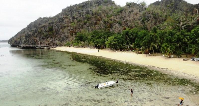
The coral reef and the island's elongated coastline

The coral reef and the island’s elongated coastline

It also has two islands and three islets. The tiny Tarakawayan Islet, at the head of the bay, lies nearly half a mile offshore, between the Kayulo and Bahile Rivers. South of Tarakawayan is White Rock Islet (or Puting Bato). Reef Islet, locally named Manyokos, lies on the eastern portion of the bay, near Marabay Point.  The 140 ft. high Camungyan Island, more popularly known as Tres Marias Island, is a 3-peaked rock formation and dive site about 2 hrs. by boat from Brgy. Baheli.

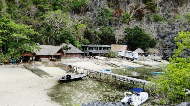
The plastic pontoon dock

The plastic pontoon dock

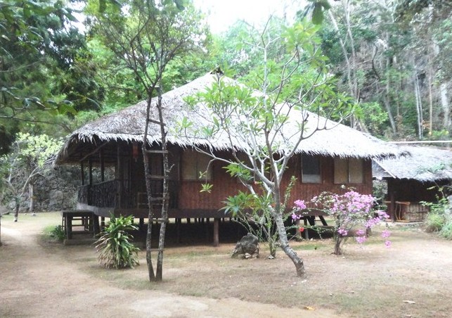
Our destination was to be the elongated, 25-hectare Isla Rita where we were to have a picnic as guests of former city mayor Edward S. Hagedorn.   From the beach, we had to walk some distance to board our big, motorized outrigger boat as it was low tide and the water very shallow. The boat trip took about 20 mins. and we docked alongside a plastic pontoon dock in front of the resthouse.  The 2-storey, native-style resthouse, elevated on concrete stilts, had a spacious wooded porch overlooking the sea at the lower level and a balcony at the second level.  Nearby was a wood and bamboo gazebo, toilet and shower rooms and quarters for the caretakers.

The resthouse

The resthouse

Measuring 1.5 miles in length from north to south, and about 200 yards in breadth, it has white sand beaches on its southwest side. The island also has a detached rock at its northern extremity, the 45 ft. high Observatory Rock which extends in a northerly direction for about 400 yards.

Isla Rita (12)

The island is also a popular dive site.  On the northwest side, the seabed slopes to 9 m. then drops off to 20 m..  Both shelf and wall have lots of hard and soft coral.  Big garoupa and snappers, small reef fish and giant clams are plentiful.  Diving season is November to June. There was to be no scuba diving for us but we availed of the next best thing – snorkeling.  PJ and I donned snorkels, fins and goggles provided for us and walked towards the dock where, just underneath, were two colorful giant clams (Tridacna gigas). Though we didn’t encounter the big garoupa and snappers as I was snorkeling along a staghorn coral forest just near the shore, I still saw a lot of small, colorful reef fish including a pair of Moorish Idols.

The author at Isla Rita

The author at Isla Rita

Sheridan Beach Resort & Spa: Sabang Beach, Sitio Sabang, Brgy. Cabayugan. Puerto Princesa City, Palawan. Palawan Sales Office: Jeco Bldg., Rizal Ave. Extn., Puerto Princesa City.  Tel (+63 48) 434 1448 to 49 and 723 7278. Mobile Numbers (+63 917) 308-3245 and (+ 63 917) 308-3245. Cebu Sales Office: Sheridan Bldg., Ouano Ave., NRA, Mandaue City.  Tel: (+63 32) 236-1001. Fax: (+63 32) 345-1000. Mobile number: (+63 917) 306-6984. Manila Sales Office: tel: (+63 2) 939-8888. Mobile number: (+63 917) 726-5224. E-mail: reservations@sheridanbeachresort.com.  Website:www.sheridanbeachresort.com.
Instagram: @sheridanresorts
Instagram official tag: #SheridanPalawan
Twitter: @sheridanresorts
Facebook: facebook.com/sheridanbeachresortandspa

Buenavista View Deck (Puerto Princesa City, Palawan)

Sheridan Beach Resort & Spa Media Tour

An invitation, from Mr. Pete Dacuycuy, to join a media team covering the 2-storey, 4-star and eco-friendly and nature-inspired Sheridan Beach Resort & Spa allowed me to reconnect with Palawan, my last visit there being in 1993 during a vacation to Club Paradise Resort in Coron.  It would also be my first visit to Puerto Princesa City.  Joining me and Pete were food blogger Ms. Joy Calipes-Felizardo (www.gastronomybyjoy.com), professional photographer P.J. Enriquez, free-lance travel writer Lester Gopela Hallig and Ms. Charmie Joy Pagulong of The Philippine Star.  We all took the very early 5:20 AM Philippine Airlines flight from NAIA Terminal III.

Buenavista View Deck

Buenavista View Deck

We arrived at Puerto Princesa Airport by 6:40 AM and were whisked, via the resort’s Toyota Grandia van, on a 75-km./2-hour drive through a winding, concrete zigzag road. Just 45 mins. from the resort, we made one stopover at Buenavista View Deck, along a high section of the road to Sabang.

Eatery and souvenir shop

Eatery and souvenir shop

Souvenir shop
It is part of the Community Based Sustainable Tourism program initiated by the Puerto Princesa City Government that aims to provide additional livelihood for locals residing in economically-marginalized communities.
Spectacular view of Ulugan Bay

Spectacular view of Ulugan Bay

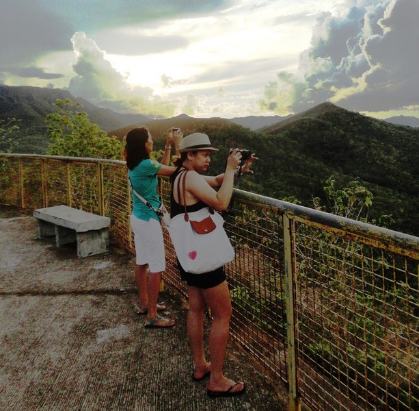
A popular stop over for tourists going to Puerto Princesa Underground River and Sabang Beach, it has an elevated concrete observation deck. Climbing the view deck, we had spectacular and relaxing views of Ulugan Bay, a deep channel on the northwestern coast of Puerto Princesa, Rita Island, the rocky outcrops of Tres Marias and Oyster Bay.  Portions of the karst formations of St. Paul’s can be viewed over the intervening areas of dense forests in the north.

Bags

Bags

Hats and caps

Hats and caps

Bracelets

Bracelets

There’s also a small eatery which sells meals and light snacks and a souvenir shop which displays and sells locally made wood carvings (masks, walking canes, chaku, police batons, etc.), baskets, necklaces, bracelets, earrings, rings, hats, T-shirts, ref magnets and key chains.

Chaku and walking canes

Chaku and walking canes

Police batons

Police batons

Corn coffee and honey

Corn coffee and honey

They also sell local food products such as bottled honey, cashew nuts and corn coffee.

Wooden masks

Wooden masks

Baskets

Baskets

Rainmakers

Rainmakers

Buenavista View Deck: Brgy. Buenavista, Puerto Princesa City, Palawan.

Imugan Falls (Sta. Fe, Nueva Vizcaya)

After checking in at Sta. Fe Forest Park, we still have free time before covering the Kalanguya Festival the next day so Rollie, Gener, Mon, Alex, Roel and I opted to explore the town’s Imugan Waterfalls, one of the town’s natural attractions. Ms. Ma. Theresa Farrah Dugay, Sta. Fe’s Municipal Tourism Officer assigned Mr. Emmanuel A. Caramat, Ms. Melany C. Lazaro and Mr. Regie Catalbas as our guides.

Imugan Falls

Imugan Falls

We all boarded our van for the 7-km./30-min. drive to the jump-off point at Brgy. Imugan for the hike to the falls, arriving there by 3 PM. At the barangay hall, we observed a float being prepared for the next day’s Kalanguya Grand Parade. Their float’s theme is centered on the ubiquitous, pear-shaped and light green chayote (Sechium edule, locally called sayote), the barangay’s principal produce.

Imugan Barangay Hall

Imugan Barangay Hall

Preparing a float

Preparing a float

Jump-off point to Imugan Falls

Jump-off point to Imugan Falls

According to Emmanuel, the nearly 1-km. hike to the falls would take us around 30 mins. The initial part of our hike was along a cemented pathway between an irrigation canal with flowing spring water and newly watered rice paddies. After crossing a stream, we now traversed a narrow, leaf-strewn but mildly graded dirt trail through a light dipterocarp forest.

Initial hike along a concrete pathway between an irrigation canal nad rice paddies

Initial hike along a concrete pathway between an irrigation canal and rice paddies

Hiking a  narrow dirt trail strewn with dead leaves

Hiking a narrow dirt trail strewn with dead leaves

A hanging bridge

A hanging bridge

The hike was scenic all throughout, with views of a hanging bridge and the boulder-strewn stream emanating from the falls below us and, along the trail, of wild orchids clinging to trees, giant ferns and stems of tiger grass (scientific name: Thysanolaena maxima), used in the manufacture of the popular walis tambo or soft broom).

Tiger grass

Tiger grass

An exotic orchid

An exotic orchid

An orchard of sayote

An orchard of sayote

Also along the way we passed numerous orchards of sayote, all sprouting on vines clinging to a moderately-spaced mesh of G.I wire and supported on poles along the steep slope of the mountain side.

Melany crossing a boulder-strewn stream

Melany crossing a boulder-strewn stream

After rounding a U-shaped bend along the trail and crossing a stream, we soon heard the rush of falling water signaling our arrival at Imugan Falls which is located between two mountains in the Caraballo Mountain Range. With a height of about 35 ft. and falling in 2 levels, its refreshing mountain spring waters drop down into a shallow catch basin.

The author at Imugan Falls

The author at Imugan Falls

As we didn’t bring bathing attire, we didn’t swim its bracingly cold waters but we did savor its natural beauty, pristine setting and quiet surroundings. To the left of the falls are some rather steep steps carved into the rock face which, according to our guides, lead to the fall’s smaller first level which also has a basin. We passed on this opportunity though and, instead, made our way back to Imugan. Our hike to the falls was truly a fitting start to our visit to Sta. Fe.

Cordillera World (Baguio City, Benguet)

Cordillera World

Cordillera World

Before we left the ever-popular Mines View Park, Melissa, Almira, Albert, Jandy and I visited the nearby Cordillera World, one of the newest attractions in the City of Pines located on the left side of the Mines View Tourism Office.

The narrow stairs leading up to the museum

The narrow stairs leading up to the museum

Wooden sleepers on a gravel bed

Wooden sleepers on a gravel bed

A pet project of Mr. Roland Cayat, this travel destination was opened last March 2011 through the help of some local investors and the support of the members of the Mines View Barangay Council.

Registration area and donation basket

Registration area and donation basket

A showcase of the rich heritage of the original mountain tribes of Northern Luzon, it is also an excellent vehicle to support a local advocacy and special program that helps out-of-school youths to go back to school or to finance and support their young families. There is no entrance fee but voluntary contributions from generous visitors to support the project are accepted.

Cordillera World (1)

Cordillera World (4)

We entered this second floor mini-museum/souvenir shop via a narrow wooden stairway whose risers feature salutations of “welcome” in five local dialects. Once inside, we had to register our names before taking photos. Do go around the displays, we walked on wooden sleepers laid on a gravel bed..

Cordillera World (2)

Cordillera World (11)

Here, we learned more about the lifestyle and culture of the highlands, seeing and sometimes touching ancient tools, clothing and accessories used by different tribes of the Cordilleras.

Cordillera World (7)

Cordillera World (8)

Visitors can even wear colorful, woven native costumes and feathery headdresses, as well as of being armed with hand-made bows, arrows and spears, and take photos as many times as they like.

Jandy and Almira in front of the replica of an Ifugao hut

Jandy and Almira in front of the replica of an Ifugao hut

At the center of the museum is a life-size replica of an Ifugao house decorated with animal skulls, woven tapestry and palay. From a viewing deck, we enjoyed the same spectacular view of the Cordillera mountains as seen from Mines View Park.  Beside it is their version of a “wishing well” (actually a pan filled with water).

Almira, Jandy, Albert and Melissa enjoying the mountain view

Almira, Jandy, Albert and Melissa enjoying the mountain view

A "wishing well"

A “wishing well”

Unique souvenirs sold here include Ifugao wine, CD that contains local Ifugao music to savour the culture even more, wood carvings and statues, pure honey, feathered headdresses and dream catchers that are hung around the place.

Cordillera World (10)

Cordillera World: Gibraltar Rd., Baguio City, Benguet.

Mt. Pulag National Park (Bokod to Camp 2)

From the DENR Office, it was another 2-hours drive, this time along mostly unpaved roads, to the forest ranger station at Camp Babalac. Along the way are breathtaking views of narrow valleys and vegetable and rice terraces. The ranger station, a place where mountaineers make final preparations, cook, rest and make last minute supply acquisition before the trek, sits near a small village at the base of the trail.  

Camp Badalac Ranger Station

Camp Badalac Ranger Station

Tour organizer Violet Imperial and our two guides

Tour organizer Violet Imperial and our two guides

It being a Chinese New Year holiday, the ranger station was filled with trekkers. Here, I crammed all I needed for the overnight camping in my larger backpack and left the rest of my clothes in the smaller backpack.  We also met our two guides and hired porters (PhP600/round trip) to help carry our backpacks to our designated camping ground at Camp 2. It was to be a 7.5-km./3.5 to 5-hour  hike to Mt. Pulag’s summit but we were to do it in stages.

The trek begins ..... (photo: Mr. Maki Las)

The trek begins ….. (photo: Mr. Maki Las)

After saying a short prayer for safety around Violet, we started our climb by 10 AM.  At first, the road was well-paved concrete.  After passing by some vegetable terraces, it was all dirt but the view was already breathtaking as we entered the pine forest.   This was also the hardest part of the trail.

Hiking along the pine forest

Hiking along the pine forest

At the ranger station, there were already worrying gray clouds ahead that brought about a slight drizzle, necessitating our wearing raincoats.  Sure enough, it began to rain, making the quite steep, uphill/downhill trail wet, muddy and slippery.  We arrived at Camp 1 by noontime.  Here, we rested awhile and ate our packed lunch of rice, chicken adobo and canned tuna.

Wet and hungry at Camp 1 (photo: Mr. Maki Las)

Wet and hungry at Camp 1 (photo: Mr. Maki Las)

Leaving Camp 1, the mossy forest soon starts, a stark contrast from the warm sunshine and pine forest we passed a while ago.  At this part of the trail, we were now trekking under the cool shelter of trees that are stunted and bonsai-like.  As the altitude increased, the air was starting to thin and we were making frequent stops to catch our breath, hearing the rapid beats of our own hearts amidst the weird silence.

The creepy and sinister mossy forest

The creepy and sinister mossy forest

Continuing on, I began to question myself and my sanity in being here. It was already raining profusely when we reached Camp 2 by 3 PM and we had to slog through the mud just to make it to our already set up dome tents. There were thoughts in my mind of continuing on to the summit in the remaining daylight but, as I was already dead tired, decided against it.  Big mistake.

Still in high spirits as we near Camp 2

Still in high spirits as we near Camp 2

Violet, Jandy, Maki and I occupied one tent; Almira, Lorelie and her kids in the nearby second tent; and friends Rose, Rayhil and Marceju with Celeste in the third.  As preparation for the cold night ahead, Jandy and I donned thermal underwear and tried to rest.  That night, it rained heavily and the wind picked up, allowing condensation to seep through our tents.

Muck, fog and rain at Camp 2

Muck, fog and rain at Camp 2

Our sleeping bags, socks, gloves and shoes were drenched as we ate our supper of pork sinigang, lumpiang shanghai and steamed rice.  There were latrines at the edge of the mountain but getting there was an effort due to the sticky mud and extreme cold. I didn’t sleep a wink as I shivered all throughout the night, with a temperature that dipped to almost a freezing zero and penetrated through the bones.

A still foggy and rainy morning at Camp 2

A still foggy and rainy morning at Camp 2

Waking up by 3 AM to trek the remaining distance to the summit where, on a clear day, mountaineers usually await the sunrise above a sea of clouds, was out of the question.  Daylight and a warm breakfast of rice, scrambled eggs and hotdog plus hot coffee and chocolate was a welcome relief. It was still drizzling when we broke camp.  As most of our stuff were waterlogged and added to the weight of backpacks, Violet and Almira now hired porters to carry their packs.  As we made our way back down the trail, the weather started to improve and the sun soon shone when we reached Camp 1.

View of the so-far unreachable summit of Mt. Pulag at Camp 1

View of the so-far unreachable summit of Mt. Pulag at Camp 1

When we arrived, the camp was filled with the tents of trekkers who weren’t allowed to proceed to Camp 2 the other day because the camp had reached the maximum number allowed. As it turned out, we were the last batch allowed to proceed.  Here, on a hill above the camp, we had a clear and beautiful panoramic view of Mt. Pulag’s so-far unattainable grassy summit as well as surrounding pine-cladded mountains.

L-R: Maki, Violet, Almira, the author, Celeste and Lorelie

L-R: Maki, Violet, Almira, the author, Celeste and Lorelie

Rest stop on the hike back

Rest stop on a grassy clearing on the hike back

As our descent was easy and more leisurely, I had more time to appreciate the mountain’s high plant diversity (home to 528 plant species, 42% of which are endemic to the area).  I was also struck by the variation in flora, from tall pine trees that clad the mountain’s hillsides.

Flora 1

Flora 2

Flora 3

Flora 4

Flora 5

Flora 6

Flora 7

There were wild orchids thriving on its slopes up to the 7,000 ft. level; a 5,877-hectare elfin forest with small stunted oak trees heavily overgrown with ferns, moss and lichen found at the 1,500-2,600-m. (4,900-8,500-ft.) level; and a natural, windswept, 804-hectare montane grassland at the summit.  The beauty of it all more than mitigated my frustration of not making it to the summit.

Beautiful mountain scenery on a sunny day

Beautiful mountain scenery on a sunny day

Vegetable terraces

Vegetable terraces

About 1.5 kms. to the ranger station, I hitched a ride (PhP100) on a habal-habal (motorcycle taxi) to the station.  Jandy was already there waiting for me when I arrived.  After about 20 mins., the others arrived – muddied, haggard and dead tired.   Our chartered jeepney that would bring us back to Baguio City was parked nearby.  After washing up, we retrieved our other belongings, loaded our packs at the jeepney’s roof rack and left the ranger station for Country Road Cafe and Restaurant where we were to have lunch.  We never made it to the summit but Mt. Pulag has not seen the last of me. I will definitely be back.

Riding a habal-habal back to the Ranger Station

Riding a habal-habal back to the Ranger Station

Camp Babalac Ranger Station: Sitio Badalac, Brgy. Bashoy, Kabayan, Benguet. Mobile number: (0930) 139-2246.

Mt. Pulag National Park – Manila to Bokod

A very big item in my travel Bucket List is to climb the three highest mountains in the Philippines – the 2,956 m. high Mt. Apo and the 2,938 m. high Mt. Dulang-Dulang, both in Mindanao, and the 2,922 m. high Mt. Pulag in Luzon, all in that order.  Of course, it made sense to first climb the latter, the nearest to home of the three.

Mt. Pulag National Park

Mt. Pulag National Park

I booked my climb to Mt. Pulag, with my son Jandy, through good friend Violeta Imperial, Exec. Director of Nature Awareness and Conservation Club, Inc.  All in all, we were 12 (our 13th member, Mr. Maki Las was to meet us in Baguio) in our group. There are four different trails going to the grassland summit of Mt. Pulag – the Bokod (also called Ambangeg) Trail, the 2 to 3-day Akiki (called the “Killer Trail,” it is the steepest) Trail, the leech (limatik)-infested Tawangan Trail and the Ambaguio (the longest) Trail in Nueva Vizcaya.   and we were going to climb the mountain via the easy Bokod Trail (also called the “Executive Trail”) which is the safest and has the mildest grade.

The ladies at our chartered passenger jeepney

The ladies at our chartered passenger jeepney

Joining Violet, Jandy and I were Expedition Leader Mr. Rexbello “Rex”  Alfafara (mobile numbers 0920-4651626 and 09327435252) of Sierra Adventurers and Mountain Explorers, Inc.; good friends Ms. Rayhil Palaganas (Financial Advisor – Sun Life Financial), Ms. Rosemarie S. Palmera and Ms. Marceju Aizza A. Ragat (JDE Finance Functional Consultant – Cyret Technologies, Inc.); Ms. Almira Ablan Tinonas (De La Salle University student/artist); Ms. Celeste Marie “Lelet” Garcia (HR Manager – Phoenix Petroleum); and Ms. Lorelie Mandela (Project Manager – Global Business World) with her children Celene and Arvin.

Country Road Cafe and Restaurant

Country Road Cafe and Restaurant

We all assembled at the Victory Liner Terminal in Pasay City and left on the 9 PM bus for Baguio City, the jump-off point for our climb.  After running the gauntlet of traffic along EDSA and 2 stopovers at Tarlac City and Sison (Pangasinan), we arrived at the city’s Victory Liner Bus Terminal by 3:45 AM.  We then boarded a passenger jeepney chartered  by Rex for our climb.  Up ahead was a 2-hour/80 km. roller coaster drive, through the winding zigzags of the fabled Ambuklao Road, to Kabayan town.  I shouldn’t have slept through part of the trip as I woke up sick on my stomach.  We had our breakfast at Country Road Café and Restaurant but I didn’t eat much.

DENR Mt. Pulag Park Office

DENR Mt. Pulag Park Office

That done, we returned to our jeepney for the short drive to the DENR Mt. Pulag Park Office to register and secure a permit, both done by Violet, and be given a short briefing.  Climbers are asked to register for orientation either here or at the Babadak ranger station at Bashoy village in Kabayan.

L-R: Almira, Rose, Rayhil, Marceju, Lorelie, Arvin, Celeste and Celene

L-R: Almira, Rose, Rayhil, Marceju, Lorelie, Arvin, Celeste and Celene

There were lots of would-be and real mountaineers waiting for orientation prior to their climb.  We were on the second batch. During our orientation, DENR Superintendent Emerita Albas gave our group a short environmental briefing on the dos and don’ts, the harsh environment and the basics of mountaineering for trekking Mt. Pulag National Park. The orientation was necessary for the climbers’ safety and the park’s environmental protection. Here are some tips and park rules to follow when climbing Mt. Pulag:

  • Garbage in, garbage out. Trash, whether organic or non-biodegradable should all be brought down and disposed of properly.
  • No intimacy at the campsite.
  • Stay on the established trails to minimize damage to vegetation and prevent further destruction of the mountain slopes. Walk single file in the middle of the trail, even when it is wet or muddy.

Hike to Camp 2 (2)

  • Respect the serenity of the place by keeping noise to a minimum level. Wildlife such as birds may get scared and interrupted from their normal routine.
  • Strong hikers, especially for big groups, should be designated to act as sweepers to take care of stragglers. In this way, weaker members are assured that they could get help from others should they be in trouble.
  • All hikers must always be guided by the Mountaineer’s Creed – take nothing but pictures, leave nothing but footprints, kill nothing but time.
  • On the way up, slower hikers must give way to stronger hikers. On the other hand, stronger hikers should not tailgate weaker hikers.
  • If there are no trail signs at trail junctions, advance group members should make temporary directional signs (e.g. Sticks, scratch on the soil, etc.) for others to follow.
  • It is always best to be on the side of caution especially when hiking along slippery trails. Light walking sticks, canes and trekking poles help a lot as it acts like another foot.  Help, especially medical in nature, may take some time to reach anybody. In case of trouble or emergencies, attract help by making as much noise as possible by hollering or shouting.
  • To avoid creating wildfires, smokers must properly put off their cigarettes as the pine forest floor is susceptible to fire, especially during summer months.  Smoking in the grassland is highly discouraged. Bonfires at the campsite are also prohibited.  For cooking and boiling water, bring a portable stove.
  • Before hiking, fill up your canteens or water bottles (1.5 to 2 liters of water is recommended per person). At camp 1 and Camp 2, there are springs nearby and the water is potable.  For people who have sensitive stomachs, the use of purifying tablets is advisable. If you are bringing bottled water with you on your hike, please keep the empty bottle and bring them back down and out the national park when you leave.
  • The weather on the mountain is unpredictable and it could rain anytime.  It is therefore advisable for hikers to bring with them rain gear (raincoat, poncho, etc.) and warm clothing (jackets, sweaters, scarves, bonnets, gloves, thermal underwear, socks, blankets, etc.) to ward off cold temperatures. But don’t wear your warm clothing yet on your hike to Camp 2 as your body will heat up from all the energy you burn.  Waterproof your things.  Bring a waterproof backpack cover, plastic bags or black garbage bags and a drybag for your camera.

Ranger Station (6)

  • As your feet are the most important part of your body during a trek (once you injure them, you have no way of going back down, lest you are carried down), wear comfortable yet sturdy shoes with good traction (you will slide and stumble, at one point or another) underneath. Make sure the shoes you wear are broken-in and comfortable.
  • For those bringing their tents, use a three or four-season tent that can withstand the cold wind and rain.
  • Bring only what is necessary as loads get heavier for every kilometer traversed. The lesser the weight on your bag, the easier your trek will be.
  • Park officers reserve the right to randomly inspect baggage to determine whether banned items (liquor, dangerous drugs, deadly weapons, etc.) are present. Such items, when found, will be automatically confiscated and kept for safekeeping.

  • Communicate with your expedition leader and/or designated/hired guide. He possesses knowledge of the area.
Expedition leader Rex Alfafara

Expedition leader Rex Alfafara

  • Respect the indigenous people’s (Ibaloi, Kalanguya, Kankana-ey and Ibanag) culture. Their culture may be different from yours but it is their culture. Most of them consider Mt. Pulag as a sacred place not only because it is a resting place and playground of their gods but also a place where they bury their dead. You are in their cultural ground.
  • If climbers reach the Badabak ranger station at 5 PM, they are advised to spend the night there and not persist on hiking to the grassland area or camping area since the area, after 5 PM, is always misty and cloudy, making directional signs and trails not easily visible.
  • Hiking is not a race.  It should be fun and is free. Take time to regulate your breathing, look around and enjoy the scenery that nature offers.
DENR Superintendent Emerita Albas

DENR Superintendent Emerita Albas

DENR-PASu Office: Sitio Ambangeg, Brgy. Daclan, Bokod, Benguet.  Tel: (074) 444-3592. Mobile number (0919) 631-5402 (Ms. Albas).

Current park fee rates (the first two are remitted to the Integrated Protected Area Fund or IPAF while the third is remitted to the Kabayan local treasury for their use):

  • Entrance fee: PhP100.00
  • Camping fee: PhP50.00
  • Green fee: PhP25.00

Aside from the fees, hikers are required to engage an accredited guide (member of MPITGA) with a ratio of 1-7 hikers to 1 guide. The pay is P500.00 per guide per overnight.

The author with tour organizer Violeta Imperial

The author with tour organizer Violeta Imperial

Nature Awareness and Conservation Club, Inc.: 18 Pioneer St., Moonwalk Village, Las Pinas City, Metro Manila. Tel: (632) 806-1720.  Mobile numbers: (0915) 510-1600 and (0932) 243-9478.  E-mail: mother_nature888@nacci888.org.

Sierra Adventurers and Mountain Explorers, Inc.: E-mail: sierra.org.ph@gmail.com, Website: www.sierra.org.ph.

Sighnaghi: City of Love (Georgia)

After our short stopover at the venerated Bodbe Monastery, we continued on our GNTA-sponsored tour, proceeding on a short 2-km. drive to the town center of Sighnaghi.  We arrived at the town by 11:30 AM and alighted at a park with a monument to Georgian philosopher, journalist, historian and native son Solomon Dodashvili (May 17, 1805 – August 20, 1836).

Postcard-pretty Sighnaghi

Postcard-pretty Sighnaghi (photo: Ms. Riva Galveztan)

Other famous sons of the town include composer Vano Sarajishvili, political figure Sandro Mirianashvili and world-renowned primitivist painter Niko Pirosmani. We were to have lunch at Pheasant’s Tears but, as we still had some time to spare, our Georgian guide  Sopho Makashvili took us on a walking tour around the town.

Monument to native son Solomon Dogashvili

Monument to native son Solomon Dogashvili (photo: Ms. Riva Galveztan)

Sighnaghi, located in Georgia’s easternmost region of Kakheti, is the administrative center of the Sighnaghi district and one of the country’s smallest (2.978 km²) towns (2002 population: 2,146).  One of Georgia’s leading trading centers in the 19th century,  Sighnaghi’s economy is dominated by the production of wine, leather, gobelin tapestry, woodcarving, metal craft, ceramics, traditional carpets and traditional food.

Uniquely designed terrace architecture of the town

Uniquely designed terrace architecture of the town

The town and its environs, also known for their landscapes and historical monuments, has recently undergone a fundamental reconstruction and has become an important part of the Georgian tourism industry (it is now known as the “City of Love”).  The town is also the jump-off point for exploring the lush vineyards of Kakheti, the cradle of wine (Georgia boasts of 500 varieties of grapes, more than anywhere else in the world).

The author exploring part of Sighnaghi's defensive wall and towers

Exploring part of Sighnaghi’s defensive wall and towers (photo: Ms. Riva Galveztan)

The town was developed in the early 18th century by the king Erekle II (Heraclius II) as a refuge for the population against Lezgin and Persian attack, hence the name sighnaghi which comes from the Azeri word signak meaning “shelter.” In 1762, he sponsored the construction of the town and erected a fortress to defend the area from marauding attacks by Dagestan tribesmen.  The 4.5 m. high, 1.5 m. wide and 4.5 km. long city wall, one of the biggest in Georgia, has 23 towers, each named after local villages the town is surrounded by, and 6 entrances.

Our guide Sopho Makashvili, Riva Galvezltan, the author and Consul Buddy Cunanan

Our guide Sopho Makashvili, Riva Galvezltan, the author and Consul Buddy Cunanan (photo: Ms. Riva Galveztan)

Sopho showed us, from afar, the section of the city’s defensive wall that has been restored for tourism and we climbed one of the towers for a panoramic view of the town.  Walking along the town’s narrow cobblestone streets, I was also enthralled by the uniquely designed terrace architecture of the 2 to 3-storey tiled-roof houses of Sighnaghi, the majority of which still date back from 17th, 18th and 19th century.  Built with fine Georgian brick, they were built to accommodate a variety of stores and workshops, above which are wooden, lacy balconies and bow-backed windows.  The town also has a beautiful fountain.

A beautiful fountain

A beautiful fountain

Consul Buddy Cunanan and I also observed a number of Georgian men playing nardi (backgammon). Popular in Georgia, men, women, children and the elderly all know how to play it, and just about every family owns a backgammon set. They say that life in Georgia is like a game of backgammon – people tend to approach life like a game of chance.

Georgian men playing backgammon in the open

Georgian men playing nardi (backgammon) in the open (photo: Ms. Riva Galveztan)

We also visited the town’s market, near the town hall, where fresh fruits and vegetables, locally made Georgian red (saperavi) and white wine and the clear and strong chacha (Georgian pomace brandy); natural honey; churchkhela (the traditional type of Georgian candy from the Caucasus region also referred to as the Georgian “Snickers”) and cheeses.  Buddy and I each tried out a glass of Georgian wine.

An array of products sold at the market

An array of products sold at the market (photo: Ms. Riva Galveztan)

There are also Georgian spice and spice mixes such as khmeli suneli (a powdered herb/spice mixture), adjika (a spicy paste or sauce seasoned with hot chili peppers) and pilpili (pepper) plus a picturesque array of knitted goods (Georgian socks with traditional patterns, local wool, hats, scarves, slippers, baby booties, etc.) for sale at cheap prices.

The town hall with its distinctive clock tower

The town hall with its distinctive clock tower

Georgia National Tourism Administration: 4, Sanapiro St, 0105, Tbilisi, Georgia. Tel: +995 32 43 69 99. E-mail: info@gnta.ge. Website: www.georgia.travel; www.gnta.ge.

Qatar Airways has daily flights from Diosdado Macapagal International Airport (Clark, Pampanga) to Tbilisi (Republic of Georgia) with stopovers at Hamad International Airport (Doha, Qatar, 15 hrs.) and Heydar Aliyev International Airport (Baku, Azerbaijan, 1 hr.). Website: www.qatarairways.com.

Exploring Sumilon Island (Oslob, Cebu)

The Sumilon Island hiking trail

The Sumilon Island hiking trail

After our lunch at the Island Pavilion Restaurant, Lara, Joy, Jimbo, Rachelle, Risa, Leica (Pete’s daughter) and I decided to burn some calories by doing a hike, with a resort guide, around the 24-hectare island.  Liana and Kaycee opted to stay behind to rest.

View of the natural lagoon from the cliffside trail

View of the natural lagoon from the cliffside trail

The nicely laid out hiking trail (open from 6 AM – 4 PM) started as we descended the steps down from the restaurant and traversed the cliffside pathway, strewn with coral rock, overlooking the natural lagoon where we could see a number of guests kayaking.  Soon enough, we entered the lush forest.  Along the trail are colored pennants tied to trees that indicate the difficulty of the trail – yellow for beginners, blue for moderate and red for advanced.

Hiking along the coral rock-strewn trail

Hiking along the coral rock-strewn trail

Soon we reached a fork in the trail.  The trail on the left traverses the northern point of the island where panoramic views of white sand beaches along the northwestern and eastern shores of the island can be seen.  The trail on the right cuts through the spine of the island and leads up to the island’s highest point, 28 m. above sea level, where a lighthouse and a Spanish-era baluarte (watchtower) is located.  We chose to explore this route.

The concrete lighthouse

The concrete lighthouse

The concrete lighthouse on the top wasn’t much.  It didn’t have a hollow core with a spiral stairway leading to the top, a feature found in many lighthouses.  Instead, steel, U-shaped ladder rungs imbedded in the concrete exterior was used.

The Spanish-era baluarte (watchtower)

The Spanish-era baluarte (watchtower)

The quadrilateral, heavily overgrown but still relatively intact baluarte was more interesting.  It was part of a network of watchtower and fortlets, extending from Santander to Sibonga, built by Augustinian Fr. Julian Bermejo (pastor of Boljo-on from 1804-1836) to warn the townspeople of the approach of pirates.  Lara and Joy entered the watchtower through a small, square hole in one of its sides.

The marine sanctuary

The marine sanctuary

The abandoned marine station of Silliman University

The abandoned marine station of Silliman University

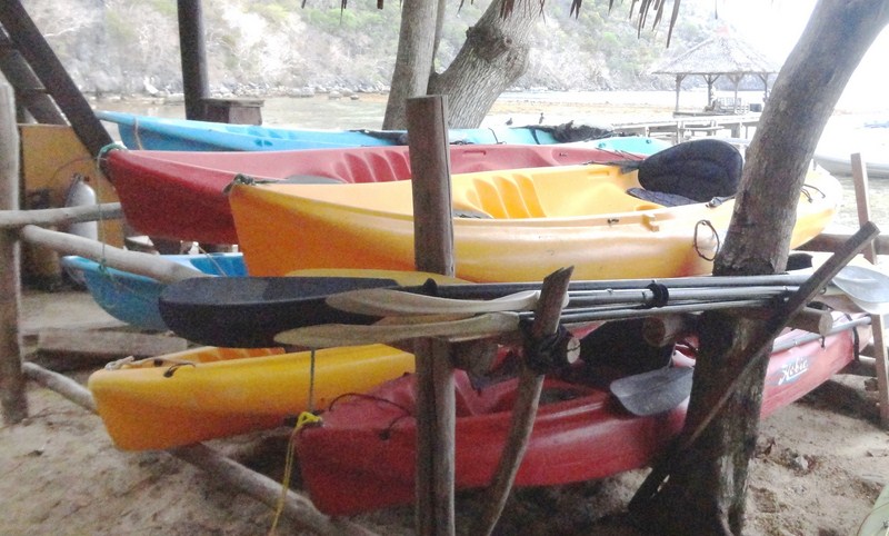
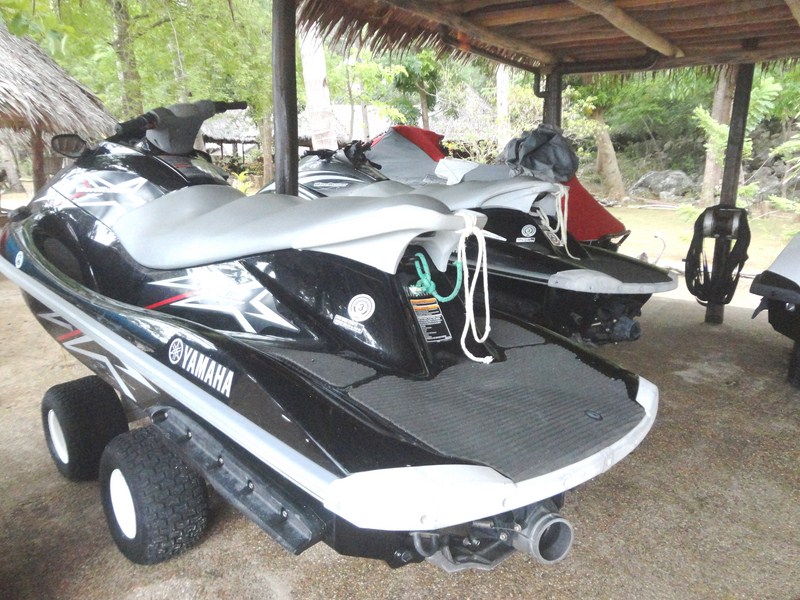
From this vantage point, we now made our way down the trail to the pristine blue waters of the western side of the island where part of Sumilon Island Marine Park is located.  Situated off Cebu’s southeastern coast, 5.5 kms. east northeast of Tanon Point, this marine sanctuary was formerly administered by Siliman University in Dumaguete City (Negros Oriental) as evidenced by a now abandoned hut of the marine station along this part of the trail.  Today, the sanctuary is managed by the resort.  Motorized water sports such as jetskiing and water skiing are not allowed to ensure that the sanctuary is not disturbed.

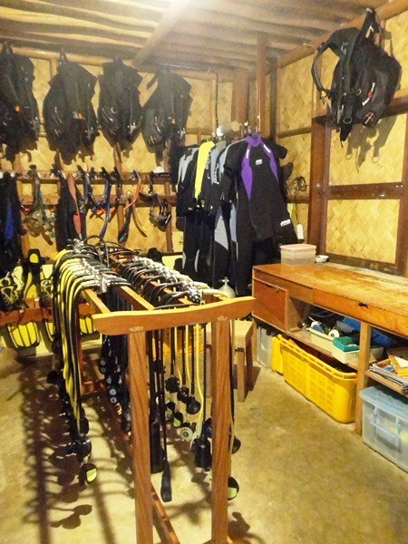
Aquamania Dive Shop

Aquamania Dive Shop

Equipment at Aquamania Dive Shop

However, fine snorkeling, over coral gardens, can be done along the western, northern and eastern sides of the island.  For scuba divers, it offers waters two to 5 m. deep and 200 m. wide and a drop-off about 100 m. off the southwest coast with spectacular underwater life including the big garoupa.  Large schools of jacks, manta rays, sharks, barracudas, sea snakes, turtles and even an occasional whale shark can be seen off the northern and southern tip.  Dive sites here include Coral Landscape, Garden Eel Plaza, Julie’s Rock and Nikki’s Wall.  Diving season is all year round.  Visibility reaches 30 m. and average depth is 20 m. with a maximum of 35 m..  Waters here are usually calm with strong currents to sometimes very rough, fierce and physically demanding currents.  The resort has a dive shop (Aquamania) with certified dive instructors and extensive diving facilities.

Flower-bedecked table set-up for two at the sandbar

Flower-bedecked table set-up for two at the sandbar

A marriage proposal etched on the sand

A marriage proposal etched on the sand

Further down the trail, we soon reached the island’s white sandbar, the only part of the island that is open to the public.  It shifts and changes its shape with the tides and the current.  Here, we can swim, snorkel or sunbathe.  It was also the setting for last night’s al fresco dinner.  When we passed by, it was already set up for a marriage proposal, with a table for two, surrounded by flower petals shaped into a heart,  set up along the beach.    Nearby, along the sand, were the words “Will you marry me?” etched with pieces of tree branches.

Grotto of Our Lady of Fatima

Grotto of Our Lady of Fatima

On our way back to our cottages, we passed by a grotto with a statue of Our Lady of Fatima and, just past it, the short and seemingly man-made Yamashita’s Cave.  We entered the latter and were surprised by a Halloween set-up, meant to scare visitors, at its very end.  We were totally drained and drenched with sweat by the time we returned to our rooms.

Entrance to Yamashita Cave

Entrance to Yamashita Cave

Sumilon Bluewater Island Resort: Brgy. Bancogon, Sumilon Island, Oslob, 6025 Cebu.  Tel: (032) 382-0008 and (032) 318-9098. Mobile numbers: (0917) 631-7514 and (0917) 631-7512.  Email: info.sumilon@bluewater.com.ph.

Cebu City booking office: CRM Bldg., Escario cor. Molave Sts., Lahug, 6000 Cebu City. Tel:  (032) 412-2436. Mobile numbers (0917) 631-7508 and (0998) 962-8263. E-mail: sales.sumilon@bluewater.co.ph.

Manila Office: Rm. 1120, Cityland/Herrera Towers, 98 Herrera cor. Valero St. Salcedo Village, Makati City. Tel: (632) 817-5751 and (632) 887-1348. Fax: (632) 893-5391.  E-mail: sumilon@bluewater.com.ph. Website: www.bluewatersumilon.com.ph.

Whale Shark Interaction (Oslob, Cebu)

After an early breakfast at Sumilon Bluewater Island Resort, we were in for whole morning of resort-sponsored tours over at Oslob – whale shark (butanding) interaction, Tumalog Falls and the Municipal Heritage Park.  At the resort wharf, we again boarded the Jeffrey (the same boat that brought us in) that would take us to Brgy. Tan-awan in the mainland ((10 kms. away from the center of the town), where whale sharks converge.  The boat trip took just 10 mins. and, near the shore, we transferred to a small outrigger boat that brought us to shore.

The gentle but majestic whale shark (photo: Liana Smith-Bautista)

The gentle but majestic whale shark (photo: Liana Smith-Bautista)

Before we could start our butanding interaction, we first had to go first to the briefing area where we registered ourselves and attended a short but straightforward 15-min. orientation on the do’s and dont’s. You can swim with the whale sharks but should be 4 m. away from it and not ride them (there is a fine of PhP2,000 or you can go to jail) and for those who would like to swim with it, they should wash off their sun block lotion as these have chemicals are harmful to the whale sharks. If you worry about getting burned in the sun while doing the activity, better wear rashguard. Pictures can be taken underwater by one of the divers assisting the activity but no flash photography is allowed as whale sharks are sensitive to light.

The briefing area

The briefing area

After this short briefing, we all returned to our boat and, just about 200 m. from the shore, the butandings were already visible.  We all donned our snorkel and masks and jumped into the water. Most of the time, the whale sharks just hang around in the water, tilting upwards at 45 degrees, with their mouths wide open as men on boats throw krill down their throats.

Our short orientation

Our short orientation

Facts about the whale shark

Facts about the whale shark

It was a bit scary at first, considering how big they were and how close they were to us, but we had nothing to fear.  A number of butanding came near me and one actually brushed under me. Any fear is eventually replaced with amazement after seeing how gentle these majestic creatures were.

The whole gang with a whale shark

The whole gang with a whale shark (photo: Ma. Joy C. Felizardo)

It was an unforgettable experience and words are not enough to describe how wonderful (and frightening for some) it is. The exhilarating and unique experience of having one of these truly amazing, gentle juvenile giants not only swim close by, but actually brush past me is one I’ll take with me to my grave.

The author's (upper right) close encounter with a whale shark (photo: Ma. Joy C. Felizardo)

The author’s (upper right) close encounter with a whale shark (photo: Ma. Joy C. Felizardo)

Oslobanons are happy and grateful to the whale sharks as they have given them an unexpected and better income. However, the idea of feeding the whale sharks on a daily basis can be disruptive for the sharks’ nature of searching for their food. Added to that, as too many people are around at any given time, you also have to be constantly on your guard as you have to dodge boats that can run over you. Their guidelines are also good in theory and are monitored by a marine biologist but they are almost impossible to police. The 4 m. required distance between man and shark is also impossible to keep as there are so many swimmers and sharks. For me, the jury is out on whether this is sustainable.

Fisherman feeding a whale shark

Fisherman feeding a whale shark

Oslob Whale Shark Watching: Brgy. Tan-awan, Oslob 6025, Cebu.  Mobile number (0925) 897-8687.  Open daily, 6:30 AM to 12 noon.

Rates: PhP500/30 mins. interaction (whale shark watching + snorkeling), PhP300 if you just want to stay in the boat (whale shark watching). An underwater camera can rent for PhP500 and the boatman can be your photographer as well. If you don’t have a memory card, they charge another PhP50 (the pictures were then transferred to our own memory card).