Extension Ridge Trail Loop (British Columbia)

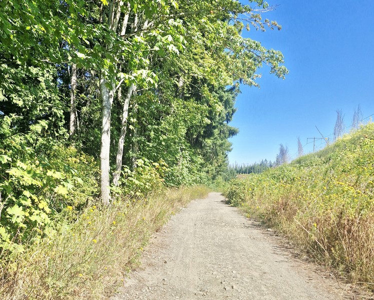
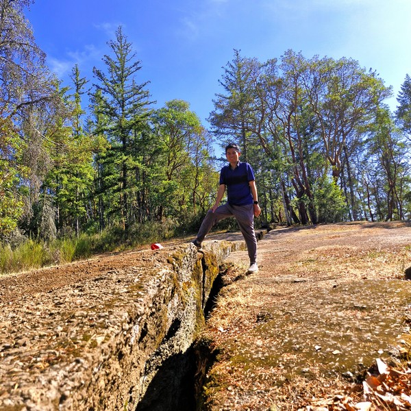
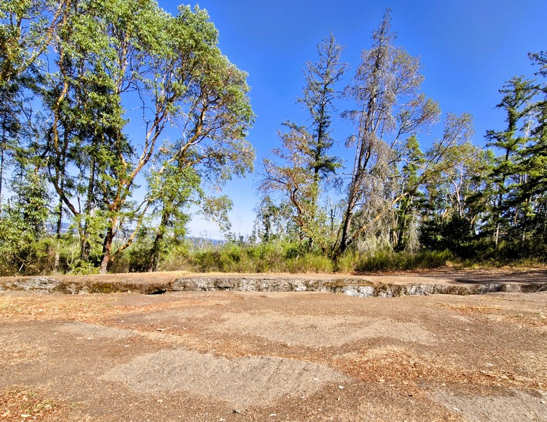
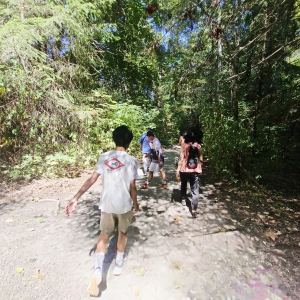
Part of the Extension Ridge Trail Loop exposed to the sun

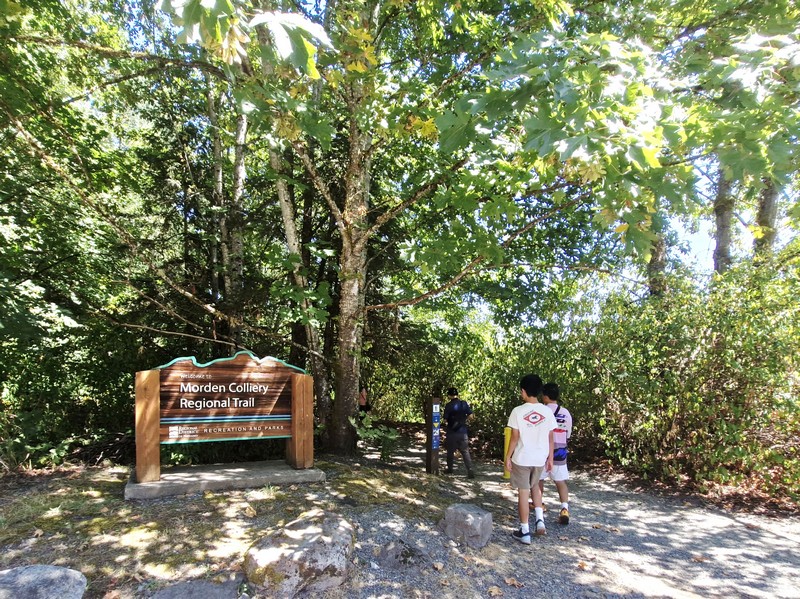
From Morden Colliery Regional Trail, it was a short, 102-km. (15-min.) drive, via Cedar Rd. and Extension Rd., to the Extension Ridge Trail Loop, a moderately-rated loop trail that features a rocky and forested setting and is famous for “The Abyss,” a large and dramatic ground fissure. We parked our car at a free roadside parking along Harewood Mines Road, near the power lines. 

Check out “Morden Colliery Regional Trail”

The trail was a 9.2-km. (5.8-mi.) loop, which takes about 2.5 to 3 hours, but we just opted for the shorter, direct 2.9-km. (1.8-mi.) out-and-back hike, which takes about an hour, as we just wanted to visit the crack. Parts of the well-used dirt trail are exposed to the sun and, as it was a bright sunny day, the hike was quite tiring and draining with the limited shade available.  There were also some tree roots and uneven rocky terrain underfoot plus a steady climb with roughly 80 m. (255 ft.) of elevation gain.

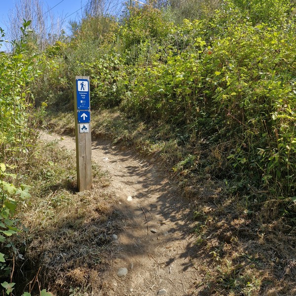
The steady climb up the trail

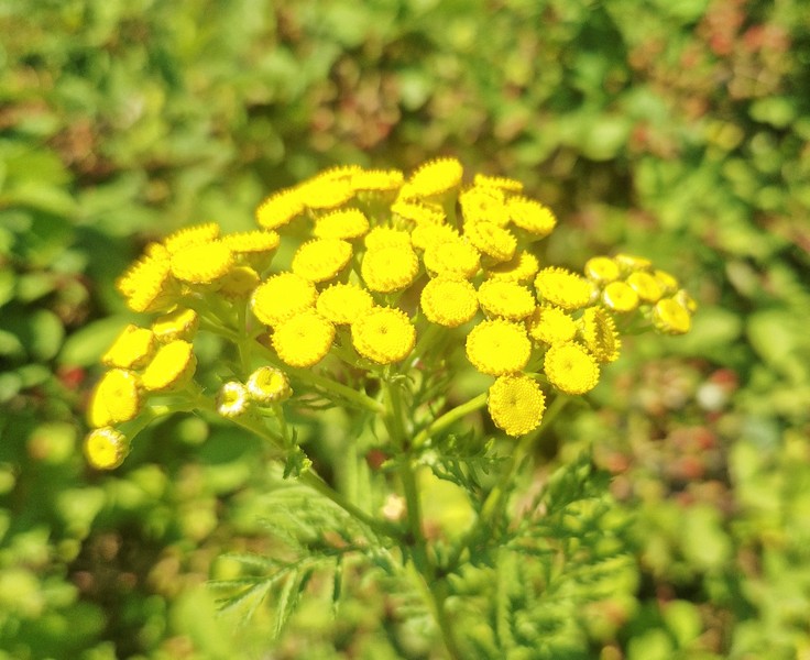
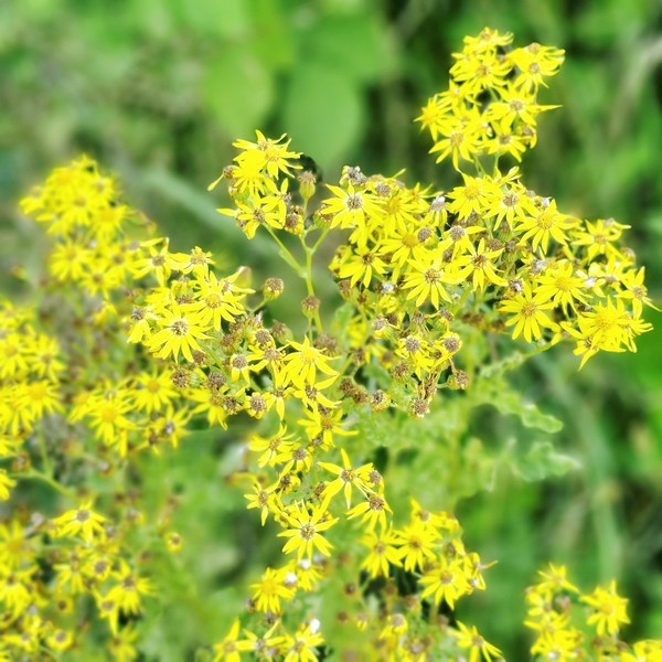
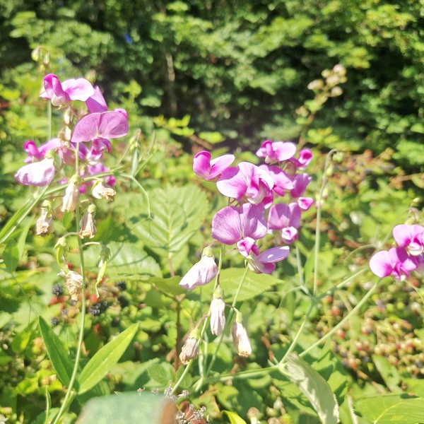
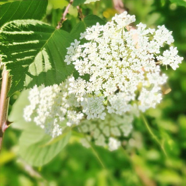
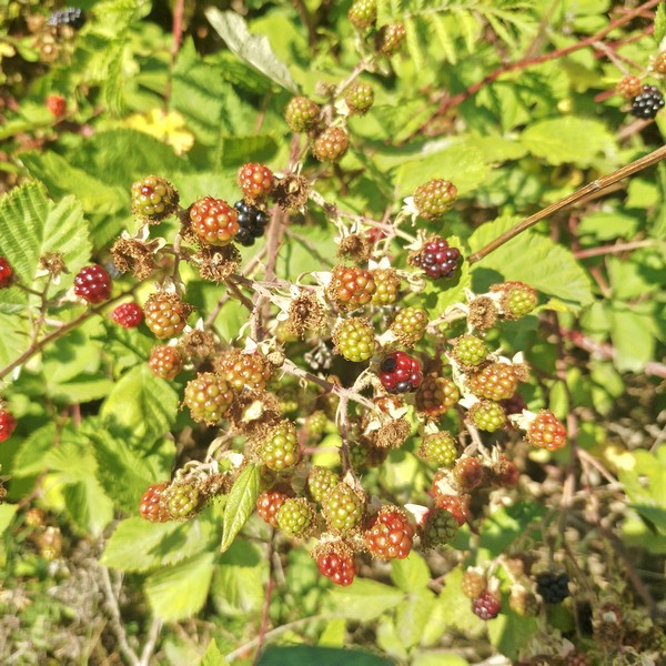
Still, you can’t help but admire some of the wildflowers along the way such as Golden Crownbeard (Verbesina enceliodes), Common Tansy (Tanacetum vulgare), Little Larkspur (Delphinium bicolor) and Sitka Valerian (Valeriana sitchensis) as well as edible Canada Blackberry (Rubus canadensis).

Common Tansy (Tanacetum vulgare)
Golden Crownbeard (Verbesina enceliodes)
Little Larkspur (Delphinium bicolor)
Sitka Valerian (Valeriana sitchensis)
Canada Blackberry (Rubus canadensis)

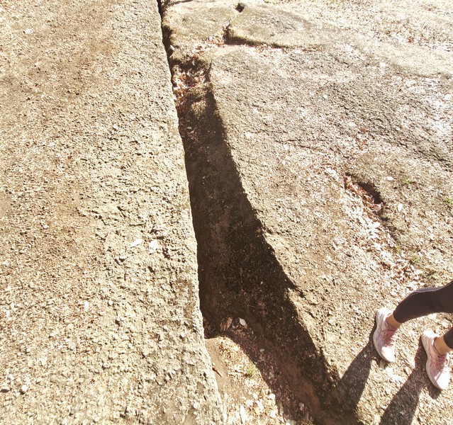
Approximately 1.5-km. into the trail we arrived at what locals popularly call “The Abyss,” a narrow earthquake fissure or deep, sharp-edged crack in the rock, about 0.40 mm. (16 in.) wide, at least 8 m. deep, and stretching roughly 40 m., with smooth exposed rock.  Around it were striking groves of native arbutus trees (Arbutus menziesii), with twisting orange-red trunks and peeling bark, growing directly out of exposed, mossy sandstone and conglomerate rock.

The Abyss

I felt a bit surreal realizing that I was standing beside a natural fracture created by the movement of the earth. However, while popularly attributed to tectonic shifts, local experts debate whether it is purely a prehistoric seismic/earthquake fault or exacerbated/caused by shallow historic underground extension coal workings that weaken the sandstone and conglomerate strata, causing it to collapse. Similar subsidence holes, cracks, and depressions occur around historic mining regions on Vancouver Island.

The author at the Abyss

There were no railings, so we had to keep a safe distance from the edge as there was a risk of falling into the gap which was wide enough for most people, especially children, and dogs (our dog Luffy was on-leash) to fall into. We also heard distant gunshots from active live fire exercises from a Department of National Defense (DND) rifle and weapons range off Lincoln Road, about 1 km. away. Their active military danger and buffer zones are strictly closed off and trespassing is prohibited.

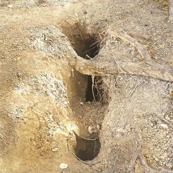
One of the smaller fissures

Past the main Abyss site, just off the beaten track, are narrower and shorter splits or fissures in the surrounding sandstone bedrock found tuck away in the forest and rocky sections, often hidden by arbutus trees, moss and forest debris

Groves of native arbutus trees (Arbutus menziesii)

Extension Ridge Trail Loop: 540 Virostko Rd. Extension, Nanaimo, British Columbia V9X 1E8.

How to Get There: This area can be accessed from a number of locations including from McKeown Way, Lotus Pinnatus Way, the Village of Extension, and the neighborhoods west of Extension Rd.

Morden Colliery Regional Trail (Nanaimo, British Columbia)

From Petroglyph National Park, it was just a short 10.1-km. (15-min.) drive to the 1.1-mile Morden Colliery Regional Trail (MCRT), a segment of a historical rail corridor that has become a popular regional and community route for walking, nature appreciation, horseback riding and cycling.

Check out “Petroglyph National Park”

The Morden Colliery Regional Trail

This small 4-hectare provincial park, in south Nanaimo, gives you access to the only remaining coal tipple (a structure that loads coal into rail cars, much like a grain elevator unloads grain) on Vancouver Island. Not well-known, it can easily be considered a Vancouver Island hidden gem.

Known for its historical significance and natural beauty, this 4 km-long corridor of Provincial Crown Land located between Morden Colliery Historic Provincial Park (maintained and managed by the Regional District of Nanaimo), in South Wellington, and  Hemer Provincial Park in Cedar, is a unique, must-visit destination for anyone interested in Vancouver Island’s history or for those simply looking for a peaceful outdoor escape.

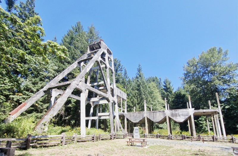
The concrete tipple

Because there is currently no bridge crossing the Nanaimo River, within the MCRT, the trail network of the MCRT consists of two separate segments – the 2 km-long North Segment, between Cedar Road and Hemer Provincial Park, and the 1-km. long South Segment between MCRT to the Nanaimo River. The Central segment of the MCRT, which runs approximately 1 km. through agricultural land from the Nanaimo River to Cedar Road, is currently undeveloped and requires two bridges to span the Nanaimo River.

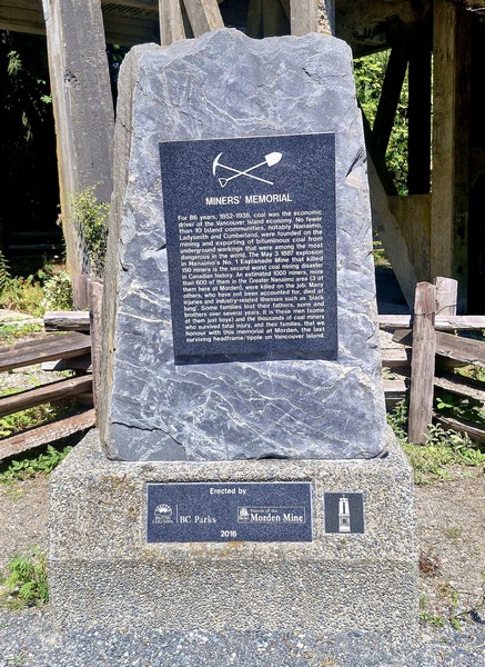
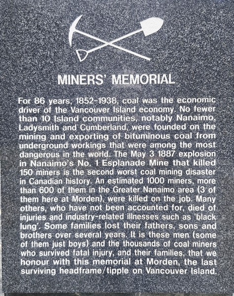
The Miner’s Memorial at the base

The MCRT runs along an old rail grade used to move coal, during the early years of the 20th century, from the mines of South Wellington to Boat Harbour. Between 1852 and 1938, coal mining was the main economic driver on Vancouver Island, and 10 small towns, notably Nanaimo, Ladysmith and Cumberland, were built because of it. In 1912, Pacific Coast Coal Mines, Ltd. (PCCM) began developing Morden Mine and, in its first year of operation, the Morden Mine produced 76,000 tons of coal.

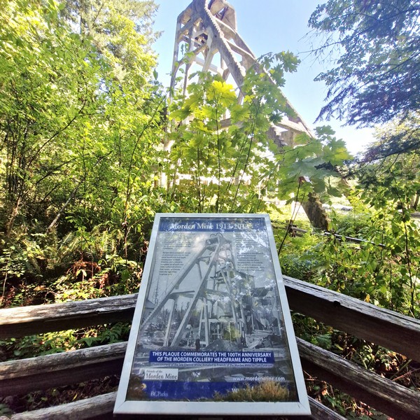
The memorial plaque

However, from 1913 to 1914, a miners’ strike disrupted operations. During that time, a 22.7-m. (74.5-ft.) high reinforced concrete head-frame, the first in the district, was constructed.

Hiking the RDN Trail

Despite modern equipment and investment, Morden Mine was not as successful as investors had hoped and never succeeded. After the strike ended, underground work resumed, but the mine struggled with poor air quality, causing frequent illnesses among the miners.  Between union strikes and unfavorable economic conditions, production stopped in 1921 and the closure caused PCCM to go bankrupt the following year. In 1930, the Canadian Coal and Iron Co. rehabilitated the mine, but production didn’t even last a full year, and the mine officially closed in 1931.

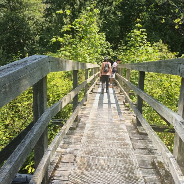
Crossing a wooden bridge along the trail
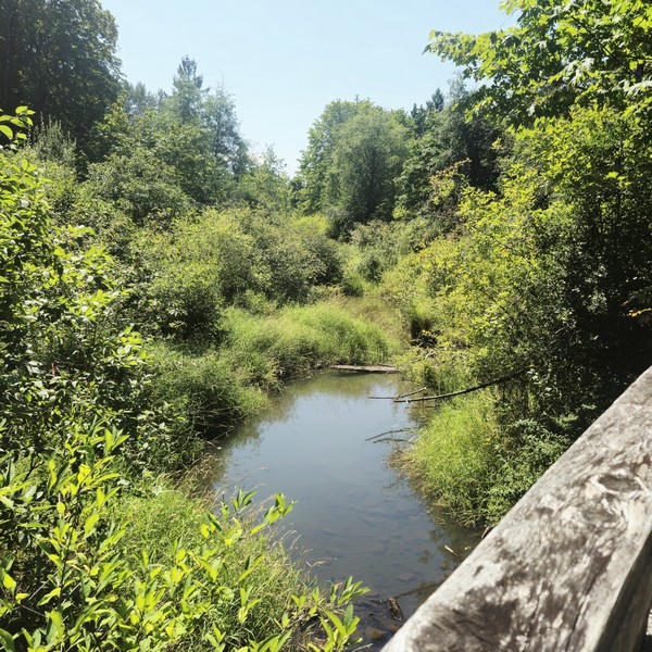
A creek we had to cross via the bridge

In 1972, to protect and preserve remnants of the Nanaimo region’s coal mining history, the area was turned into a provincial park (largely due to the efforts of George Wilkinson, a prominent Vancouver businessman) and recognized as a National Historic Site of Canada but, despite the designation, little was done to preserve the remaining structures. In 2003, “Friends of Morden Mine,” a group of concerned citizens, got together to try to save the remains.

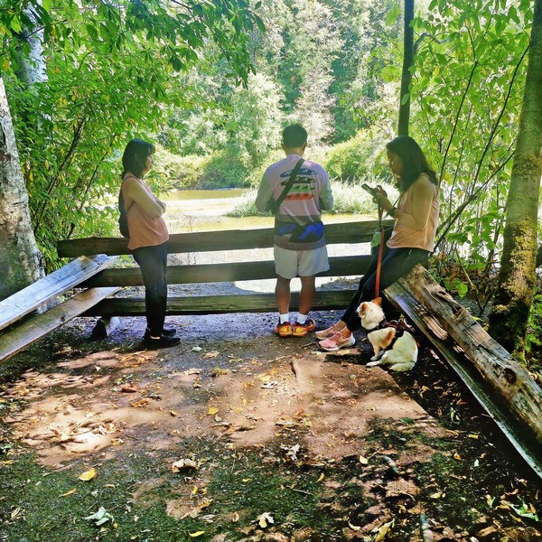
The viewpoint at the end of the trail

In 1995, the Regional District of Nanaimo (RDN), under license from the Province of British Columbia, initiated development of the MCRT corridor for recreational trail use. In 2019, the Government committed $1.4 million to restore the concrete headframe and tipple structure at Morden Colliery Historic Provincial Park.  Consequently, at the same time, improvements were made at the park.

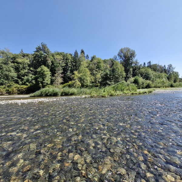
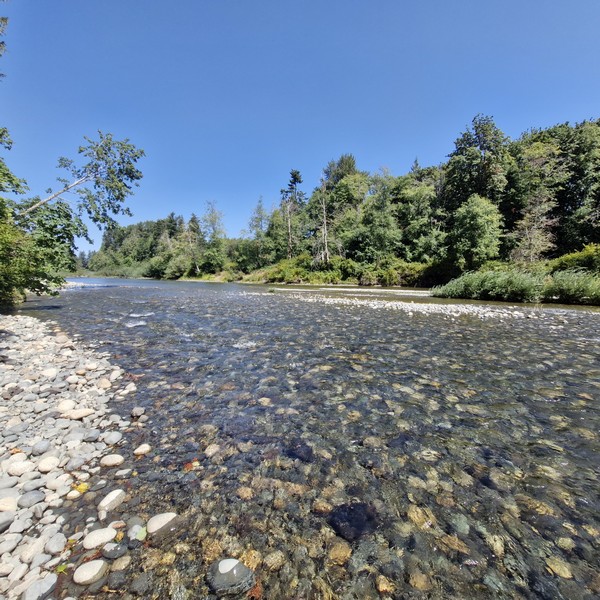
The Nanaimo River

Upon arrival at Morden Colliery Historic Provincial Park, we parked the car just across the concrete Morden Mine tipple, its remaining concrete head-frame standing as a rare monument to Vancouver Island‘s coal mining history.  The first of its kind in North America (before 1913, tipple were usually made of wood) it is, ironically, one of only two left standing (the other is the O’Gara Coal Mine No. 12 Tipple, built in 1923, in Muddy, Illinois) and the only one in Canada.


A memorial, at its base, commemorates the estimated 1,000 miners who were killed doing this very dangerous job, with 600 in the Greater Nanaimo area and 3, in particular, at the Morden Mine, as well as the unfortunate workplace deaths that do not include those who died of industry-related illnesses, such as black lung, of which there were many.

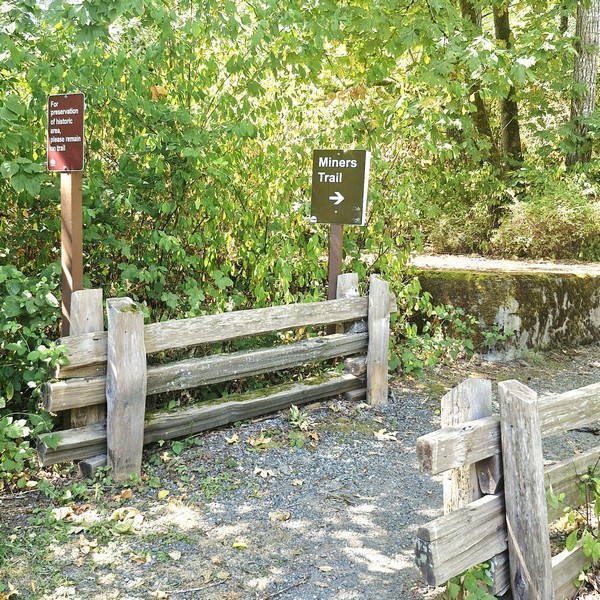
The Miner’s Trail

From Morden Colliery Historic Provincial Park, we first hiked the wide, 1.2-km. long and fully accessible gravel path, with two wooden bridges, developed by the RDN. The RDN Trail lead to a view deck overlooking a quiet and tame section of the Nanaimo River. Currently, one can only cross the river on foot (getting wet in the process) but, eventually, the RDN hopes to build a bridge connecting Morden Colliery Historic Provincial Park with Hemer Provincial Park in Cedar.

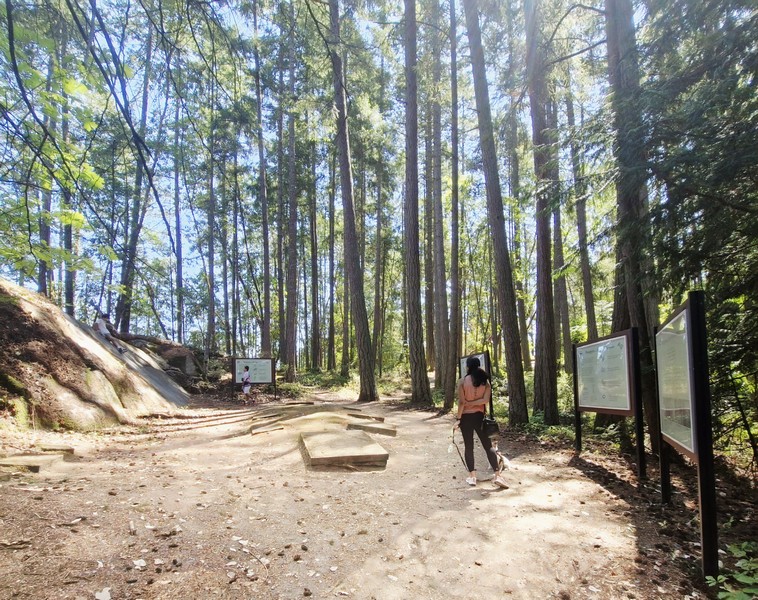
Back at Morden Colliery Historic Provincial Park, we then walked along the short Miners Trail that follows the old rail grade used to move coal at the mine.  There were plenty of signs to guide us.  Along the way, we saw remnants of the mining operation that once took place here.

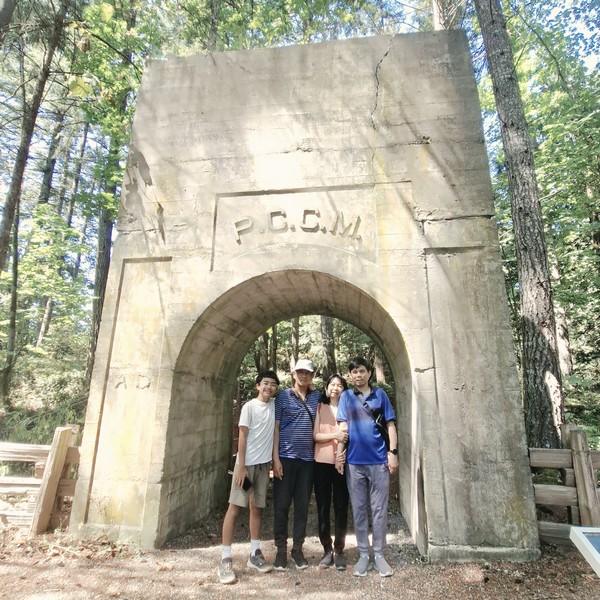
Kyle, the author, Grace and Jandy under The Arch

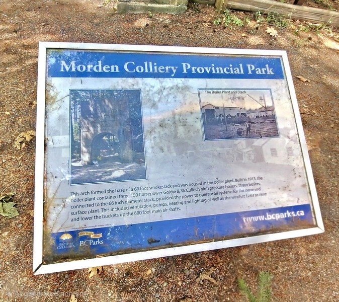
The concrete “Arch,” the surviving heavy structural base of a 60-ft. high, 56-in. diameter industrial smokestack, was built around 1913 by the Pacific Coast Coal Mines (PCCM), and once supported the boiler plant (with 3 150 horsepower Goldie & McCulloch high pressure boilers) that powered the historic mine site’s ventilation, pumps, heating and lighting as well as the winches to raise and lower the buckets up the 600-ft. main air shafts.

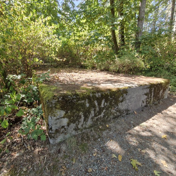
Remains of the concrete foundation

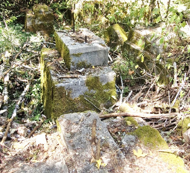
Near the towering headframe ruins are the foundations and structural remnants of the hoist house that housed the electric winding engines and heavy cable spools used to operate the skip/cage system, the electric winding machinery to raise and lower workers and coal cars via dual steel cables sunk roughly 180 m. (600 ft.) down to the main coal seam, in the concrete headframe.

Another remnant of the concrete foundation

Morden Colliery Regional Trail: 1L7, 1840 Cedar Rd., Nanaimo, British Columbia V9X 1H9.  Tel: (250) 390-4111.

How to Get There: Morden Colliery Historic Provincial Park is located 7 kms. south of Nanaimo. It is accessible off Highway 1 on Morden Road.

Petroglyph Provincial Park (Nanaimo, British Columbia)

On our second whole day in Nanaimo, we decided to visit the small, 2-hectare Petroglyph Provincial Park, a short 8.2-km. (15-min.) drive from our motel. From the parking lot, a short walkway lead to an interpretive area with information boards that offer details about the history of the area and help to decipher the petroglyphs.

Main interpretive area at Petroglyph Provincial Park with casts and information boards

Established on August 24, 1948, the provincial park protects a remarkably high concentration of petroglyphs, date to at least the 10th century CE,  found near the estuary of the Nanaimo River.  These carvings depict mythological sea creatures, human figures, and animals that are symbolic of the spiritual and cultural history of the Coast Salish and Snuneymuxw First Nations.

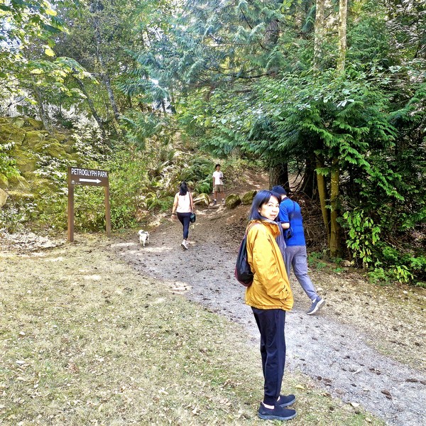
Cheska, Kyle, Grace and Jandy at the entrance of the park trail

The locations of these traditional prehistoric rock art carvings were chosen carefully, almost always made at places of power or mystery, where forces of nature were believed to be especially strong. These areas are usually marked by a natural feature such as a waterfall,  rock formation or caves, and most are near water.

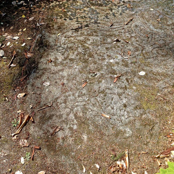
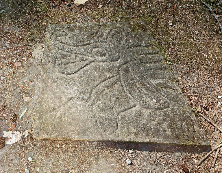
Hard to verify, but I’m guessing this is one of the original petroglyphs.

Slightly further up the trail is the large sandstone gallery area, located on a hill overlooking Nanaimo Harbor, covered in the real petroglyphs and moss. The images, depicting everything, from mystical wolf-like creatures to fish and human figures, were made for a variety of reasons, including territorial ownership and to commemorate special events among a people with no written language.

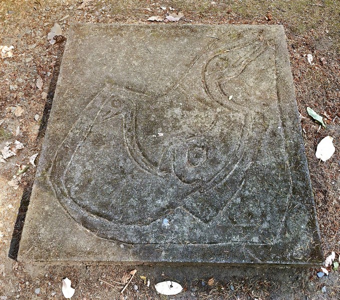
A cast of a pteroglyph, probably a mythological sea creature

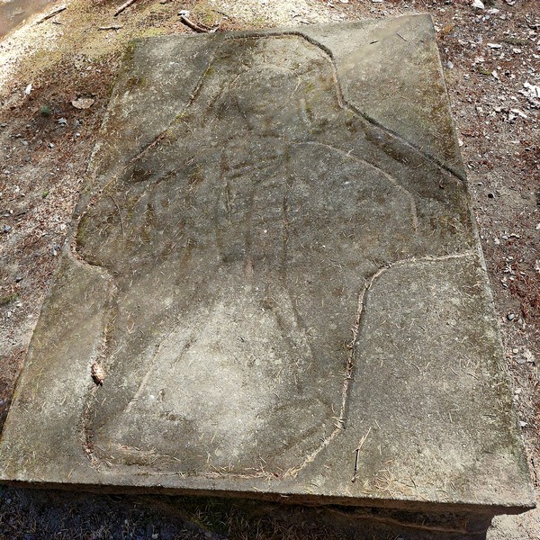
Eight concrete replica castings of the petroglyphs can be found in the main interpretation area. Here, visitors can make rubbings of the castings by stretching cloth or paper across the carving and lightly rubbing with a crayon, charcoal or wax, which leaves a reverse imprint. These rubbings make a great souvenir of a visit to this intriguing and educational park. 

A cast of a petroglyph, probably a human figure

To protect the petroglyphs and surrounding vegetation, we stayed on the designated trails. Over or near to the original ancient indigenous artwork are more modern unauthorized rock carvings, including English letters, added by vandals.

A cast of a petroglyph, probably a wolf-like creature

Petroglyph Provincial Park: .990-960, Trans-Canada Highway, Nanaimo, British Columbia.  Tel: (250) 474-1336. Open daily, 7 AM – 10 PM.  Coordinates: 49°08′27″N 123°55′36″W.
How to Get There: It is located 4 kms. (2.5 mi.) south of the city of Nanaimo, on a hill overlooking Nanaimo Harbour. Access to the park is via a pull-off from Highway 1. Watch for signs. The parking area is a pull off, next to Highway 1. From there, it is a short walk to reach the petroglyphs, less than 500 m. in a loop.

Drumbeg Provincial Park (Gabriola Island, British Columbia)

From Brickyard Beach, it was a short 8-km. (12-min.) drive to the 55-hectare (140-acre) Drumbeg Provincial Park at the east coast of Gabriola Island, overlooking the scenic Gabriola Passage. It is one of the most relaxed and scenic spots on Gabriola, and an easy day trip from Nanaimo.  A popular area for diving, hiking, nature viewing, sunbathing and picnicking, facilities at this park include a grassy field, pit toilets, picnic tables, hiking trails and an information shelter.

Check out “Brickyard Beach”

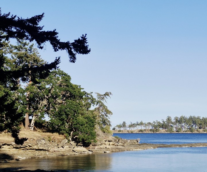
Drumbeg Provincial Park

Interpretive signage (donated by the Heartland Conservancy Group and the Gabriola Theatre Club), located at the information shelter in the day-use areas, offered information about the protected endangered Garry oak ecosystem and meadows (a rare and ecologically sensitive habitat that is especially pretty in spring when the wildflowers come out), undeveloped Douglas fir forest landscapes and the diverse marine zone in the park. Along with a number of intertidal creatures, bald eagles, great blue herons, harbor seals and American oystercatchers can be spotted here.

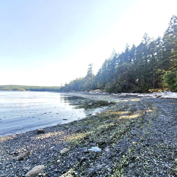
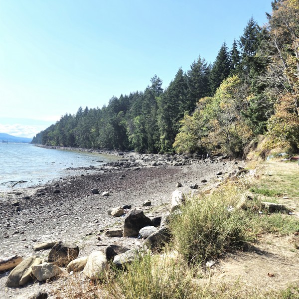
The kilometer-long sand and pebble beach

Managed by  BC Parks, this day-use only provincial park (one of three provincial parks on Gabriola Island, the others being Gabriola Sands Provincial Park on the northwest shore and Sandwell Provincial Park on the northeast shore) was established in 1971.  Offering excellent views of the Strait of Georgia and the Coast Mountains on the mainland, the shoreline here is the main draw.

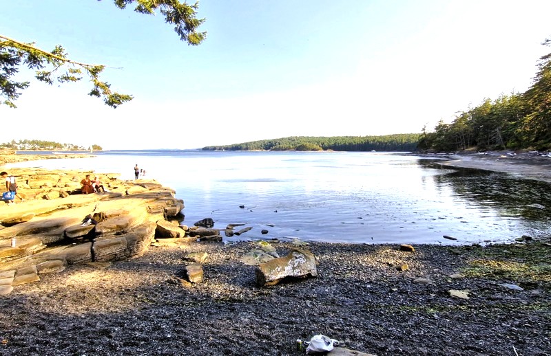
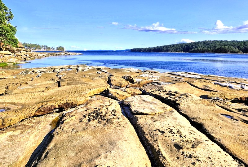
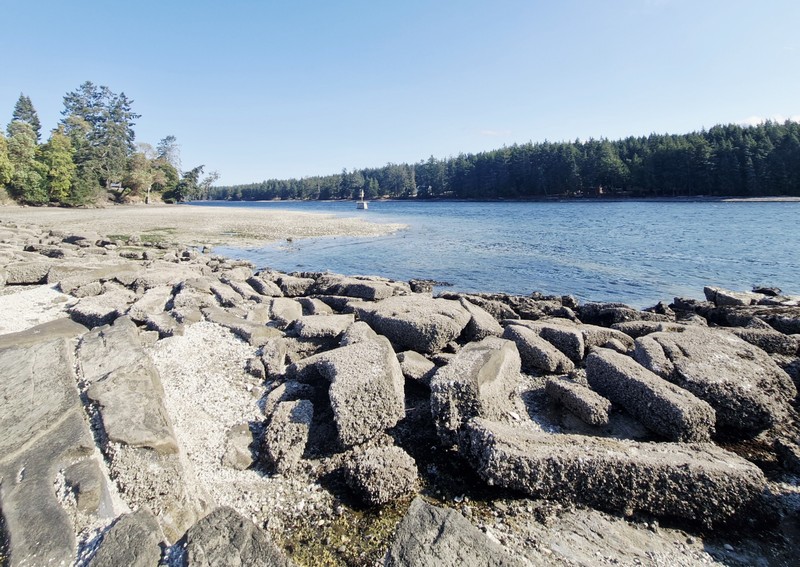
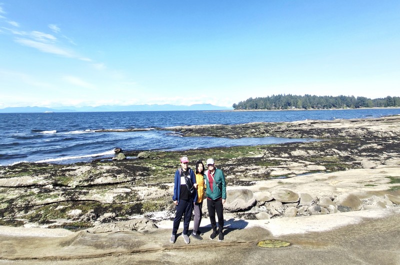
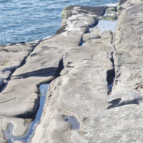
The park contains a kilometer-long sand and pebble beach, which curves around the bay, with unique and striking, sculpted sandstone and conglomerate rock formations that Gabriola is known for, best seen and fully exposed at low tide (the time we arrive). The formations include shelves, ridges, and pockets that, though the terrain is uneven, are fascinating to explore and walk across.

The unique and striking, sculpted sandstone and conglomerate rock formations

We picked a spot along the quiet beach for our picnic.  There was no drinking water, so we brought your own.  While picnicking, we watched boats navigating the narrow Gabriola Passage just offshore. The sheltered bay at Drumbeg warms up nicely in summer, making it one of the better swimming spots on the island. However, strong tidal currents run between the islands and riptides and currents can be dangerous.

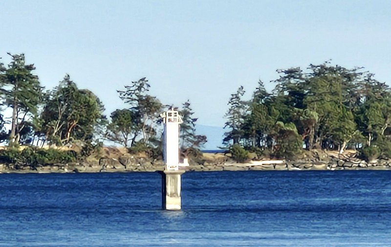
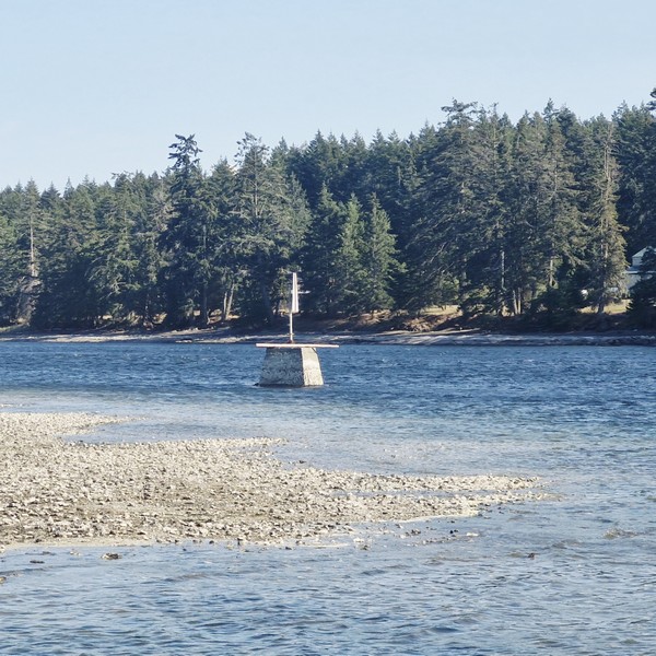
A light beacon used as a navigational aid

Following the shoreline are about 2 kms. of easy, gentle and well-maintained walking/hiking trails that meander along the shoreline and through the upland above the beach, well suited for families, with frequent openings to the water and quiet spots to stop for a picnic.  The route passes through rare and fragile Garry oak and open meadows (keep to the trails to protect the fragile meadow plants). Underwater enthusiasts can dive from the shores of the park, or they can head out to Rogers Reef, by boat, and still stay out of the strong currents that run through Gabriola Passage.

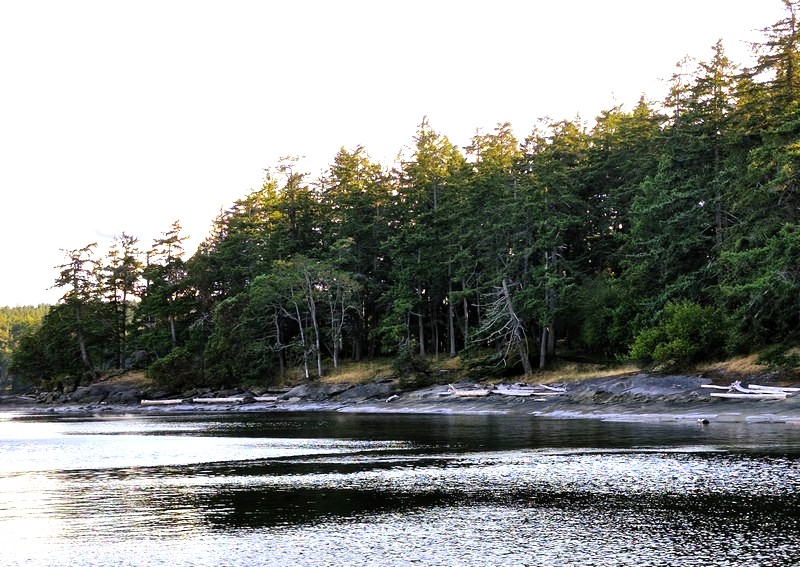
The shoreline forest of Douglas firs and Garry oaks

After our picnic, we returned to our car for the 15.3-km. (20-min.) drive back to the Descanso Bay Ferry Terminal for our scheduled 9:25 PM return trip, via BC Ferries MV Island Gwawis, back to Nanaimo’s Departure Bay Terminal.

Drumbeg Provincial Park: Stalker Rd., Gabriola Island, British Columbia V0R 1X0. Tel: (250) 474-1336.  Coordinates: 49°07′57″N 123°41′39″W.

How to Get There: BC Ferries has 25-min. crossings, from Nanaimo Harbor, to Gabriola Island. Depending on the season, the ferries run almost every half-hour, from 5:45 AM to 11 PM. From the Descanso Bay Ferry Terminal, follow South Road, across the island toward the south end, then follow signs via Coast Road and Stalker Road to the park. The road in to the park is narrow (only wide enough for one car) and the drive takes roughly 20 minutes. The small parking lot is adequate for most of the year, but it can fill on warm summer weekends, so arrive earlier in the day.
Brickyard Beach (Gabriola Island, British Columbia)

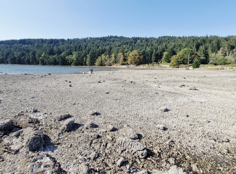
From Malaspina Galleries Community Park, we next drove 9.8 kms. (a 15-min. drive) to Brickyard Beach, a rocky beach rich in industrial history located on the southwest coastline of Gabriola Island. The beach is located on False Narrows that separates Gabriola Island from Mudge Island and Vancouver Island.

Check out “Malaspina Galleries Community Park”

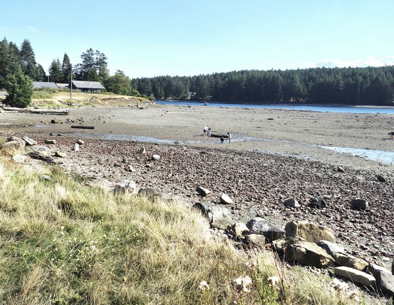
Brickyard Beach with Mudge Island, across False Narrows, in the background

It was once the site of Gabriola Brickyard, the largest industry and employer (of Gabriolans and Chinese contract workers) on the island. From 1890 to 1950, it was actively producing, all by hand, up to 80,000 bricks per day. The work was difficult, noisy, and dirty, but the bricks were used for construction of buildings in Nanaimo, Victoria, Vancouver and New Westminister in British Columbia.


The brickyard was located at the base of Brickyard Hill, just north of Ferne Road. The raw material was plentiful blue and brown shale, extracted on the hill by the beach, which was crushed to make clay. There was no electricity at Gabriola at the time and the plant operated on steam pumps heated by local firewood and cheap coal from Nanaimo. To heat the crushed shale, workers shoveled coal and wood into a fire and pressed the shale into bricks, four at a time, using a hand-operated hydraulic press.

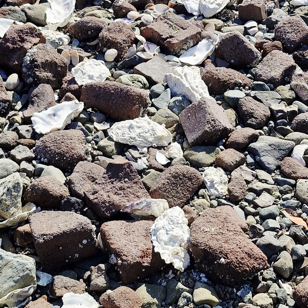
Remnants of bricks mixed with sand, clam shells and pebbles

The ease of transportation, by ocean, made the location functionable.  During low tide, the bricks were loaded onto scows that departed from the shore, with the high tide, for shipping. In 1952, because construction techniques had advanced beyond bricks, production ceased and the plant was closed and, a little later, the kilns and buildings were dismantled and the area was bulldozed and cleared.

Brush and undergrowth have now reclaimed most of the site but pieces of misshapen, defective or broken “Dominion” brand red bricks, that were culled by workers on the beach, have remained there still, mixed with the sand and pebbles.  That’s how Brickyard Beach turned out. Today, there is still evidence of the old bricks located throughout the beach. However, because of storms, winds and human activity, most are crushed and mixed in with the sand and pebbles.

Today, little remains of the Gabriola Brickyard except for piles of broken bricks heavily littered on Brickyard Beach and the name of the steep hill on South Road. Enterprising locals still dig these historic bricks out of the banks. From the shore of the beach, it is easy to see Mudge Island (where orcas are frequently spotted) and the Pylades Islands and there are views of birds and marine activity as boats and kayaks often explore the area. The False Narrows is a busy marine route used frequently by sailboats, fishing vessels and yachts.

False Narrows. In the foreground are debris which, I am guessing, are probably from the dismantled factory and kilns

During low tide, the ocean water recedes, revealing a land of tidal pools that are full of marine life like sea anemones, crabs and star fish. There are opportunities for birdwatching and wildlife viewing like sea birds, predator birds, seals and more. Brickyard Beach, a launch and landing point for kayaking (the close proximity to the bays and coves on Mudge Island and the Pylades Islands makes the beach ideal for launching a kayak), is also a popular location for beachcombing, clam digging, gathering oysters and sightseeing.

Brickyard Beach: 1633 South Rd., Gabriola, British Columbia V0R 1X6.

How to Get There: A ferry leaves, almost every hour, for Descanso bay Ferry Terminal on Gabriola Island, from Nanaimo Harbor.  The crossing takes 25 mins. From Descanso bay Terminal, it is a 7.3-km. (4.5-mi.)/10-min. drive to the beach. Drive up Ferry Hill onto North Road, connect toward South Road, and follow it southeast to 1633 South Road.

Malaspina Galleries Community Park (Gabriola, British Columbia)

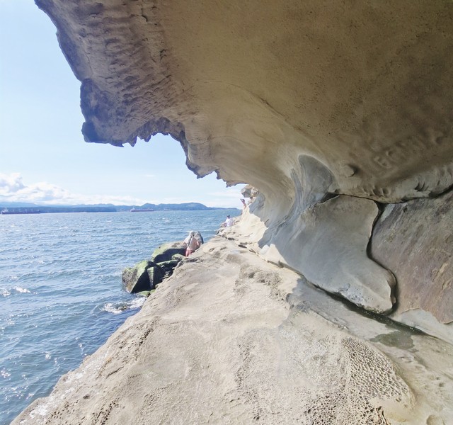
The tunnel of the Malaspina Galleries Community Park

After lunch at Ground Up Café and Catering, we drove the short 3.6-km. (5-min.) distance to the nearby Malaspina Galleries Community Park, a unique, wave-shaped sandstone rock formation on the northwest shore of Gabriola Island.  The galleries were named for Alejandro Malaspina (November 5, 1754 – April 9, 1810), an Italian-born 18th century explorer sailing for Spain, who charted parts of this coast in the early 1790s. For well over a century, the formation has drawn artists and visitors.

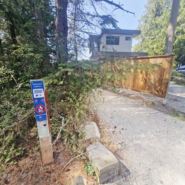
The entry through the park

One of the most photographed natural features in the Gulf Islands and one of Gabriola Island’s signature natural sights, the galleries are located within a small community park at the end of a dead-end road in a residential neighborhood so parking was limited. Luckily, we were able to park.  

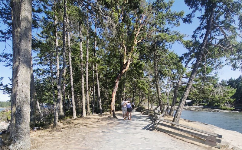
The trail leading to the rocky bluff

From the parking area, it was a short 100 m. (2 to 3-min.) walk, through a shaded, green West Coast evergreen environment typical of the Gulf Islands, to the rocky shoreline flats. Striking, vibrant arbutus trees, distinctive Pacific Northwest native trees, grow right above and alongside its famous weathered sandstone wave formations.

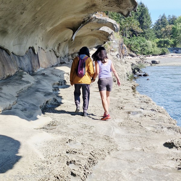
Grace and Cheska walking through the overhang

Upon reaching the shoreline from the trail, the galleries were on the left side of the rocky bluff. Carved by wind and waves into a shape that genuinely resembles a breaking, barreling wave frozen in stone. This overhanging sandstone rock formation, called a rip curl, stretches about 100 m. and stands about 4 m. high, forming a sheltered, tunnel-like passage with a ceiling, running along its length, you can walk beneath.

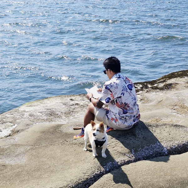
Bryan reading a book with our pet dog Luffy beside him.

As we arrived during the summer season, the area was packed with tourists. It was low tide (access along the shore is limited during high tide) and visitors were walking the shoreline, some looking for sea stars, sand dollars and other tide-pool life on the exposed walkable shoreline shelves.

Jandy, Grace and the author along the walkable shoreline shelf

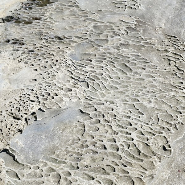
At the tunnel floor are tafoni, a geological weathering process that creates a distinctive Swiss-cheese or honeycomb texture visible across the sandstone. Saltwater spray and tiny salt crystals seep into the porous sandstone and, as the crystals dry and expand, they pop tiny sand grains loose over hundreds to thousands of years, hollowing out individual pockets.

Distinctive Swiss-cheese or honeycomb texture visible across the sandstone

The Malaspina Galleries Community Park are a great fit for photographers and families wanting a quick, scenic natural stop.  Walking beneath the passage, we appreciated the relentless erosive power of the ocean’s and got a sense of the impressive scale that photos struggle to capture.

Scenic tide pools

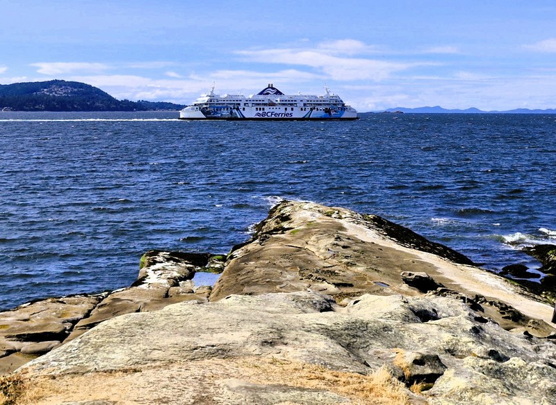
Since the final approach is over uneven rock, the site is not for anyone with mobility challenges. Fishing or beach fires are also not allowed. The rocky point was also a great scenic coastal viewpoint where you can watch the regular BC Ferries ships crossing the Strait of Georgia between Nanaimo Harbor and Descanso Bay.

A BC Ferries ship, seen from the rocky bluff, crossing the Strait of Georgia

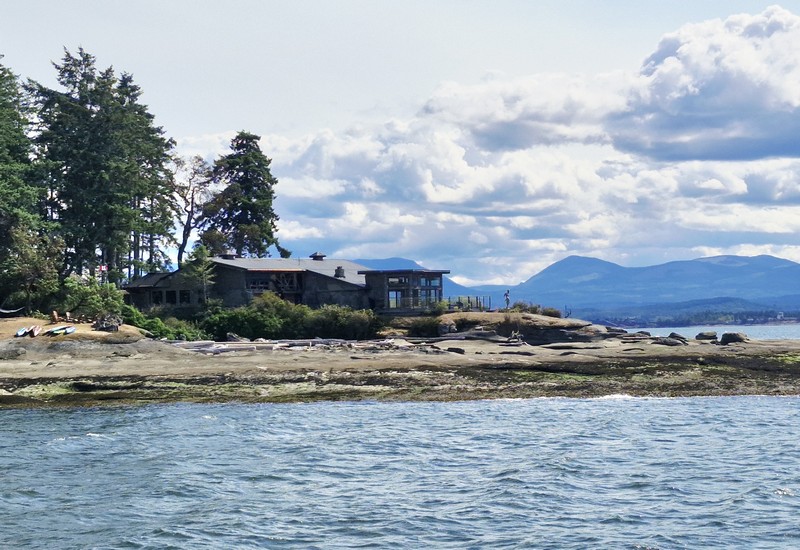
There’s also a house on the opposite shore which, I am guessing (I may be wrong), would be the Foster’s House (belonging to an early settler family) seen on a 1903 Malaspina Galleries postcard showing a standing man and a seated woman, a rowboat and the house in the background.

The Foster’s House?

Malaspina Galleries Community Park: 99 Malaspina Drive, Gabriola, British Columbia V0R 1X1. Admission is free. A tide-dependent stop, at low tide the formation is fully walkable and the tide pools are exposed while at high tide, the water comes up against the rock and access along the shore is limited or cut off.  Before you go, check a tide table. For safety and preservation, it is best to view and walk beneath the formation rather than climb the top of the soft, eroding sandstone overhang, a natural feature that continues to weather. As it is often the first stop for visitors, parking spaces fill quickly on summer weekends, especially right after the ferry unloads. Park respectfully and avoid blocking driveways. There are no restrooms on the site, only pathways and trash/recycling bins. The area offers opportunities to explore other natural formations, such as the Galiano Gallery and the “honeycomb holes.”

How to Get There: BC Ferries has 25-min. crossings, from Nanaimo Harbor, to Gabriola Island. Depending on the season, the ferries run almost every half-hour, from 5:45 AM to 11 PM. From the Descanso Bay Ferry Terminal, follow Taylor Bay Road, turn onto Malaspina Drive, and continue to the very end, where a short trail leads to the shore in about two to three minutes.

Discovery Fishing Pier (Campbell River, British Columbia)

Discovery Fishing Pier

From Nymph Fall Nature Park in Courtenay, it was a 50.8-km. (40-min.) drive to Campbell River where we decided to stroll along Discovery Fishing Pier, Canada’s first-ever saltwater tidal fishing pier located beside the Government Wharf in downtown Campbell River. We parked our car at a parking lot the pier shares with the Discovery Passage Aquarium and the Campbell River Maritime Heritage Centre.

Check out “Nymph Fall Nature Park” and “Campbell River Maritime Heritage Centre”

The pier as seen from the breakwater
Government Wharf

The 183-m. (600-ft.) long, wooden and wheelchair-accessible Discovery Fishing Pier, a local icon located in the heart of Campbell River, was a joint project between the municipality and the local Rotary Club.  Opened on July 4, 1987, it is the perfect location for sunset photos, with the opportunity to see seals, dolphins and occasional whales in the distance. 

The author, Grace, Jandy and Kyle

It extends 45 m. (150 ft.) from shore, allowing for unobstructed views of Campbell River and its waterfront as well as the Discovery Passage, Cuadra Island and cruise ships transiting the passage. Unfortunately, to maintain cleanliness and safety of walkers and fishers, smoking and dogs (and our Luffy) were not allowed.

The historical plaque

A favorite spot with local anglers, the pier provides easy access to recreational fishing, with rustic “game chairs,” fish-cleaning troughs, drop-nets for winching up large salmon, shelter with seating and tables, built-in rod holders, nets to help lift your catch, weighing scales, bait stands, picnic tables and benches for public use.

Rustic game chairs
Shelter with seating and tables

The Discover Fishing Pier Ice Cream Shop, the seasonal concession stand (open May to October), provides rod and tackle rentals ($7.30/hr.) and, during the summer months, their staff also run a leaderboard that tracks all the catches made off the pier. If you do plan on doing some fishing, you’ll need to buy a valid Tidal Waters fishing license and the closest place to the pier to purchase one is at the Tyee Marine Fishing and Outdoors Shop. 

The Discover Fishing Pier Ice Cream Shop

Aside from fishing, the concession stand is famous for its delicious (and giant), value-heavy, rotating hard ice cream, including lactose free ice cream (vanilla flavor only), on freshly-baked brown waffle cones. They also have a limited menu, offering fish and chips, wraps, bagels, popcorn, burgers, freshly made muffins, pizzas, seafood, banana bread (when available), brownies, hot dogs, fried pickles, French fries, and coffee.  They also have washrooms and a drinking fountain.

Campbell River Maritime Heritage Center on the near right

Discovery Fishing Pier: 655 Island Highway, Campbell River, British Columbia.  Tel: (778) 346-1868.  E-mail: discoverypier@gmail.com.

Nymph Fall Nature Park (Courtenay, British Columbia)

On our second whole day in Vancouver Island, we drove 58.3 kms. (a 40-min. drive) from Qualicum Bay Resort to Nymph Falls Nature Park a popular summer spot for swimming and picnics known for its series of small waterfalls along the Puntledge River, clear pools, and easy multi-use trails that work well for families, casual walkers, and anyone who wants a quick escape from town.

Nymph Falls Nature Park

This park, originally a recreation reserve, protects 61 hectares (151 acres) of second-growth forest (Douglas fir, Western Hemlock and Western Red Cedar), as well as a few black cottonwoods, Sitka spruce, big-leaf maple, red alder and Pacific yew, located on the north side of the Puntledge River. Members of the Plateau Road Residents Association have improved and maintained the trails for many years.

The author, Grace, Jandy and Kyle

During World War II, the picnic table clearing, close to the river at the base of the Nymph Falls Nature Park main entrance, was once the site of a labor camp for conscientious objectors (e.g. Mennonites).  In 1977, fish ladders were blasted out to help spawning salmon swim upstream.

In 1992, the Comox Valley Regional District (CVRD) received a 20-year lease over this piece of Crown Land for park purposes. In 2012, this lease was renewed for another 30 years. In November 2012, the CVRD purchased, for $379,000, a 5.5-hectare property located on the untledge River northeast of Crown-owned portion Nymph Falls Park from 0768816 BC Ltd., Inc. (also operating as 3L Development).

After parking our car at the designated parking stalls at the trailhead, the falls were an easy 500-m. stroll along a wide and gentle, wheelchair friendly River Trail. As we arrived during summer, we saw unusual plants such as gnome plant and Indian pipe along edge of the trail, and its glacial waters were running calm, clear and cool, revealing a series of exposed bedrock ledges, making the park and nearby Barber’s Hole popular spots for a refreshing dip on hot days. The river changes with the seasons. From fall to spring, the river and falls rages over the exposed bedrock ledges, to the delight of whitewater enthusiasts.

Kyle and Cheska with pet dog Luffy

We walked out onto the long flat rock outcrop at the shore, watching out for slippery rocks due to algae deposits, for a spectacular view of the Puntledge River and the spectacular Nib Falls, which cascades over man-made fish ladders falls (where you’ll often notice flashes of red or silver in the water).  We didn’t sunbathe and swim (steps to the river located just 40 m. downstream of the falls provide access to the rock outcrops and pools of clear water) but there were benches and picnic areas placed beside the water and throughout the forest, where we had a late lunch.  Additional tables were also spaced out, along the trail network, for those who prefer quieter corners of the park.

A bonsai-like evergreen tree directly out of a small rocky island

In the middle of the rushing Puntledge River is a solitary, iconic and highly photographed bonsai-like evergreen tree directly out of a small rocky island. This tree survives on a slab of exposed bedrock amid cascading glacial water. Attempting to swim or wade out to the solitary tree island is dangerous as the bedrock shelves create treacherous undertows and high-velocity currents.

High velocity currents

Solitary but resilient wildflowers, surviving in thin layers of organic matter trapped within the rock’s unique weathered “tafoni” pits, also bloom directly out of the moss-covered crevices, pockets, and fissures of the exposed Cretaceous sandstone bedrock along the Puntledge River.

Wildflowers blooming directly out of the moss-covered crevices

They include succulent broad-leaved stonecrop (Sedum spathulifolium), dense clusters of tiny pink sea blush (Plectritis congesta), bright yellow monkeyflower (Erythranthe guttata), red-and-yellow wild columbine (Aquilegia formosa) and delicate white small-flowered alumroot (Heuchera micrantha).

Wildflowers growing on a rock beside Nib Falls

From October to November, as the water levels rise and temperatures cool, this is a good place to see returning salmon working their way up the Puntledge River, towards the spawning grounds upstream, as the fast-moving channels around Nymph Falls and Nib Falls create natural pinch points where you can sometimes watch fish leap through the current. Though numbers vary from year to year, this is still one of the more accessible places, in the Comox Valley, to experience the fall salmon run up close.

Nib Falls

The Puntledge River, which once boasted an abundance of various species of fish, is an important part of the salmon run and the Puntledge River Hatchery was built downstream to save Chinook salmon from extinction and, altogether, help rebuild a healthy fish population. 

The short trail leading to the falls

Facilities here are simple but thoughtful.  There are several pit toilets, picnic tables, and signed routes from the two main parking lots. A well-marked, multi-use trail network, within Nymph Falls Nature Park, connect with a larger system up and down the river and wind through second-growth forest to key viewpoints where benches appear. The walking trails vary, from gentle riverside paths to wider forest routes, giving you options for short outings or longer loops, and the routes are well signed,

Smaller waterfalls located upstream

Most commonly seen along the trails and river are birds such as osprey, Cooper’s hawk, bald eagle, Glaucous-winged gull, American dipper, northern flicker, red-breasted sapsucker, varied thrush, brown creeper, Pacific wren, red-breasted nuthatch, chestnut-backed chickadee, golden-crowned kinglet, belted kingfisher and dark-eyed junco.

Nymph Fall Nature Park: 4481 Forbidden Plateau Rd., Courtenay, British Columbia V9J 1R2. Tel: (250) 334-6000.

How to Get There: Nymph Falls Nature Park is just a short 10-min. drive from Courtenay and Comox.

Cathedral Grove (Port Alberni, British Columbia)

After our hike to the Hole in the Wall, we drove another 13.9 kms. (a 20-min. drive), heading east along BC Highway 4, to get to the Cathedral Grove.  Located within the 301-hectare (740-acre) MacMillan Provincial Park (it officially became a Class A provincial park in 1947), it is one of the most accessible and incredible old-growth forests on Vancouver Island. Each year, this iconic destination draws more than half a million visitors. We parked our car at a small roadside parking areas, on both sides of Highway 4.  It being summer, we were lucky as we arrived late in the day.  It usually fills up quickly, especially during weekends.

Check out “Hole in the Wall”

Cathedral Grove

For thousands of years, the Hupacasath First Nation and other local indigenous groups have cared for the land, using the giant trees for shelter and tools. Since the 1920s, Cathedral Grove has been a famous stop along the Alberni Road. Viscount Willingdon, the Governor General of Canada, named the site “Cathedral Grove” in the 1920s because the tall trees looked like a grand church.

Plaque honoring Scottish botanist David Douglas

In 1944, Harvey Reginald MacMillan, a timber baron who wanted to log this whole area, donated 136 hectares of his company’s land to the public after concerned locals and first nations protested fiercely, making it one of the first successful conservation victories in British Columbia. It’s ironic though that the park was named after the man who wanted to cut it all down. Unfortunately, although this grove was protected, most of the surrounding watershed was chopped down and cleared.

Douglas fir

An easy stop on the drive to Port Alberni, the Pacific Rim, or central island lakes, here a short network of combined flat loop trails, with a combined walking distance of roughly 2.2 kms., takes you beneath towering Douglas fir and Western Red Cedar trees, with trunks so wide you can barely wrap your arms around them. Boardwalks, wide gravel paths, and frequent viewpoints makes you experience the forest at a relaxed pace.

Western Red Cedar

The Douglas fir are the granddaddy of this forest.  They were huge and massive, with a long branch-free trunk 9 m. in circumference, and a canopy up high.  Their dark brown bark looks much thicker, with irregular, thick ridges. Western Red Cedar trees have trunks that flare out at the base, with reddish-brown bark with long ridges. Their leaves, spread out on the twigs in flat, fan-like swooshes, have a lovely smell. Western Hemlock, the most common tree on the British Columbia coastline, doesn’t mind shade, growing up beneath the other giants. Its drooping branches have a feathery, flat, glossy and soft foliage that, when the sunshine streams through it, looks fabulous.

Western Hemlock

Cathedral Grove has two main trail areas on either side of Highway 4, making it easy to explore, in a single short visit, both the north and south sections. The north section has a boardwalk-style loop that works well for most wheelchairs and strollers while the south section has upgraded but slightly more uneven but wide gravel paths. To help manage traffic, both trails are one-way loops.

Kyle, Cheska, Grace and Jandy entering the South Trailhead

We first entered the Cathedral Grove’s south section, a 1-km. long dirt path which was muddy due to rain that day. At the entrance was a plaque honoring Scottish botanist David Douglas, after whom the Douglas fir was named. Good thing we wore proper footwear. Upon stepping into the trail, we felt like entering another world.

Bigleaf Maple

We were captivated by its towering old-growth trees, deep green moss, and quiet forest floor. There’s no boardwalk here, but the route is still flat and easy to follow. To protect the forest floor and root systems, we stayed on the designated trails. Smoking is also strictly prohibited. We encountered exposed roots and fallen trees, particularly through the “Living Forest” section. 

Sword ferns

This trail is a bit more hands-on, with opportunities to step over logs, get close to the trees and, along the way, snap some great photos. Most of the forest trees (giant Douglas fir, Western Hemlock, Western Red Cedar and a few maple trees) we saw today are younger growth that regenerated after a major forest fire that swept through this part of Vancouver Island around 300 to 400 years ago.  However, some of the oldest giants here are well over 800 years old. Following the “Big Tree Trail,” we made our way up to the superstar of the hike – the largest Douglas fir around. At 72 m. (236 ft.) tall, it stands higher than the Leaning Tower of Pisa. 

Hanging tree moss

From the South Trailhead, we carefully crossed the highway to enter the North Old Growth Trail.  This trail features groves of ancient Western Red Cedar (British Columbia’s official tree) near Cameron Lake.  

North Old Growth Trail

To protect the tree roots, a beautifully maintained boardwalk trail winds around most of the trails, extending approximately 1.2 kms. This was fine for our footwear as we didn’t get muddy or soggy. Plus it is wheelchair accessible.  Along the trail, there were scenic spots along the Cameron River.

Cameron Lake and Mt. Arrowsmith seen at a distance

Along this trail, we encountered a lot of enormous fallen trees, a legacy of severe windstorms (when massive trees were knocked down) in 1990, 1997, 2018 and 2024, creating open spaces and nurse logs that feed new plant growth, and a striking visual and ecological narrative. These fallen trees now play an important role in the forest’s renewal as atop the old, nutrient-rich logs, newer trees now thrive, creating an awe-inspiring cycle of renewal of the ecosystem. Some trees grew into each other as we saw the differences in the bark.

Boardwalk at the North Old Growth Trail

It took us more than an hour to walk both sides of this well-loved roadside attraction as we stopped for photos and read interpretive signs.

Root rot

Cathedral Grove: MacMillan Provincial Park BC-4, Port Alberni, British Columbia V0R 1G0. Open year-round, with lush moss and ferns in the rainy months. Avoid visiting during strong winds, as large branches and trees can fall in old-growth forests. Admission is free.  There are pit toilets on both sides of the highway. Dogs are welcome but must remain leashed. On windy days, consider skipping your visit or waiting for calmer conditions, as large branches and trees can fall in old-growth forests.

How to Get There: The park, conveniently located 16 kms. east of Port Alberni and 30 kms. west of Parksville, along Highway 4, is easily reached by car or via organized tour groups.  Public transportation is not available.

Hole In The Wall (Port Alberni, British Columbia)

From the Old Country Market in Coombs, we drove 33.1 kms. (a 30-min. drive) to explore the Hole in the Wall, a popular stop for many and an unofficial tourist spot with limited parking and signage.  A trailhead leading to the Hole in the Wall was across the Coombs Country Candy Shop just outside Port Alberni.

The Hole in the Wall

There was no other available parking (there was only space for three or four cars) at the pullout on Highway 4 heading uphill out of town, and getting to the trailhead entailed crossing the extremely busy highway (there is no crosswalk available and you had to be extra careful when crossing the highway) plus we can’t park in the parking lot of Coombs Country Candy, as this is for store patrons only.  So we drove further east, on the south side of the highway, where we were able to park the car at one of the few parking spaces available at a tiny pull-out before the curve heading out of Port Alberni. It was right at the trailhead and we didn’t have to cross the busy road.

The Hole in the Wall is a manmade structure.  From the 1910s through the 1940s, as demand for water increased, there have been numerous dam and pipeline improvements in Port Alberni. Before the 1967 amalgamation of Port Alberni, this area was a shortcut for the town’s water supply. In 1940, after a dry summer, a hole was blasted through a massive wall of volcanic shale, and a large wood stave pipeline was laid to bring water from Rogers Creek to Port Alberni. 

The trail through the lush forest

The pipe is now gone (removed by the 1960s) but, to this day, you can still see the remains of the old water piping metal straps still partly buried in the ground, on the side of the trail, that formerly bound the old water pipeline.  However, the creek water, passing through the empty hole, now leaves us with a unique structure and a beautiful water feature – a charming waterfall flowing through a man-made rock opening.

Cheska, Kyle, Grace and Jandy

The entrance, on the south side of the highway, was unmarked. It was supposed to be just a short 1.2-km., reasonably straightforward hike to Hole in the Wall, steep in some spots, but it required a bit of fitness and good footwear and, as it rained the day before, the gravelly trail, first down and then up, was muddy. It was also intermittently signed. As we made your way down the trail, we entered deeper into the rainforest.

Wooden sign on the tree

The trail leveled out, and mossy trees and ferns surrounded us, growing down the slopes. The slightly steeper portion can be handled, by running shoes, on a dry day but it was muddy on the day of our visit. We had to watch out for washed-out sections. As we meandered through the lush forest, we kept our eyes peeled for wildlife. At the first clearing, the path split in two. The forest floor was rich with ferns, moss, and towering trees. Even though the main track was straight ahead of us, we headed right, going downhill. There was a wooden sign hidden in the tree indicating the way. The short but steep descent down took us to our destination.

The descent downhill

Finally, after roughly 20 to 30 minutes, we heard the sound of running water as we approached, a sure sign that we were getting close.  Looking across the river, we finally found this idyllic and tranquil retreat with natural and man-made features – a large, strikingly circular opening carved in the shale wall, along Rogers Creek, with a tiny waterfall flowing through it now.

Kyle, the author, Grace and Jandy at the Hole in the Wall

This beautiful oasis, with its rain forest, ferns and river rock beds, had a lot of moss on the big cedar trees and stumps but, despite the rain, there wasn’t much water running through the hole. The crystal-clear water flowed into a shallow pool, reflecting the beauty of the forest canopy above. The exposed shale rock beautifully showed off the earth’s many layers.

Two logs on the massive concrete slab that was part of the original pipeline’s supporting structure
The two fallen logs
Kyle crossing the logs

As it was summer, visitors swam or waded through the water to stand for photographs in the large structure. The best vantage point for a photo is from two fallen logs, on a massive concrete slab (part of the original pipeline’s supporting structure), across from the Hole in the Wall. Now used as an elevated viewing platform, it required walking across (which Kyle did) the logs which can be slippery.

The shale wall along the pool
The crystal-clear pool below the hole

They say that, if you continue down along the creek, and you can find an old dam downstream with a bonus waterfall. You can also continue down the path, for about 2-3 mins., where you can find really neat inuksuks or cairns (man-made stacks of rocks). Hundreds of these rock creations used to be there, but the creek expanded and washed many away during the 2021 fall floods.  On our return trip, we had to walk uphill most of the way.

Weigela

Hole In The Wall: Port Alberni, British Columbia V9Y 7M4. Coordinates: 49.2603° N, 124.7482° W.
How to Get There: It is actually located near Port Alberni, off Highway 4 (across from Coombs Country Candy at 2101 Old Nanaimo Highway, not Campbell River).