Drumbeg Provincial Park (Gabriola Island, British Columbia)

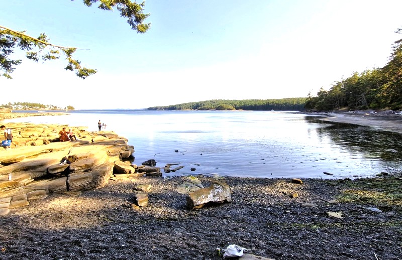
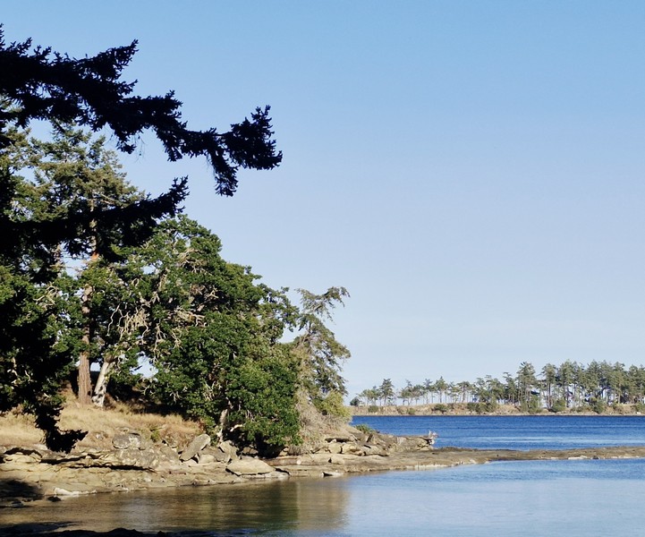
From Brickyard Beach, it was a short 8-km. (12-min.) drive to the 55-hectare (140-acre) Drumbeg Provincial Park at the east coast of Gabriola Island, overlooking the scenic Gabriola Passage. It is one of the most relaxed and scenic spots on Gabriola, and an easy day trip from Nanaimo.  A popular area for diving, hiking, nature viewing, sunbathing and picnicking, facilities at this park include a grassy field, pit toilets, picnic tables, hiking trails and an information shelter.

Check out “Brickyard Beach”
Drumbeg Provincial Park

Interpretive signage (donated by the Heartland Conservancy Group and the Gabriola Theatre Club), located at the information shelter in the day-use areas, offered information about the protected endangered Garry oak ecosystem and meadows (a rare and ecologically sensitive habitat that is especially pretty in spring when the wildflowers come out), undeveloped Douglas fir forest landscapes and the diverse marine zone in the park. Along with a number of intertidal creatures, bald eagles, great blue herons, harbor seals and American oystercatchers can be spotted here.
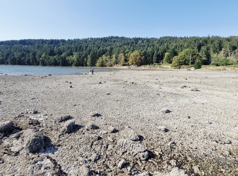
The kilometer-long sand and pebble beach

Managed by  BC Parks, this day-use only provincial park (one of three provincial parks on Gabriola Island, the others being Gabriola Sands Provincial Park on the northwest shore and Sandwell Provincial Park on the northeast shore) was established in 1971.  Offering excellent views of the Strait of Georgia and the Coast Mountains on the mainland, the shoreline here is the main draw.

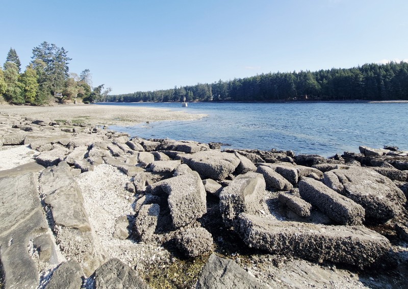
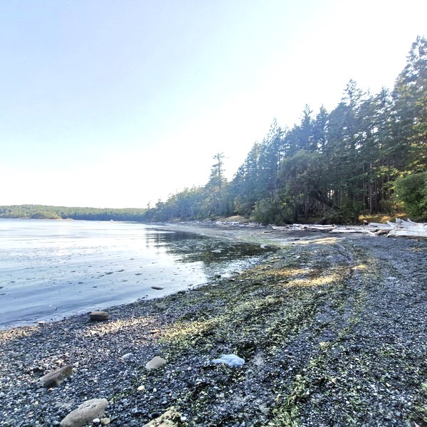
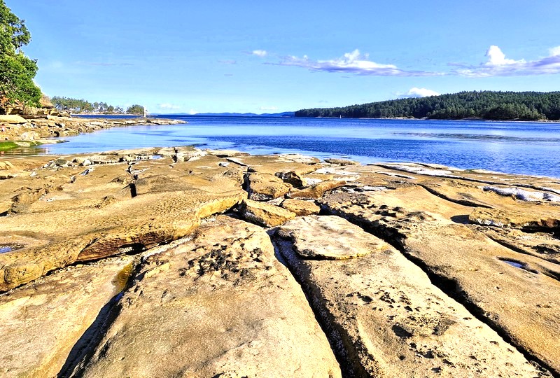
The park contains a kilometer-long sand and pebble beach, which curves around the bay, with unique and striking, sculpted sandstone and conglomerate rock formations that Gabriola is known for, best seen and fully exposed at low tide (the time we arrive). The formations include shelves, ridges, and pockets that, though the terrain is uneven, are fascinating to explore and walk across.
The unique and striking, sculpted sandstone and conglomerate rock formations

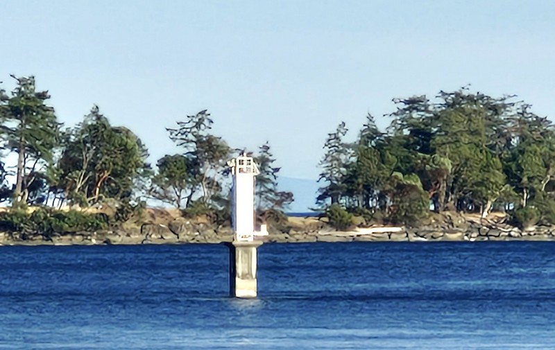
We picked a spot along the quiet beach for our picnic.  There was no drinking water, so we brought your own.  While picnicking, we watched boats navigating the narrow Gabriola Passage just offshore. The sheltered bay at Drumbeg warms up nicely in summer, making it one of the better swimming spots on the island. However, strong tidal currents run between the islands and riptides and currents can be dangerous.
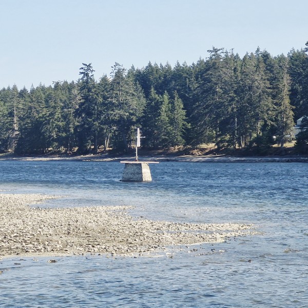
A light beacon used as a navigational aid

Following the shoreline are about 2 kms. of easy, gentle and well-maintained walking/hiking trails that meander along the shoreline and through the upland above the beach, well suited for families, with frequent openings to the water and quiet spots to stop for a picnic.  The route passes through rare and fragile Garry oak and open meadows (keep to the trails to protect the fragile meadow plants). Underwater enthusiasts can dive from the shores of the park, or they can head out to Rogers Reef, by boat, and still stay out of the strong currents that run through Gabriola Passage.
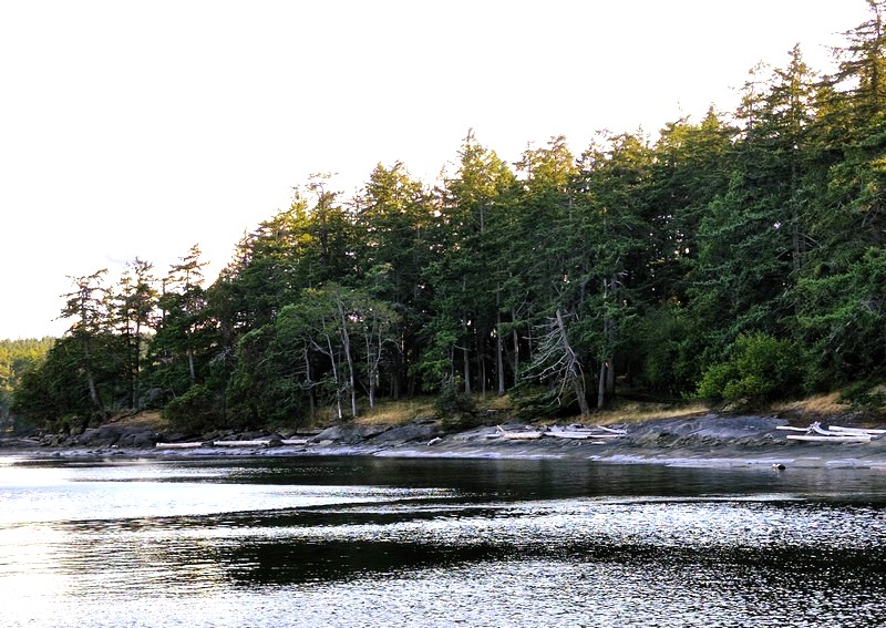
The shoreline forest of Douglas firs and Garry oaks

After our picnic, we returned to our car for the 15.3-km. (20-min.) drive back to the Descanso Bay Ferry Terminal for our scheduled 9:25 PM return trip, via BC Ferries MV Island Gwawis, back to Nanaimo’s Departure Bay Terminal.
Drumbeg Provincial Park: Stalker Rd., Gabriola Island, British Columbia V0R 1X0. Tel: (250) 474-1336.  Coordinates: 49°07′57″N 123°41′39″W.

How to Get There: BC Ferries has 25-min. crossings, from Nanaimo Harbor, to Gabriola Island. Depending on the season, the ferries run almost every half-hour, from 5:45 AM to 11 PM. From the Descanso Bay Ferry Terminal, follow South Road, across the island toward the south end, then follow signs via Coast Road and Stalker Road to the park. The road in to the park is narrow (only wide enough for one car) and the drive takes roughly 20 minutes. The small parking lot is adequate for most of the year, but it can fill on warm summer weekends, so arrive earlier in the day.
Brickyard Beach (Gabriola Island, British Columbia)

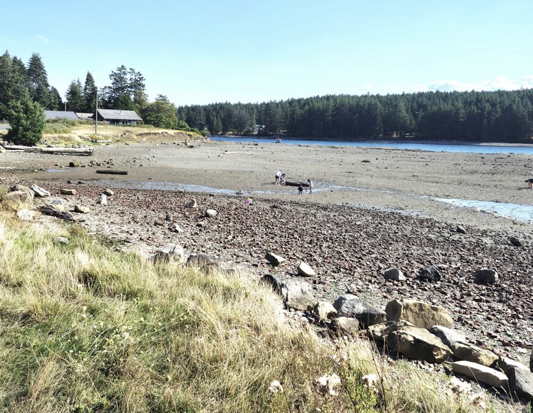
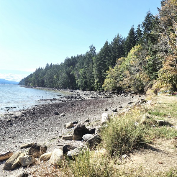
From Malaspina Galleries Community Park, we next drove 9.8 kms. (a 15-min. drive) to Brickyard Beach, a rocky beach rich in industrial history located on the southwest coastline of Gabriola Island. The beach is located on False Narrows that separates Gabriola Island from Mudge Island and Vancouver Island.

Check out “Malaspina Galleries Community Park”

Brickyard Beach with Mudge Island, across False Narrows, in the background

It was once the site of Gabriola Brickyard, the largest industry and employer (of Gabriolans and Chinese contract workers) on the island. From 1890 to 1950, it was actively producing, all by hand, up to 80,000 bricks per day. The work was difficult, noisy, and dirty, but the bricks were used for construction of buildings in Nanaimo, Victoria, Vancouver and New Westminister in British Columbia.


The brickyard was located at the base of Brickyard Hill, just north of Ferne Road. The raw material was plentiful blue and brown shale, extracted on the hill by the beach, which was crushed to make clay. There was no electricity at Gabriola at the time and the plant operated on steam pumps heated by local firewood and cheap coal from Nanaimo. To heat the crushed shale, workers shoveled coal and wood into a fire and pressed the shale into bricks, four at a time, using a hand-operated hydraulic press.
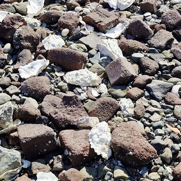
Remnants of bricks mixed with sand, clam shells and pebbles

The ease of transportation, by ocean, made the location functionable.  During low tide, the bricks were loaded onto scows that departed from the shore, with the high tide, for shipping. In 1952, because construction techniques had advanced beyond bricks, production ceased and the plant was closed and, a little later, the kilns and buildings were dismantled and the area was bulldozed and cleared.

Brush and undergrowth have now reclaimed most of the site but pieces of misshapen, defective or broken “Dominion” brand red bricks, that were culled by workers on the beach, have remained there still, mixed with the sand and pebbles.  That’s how Brickyard Beach turned out. Today, there is still evidence of the old bricks located throughout the beach. However, because of storms, winds and human activity, most are crushed and mixed in with the sand and pebbles.

Today, little remains of the Gabriola Brickyard except for piles of broken bricks heavily littered on Brickyard Beach and the name of the steep hill on South Road. Enterprising locals still dig these historic bricks out of the banks. From the shore of the beach, it is easy to see Mudge Island (where orcas are frequently spotted) and the Pylades Islands and there are views of birds and marine activity as boats and kayaks often explore the area. The False Narrows is a busy marine route used frequently by sailboats, fishing vessels and yachts.

False Narrows. In the foreground are debris which, I am guessing, are probably from the dismantled factory and kilns

During low tide, the ocean water recedes, revealing a land of tidal pools that are full of marine life like sea anemones, crabs and star fish. There are opportunities for birdwatching and wildlife viewing like sea birds, predator birds, seals and more. Brickyard Beach, a launch and landing point for kayaking (the close proximity to the bays and coves on Mudge Island and the Pylades Islands makes the beach ideal for launching a kayak), is also a popular location for beachcombing, clam digging, gathering oysters and sightseeing.

Brickyard Beach: 1633 South Rd., Gabriola, British Columbia V0R 1X6.

How to Get There: A ferry leaves, almost every hour, for Descanso bay Ferry Terminal on Gabriola Island, from Nanaimo Harbor.  The crossing takes 25 mins. From Descanso bay Terminal, it is a 7.3-km. (4.5-mi.)/10-min. drive to the beach. Drive up Ferry Hill onto North Road, connect toward South Road, and follow it southeast to 1633 South Road.

Discovery Fishing Pier (Campbell River, British Columbia)

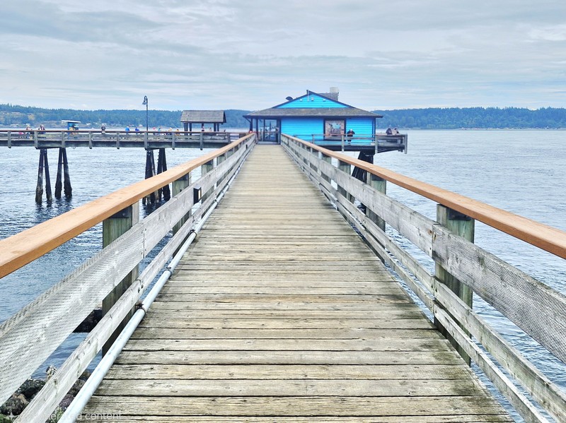
Discovery Fishing Pier

From Nymph Fall Nature Park in Courtenay, it was a 50.8-km. (40-min.) drive to Campbell River where we decided to stroll along Discovery Fishing Pier, Canada’s first-ever saltwater tidal fishing pier located beside the Government Wharf in downtown Campbell River. We parked our car at a parking lot the pier shares with the Discovery Passage Aquarium and the Campbell River Maritime Heritage Centre.

Check out “Nymph Fall Nature Park” and “Campbell River Maritime Heritage Centre”

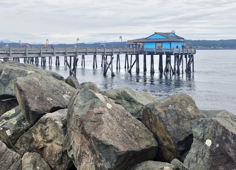
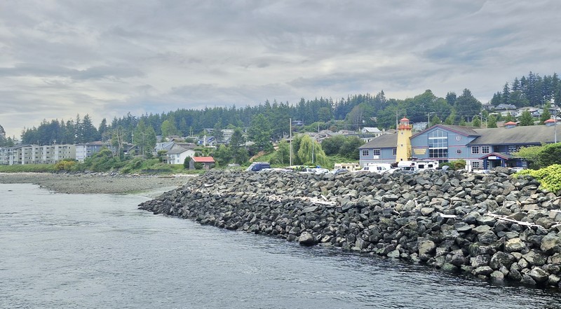
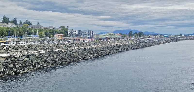
The pier as seen from the breakwater
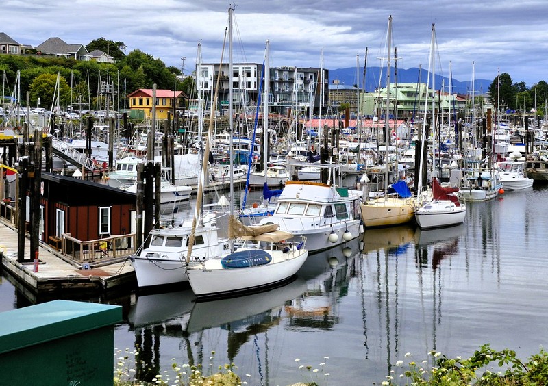
Government Wharf

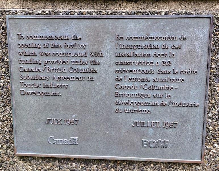
The 183-m. (600-ft.) long, wooden and wheelchair-accessible Discovery Fishing Pier, a local icon located in the heart of Campbell River, was a joint project between the municipality and the local Rotary Club.  Opened on July 4, 1987, it is the perfect location for sunset photos, with the opportunity to see seals, dolphins and occasional whales in the distance. 

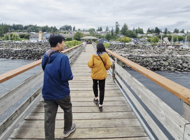
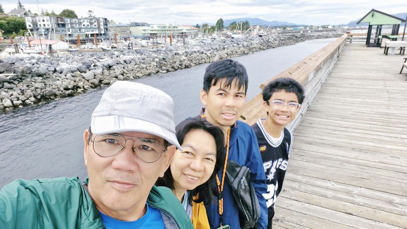
The author, Grace, Jandy and Kyle

It extends 45 m. (150 ft.) from shore, allowing for unobstructed views of Campbell River and its waterfront as well as the Discovery Passage, Cuadra Island and cruise ships transiting the passage. Unfortunately, to maintain cleanliness and safety of walkers and fishers, smoking and dogs (and our Luffy) were not allowed.

The historical plaque

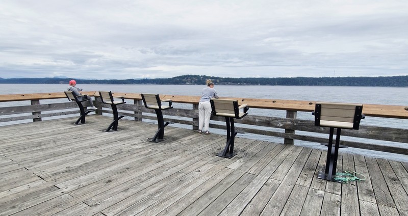
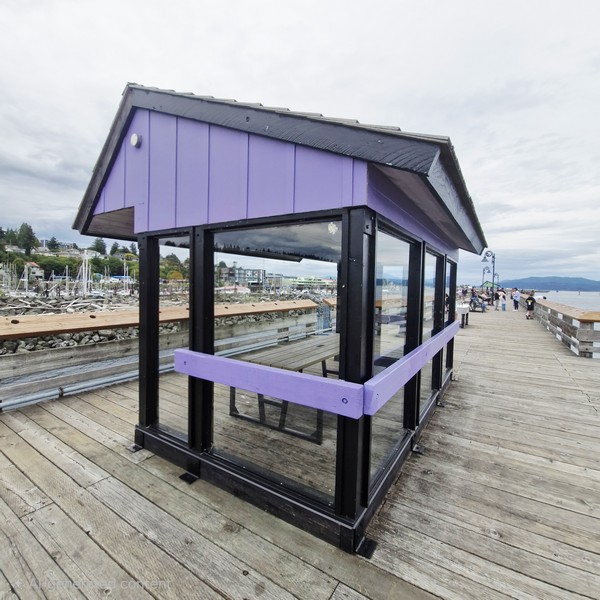
A favorite spot with local anglers, the pier provides easy access to recreational fishing, with rustic “game chairs,” fish-cleaning troughs, drop-nets for winching up large salmon, shelter with seating and tables, built-in rod holders, nets to help lift your catch, weighing scales, bait stands, picnic tables and benches for public use.

Rustic game chairs
Shelter with seating and tables

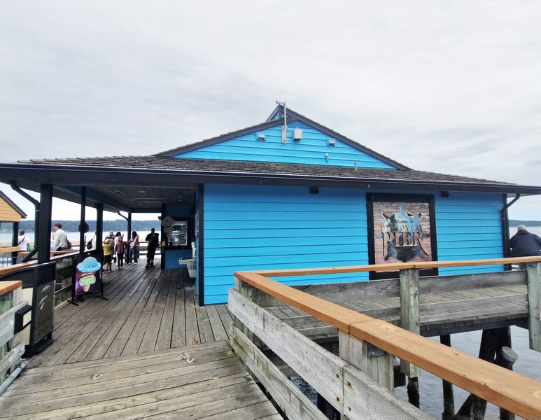
The Discover Fishing Pier Ice Cream Shop, the seasonal concession stand (open May to October), provides rod and tackle rentals ($7.30/hr.) and, during the summer months, their staff also run a leaderboard that tracks all the catches made off the pier. If you do plan on doing some fishing, you’ll need to buy a valid Tidal Waters fishing license and the closest place to the pier to purchase one is at the Tyee Marine Fishing and Outdoors Shop. 

The Discover Fishing Pier Ice Cream Shop

Aside from fishing, the concession stand is famous for its delicious (and giant), value-heavy, rotating hard ice cream, including lactose free ice cream (vanilla flavor only), on freshly-baked brown waffle cones. They also have a limited menu, offering fish and chips, wraps, bagels, popcorn, burgers, freshly made muffins, pizzas, seafood, banana bread (when available), brownies, hot dogs, fried pickles, French fries, and coffee.  They also have washrooms and a drinking fountain.

Campbell River Maritime Heritage Center on the near right

Discovery Fishing Pier: 655 Island Highway, Campbell River, British Columbia.  Tel: (778) 346-1868.  E-mail: discoverypier@gmail.com.

Nymph Fall Nature Park (Courtenay, British Columbia)

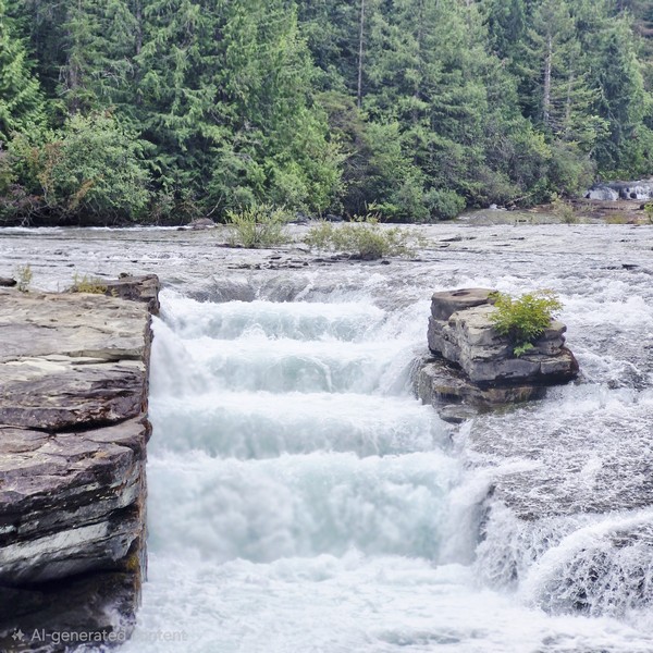
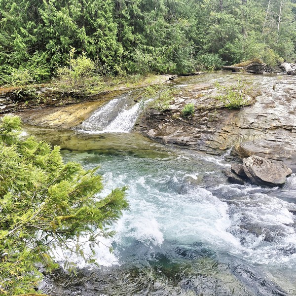
On our second whole day in Vancouver Island, we drove 58.3 kms. (a 40-min. drive) from Qualicum Bay Resort to Nymph Falls Nature Park a popular summer spot for swimming and picnics known for its series of small waterfalls along the Puntledge River, clear pools, and easy multi-use trails that work well for families, casual walkers, and anyone who wants a quick escape from town.

Nymph Falls Nature Park

This park, originally a recreation reserve, protects 61 hectares (151 acres) of second-growth forest (Douglas fir, Western Hemlock and Western Red Cedar), as well as a few black cottonwoods, Sitka spruce, big-leaf maple, red alder and Pacific yew, located on the north side of the Puntledge River. Members of the Plateau Road Residents Association have improved and maintained the trails for many years.

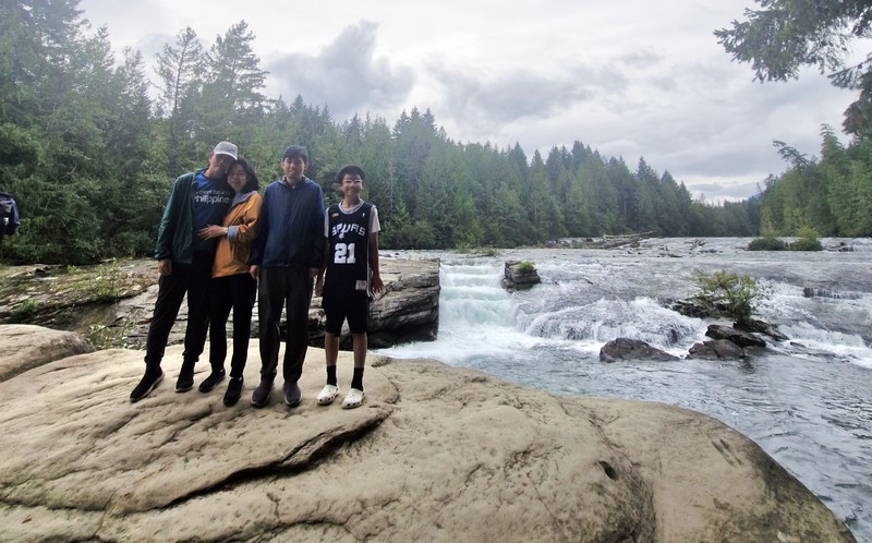
The author, Grace, Jandy and Kyle

During World War II, the picnic table clearing, close to the river at the base of the Nymph Falls Nature Park main entrance, was once the site of a labor camp for conscientious objectors (e.g. Mennonites).  In 1977, fish ladders were blasted out to help spawning salmon swim upstream.

In 1992, the Comox Valley Regional District (CVRD) received a 20-year lease over this piece of Crown Land for park purposes. In 2012, this lease was renewed for another 30 years. In November 2012, the CVRD purchased, for $379,000, a 5.5-hectare property located on the untledge River northeast of Crown-owned portion Nymph Falls Park from 0768816 BC Ltd., Inc. (also operating as 3L Development).

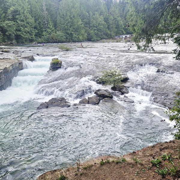
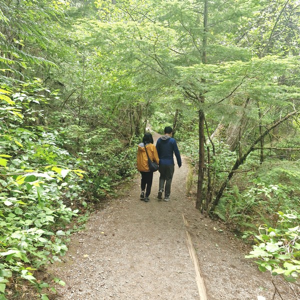
After parking our car at the designated parking stalls at the trailhead, the falls were an easy 500-m. stroll along a wide and gentle, wheelchair friendly River Trail. As we arrived during summer, we saw unusual plants such as gnome plant and Indian pipe along edge of the trail, and its glacial waters were running calm, clear and cool, revealing a series of exposed bedrock ledges, making the park and nearby Barber’s Hole popular spots for a refreshing dip on hot days. The river changes with the seasons. From fall to spring, the river and falls rages over the exposed bedrock ledges, to the delight of whitewater enthusiasts.

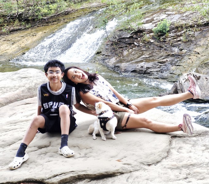
Kyle and Cheska with pet dog Luffy

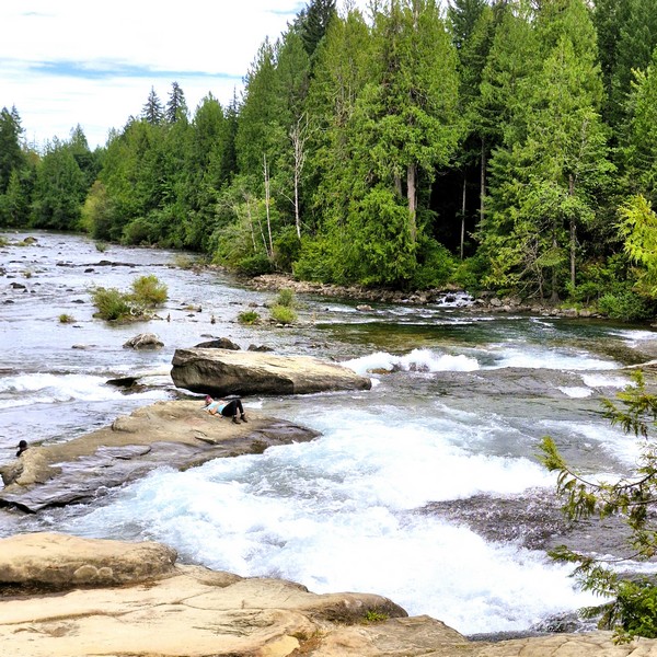
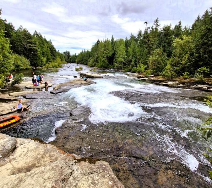
We walked out onto the long flat rock outcrop at the shore, watching out for slippery rocks due to algae deposits, for a spectacular view of the Puntledge River and the spectacular Nib Falls, which cascades over man-made fish ladders falls (where you’ll often notice flashes of red or silver in the water).  We didn’t sunbathe and swim (steps to the river located just 40 m. downstream of the falls provide access to the rock outcrops and pools of clear water) but there were benches and picnic areas placed beside the water and throughout the forest, where we had a late lunch.  Additional tables were also spaced out, along the trail network, for those who prefer quieter corners of the park.

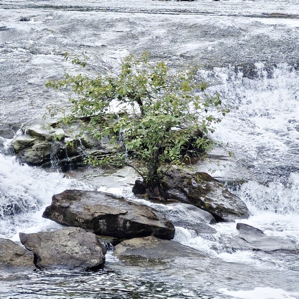
A bonsai-like evergreen tree directly out of a small rocky island

In the middle of the rushing Puntledge River is a solitary, iconic and highly photographed bonsai-like evergreen tree directly out of a small rocky island. This tree survives on a slab of exposed bedrock amid cascading glacial water. Attempting to swim or wade out to the solitary tree island is dangerous as the bedrock shelves create treacherous undertows and high-velocity currents.

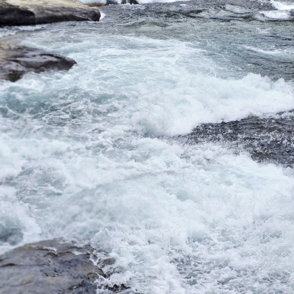
High velocity currents

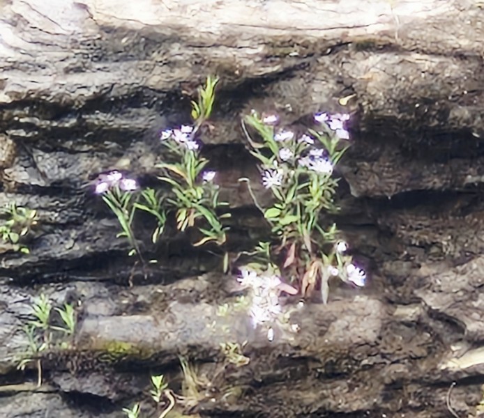
Solitary but resilient wildflowers, surviving in thin layers of organic matter trapped within the rock’s unique weathered “tafoni” pits, also bloom directly out of the moss-covered crevices, pockets, and fissures of the exposed Cretaceous sandstone bedrock along the Puntledge River.

Wildflowers blooming directly out of the moss-covered crevices

They include succulent broad-leaved stonecrop (Sedum spathulifolium), dense clusters of tiny pink sea blush (Plectritis congesta), bright yellow monkeyflower (Erythranthe guttata), red-and-yellow wild columbine (Aquilegia formosa) and delicate white small-flowered alumroot (Heuchera micrantha).

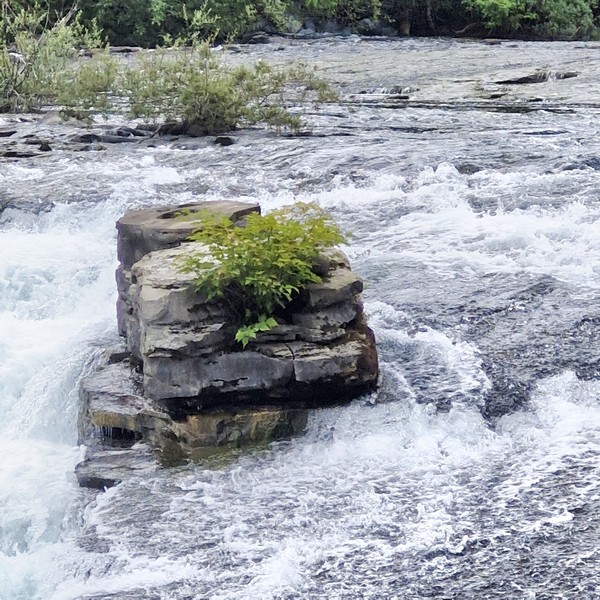
Wildflowers growing on a rock beside Nib Falls

From October to November, as the water levels rise and temperatures cool, this is a good place to see returning salmon working their way up the Puntledge River, towards the spawning grounds upstream, as the fast-moving channels around Nymph Falls and Nib Falls create natural pinch points where you can sometimes watch fish leap through the current. Though numbers vary from year to year, this is still one of the more accessible places, in the Comox Valley, to experience the fall salmon run up close.

Nib Falls

The Puntledge River, which once boasted an abundance of various species of fish, is an important part of the salmon run and the Puntledge River Hatchery was built downstream to save Chinook salmon from extinction and, altogether, help rebuild a healthy fish population. 

The short trail leading to the falls

Facilities here are simple but thoughtful.  There are several pit toilets, picnic tables, and signed routes from the two main parking lots. A well-marked, multi-use trail network, within Nymph Falls Nature Park, connect with a larger system up and down the river and wind through second-growth forest to key viewpoints where benches appear. The walking trails vary, from gentle riverside paths to wider forest routes, giving you options for short outings or longer loops, and the routes are well signed,

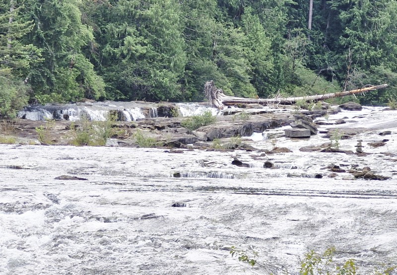
Smaller waterfalls located upstream

Most commonly seen along the trails and river are birds such as osprey, Cooper’s hawk, bald eagle, Glaucous-winged gull, American dipper, northern flicker, red-breasted sapsucker, varied thrush, brown creeper, Pacific wren, red-breasted nuthatch, chestnut-backed chickadee, golden-crowned kinglet, belted kingfisher and dark-eyed junco.

Nymph Fall Nature Park: 4481 Forbidden Plateau Rd., Courtenay, British Columbia V9J 1R2. Tel: (250) 334-6000.

How to Get There: Nymph Falls Nature Park is just a short 10-min. drive from Courtenay and Comox.

Miette Hot Springs (Miette Hot Springs, Alberta)

Miette Hot Springs

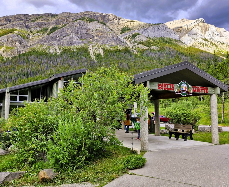
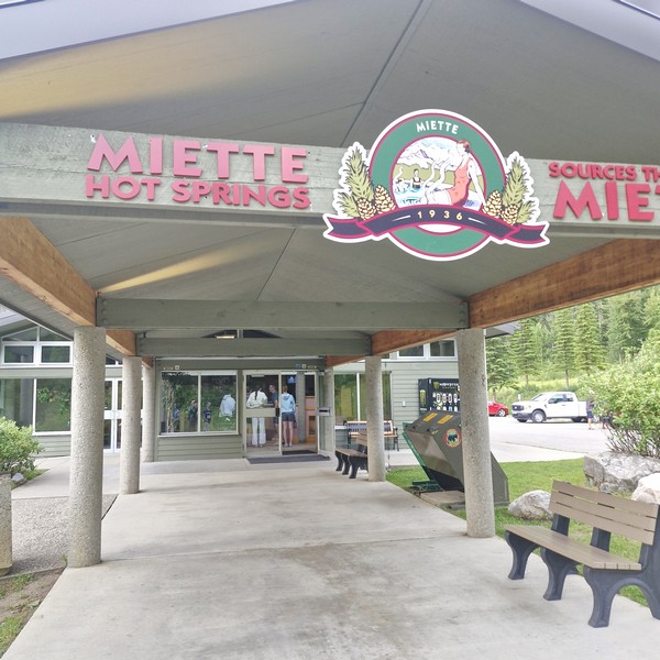
After our stopovers at the Cold Sulfur Spring and Emerald Pond, we continued on our way to Miette Hot Springs, a modern, commercially developed hot springs, built in 1986, in Alberta’s  Jasper National Park. It features the hottest hot springs in the Canadian Rockies. Its beautiful location and luxurious water make it one of the top things to do in Jasper National Park and one of Alberta’s best kept secrets.

Check out “Cold Sulfur Spring” and “Emerald Pond”

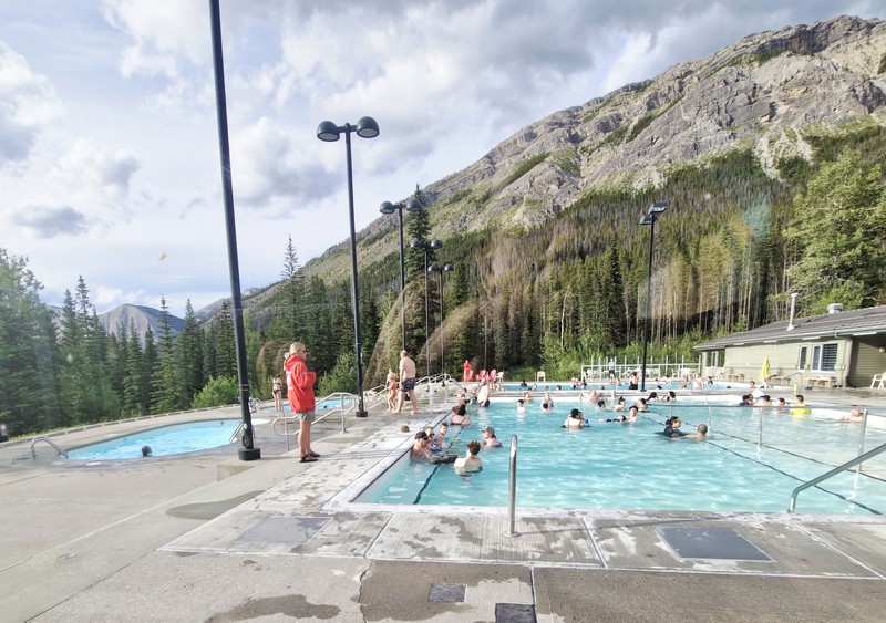
The outdoor hot pools

Offering visitors a view of the surrounding Fiddle River Valley, it has two outdoor hot pools and two cold plunge pools of different temperatures. From the mountain, the natural hot springs water flows at 54°C (129°F) and is then cooled to a comfortable temperature of approximately 37 and 40 ºC (98 and 104 ºF) as it enters the hot springs pool.  The top five minerals found in the Miette Hot Springs are sulphate (1130 mgs./l), calcium (307 mgs./l), bicarbonate (124 mgs./l), magnesium (56 mgs./l) and sodium (10.5 mgs./l).

The Source of the Springs Trail

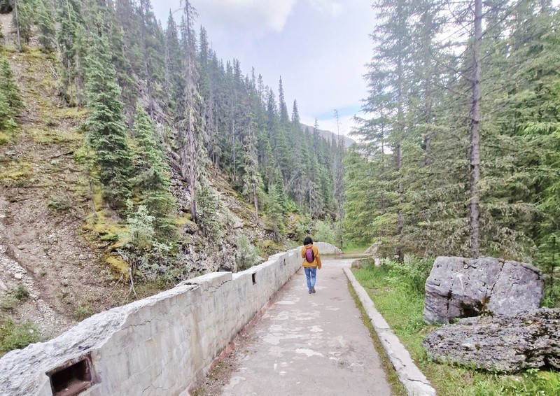
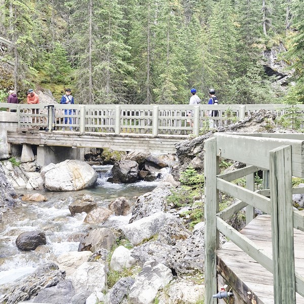
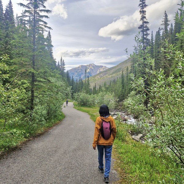
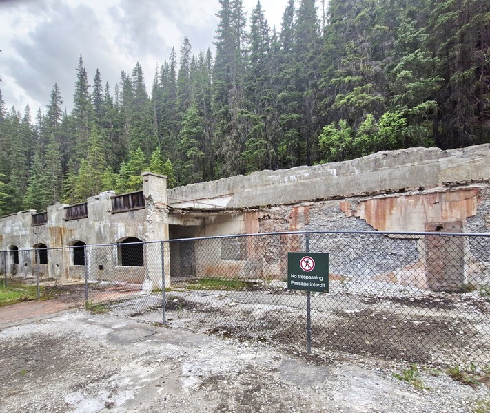
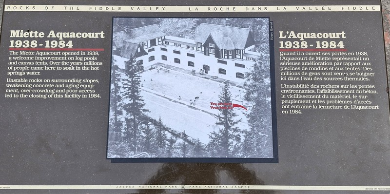
From the current parking area, we walked along the 600 m. long and winding Source of the Springs Trail, featuring boardwalks, to check out the original Miette Aquacourt and the source of the spring itself. The original Miette Aquacourt, an abandoned historic bathhouse and pool site, was built, together with an automobile road, as a federal relief program project, opening up work to several hundred men, during the Great Depression. 

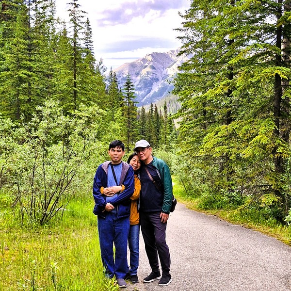
Jandy, Grace and the author at the Source of the Springs Trail

Construction started in 1934 and it was opened in 1938, operating until September 1984 when it was closed, due to rock instability on the surrounding slopes, old equipment, poor access, overcrowding and aging concrete, and replaced by the new facility located 1 km. down the road. Its old pool basin is now filled with trees and dirt.

Miette Aquacourt

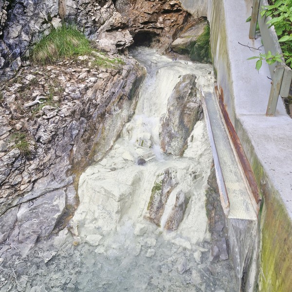
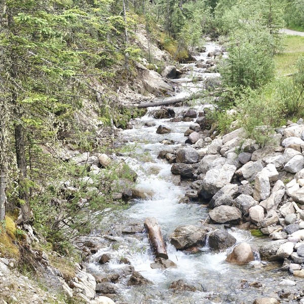
Upon crossing the bridge over Sulphur Creek, we saw the natural Sulphur Creek hot spring, the largest and fastest flowing of the three springs in area. The water source, coming from about 1,500 ft. down the mountain, was very hot (54°C) and had a very strong sulfur smell.

Sulfur Creek
Crossing the bridge over Sulfur Creek…..

This source spring was first used by local First Nations communities who, in turn, introduced them, during the 19th century, to members of the Hudson’s Bay and North West Companies. In the 1910s, a crude pack trail was created, providing visitors with access via foot and horseback. By 1919, a rough trail and modest structures such as a log bathhouse and two sweat houses had been built by coal miners working in the nearby coal mining camp of Pocahontas down the valley.
Sulfur Creek Hot Spring

Miette Hot Springs: Miette Rd., Miette Hot Springs, Alberta T0E 1E0. Admission: $19.75 (adults) and $17.25 (youth and seniors) for a single entry. Tickets are sold first-come, first-served in person, and a separate national park pass is also required to visit the area. Coordinates: 53°7′47.507″N 117°46′13.876″W.
How to Get There: Located between the towns of Hinton and Jasper, the complex is at the end of the 17-km. (11 mi.) seasonal Miette Road off of Highway 16, near the east gate of the park.

Emerald Pond (Jasper, Alberta)

Emerald Pond

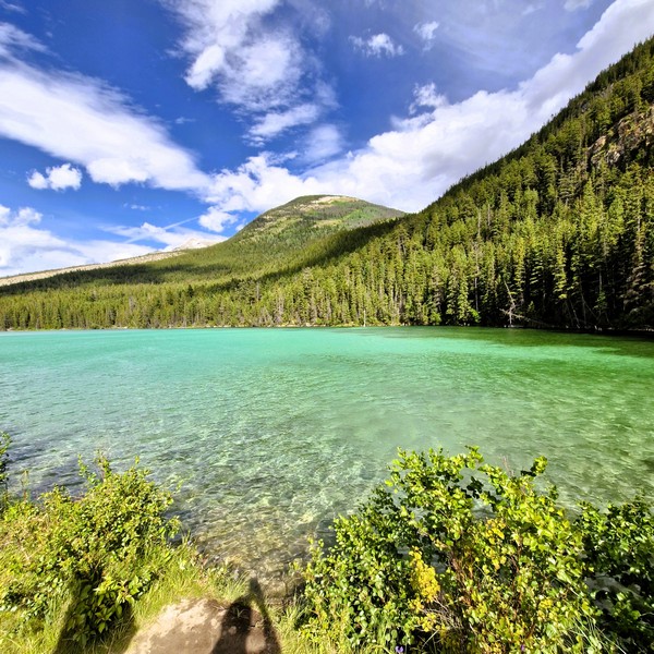
From the Cold Sulfur Spring, a short, narrow dirt path lead us to Emerald Pond, a stunning freshwater lake nestled in the heart of Yoho National Park.  This tiny, crystal-clear roadside stop had a vibrant bright green emerald color, plus towering trees, lush greenery and a breathtaking mountain backdrop, offering picturesque views and opportunities for photography that made it an enchanting destination for outdoor enthusiasts.

Check out “Cold Sulfur Spring”

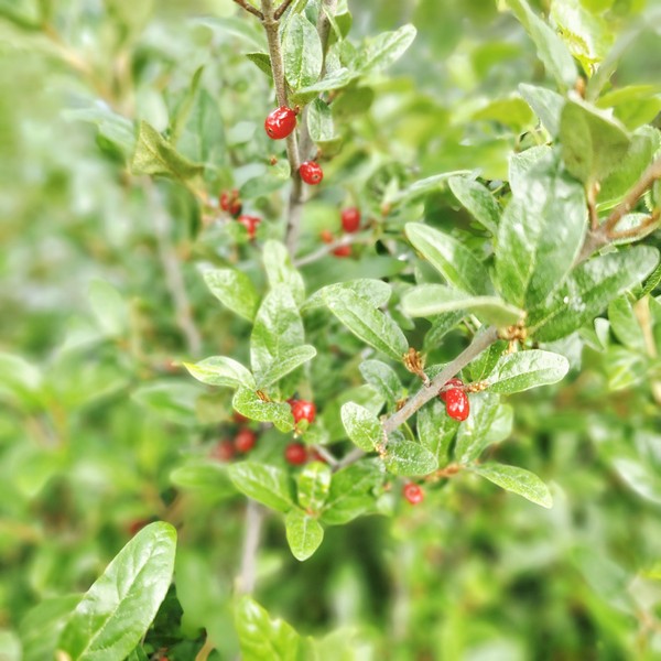
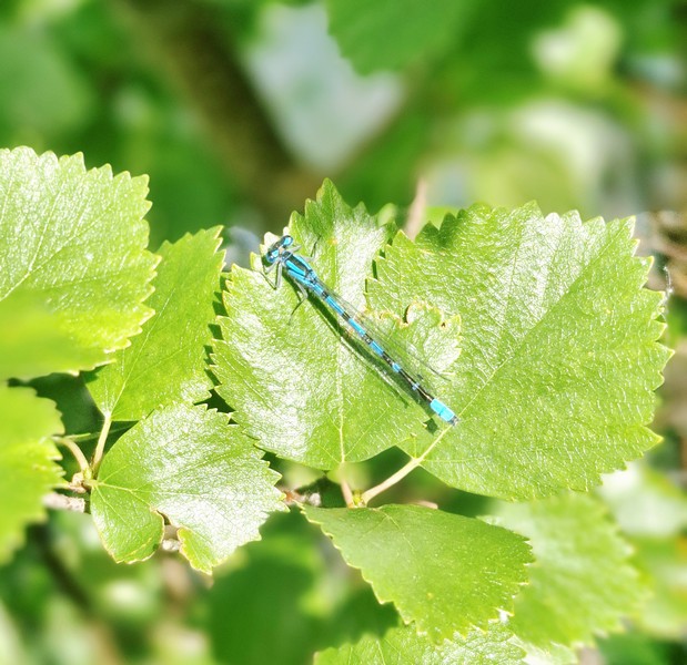
As we arrived mid-summer, when warm air temperatures brought out high levels of insect activity around the water’s edge, we spotted intricate, beautiful and striking iridescent blue dragonflies, with perfect little wings and alien-like heads, darting above the vibrant water and among the slender, green branches of red huckleberry (Vaccinium parvifolium) plants.

Red Huckleberry (Vaccinium parvifolium)

Strictly a quick scenic viewpoint, there are no trash cans, picnic tables, or benches here. As it sits right off the highway, it makes it a fast and easy place to pull over for photos of the water and mountain reflections. For hikers, picturesque hiking trails wind around the lake, offering panoramic views and opportunities to spot wildlife. You can also explore, via canoe, on the crystal-clear waters or just take a leisurely stroll along the shoreline to soak in the beauty of this scenic hidden gem.

Blue dragonflies

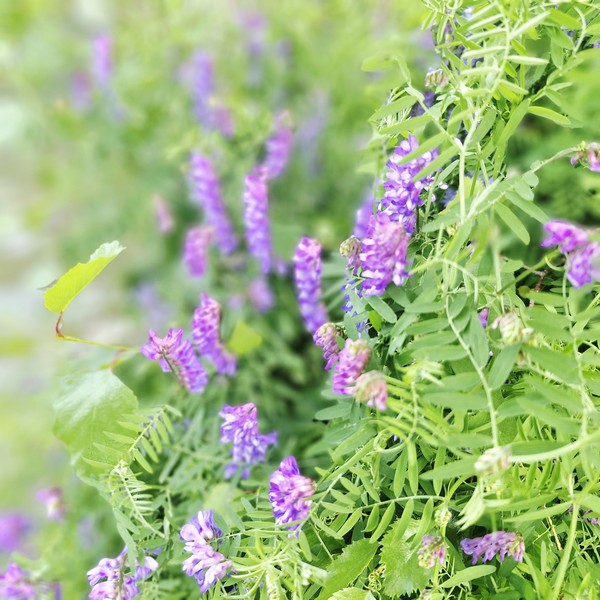
The pond, fed by underground, mineral-rich thermal springs, is also a great spot for swimming, fishing, and snorkeling. However, camping and fires are not permitted at Emerald Pond. The best time to visit is during the summer months (the time we visited) when the water is warm and the foliage is at its peak, with summer displays of pink fireweed, violet asters and wild blue lupines.

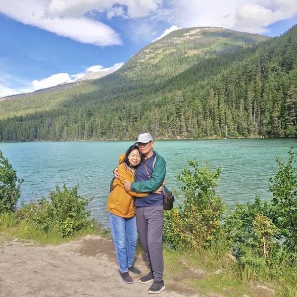
Grace and the author

With its serene atmosphere and abundant flora and fauna, this small pond promises a fun-filled experience for hikers, nature lovers, or those simply seeking some tranquility, in the midst of nature’s wonders. The area is also home to diverse wildlife, such as moose, deer, and a variety of bird species. Visitors are reminded to respect the natural environment and leave no trace behind. Be sure to bring sturdy hiking shoes, bug spray, and a camera to capture the beauty of this hidden gem.

Emerald Pond: Improvement District No. 12, Jasper, Jasper National Park, Alberta T0E 0A8.

How to Get There: The pond is found directly along the Yellowhead Highway (Highway 16), about 21 kms. north of the town of Jasper. A small pullout/parking area is available on the eastbound side of the highway (roughly 200 m. before the pond).

Emerald Lake (Field, British Columbia)

From The Caves National Historic Site of Canada, we headed 98 kms. (a 1.25-hr. drive) northwest, from Banff, Alberta, onto the Trans-Canada Highway (Highway 1), to reenter British Columbia at the town of Field, then turned right onto Emerald Lake Road, to stop by Emerald Lake, a freshwater lake in Yoho National Park, one of the four contiguous national parks in Canada’s Rocky Mountains, along the boundary of British Columbia and Alberta Provinces. The lake is the largest of the 61 lakes and ponds located inside the park.

Check out “The Caves National Historic Site of Canada”

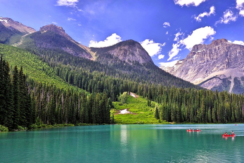
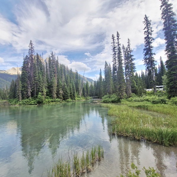
Emerald Lake

The first non-indigenous person to set sight on Emerald Lake was famed Canadian mountain guide Tom Wilson, who stumbled upon it by accident in 1882 when he was led lakeside while rounding up a string of his horses that had gone astray. He gave the lake its name because of its remarkable, vivid, turquoise green-colored waters due to glacial silt (rock flour), different rock type producing the powdered sediment that is suspended in the glacial water, reflecting the entrancing emerald green spectrum of sunlight rather than the blue spectrum seen in Moraine Lake, Hector Lake, Bow Lake and Peyto Lake in neighboring Banff National Park. Earlier that same year, Tom also discovered another lake which he had given the same name (which appeared briefly on the official map) but it was shortly renamed Lake Louise.

Check out “Lake Louise” “Peyto Lake” and “Lake Moraine”

This stunning glacial alpine lake, a scenic natural destination, is the most famous one of and the most admired locations in Yoho National Park.  The majestic mountains of the President Range, named after the President and Vice-President of the coast to coast Canadian Pacific Railway, add to the beautiful of this lake, as well.

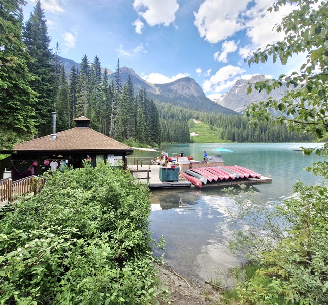
Emerald Sports

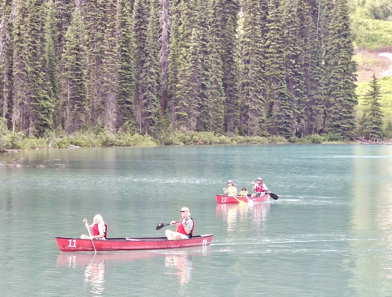
The lake has an unmatched diversity of both activities and landscapes suited to the enthusiastic traveler. Canoeing  and walking are favorite activities here and, during the summer months, fishing is also quite popular. Canoe ($.75 for 1 hour, with a max of 3 people in the canoe) and rowboat rentals are available Emerald Sports (also known as Emerald Sports & Gifts), as are cross-country skis and snowshoes in the winter.

Canoeing at the lake

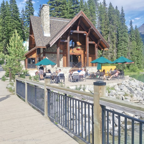
Swimming, though allowed and highly recommended for the experience, is not for the faint of heart as the water is cold due to it being fed by glaciers. The rustic Emerald Lake Lodge is a leisurely delight for those having lunch at Cilantro Café’s lakeside patio. The lodge also offers cabins overlooking the lake and mountains. Near the start of the trail loop are some picnic tables.

Emerald Lake Lodge

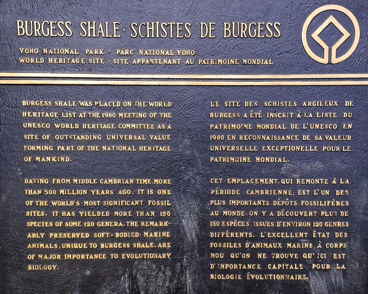
A 5.2-km. (3.2-mi.) flat loop, family-friendly trail circling the shoreline, taking about 1.5 to 2 hours to complete, is one of the least strenuous but most rewarding in the park. From the lake, you can view an incredible breadth of geological features including the world-famous Burgess Shale fossil beds, the Michael Glacier, and an avalanche slope carpeted by meadows, where moose often graze.  Other more advanced hiking trails go in different directions up into the mountains.

Burgess Shale plaque

The lake’s elevation of 1,200 m. (4,400 ft.) above sea level produces a unique selection of flora. Trees found here include western red cedar, western yew, western hemlock and western white pine.  At moist, shady enclaves, you can spot a variety of tiny, fragile wild orchids that survive only in finely balanced conditions. If you’re paying attention, you may be rewarded with a Yellow Lady Slipper, Spotted Orchid, or Calypso sighting.

As animals are drawn to this important water source, Emerald Lake is a fantastic place to see wildlife such as bald eagles, moose, and ospreys as well as waterfowl such as loons and mergansers. Grizzly bears and American black bears are fairly common. However, as many wild animals live in the area and are protected by park law, hunting is prohibited in the park. From November until late April or early May, the lake is frozen due to its 53-degree latitude and moderately high altitude.

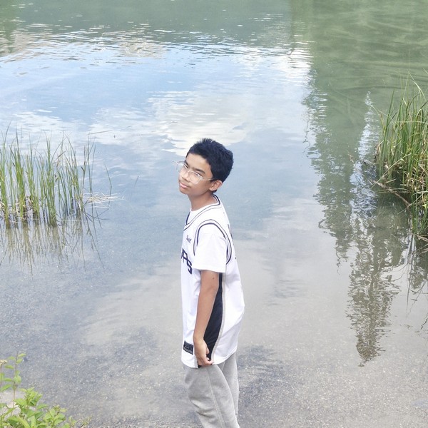
Kyle frolicking by the lake

Emerald Lake: 1 Emerald Lake Rd., Field, Yoho National Park, British Columbia V0A 1G0. Coordinates: 51.444°N 116.531°W.

How to Get There: Emerald Lake is a 50-km. (30-mi.) drive to the west of Golden, a 2.5-hr. drive from Calgary, a 28-km. (35-min.) drive from Lake Louise and 10 kms. (a 15-min.) drive west of the small railway village of Field, in Yoho National Park, near the highway exit to Emerald Lake, which has a park-operated visitor center.  A two-lane paved road, about 9 kms (6 mi.) long, connects the Trans-Canada Highway with Emerald Lake. Parking fills up fast in the summer, so it is best to arrive early in the morning.

Mega Grand World Hanoi (Vietnam)

Mega Grand World Hanoi

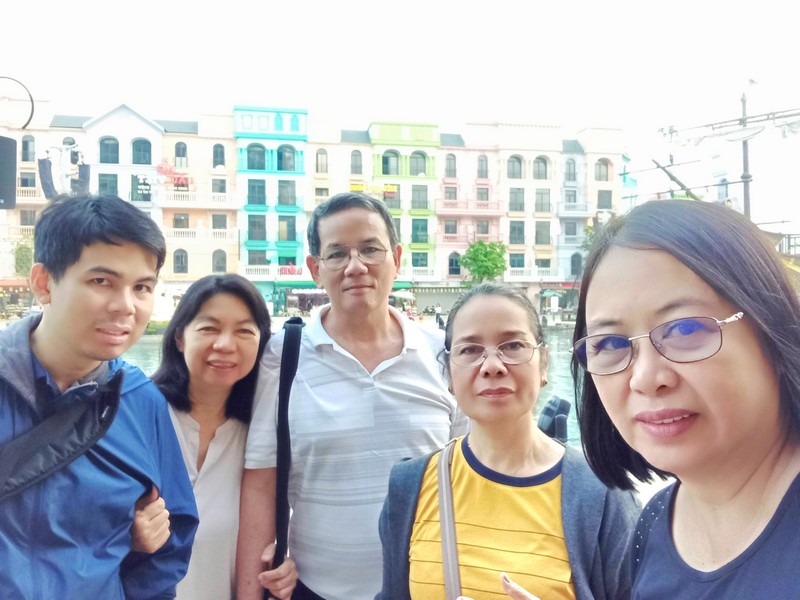
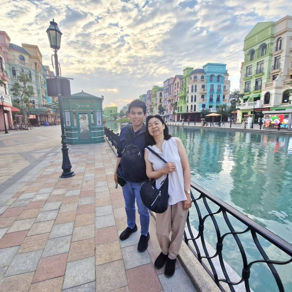
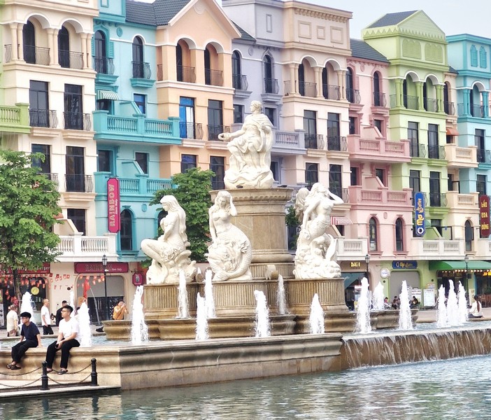
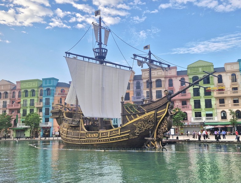
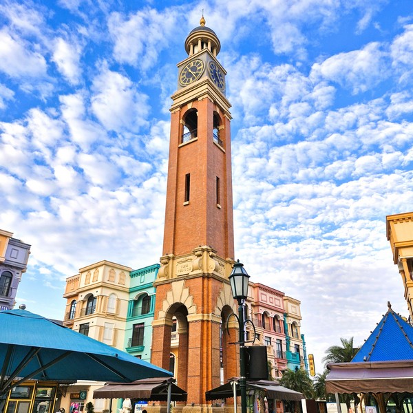
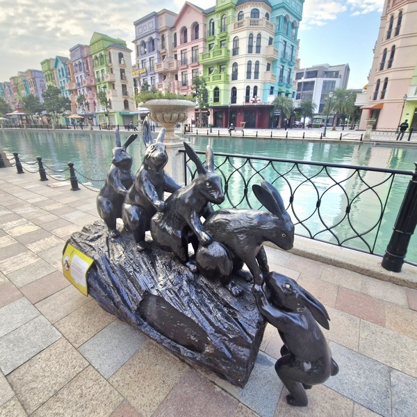
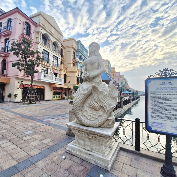
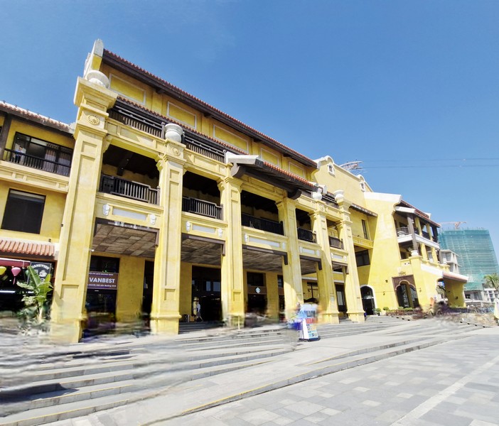
Prior to our departure back to Manila, we made a short stopover at the Mega Grand World Hanoi, a large-scale entertainment and leisure complex that opened in 2023.  Designed to be a comprehensive destination for both locals and tourists, it combines shopping, dining, cultural experiences, and entertainment. This new urban area, mega complex and vibrant festive space, conveniently situated at the heart of Ocean City, to the east of Hanoi, offers visitors a unique blend of top-tier entertainment, upscale shopping, vibrant events, and where visitors can immerse themselves in the rich cultural tapestry of Asia and Europe via a captivating fusion of Asian and European landscapes. 

L-R: Jandy, Grace, the author, Lourdes and Lorraine

It connects the Coral Avenue of Vinhomes Ocean Park 2, the Four Seasons Avenue of Vinhomes Ocean Park 3, and Ring Road 3.5. From the timeless elegance of Venetian-inspired areas and the bustling energy of Korean-inspired zones, Grand World provides endless opportunities for sightseeing and photography.

Jandy and Grace

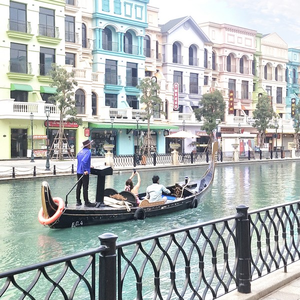
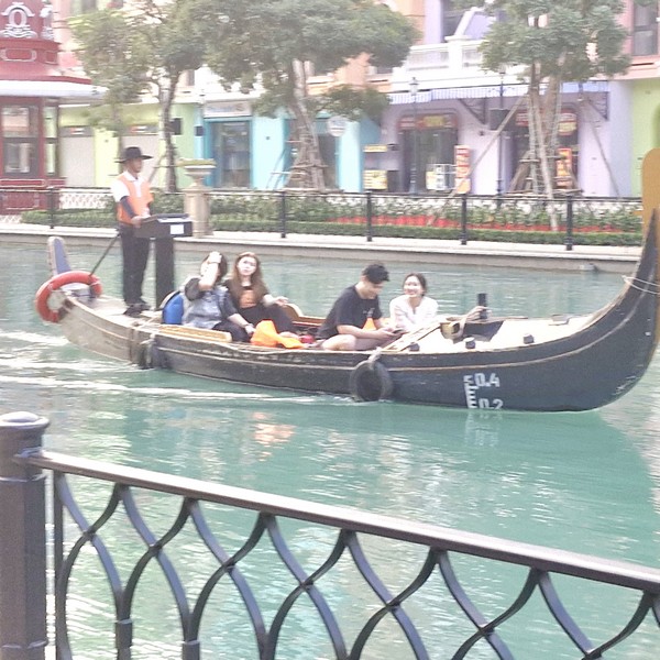
The lively Venice – Riverside Western Market, featuring an authentic array of colorful shops lining the colorful streets and enchanting banks of the river, offers Italian charm with gondola boats, which are reminiscent of those found on Venetian canals. Visitors can board these gondolas and enjoy a picturesque cruise along the serene, 830-m. long canal, admire the magnificent sunset, explore the diverse shops, and immerse themselves in the vibrant culture that this zone encapsulates. During the ride, you will also get to enjoy impromptu European music performances.

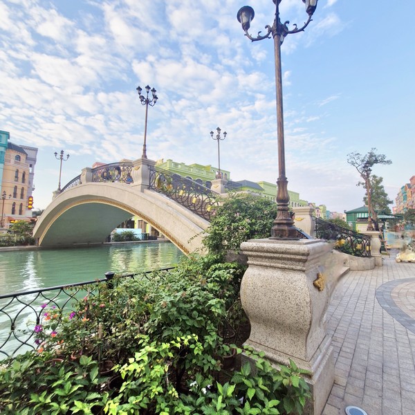
Pedestrian bridge crossing the canal

Crossing the canal is a pedestrian bridge connecting to Asia, with typical Korean ancient houses in the K-Town subdivision.

The bustling K-Town – Coastal Eastern Street, featuring a dynamic blend of traditional and modern architecture, creates a vibrant ambiance reminiscent of some of Korea’s most iconic areas. This zone captures the essence of both ancient and contemporary Korean culture through its diverse offerings, including the upscale Gangnam shopping street, the multicultural Itaewon cultural street, the youthful Hongdae food and art street, and the bustling Myeongdong fashion and beauty street.

Little Hong Kong, a zone that captures the essence of Hong Kong, feels like entering a paradise of shopping, entertainment, and joy. Stepping into Little Hong Kong, visitors can experience the culinary delight and cultural life of Hong Kong, right in Hanoi, as they enjoy an array of experiences that extend from vibrant shopping streets to lively entertainment venues, including lounges, bars, and pubs.

The unique Grand Voyage Show, a special, unforgettable performance held on Asia’s largest outdoor boat stage, brings to life the bustling and magnificent European trade route, crossing the maritime Silk Road, five oceans, and the trading port of Hoi An, Vietnam through captivating performances enhanced by advanced technology, impressive 3D mapping, dynamic sound and light effects, a giant water screen, and a talented cast of over 62 actors.

Gondola ride

The mesmerizing and unforgettable “Journey to the Wonderland,” a circus show presented by a talented troupe of professional performers from China, invites and transports audiences to a new realm of thrilling dreams through the captivating language of elaborate circus performances. With awe-inspiring acts and mesmerizing choreography, the show promises to dazzle audiences of all ages.

The fantastic and delightful carousel ride, with its vibrant colors and enchanting music, offers a nostalgic journey for visitors of all ages as you enjoy panoramic views of Grand World’s bustling atmosphere while being carried away by the gentle motion of the carousel.

Grand World, a shopping paradise that cater to every shopping enthusiast’s needs, boasts a plethora of renowned fashion and cosmetic brands. Visitors can also shop for furniture at Sinh Phu, sofas at Kuka Home, and household appliances at Lock & Lock. 

Come evening, visitors are treated to a dazzling spectacle of lights and colors as fireworks light up the sky above Grand World, adding an extra layer of magic as you’re strolling through the vibrant streets, enjoying a delicious meal at a restaurant, or simply taking in the sights and sounds of the bustling complex.

The serene Tropical Lagoon, a man-made beach with fine white sand and clear blue water amidst urban landscapes, provides the perfect setting for moments of relaxation and rejuvenation. It also boasts an array of artworks, making it a haven for photography enthusiasts seeking to capture quality photos.

Grand World 0ffers an unparalleled culinary experience, with hundreds of renowned domestic and international brands. Visitors can indulge in dishes from Vietnam’s three regions as well as explore unique flavors from Thai, Korean, Japanese, Italian, and American cuisines. After a satisfying meal, you can relax at beautiful coffee shops, bars, and clubs, including favorites like Highlands Coffee, Trung Nguyen Legend, Katinat Cafe, Poseidon Bar, and 729 Club.

VinWonders Wave Park & Water Park, surrounded by blue water and white sand, offers a variety of thrilling and exhilarating water sports activities such as slides, themed playgrounds, and outdoor and indoor pools.

Mega Grand World Ha Noi: Nghĩa Trụ, Văn Giang, Hung Yen, Vietnam.  Tel: +84 1900 232389. Open 24/7 (some activities and services have specific operating hours). You will need to pay for optional experiences like gondola rides or costume rentals.  Entrance fee: Free of charge (some activities and services have specific fees). The main daily show, “The Grand Voyage,” takes place on the Venice River at 9 PM (21:00). Various attractions have different opening and closing times. The gondola ride service on the Venice river operates daily, from 10 AM to 8 PM. The Teddy Bear Museum may have separate ticket prices. A general admission ticket is available for around $150,000 VND. 

How to Get There: Visitors can easily reach Grand World from Hanoi via various means of transportation. If you have a motorbike or car, you can drive to Grand World from Hanoi yourself in just about 50 minutes from the city center. This complex is equipped with numerous parking lots.  Just follow the route: Vinh Tuy Bridge – Co Linh Street – Hanoi-Hai Phong Highway – Grand World. VinBus. which continuously operates, connects Grand World with various locations in downtown Hanoi. Free electric VIN bus service is available from Hoan Kiem and Time City to Grand World Hanoi. 

Ambrose Day Cruise (Ha Long, Vietnam)

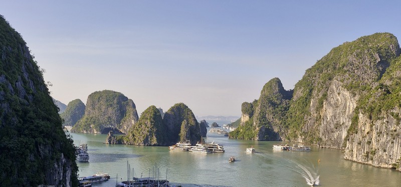
Ha Long Bay

After breakfast at Tru by Hilton Viet Tri City Centre, we all boarded our coach for the over 4-hour/258-km. drive, including short stopovers at Hanoi and Hai Durong, to Ha Long Bay arriving, before noon, at the Ha Long International Cruise Port which just came into operation in 2019, is closer to the city center and, hence, easy to travel.

Ha Long International Cruise Port

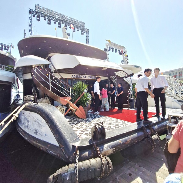
Upon entering the terminal, we walked towards the berthing area of Ambrose Cruise which was to take us on a a modern, 5-star luxury six-hour day cruise of Ha Long Bay.

Ambrose Day Cruise

Launched in 2025, Ambrose Cruise is a 40 m. long, vessel, with three luxurious decks with an area of 400 sq. m.. Built in an elegant and sophisticated Indochina style, it can accommodate up to 99 guests.

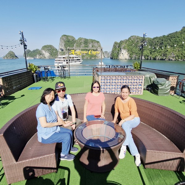
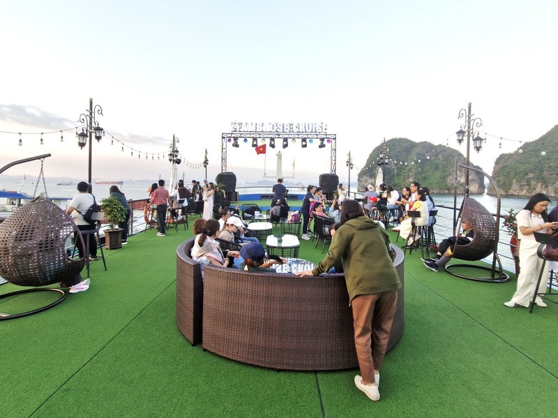
L-R: Grace, Jandy, Lorraine and Lourdes at the sun deck
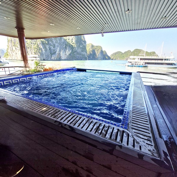
The jacuzzi pool

It has an infinity Jacuzzi pool on the second deck, an ocean-view restaurant and bar, a grand stage with a large LED screen and state-of-the-art sound and lighting systems, and a spacious outdoor lounge area.  I liken it to a “floating hotel” with high-class, 5-star standards.

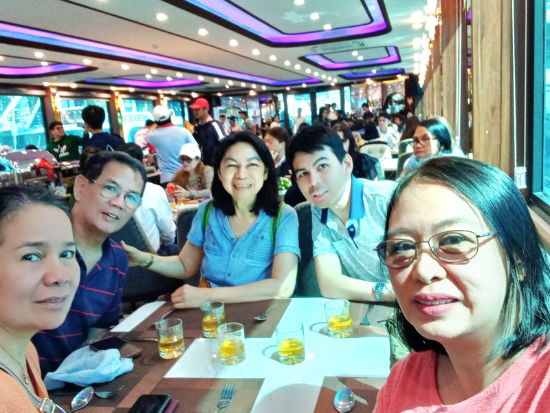
L-R: Lourdes, the author, Grace, Jandy and Lorraine at the dining area
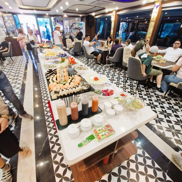
The lunch buffet

We arrived just in time for a premium gourmet buffet lunch with a wide selection of local traditional Vietnamese dishes, including vegetarian/vegan options, seafood, fish and chicken.  The spacious dining area featured a wooden ceiling, a yellow lighting system and black and white pattern floor tiles. 

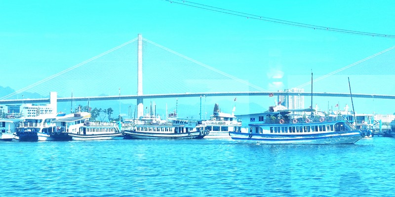
Bai Chay Bridge
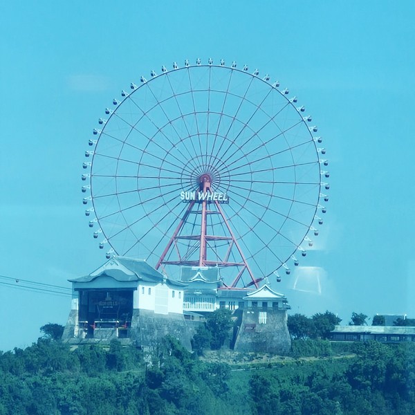
The Sun Wheel
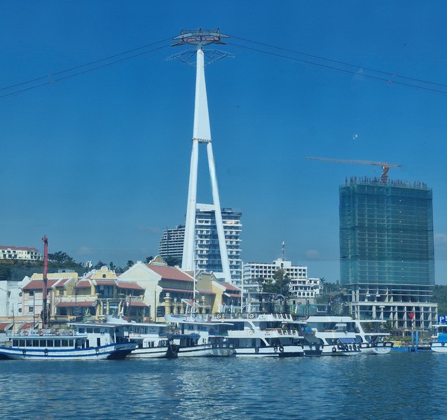
The cable car tower of Queen Cable Car

We were soon on our way and, as we were dining, we had great panoramic views, from large windows, of the city’s harbor as well as its iconic landmarks such as the breathtaking Sun Wheel (a towering Ferris wheel, with 64 cabins, perched atop Ba Deo Mountain), the Queen Cable Car (known for having the world’s tallest cable car tower and a double-decker cabin) and the Ban Chay Bridge (a unique cable-stayed bridge) and, soon enough, of limestone islands such as Hon Ga Choi, Hon Dinh Huong and Hon Cay Dua.

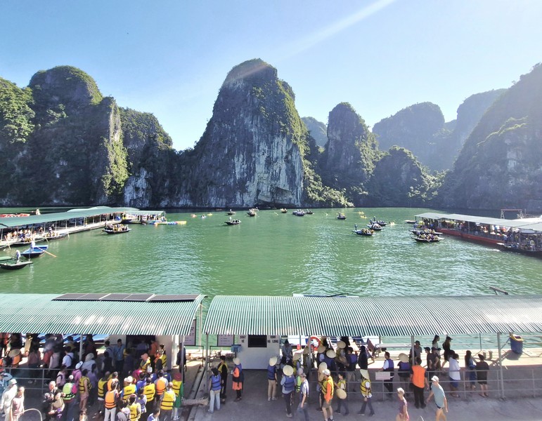
Bo Hon Island

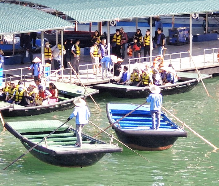
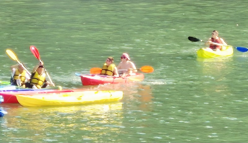
The first stop in our itinerary was Bo Hon Island where tourists can ride traditional bamboo rafts (a relaxed, local-guided option perfect for families or those wanting to soak in the scenery without paddling) or go kayaking (a self-paced adventure), paddling through the low archway of the natural tunnel of Luon Cave (Hang Luon), into a serene, enclosed lagoon, surrounded by limestone cliffs with lush vegetation, where you can spot rare orchids, ferns and playful golden monkeys.

Tradinional bamboo rafts
Kayaking at Ha Long Bay

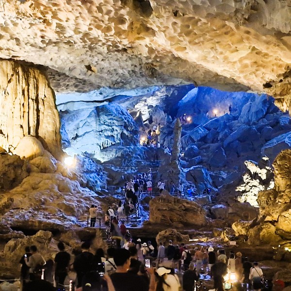
Our next stop, also on Bo Hon Island, was Sung Sot Cave/Surprising Cave (Thien Cung Cave), the largest and the most beautiful cave in Ha Long Bay.

Check out “Sung Hot Cave”

Sung Hot Cave

After disembarking from the boat, Jandy and I and joined other tourists, from other boats, in exploring the cave’s stunning formations of stalactites and stalagmites and two vast chambers.

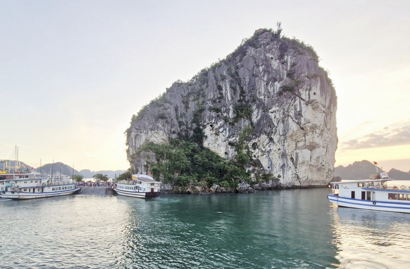
Ti Top Island

Our last stop was the 3.7-hectare Ti Top Island, one of the smallest islands making up Ha Long Bay and a not-to-be-missed stopover for tourists in the journey of exploring the bay. Originally called Nghia Dia or Hong Thap Tu, the island was renamed after the Russian cosmonaut Gherman Titov during his visit to Ha Long Bay in 1962. Here, tourist can go swimming along the beautiful, crescent-shaped Vang Trang Beach, with its smooth white sand beach, or hike up 400 steep steps, up a 100-meter high hill, to the island’s peak for spectacular panoramic bay views.

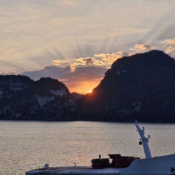
Sunset party at sundeck

Come sunset, a party was held on the sundeck where guests relaxed and served Vietnamese tea, cake, fresh fruits, and snacks.

Sunset at Ha Long Bay

Ambrose Cruises: 173 An Duong Vuong Street, Tay Ho, Hanoi, Vietnam. Tel/ Whatsapp: +84.987.876.013.  Email: contact@cruise-halong-bay.com.

Sto. Nino Cold Spring (Catarman, Camiguin)

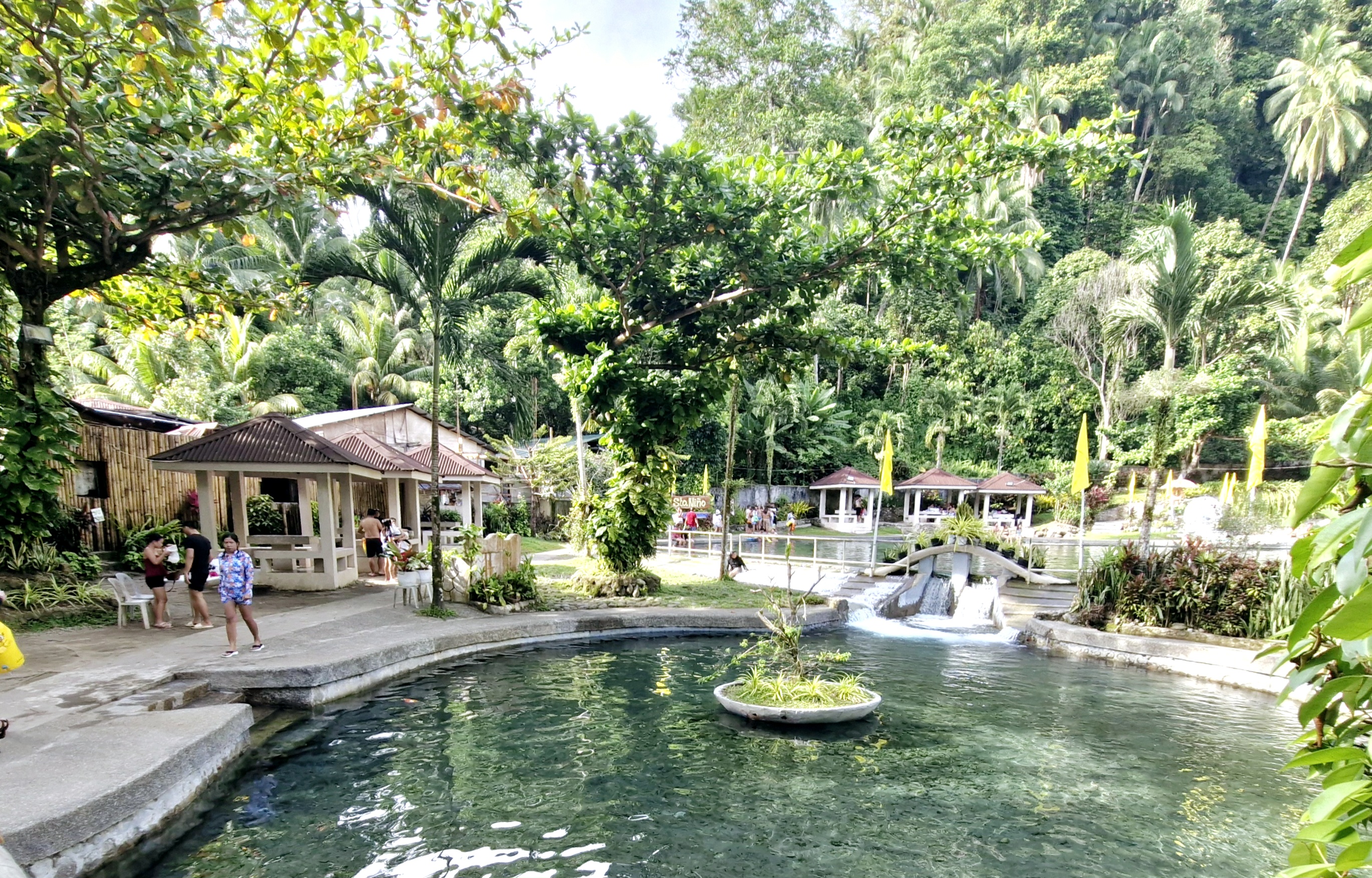
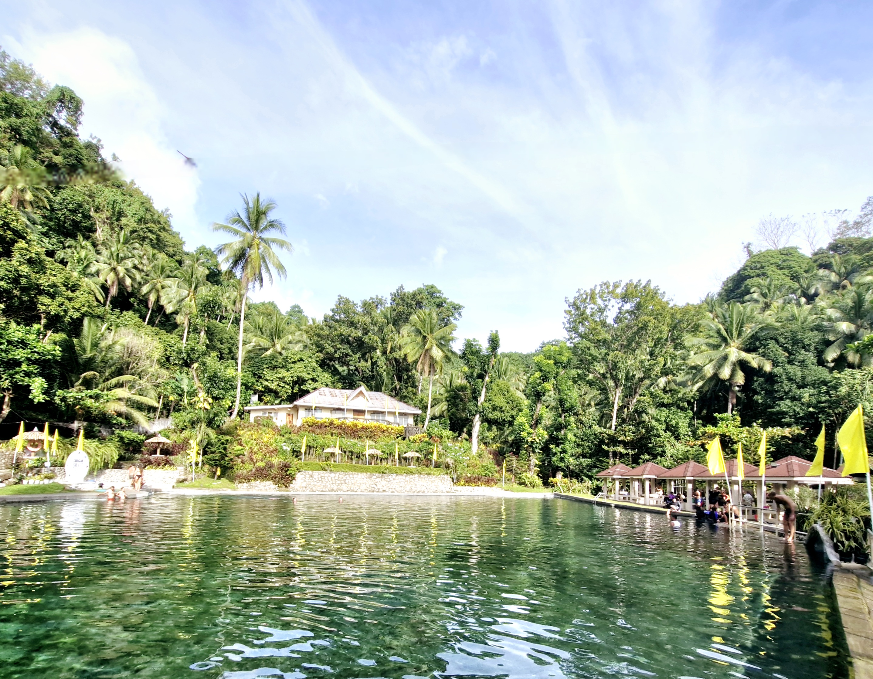
Sto. Nino Cold Spring

From Tuasan Falls, we again boarded our multicab for the 10.3-km. (25-min.) drive to Sto. Nino Cold Spring, the largest cold water spring in the province.

Check out “Tuasan Falls”

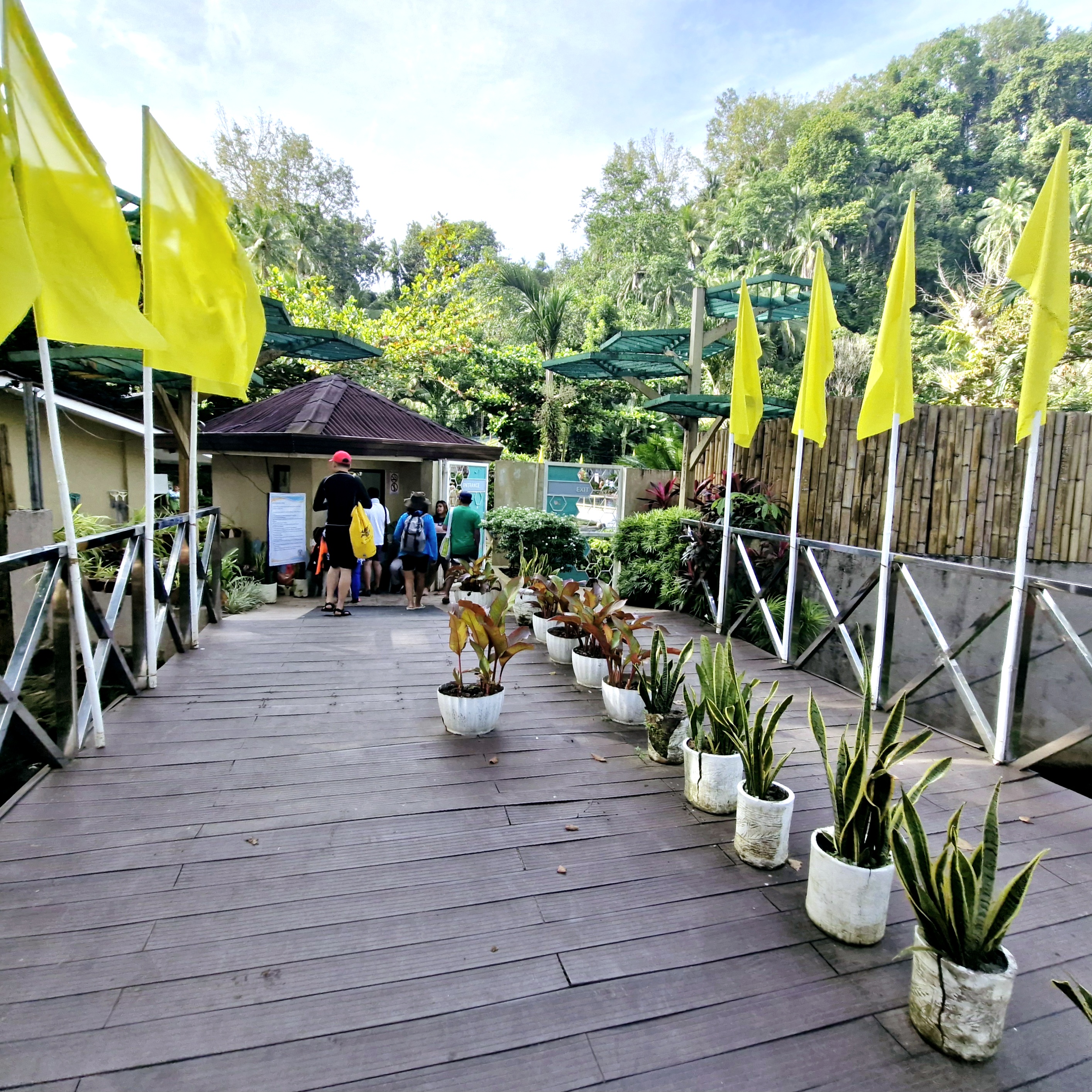
The entrance to the resort

Also known as Kiyab Pool. It has 2 stone pools, the larger one measuring 25 m. by  40 m.  and its depth varies from one-half meter to 2 m..

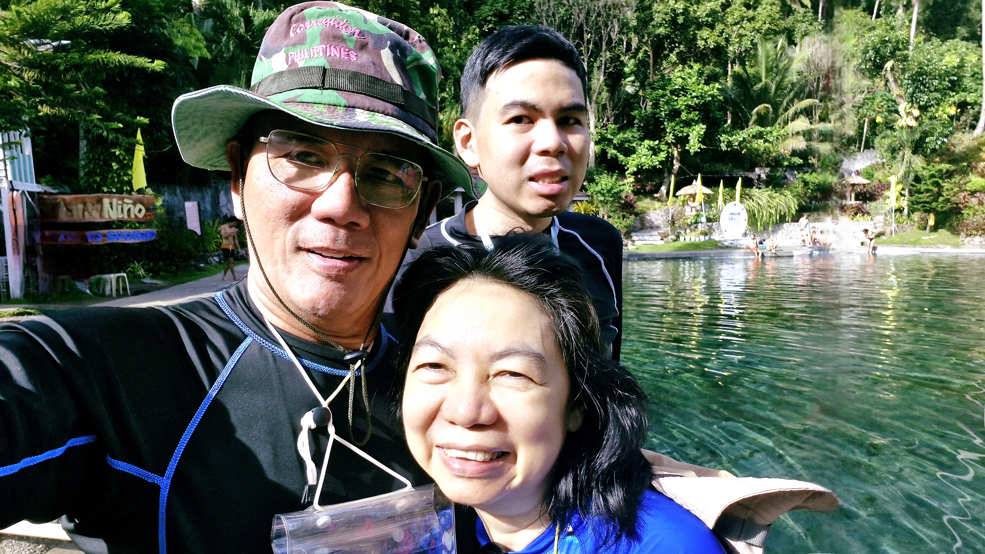
The author with Grace and Jandy⁰

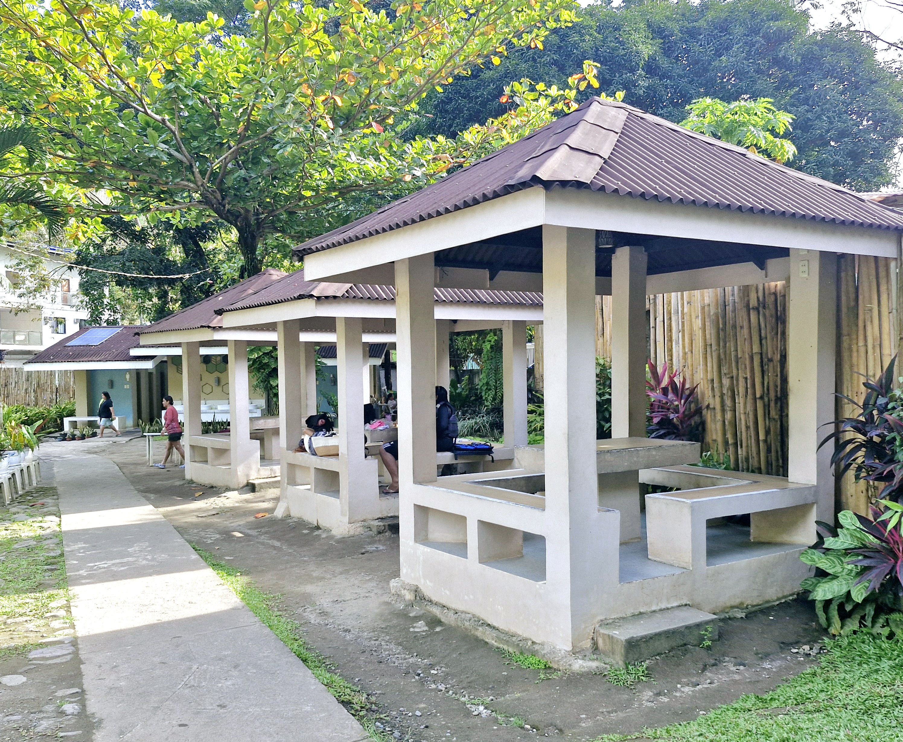
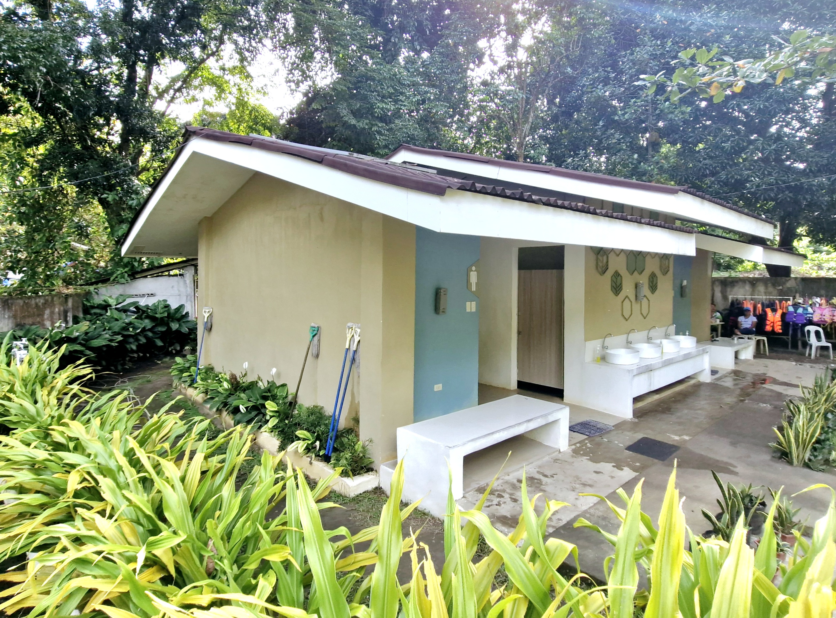
The other is a kiddie pool.  The resort also has picnic huts (rented for Php150), toilets, function hall and native stores for picnickers.  Even if it wasn’t a weekend,  the resort was still packed with picnickers during our visit.

Here, I swam its icy-cold, crystal-clear spring water, flowing from Mt. Mambajao, continuously sprouting from its sandy bottom, sharing the spring waters with some tiny fish.

Picnic huts

Toilets and changing rooms

Sto. Nino Cold Spring: Brgy. Mainit, Catarman, Camiguin.  Admission: PhP70/pax. Open Mondays and Thursdays, 11 AM to 5 PM, and Tuesdays, Wednesdays, Fridays, Saturdays and Sundays, 8 AM to 5 PM.

How to Get There: The spring is located 4 kms. north and uphill of Catarman town proper. From Mambajao, it is a 45-min. drive. From the main road, make a turn into 2.4-km. long dusty track to the spring.