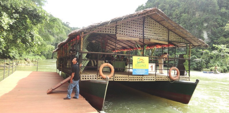
Floating restaurant of Village Floating Resto & Cruises
Upon arrival at Loboc, we all crossed over to the other bank of the Loboc River, via the Alfonso L. Uy Promenade, to get to the Loboc Tourism Complex where the floating restaurants are docked. It has been 11 years since the last time I had my first Loboc River Cruise with my family and I was curious as to what’s new with the cruise.
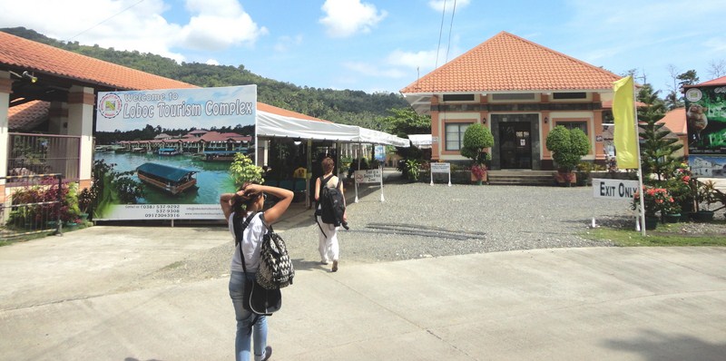
The Loboc Tourism Complex – a tourist attraction by itself
This time, I now notice so many improvements in the area. Well for one the floating restaurant terminal is now concreted, there are now lamp posts along the river banks (for night cruises), helpful directional signage and an orderly parking lot, the restrooms are clean and the complex was wi-fi enabled. This made the complex an exceptional tourist attraction by itself.
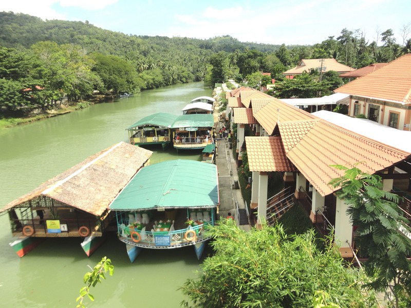
Floating restaurant terminal
When we got to the boat terminal, we were all whisked to the waiting double-hulled floating restaurant of Village Floating Resto & Cruises. The setup this time was different from our past typical boat tour. Instead of different tables for different groups of guests, a long, flower-bedecked table was instead set up with green table cloth and fresh buco in the shell for each one of us.
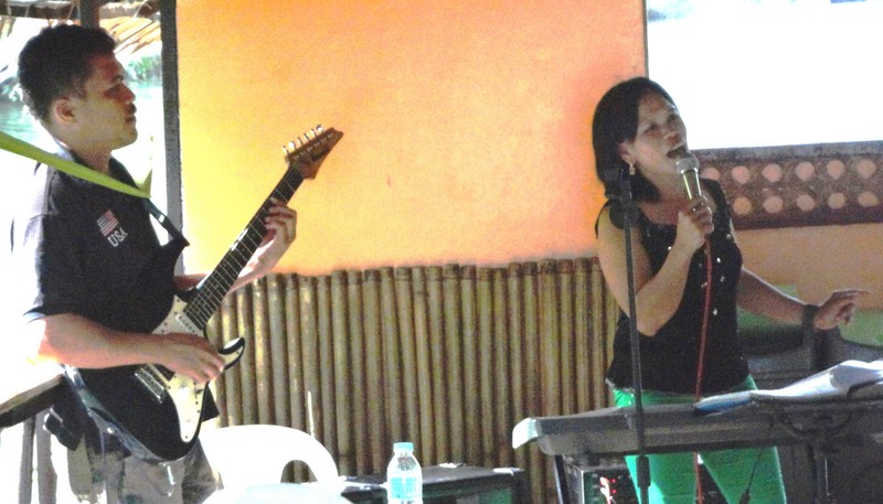
Being serenaded with bossa nova songs
Our lunch was also to be something different, not the typical buffet. When our boat got underway, we were first entertained by a local band with a versatile and talented female lead vocalist singing bossa nova songs for our listening pleasure. This got us in the mood for lunch, however late it was.
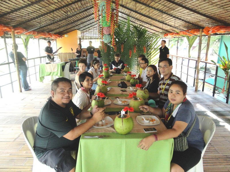
Our media group
The food soon started coming in, starting with the appetizers – fish kinilaw, puso salad and summer rolls. This was followed by law-oi soup. The main course that followed next was out of the ordinary – a humongous boodle feast, to be eaten kamayan-style
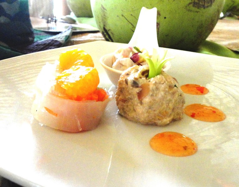
Appetizers – fish kinilaw, puso salad and summer rolls
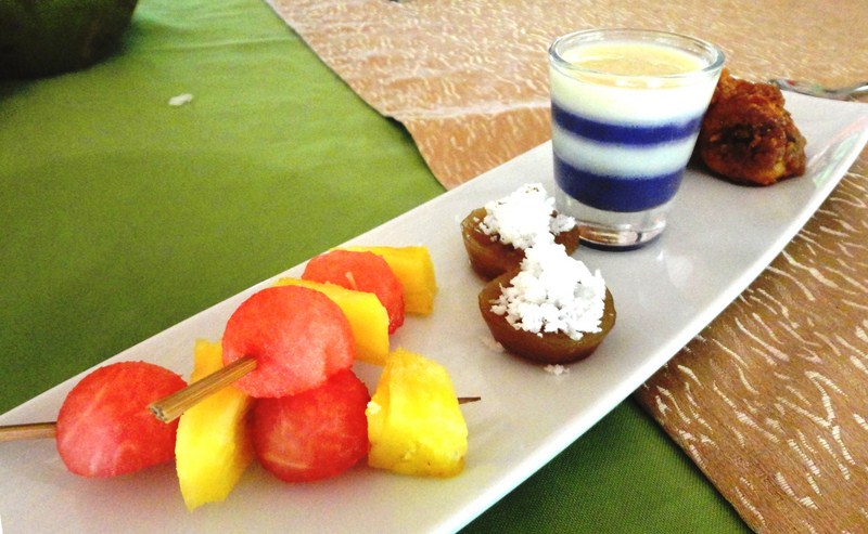
Fruit skewers, puto cuchinta, ube pannacotta, bananacue
It consisted of pork humba, chicken inasal, sisig-stuffed squid, grilled vegetables, pinais na isda and corn on the cob plus steamed rice, all laid out on banana leaves. Our delightful lunch was capped by a series of desserts consisting of ube pannacotta, bananacue, puto cuchinta and fruit skewers.
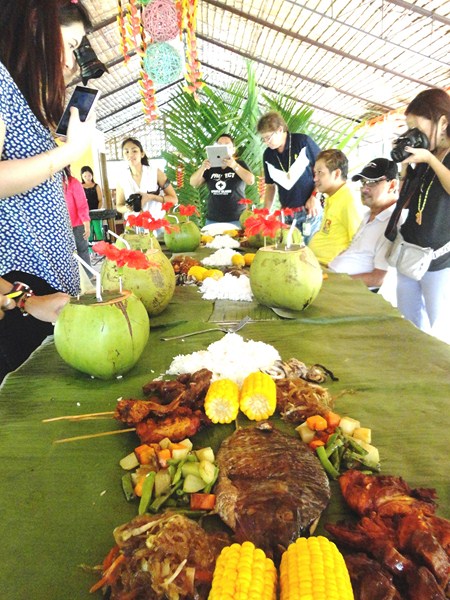
Our boodle feast
In about an hour, our boat reached the endpoint of our 2-km. cruise – Busay (or Tontonan) Waterfalls. These series of low waterfalls, used to generate electricity for the town, drops 15 m. in 2 stages. We were already done with lunch when docked near a floating wooden platform with rope railing. Alighting here, we had the luck of seeing a rare rainbow beneath a nearby small waterfall.
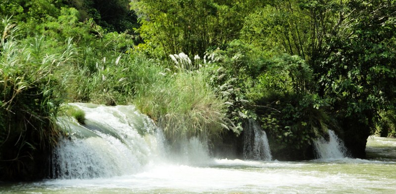
Busay Falls
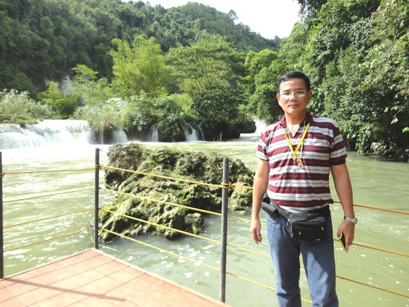
The author at the floating viewing platform
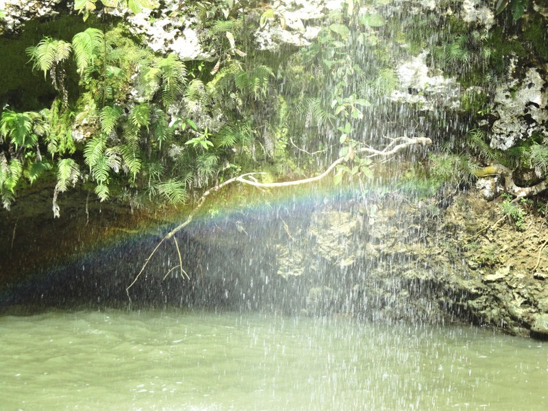
The rainbow uderneath a small waterfall
After a few minutes at the viewing deck, we again boarded our boat and, when all were accounted for, turned around for our return trip upriver. Along the river, the boat stopped at a small bamboo and nipa jetty decorated with banderitas and colorful guitars hung on the rafters. Here, some locals, dressed in apple-green filipiniana outfits, provided us a culture show, dancing the kuradang and the tinikling.
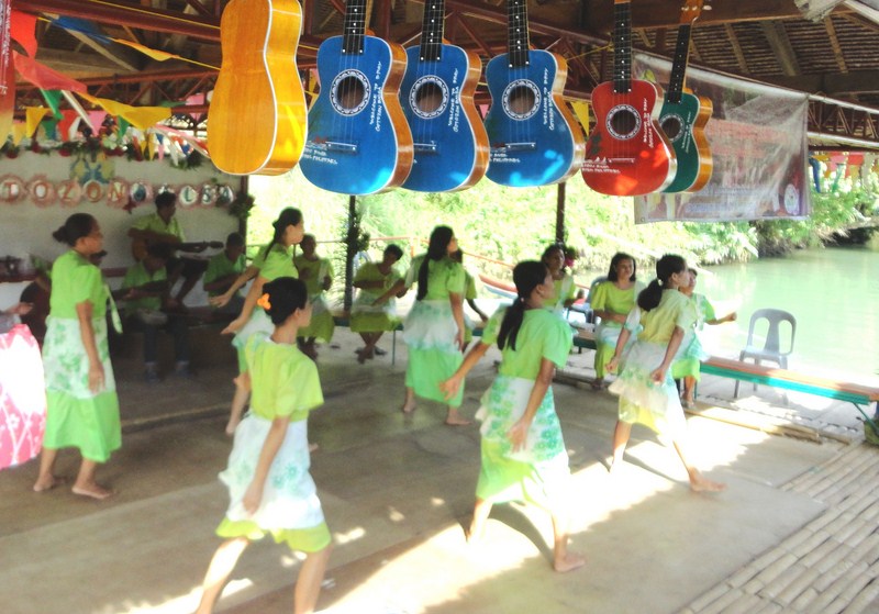
A kuradang dance performed for us at a riverbank jetty
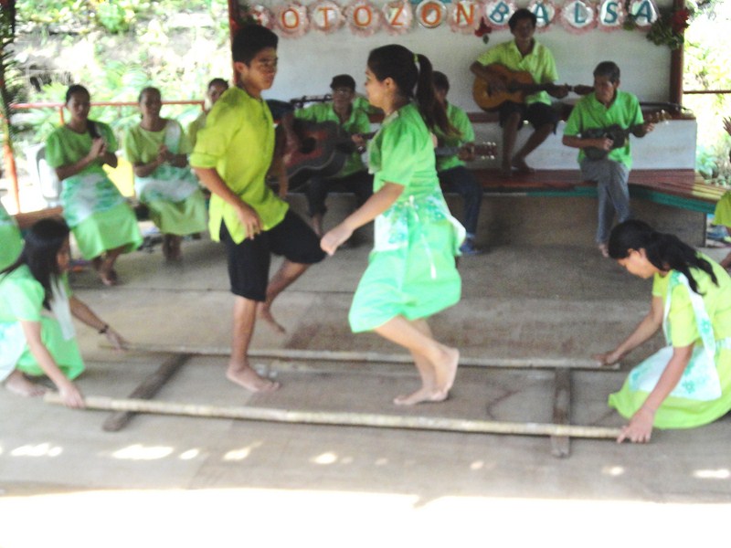
Tinikling dancers in action
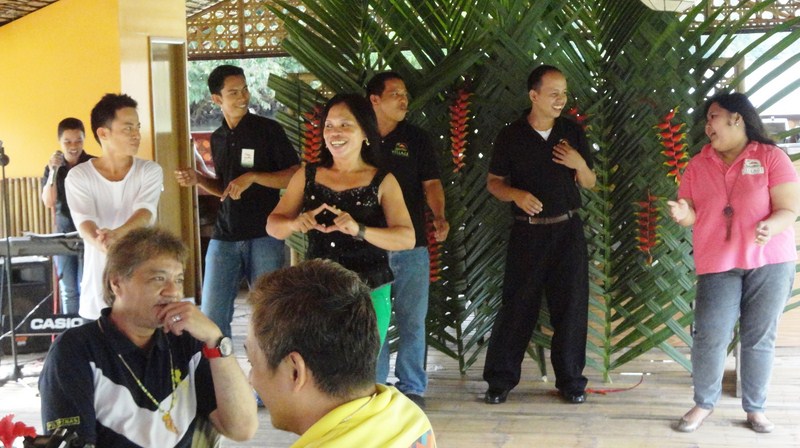
Continuing on our return cruise, our band, not to be outdone, also regaled us with a modern dance number. Soon enough, we back at the boat terminal by 3:30 PM, totally refreshed by this showcase of Boholono hospitality, cuisine and culture and quite ready for our next adventure.
The band and staff of Village Floating Resto & Cruises
Village Floating Resto & Cruises: Brgy. Valladolid, Loboc, Bohol. Tel: (038) 537-9223 and (038) 501-8078. Mobile number: (0928) 507-7627. E-mail: villagefloatingresto@yahoo.com.