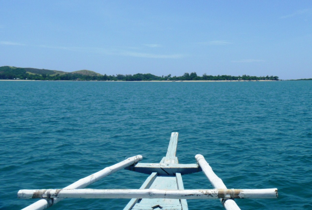
Calaguas Islands (Vinzons, Camarines Norte)

A pristine paradise discovered

Part of my itinerary during my first week of February visit to Camarines Norte was to camp overnight at the famed Calaguas Islands, a group of 17 islands northeast of Daet under the jurisdiction of the town of Vinzons.   This was not to be as three days of continuous rain prevented us from doing so.  Two months later, I was again invited back in the province during the peak of summer, covering the 4th Bagasbas Summer Festival in Daet with blogger Mark Vincent Nunez.  This time the weather was perfect, with bright sunshine, clear skies and calm seas, and Mark and I were again invited by Provincial Tourism Officer Atty. Debbee Francisco to visit these islands  famed for their Boracay-like (minus the commercial development) white sand beaches.

Minaongan Fish Port in Paracale

Aside from Debbee and Mr. Amable Miranda, a member of her staff, and ABC TV 5 crew Ms. Justine Santos and cameramen Mr. Amor Casiano and Mr. Dencio Suing; Mark and I were joined by participants of the summer surf festival who availed of the special participant’s price of PhP1,350 per person (normal rates range between PhP1,800-2,300) which included the boat ride to and from the island, tents and two meals with snacks. They include Ms. Joie Lacson, Ms. Iya Yujuico, Ms. Katrina Cruz, Ms. Lei Reinares and Mr. Philipp Cabales of www.pakyaw.com; Mr. Arnel Pahuway of World Vision; and Mr. Darryll Montebon of Jubilee Christian Academy.

Survivor Calaguas

From Daet, we all boarded a van for the 38-km. drive to Minaongan Fish Port in Paracale, arriving there by 2:30 PM.  Here, we all boarded a large, 25-pax outrigger boat.  Provisions for our overnight stay were loaded as well.  The boat ride took all of two hours, passing a number of rocky outcrops and beautiful islands with white sand beaches, and we landed on a cove called Mahabang Buhangin (“long sand”) at the 8 km. long Tinaga Island, the most frequented camping and swimming site for tourists. The beach was everything it was hyped up to be: powdery fine white sand, crystal clear waters and blue skies.

On our way

It was now late in the afternoon (4:45 PM) when we landed and, once the provisions were landed, we all set up our respective tents in a shaded area, Mark and I staying in one of the seven tents.  A comfortable hammock was already in place.  As the beach faced the west, we were in for a magnificent sunset show.  After a delicious dinner of grilled fish and chicken, we all shared a good chat and laughs while toasting marshmallows over a bonfire. It was already late in the night when we called it a day.

Sunset at Mahabang Buhangin

Come morning, we awoke to a delicious Filipino breakfast of fried rice, fried egg, hot coffee and crispy dilis (anchovies) and espada.   Dabbing on a lot of sunblock, we all savored the sand, sun and sea, doing snorkeling, sunbathing as well as swimming.  Later, some of us tried to burn our excess calories by walking along the beach and then climbing up a nearby hill.   The view up there was fantastic, with a bird’s eye view of Mahabang Buhangin on one side and the nearby Guintinua Island and other smaller islands on the other side.  A photographer’s dream, it was truly beauty from every camera angle. which we all indulged in, kamayan style.

Mahabang Buhangin seen from the hill

Our cameras also espied boatloads of tourists coming in from the mainland, it being a Sunday weekend.  It was time to go and, it was with regret that we went down the hill.  Back on the beach, many boats were unloading their cargo of tourists, surfer friend Mr. Oween Andrade and his family among them, plus their provisions.  It was just fitting that we left by 10 AM, giving up our campsite to these tourists, as we wanted to avoid the influx of this maddening crowd.  We thus left the island with bittersweet memories, hoping one day to again savor its beauty. Quoting from the lyrics of an Ogie Alcasid song, “Sana Maulit Muli.”

Posing with Guintinua Island on the background


The Famous Salt Beds of Dasol (Pangasinan)

The famous salt beds of Dasol

After our lunch and ocular visit of Dasoland, we again boarded our van to finally make our way back to Manila.  Its been a very busy and educational three days in Pangasinan. However, we haven’t traveled far when we espied the famous salt beds of Dasol.  We therefore stopped along the highway to take pictures of these fascinating man-made creations.  The  province’s name was derived from the word panag-asinan (“place where salt is made”) and Dasol is one of only four Pangasinan towns (the others are Anda, Bani and Bolinao) that produce salt.

Baskets of raw salt

These salt beds, glistening whitely in the late afternoon sun, have sluices that are opened to allow about 3 inches of sea water from  the incoming ocean tides of Dasol Bay to pour into and be trapped in a checkerboard of shallow ponds lined with grayish-brown clay and paved with shards of clay pots, similar to inland rice paddies.  The impounded water is allowed to naturally evaporate in the sun for a few hours, after which thin crusts of salt crystals would form on the surface and sink to the bottom of the pond.  The resulting encrusted salt is then raked, gathered into small neat piles, scooped into baskets and then transferred to a bigger pile in a hut.  The raw salt is then brought to the cooking sheds to be washed, boiled and condensed into pure rock salt. During the rainy season, the salt beds are converted into fish ponds.

Balingasay River (Bolinao, Pangasinan)

The clean, multi-awarded Balingasay River


On the way back to the Tourist Center from Enchanted Cave in Bolinao, we made a short stopover at a bridge to photograph the 7-km. long, pristine and now fishpen-free Balingasay River (Brgy. Balingasay),  twice winner of the Gawad Pangulo sa Kapaligiran Award for inland bodies of water in the Ilocos Region and a recipient of the highly prestigious Wetlands Conservation Award in 1994. Set aside as a protected seascape, this river, noted for its scenic beauty and biodiversity, has 15 hectares of century-old and new growth mangroves areas, 30 hectares of of attap palms (used for nipa hut roofing), wild ferns and balete trees hanging into the water.  These protect the river from erosion and pollution.  Different species of wild birds (locally called kiaw and pagaw) also make their home atop the trees and wild ducks, lizards, monkeys and wild boar also make their home in the forest.

Some boats parked at the river mouth

The Balingasay River is fed by Quibuar Spring, Bolinao Falls and several other springs and creeks. Fresh water meets the sea water of the South China Sea toward the middle of the river,  a perfect environment for unique fish (malaga, lapu-lapu, etc.) and shellfish (crabs, shrimps and oysters) species to flourish.  Boats from the bridge can be rented (PhP500) to explore the river which connects 5 villages to the town proper, located 5.5 kms. from the mouth of the river. Aside from regular outrigger boats, some boats that ferry villagers are made, through Filipino ingenuity, from discarded wings of World War II airplanes secured from the former U.S. Naval Base in Subic.  The wings are fitted with bamboo and wood as “balancers” and then wooden seats are installed for 12 people.

Bolinao Marine Laboratory (Pangasinan)

Bolinao Marine Laboratory

After our brief rest stopover at El Pescador Beach Resort, we proceeded to the Bolinao Marine Laboratory (BML), the official marine station, started in 1983, of the Marine Science Institute (MSI), University of the Philippines.The BML, located 2 kms. from Bolinao town proper, has a main laboratory building (with research lab and classrooms), administration building, staff houses, dormitories and a land-based hatchery.  A venue for research work, BML also aims to be a focal point for extension activities involving the municipality and the various communities inhabiting the coast; serve as an educational exhibit center for research activities on marine science; to offer direct service to the local community in the form of environmental education programs and; to assist in the formulation of coastal management plans for the municipality.

Giant clams

At BML, we observed the laboratory’s propagation of the endangered giant clam (Family Tridacnidae),  sea urchins and certain species of sea cucumbers through grow out culture and sea ranching.  The sea cucumber Holothuria scabra, one of the most expensive if not the most expensive in the market, are, once bred, are then planted in research pens in Santiago Island.  Sea urchins (scientific name: Tripneustes gratilla), locally called uni, have been overharvested by fishermen in the 1980s and 90s for the Japanese market. These too are bred, fed with processed sea weeds (sargassum) in a hatchery and re-seeded.  BML also does habitat restoration (e.g., coral transplantation) and sets up marine protected areas for coral and sea grass conservation. 

Bolinao Marine Laboratory: U.P. Marine Science Institute (MSI), Brgy. Luciente 1, Bolinao, Pangasinan.  Tel: (075) 541-8022 ext. 102. E-mail: chin445@yahoo.com.

Paoay Lake National Park (Ilocos Norte)

Cattle and boats for hire line the lake shore

After our brief sojourn in Batac City, we next proceeded to the Malacanang Ti Amianan (Malacanang of the North) in Paoay.  Along the way, we made a brief stopover at the view deck of Paoay Lake National Park.  This 470-hectare, horseshoe-shaped lake, the largest in the province, was declared as a National Park on June 21, 1969 by virtue of Republic Act No. 5631.  Once known as Naguyudan, it is known to the locals as Dakkel a Danum and is a popular picnic site. The lake is artificially seeded with various species of colorful fish and is 10 m. deep, yet the surface is below sea level.  Its fresh water comes from a subterranean source.

Lakbay Norte 2 at Lake Paoay National Park

According to a charming but Sodom and Gomorrah-like legend, it is said that a once-prosperous town, San Juan de Sahagun, once stood where the lake is now.  The materialism of the town and the indolence of its people incurred God’s wrath, so he sent an earthquake and flood waters that swallowed up the town and formed the lake.   Town elders will tell you that the original townsfolk, in gaudy fiesta finery, can still be seen as colorful, transformed fishes swimming around with earrings and bracelets.  Geological studies indicate that the lake was formed by a massive earthquake that caused the ground to sink and be filled with water from underground springs.  

A barge used to cross the lake

The lake is ideal for bird watching   Common residents here include the endemic Philippine Duck (Anas luzonica), the White-Collared Kingfisher (Halcyon chloris), the White-Throated Kingfisher (Halcyon smymensis), the Brahminy Kite, cattle egret and little egret. Migratory birds that linger for a while here include the Tufted Duck (Aythya fuligula), the Grey Heron (Ardea cinerea), great egret and the osprey. Cottages (PhP50) can be rented at the viewing deck.

Paoay Lake is located north of Paoay town, 3 kms. off the main highway and 3 kms. from the sea.

Sandboarding and 4x4s at La Paz Sand Dunes (Laoag City, Ilocos Norte)

Ida Noelle tries sandboarding while the others look on

After our nostalgic trip down the Marcos trail and some visita iglesia, it was now time for adventure back at Laoag City – sandboarding and 4x4s at  the unique La Paz Sand Dunes in Brgy. La Paz.  These low-lying, 10-30-m. high (some reach as high as 90 m.) elongated hills, along  the coast, north of the Laoag River, are locally called Bantay Bimmaboy (because of their pig shapes) and are declared National Geological Monuments.  They form, together with those stretching south of the Laoag River, a 16-km. long beach. Sandboarding is like snowboarding but done on sand and the sand board is very much like the snow board – just slip your feet to the straps attached to the wooden board.  In La Paz, this sport was first unveiled on August 2, 2009 by the Laoag Eco-Adventure Development (LEAD) Movement, a group that promotes adventure and eco-tourism.

Sandboarding on my butt

Instructors at the steep site (called “Devil’s Drop”) showed us how to strap our feet, properly mount the sand board, and where our center of gravity should be on our way down. Boards are waxed  first. prior to mounting.  You can sandboard standing up or, for those who balk at the thought of speeding down a  steep, 25-30 foot high hill, you can do it sitting down.  Having had a sprain on my right foot since my Anuplig Falls hike, I wasn’t going to do this standing up.  Even when seated, I still fell halfway. Getting back up on the slope, via the loose sand, was a great effort (you have to use the board as a prop). Finally, I succeeded on my second try.  Some in our media group were naturals or have done this before, effortlessly surfing, standing up, down the dunes without a hitch. For the newcomers, it took a while to find their balance and many  also fell halfway down the slope.  However, once you find your rhythm and balance, you’re hitched, wanting to do it all over again and again.

4×4 off-road vehicle

The thrill of the 15-min. 4 x 4 ride, patterned after that in Dubai, comes from riding at the back of the 4×4 off-road vehicle, with only a grab bar for you to hang on for dear life as you speed up a very steep hill then go down even faster. At one point our expert driver, barely into his teens, sped up a hill then suddenly let the vehicle fall back in reverse, making us grab the bars even tighter.  Truly a great adrenaline rush.  Of course, accidents can happen and we almost had one as our driver sped up the hill only to find out, at the last moment, that another was also heading up, on a collision course, at the reverse slope.  Close call.  Our driver had to back down.

The sand adventure package, consisting of the 4×4 adventure and sandboarding, costs PhP2,500 for one hour, maximum of 4 persons per jeep. Mobile number: (0919) 873-5516, (0932) 358-7521 and (0917) 523-0331).
After our La Paz Sand Dunes adventure, we again boarded our shuttle bus for San Nicolas   where we were invited for a buffet dinner at Ilocos Rosewell Hotel and Restaurant’s atrium-style lobby.
Laoag Eco-Adventure Development (LEAD) Movement, Inc.: Tel: (077) 772-0538.  Mobile number: (0919) 873-5516. Website: http://leadmovement.wordpress.com/.
Ilocos Rosewell Hotel and Restaurant: Brgy 1, San Francisco National Highway, San Nicolas, Ilocos Norte. Tel: (077) 670-6528 and 781-2122.  Fax: (077) 781-3700.  Website: www.ilocosrosewellhotel.com.

The Surreal World of Kapurpurawan Rock Formation (Burgos, Ilocos Norte)

Kapurpurawan Rock Formation: The Sphinx-like “Head”

After our biscocho and salt making observation tour in Pasuquin, our Lakbay Norte 2 media group then boarded our bus and proceeded to the fellow Ilocos Norte town of Burgos.   From the National Rd. our bus turned towards a gravel road and traversed it for about 3 kms. until we reached a makeshift picnic hut, our jump-off point for the amazing, unique and Sphinx-like Kapurpurawan  Rock Formation, one of the best places to visit in the town, aside from the iconic Cape Bojeador Lighthouse, the country’s tallest.

Bonsai-like plants amid pools of limpid sea water

From the hut, it was a 30-min. walk, along concrete steps, dirt track and then, through a tidal pool.  At the tidal pool, sea water-filled coral rock pools, of varying sizes, and bonsai-like vegetation can be seen sporadically.  The rock formation was formed from sandstone naturally carved by weathering from wind, sand and water to create different surreal shapes such as the iconic “Head,” “Cradle” and the “Resting Dragon.” The word kapurpurawan was derived from the Ilocano root word puraw meaning “white” and these formations are said to be much whiter during the summer months of April and May.

This rock formation, possibly the “Resting Dragon,” looks
like a slithering cobra  about to pounce

Our short Kapurpurawan Rock Formation hike made us hungry and, as it was lunchtime, we proceeded to the nearby, picturesque town of Paoay for lunch at Cafe Herencia.

Check out “Restaurant Review: Cafe Herencia

Herencia Cafe: MacArthur St., Brgy. 14, Sangladan, Paoay, Ilocos Norte.  Tel: (077) 614-0214

On the Road to Adams (Ilocos Norte)

It was still raining and windy in the early morning when we left Kapuluan Vista Resort in Pagudpud, via coaster, for the nearby town of Adams, located at the foot of the Gran Cordillera Central Mountain Range. This fairly young (it became independent from Bangui on May 16, 1983 by virtue of Republic Act No. 337), 159.31 sq. km. town has a sparse 2007 population of 1,522 uniquely spread out in only one barangay with 8 sitios.   Our coaster backtracked towards the Cagayan boundary, again traversing the 1.3-km. long Patapat Viaduct  until we reached a junction at Brgy. Panzian. Incidentally, Patapat’s rocky shore is now littered with the unsightly, rusting hulk of the marooned Korean-owned MV Nam Yang 8 oil tanker which listed at the height of Typhoon Juan in January 2010, causing an oil spill.
The marooned MV Nam Yang 8

Our coaster finally stopped at the junction in Brgy. Panzian.  This was the end of the road for our coaster and, from hereon, we were to tackle the last, rugged 13-km. uphill drive to the town via a dump truck (the only suitable transportation for our group as the only other way was via single-seat motorcycles).  

Our transportation to Adams

Most, except those who sat beside the driver and on a cooler box, good-naturedly endured the hour-long trip standing up and clinging to the sides of the truck.  The going was really rough as the road was really bumpy and we had to watch out for overhanging tree branches.  

A sparkling stream
Rice fields

The hardships and rigors of the ride was somewhat offset by the rugged and pastoral beauty of the countryside which included sparkling streams and rivers; verdant rice fields; lush lowland and montane rainforests, colorful flowers and a number of narrow hanging bridges that traverse the streams and rivers.

One of the town’s hanging bridges

Arrival in Pagudpud (Ilocos Norte)

The eco-friendly Kapuluan Vista Resort

We left the coastal town of Claveria, our last Cagayan destination, by 5:30 PM and it was already nighttime when our bus crossed the border into Ilocos Norte and the resort town of Pagudpud.  The weather still wasn’t cooperating with us and it was still raining when we arrived, by 7:30 PM, at Kapuluan Vista Resort where we were welcomed by Mike and Alma Oida, the resort’s gracious Fil-American owners.  Gabby Malvar, Dandi Galvez, Kim Madridejos, Roland “Jun” Fontilla, Frank Dizon and I were assigned to a six-bed dorm. Though not airconditioned, we certainly didn’t need it as the cool sea breeze wafted into the room.

Check out “Resort Review: Kapuluan Vista Resort

Grilled fish and liempo main course

The gloomy weather was somewhat offset by the warmth and hospitality of our young hosts and their staff and our delicious dinner, served on a banig place mat, which consisted of cilantro soup and garden salad with dressing for starters, a main course of tender grilled fish and liempo (pork belly) with tomato salsa, and buko pandan with homemade vanilla ice cream for dessert.  Most of the herbs and vegetables served here are grown and picked daily from the resort’s organic garden.  Breakfast, on the still raining and windy early morning, consisted of a Filipino breakfast of Vigan longanisa with fried egg and garlic fried rice.

Pagudpud – a new surfing haven

While dining, Mike, an avid surfer and fitness buff who can still speak fluent Tagalog, and the Ilocano-speaking Alma (whose roots are in La Union) regaled us with their story of how these newlyweds, who both worked for Ikea, were drawn to the waves and rustic beauty of Pagudpud’s Blue Lagoon six years ago, liking it so much that they resigned from their jobs, packed up all their belongings in the US and decided to settle here. They bought an 8,000 sq. m. undeveloped piece of heaven near the Dos Hermanos rock formation where they built their eco-friendly dream home and resort.

Kapuluan Vista Resort: Sitio Baniaran, Brgy. Balaoi, Pagudpud, Ilocos Norte.  Tel: (072) 888-2809.  Mobile numbers: (0920) 952-2528 and (0920) 928-5273.  E-mail: kapuluan_vista_resort@yahoo.com.  Website: www.kapuluanvistaresort.com.

Enchanting Claveria (Cagayan)

Claveria Cove

We left Buguey around 1:30 PM and our bus was to travel another 2 hours to get to Claveria, the last Cagayan town prior to entering Ilocos Norte.  It was now raining intermittently when we traversed the beach boulevard facing the town’s clean, 4 km. long brown sand Claveria Cove.  It was very windy when we alighted the bus for some photo ops and the waves along the beach were very turbulent.  On our left, we could sees the hazy outlines of the rock formations Punta Lakay-Lakay (“old man”), Punta Baket-Baket (“Old woman) and Punta Ubing-Ubing (“child”).  The onset of rain necessitated our return to the bus.

Lakay-Lakay Blue Lagoon

Back on our bus, we proceeded to Taggat to visit Lakay-Lakay Blue Lagoon. This lagoon is also located in a cove, albeit a smaller one.  As the bad weather prevented fishermen from going out to sea, the shore of this fishing village was filled with similarly-colored (blue and white with yellow stripes) fishing boats parked prow-to-bow and outrigger-to-outrigger. Minus the boats and in sunny weather, the panorama before us would have been a photographer’s dream.  Picture a lagoon enclosed by towering cliffs on both sides (the cliff on the right is topped by a cross) and jagged, rocky islands, all lashed and sculpted by the turbulent, churning waves of the sea.   Only in my dreams can I imagine such a scenery. In calmer weather and low tide, I could have swam to those rocky islets. Rain again woke me up from my day dream and we all had to run back to our bus.

Claveria town hall

Back in our bus, we next proceeded to the Claveria municipal hall where the amiable Mayor Celia Layus and other town officials welcomed us.  A merienda of buko juice, still in its shell, palitaw ( a sweet, flat and glutinous rice cake topped with brown sugar) and ginataan was prepared for us.  During the presscon, Mayor Layus narrated her plans to put up a zip line facility in the lagoon.  Personally, I would prefer that they leave the lagoon as it is and set up the zip line somewhere else in the town.