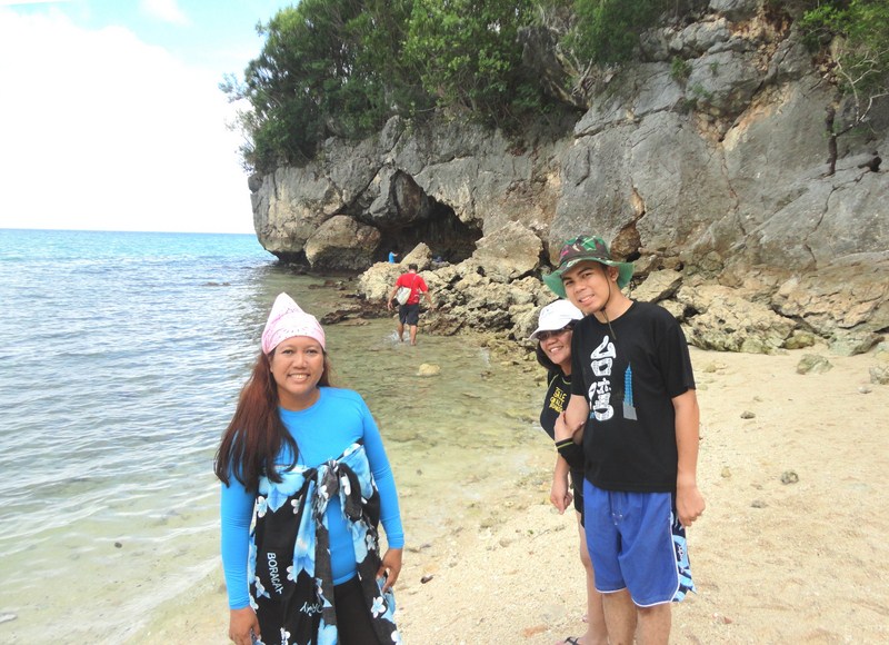
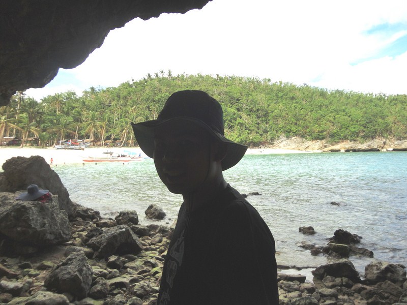
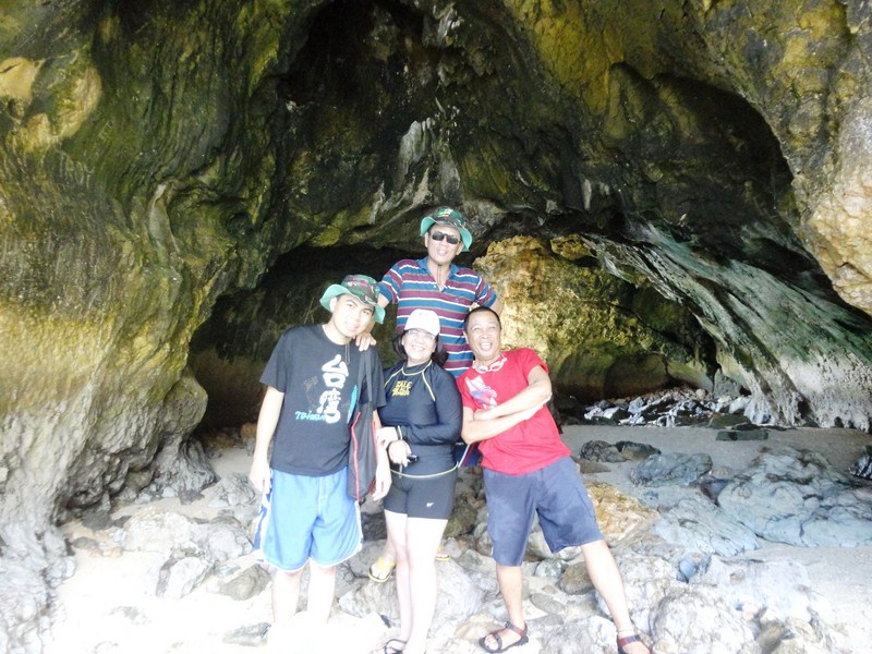
Hinagdanan Cave (Dauis, Bohol)

Hinagdanan Cave

Hinagdanan Cave

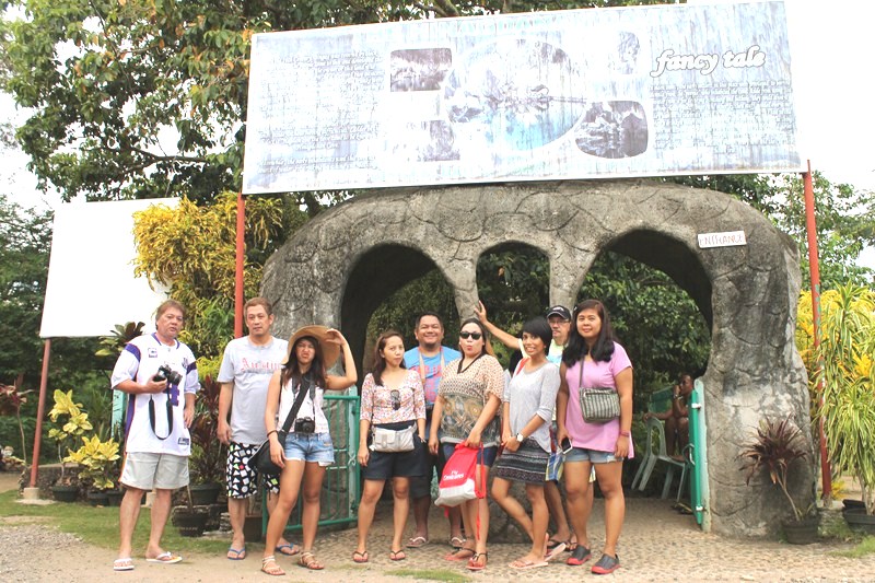
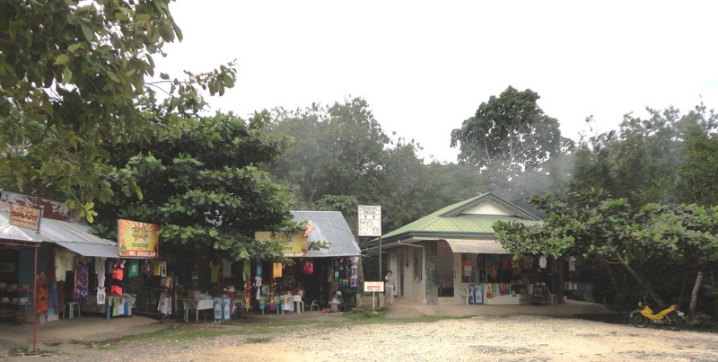
After our late lunch and short rest at our resort, we were back on the road again on our airconditioned coach, making a short 13-km./15-min. drive to the next town of Dauis where we made a stopover at Hinagdanan Cave.  Upon arrival at the parking lot, we first noticed a number of hawker stalls selling T-shirts, trinkets and other souvenirs, at the end of which is the ticket booth where visitors pay a small entrance fee to enter and explore the cave.

The entrance booth

The entrance booth

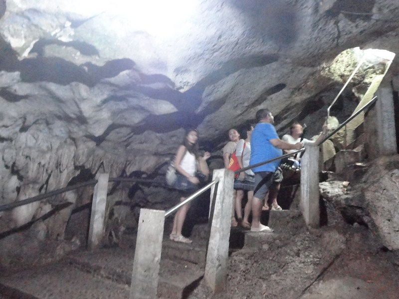
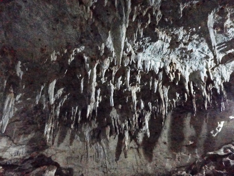
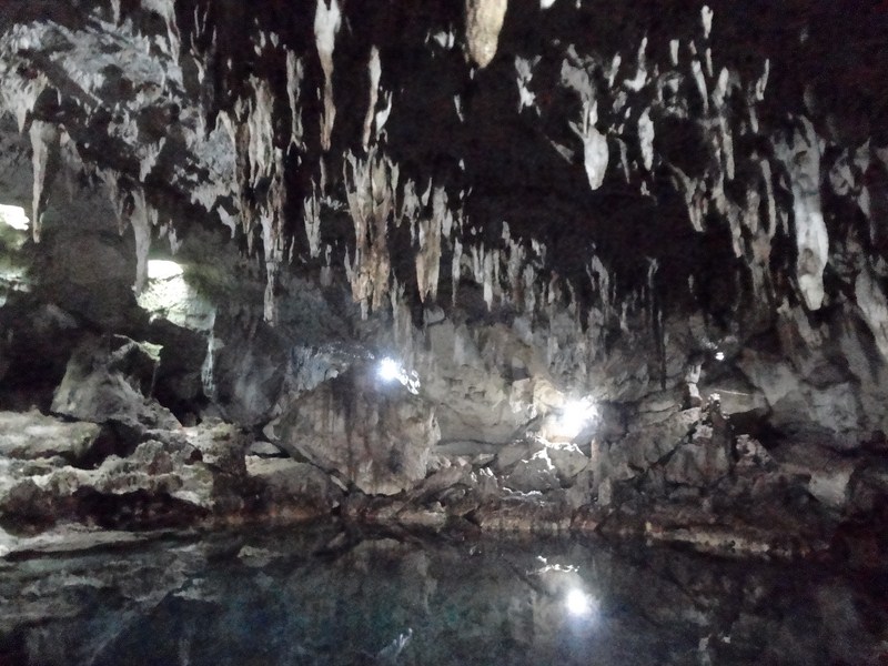
Accompanied by a local guide, we entered this cave via an unbelievably small opening with steep concrete stairs (with railings installed), through which only one person at a time can descend or ascend.  The cave was quite dark, slippery and wet, not really recommended for elderly or those with disabilities.  Its single, 100 m. long cavernous chamber is studded with stalactites,  stalagmites and other rock formations typically found in limestone caves.

The concrete stairs leading down to the cave

The concrete stairs leading down to the cave

According to our guide, Hinagdanan Cave was accidentally discovered when the owner of the area discovered the hole (now a skylight) while clearing the decaying branches on his land. The owner then threw a stone into the hole. Hearing a splash, he realized that a pool existed underground. He then built a ladder to get into the cave. Later, they named the cave Hinagdanan, meaning “laddered.”

Stalactites hanging from the cave ceiling

Stalactites hanging from the cave ceiling

Our guide was quite funny and witty with his scripted jokes (his delivery though made it funny). He was also proficient and trained enough to use a DSLR camera, knowing all the spots for nice pictures, the correct camera settings when taking pictures inside that dark cave, all the angles and the f/stops to make sure you get them.  We accepted his offer to take our pictures, using Joy’s camera. He took some really good shots inside.

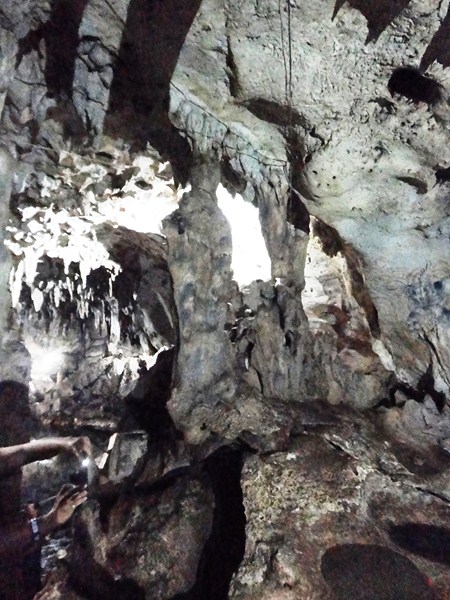
Grotesque rock formations

Grotesque rock formations

If you’ve seen larger caves like I did, then you’ll probably not be impressed with this fairly small cave (maybe a maximum of 30 persons can be inside at the same time) as it wasn’t really grand or magnificent in terms of size.  However, it is exciting and interesting enough for those who are not really into caving but would still want to experience going inside a cave.

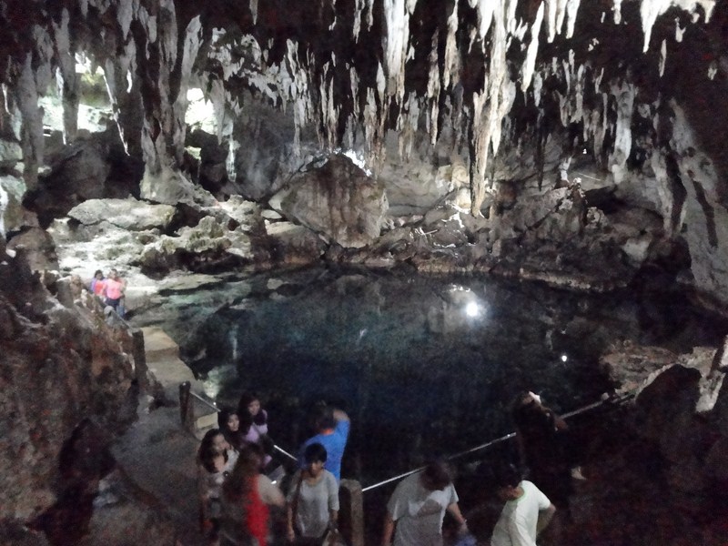
The beautiful cave pool

The beautiful cave pool

Inside is an picturesque, underground spring-fed swimming pool, with a depth of 15 ft. in the middle, illuminated by two natural skylights. Since it has an ocean exit, when it’s high tide, water seeps into the pool and raises its water level.  The owner also placed lights inside the cave so visitors don’t end up fumbling around. The cave and the water are cool and there was no strange smell inside the cave as there are no bats, just swallows.

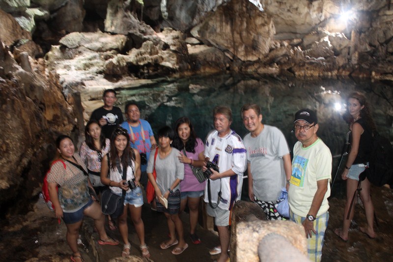
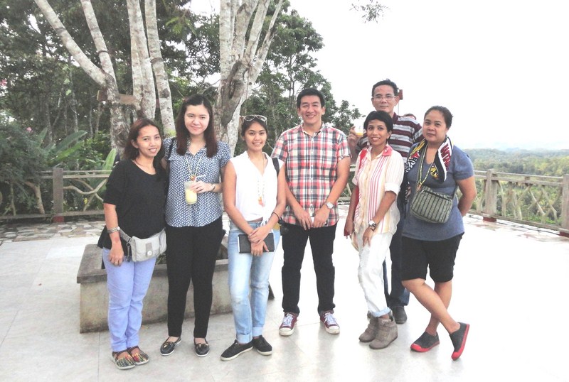
Our media group

Our media group

I have visited this cave some 11 years ago and the cave still looked the same, minus the guides and souvenir shops that have mushroomed in the vicinity. Just like a number of our Philippine geologic treasures, some of its rock formations have, over the years, been vandalized or marked up with graffiti.

The souvenir stalls above ground

The souvenir stalls above ground

Hinagdanan Caves: Brgy. Bingag, Dauis, Bohol. Admission: PhP30.

How to Get There: Hinagdanan Cave is located 10 kms. from Tagbilaran City and 2.5 kms. from Dauis town proper, near Pangalo Island Nature Resort.

Pamilacan Island (Baclayon, Bohol)

Pamilacan Island

Pamilacan Island

It was now Day 2 of our 3-day media familiarization tour of Bohol.  After a very early breakfast at Panglao Bluewater Resort, we were slated to do some dolphin watching off Pamilacan Island, followed by lunch at Balicasag Island.  The tide was still low and our large motorized outrigger boat was anchored some distance off.  To get on board her, we took turns riding a tandem kayak until all were on board.  The sun was already up in the sky when we got underway.

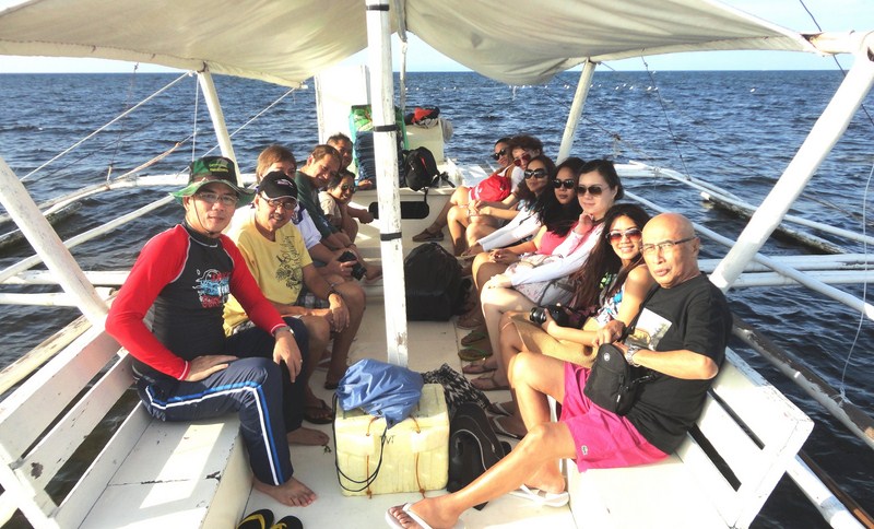
On our way

On our way

The island’s name was derived from the word meaning “nesting place of manta rays.”  However, it has also been interpreted to to have been derived from the word pamilac, a harpoon (large hooked implement) used to capture manta rays, dolphins, whale sharks and Bryde’s whales. Under the jurisdiction of the municipality of Baclayon, it is situated 14 kms. (8.7 mi) south of the Bohol mainland.

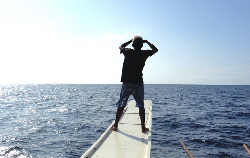
Our spotter scanning the horizon for dolphins or whales

Our spotter scanning the horizon for dolphins or whales

The waters around the island are home to at least 11 species of dolphins and whales, including the playful Spinner Dolphins, Bryde’s whales and the gigantic Sperm Whale. Blue Whales are sometimes seen in the early months of the year. The whale watching season begins in March until the onset of the rainy season in June or July.

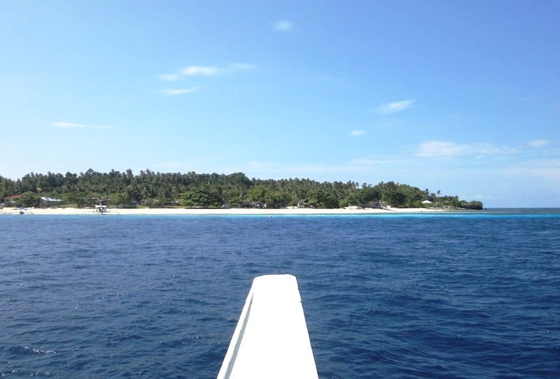
Soon to make landfall

Soon to make landfall

The 15 to 20 m. long boat we rode on was possibly a former canter, a boat formerly used for whale hunting.  These have been refitted with seats and roofing for a comfortable ride for 7 to 10 passengers who want to go whale or dolphin watching.  A skilled, elderly spotter, who is also an excellent guide, soon took his place at our boat’s bow, scanning the horizon for any whales or dolphins. Resident dolphins and small whales can be found all year round but sightings are dependent on weather and sea conditions.  Just like my first try in 2003, we were unlucky to find any of them.

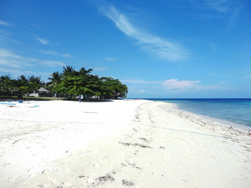
The island's immaculately white sand beach

Footprints along the island’s immaculately white sand beach

We made landfall at the island’s beautiful white sand beach located on its northwest side.  Upon landing, we were welcomed by members of the island’s small and closely knit fishing community which has around 200 families living in 3 sitios – one facing Baclayon, another amid an island and a third on the southern coast.  Their main livelihoods now concentrate on dolphin and whale watching tours and subsistence fishing. In the past, it also included whale, dolphin and manta ray hunting. However, with the strict enforcement of marine life preservation laws in the country, this practice was stopped. Their houses, though, are still adorned with jaws and bones of these marine mammals.

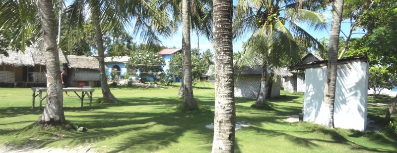
The island's barangay

The island’s barangay

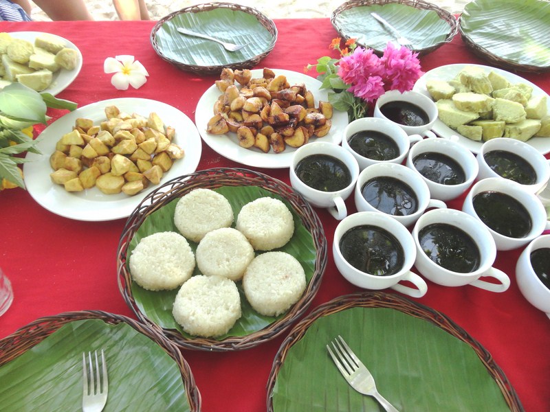
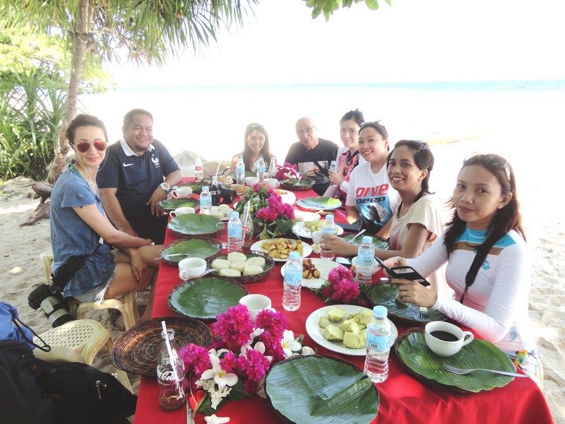
When we arrived, a table (with red tablecloth) and chairs were set up under a shady palm tree, beside some picnic sheds.  A merienda of sliced camote (sweet potatoes), either steamed, caramelized or fried, plus rice cakes and corn coffee were prepared for us. The latter looked and tasted like your good old caffeinated coffee but is said to be healthier.

A merienda of camote, rice cake and corn coffee

A merienda of camote, rice cake and corn coffee

After this filling repast, I together with Czarina, Euden, Joy, Kathleen and Lara went on a snorkeling tour on 3 small boats, each with a local boatman who paddled for us.  Czarina joined me on one boat.  The island’s wide flat reef, now a marine sanctuary, offers good snorkelling and diving (it has some great dive sites such as Dakit-Dakit).

Dining al fresco along the beach

Dining al fresco along the beach

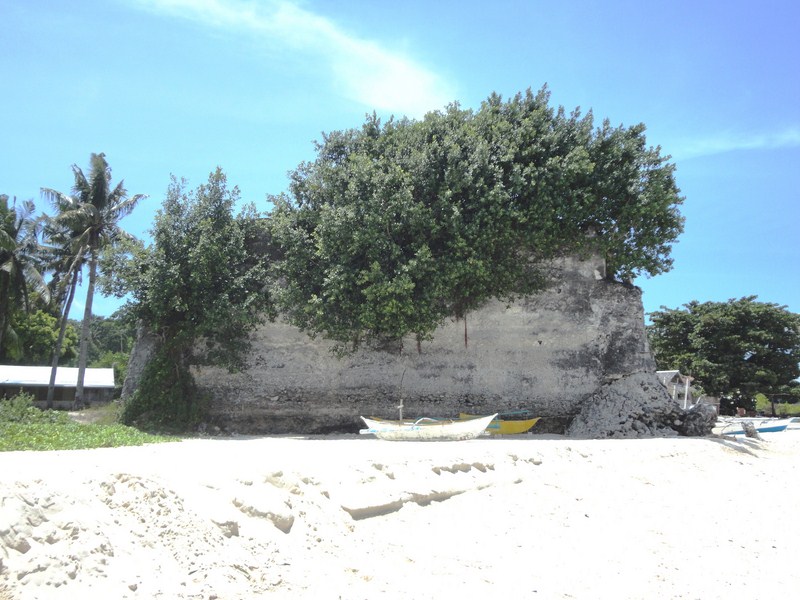
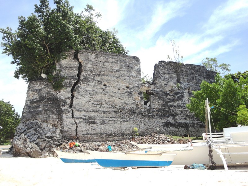
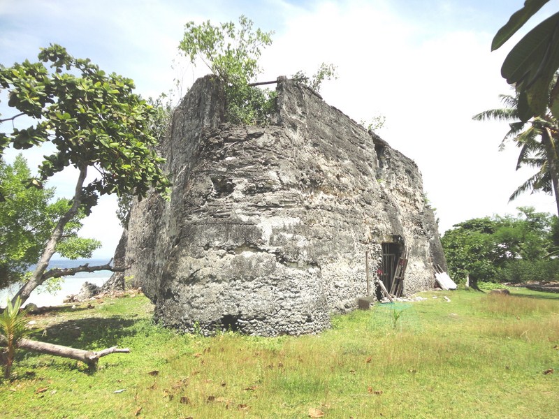
After some great snorkeling over coral gardens, we returned to shore early as Czarina wasn’t feeling good.  Back on dry land, I explored the nearby Spanish-era fort which, in the past, served as a watch station for pirates, intruders and other enemies. Triangular in shape and probably constructed in the 19th century, it was made with rubble while cut coral blocks lined its portal and windows. The three corners of the structure were supported by round buttresses.

The triangular, Spanish-era fort

The triangular, Spanish-era fort

Another view of the fort

Another view of the fort

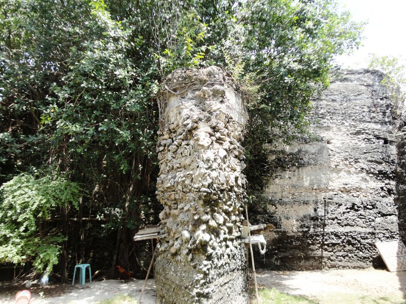
Inside are embedded trusses and a triangular pillar in the middle, indication that the fort may have had a second floor, probably made of wood. A large hardwood cross, with an 18oos date carved on it, once stood near the fort but is now housed in a nearby modern chapel. The fort was said to have formed a network with the towns of Baclayon, Loay and Tagbilaran.

View of the fort from another angle

View of the fort from another angle

The ladies were already back from their snorkeling trip when I returned.  Soon enough, we were back on board our boat for the second half of our island hopping expedition – Balicasag Island.  The waters were already choppy when we left and our boat had to travel slowly as the waves kept pounding the boat.  Soon a number of us (including me), especially the already ill Czarina, were already feeling seasick and, since our destination was still a long way off and it was already way past noontime, it was decided to just return to our resort.  Anyway, I have been to Balicasag Island 11 years ago, going around it on foot and snorkeling its coral gardens.  However, I felt sorry for those who haven’t been there. Oh well, you can’t win them all.
The triangular pillar in the middle of the fort

The triangular pillar in the middle of the fort

How to Get There: Pamilacan Island is located about 20 kms. southeast of Tagbilaran City, 23 kms. east of Balicasag Island and 11 kms. (a 45-min. pumpboat ride) offshore from the town. Pumpboats can be hired at Baclayon port.
Chocolate Hills Adventure Park (Carmen, Bohol)

Chocolate Hill Adventure Park (CHAP)

Chocolate Hill Adventure Park (CHAP)

After our delightful Loboc River Cruise, we all returned to our airconditioned coaster for the highlight of our Bohol Countryside Tour – the Chocolate Hills Adventure Park (CHAPS) which is owned and run by Camanayon Hill Development Corp.

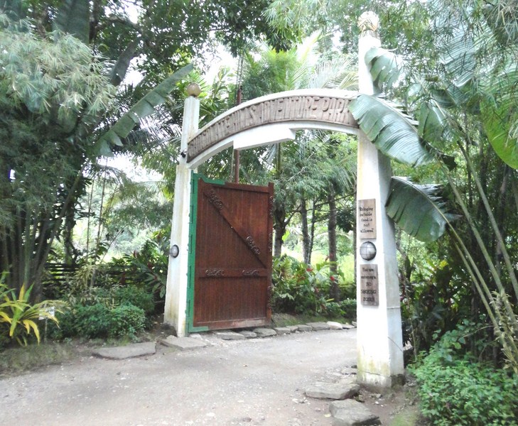
The park entrance

The park entrance

Situated in Carmen, it is the latest eco-tourism and adrenaline pumping adventure park in Bohol. The sprawling 4-hectare park offers thrilling adventure activities like hiking trails, tree top adventures and the famous, exciting  and very unique bike zip line dubbed as “The Rush.”  The 37-km. drive, via the Loay Interior Rd., took about 40 mins. and we arrive at CHAPS by 4 PM.

The wooden bridge leading to the receiving area

The wooden bridge leading to the receiving area

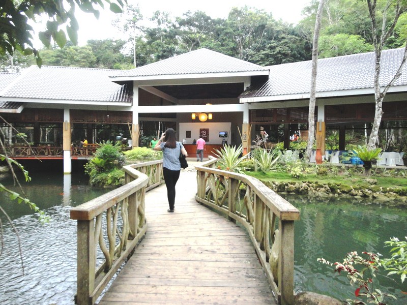
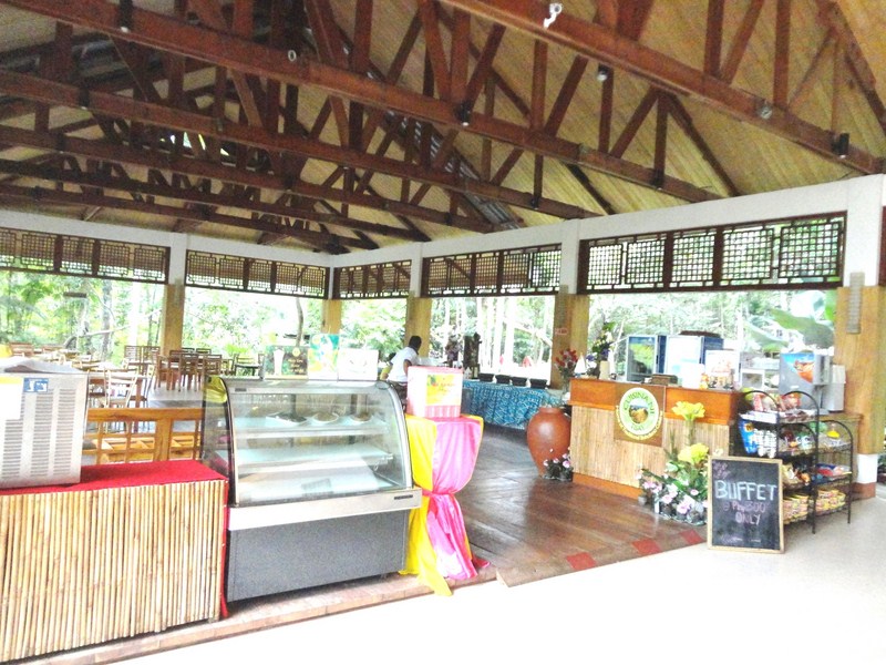
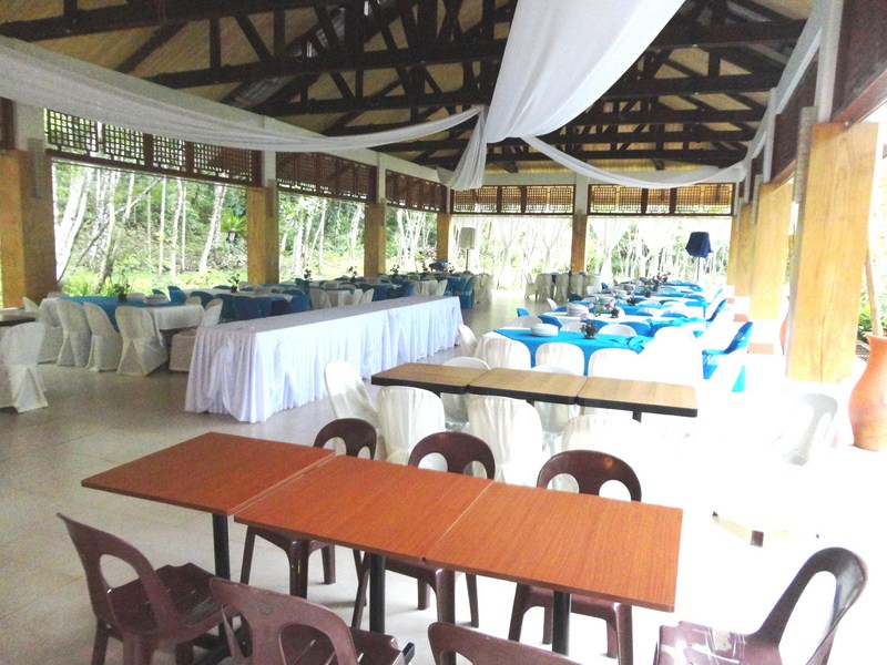
From the park entrance, we first crossed a short wooden bridge, over a natural pond, to a main receiving hall that houses the reception desk in the middle,  a small open-air restaurant  (Cuisina ni Tesai) offering Boholano dishes plus some souvenir stalls on the left and an events place on the right.
Cusina ni Tesai and souvenir shops

Cusina ni Tesai and souvenir shops

The events place

The events place

Here, Josue took a head count on those who would avail of the adventure packages. However, Joy, Czarina, Julia, Lara and yours truly were here for “The Rush” – the bike zip which takes biking to another level.
Hiking up the wooden boardwalk

Hiking up the wooden boardwalk

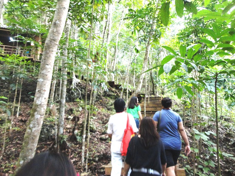
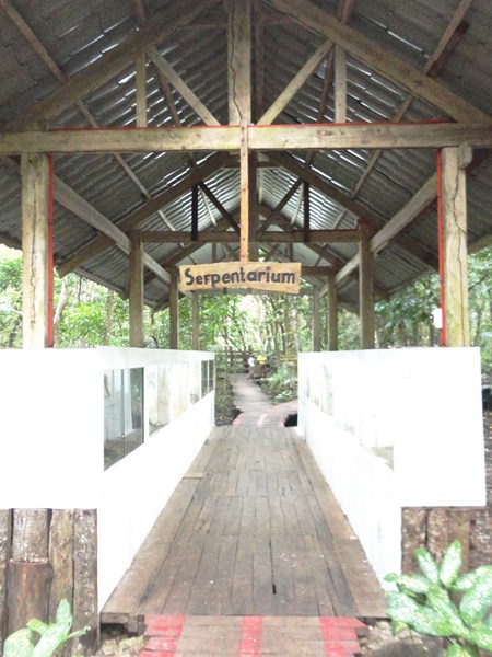
From the pavilion, we all hiked along a wooden boardwalk that meanders over a brook. Along the hiking trail, we passed by a serpentarium that houses a few snakes (python, green Oriental whip snake, etc.) found around the area during the construction of the park plus some sugar gliders and hedgehogs.

The Serpentarium

The Serpentarium

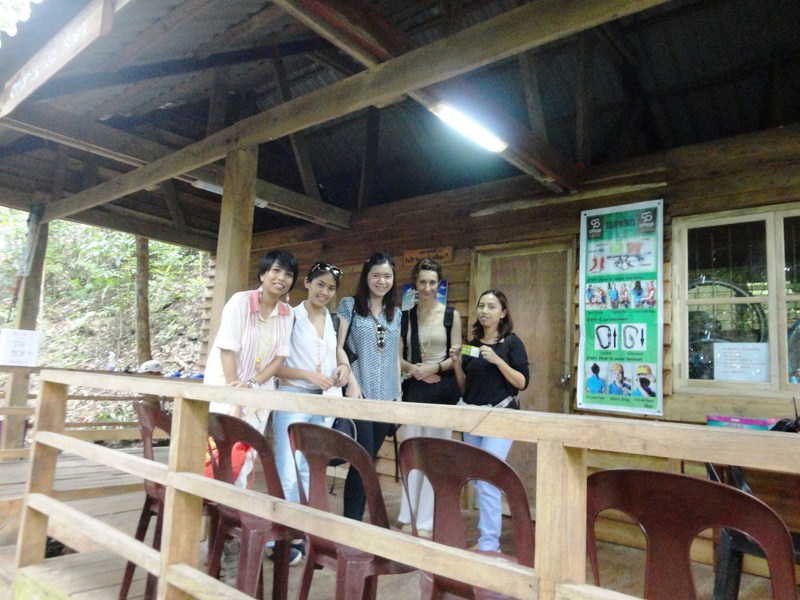
We made a stopover at a cottage where a nurse checked our blood pressure (mine was 140/90). Lara had to back out for reasons I will not divulge.  We were also given a briefing on what to expect on the bike zip.

Ladies at the briefing cottage

Ladies at the briefing cottage

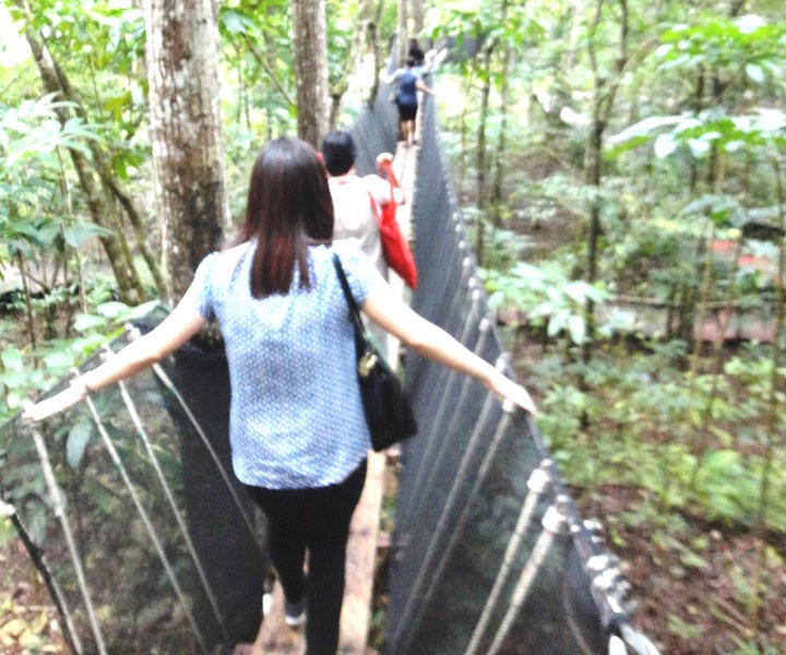
After climbing all 268 steps (including crossing a hanging bridge 4 at a time) along the hiking trail, we were already a little out of breath when we reached the viewing deck.

Crossing a hanging bridge

Crossing a hanging bridge

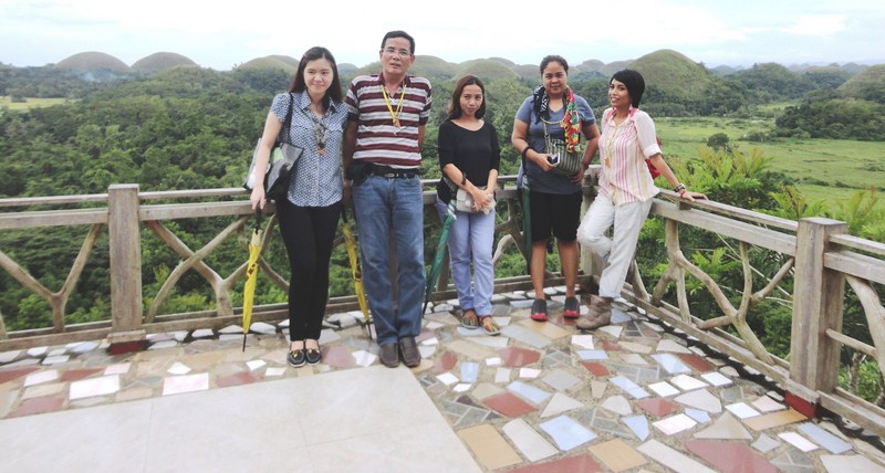
Since the massive magnitude 7.2 earthquake of October 15, 2013 destroyed parts of the old viewing deck (as well as a few of the 1,776 Chocolate Hills) in the town of Carmen, the one at CHAP’s became the de facto viewing deck (the hills are much farther away though) while the old one, which has a much grander view, is being rebuilt.
Czarina, the author, Joy, Kath and Euden at the viewing deck

Czarina, the author, Joy, Kath and Euden at the viewing deck

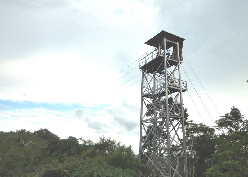
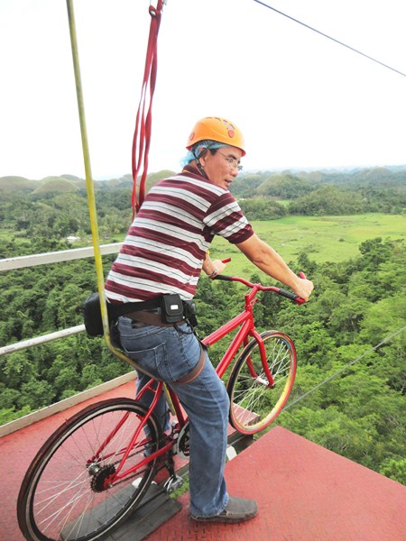
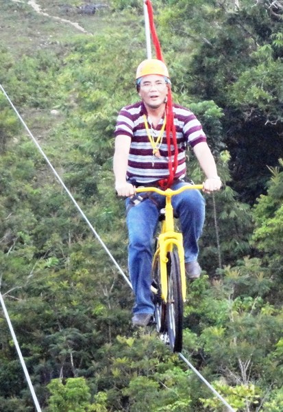
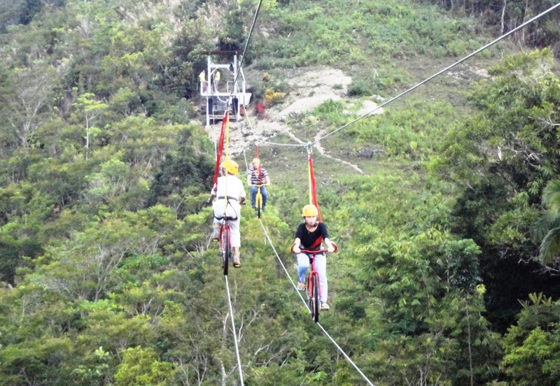
The Bike Zip is a 275-m. (550 m. round trip) long zip line, 150 ft. above the ground, using a mountain bike to cross from one hill to another. After all suiting up with helmet, harness and hairnet (?), we all climbed the stairs going up to the tower. The bicycle, minus the rubber tires, is securely joined to the zip line so there’s no problem balancing. All we had to do was pedal and feel the ride.
The bike zip tower

The bike zip tower

I was supposed to go first and I was already mounted on the bike and ready to go when I suddenly got chills and almost chickened out.  I have somehow conquered my fear of heights, having gone ziplining a number of times, but seeing how high I was from the ground, the scenario seeing the hills high up in the sky made me shudder.

Getting ready to hit the zip

Getting ready to hit the zip

I allowed Joy to have first crack at it and, as soon as she made it to the other side, I gathered the courage and followed suit.  The ride was scary at first as I had this feeling that, at any moment, my bike would fall off from the zip line. It took some time to for me to feel at ease with the ride but, once I got the feel for it, the ride slowly became enjoyable and exciting.

Traffic along the bike zipline

Traffic along the bike zipline

The ride truly gave me a different experience of seeing the famous Chocolate Hills.  They say that the windier and rainier it is, the more exciting the bike ride is. Due to the rush of emotions, now I know why they call it “The Rush.” It was truly an exciting, one-of-a-kind experience.  After Joy and I, Czarina and Julia followed our lead.  After our bike zip, we interviewed Mr. Jing E. Velaso, Managing Director of CHAP on the parks’s current facilities and future plans (including overnight accommodations).

Experiencing the rush

Experiencing the rush

The park has a 9-course rope challenge adventure course – “Islands in the Sky,” “Burma Loops,” “Burma Planks,” “Hanging Bridge” (2 stages), “Earthquake,” “Vine Walk,” “Jacob’s Walk,” “Tyrolean” and  the “Zipline.” You  get to “Zipline” upon completing half of the course and then the “Ttyrolean” traverse for the rest of the course. Upon completion of all courses, you rappel your way down.  These trails test one’s strength, balance, endurance, strategy and patience.

Media team with CHAP Managing Director Mr. Jing E. Velasco (center)

Media team with CHAP Managing Director Mr. Jing E. Velasco (center)

Rates: The Rush (Bike Zip): PhP400, The Snake Ladder (Tree Top RCA): PhP200, The Pentagon (Tree Top RCB): PhP350, Gymnaskids (Child Rope Course): PhP300, Eco-Hiking Trail: PhP200,Chicken & Fish Feeding: PhP50.

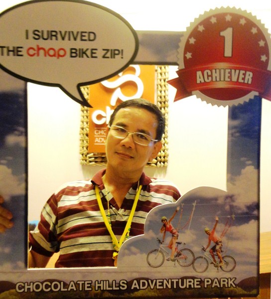
I survived

I survived

Chocolate Hills Adventure Park (CHAP): Sitio Camanayon, Brgy. Buenos Aires, Carmen, Bohol. Mobile number: (0917) 304-1341  and (0932) 667-7098.  Email: chocolatehills_adventurepark@yahoo.com.  Entrance Fee: PhP60. Open daily, 8:30 AM – 5:30 PM.

How to Get There: CHAPS can be reached in an hour and a half by riding a bus or van from Dao Terminal in Tagbilaran City.

Loboc River Cruise (Bohol)

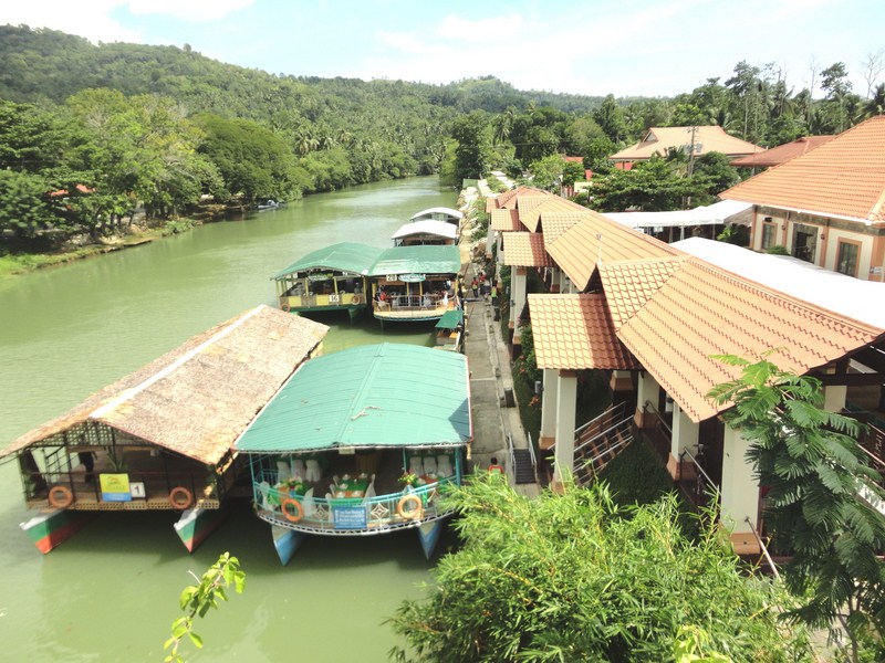
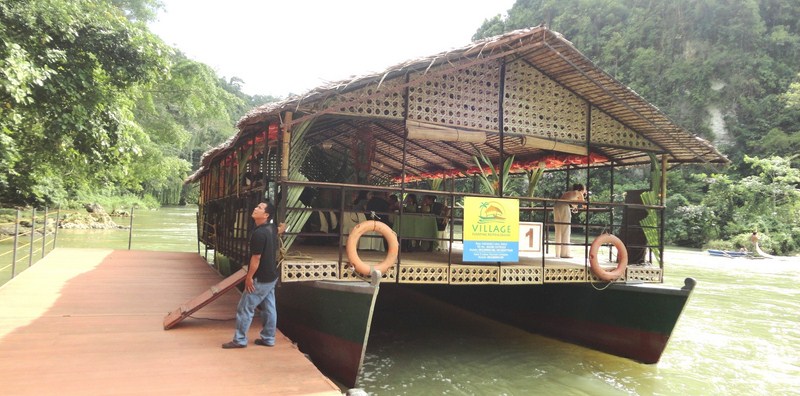
Floating restaurant of Village Floating Resto & Cruises

Floating restaurant of Village Floating Resto & Cruises

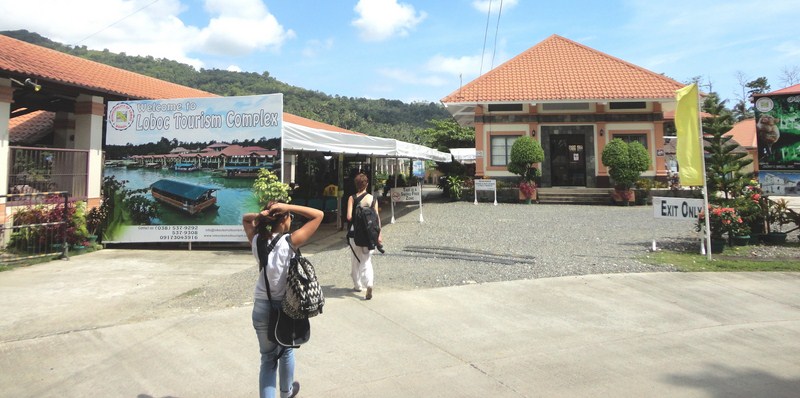
Upon arrival at Loboc, we all crossed over to the other bank of the Loboc River, via the Alfonso L. Uy Promenade, to get to the Loboc Tourism Complex where the floating restaurants are docked.  It has been 11 years since the last time I had my first Loboc River Cruise with my family and I was curious as to what’s new with the cruise.

The Loboc Tourism Complex - a tourist attraction by itself

The Loboc Tourism Complex – a tourist attraction by itself

This time, I now notice so many improvements in the area. Well for one the floating restaurant terminal is now concreted, there are now lamp posts along the river banks (for night cruises), helpful directional signage and an orderly parking lot, the restrooms are clean and the complex was wi-fi enabled.  This made the complex an exceptional tourist attraction by itself.

Floating restaurant terminal

Floating restaurant terminal

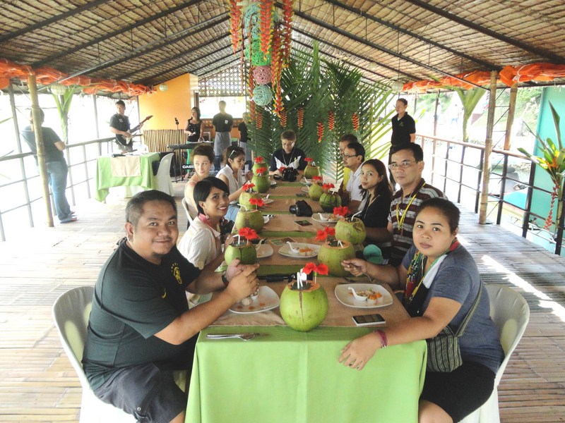
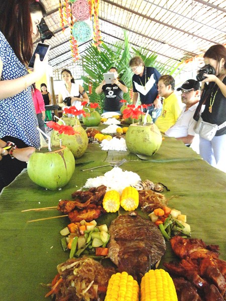
When we got to the boat terminal, we were all whisked to the waiting double-hulled floating restaurant of Village Floating Resto & Cruises.  The setup this time was different from our past typical boat tour.   Instead of different tables for different groups of guests, a long, flower-bedecked table was instead set up with green table cloth and fresh buco in the shell for each one of us.

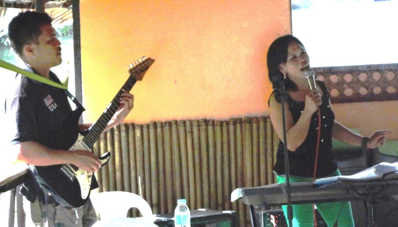
Being serenaded with bossa nova songs

Being serenaded with bossa nova songs

Our lunch was also to be something different, not the typical buffet.  When our boat got underway, we were first entertained by a local band with a versatile and talented female lead vocalist singing bossa nova songs for our listening pleasure.  This got us in the mood for lunch, however late it was.

Our media group

Our media group

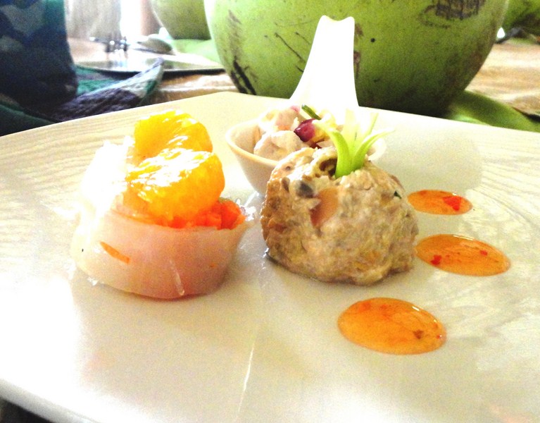
The food soon started coming in, starting with the appetizers – fish kinilaw, puso salad and summer rolls.  This was followed by law-oi soup.  The main course that followed next was out of the ordinary – a humongous boodle feast, to be eaten kamayan-style

Appetizers – fish kinilaw, puso salad and summer rolls

Appetizers – fish kinilaw, puso salad and summer rolls

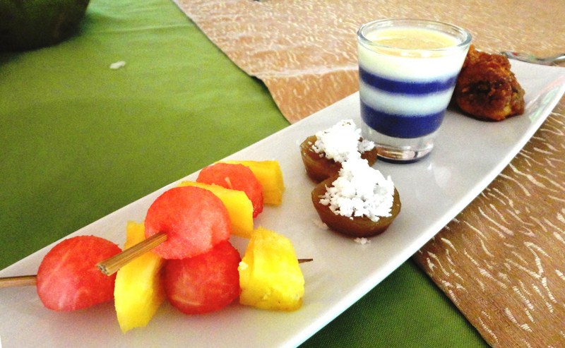
Fruit skewers, puto cuchinta, ube pannacotta, banancue

Fruit skewers, puto cuchinta, ube pannacotta, bananacue

It consisted of pork humba, chicken inasal, sisig-stuffed squid, grilled vegetables, pinais na isda and corn on the cob plus steamed rice, all laid out on banana leaves.  Our delightful lunch was capped by a series of desserts consisting of ube pannacotta, bananacue, puto cuchinta and fruit skewers.

Our boodle feast

Our boodle feast

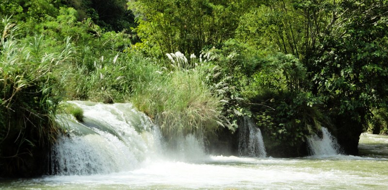
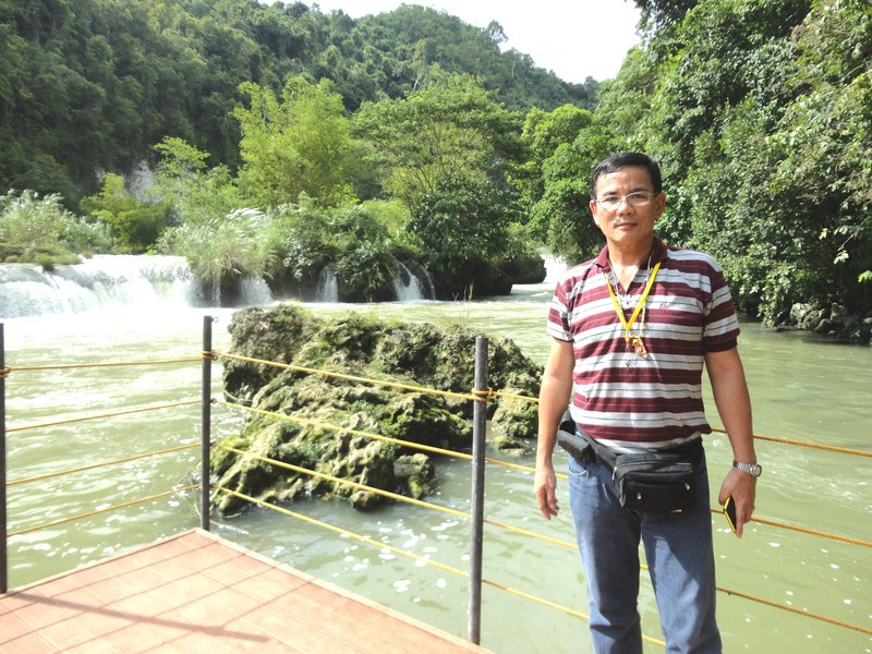
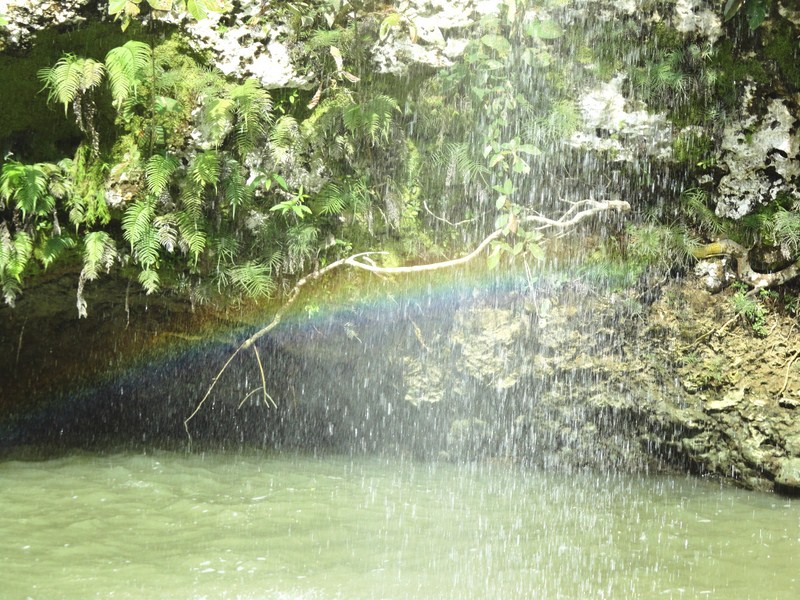
In about an hour, our boat reached the endpoint of our 2-km. cruise – Busay (or Tontonan) Waterfalls.  These series of low waterfalls, used to generate electricity for the town, drops 15 m. in 2 stages.  We were already done with lunch when docked near a floating wooden platform with rope railing.  Alighting here, we had the luck of seeing a rare rainbow beneath a nearby small waterfall.

Busay Falls

Busay Falls

The author at the floating viewing platform

The author at the floating viewing platform

The rainbow uderneath a small waterfall

The rainbow uderneath a small waterfall

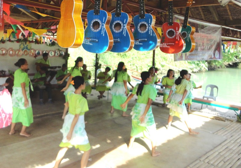
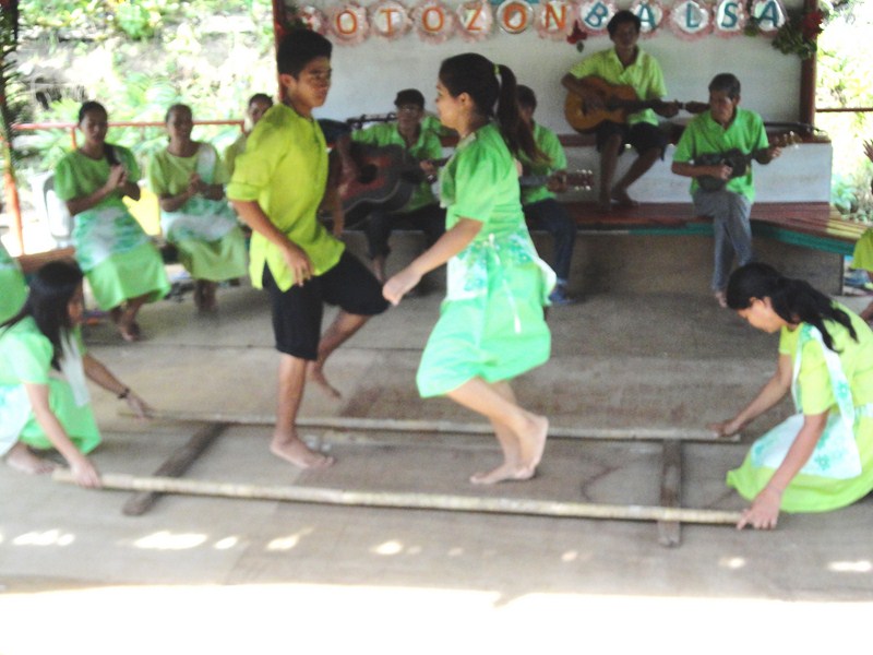
After a few minutes at the viewing deck, we again boarded our boat and, when all were accounted for, turned around for our return trip upriver.  Along the river, the boat stopped at a small bamboo and nipa jetty decorated with banderitas and colorful guitars hung on the rafters. Here, some locals, dressed in apple-green filipiniana outfits, provided us a culture show, dancing the kuradang and the tinikling.

A kuradang dance performed for us at a riverbank jetty

A kuradang dance performed for us at a riverbank jetty

Tinikling dancers in action

Tinikling dancers in action

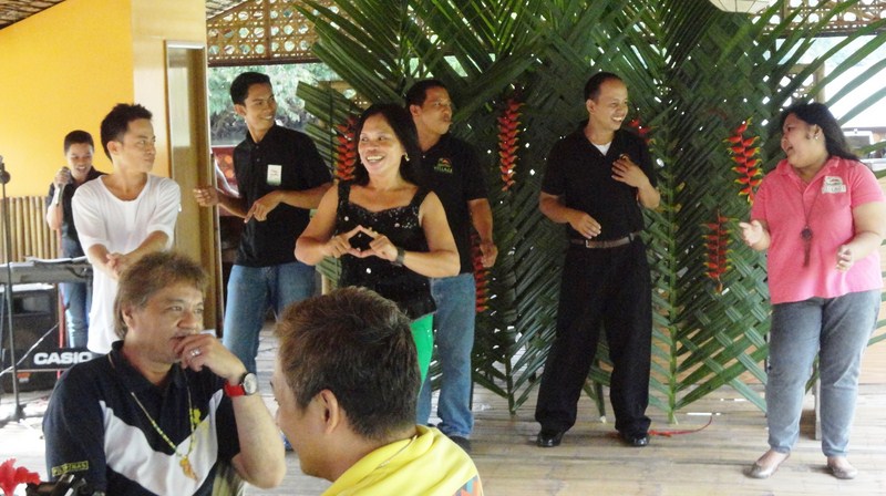
Continuing on our return cruise, our band, not to be outdone, also regaled us with a modern dance number. Soon enough, we back at the boat terminal by 3:30 PM, totally refreshed by this showcase of Boholono hospitality, cuisine and culture and quite ready for our next adventure.

The band and staff of Village Floating Resto & Cruises

The band and staff of Village Floating Resto & Cruises

Village Floating Resto & Cruises: Brgy. Valladolid, Loboc, Bohol. Tel: (038) 537-9223  and (038) 501-8078. Mobile number: (0928) 507-7627. E-mail: villagefloatingresto@yahoo.com.

Philippine Tarsier and Wildlife Sanctuary (Corella, Bohol)

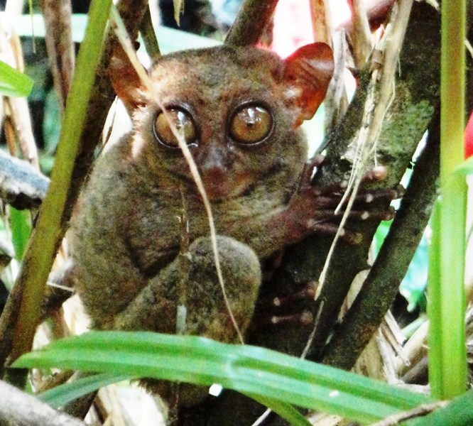
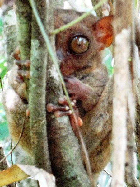
The tarsier in its nature habitat

Upon landing at Tagbilaran Airport, we were welcomed at the terminal by our local tour guide Mr. Josue Hinay of Travel Village and Tours.  Boarding our airconditioned coaster, we proceeded on our scheduled Countryside Tour of Bohol. After a 30-min./10 km. drive northeast of the city, we arrived at  the 7.4-hectare Philippine Tarsier and Wildlife Sanctuary.

The Philippine Tarsier and Wildlife Sanctuary

The Philippine Tarsier and Wildlife Sanctuary

An arm of the Philippine Tarsier Foundation, Inc. (PTFI), the sanctuary was established in 1996 to protect the tarsier (Tarsius syrichta), Bohol tourism’s mascot.  Known locally as mamag, mago, magau, maomag and magatilok-iok, here the tarsiers are allowed to live and reproduce freely in a natural setting.

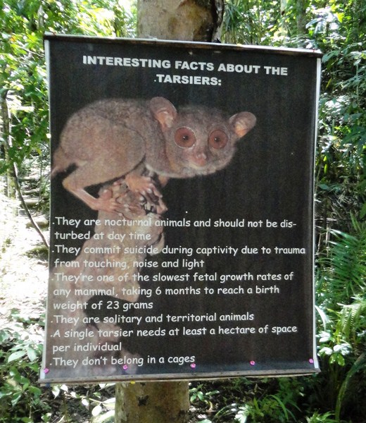
What you should know about the tarsier

What you should know about the tarsier

The tarsiers, formerly hunted down, captured and then sold to local and foreign visitors, were declared to be specially protected faunal species of the Philippines by virtue of Proclamation No. 1030, as declared by former Pres. Fidel V. Ramos on June 23, 1997. A 167-hectare sanctuary has been set up in areas within Corella, Sikatuna and Loboc towns where numerous sightings of the tarsiers have been made within their forested domain. Poaching, killing and even wounding of these tarsiers as well as the destruction of its declared habitat are strictly prohibited.

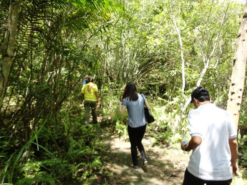
Hiking along the Tarsier Trail

Hiking along the Tarsier Trail

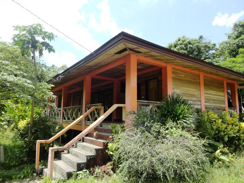
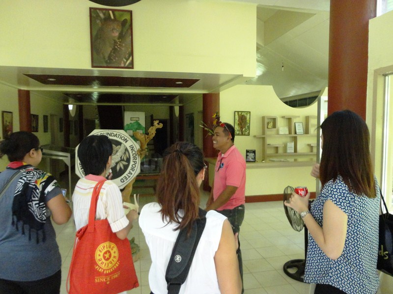
Alighting from our coaster, we made our way to the Tarsier Research and Development Center which has a visitor’s center complete with a reception and souvenir counter, an exhibition area, an audio-visual room, a mini-cafeteria, toilets, and administration offices.  Here, we were assigned a trained volunteer guide who led us through a net enclosure with a 7-ft. high fence (to keep house cats out and the insects in) where 100 tarsiers are kept for feeding, breeding and display.

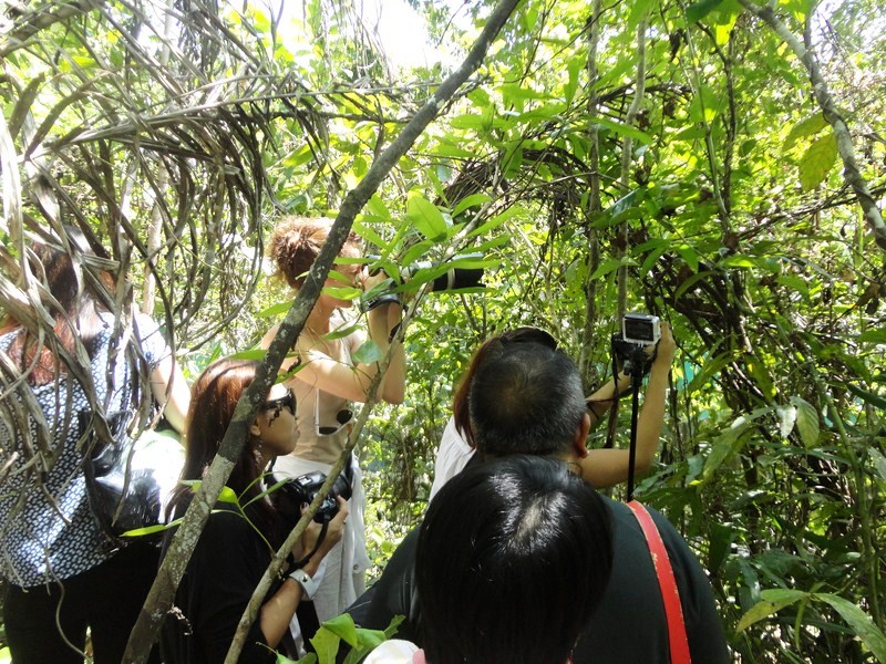
Taking turns potographing the tarsier

Taking turns potographing the tarsier

Here, we saw and observed, up close and personal, three of them in their nature habitat which consists of mature secondary growths of mahoganyteak and ficus trees as well as many varieties of palmfernbamboo clumps, tall grass patches, thick bushes and other greenery which grow in profusion.  We were allowed to take pictures but were urged to do so quietly and not to handle them so as not to put stress on these nocturnal animals who, during daytime, are asleep.

A close up shot

A close up shot

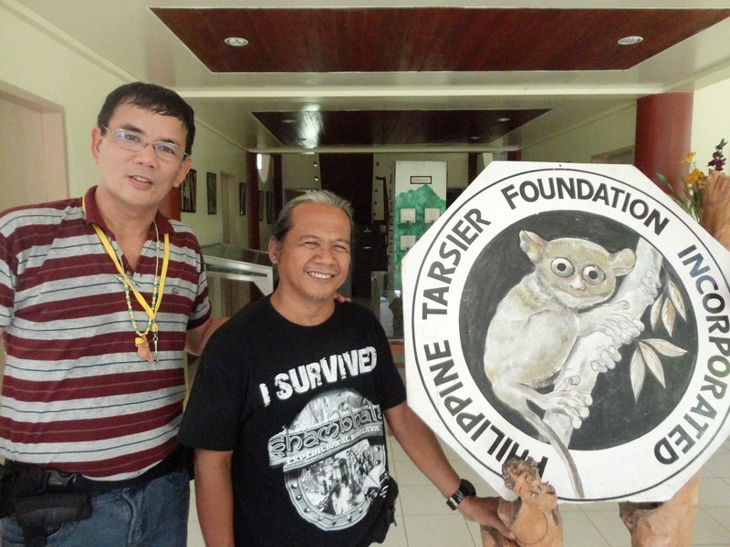
Back at the Visitors Center, Josue introduced us to Carlito “Lito” Pizarras, the Field Supervisor of the sanctuary.  Known as the “Tarsier Man,” Lito once hunted tarsiers for a living, shooting them out of the trees with an air rifle or trapping them for his father, a taxidermist who augmented the family income through the sale of the preserved, stuffed tarsiers which, at that time, went for PhP300.  He also caught them alive for collectors, hobbyists and tourists by simply shaking the trees until the tarsiers fell.

The Visitors Center

The Visitors Center

Sometime in the 1970s, Lito gave up his air gun, formaldehyde and the other awful tools of his trade, devoting the rest of his life in trying to save this exotic mascot of the Philippines’ receding tropical forests. He has since become an enthusiastic environmentalist and conservationist and, when he noticed their receding numbers, he began keeping several of the tarsiers at the backyard of his residence in Corella, breeding 20 of them successfully. In 1985, he sent 10 live tarsiers to the Chicago Zoo in the United States and, in 1998, he was hired by the foundation, maintaining the net enclosure and serving as a resource person and guide to visitors and researchers at the Research and Development Center. When the UK’s Prince Charles visited Manila on July1997, Lito made a symbolic presentation of a pair of tarsiers to his Royal Highness at Malacañang Palace.

The author with Carlito Pizarras

The author with Carlito Pizarras

Tarsier Research and Development Center: Km. 14, Brgy. Canapnapan, Corella, 6337 Bohol. Mobile numbers: (0927) 541-2290 (Program Manager). E-mail: joanniemaryc@yahoo.com. Website: www.tarsierfoundation.org.

Travel Village and Tours: Bohol Tropics Resort Club, Graham Ave.,
Tagbilaran City, Bohol.  Tel (038) 411-4023  and (038) 501-8078. Fax (038) 411-5928.  Website: www.boholtravelvillage.com.

Beach Camping at Dampalitan Island (Padre Burgos, Quezon)

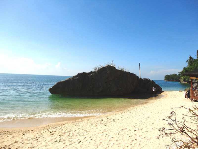
From Borawan in Lipata Island, Jandy, Maricar, Violet, Lanny and I returned to our hired boat which was going to bring us to our camping destination – the rocky and undeveloped Dampalitan Beach on Dampalitan Island.

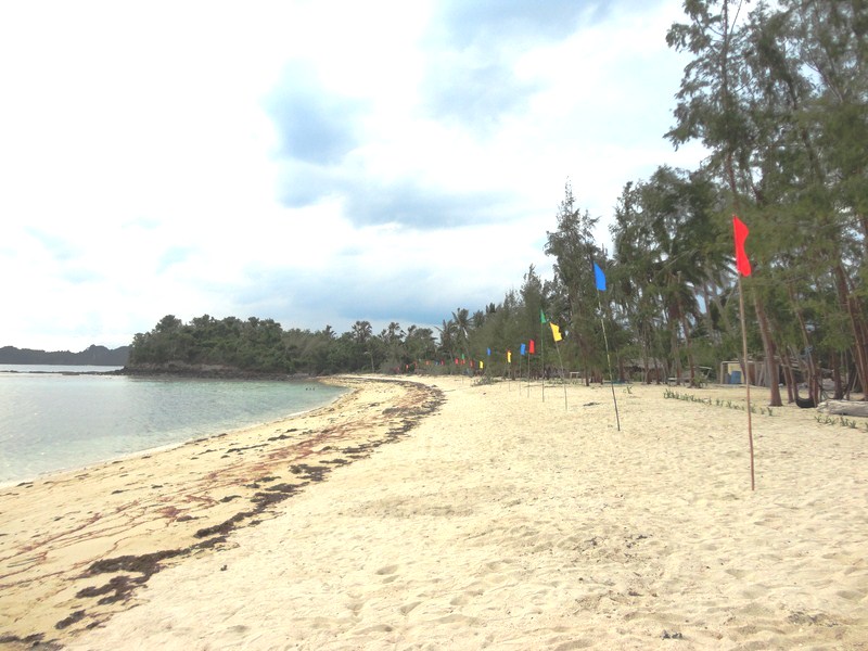
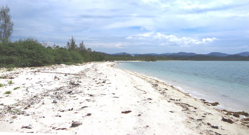
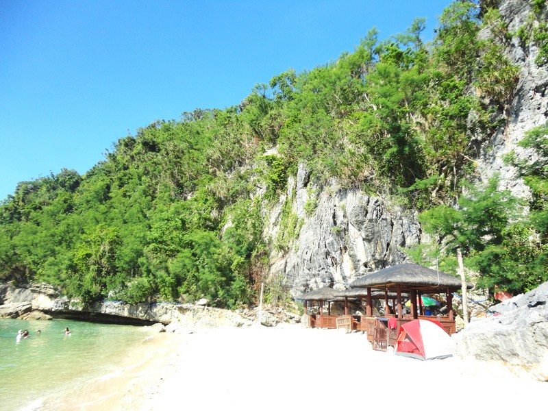
Western side of Dampalitan Beach

Western end of Dampalitan Beach

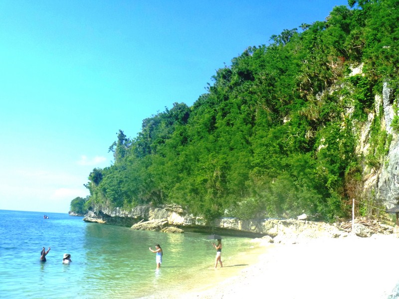
It was just a short 10-15 minute boat ride to the island and we made landfall just before noontime.  The island had a long, wide and lovely stretch of tree-lined white sand beach – the perfect beach camping ground.

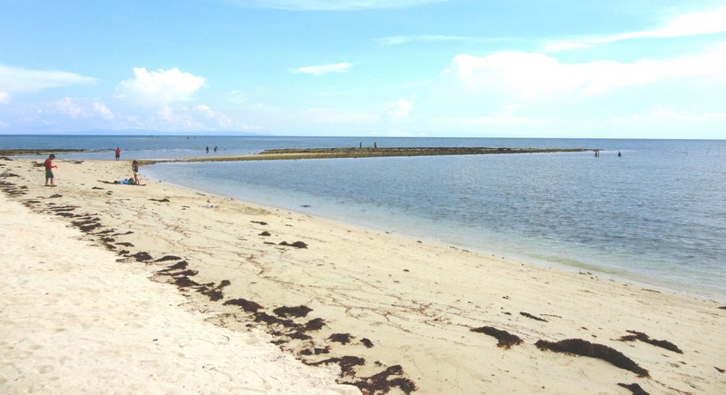
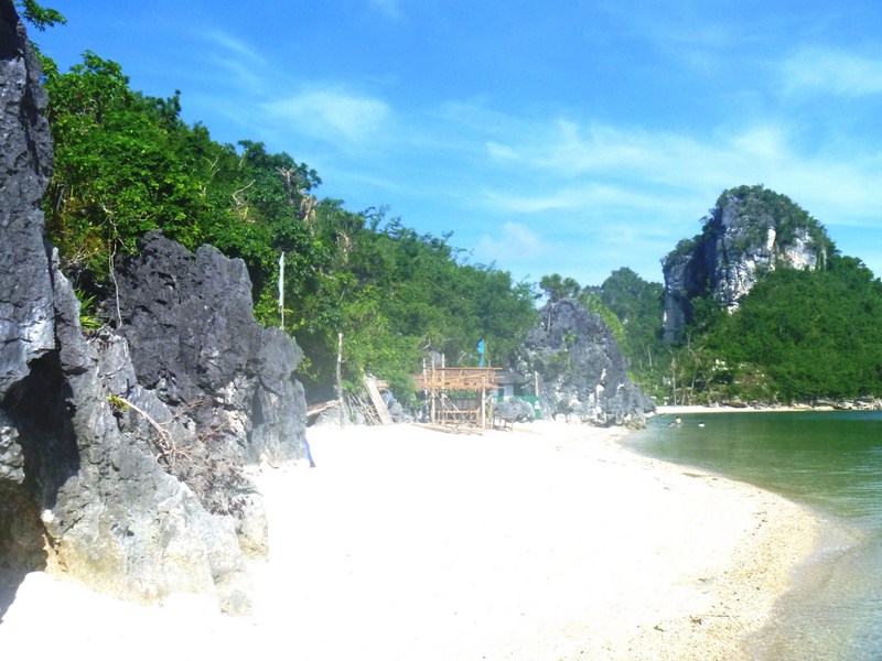
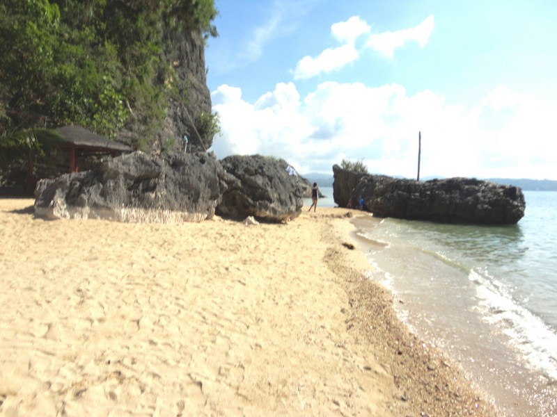
Eastern end of Dampalitan Beach

Eastern end of Dampalitan Beach with exposed rock formations

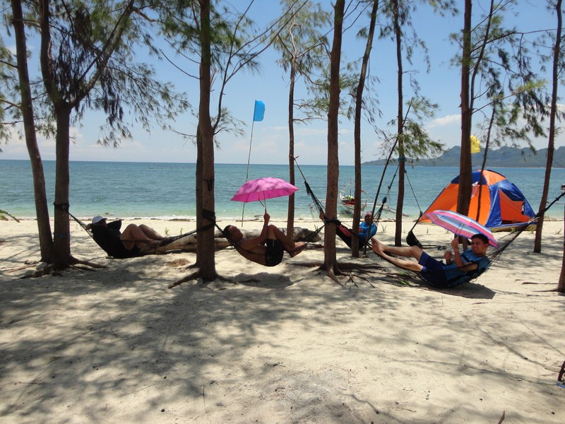
As I was first off the boat, I proceeded to scout around for a suitable spot to set up our tent.  I found a spot somewhat shaded by some worn out and tattered coconut and pine-like agoho (Casuarina equisetifolia) trees.

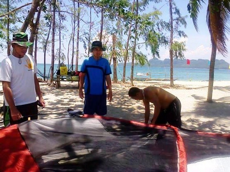
Setting up the 5-pax Coleman tent

Setting up the 5-pax Coleman tent

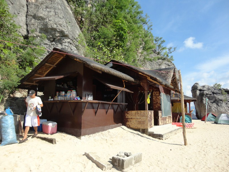
Beside it is a bamboo picnic table and the remains of one of 10 nipa cottages which were damaged or destroyed by the recent typhoon Glenda (international name: Rammasun). Strung at the trunks of the trees are 4 threadbare but still sturdy hammocks.

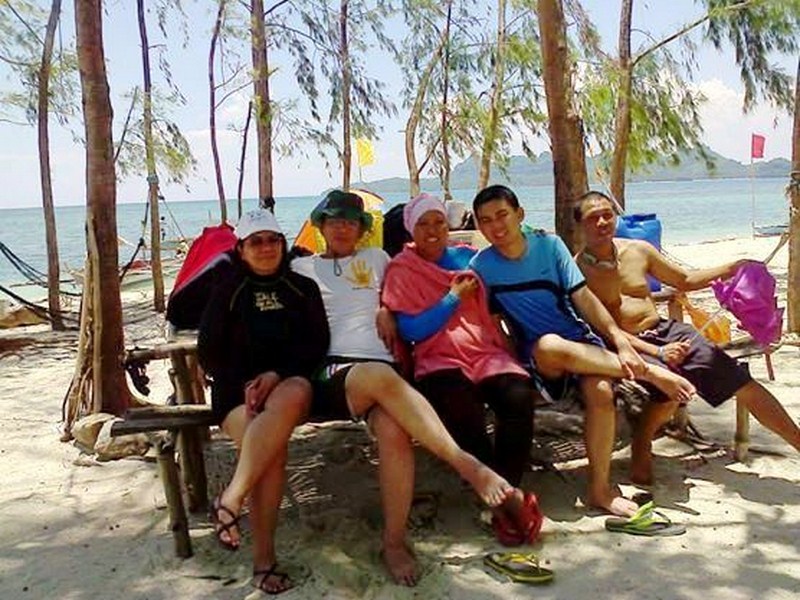
Maricar, the author, Violet, Jandy and Lanny at our picnic table

Maricar, the author, Violet, Jandy and Lanny at our picnic table

Still, the spot suited us just fine.  The owner of the nearby house, which had a convenience store and a storage tank for fresh water (sold at PhP50 per container), informed us on the fees to be paid – an entrance fee of PhP60 per person (total: PhP300) plus a camping fee of PhP200.  We also rented the nearby picnic table (for PhP150) where we temporarily laid down our just unloaded camping gear and  provisions.

Lazing around in our hammocks

Lazing around in our hammocks

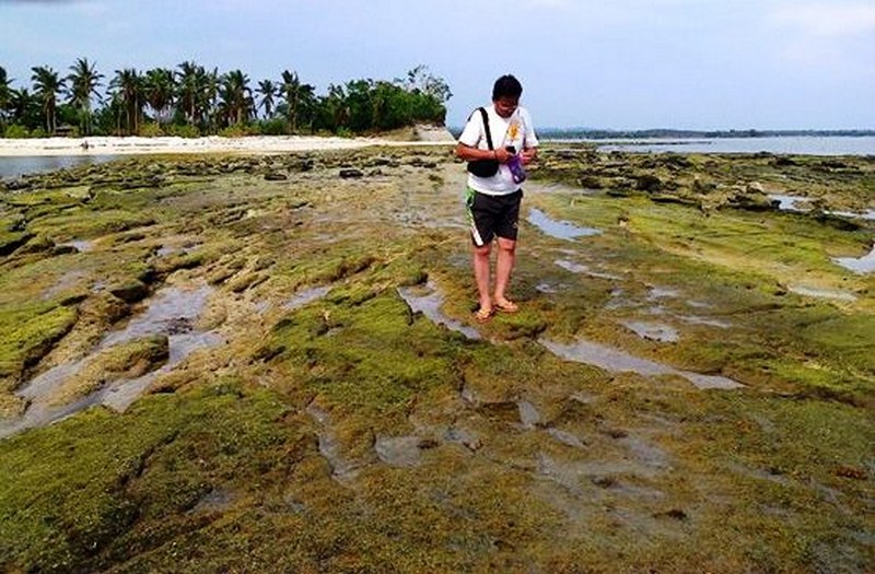
First up on our agenda was the setting up of our 5-pax, 3 m. x 3 m. Coleman dome tent with peaked rainfly.  That done, we rested awhile, with Violet, Maricar, Jandy and Lanny doing so on the hammocks while I did so in our tent.  Come late afternoon, the sun was now low on the horizon and low tide was setting in so we decided to do some swimming and explore the now exposed rock formations. Cloudy skies prevented us from viewing the sunset.

Exploring the exposed rock formations

Exploring the exposed rock formations

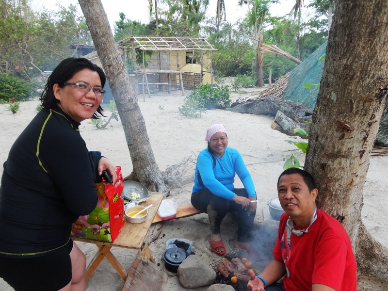
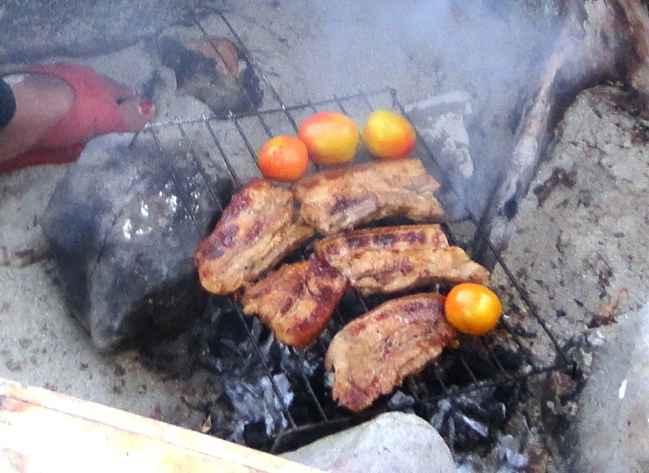
When we returned to our campsite, another group of young overnight campers have already set up their tents beside us and were already preparing their barbecue grills for dinner.  We also followed their lead, borrowing a grille from the caretaker and buying a pack of charcoal as we also brought along some juicy, marinated pork belly (liempo) for grilling.  While Violet and Lanny were tending to the grilling, Maricar was busy preparing her signature yang chow fried rice.

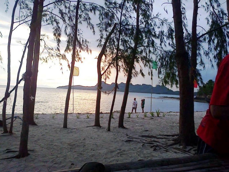
Dusk at Dampalitan Island

Dusk at Dampalitan Island

After enjoying this wonderful al fresco repast, we next washed away the sea salt from our bodies, Jandy and I sharing a container of fresh water.  We all whiled the time away by playing a card game of  pekwa (the Philippine name for the game fan tan or card dominoes) and later chatted about our life experiences.  Retiring early, Violet, Maricar, Jandy and I occupying the tent while Lanny slept in one of the hammocks outside.  The night was initially warm but it slowly cooled, via an incoming sea breeze, in the wee hours of the morning.

Dinner preparation courtesy of Maricar, Violet and Lanny

Dinner preparation courtesy of Maricar, Violet and Lanny

Come morning, breakfast was another al fresco affair, with pork luncheon meat,  freshly cooked steamed rice and cups of coffee.  We then dismantled our tent and packed our belongings.  As we still had time before the 10 AM arrival of our boat, the others went swimming while I decided to explore the island beyond the cliffs confining the cove.

Our grilled pork belly (liempo)

Our grilled pork belly (liempo)

Past the cliffs was another cove with a long, beautiful but deserted stretch of white sand beach lined, not by trees, but by mangroves.  I didn’t go very far as the sun was high up in the sky and I forgot to bring a hat.  When I returned to our campsite, our boat had already arrived and our gear loaded.  After paying our bill, we boarded our boat for the short return trip back to our cottage at Brgy. Basiao where, after washing up, we loaded our stuff and left for Lucban (Quezon).

The magrove-lined, white sand cove beyond the cliff

The magrove-lined, white sand cove beyond the cliff

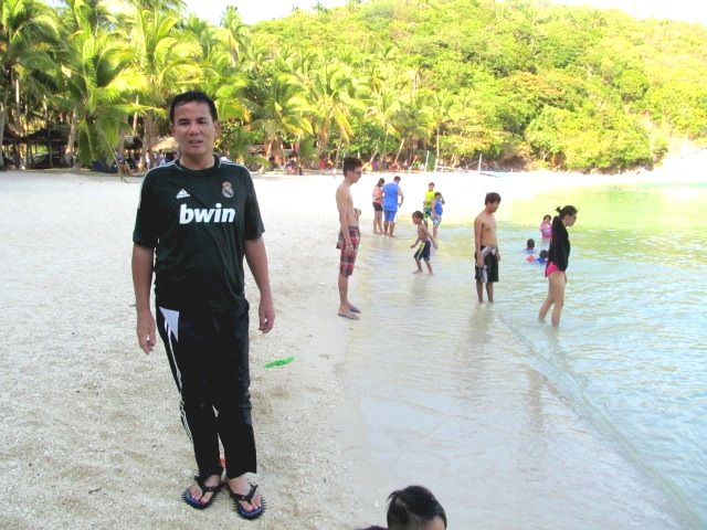
Dampalitan Beach may not be outstandingly beautiful but it is still nice and somewhat laid-back, offering a quiet beach retreat quite unlike crowded and overdeveloped beaches such as Boracay.  Similar to Anawangin or Nagsasa Cove in Zambales, it is really more for camping, picnicking, swimming, hiking, watching the sunset or just lazing around in a hammock.

Borawan Beach (Padre Burgos, Quezon)

After an early breakfast of corned beef and rice at Basiao Resort, Jandy, Maricar, Violet, Lanny and I double checked all the stuff we were to bring for our island hopping and beach camping (at Dampalitan Island) trip – tent, portable stove, rechargeable lamp, provisions, extra clothes, etc. Our boatman arrived by 8 AM and he started to load all our stuff.

Borawan Beach

Borawan Beach

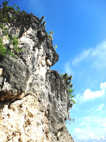
Limestone cliffs

Limestone cliffs

Soon we were off to our first destination – Lipata Island.  We arrived there after a short 15-min. boat trip.  The island is the site of Borawan Beach, situated within lush mountains and rocky cliffs overlooking the Tayabas Bay in the Sibuyan Sea.  Day trippers here are required to pay an admission fee of PhP80 per person (plus another fee if you will stay overnight).

DSC04342

DSC04349

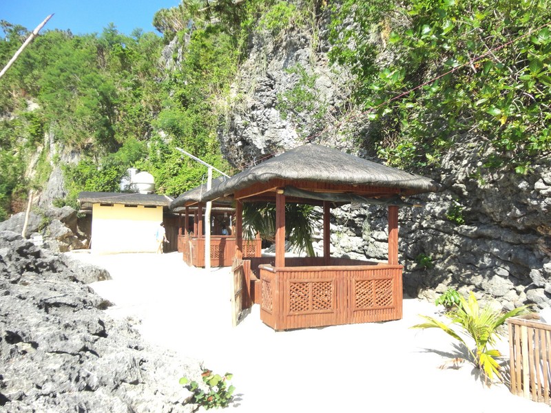
When we arrived, the island was somehow pack with a number of overnight guests who stayed in tents (for those without one, these can be rented for PhP500).  The island also has communal showers (PhP20) and toilets (PhP10) with fresh water.  There are also a few nipa picnic huts for rent and a small store selling overpriced food and snacks.

DSC04350

P1210436

The island’s name is said to be a portmanteau (blend) of the world-famous islands of Boracay and Palawan. Indeed, the beach has its own spectacular (though not as grand) rock formations like the limestone cliffs of Palawan but, sorry to say, not the crystal-clear waters and the fine, white sand of Boracay. The coarse sand beach is actually beige and it certainly isn’t a long stretch dotted with coconut trees. Instead, the shoreline of this short stretch of beach is dotted with huge rock boulders with a backdrop of high limestone walls.

A small store selling food and drinks and renting out tents

A small store selling food and drinks and renting out tents

The shower room and picnic huts

The shower room and picnic huts

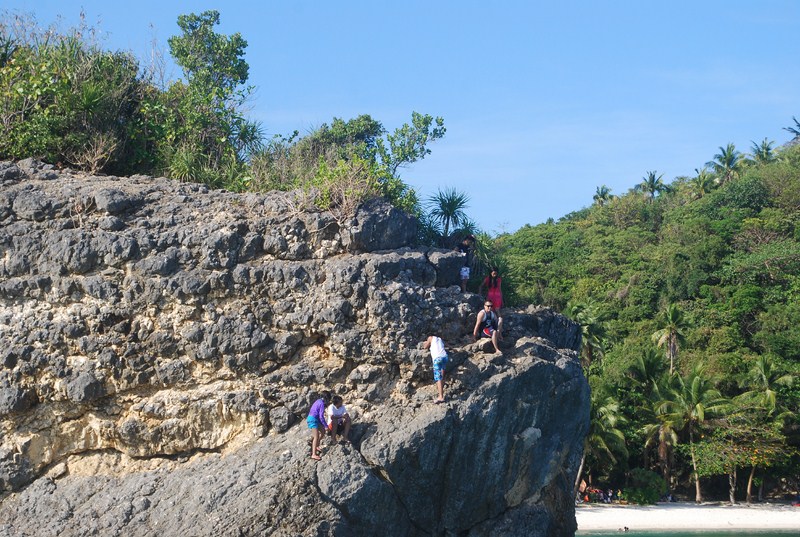
Still, its towering, Palawan-like karst formations and limestone cliffs are perfect for rock climbing, bouldering and rappelling.  It’s also a good venue for photo ops.  Swimming here is done cautiously as there are a lot of sea urchins and jellyfish.  The overnighters also told us that they saw 3 sea snakes near the huge boulder.  Anyway, we didn’t plan to stay overnight on the island.  After partaking of our packed lunch of adobo and rice, we left the island by 11 AM.

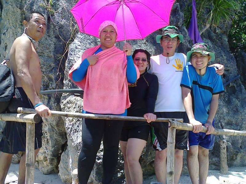
Lanny, Violet, Maricar, the author and Jandy

Lanny, Violet, Maricar, the author and Jandy

How To Get There: Go to Brgy. Marao in Padre Burgos and, from there, you can rent a boat bound for Borawan.

Return to Puting Buhangin Beach (Pagbilao, Quezon)

Jandy, Maricar, Violet, Lanny and I have barely caught our breath upon arriving at Basiao Resort but, as it was still early in the afternoon, we decided to avail of a island hoping tour.   Normally, it cost PhP1,800 for a day tour but, as we were doing it over 2 days, we were to pay PhP2,000.  We had a choice of 3 islands – Dampalitan Island, Lipata Island and Pagbilao Grande Island.

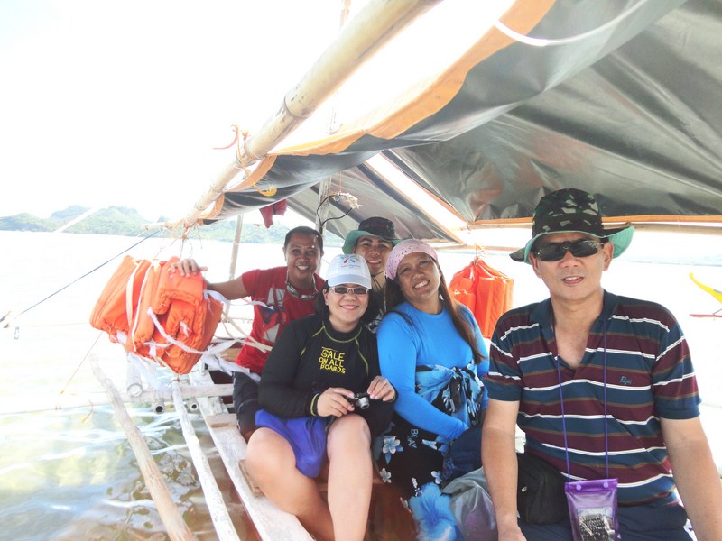
On our way to Pagbilao Grande Island

On our way to Pagbilao Grande Island

The first two, part of Padre Burgos town, were just nearby so we chose the latter which was part of Pagbilao town.  This wouldn’t be my first visit to the island, having done so during a media tour at Pagbilao a little over 4 months ago.  However, this would be the first time I would leave for the island from Padre Burgos which is, distance-wise, nearer to the island than Pagbilao town.

The Bagosina island with a house on top

The Bagosina island with a house on top

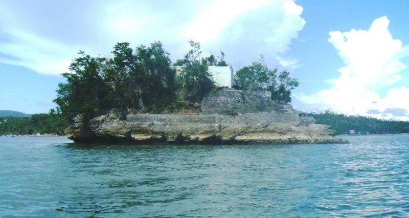
For this island tour, we just donned our swimming attire.  The boat trip took just 45 mins. Along the way, we passed the nearest of the Bagosina Islands, which had an unsightly roofless house (damaged by typhoon Glenda) on top.

Lipata Island

Lipata Island

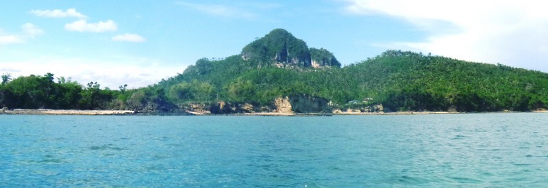
We also passed the white sand beaches and towering rock formations of Lipata Island (site of Borawan Beach), one of our 2 island destinations scheduled for tomorrow (the other is Dampalitan Island).

A hill being graded at the TEAM Power Plant in Pagbilao Grande Island

A hill being graded at the TEAM Power Plant in Pagbilao Grande Island

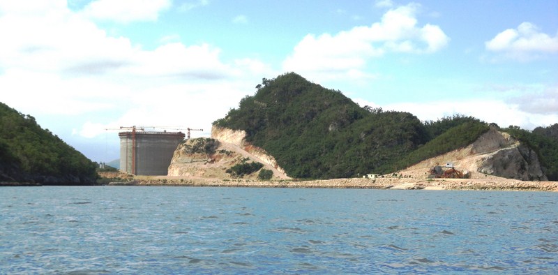
At Pagbilao Grande Island, only the tall chimney of 735-MW Team (Tokyo Electrification and Marubeni) Energy coal-fired thermal power plant  could be seen during our boat trip.  We also saw the damage being done on the nearby hill, possibly to create a new road for the power plant.  It wasn’t a nice sight.

Puting Buhangin Beach

Puting Buhangin Beach

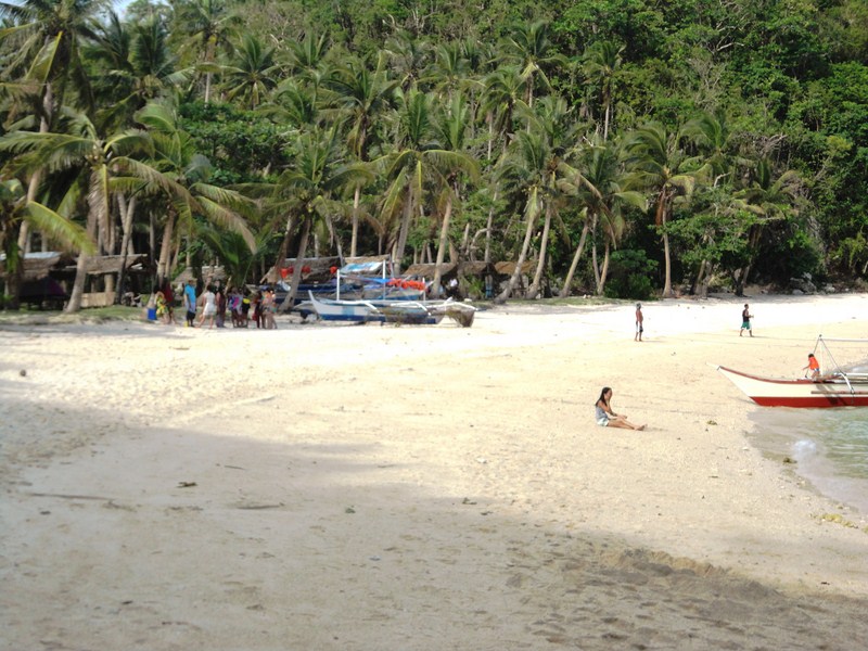
We soon made landfall at the beautiful cove of the 70 m.  long and 10 m. wide Puting Buhangin (which literally means “white sand”) Beach with its white sand, clear emerald waters and coconut trees.  Unlike my first visit, the beach (also called Lukang Beach  after the Lukang family) wasn’t  as  packed with picnickers and beachcombers.

Violet, Maricar and Jandy near the Kuwebang Lambas' beachside entrance

Violet, Maricar and Jandy near the Kuwebang Lambas’ beachside entrance

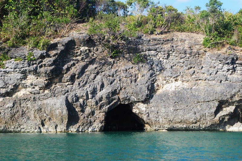
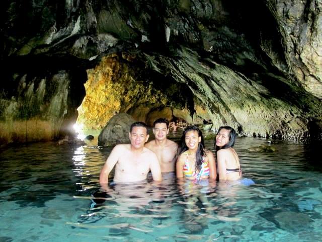
However, we were more interested at the small, unique and tunnel-like  Kwebang Lampas, located at one end of the beach, than with the beach itself.  During my first visit, the waters inside the cave were waist deep and we didn’t venture to go out its seaside entrance.  This time around, it was low tide and the cave floor was exposed.  What’s more, we were able to venture out its seaside exit, below beautiful rock limestone formations, and enjoy the warm waters.

Kuwebang Lampas (2)

Back at our boat, we paid the mandatory PhP80 entrance fee per person (PhP400 for all five of us).  It was now late in the afternoon when we returned to the mainland and our boat had to dock some distance from the shore as it was now low tide.

Jandy, Maricar, the author at Lanny at Kwebang Lampas

Jandy, Maricar, the author at Lanny at Kwebang Lampas

Puting Buhangin Beach: Pagbilao Grande Island, Brgy. Ibabang Polo, Pagbilao, Quezon.

The Pagbilao Islands (Pagbilao, Quezon)

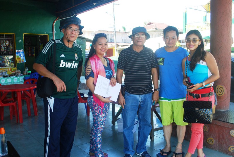
It was already midway in the afternoon when we finished our lunch at Cortijo de Palsabangon Farm Park & Restaurant and, according to Lurhen, we had to leave now if we were to catch the boat and avoid the low tide at Pagbilao Wharf (also known as Daungan) in Sitio Kalawit.  Up ahead was the piece de resistance of our Appsline Travel-sponsored Lucena-Pagbilao Media Tour – the Pagbilao Islands.

Author at Pagbilao Grande Island

Author at Pagbilao Grande Island

Upon arrival at Daungan, our huge 25-pax outrigger boat was already waiting for us.  Here, we met up with Mr. Celedonio “Dionnie” Dapla, member of the town’s tourism council and former head of the DENR Mangrove Experimental Forest.  We were supposed to visit Dionnie’s forest-farm and nursery in Brgy. Pinagbayanan but, as it was already late in the day to do so, he just saw us safely off.

L-R: The author, Lurhen, Dionnie, Rannie and Mel

L-R: The author, Lurhen, Dionnie, Rannie and Mel at Daungan

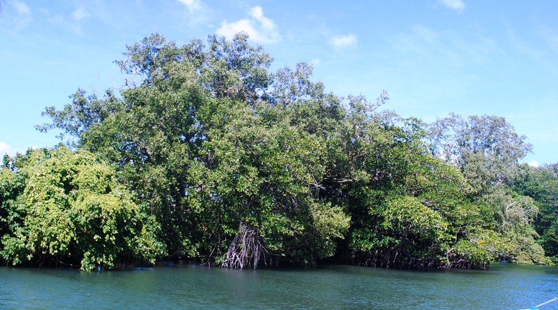
Mel, Maichel, Angela, Lurhen (with her son Marxus), Rannie and I were soon on our way, cruising the river, passing thick patches of mangrove forests along the way before heading out into Pagbilao Bay and the open sea.

Mangrove forests

Mangrove forests

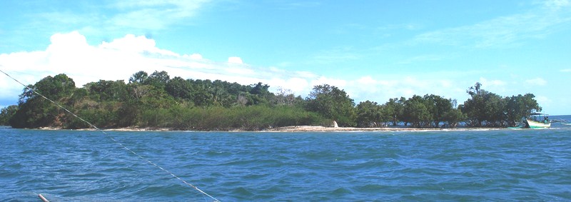
The Pagbilao Islands, also called Pulo Island, are a lovely pair of islands (Pagbilao Grande in the north and Pagbilao Chico in the west)  joined together by a 500 m. long, 200 m. wide (3 m. above sea level at its highest point) sandy isthmus called Tulay Buhangin (meaning “sand bridge”).  The main settlement (also called Tulay Buhangin) is located here.

On our way into the open sea

On our way into the open sea

Though part of Pagbilao town, the islands are more accessible by boat from Padre Burgos.  Bounded by Laguimanok Bay in the north and east and Tayabas Bay in the west, the islands are 100 feet above sea level on a promontory overlooking Padre Burgos town to the east.  This ancient and still developing coral rock formation has numerous coves, caves cliffs and a hilly interior with clumps of giant yuccas and small, emerald forests.  There are also white sand beaches and rich fishing grounds.

Patayan Island (Pagbilao Chico Island)

Patayan Island (Pagbilao Chico Island)

Around 30-40 mins. on our journey we passed Pagbilao Chico Island, also called Patayan Island.  It has a smooth stone beach and a single privately-owned beachhouse that can be rented out.  Its Bansilan Cave has cathedral-like dimensions.

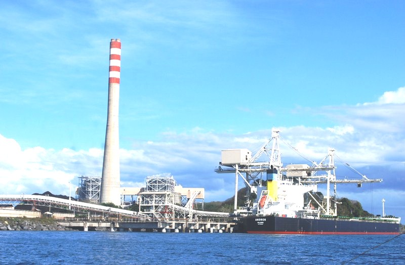
The Team Energy coal-fired thermal power plant

The Team Energy coal-fired thermal power plant

We next espied the tall chimney of 735-MW Team (Tokyo Electrification and Marubeni) Energy coal-fired thermal power plant.  During our visit, a  huge cargo ship was unloading coal at the power plant.  The plant is the landmark for those taking the land route to Puting Buhangin Beach. Turning a corner past the power plant, we were greeted by beautiful rock limestone formations and Kwebang Lampas and, past it, the beautiful cove with white sand Puting Buhangin Beach with its clear emerald waters and coconut trees.

Puting Buhangin Beach

Puting Buhangin Beach

The 70 m.  long and 10 m. wide white sand Puting Buhangin (which literally means “white sand”) Beach, with Kwebang Lampas at one end, is located in Brgy. Ibabang Polo at the southwestern part of Pagbilao Grande Island.

Author at Puting Buhangin Beach

Author at Puting Buhangin Beach

We requested the boatmen to dock and, upon reaching the shore, Rannie and I  made for the beach. This private beach (also called Lukang Beach  after the Lukang family), available to the public on day trip visits (PhP100 entrance fee), was filled with people during our visit.  Some were staying on native picnic huts (rented for PhP300-500); others pitched tents along the beach, while others just availed of the shade of coconut trees.

Visitors making their way to the beach via the power plant and limestone formations

Visitors making their way to the beach via the power plant and the treacherous limestone formations

Other destination, though, was the small, unique cave right at the edge of the cove famously known as Kwebang Lampas whose opening we saw on the way to the cove.  Walking along the beach, we reached the foot of the limestone formation and carefully negotiated the rocks to the entrance of this easily explored, tunnel-like cave.   We could see the cave’s other opening at the opposite end.

Kwebang Lampas

Kwebang Lampas

They say that the water at one end of the cave is freezing cold, while water at the opposite end is warm, but I didn’t notice any difference.  Mel, Angela and Maichel soon joined us. After the usual photo ops, using Rannie’s camera, we made it back to the beach and our boat, thoroughly sated with the adventure we just experienced.  It was with some feeling of regret that we  left the island back for the mainland.

The author, Maichel, Mel and Angela at Kwebang Lampas

The author, Maichel, Mel and Angela at Kwebang Lampas

Appsline Travel Services and Consultancy: Phase 2, Krisanta Village, Brgy. Bukal, Maharlika Village, Pagbilao, Quezon.  Tel: (042) 716-0067.  Mobile number: (0922) 633-0363 (Ms. Lurhen T. Cortes). E-mail: yvette_24@yahoo.com andappsline0305@gmail.com.

Ouan’s The Farm Resort (Lucena City, Quezon)

After checking out at the Quezon Premier Hotel, Mel, Rannie, Angela, Maichel and I drove out to Ouan’s The Farm Resort, , a popular  choice of visitors to Lucena City, whether for business or pleasure, exploring or just passing through.  Here, the thrills of a complete family resort are combined with the simple, laid back life on the farm, with its butterfly haven, fish pond, goats, chickens, fruit-bearing trees, lush vegetation and fresh air.

Ouan's The Farm Resort

Ouan’s The Farm Resort

Upon arrival at the reception area, we were welcomed by resort Gen. Manager Ma. Louchiel S. Labay who prepared for us a breakfast of pancit habhab, chicken empanada, fresh buco and pandan juice.  Also on hand was travel/tourism consultant Ms. Lurhen T. Cortes, Gen. Manager of Appsline Travel Services & Consultancy, who was to tour us around Pagbilao town.

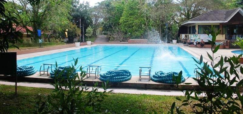
Olympic size swimming pool

Olympic size swimming pool

Pancit Habhab

Pancit habhab

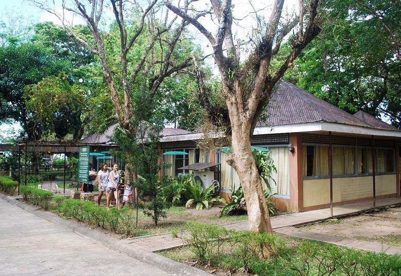
After breakfast, Lurhen and some of the resort staff toured us around the grounds.  The resort has overnight accommodations (standard rooms, suites, dorms) and a number of swimming pools ranging from Olympic size, to free form and kiddie pools.  It also has a coffee shop (Grandma’s Kitchen); cozy and spacious conference rooms and function halls; a firing range; tennis court; basketball/volleyball court, camp site; sauna and football field.

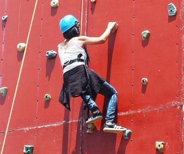
Angela scales the climbing wall

Angela scales the climbing wall

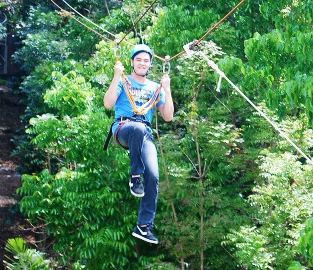
Of particular interest to us was their wall climbing, rappelling and zipline facility and everybody proceeded there.  My four companions decided to try out all 3 activities while I, with my bum knees, just watched from the sidelines. Louchiel’s daughter also joined them on the single pulley zipline.  Once on the other side, they then climbed another tower and zipped back to the starting point.  Maichel and Angela also successfully climbed up and rappelled down the climbing wall.  Mel only did the latter while Rannie tried and failed on the former.

Maichel tries ziplining

Maichel tries ziplining

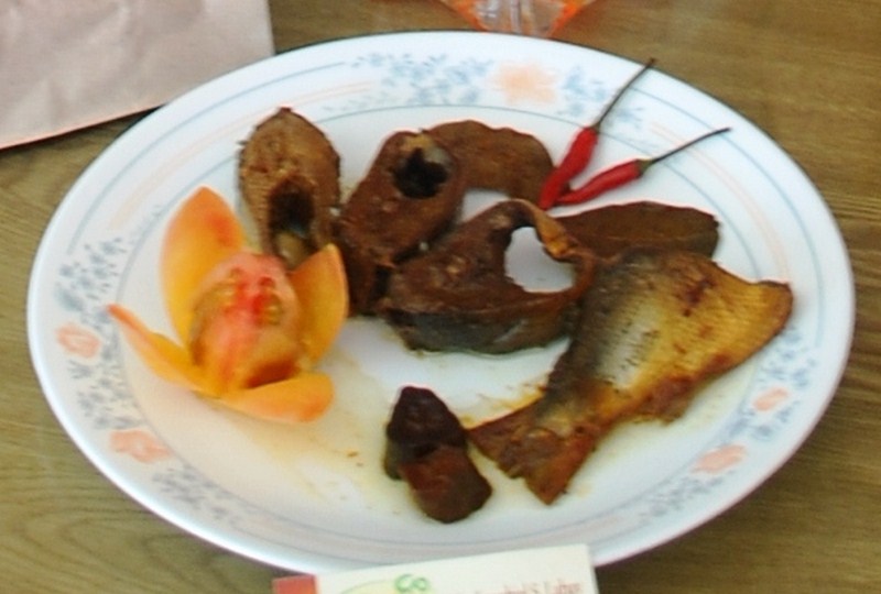
Back at the reception area and prior to leaving, Louchiel also introduced to us their new product – milkfish (bangus) sardines.  These fish are cooked in a pressure cooker so that the bones become so tender they can be eaten.

Ouan's signature bangus sardines

Ouan’s signature bangus sardines

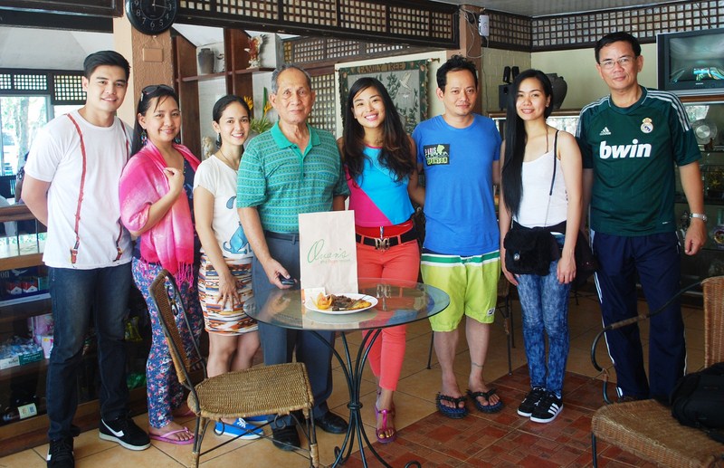
Louchiel also introduced us to her father, retired PNP Chief (during the Ramos administration) Dir.-Gen. Recaredo A. Sarmiento II (PMA Class 1966), who is from Buenavista in Marinduque.  His father and namesake was Buenavista’s longest serving mayor.  A proponent of modern farming, he was once a provincial agriculture program consultant in Marinduque.  Back at the farm, he tends to his tree plantation, notably his duku and longkong lanzones trees.

L-R: Maichel, Lurhen, Gen. Sarmiento, Mel, Rannie, Angela and the author

L-R: Maichel, Lurhen, Louchiel, Gen. Sarmiento, Mel, Rannie, Angela and the author

Ouan’s The Farm Resort: Km 133 Diversion Road, Kanlurang Mayao, Lucena City 4301, Quezon. Tel: (042) 710-4552 and (042) 373-4728. Mobile numbers: (0923) 744-4181 and (0923) 749-4333. E-mail: ouansfarm@yahoo.com. Website: www.ouansthefarmresort.com.

Appsline Travel Services and Consultancy: Phase 2, Krisanta Village, Brgy. Bukal, Maharlika Village, Pagbilao, Quezon.  Tel: (042) 716-0067.  Mobile number: (0922) 633-0363 (Ms. Lurhen T. Cortes). E-mail: yvette_24@yahoo.com andappsline0305@gmail.com.