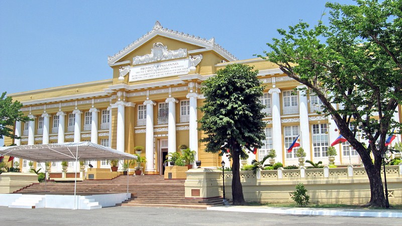
Pangasinan Provincial Capitol (Lingayen)

The Pangasinan Provincial Capitol

The Pangasinan Provincial Capitol

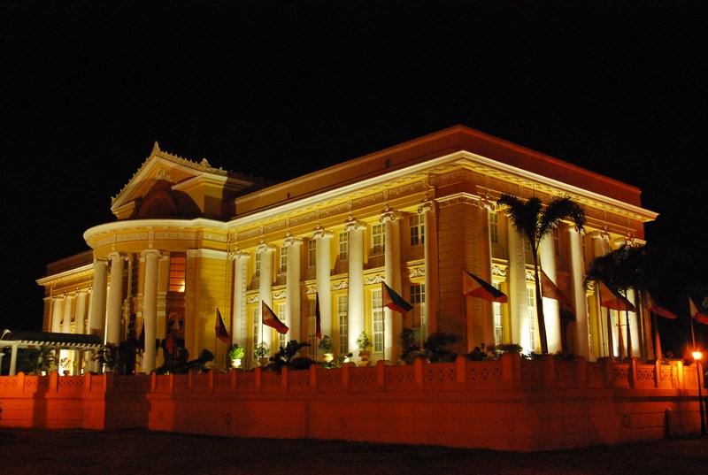
At the Capitol Grounds, Jandy, Cheska, Katrina, Janet and I visited the Provincial Capitol.  Built in 1912 (one of the first to be built in the country) during the term of Gov. Daniel Maramba, this imposing “Potomac Greek” building is, for me, the most beautiful in the country.  We first saw it when we arrived at the town at night, its stately marble columns beautifully lit.

The beautifully lit Provincial Capitol at night

The beautifully lit Provincial Capitol at night

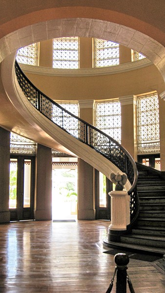
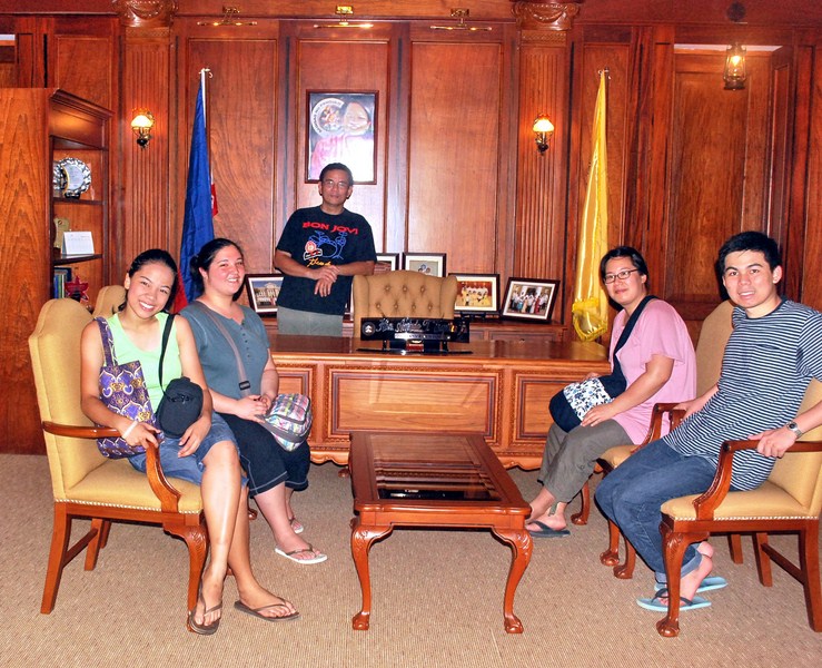
Surprisingly, it was open during this holiday and the caretaker allowed us to climb its exquisite spiral staircase to visit the Governor’s Office and  the Provincial Board Room. At the latter, we got to sit at the Vice-Governor’s chair, handle a gavel and “preside” over a meeting.

The winding stairway

The winding stairway

Cheska, Katrina, the author, Janet and Jandy at the Governor's Office

Cheska, Katrina, the author, Janet and Jandy at the Governor’s Office

Later, we went up the roof deck where Commonwealth Pres. Manuel L. Quezon used to host elegant receptions and parties before World War II.

View of the Capitol grounds and Lingayen Gulf from the roof deck

View of the Capitol grounds and Lingayen Gulf from the roof deck

Here, we had a panoramic view of the Capitol Grounds, Lingayen Gulf and the town. The west wing was restored after destruction by shelling in 1945.

A Historical Tour of Clark (Pampanga)

After watching the early morning flight of Clark’s famous hot air balloons, Jandy and I returned to our Toyota Revo and made our way out of Clark as we still wanted to explore nearby Angeles City.  Along the way we made brief stopovers at some of Clark’s historical sights.  Our first stopover was at the old parade grounds.

Fort Stotsenberg Gate Posts

The Fort Stotsenberg Gate Posts once stood at the Dau Gate, the first gateway to Fort Stotsenberg , from the early 1900s until the Japanese Occupation in 1942 when they were removed and buried as landfill.  Unearthed intact in 1965,  these posts were moved to the American Legion Post (near the Personnel Office and not far from the Clark Gym) and finally relocated to the south side of the entrance of the parade grounds in 1984.

Clark Museum

Near the old parade grounds, on the original site of the 217-bed base hospital (dating to September 1903) and the Base Commander’s office, is the Clark Museum, also called the Kapampangan Museum.


Check out “Clark Museum

Death March Marker

At the entrance of the Clark Veterans Cemetery, along the main entrance road, just past the main gate, is the Death March Marker.  This memorial marker was erected by the Manila BPO Elks lodge in honor of fellow Elks, American and Filipino POWs, who passed this spot during the infamous Bataan Death March in 1942.

Clark Veterans Cemetery

Just inside the Main Gate, along the Mitchell Highway, is the 20.365-acre, 12,000 plot Calrk Veterans Cemetery, formed between 1947 and 1950 to house 7,559 military and civilian remains.  There are headstones/markers and remains from at least 4 other U.S. military cemeteries (Fort Stotsenberg 1 and 2, Fort McKinley and Sangley Point Naval Cemetery).  These include 2,030 fallen American soldiers, including at least 638 Philippine Scouts (PS) from the pre-World War II era.  Some, but not all, were veterans of the Spanish-American war and the Philippine-American War.

Graves of the unknown dead

Others are graves of U.S. veterans from the U.S. Army, U.S. Navy, U.S. Marine Corps, U.S. Coast Guard and U.S. Air Force who died after World War II (all World War II dead were moved to the American Cemetery in Manila) and during the Korean and Vietnam War.  The largest category interred is civilian, mostly U.S. and Filipino, all of whom worked for the U.S. government, and their dependents.  In addition, nationals from France, Spain, Canada, Japan, China, Vietnam and India are also buried there.  A little over 1,600 remains are still unidentified.  The cemetery is also the only place in the former U.S. 13th Air Force base where the U.S. flag flutters alongside the Philippine flag.

Salakot Arch

Finally, at the main gate entrance to the Clark Freeport Zone, at Bayanihan Park, is the Salakot Arch, a cavernous welcome landmark fashioned after a farmer’s hat built in 1979.  It stands as a sign of Philippine-American friendship over the years and was originally built to symbolize the historical March 14, 1947 signing of the RP-US Military Bases Agreement.  Beyond the arch is Angeles City.

The City of "Angels" (Angeles City, Pampanga)

Angeles City

After the culmination of Clark’s Hot Air Balloon Festival, Jandy and I drove on to Angeles City for a walking tour of the City of Angels.  Many know Angeles City only as a rest and recreation area frequently visited by the U.S. servicemen from nearby Clark Air Base.  Even with the base’s closure, Angeles is still home to a large colony of expatriates as many Americans chose to permanently settle in city, particularly in the Balibago District.  They were just about everywhere I looked in the city.  However,  not many people know that, on March 17, 1899, Angeles was briefly made the capital of the First Philippine Republic by Gen. Emilio Aguinaldo.  In fact, the first and only anniversary of the Declaration of Philippine Independence (June 12, 1899) was celebrated here.  Upon its capture by the Americans on November 5, it was made the headquarters of Maj.-Gen. Arthur MacArthur (father of Douglas).  Angeles, once just a jungle clearing and a northernmost barrio of San Fernando called Kuliat (after an indigenous vine that grew abundantly in the area), soon grew rapidly around the former Clark Air Base and was made into a chartered city on June 22, 1963 by virtue of Republic Act No. 3700.

Holy Rosary Cathedral

Many relics of the city’s Spanish and American era past still exist, all within the Sto. Rosario Historic District and all within walking distance from each other. My walking tour started at the Holy Rosary Cathedral (where I parked my car), along Sto. Entierro corner Sto. Rosario St.

Check out Cathedral of the Holy Rosary

The Holy Family Bldg., the former convent, was used by the U.S. Army from August 1899 to December 1900 as a military hospital and by the Japanese Army as a troop barracks, officers’ quarters and arsenal in early 1942.

Angeles Physical Therapy Rehabilitation Center

Adjacent to the cathedral is the 2-storey Museo Ning Angeles, the former City Hall built in 1922.    This museum, opened on December 8, 1999, now showcases Kapampangan lifestyle and culture.

Check out Museo Ning Angeles

The Angeles Physical Therapy Rehabilitation Center, now a center for polio and stroke patients, was first built in 1899 as the deposito for religious statues and carriages used in religious processions.   From 1899 to 1901, it was utilized by the U.S. Army as a jail  for recalcitrant U.S. troops and, from 1946 to 1947, as headquarters of U.S. Army 11th Film Exchange.  From February 6, 1967 to 1986, it was  the City Post Office.

Bale Matua

The oldest building in the city is Bale Matua, also known as the Founder’s House.  It was built in 1824 by Don Angel Pantaleon de Miranda, the former gobernadorcillo of San Fernando, and his wife Doña Rosalia de Jesus.  Together, they founded Angeles in 1796.  On December 8, 1829, the barrio was separated from San Fernando and was renamed Angeles in honor of Don Angel and the town’s patron saints, the Holy Guardian Angels (Los Santos Angeles de los Custodios).  To build Bale Matua, Angel used materials salvaged from their older house built around 1811. The house was later inherited by their only daughter, Doña Juana de Miranda de Henson.  It has high stone walls and an ornate gate and was declared as a Historical Site by the National Historical Institute.

Nepomuceno Ancestral House

The Nepomuceno Ancestral House, along Sto. Rosario St., was the home of Don Ciriaco de Miranda, the first gobernadorcillo of Angeles. Built in 1840, it was inherited in 1868 by Don Ciriaco’s niece, Doña Agustina Henson de Nepomuceno.  A restored grain storehouse (kamalig), along Sto. Rosario St., between these two old houses, was also built in 1840 by Don Ciriaco. In 1980, it was restored by Armando L. Nepomuceno and is now home to Armando’s Pizza and the Camalig Restaurant.   Bale Herencia, at the corner of Lakandula and Sto. Rosario Sts., was built in 1860 by carpenters from Vigan (Ilocos Sur). Said to have been built for the mistress of a parish priest, the current owners now use it as a banquet hall.

Bale Herencia

Stotsenberg Parade Grounds (Clark Field, Pampanga)

When one mentions Clark Field in Pampanga, the first thing that comes in most peoples’ minds is duty-free shopping.  Having booked ourselves for an overnight stay at Hotel Vida, we also did that, doing some shopping at Puregold.  However, there’s more to Clark than just duty-free shopping.  For one, there’s history.

Stotsenberg Parade Grounds

Lots of history exists around the Stotsenberg Parade Grounds.  Large houses called “barns,” built with Oregon pine shipped from the U.S. and used as officers’ quarters, are arranged in a row along the grounds.  Built from 1910-1913 at a cost of US$1,309.9 each by Filipino, Chinese and Japanese laborers, they were the first permanent structures in Fort Stotsenberg (named after Col. John W. Stotsenberg, killed in the Battle of Quingua, Bulacan on April 23, 1899), the forerunner of Clark Field (renamed as such in 1919 after Army aviator Maj. Harold M. Clark who was killed in an air crash in the Panama Canal).  

CDC Exhibition of Kapampangan Crafts

Over the years, until 1922, hundreds of these barns were built but, by the mid 1980s, most of these barn houses were demolished.  Those along Cardinal Santos Ave., now called the Centennial Block, are all that remain.  The huge, shady and century-old acacia (monkey pod) trees in the area were planted in 1903.  

Centennial House: Lifestyle in Stotsenberg Museum

Many of theses barn houses have undergone adaptive reuse. One barn house, Bldg. 2081, houses the Mabalacat Municipal Tourism Office.  Another houses the Clark Development Corp. (CDC) Exhibition of Kapampangan Crafts.  A number also house restaurants such as Cafe Mesa Coffee Shop and Bar (Bldg. 2078) and Red Crab Alimango House (Bldg. 2078).  Another houses a museum (Centennial House Lifestyle in Stotsenberg Museum).

Cafe Mesa Coffee Shop and Bar

The Death Place of  Roxas Marker, directly across the street from the CDC office, close to the Philippine flag, was built in memory of the Philippine president Manuel A. Roxas who, upon the invitation by the U.S. 13th Air Force commander, came to see for himself the massive reconstruction and rehabilitation work in war-damaged Clark on  April 15, 1948.  That same, while delivering a speech at Kelly Theater, he suffered a heart attack and died. 

Death Place of Roxas Marker

At the western edge of Stotsenberg Parade Grounds is the 26th Cavalry Memorial which commemorates the men of the 26th Cavalry Philippine Scounts, U.S. Army, who died during their heroic action at Lingayen (Pangasinan) in 1941.  Next to it is the U.S. Army Air Corps and Philippine Air Force Monument which details the joint participation of the Philippine and American military forces

26th Cavalry Monument
US and Philippine Air Corps Monument

Cafe Mesa Coffee Shop and Bar: Cardinal Santos Ave., Clark Special Economic Zone, Pampanga.  Tel: (045) 499-0694.

Red Crab Alimango House: Cardinal Santos Ave., Clark Special Economic Zone, Pampanga.  Tel: (045) 599-5345.


Camp John Hay Museum (Baguio City, Benguet)

Camp Hohn Hay Museum

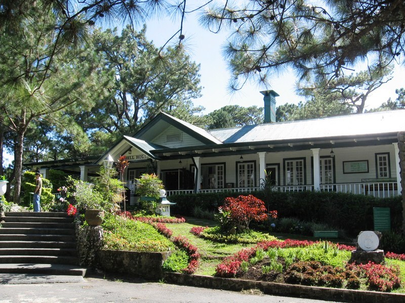
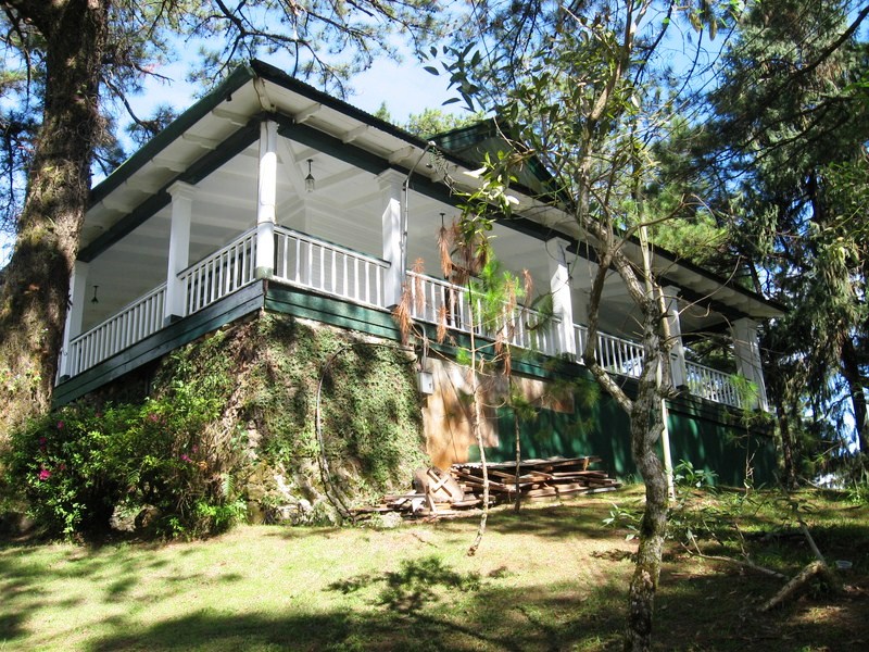
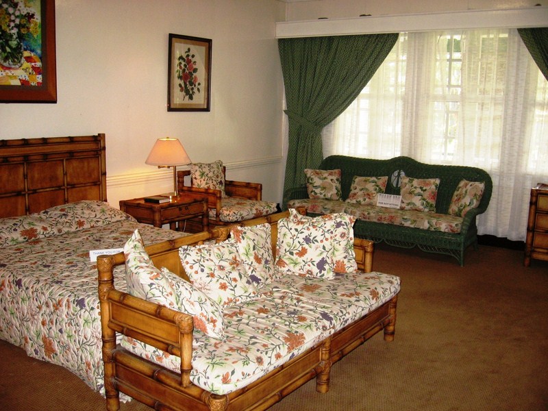
The Camp John Hay Museum, opened on October 25, 2003, was formerly the Bell House, named after U.S. Maj.-Gen. J. Franklin Bell, the commander of the Philippine Division in 1911 to 1914.

Bell transformed Camp John Hay from a small convalescent facility into a major military resort. Initially built as the vacation home of the Commanding General, it exemplifies American Colonial architecture and lifestyle.

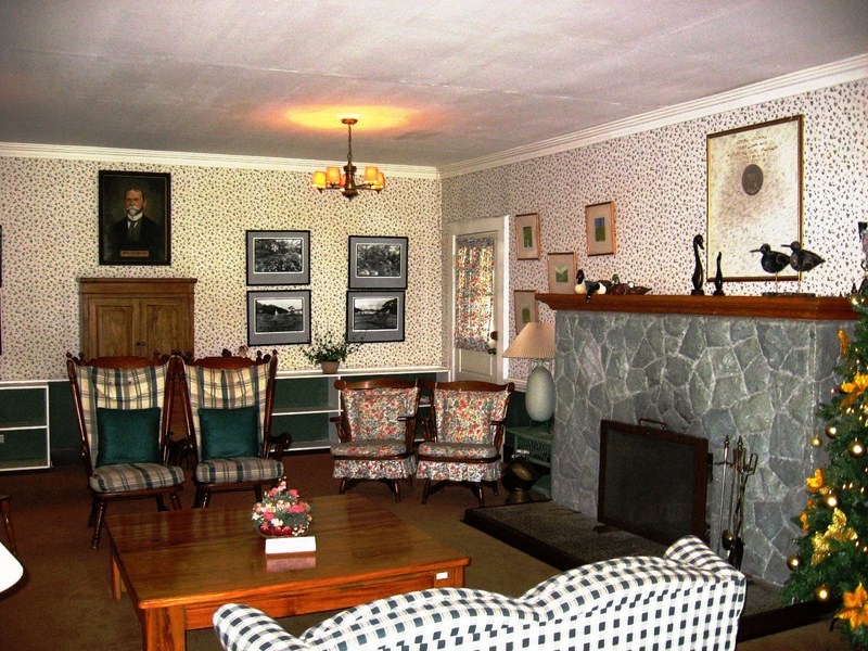
Living Room

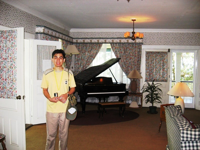
The grand piano

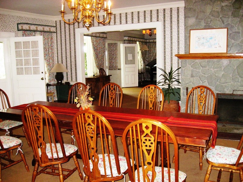
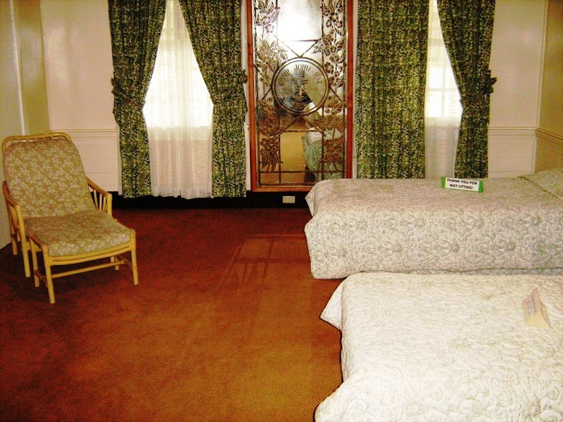
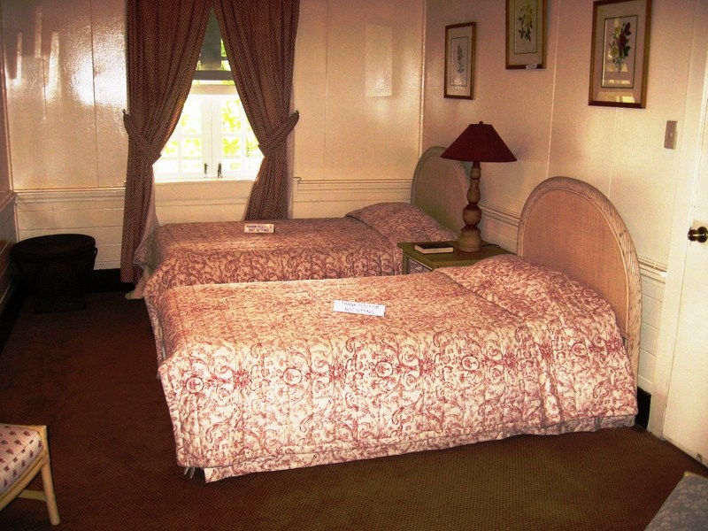
Part of the Camp John Hay Historical Core, today this one-storey houses is the repository of artifacts and other indoor exhibits. Its interiors, consisting of 3 spacious bedrooms, a living room, dining room and kitchen, are tastefully decorated with period furniture showcasing the traditional American country style typical of old American homes. Each room has its own fireplace.

Dining Room

Master Bedroom

At the entrance are twin brass seals that used to adorn Camp John Hay’s main gate. The living room, complete with a  grand piano, displays a portrait of John Milton Hay (after whom the camp was named). Various images on the walls narrate Camp John Hay’s history.  A library can also be found at right side of the house.

Bedroom 1

Bedroom 2

The front porch has a scaled model of Camp John Hay. Here, one can look down into the Bell Amphitheater.   Along with the amphitheater, the house is now declared as a historic landmark.

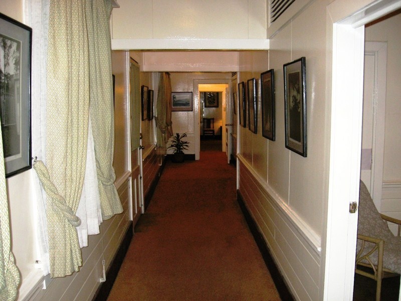
Hallway

Front Porch

Camp John Hay Museum: Camp John Hay, Baguio City, Benguet. Admission (for Historical Core): PhP60 (standard), PhP40 (Baguio residents) and PhP30 (senior citizens/students). Open daily, 9 AM – 5 PM.  Visitors are not allowed to sit on the furniture, smoke or take food inside. Tel: (074) 444-8981. (Camp John Hay Management Corp. Office)

How to Get There: The best way to get there is via a taxi from Baguio CBD/Session Road.  Jeepneys are not allowed to enter.

Ancestral Houses of Boac (Marinduque)

Once settled in our suite at Villa Carlos Resort, we prepared breakfast at the balcony, cooking (not allowed though) canned food which we brought along for the trip using my portable stove.  That done, we now left the resort to explore Boac in detail.  The town proper had many large, high-ceilinged Spanish and American-era ancestral houses, some well-preserved and others dilapidated and in need of repair.  Many have capiz windows, ventanillas and double roofs with unusual braces reminiscent of braces used to prop up windows in nipa houses.

Boac town proper (notice the braces used to prop up roofs)
The Trivinio Ancestral House

Uyugan and Back (Batanes)

Songsong Ruins
Old LORAN Station

Entering Uyugan, we passed by the old LORAN (Long Range Aid to Navigation) Station, in Alapad Point in Brgy. Imnajbu and the ruins of Songsong, a cluster of roofless old stone houses of a once thriving community of fishermen that was abandoned in 1955 after the inhabitants experienced severe famine as a consequence of the strong typhoons and tsunami in 1953 and 1954. The villagers resettled to Maramag, Bukidnon. Some of the ruins are now being restored while others are already inhabited.

Entry to Dipnaysujuan Tunnels

Along the Vajangshin Road, we passed by one of the 5 openings of the the Dipnaysujuan Tunnels, an abandoned Japanese-built World War II network of 8-ft. high and 6-ft. wide bat-filled tunnels. Too bad, we didn’t have kerosene lamps or flashlights to explore the dark tunnels.  Finally, on the way back to Basco, we also passed by an idjang (one of 17 throughout the province), a rocky castle-like natural fortress where pre-Hispanic Ivatans lived.

Basco idjang

Tour of Batan Island: Mahatao (Batanes)


Batan Island circuit road

On my second day in Batanes, I paid a courtesy call and asked for assistance from Gov. Vicente S. Gato and Tourism Officer Elmo Merin at the Provincial Capitol (built from 1794 to 1798 as the Casa Real or Spanish Governor’s residence) in Basco.  The Capitol fronts the grassy plaza leading down to Kanyuyan Port and Beach in Baluarte Bay.  Gov. Gato, a keen promoter of Batanes’ tourism potential, gladly allowed me the use of a Toyota Revo to be driven by Mr. Luciano “Anong” de Guzman.  He also assigned Ms. Joy Gabaldon and Mr. Jose “Boging” Astudillo as my guides.

The Provincial Capitol

Our route around the 35.5-sq. km., generally mountainous Batan Island skirted the west coast through Mahatao and Ivana to Uyugan. The winding circuit around the island took nearly 1.5 hrs. This included stopovers for photo ops and a longer wait to replace a flat tire.  All throughout, I was rewarded with a vista of sheer limestone cliffs alternating with gently rolling hills, great boulder beaches and some black and white sand beaches hemmed in by a broad fringing reef.  

Reliving the “Sound of Music” at Payaman

The wind-swept, vast and sprawling Racuh a Payaman, at Mahatao’s outskirts, is a huge track of communal pastureland preserved by the villagers.  Popularly called the “Marlboro Country of Batanes,” cattle, carabao and horses grazed at its endless array of rolling hills.  A photographer’s and nature lover’s delight, the hills have a breathtaking view of Mt. Iraya, the Pacific Ocean, the Mahatao Lighthouse and nearby fields hedged with trees that break the wind’s full fury, allowing root crops to grow.   They say this the place to catch a breathtaking Batanes sunrise.  Here, I can’t help but do a “Sound of Music  pose. 

Church of San Carlos Borromeo
At Mahatao town proper is the venerable San Carlos Borromeo Church, in Mahatao, one of 26 churches listed as National Cultural Treasures by the National Museum.  First built by Dominican friars in 1789, the present church dates to 1873.  It has an espadana-style façade (with two round arches at roof levels for the bells) and massive buttresses at the outer walls (which serve as stairways for servicing its then cogon-covered roof).    At the church courtyard and at the elementary school grounds are Spanish-era stone lampposts used as guiding lights to guide fishermen and early mariners safely to the anchorage just beyond the town’s seaport.   The town’s Spanish-era bridge also retains its centuries-old features.  

Stopover at Carcar City (Cebu)

The cake-like kiosk

Another long stopover, for merienda, was made at a Jollibee in the  junction town of Carcar, 40.3 kms. (a 1-hour drive) from Cebu City. It just rained, but this didn’t stop me from exploring Cebu’s version of a “heritage town” in detail. Just outside, a wonderful round kiosk from the American era greeted me, valiantly standing proud, amid large offending billboards, at the center of the Carcar Rotunda. It is one of the best surviving examples of its genre in the country.Carcaranons engage in blacksmithing and the making of footwear and native delicacies such as ampao (sweetened and crispy rice crunchies), bucarillo (colored coconut candy) and chicharon (pork skin cracklings). Tacoy (sweet pomelos) are also grown here.

Church of St. Catherine of Alexandria

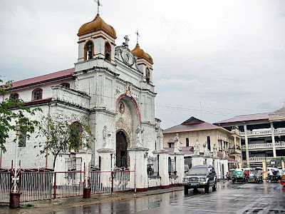
The town’s affluence during the Spanish colonial era is still evident in its sprawling plaza and its surviving large and small intricately decorated antique manors. Carcar is noted for its striking examples of preserved colonial architecture, both from the Spanish and American eras. The most notable structure is the Church of St. Catherine of Alexandria.

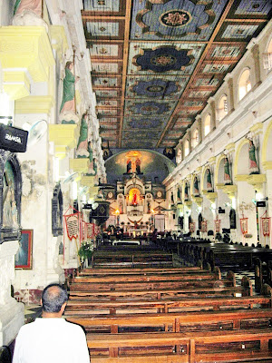
Church interior

Its lovely and massive Graeco-Tuscan façade has a strong Muslim influence as seen from its double recessed arched main entrance (similar to an iwan of a Middle Eastern mosque).

The church patio, surrounded by a low fence of coral stone and wrought iron, has statues of the 12 Apostles, all painted white, except for that of Judas (standing all alone on a pedestal in front of the convent), which is painted black.

St. Catherine’s Dispensary

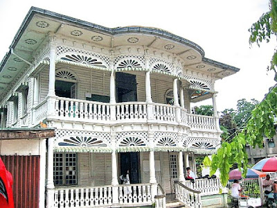
On the same hill as the Church are the American-era Carcar Dispensary and St. Catherine’s Academy (founded in 1923). The façades of both are decorated with carved wooden gingerbread fretwork, cut out in the manner of Victorian houses and all looking as delicate as fragile heirloom lace that could flutter even with a slight breeze. At the foot of the hill is a small but imposing plaza decorated with statues.

Mercado Mansion

Within the town are 46 quaint and antique ancestral houses called balay na bato (stone houses), some decorated with intricate lacy (calado) woodwork from the 1920s. This calado architecture, prevalent in Carcar, is unsurpassed in the country. A number of old houses, some older than the church, are found at the foot of the hill.


Silliman University (Dumaguete City, Negros Oriental)

A big portion of Dumaguete City’s progress was said to have been due to the presence of the Protestant-run Silliman University, founded as the Silliman Institute (an elementary school) by American Presbyterian missionary Dr. David Sutherland Hibbard and his wife Laura, through a grant, on August 28, 1901, by Dr. Horace Brinsmade Silliman.  It was later converted into a college in 1910 and into a university on March 1938.  This 61-hectare university, with its 13 colleges and schools, is the first university outside Manila and is also the first and only Protestant university in the Philippines.  It is dotted with many old and shady acacia trees.

Silliman University campus

The university is another showcase of American-era architecture.   Silliman Hall, built along Silliman Ave. in the Southern U.S. architectural style, is the oldest building within the campus.  It was inaugurated on 30 November 1903 and was restored in 2000.  The iron posts supporting the metal ceiling of the south wing was salvaged out of construction materials from a New York theater.  The S. U. Ethnographic Museum, at the building’s second floor, houses an extensive collection of artifacts and archaeological findings, 2,000-year old Sung and Ming porcelain, voodoo paraphernalia from Siquijor and rare shells such as Glory of the Sea (Conus gloriamaris).

Silliman Hall

Other old buildings within the campus include Guy Hall (completed in 1918), Oriental Hall (built in 1921), Channon Hall (built in 1923) and the Schiede Chapel, the former Mission Hospital Chapel (built in 1937).  Hibbard Hall, started in 1930 and completed in 1949, was the former library building (since 1932).  Built on a more modern note is the 900-person Henry Luce Auditorium, named after Claire Isabel McGill Luce, the founder and publisher of Time-Life magazines.  It was built at a cost of PhP5 million from January 2, 1973 to October 6, 1974.  The Chapel of the Evangel, along Hibbard Ave., was completed in 1957 and was designed by world-famous Chinese-American architect I.M. Pei.  The S.U. Main Library and Media Center, built at a cost of US$ 1.275 million through a grant from USAID and inaugurated in 1979, is reputed to have the biggest collection (more than 100,000 volumes) of books and publications in Asia.  The 188-bed S.U. Medical Center Hospital, along Aldecoa Drive, was built at a cost of PhP5.5 million and was inaugurated on 28 August 1976.

Silliman University: Real St., Dumaguete City, Negros Oriental.