
After our visit to the Natural Carpet Industries Factory, Brgy. Sumlang Chairman Felipe Noe M. Mapa, Jr. invited us to visit scenic and tourist-friendly Sumlang Lake, Camalig’s newest tourist attraction. To get there, Euden, Lito, Star, Oliver, Ida, Babes, and I rode on an SUV while Nestor, Rommel, George and Alex road on a red pickup as we negotiated the short distance, along a narrow dirt road, to get to the lake.
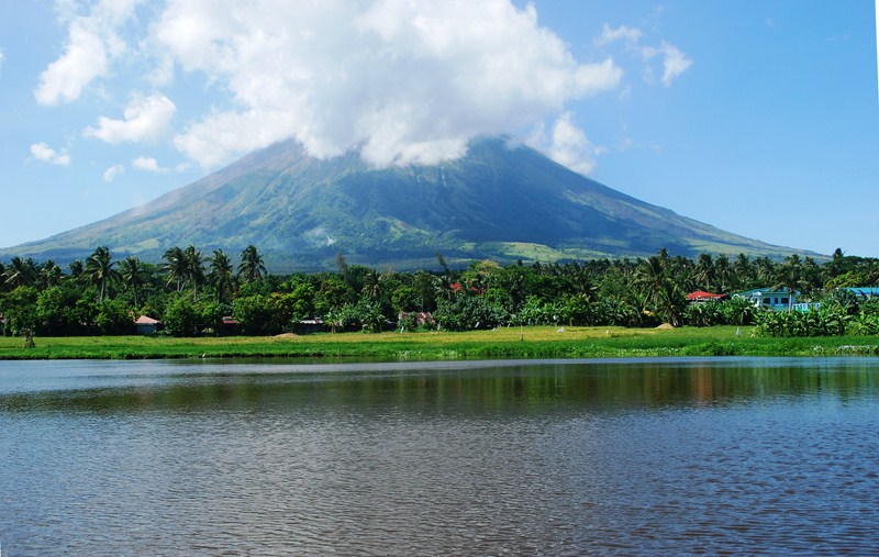
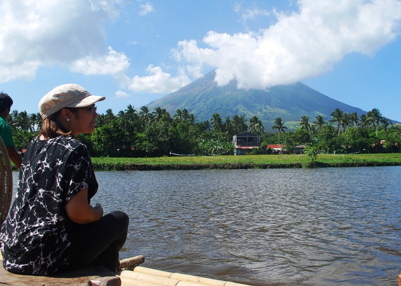
Sumlang Lake with the partly cloud-shrouded Mt. Mayon in the background
Upon arrival, we all sat on bamboo benches under shady coconut trees overlooking the lake, partaking of a merienda of pinangat sandwiches, langka (jackfruit) and fresh buco. While dining, we all enjoyed the majestic view of the partly cloud-shrouded perfect cone of Mt. Mayon and observed children flying their kites along the lakeshore.
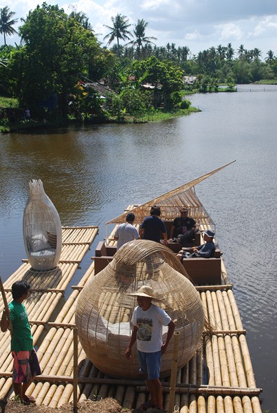
Boarding our nicely furnished bamboo rafts
Later, Felipe invited us to go cruising on the lake on board bamboo rafts. Accompanied by boatmen using long poles to move the raft, Mr. Jockey Serrano (of the Albay Provincial Tourism Cultural Affairs Office), Boyet, Ida, Babes, Lito and I boarded the bigger raft while Rommel rode solo on the smaller raft, seated on a woven wicker canopy chair. The others decided to stay behind.
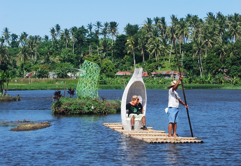
The smaller bamboo raft with Rommel on board
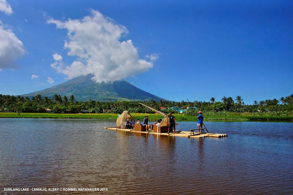
Cruising the lake on a bamboo raft (photo: Rommel Natanauan)
The raft ride on the placid lake was an experience by itself. On the raft, Jockey, Babes, Lito and I were comfortably seated on rattan armchairs and sofas with soft, white cushions and woven wicker canopies to partly shield us from the heat of the sun. Ida and Boyet tried out the day bed with rattan roofed canopy. A driftwood center table completed the rustic furnishings which are all products of Bicolano creativity and ingenuity.
The pensive Ida enjoying the rustic scenery
Thus comfortably seated, we enjoyed the rural scenery of coconut, banana and fruit tree plantations; rice fields; water lilies; swimming ducks; grazing cows and occasional, roosting cattle egrets; all with postcard-pretty Mayon Volcano as a backdrop. The lake is also an ideal spot for fishing as carp, tilapia and dalag (mudfish) abound.
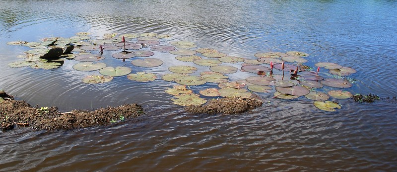
Lotus flowers
Sumlang Lake: Brgy. Sumlag, Camalig, 4502, Albay
Mayor’s Office: Municipal Hall, Poblacion, Camalig, 4502, Albay. Tel.: (052) 484-1965.
Municipal Tourism, Culture and Arts Office: Camalig Tourism and Pasalubong Center, Brgy. 2, Camalig, Albay. Mobile number: (0927) 621-3315. E-mail: camalig_tourism@yahoo.com.
Provincial Tourism and Cultural Affairs Office (PTCAO): Albay Tourism Bldg., Albay Astrodome Complex, Capt. F. Aquende Drive, 4500 Legaspi City, Albay. Tel: (052) 481-0250 and (052) 742-0242. E-mail: albaytourism@yahoo.com and albaytourism@gmail.com.
.JPG)
.JPG)
.JPG)
.JPG)


