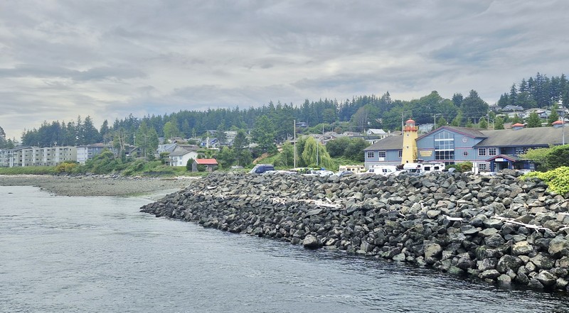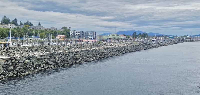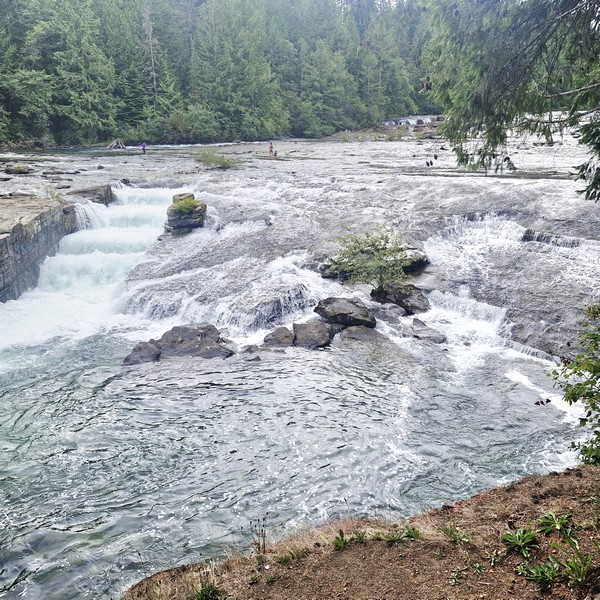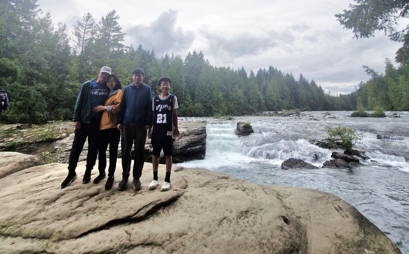
Coombs (Vancouver Island, British Columbia)

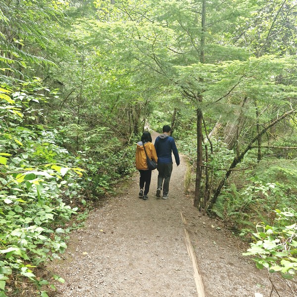
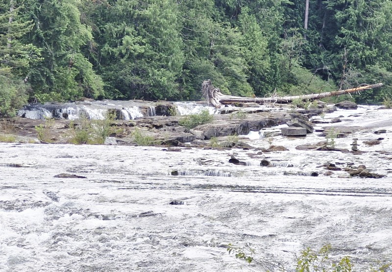
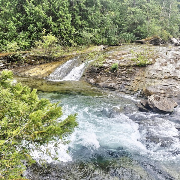
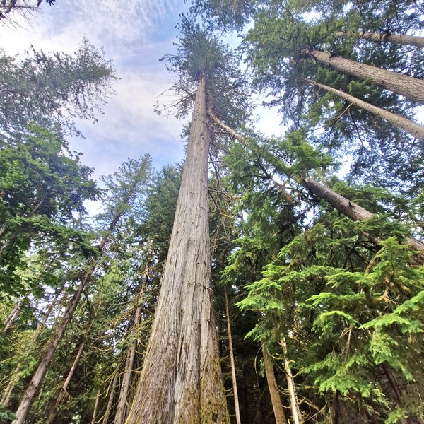
On our first full day in Vancouver Island we drove 24 kms. (a 20-min. drive), from Qualicum Bay Resort in the town of Qualicum Beach, to the nearby touristy town of Coombs.  The town had its beginnings in 1910 when, under the leadership of Ensign Cargo, the Coombs area was settled by some of the nearly 250,000 Welsh and English members of the Salvation Army who immigrated to Canada early in the twentieth century.  The town was named after Capt. Thomas Bales Coombs, the Salvation Army’s Canadian Commissioner.

Coombs

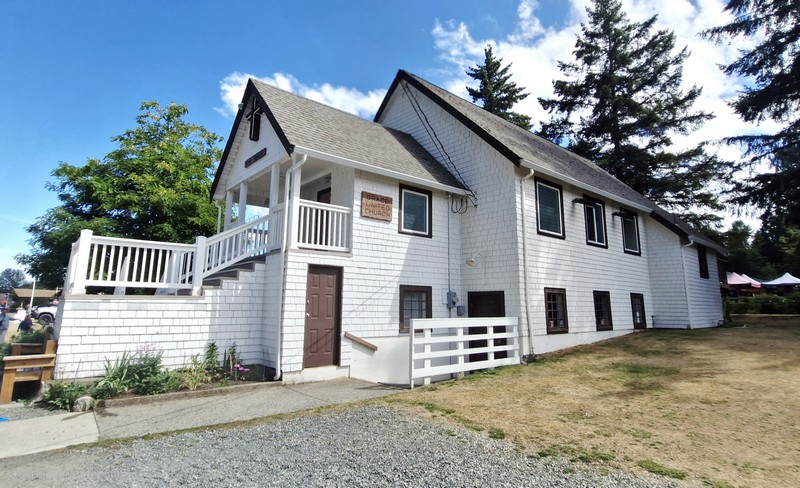
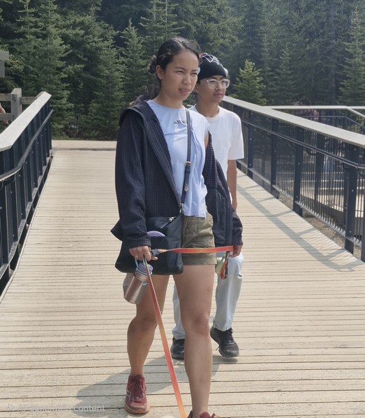
We parked our car near the nearly 80-year old Grace United Church.  This Salvation Army church, built in 1945, was designed by Sam Little of St. Andrew’s Lodge in Qualicum Beach.  Our dog Luffy was allowed around the market and patios (but not in stores unless they are service dogs).

Grace United Church

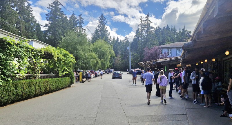
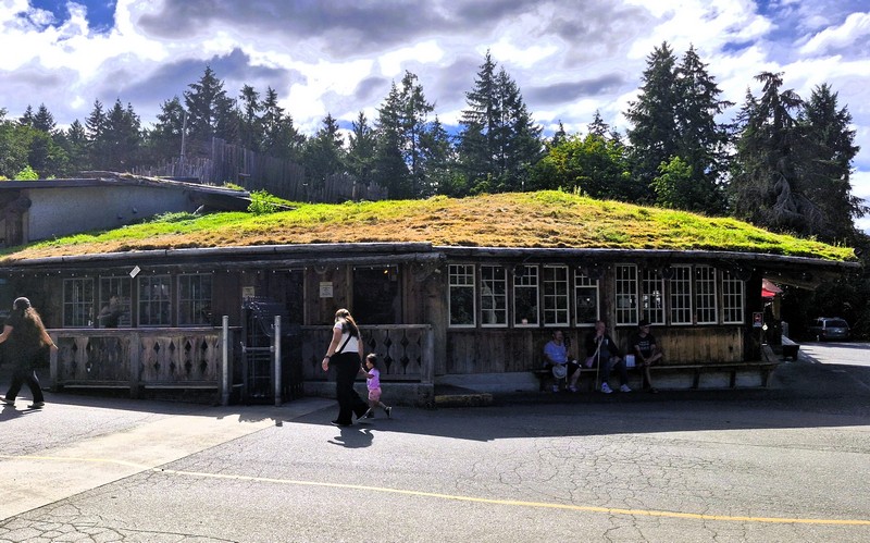
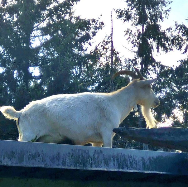
Our first stop, and a must-see, is the town’s Old Country Market (more often known as “Goats on the Roof”), a charming roadside shop providing fresh produce, groceries and gifts to travelers heading to the west coast of Vancouver Island.  Known for its grass-topped roof with a family of resident goats, over the years it has evolved and grown into a beloved landmark of Coombs. The goats are generally on the roof, 24/7, from the May long weekend until late October. During the off-season, they call a nearby farm in French Creek, near Parksville, their home, but they can also be seen in the grassy field beside Cuckoo’s Restaurant.

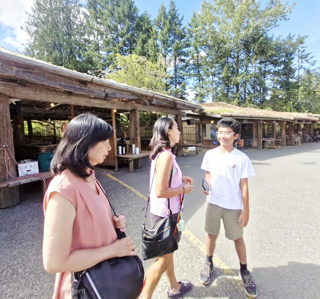
Grace, Cheska and Kyle

In 1973, the original market was created by Kristian Graaten who, with his wife Solveig and their children, emigrated to Vancouver Island from Norway in the 1950s. Kris grew up in Lillehammer, a small community of Norway, where many Norwegian homes and farm structures are built directly into the hillside, with the sod roof becoming an extension of the hillside.  Inspired to include a sod roof in his design of the market Kris, with the help of sons, Svein and Andy, and son-in-law, Larry Geekie, unwittingly began to build what would become perhaps the most famous sod-roof building in the world.

Old Country Market and its sod roof

The grass on the roof was higher than Kristian liked. It was the weekend of the Coombs Fall Fair and the grass was getting rather long. Legend has it that, after a few glasses of wine, Larry suggested that they “borrow” some goats to “mow” the grass and perhaps provide some entertainment for passing cars. Needless to say, the goats became an instant hit with locals and tourists alike.

Goat on the roof

Today, the Old Country Market is now owned and operated by Larry and Lene Geekie and their family who keep retooling and expanding their retail concept.  Three of their children work with Larry, managing different aspects of the business and buying merchandise from India and China as well as other international markets. 

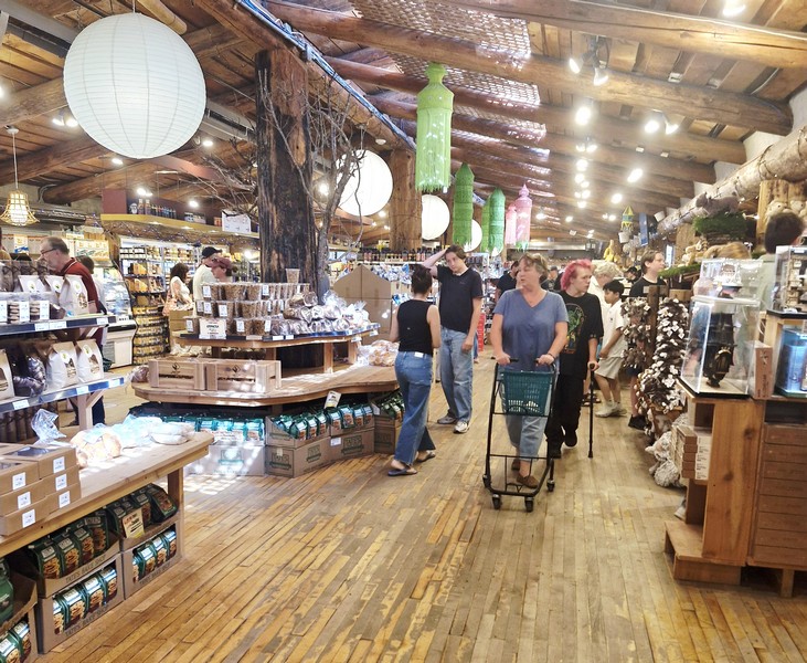
Old Country Market interior

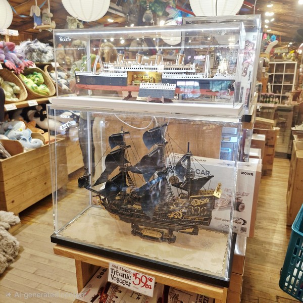
The market sells international foods, fresh-baked goods, imported gifts from the far reaches of the world, and a superb delicatessen specializing in a variety of international meats and cheeses. There is also an on-site restaurant. What impressed us, within its eclectic Toy and Import Section, was the Rolife DIY miniature house kits and 3D wooden puzzles, especially the diorama and book nook sets. They were quite expensive though.

Rolife DIY miniature house kits and 3D wooden puzzles

Nearby is Billy Gruff Creamery (opened March 10, 2016), an ice cream shop with one of the best selections of ice cream, homemade gelato (rich, creamy and bursting with flavor), affogato and sorbeto found on Vancouver Island.  Here, we bought double scoops, on waffle cones and cups, of some of their over 70 flavor choices, including 8 dairy-free options. 

It had a unique ordering process of paying first and then placing your order which adds to their charm.  However, you have to select the scoop without tasting. The serving size for the price was topnotch. They also offer vegan options like banana and walnut bread as well as Buddha bowls and sushi treats.

Coombs Emporium

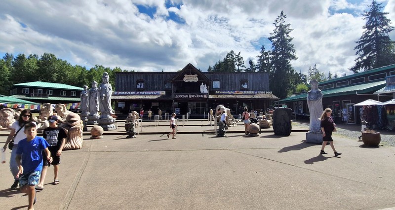
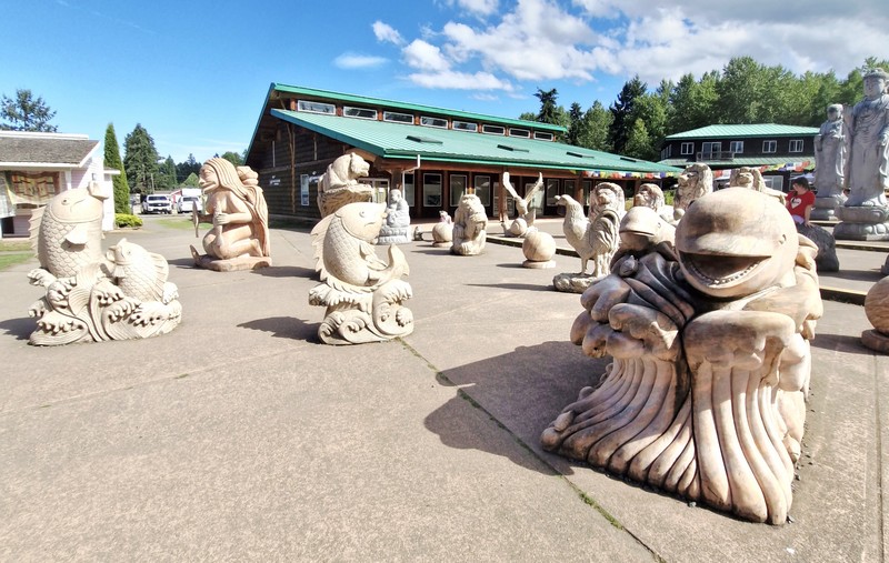
Across from the famous Old Country Market is Statue Square, a delightful, not-so-hidden gem.  This charming open-air courtyard, outside the huge Coombs Emporium, is another popular roadside stop for families and photographers as filling the square is an impressive collection of large, massive hand-carved and intricate carvings of animal figures (lions, camels, fish, birds, giraffes, orangutans, etc.), a couple of Chinese and Hindu Buddhas, mythological shapes, Native American gods, and polished stone and marble art pieces as well as wooden sculptures of bosomy women that have left us pleasantly surprised. The exhibit is free.

Statue Square

Rather than by a single named local artist, the monumental statues were crafted by traditional stone artisans (they are not named or credited publicly) from China commissioned and imported by the Lee family (the emporium’s owners) as part of their extensive international art collected over 40 years.  Some of the individual pieces weigh up to 9 tons plus some of the complex sculptures took artisans up to 7 years to complete.   The wooden sculptures, on the other hand, were hand-carved by Indonesian and other Southeast Asian sculptors.  These certainly add character to the area and are still worth exploring for their beauty and uniqueness.

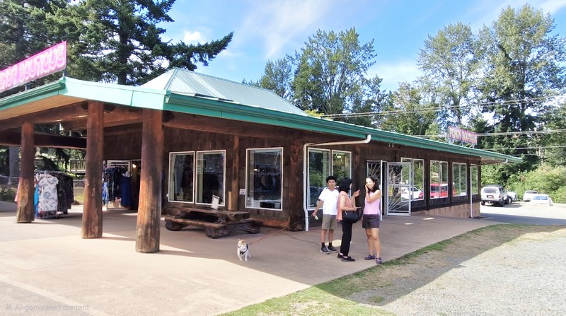
Fengy Boutique

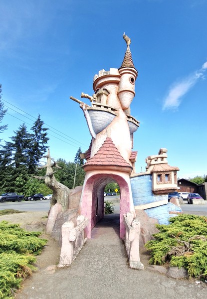
The square is surrounded by small boutique buildings sharing a similar tourist-market vibe selling jewelry, imported crafts, clothing, and chainsaw wood carvings. Nearby, beside the road, is whimsical Fairy Castle which even has a goat on the pointed roof to tie it into the rest of the area.

Fairy Castle

Old Country Market: 2326 Alberni Highway, Coombs, British Columbia V0R 1M0.  Tel: (250) 248-6272.  Website: www.oldcountrymarket.com.  Open daily from roughly March to December, usually around 9 AM to 6 PM.
Billy Gruff Creamery & Bistro: 2310 Alberni Highway, Coombs, British Columbia V0R 1M0.  Tel: (250) 248-6272.  Open daily, 10 AM – 5 PM.

Coombs Emporium: 2300 Alberni Highway, Coombs, British Columbia V0R 1M0.  Tel: (250) 248-5895. Open daily, 9 AM – 5 PM.

Miette Hot Springs (Miette Hot Springs, Alberta)

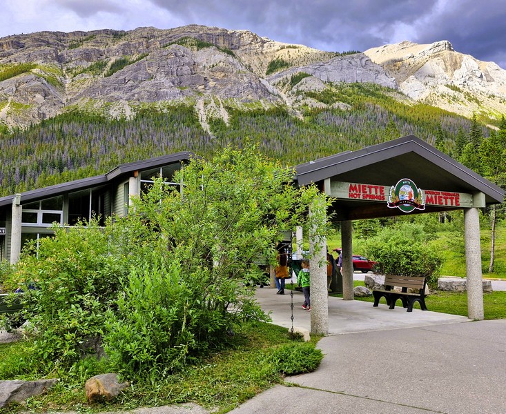
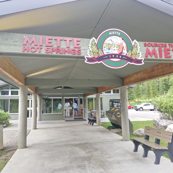
Miette Hot Springs

After our stopovers at the Cold Sulfur Spring and Emerald Pond, we continued on our way to Miette Hot Springs, a modern, commercially developed hot springs, built in 1986, in Alberta’s  Jasper National Park. It features the hottest hot springs in the Canadian Rockies. Its beautiful location and luxurious water make it one of the top things to do in Jasper National Park and one of Alberta’s best kept secrets.

Check out “Cold Sulfur Spring” and “Emerald Pond”

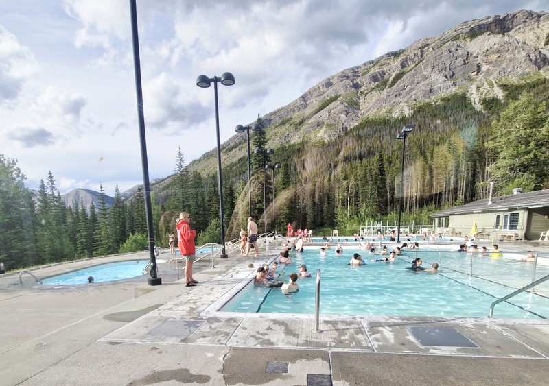
The outdoor hot pools

Offering visitors a view of the surrounding Fiddle River Valley, it has two outdoor hot pools and two cold plunge pools of different temperatures. From the mountain, the natural hot springs water flows at 54°C (129°F) and is then cooled to a comfortable temperature of approximately 37 and 40 ºC (98 and 104 ºF) as it enters the hot springs pool.  The top five minerals found in the Miette Hot Springs are sulphate (1130 mgs./l), calcium (307 mgs./l), bicarbonate (124 mgs./l), magnesium (56 mgs./l) and sodium (10.5 mgs./l).

The Source of the Springs Trail

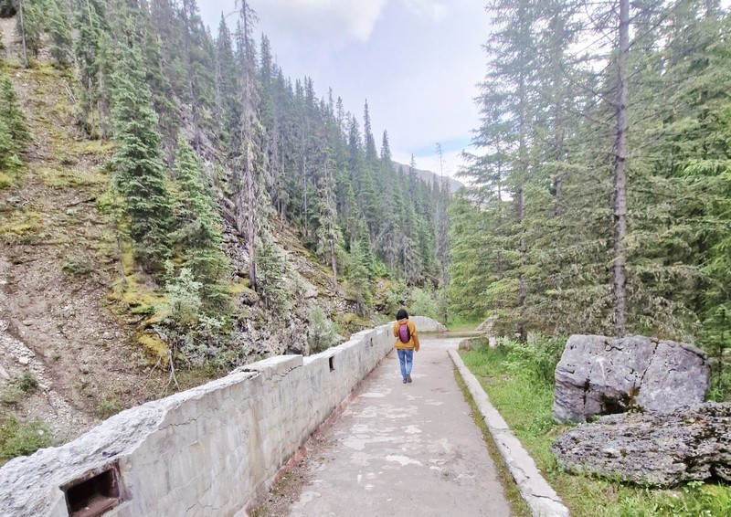
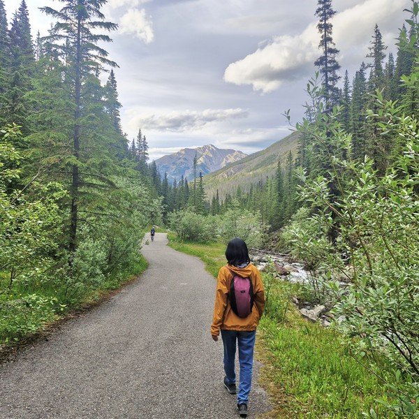
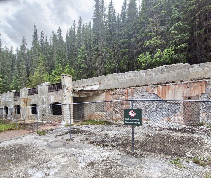
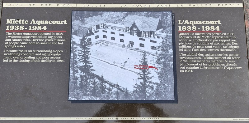
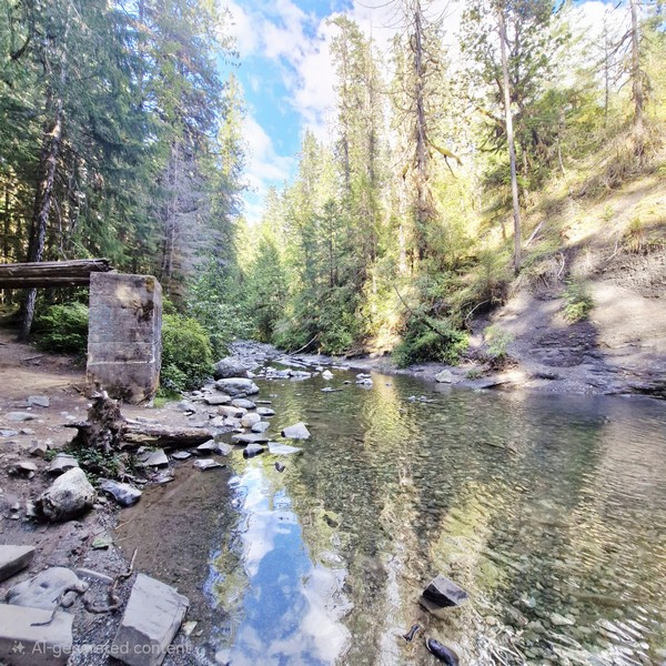
From the current parking area, we walked along the 600 m. long and winding Source of the Springs Trail, featuring boardwalks, to check out the original Miette Aquacourt and the source of the spring itself. The original Miette Aquacourt, an abandoned historic bathhouse and pool site, was built, together with an automobile road, as a federal relief program project, opening up work to several hundred men, during the Great Depression. 
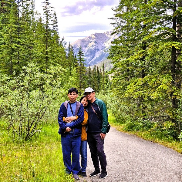
Jandy, Grace and the author at the Source of the Springs Trail

Construction started in 1934 and it was opened in 1938, operating until September 1984 when it was closed, due to rock instability on the surrounding slopes, old equipment, poor access, overcrowding and aging concrete, and replaced by the new facility located 1 km. down the road. Its old pool basin is now filled with trees and dirt.

Miette Aquacourt

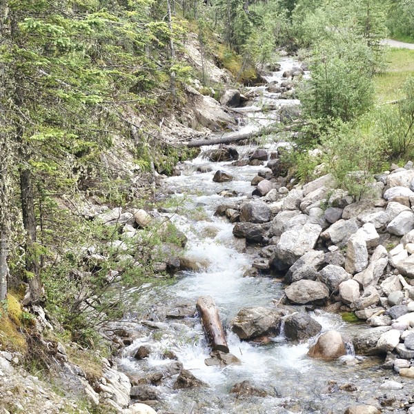
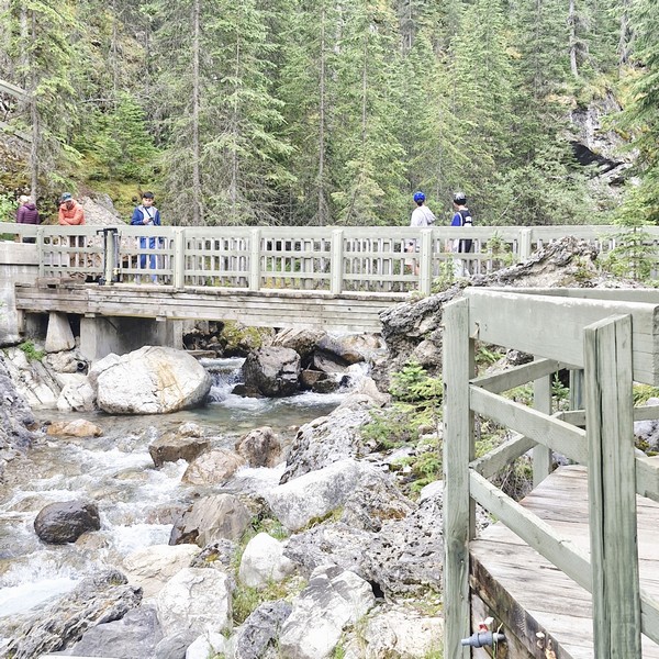
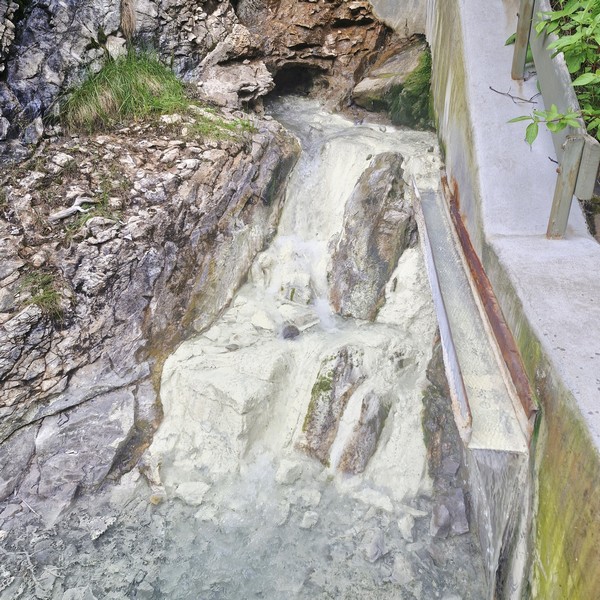
Upon crossing the bridge over Sulphur Creek, we saw the natural Sulphur Creek hot spring, the largest and fastest flowing of the three springs in area. The water source, coming from about 1,500 ft. down the mountain, was very hot (54°C) and had a very strong sulfur smell.

Sulfur Creek
Crossing the bridge over Sulfur Creek…..

This source spring was first used by local First Nations communities who, in turn, introduced them, during the 19th century, to members of the Hudson’s Bay and North West Companies. In the 1910s, a crude pack trail was created, providing visitors with access via foot and horseback. By 1919, a rough trail and modest structures such as a log bathhouse and two sweat houses had been built by coal miners working in the nearby coal mining camp of Pocahontas down the valley.

Sulfur Creek Hot Spring

Miette Hot Springs: Miette Rd., Miette Hot Springs, Alberta T0E 1E0. Admission: $19.75 (adults) and $17.25 (youth and seniors) for a single entry. Tickets are sold first-come, first-served in person, and a separate national park pass is also required to visit the area. Coordinates: 53°7′47.507″N 117°46′13.876″W.

How to Get There: Located between the towns of Hinton and Jasper, the complex is at the end of the 17-km. (11 mi.) seasonal Miette Road off of Highway 16, near the east gate of the park.

Emerald Pond (Jasper, Alberta)

Emerald Pond

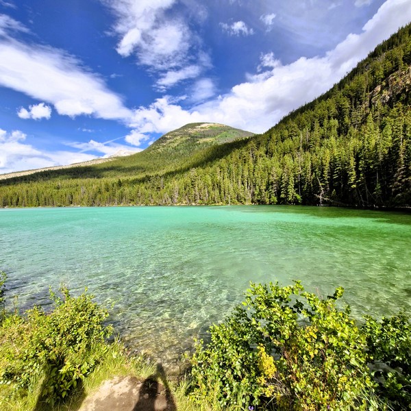
From the Cold Sulfur Spring, a short, narrow dirt path lead us to Emerald Pond, a stunning freshwater lake nestled in the heart of Yoho National Park.  This tiny, crystal-clear roadside stop had a vibrant bright green emerald color, plus towering trees, lush greenery and a breathtaking mountain backdrop, offering picturesque views and opportunities for photography that made it an enchanting destination for outdoor enthusiasts.

Check out “Cold Sulfur Spring”

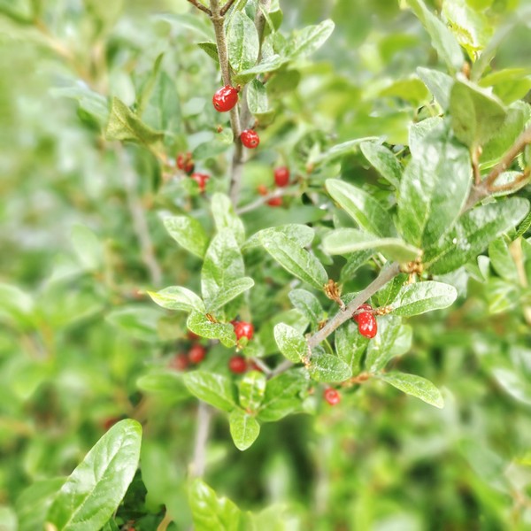
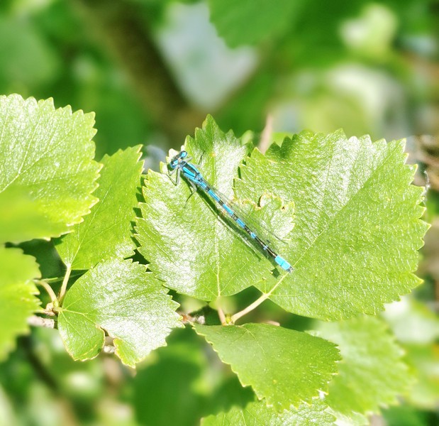
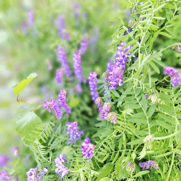
As we arrived mid-summer, when warm air temperatures brought out high levels of insect activity around the water’s edge, we spotted intricate, beautiful and striking iridescent blue dragonflies, with perfect little wings and alien-like heads, darting above the vibrant water and among the slender, green branches of red huckleberry (Vaccinium parvifolium) plants.

Red Huckleberry (Vaccinium parvifolium)

Strictly a quick scenic viewpoint, there are no trash cans, picnic tables, or benches here. As it sits right off the highway, it makes it a fast and easy place to pull over for photos of the water and mountain reflections. For hikers, picturesque hiking trails wind around the lake, offering panoramic views and opportunities to spot wildlife. You can also explore, via canoe, on the crystal-clear waters or just take a leisurely stroll along the shoreline to soak in the beauty of this scenic hidden gem.

Blue dragonflies

The pond, fed by underground, mineral-rich thermal springs, is also a great spot for swimming, fishing, and snorkeling. However, camping and fires are not permitted at Emerald Pond. The best time to visit is during the summer months (the time we visited) when the water is warm and the foliage is at its peak, with summer displays of pink fireweed, violet asters and wild blue lupines.

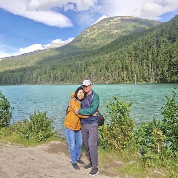
Grace and the author

With its serene atmosphere and abundant flora and fauna, this small pond promises a fun-filled experience for hikers, nature lovers, or those simply seeking some tranquility, in the midst of nature’s wonders. The area is also home to diverse wildlife, such as moose, deer, and a variety of bird species. Visitors are reminded to respect the natural environment and leave no trace behind. Be sure to bring sturdy hiking shoes, bug spray, and a camera to capture the beauty of this hidden gem.

Emerald Pond: Improvement District No. 12, Jasper, Jasper National Park, Alberta T0E 0A8.

How to Get There: The pond is found directly along the Yellowhead Highway (Highway 16), about 21 kms. north of the town of Jasper. A small pullout/parking area is available on the eastbound side of the highway (roughly 200 m. before the pond).

Cold Sulfur Spring (Jasper, Alberta)

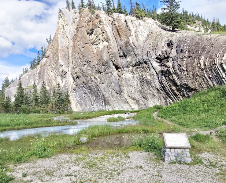
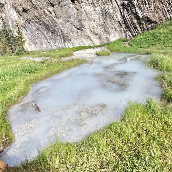
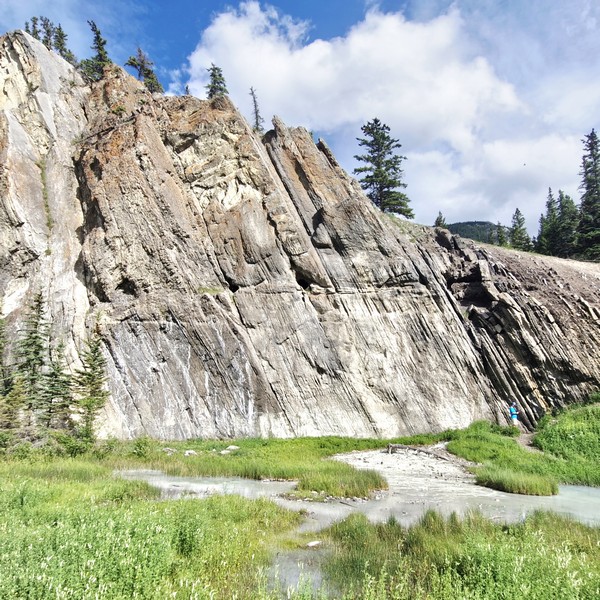
From Jasper, we headed for Miette Hot Springs, a 58.8-km. (one-hour) drive away. On the eastbound side of the Yellowhead Highway 16, we stopped by a small pullout/parking area where a narrow, short walking path, running roughly 200 to 250 m. along the roadside, led us to the shoreline of a cold sulfur spring and pool area, a road trip highlight around Jasper National Park.  Its crystal-clear water had a striking, vibrant green-turquoise hue caused by mineral and sulfur content from the local springs. There are no picnic benches or formal facilities here; it is strictly a quick roadside scenic stop.

Check out “Miette Hot Spring”

Cold Sulfur Spring

Located right by a limestone cliff, 1,021 m. above sea level, it features unique cold sulfur water and microbial white filaments. The cold water, roughly 7° to 9° C, actually originates from deep underground (2+ kms. down) where rocks heat it past 100° C, under heavy pressure, before it migrated upward along fault lines and mixed near the surface.

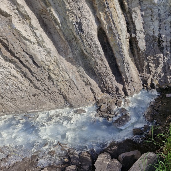
The opaque, cloudy appearance of the spring comes from dissolved hydrogen sulfide gas that reacts with oxgen to form microscopic elemental sulfur particles suspended in the water.

The microbial white filamentous bacterial mats, seen thriving in the sulfur-laden run-off, are bacteria such as Baggiatoa and Thiothrix which use the hydrogen sulfide in their life cycles, releasing pure yellow sulfur as waste products.  The yellow is masked by the white color of the bacteria. Ancient micro-fossils (stromatoporoids/saltwater sponges) are embedded in  the nearby rock cuts.

Hydrogen sulfide bubbling up from the water of the spring

We immediately noticed a distinct rotten egg smell from trace amounts, bubbling up from the water, of hydrogen sulfide, a poisonous gas that the human nose is very sensitive to.  Its concentration is very low and, therefore, not dangerous except for persons especially sensitive to the gas.  Its presence tells us that this water was hot enough and under enough pressure to acquire sulphate from the sulfur-bearing minerals in the rock here.

Bighorn sheep are frequently seen here, especially during morning hours, as they get sulfur (an essential element for their hair which they shed, in large quantities, every year) from the mineral-rich spring water and salt content. Agile climbers, the cliffs above also provide the sheep with an escape terrain from predators. As we arrived in the late afternoon, we didn’t any bighorn sheep during our visit.

The cliffs above the spring where bighorn sheep climb to escape predators

Cold Sulfur Springs: Highway 16, Jasper, Alberta.  Coordinates: N53° 02.711’, W118° 04.950’

How to Get There: The paved pull-off is located 22.6 kms. east of Jasper, not far past the bridge over the Athabasca River. The stop is 56.1 kms. west of Hinton, 22.9 kms. past the eastern park gate.

Athabasca Glacier (Jasper, Alberta)

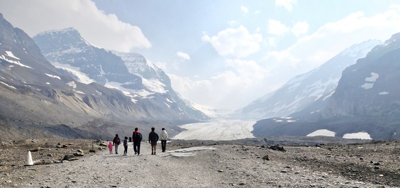
After our short stopover to view Panther Falls, it was a short drive to the Athabasca Glacier, the most visited glacier in North America and one of the most accessible (due to its close proximity to the road) glaciers in the world.  Grace, Jandy and I were supposed to take a ride onto the glacier in a massive, all-terrain Ice Explorer vehicle (tours depart from the Columbia Icefield Glacier Discovery Centre, located directly across the highway from the glacier) but we decided to just join Cheska, Bryan and Kyle who were exploring the glacier on foot.

Athabasca Glacier

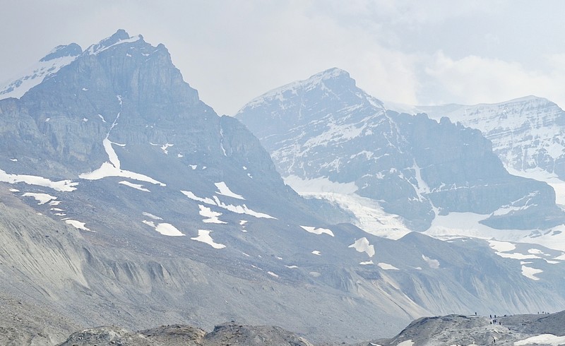
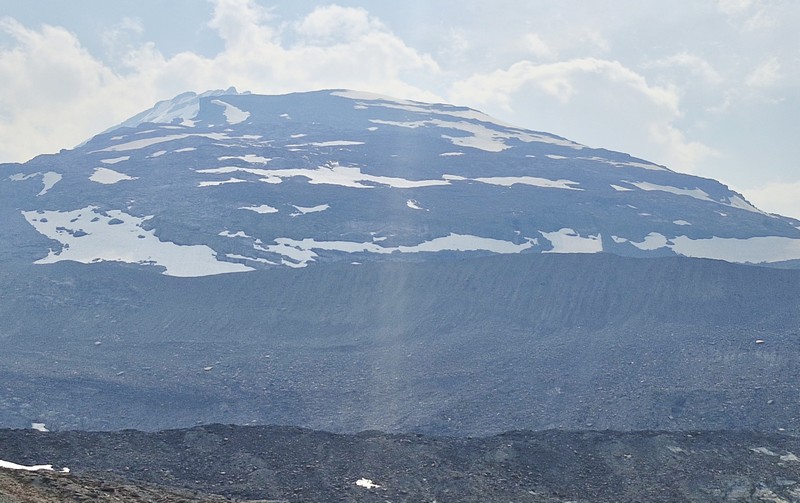
One of the largest non-polar ice fields in the world and a part of the Canadian Rocky Mountain Parks UNESCO World Heritage Site, this ice river is located in Jasper National Park within the Canadian Rockies and sits below monumental summits including 3,491-m. (11,453-ft.) high[Mt. Athabasca, the 3,450-m. (11,320-ft.) high Mt. Andromeda and 376-m. (1,234-ft.) high Snow Dome. Lying on a wide, elevated plateau, it is one of the six principal ‘toes’ of the Columbia Icefield, a surviving remnant of the thick ice mass that once mantled most of Western Canada’s mountains, and is the largest icefield in the Canadian Rockies.

Mt. Athabasca and Mt. Andromeda

This ancient, receding “river of ice” is a striking, must-see stop in the Canadian Rockies. The glacier, covering an area of 6 sq. kms. (2.3 sq. mi.) stretches about 6 kms. (3.7 mi.) in length and was measured to be between 90–300 m. (300–980 ft.) thick. 

Snow Dome

Because of a warming climate, the shrinking glacier has experienced significant glacier recession, increased temperatures and, in recent years, a notable lack of snowfall and snowpack.  It currently loses depth at a rate of about 5 m. (16 ft.) per year and has receded or melted more than 1.5 kms. (0.93 mi.) and lost over half of its volume in the past 125 years. 

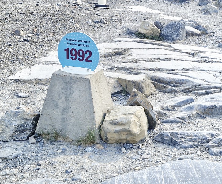
The 1992 Marker

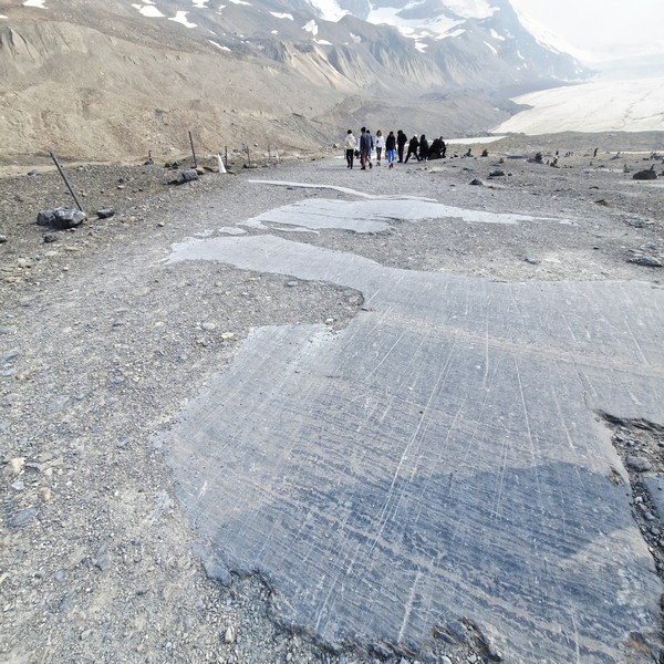
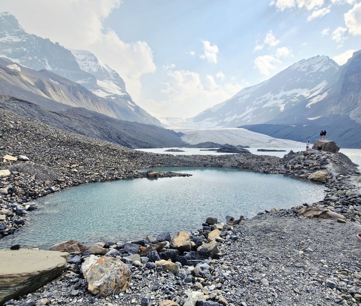
What really struck me was the tombstone-like “1992” marker that indicates the edge of the ice in 1992. The distance from that point up the edge of the glacier was now more than 150 meters.  A moonscape of rocky moraines (piles of rock and sediment carried by the glacier) and glacier-eroded depressions, filled with meltwater, were left in its place.  There was also evidence of glacial striation (scratches cut into the bedrock by the moving glacier).

Glacial Striations

Firsthand evidence of the rapid retreat of this glacier has been witnessed, over the past century, by millions of visitors. A variety of researchers have documented this phenomenon, a direct indicator of the adverse effects of climate change on the glacier’s health and stability and, in 2023, the Athabasca Glacier saw more glacier ice melt than in any of the past 10 years. To ensure its ecological integrity for present and future generations, Parks Canada continues to work towards fostering public understanding, appreciation and enjoyment of the Athabasca Glacier.

Glacier-eroded depressions, filled with meltwater

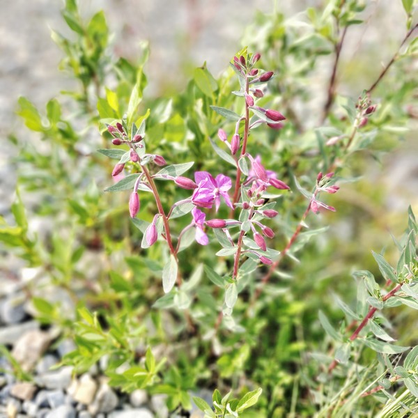
Hardy alpine plants and early colonizing species have slowly establish themselves in the rocky, wind-swept forefield left behind by the receding Athabasca Glacier in Jasper National Park. They include Fireweed (Chamerion augustifolium), Alpine stitchwort (Cherleria obstrusiloba), Reddish stitchwort (Sabulina rubella) and Mountain Avens (Dryas species), River Beauty (Chamaenerion latifolium) and White arctic whitlow-grass (Draba fladnizensis).

River Beauty (Chamaenerion latifolium)

Ideally placed to catch much of the moisture that Pacific winds carry across the British Columbia interior, nearly three-quarters of the park’s highest peaks are located close to the icefield. Spilling from the Columbia Icefield over three giant bedrock steps, the Athabasca Glacier flows down the valley.

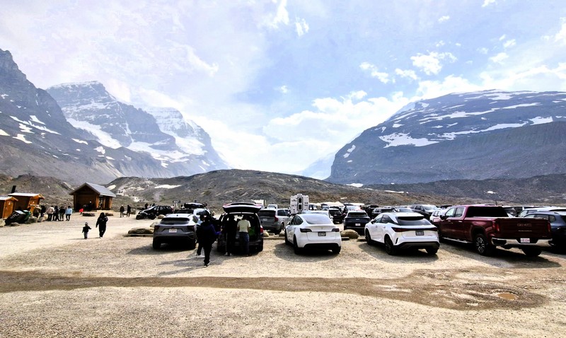
The parking area

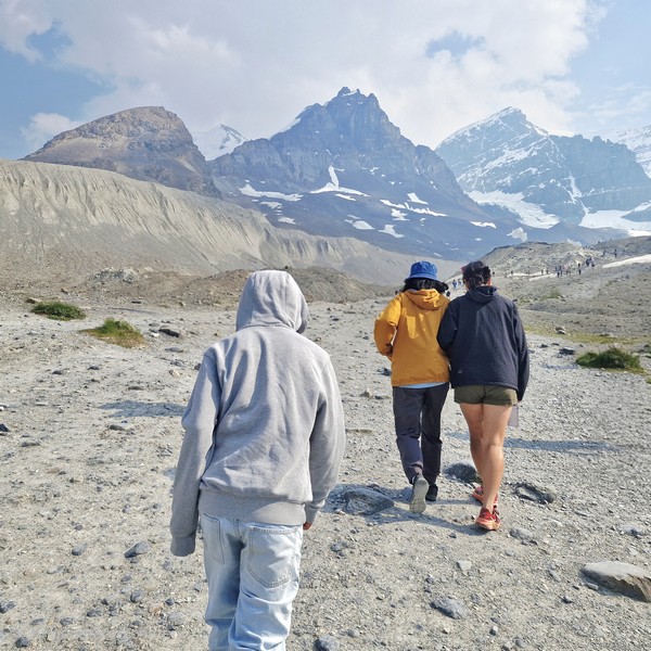
However, though easily accessible, our travel onto the glacier was not easy and we were not properly equipped with the right clothing as we just wore light jackets and woolen bonnets and gloves. Even during our visit on the second week of July, in the middle of summer, temperatures at the glacier that day were quite chilly, with strong, cold katabatic winds (cold, dense airflows that rush downhill from the steep face of the glacier) coming off the ice.

Kyle, Grace and Jandy hiking towards the glacier

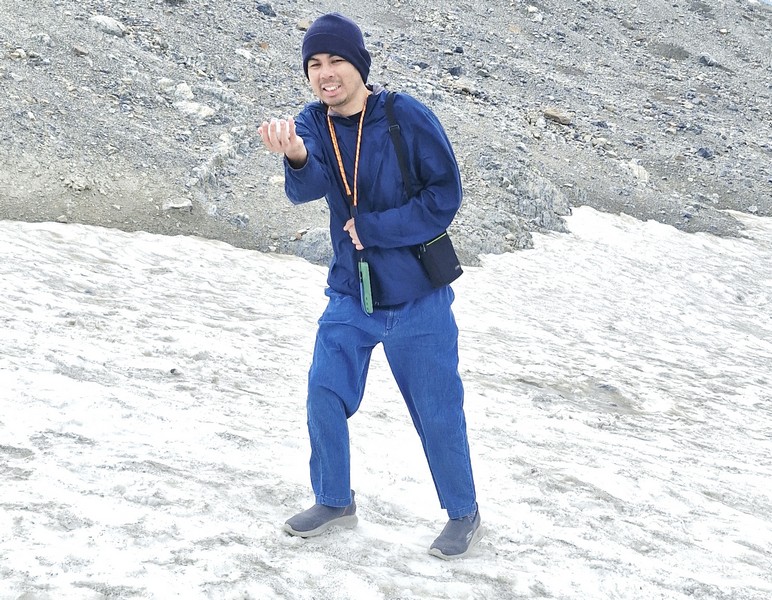
When we left the parking area, it was a mild 15°C to 20°C (59°F–68°F).  However, it dropped sharply down to around 4°C to 10°C (40°F–50°F) or near freezing, at the edge of the ice surface, and it felt much colder due to the strong winds. Our visit, though, provided a first of Jandy – his first experience with snow.

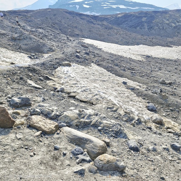
Patches of “dirty” snow

Walking onto the glacier independently is highly discouraged as hidden crevasses  are incredibly dangerous, and wandering onto the ice without proper gear or a guide has proven fatal in the past, leading to the deaths of unprepared tourists.  For your safety do not cross the barriers.

Jandy enjoying his first encounter with snow

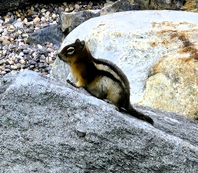
Along the way, we passed by patches of “dirty snow” and dark lines which are a completely natural and highly studied phenomenon, their dark, soot-like appearance caused by cryoconite, rock dust and wildfire ash. We also encountered a Golden-mantled ground squirrel.

Golden-mantled ground squirrel

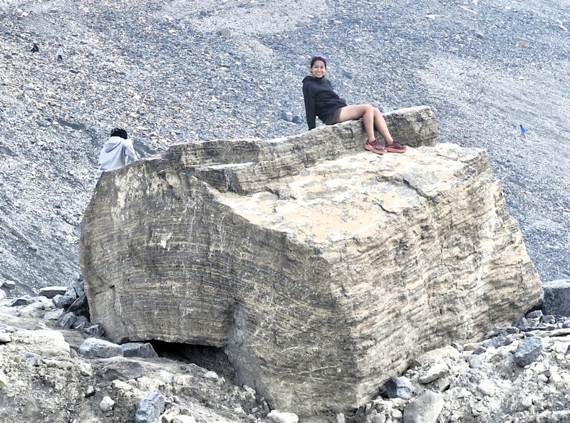
We also encountered (and climbed up) a number of glacier erratics, large boulders moved by glacial ice and left in an area with a completely different underlying bedrock type.

Kyle and Cheska atop a glacier erratic

The Columbia Icefield Glacier Discovery Centre is also used as a lodge and for ticket sales for sightseeing on the glacier. It has two restaurants and a Starbucks. Standard buses here transport tourists from the center to the glacier edge, where they board specially designed snow coaches for transport over the steep grades, snow and ice part way up the glacier. The center is closed during the winter (mid-October to mid-April).

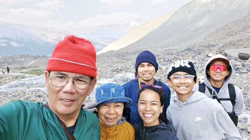
The author, Grace, Cheska, Kyle, Bryan ……

The Columbia Icefield Skywalk, located nearby, is a 918-ft. high, suspended glass-floored platform offering incredible, jaw-dropping views of the glacier-formed valleys. If you want to take an Ice Explorer tour or a guided hike, book your passes in advance through the Columbia Icefield Adventure platform to secure your preferred time slot. 

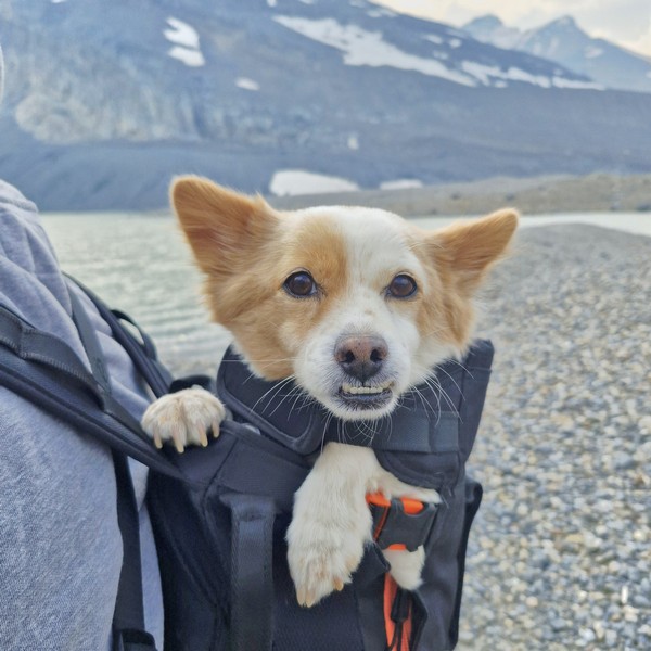
…. our pet dog Luffy

Athabasca Glacier: Highway 93 North – Icefield Parkway, Improvement District No. 12, Jasper, Alberta, T1L 1J3.  Tel: (888) 740-0307. Toll Free: (866) 506-0515. Coordinates: 52°11′55″N 117°14′37″W.

How to Get There: The glacier is directly off the Icefields Parkway (Highway 93N) and is 105 kms. (about an hour drive) south of Jasper and 128 kms. (a 2-hour drive) north of Banff. The leading edge of the glacier is within easy walking distance.

Peyto Lake Viewpoint (Lake Louise, Alberta)

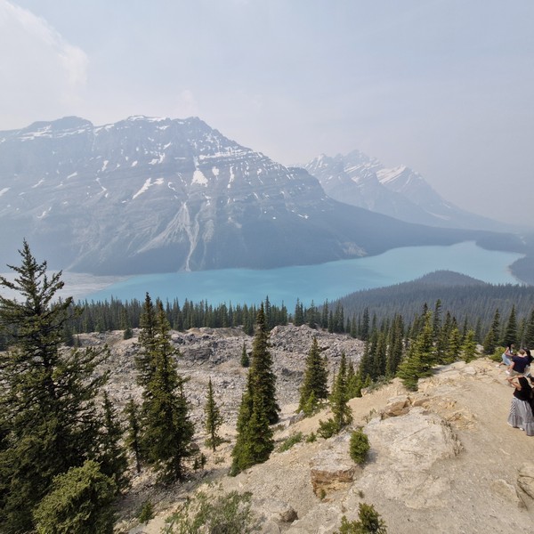
From the Bow Lake Viewpoint, it was a short 7-km. (5-min.) drive to the jump-off for the viewpoint to Peyto Lake, one of the most breathtaking and recognizable lakes in the Canadian Rockies and an awe-inspiring sight that is well worth a stop as you travel the famous Icefields Parkway. 

Peyto Lake

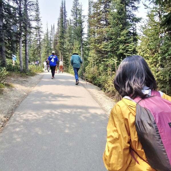
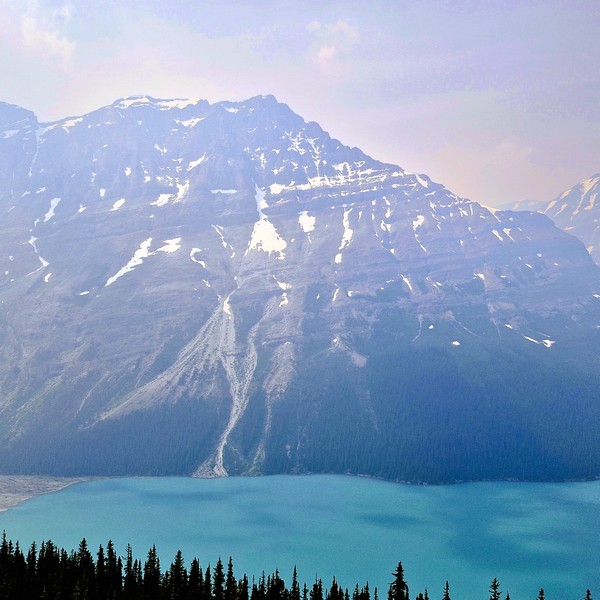
From the parking lot, it was a short, moderate yet rewarding 700 m. (10-15-min.) hike, along the fully paved Peyto Trail, to one of the most stunning viewpoints in Canada, overlooking Peyto Lake’s bright turquoise waters, surrounded by rugged Waputik Range, including the 2,911-m. (9,551-ft.) high Cauldron Peak, the 2,980-m. (9,780-ft.) high Peyto Peak and 2,966-m. (9,731-ft.) high Mt. Jimmy Simpson, and dense forests. As it was summer (the peak season), the area was packed with tourists.

Check out “Bow Lake Viewpoint”

The Peyto Trail

Peyto Lake, a mesmerizing glacier-fed lake in Banff National Park in the Canadian Rockies, near the Icefields Parkway, is the origin of the Mistaya River, which heads northwest from the lake’s outflow, eventually merging into the North Saskatchewan River at Saskatchewan River Crossing. The third most visited lake in Banff National Park (after Moraine Lake and Lake Louise), it  was named after Ebenezer William “Bill” Peyto, an early local trail guide and outfitter, pioneer, and trapper in the Banff area who, beginning in 1913, was one of the first wardens in Banff National Park. 

Check out “Moraine Lake” and “Lake Louise”

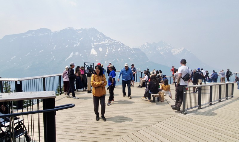
Peyto Lake Viewpoint

Fed by Peyto Creek, which drains water from Caldron Lake and Peyto Glacier (part of the Wapta Icefield), it was formed, at a surface elevation of 1,860 m. (6,100 ft.), in a valley of the Waputik Range, between Caldron Peak, Peyto Peak and Mount Jimmy Simpson. The lake is best seen from Bow Summit, the highest point on the Icefields Parkway.

The lake, one of the most recognizable and most visited sites in Banff National Park, was formed approximately 10,000 to 12,000 years ago by the retreat of the Peyto Glacier.  For millennia, the indigenous peoples have used it for sustenance and ceremony. In the late 19th century, early explorers encountered the magnificent body of water, calling it Doghead Lake as it exactly resembles a dog’s head from high points near its south end. It is 2.8 kms. (1.7 mi.) long, 0.8 km. (0.50 mi.) wide and has a surface area of 1.4 sq. km. (0.54 sq. mi.) and a maximum depth of approximately 90 m.

Cauldron Peak

The lake gets its fame from its striking, almost eerie, bright, turquoise color, a trick of the light, which is due significant amounts of suspended glacial rock flour particles produced, during the summer, as nearby Peyto Glacier grinds down the surrounding mountains, and flows into the lake, refracting the light.  Because of its bright color, the lake often appears in photos in illustrated books.  The area around the lake is a popular sightseeing spot.

Cheska and Kyle

Peyto Lake isn’t as developed as Moraine Lake and Lake Louise but, in 2021, Parks Canada recently completed a major investment to update the infrastructure at the Peyto Lake area, replacing old restrooms in the lower and upper lot areas, improving signage, adding more parking, expanding the viewing platform, and safeguarding the area’s ecology.  However, there are no washrooms in the main viewing platform and no food and drink facilities in the whole area.

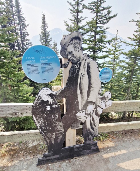
Bill Peyto

Peyto Lake Viewpoint: Lake Louise, Banff National Park, Alberta. Coordinates: 51°43′37″N 116°31′19″W.

How to Get There: The viewpoint is a 1.25-hour drive, via the Trans-Canada Highway and Icefields Parkway, from Banff, a 30-min. drive, via the Icefields Parkway, from Lake Louise, a 2.75-hour drive, via the Trans-Canada Highway and Icefields Parkway, from Calgary, and a 2.5-hour drive, south of the Icefields Parkway, from Jasper.  The viewpoint is about a 10-15-minute hike, on a paved path, from the parking lot which has a lower lot for cars and a upper lot for RVs and tour buses.  There is no public transportation along the Icefields Parkway so you will have to travel by car, shuttle or tour bus.

Bow Lake Viewpoint (Alberta)

After checking out at Douglas Fir Resorts & Chalets in Banff, we proceed on the long 291-km. (3.5-hr.) drive to the town of Jasper.  After an hour’s drive and about 95 kms. along the way, we made a stopover at the Bow Lake Viewpoint. Situated right off the Icefields Parkway (Highway 93) in Banff National Park, Alberta, it offers a stunning panorama of bright turquoise, glacier-fed (by the Crowfoot Glacier) waters of Bow Lake framed by the towering peaks of the 3,055-m. (10,023-ft.) high Crowfoot Mountain (which plunges directly into the alpine basin), the 2,840-m. (9,320-ft.) high Bow Peak, and the dramatic Bow Glacier.

Bow Lake

The small but beautiful Bow Lake, with very calm and serene waters, is the lake closest to and the main source of the headwaters of the Bow River which runs down, out of the Canadian Rockies, past Banff town, to Calgary, the third largest city of Canada, and beyond. It is one of the last lakes to thaw in the summer. Surrounded by the high peaks of the Waputik Range of mountains, this beautiful, glacier-fed lake, mainly formed by the melted water, turns a lovely, vivid, postcard-like turquoise shade, with a bluish tinge, due to glacial silt reflecting the sunlight.

Crowfoot Mountain

Bow Lake may not be as popular as Lake Louise, Peyto Lake and Moraine Lake, but it is almost as beautiful, with its large glacier as a backdrop, and also does not have the crowds and congestion of the aforementioned lakes.  Imagine the beauty of these three lakes, but without the crowds. That is Bow Lake. This lake is also larger than the more popular lakes, and while the blue isn’t quite as intense, it is still gorgeous, and the walk along the lake is flat and relaxing and you can get a good view of the glacier. 

Check out “Lake Louise,” “Peyto Lake Viewpoint” and “Moraine Lake”

The reflection photos you can take here are also amazing.  This lake is a favorite of photographers as its still water allows them to capture reflections of the mountains. Early morning or late afternoon provides the calmest water for mirror-like mountain reflections.

Num-Ti-Jah Lodge

The historic Num-Ti-Jah Lodge, a lodge at the lake, has a coffee shop (where you can get some coffee and a bowl of soup or chili) and gift shop. This quaint wooden building, with a red sloping roof, was one of the original lodges of the Canadian Rockies.  The lodge was originally a small, octagonal log cabin built by Jimmy Simpson in 1922.  In the 1930s, the main lodge was built. Close to the lodge is a charming wooden footbridge near its shoreline.

Wooden footbridge

The day use parking lot at the end of the road has lots of picnic tables.  Aside from the pullover on the Icefields Parkway, another location where you can view Bow Lake is from the lakeside. To get to the lakeside, head to the parking lot area with the numerous restrooms that had been built. The lakeside is a short walk from the parking lot and will enable you to walk past the lodges and the Hanging Glacier Cafe (sells snacks, coffee or souvenirs). The desirable Bow Lake views, with its stunning mountain backdrop, are approximately a 5-min. walk from the parking lot.

Bow Glacier

Truly, this place was a welcome break from the massive crowds of people. While not as dramatic in size or location as Peyto Lake, it still possesses the striking blue coloration owning to mineral suspension. Not a must-see if you’ve already viewed Peyto Lake, but as Bow Lake is right by the road and less busy and it’s also easier to access. The atmosphere at the lakeside was enjoyably quiet/not crowded and was almost meditative as it provided the opportunity to absorb the beauty.

A large parking lot offers plenty of space for the many cars and motorhomes though it is a bit of an issue near the restrooms. An overflow parking lot is available.

Bow Lake Viewpoint: Improvement District No. 9, Alberta T0L 1E0.

How to Get There: The lake, located along Highway 93 North (Icefields Parkway) inside Banff National Park, is a 37-km. (a 20-30 min.) drive north of Lake Louise.

Takakkaw Falls (Field, British Columbia)

Takakkaw Falls seen from the parking lot

From Emerald Lake, it was a 33-km. (40-min. drive) to the impressive, horsetail type (a water feature where the descending water keeps close contact with the bedrock most of the way down, looking like a horse’s tail) Takakkaw Falls which features a picnic area, basic campsites on a first-come, first-served basis, and washrooms near the parking lot. 

Check out “Emerald Lake”

Beginning our hike….

Upon arrival at the parking area and opening our car door, we can already hear the roar of the falls half a mile away. From the picnic area, it was a short, easy 750 m. hike to the base of the falls, crossing a pedestrian footbridge, over the milky, fast-flowing glacial runoff of the Yoho River, to get there.

The pedestrian footbridge
Crossing the bridge

The falls created a strong, heavy and chilly mist that dropped the local air temperature significantly and quickly by 10 to 20 degrees near the base compared to the parking area. Even after donning our jackets, bonnets and gloves, we still felt the biting cold. 

The milky-white Yoho River seen from the bridge
Another view of the Yoho River

The refreshing spray also got us wet (a raincoat or poncho would have been better) and the rocks and gravel near the water got very damp and slick. Occasionally, when the sunlight hit the fine mist at just the right angle (splitting the white light into a bright arc of colors), a rainbow would appear.

Nearing our destination…..

Takakkaw Falls (also spelled Takkakaw) is fed by the meltwater of the Daly Glacier, which is part of the Waputik Icefield, which keeps the volume of the falls up during the warm summer months.  It is a tourist attraction, particularly in late spring after the heavy snow melts, when the falls are at peak condition.

Takakkaw Falls with a rainbow beside it

The total vertical height of Takakkaw Falls has been placed, by various sources, at between 302 m. (991 ft.) and 373 m. (1,224 ft.). In 1985, a survey found that the main drop of the falls is 254 m. (833 ft) high, still making it one of the tallest waterfalls in Canada and easily one of the most dramatic. However, it is often mislabeled as the second tallest waterfall  in Canada (the World Waterfall Database lists about 55 higher waterfalls in Canada).

Kyle, the author, Grace and Jandy with the falls in the background

The fall’s name means “it is magnificent” in the Cree language and the name is apt. However, despite the name’s Cree origin, the indigenous Cree people didn’t give the falls this name nor did they historically inhabit this area. Rather, its name was suggested by Sir William Cornelius Van Horne, the head of the Canadian Pacific Railway, and officially adopted in 1904. However, Takakkaw Falls, as well as Yoho National Park, is located on the traditional and unceded territory of the Secwepemc (sah-wep-em) Nation who lived there since time immemorial.

Additional alpine scenery…..

The falls serves as the main trailhead for several scenic alpine hikes, including the demanding but breathtaking Iceline Trail. If you followed the trails down the river below the waterfall, you would find a treasure trove of smaller falls with names as playful as their alpine settings.

Takakkaw Falls: Yoho National Park, Field, British Columbia.  Coordinates: 51°29′59″N 116°28′22″W. The best time to visit the falls is mid-to-late summer (July and August) when peak glacial melt creates a powerful, thundering cascade.

How to Get There: Takakkaw Falls is a 37-km. (30-min.) drive west of Lake Louise and 93 kms. from Banff. It is accessible via the steep, seasonal Yoho Valley Road (typically open mid-June to mid-October). The Yoho Valley Road branches off the Trans-Canada Highway near the village of Field, British Columbia. Due to steep switchbacks and tight curves, this 14 km road is closed to all vehicles over 7.6 m. (25 ft.).

Emerald Lake (Field, British Columbia)

From The Caves National Historic Site of Canada, we headed 98 kms. (a 1.25-hr. drive) northwest, from Banff, Alberta, onto the Trans-Canada Highway (Highway 1), to reenter British Columbia at the town of Field, then turned right onto Emerald Lake Road, to stop by Emerald Lake, a freshwater lake in Yoho National Park, one of the four contiguous national parks in Canada’s Rocky Mountains, along the boundary of British Columbia and Alberta Provinces. The lake is the largest of the 61 lakes and ponds located inside the park.

Check out “The Caves National Historic Site of Canada”

Emerald Lake

The first non-indigenous person to set sight on Emerald Lake was famed Canadian mountain guide Tom Wilson, who stumbled upon it by accident in 1882 when he was led lakeside while rounding up a string of his horses that had gone astray. He gave the lake its name because of its remarkable, vivid, turquoise green-colored waters due to glacial silt (rock flour), different rock type producing the powdered sediment that is suspended in the glacial water, reflecting the entrancing emerald green spectrum of sunlight rather than the blue spectrum seen in Moraine Lake, Hector Lake, Bow Lake and Peyto Lake in neighboring Banff National Park. Earlier that same year, Tom also discovered another lake which he had given the same name (which appeared briefly on the official map) but it was shortly renamed Lake Louise.

Check out “Lake Louise” “Peyto Lake” and “Lake Moraine”

This stunning glacial alpine lake, a scenic natural destination, is the most famous one of and the most admired locations in Yoho National Park.  The majestic mountains of the President Range, named after the President and Vice-President of the coast to coast Canadian Pacific Railway, add to the beautiful of this lake, as well.

Emerald Sports

The lake has an unmatched diversity of both activities and landscapes suited to the enthusiastic traveler. Canoeing  and walking are favorite activities here and, during the summer months, fishing is also quite popular. Canoe ($.75 for 1 hour, with a max of 3 people in the canoe) and rowboat rentals are available Emerald Sports (also known as Emerald Sports & Gifts), as are cross-country skis and snowshoes in the winter.

Canoeing at the lake

Swimming, though allowed and highly recommended for the experience, is not for the faint of heart as the water is cold due to it being fed by glaciers. The rustic Emerald Lake Lodge is a leisurely delight for those having lunch at Cilantro Café’s lakeside patio. The lodge also offers cabins overlooking the lake and mountains. Near the start of the trail loop are some picnic tables.

Emerald Lake Lodge

A 5.2-km. (3.2-mi.) flat loop, family-friendly trail circling the shoreline, taking about 1.5 to 2 hours to complete, is one of the least strenuous but most rewarding in the park. From the lake, you can view an incredible breadth of geological features including the world-famous Burgess Shale fossil beds, the Michael Glacier, and an avalanche slope carpeted by meadows, where moose often graze.  Other more advanced hiking trails go in different directions up into the mountains.

Burgess Shale plaque

The lake’s elevation of 1,200 m. (4,400 ft.) above sea level produces a unique selection of flora. Trees found here include western red cedar, western yew, western hemlock and western white pine.  At moist, shady enclaves, you can spot a variety of tiny, fragile wild orchids that survive only in finely balanced conditions. If you’re paying attention, you may be rewarded with a Yellow Lady Slipper, Spotted Orchid, or Calypso sighting.

As animals are drawn to this important water source, Emerald Lake is a fantastic place to see wildlife such as bald eagles, moose, and ospreys as well as waterfowl such as loons and mergansers. Grizzly bears and American black bears are fairly common. However, as many wild animals live in the area and are protected by park law, hunting is prohibited in the park. From November until late April or early May, the lake is frozen due to its 53-degree latitude and moderately high altitude.

Kyle frolicking by the lake

Emerald Lake: 1 Emerald Lake Rd., Field, Yoho National Park, British Columbia V0A 1G0. Coordinates: 51.444°N 116.531°W.

How to Get There: Emerald Lake is a 50-km. (30-mi.) drive to the west of Golden, a 2.5-hr. drive from Calgary, a 28-km. (35-min.) drive from Lake Louise and 10 kms. (a 15-min.) drive west of the small railway village of Field, in Yoho National Park, near the highway exit to Emerald Lake, which has a park-operated visitor center.  A two-lane paved road, about 9 kms (6 mi.) long, connects the Trans-Canada Highway with Emerald Lake. Parking fills up fast in the summer, so it is best to arrive early in the morning.

Cave and Basin National Historic Site of Canada (Banff, Alberta)

On our first whole day in Banff, we departed Douglas Fir Resorts & Chalets for the short 3.8-km. (10-min.) drive to The Cave and Basin National Historic Site of Canada, the first ever federally protected reserve in Canada and the birthplace of the country’s national park system (now, Canada has 37 national parks, 11 national park reserves, and 1004 national historic sites, 171 of which are administered by Parks Canada). As we arrived in July, well within between June 19 and September 7, 2026 (when Parks Canada waived all entry fees for visitors this summer), our entrance to the site was free.

Cave and Basin National Historical Site

A special place for Indigenous Peoples for over ten thousand years (and continues to be so to this day), with important and longstanding cultural significance, it is a gathering place for sharing stories about conservation and the connection between people and the land. Together with Banff National Park, it is part of the traditional territories of the Blackfoot Confederacy, the Îyârhe Nakoda of the Chiniki, Bearspaw, and Goodstoney First Nations; the Tsuut’ina First Nation; and the Métis Nation of Alberta.

The author, Kyle, Jandy and Grace inside The Cave

Here’s the historical timeline of the site:

  • In 1859, the first written recorded reference to hot springs here was made by James Hector of the Palliser Expedition.
  • In 1875, Joe Healey happened upon the Cave and Basin site long after Indigenous Peoples.
  • In 1883, Frank McCabe and brothers Tom and William McCardell, three Canadian Pacific Railway workers, using a felled tree, descended through the skylight entrance into the cave and the thermal springs.
  • In 1884, they constructed a small cabin nearby with the intention of commercializing the Cave and Basin site. In those days, hot springs were extremely valuable since hot water was not readily available from a tap like it is today. The CPR workers knew this would attract people and wanted to monetize it. Conflicting claims by other parties prompted intervention by the Canadian government headed by John A. Macdonald.
  • In 1885, an order-in-council reserved 26 sq. kms. (10 sq. mi.) around the Cave and Basin, the Banff Hot Springs Reserve. This was the genesis of Canada’s national parks system.
  • In 1886, the Canadian government held an inquiry into the various private claims to settle on compensation. That same year, an artificial tunnel was driven into the Cave and Basin to aid visitation. Its construction, according to articles in the Calgary Herald at the time, was contentious even in 1887.
  • In 1887, a bathhouse, the first structure on the site, was built.
  • In 1904, a new, naturally-heated pool was built as the existing one proved inadequate by 1902,
  • In 1912, bottled water from the Cave and Basin site was sold for its alleged curative powers.
  • In 1914, a stone bathhouse, designed by architect Walter S. Painter, was completed and opened to the public. Many of the early structures were built by detainees held at a World War I Ukrainian Canadian internment camp located nearby. The camp had a significant Ukrainian contingent.  It continued to operate until 1994.
  • In 1924, western mosquitofish were introduced into the hot springs in an attempt to control mosquitos. Tropical fish illegally introduced into the lower springs by local aquarium enthusiasts may have contributed to the extinction of the Banff longnose dace.
  • In 1975, the pools were closed.
  • On November 13, 1981, the Cave and Basin was formally declared a National Historic Site.
  • In 1985, on the anniversary of the order-in-council that established the original reserve around the Cave and Basin, Canada’s national parks system celebrated its centennial. That same year, the pools were also restored.
  • On August 20, 1985, Prince Philip, Duke of Edinburgh and consort of the Queen of Canada, unveiled the National Historic Site plaque.
  • In 1992, the pools were permanently closed. An interpretive center now uses the structures.
  • In 2000, the Committee on the Status of Endangered Wildlife in Canada listed the Banff Springs snail as an endangered species. Cave and Basin hot springs are also notable as the habitat for this snail.
  • In the summer of 2010, First Nations ceremonies and rituals began again in the Cave and Basin. (the Stoney people stopped coming to the Cave once Canadian Pacific Railway workers and settlers arrived in Banff).
  • On September 13, 2013, a permanent exhibit about Canada’s first national internment operations was opened at the Cave and Basin site (it was postponed three months by extensive flooding across southern Alberta), with an address by Jason Kenney, Minister of Employment and Social Development and Minister for Multiculturalism
Rotunda

Located within the Canadian Rocky Mountains, at the site of natural thermal mineral springs around which Canada’s first national park, Banff National Park, was established, it is the lowest component of nine sulphurous hot springs clustered, in three groups on the northeast flank of Sulphur Mountain, all located along the Sulphur Mountain Thrust Fault below Devonian limestones.

National Historic Site bronze plaque

The mineral spring issues from Sulphur Mountain where surface water penetrates the rock, absorbing minerals and being heated, by geothermal energy, from an estimated depth of 3 kms., to emerge in a cave and in a nearby basin before joining the Bow River drainage system below.

Main Building

At the entrance is a rotunda with interpretative panels commemorating the historic 1883 discovery by railway workers plus the official National Historic Site bronze plaque, unveiled by Prince Philip, Duke of Edinburgh on August 20, 1984, designating the thermal springs as the birthplace of Canada’s national parks system. 

Cave Story Hall

Near the entrance, at the south belvedere of the main building, is a narrow artificial tunnel leading to The Cave, a dimly-lit natural grotto and hot spring.  The tunnel ceiling was low in some places, so I had to mind my head. Before entering the cave, we took time to read the education displays and panels at Cave Story Hall to have a deeper understanding of the impact and significance of what we are seeing when we enter The Cave. 

The oil-based mural of Roland Rollinmud at Cave Story Hall

Near the entranceway and and tunnel of the hall is a remarkable oil-based mural, created by artist Roland Rollinmud (an elder from Stoney Nakoda Nation) and presented to Parks Canada in 2011, depicting Indigenous elders climbing down into the cave through the vent hole on rawhide ladders

Entrance to The Cave

This large hollowed-out cavern, with a steaming mineral pool below, is the only cave large enough to comfortably accommodate groups of people.  A small vent hole, in the rock ceiling, acts as a natural skylight, letting in enough sunlight to reflect off the pool and glisten on the smooth red and white flowstone layers running down the cave walls. You’ll also find stalactites and stalagmites, glacial till and a small trickling waterfall.

The tunnel leading to The Cave

A single elevated platform overlooks the water. There are stanchions in place to make it abundantly clear you enter along the righthand side of the hall in a line that terminates at the platform. After your time on the platform, you exit via the left-hand side of the tunnel. Relatively small, the cave has a single opening at the top that lets in natural light.

The Cave
The source of the spring

Immediately following its “discovery,” almost all of the delicate cave formations had been stripped out thinking it would improve the accessibility and aesthetic. Steam continually rose from the geothermally heated waters, and the earthy mineral scent of hydrogen sulfide filled the air, which kind of makes you second guess wanting to jump in. While the rotten egg smell never goes away, it does become tolerable. 

The original bathhouse now the Interpretive Centre and Museum

The former original 1887 bathhouse and restored 1916 interior public swimming pool complex for nearly 100 years, built with Classical Revival details, has now been renovated into an Interpretive Centre and Museum. Visitors here can enjoy interactive and interpretive media exhibits, detailing the 1883 discovery of the thermal hot springs by railway workers, and short films that takes you through a journey of Canada’s National Parks, and heritage of thermal waters.

The Basin

On top of the main building are the covered Belvedere Viewing Decks, overlooking the historic site, that offer panoramic views of the surrounding Canadian Rocky Mountains, marshland and mountain ridges.

View of the Canadian Rocky Mountains from the view deck

Outside the old pool complex, adjacent to The Cave, is The Basin (a pool of mineral water), the natural springs which flow into the Cave and Basin. It has been rewilded as close to its original state as possible and is now protected. A helpful ranger explained more about the animals that call these thermal pools home. They include tiny fish that have been introduced to these thermal waters (mosquito fish, jewelfish and sailfin molly), damselfly (Argia vivida) larvae that were in among the algae and, if you look closely, you’ll catch a glimpse of the endangered Banff Springs Snail (Physella johnsoni) in the pools.

Bryan, Cheska, Kyle and Jandy searching for Banff Spring Snails among the algae.

These tiny snails that are only found in the Upper Hot, Kidney, Middle, Cave, Basin and Vermilion Lake Springs in this area. All of the thermal pools, except the Banff Upper Hot Springs, a separate facility some 5 kms. (3 mi.) southeast of the Cave and Basin, have been closed off to humans in order to preserve this limited habitat.

8×8 ft. murals painted on outdoor display boxes
Murals displayed within the building

Located around the parking lot and historic bathing pavilion are large 8×8 ft. murals, painted on outdoor display boxes, which were placed during the spring-to-fall visitor season and can be viewed during regular site hours. These rotating large-scale outdoor mural projects were created by indigenous artists, in collaboration with the Whyte Museum of the Canadian Rockies.

Cheska, Grace, Bryan and Kyle at the Discovery Boardwalk

Within the complex are the Discovery Boardwalks that lead you up the hill and through unique marshes created by the natural springs. Along the walk, you’ll encounter the original surface vent hole and, next to it, are vestiges of the log shanty, built between 1883 and 1885, known as ”the Hotel,” so they could stay close and protect it from other prospectors. 

The original vent hole

There are also few other smaller hot pools with bright blue-green waters and filled with pink bacteria and algae.

One of the smaller thermal pools

The boardwalks also feature educational signage, upper views of the Cave and Basin complex, and stunning, sweeping mountain and valley vistas of the Canadian Rocky Mountains. For those with stamina, you can hike along the 7.4-km. round trip Sundance Trail and the 2.7-km. Marsh Loop.

The Hotel

Cave and Basin National Historic Site of Canada: 311 Cave Ave., Banff, Alberta T1L 1K2.  Tel:+1-403-762-1566.  E-mail: caveandbasin@pc.gc.ca.  Admission: $9.00 (adults), $7.50 (seniors) and free for children. Free admission on Canada Day. Open daily, from May 15 to October 15, 9:30 AM to 5 PM. Closed: September 21 to 24, 2026. Coordinates:

How to Get There: It is located about 2 kms. and a 30-min. walk from the town center. Once you cross the bridge, look for the dedicated walking trail. The Cave and Basin Trail will take you all the way there. From Banff, head south on Banff Avenue (the main street through Banff), over the Bow River Bridge to a T-intersection, and then turn right on Cave Avenue and follow the signs. The Cave and Basin parking lot is located at the end of this road. By bus, Roam bus route #4 will take you to the Cave and Basin.