Balicasag Island (Panglao, Bohol)

Balicasag Island Dive Resort

Panglao Island’s deep waters are home to whales and dolphins that appear all year round, especially between the months of April and June.  Having arrived on the last week of May, we were hoping to do some dolphin watching of our own at nearby Balicasag Island which lies off Panglao Reef, 4 kms. southwest of Duljo Point.   Balicasag is also touted as the country’s second best diving spot.  The island’s north and northwest side has a narrow shelf, 10 to 50 m. wide and about 7 m. deep, ending in 2 excellent vertical walls that fall forever.   In fact, 80 to 90% of the tourists who visit Panglao come primarily for the Balicasag scuba diving.  The first recorded dive of the island on the island was done on May 6, 1984.   

On our way

To get to the island, I hired an outrigger boat.  Grace, my kids Jandy and Cheska and my brother-in-law Mark joined me and we all brought our swimming and snorkeling gear, suntan lotion and some packed lunch.  We left very early in the morning for the 10-km. (45-min.) boat ride to the island. However, throughout the boat tour, we failed to sight any dolphins or whales and so we contented ourselves with snorkeling its beautiful underwater scenery just off the shore. 

Balicasag Island

We later made a landfall at the other side of the flat, barren 21-hectare island which is ringed by a pristine sandy shell, coraline beach. The island’s name was derived from the Visayan words bali, meaning “change,” and kasa, meaning “noise,” in reference to the waves slapping the shore as the wind changes direction.  The island was declared as a lighthouse reservation as early as 29 October 1907.  Jandy and I went around the island in less than half an hour.  On the southwest side of the island is the 1.5-hectare, Philippine Tourism Authority (PTA)-managed Balicasag Island Diving Resort, established on April 6, 1987.  Right in front of the resort is a 3.44-hectare marine sanctuary declared by the Department of Environment and Natural Resources (DENR). The resort has 10 native-style duplex cottages with bath and porch, plus a main restaurant pavilion with an adjacent alfresco dining area and bar.  It also has a dive shop offering dive courses.

Loboc River Cruise (Bohol)

After our short bonding with the tarsiers and my church visit, we all returned to the dock where our double-hulled, flower-bedecked floating restaurant was now waiting for us.  The restaurant has 4 long tables, 8 benches, kitchen, mini-bar and comfort room and is pushed along the river by a motorized boat.   We started our cruise from Loay Bridge. Cruising along, we dined on grilled pork or fish, fried shrimps or steamed crabs, all with chopped tomatoes and onions on the side; pansit plus other native fare, all served with generous servings of pandan-scented rice on wooden plates lined with banana leaves.  We washed these all down with either ice-cold soft drinks or the much healthier buko juice.   

Loboc River Cruise

The idyllic rural scenery is also a visual treat.  Along the way we observed heartwarming daily activities like mothers washing clothes and children bathing nude or diving from coconut trees bent precariously close to the water.  We also passed returning floating restaurants and small native outriggers loaded with passengers.  The endpoint of our 2-km.  cruise was Busay (or Tontonan) Waterfalls.  The falls drops 15 m. in 2 stages and is used to generate electricity for the town.   Here, we dropped anchor and guests were given the option to go for a quick, cool swim or just continue chatting or dining.  We just did the latter.  After about 30 mins., the boat made the return trip back to Loboc.   

Busay Falls

Panglao Island (Bohol)

Alona Beach

We all left Cebu City very early in the morning of May 24 via an Oceanjet fast ferry for Tagbilaran City, Bohol’s capital and route center.  Upon arrival at the city’s wharf, we motored, via taxi, to Panglao Island which is connected to the mainland via 2 bridges. The older Taytay Bridge, near the City Hall, goes to Panglao (18.1 kms. away) while the Gov. Jacinto Borja Bridge, located 2 kms. southeast, connects the city’s Bool District with Dauis (3.1 kms. away).  The flat 98.4 sq. km., coralline limestone Panglao Island is located south of the city.    

Lost Horizon Beach Resort

We booked ourselves at an airconditioned room with bath and cable TV at Lost Horizon Beach Resort along Alona Beach.  The resort also has fan-cooled rooms with bath or common bath, a restaurant, swimming pool and a bar.   Alona Beach is one of Panglao Island’s 4 beaches, all of them white sand.  The  other beaches are the 1.2-km. long, pretty shallow Doljo Beach (located between rocky promontories); Dumaluan Beach along the east coast; and Momo Beach on a quiet cove on the west side. 

At Trudie’s Place

The sand off these beaches, although not as fine as that in Boracay, is just as white.  A fact, known only by a few people, is that many white sand beaches on Mactan Island in neighboring Cebu are covered by sand imported from Bohol, including Panglao.  Alona Beach, on the southeast side, is the most beautiful, most popular and, tourist-wise, the most developed beach of the four on the island. This beach, located in Brgy. Tawala, is said to have been named after Alona Alegre, the bomba star of the 1970s whom people say romped naked here during a film shoot.  It has a number of small, individually-designed beach resorts, restaurants, beach bars and dive shops, all spread along the beach for about 1.5 kms..  This attractive, white sand beach is good for snorkeling.  It is, however, clogged with seaweed growing in knee-deep waters, especially between December and March.    

Lost Horizon Beach Resort: Brgy. Tawala, Alona Beach, Panglao, Bohol.  Tel: (038) 502-9099 & 502-9088.  Cebu City booking office: fax: (032) 232-4893. Website: www.losthorizonresort-bohol.com.

Hike to Pintong Alipi Falls (Morong, Bataan)

Morong River

We arrived at Sitio Kanawan in Brgy. Binaritan by 11 AM. A very short hike led us to a pastoral scene of the moderately flowing Morong River fringed on both banks by dense forest and crossed by a hanging bridge of wood planks and steel cables.  Two in our party went ahead to prepare lunch at the Aeta Resettlement Area.  We, however, couldn’t and didn’t resist a cool dip at the river’s inviting waters.  That done, we crossed the bridge and proceeded, along a well-marked trail, toward Kanawan, pausing only to rest at Mang Kit’s mango tree farm.  Kanawan’s 147 households have a mixed population of lowlanders or unat (meaning “straight-haired”) and resettled Aetas or kulot (meaning “kinky-haired”).  The Mt. Pinatubo-displaced Aetas were resettled there in 1987 (through Pres. Corazon Aquino’s Proclamation No. 129) and an Aeta kapitana (captain) currently heads the village.  Every 5 May, the Aetas perform a kabikin or marriage ritual.

Hanging bridge

We arrived at the village just in time for a tinolang manok lunch.  This we attacked with gusto, and justly so as we would need the energy to tackle the long hike ahead.  Laden with water containers, we also secured the services of 48-year old Mr. Iglezerdo “Guilling” Alejo of Task Force Kalikasan as our guide.  After a short hike through rice paddies, our band soon entered the cooling shade of the dense forest.  And dense it really was as about 70% of Morong town is included in the SBMA reservation, with 9,694 hectares identified as watershed primary growth forest area.

The trek begins …..

The hike, through an often well-marked trail strewn with dried leaves and rocks, entailed some dry streambed crossings and quite steep and strenuous mountain climbing.  At the end of this very tiring, almost three-hour hike was the rewarding vista of the well-hidden, 80-foot high Pintong Alipi Falls which is fed by numerous springs sweeping along the mountain.  We relaxed our visibly tired bodies at the cool, refreshing waters of the fall’s shallow pool, as well as enjoyed a back massage underneath the falls itself.  It was truly worth the long hike.

Pintong Alipi Falls

Recharged, we began our return trek to Kanawan, meeting two Aetas gathering honey along the way.  We arrived by 5:30 PM.  After a short rest and some sustenance, we groped our way back to our jeep, our path lit by flashlights.  Our progress back to the town was somewhat stalled by the Good Friday parade of carrozas.   Instead of fretting, we just curiously watched the parade pass us by.  Back at Mang Kit’s house, we hungrily gorged ourselves at supper.  I was just too spent to even walk the short distance back to Vener’s house, collapsing instead to a blissful sleep at Mang Kit’s living room sofa.

Biak-na-Bato National Park (Bulacan)

Biak-na-Bato National Park

I got an invitation from Jesu-Mariae School (JMS), my son Jandy’s school, to join an outbound education demonstration tour for teachers at Biak-na-Bato National Park in Bulacan sponsored by Lakbay Kalikasan and I promptly accepted.  Five JMS teachers were to accompany me – Ms. Ofelia “Openg” E. Bermas, Ms. Maritess H. Dimaranan, Mr. Robert V. “Rob” Castañeda, Mr. Joel P. Fatlaunag and Mr. Ronnie Boy R. Lansangan.   

The Balaong River

We left Manila fittingly on April 9, Araw ng Kagitingan, and were picked up, by 5 AM, at the EDSA Shrine by a Lakbay Kalikasan-chartered airconditioned tourist bus.  In all, there were 48 of us from different schools.  Our Lakbay Kalikasan hosts were Ms. Rosa-Vina S. Prudente (Team Leader and Lecturer), Mr. Ryan Viado (Team Leader 1), Mr. Roger Quizol (Team Leader 2), Ms. Hanna Garcia, Mr. Bobby Estrebillo and Mr. Joel Garalde.  We arrived at Biak-na-Bato by 9 AM after a 3-hr. trip (including waiting for latecomers, a stopover for breakfast and calls of nature) via the North Luzon Expressway (NLEX), exiting at Sta. Rita/Baliwag Exit.  Then, from the National Highway, we headed towards Plaridel and Baliwag. At a Y intersection 7 kms. from San Ildefonso, we took the road to the right then,  about 1 km farther, another right at another intersection leading straight to Biak na Bato.

Yungib 2 Cave

This 2,117-hectare National Park, site of Gen. Emilio Aguinaldo’s Biak-na-Bato Republic, covers a large part of San Miguel de Mayumo and parts of San Idelfonso and Doña Remedios Trinidad (DRT).  Its attractions are its series of 16 major caves, some unexplored, that lies at the rocky foothills of the Sierra Madre Mountains. The park is bordered by a small mountain range (the 432-m. high Mt. Nabio, the 422-m. high Mt. Susong Dalaga and the 380-m. high Mt. Silid) in the east and the Balaong River in the west.   It also has low, 140-m. high, rolling hill lands.  Also within the park are Brgys. Biak-na-Bato, Kalawakan and Sibul. The park has two areas: the easily accessible Front Country and the undeveloped and hard to reach Back Country.  

Yungib 3 Cave

It seemed that we weren’t literally going for a walk in the park as our bus entered the Back Country. There are 3 trails leading to the Back Country and its rarely-visited caves.  The trail we chose was well-marked. It starts directly across the Balaong River from the park entrance and proceeds over hills towards Mt. Silid.  We are to explore several semi-caves and at least one pit cave.  From a trail branch to the top of Bahay Paniki Cave, we can also explore 2 more caves without spelunking gear.

Yungib 1 Cave

Reality meets history at this trail as we were going to walk under the blazing heat of the sun through an unpaved, poorly shaded and dusty trail as our Katipunero ancestors did over a century ago.  No pain, no gain.  However,we had the luxury of doing some stretching exercises before our hike. Accompanying us was park guide Mr. Patricio Garcenilla.  Our nostalgic 2-hr. trek took us to 4 caves – Yungib 2, Yungib 3, Tangapan Cave and Yungib 1. The first 3 were naturally lighted and all had at least 2 entrances.  In every cave, we were given a historical overview of what each cave served.  Yungib 2, the so-called Pagamutan (“infirmary”), was, in the past, the nearest cave from the battlefield. Here, in this makeshift hospital, our Katipunero ancestors sought medical help for battle wounds.  Yungib 3, on the other hand, served as the Katipuneros’ storage for weapons, food and other war necessities.

Tangapan Cave

Tangapan (“meeting place”) Cave, near the third trail’s start, was where Gen. Aguinaldo first made contact with other revolutionaries.  Its well-lit main chamber is accessed by a front and back entrance.  A small tunnel, leading to the river, requires the use of helmets and lights for exploring.  Our final destination, Yungib 1, was the longest and the darkest of the four.  Called the “Ambush Cave,” here our Katipunero ancestors would lie in ambush as they waited for pursuing Spanish soldiers.  They escaped via a rear entrance.  We also made our “escape” via the same route, watching our heads as we groped in the dark.  In all 4 caves, we all said a prayer dedicated to our brave ancestors prior to departing. 

Gen. Aguinaldo Cave

After this nostalgic travel through time, it was back to our bus for a short drive to the developed Front Country.  The parking area before the entrance was filled with food stalls selling just about anything from snacks, maps and even souvenirs made from Biak-na-Bato limestone.  This time, we hiked along paved trails straddling the river to our designated picnic area.  Along the way, we passed (but didn’t explore) the Gen. Aguinaldo Cave and Cuarto-Cuarto Cave. Gen. Aguinaldo Cave, also called Biak-na-Bato Cave, was Aguinaldo’s headquarters in 1897 and site of the republic. The Pact of Biak-na-Bato was also signed here.

Bahay Paniki Cave

Once at the picnic area, we pigged out, kamayan style, on a feast of pork adobo, inihaw na talong (eggplant), tokwa (tofu), rice, and a salad of diced tomatoes, onions and salted eggs, all washed down with soft drinks or bottled water. Just when we felt like dozing off, a whistle blew signaling the start of more trekking.  Whatever we ate seemed to disappear as we traversed the paved, up-and-down (mostly up) trail to Bahay Paniki (“House of Bats”) Cave.  This easy-to-explore and well-lit cave is located upstream from the river.  Probably the largest cave in the area, it has a rather deep natural indoor swimming pool fed by an underground stream.  Thousands of fruit bats fly in and out from dawn and dusk.  The presence of these bats also meant the presence of guano (bat droppings), a sure source of income for the inhabitants.  However, it was a cause of concern for those of us who wanted to swim.  What the heck!  A number of us (including me), with or without life vests, dove in and enjoyed the cool waters.

Lakbay Kalikasan: G/F Balai Lakbay, 2 Alondras St., Mira-Nila Homes, Tandang Sora Ave., Quezon City, Metro Manila.  Tel: (632) 932-7818 to 19.  Mobile number: (0917) 500-4796. Website: www.lakbaykalikasan.com.

Trek to Sto. Kalbaryo (Dolores, Quezon)

Pointing to heaven

Finally, we were cleansed enough to climb up Sto. Kalbaryo (Durungawan II to mountaineers), a bare, lava rock-filled mountain located just below Mt. Cristobal.  The highest mountain in Complex 1, it is so called because, during Holy Week, hundreds of pilgrims trace Christ’s supposed ascent from Dolores to the summit, re-enacting Christ’s passion and death.    We were to do ours two weeks early. The hot afternoon sun was still shining brightly up in the sky as we clambered our way, thirsty and sweating profusely, through a well-marked trail, up the treeless and rocky mountain.

The author with Rob and Ely

Throughout my trek, I also felt the mystique and magic of Mt. Banahaw and Mt. Cristobal around me, more so when we reached the top where 3 wooden crosses were strategically planted to recreate the actual crucifixion scene. By tradition, on Good Friday, the summit is deserted, as mystics believe that only God the Father may bear witness to His Son’s death.  It is also said that on that same day, an enkanto (spirit) opens a hidden cave near the crosses which acts as a pathway to the netherworld.  Anyone at the summit, at this time, will be forced to enter it and never return.  Reaching the summit of a mountain was a first for many of my companions. For me, it brought me 2,400 ft. nearer to Heaven and my Creator.    Thus, it was with deep regret and a heavy heart that I had to make the shorter but more difficult descent down the mountain and back to earth.  For me, my climb up that mountain has been well worth it as this most jaded of travelers has left it purer in heart.

Lakbay Kalikasan: G/F Balai Lakbay, 2 Alondras St., Mira-Nila Homes, Tandang Sora Ave., Quezon City, Metro Manila.  Tel: (632) 932-7818 to 19.  Mobile number: (0917) 500-4796. Website: www.lakbaykalikasan.com.

Sto. Lucia Complex (Dolores, Quezon)

Lakbay Kalikasan, Southeast Asia’s first and premier outbound education outfitter, embarked on a series of outbound education demonstration tours for teachers from other schools willing to try out their outbound education programs and they invited me to cover one of these tours that promote appreciation of the living remnants of a pre-Hispanic tradition which is still being practiced today in Mt. Banahaw, that of worshiping nature (rivers, mountains, old trees and fields) in the belief that such natural objects were the habitats of spirits. Jesu-Mariae School, my son Jandy’s school, joined the tour and they were represented by Robert “Rob” V. Castañeda and Eleser “Ely” Borero.  

Hiking up Calvario

Our destination was Mt. Banahaw’s Brgy. Sta. Lucia Complex 1 in Dolores (Quezon), one of Banahaw’s 4 complexes – the others being Kinabuhayan (Resurrection), Durungawan (Window) and Ilalim (Crater), which lies at the foot of the 1,470-m. high Mt. Cristobal.  We left the EDSA Shrine (our assembly place) by 5:30 AM, April 9 (Bataan Day), on board one of two vans. Joining us were 16 other teachers from 6 Metro Manila schools (Augustinian Abbey School, Madre Pia, Miriam College, Olivarez College, St. Benedict and Santa Catalina High School).  Our Lakbay Kalikasan hosts were Mr. Ramon Jocson (Corps Director), Mr. Ronaldo Dalofin (Team Leader/Lecturer 2), Mr. Roger Quizol (Team Leader 2), Mr. Oscar Orbe (Team Leader 3) and Ms. Billy de la Cruz (Facilitator 3).   The trip to Dolores was to take all of 3 hours.

Upon arrival at Sta. Lucia, we visited the compound of the Suprema Iglesia del Ciudad Mystica del Dios, Inc.  (Supreme Church of the Mystic City of God), the largest of Banahaw’s 66 to 88 registered colorums, entering it via a huge 20-foot high stainless steel gate.   The word colorum is derived from the Latin Mass invocation in saecula saeculorum.  These esoteric folk Christian religious communities, varying in size from several thousand members to a few adherents, believed that Mt. Banahaw is the site of the Holy Land and that Christ walked in the area.  They also share an intense nationalism and reverence for National Hero Jose Rizal who is considered a demigod or the Tagalog Jesus Christ.  Many sects also believe in the ascendancy of the female (Ciudad Mystica included) and women, rather than men, perform the priestly functions. These religious sects around Dolores resent the kulto (cult) connotation insinuated by non-believers. 

Piedra Mental

Mt. Banahaw is full of sacred natural shrines locally called puwestos (places), all said to have been discovered by Katipunero Agripino Lontok, and one of our objectives was to undergo and relive the pre-Hispanic tradition of pamumuwesto (spiritual pilgrimage) by hiking, crossing rivers and entering caves, all sacred destinations with deep historical and symbolical meanings, communing with the spirits for paglilinaw (discernment) and paglilinis ng loob (inner cleansing) so that we may take the challenges ahead.  Along the way, lectures and meditations are intermittently given and, in all puwestos, candles are always lit.

My baptism

We descended, down a gorge, to Sta. Lucia Falls, fed by the cool Lagnas (or Kinabuhayan) River, and Piedra Mental, a stone altar where pilgrims pray for mental discernment as they go through the pamumuwesto. At the stream which courses down Banahaw (also called Ilog ng Jordan, alluding to John the Baptist’s baptism of Christ), we “cleansed” or “purified” (water is a universal archetype for cleansing) ourselves and drank the sulfuric waters of the falls 3 times (symbolic of the Triune God – the Father, the Son and the Holy Spirit) prior to our entering the sacred caves (kuweba), the pilgrim’s church.  After our ritual baptism, we we then climbed up the steep gorge. 

One of many caves in Sta. Lucia Complex

At the huge boulder of Kaban ni San Isidro, the gate to the entire complex of Sto. Kalbaryo, we lighted candles and said a short prayer for safety and guidance, while at the book-shaped boulder called Aklat ng Buhay (the Book of Life said to contain our names, date of birth and even date of death) at Prisintahan , we imaginatively “register” our names and those of our loved ones. A real hurdle was the 40-m. long Santong Husgado (Holy Judge), one of the caves at Ina ng Awa revered by the religious sects and given Biblical names.  Said to test the purity of those who enter, it is believed that when you get out of this cave, 7 years of your sins will be forgiven but, if you are not completely malinis (cleansed), you will be trapped inside. 

Santong Husgado

We had to hike, barefoot, from Ina ng Awa to the cave opening (with lit candles strategically placed along the cave), carrying just the clothes on our back.  The ladies,  with their small frames, decided to go in first.  I was the last to enter this “cave” which was more of a rabbit hole.  All the while, I was figuring out how to get my 5’-10,” 188-pound frame inside that hole. Ready and willing for this test of faith (pagsubok), I kept remembering the familiar Biblical proverb “I can do anything through Christ who strengthens me” (Philippians 4:13).  Crawling through it entailed a lot of body contorting as well as decision-making. “Should I enter head or feet first?”  “Should I do it on my stomach or on my back?” Finally, after what seemed like an eternity of struggle, I finally made it out to Ina ng Awa. Now I know how a worm feels.   I, together with the others, were all mud-splattered yet, surprisingly, our habit-cladded sister colleague from Madre Pia was still spotlessly clean.  Could it be divine intervention?  I wonder.   

Lakbay Kalikasan: G/F Balai Lakbay, 2 Alondras St., Mira-Nila Homes, Tandang Sora Ave., Quezon City, Metro Manila.  Tel: (632) 932-7818 to 19.  Mobile number: (0917) 500-4796. Website: www.lakbaykalikasan.com.

Anilao’s Gulugud Baboy (Mabini, Batangas)

I accepted an invitation from my friend Rosevie “Vi” Sevilla to join her and her friends Ms. Dynah Pizarro and Ms. Cecil Divinagracia on a camping hike to the 501-m. high Mt. Panay (locally called Gulugud Baboy) in Anilao in Mabini, Batangas.  Gulugud Baboy is the highest point on the rocky headland of the Calumpang Peninsula. I brought along my son Jandy plus my tent and other camping equipment.  To joining us later, in a separate vehicle, were Edwin A. Guisihan, Jersey Miranda, Joseph de la Rosa and Carlo Peña.  The morning trip from Manila was via the South Luzon Expressway (SLEX) to the Calamba Exit, then on to the Batangas towns of Sto. Tomas, Malvar, Cuenca, Alitagtag, Sta. Teresita and Bauan as well as the cities of Lipa and Tanauan.   It took all of 3  hrs., traffic and all, including stopovers and asking for directions.

Gulugud Baboy

We arrived at the port just in time for a carinderia-style lunch.  That done, we proceeded down to a road on the left located about 200 m. before the marketplace and jeepney terminal.  From here, we drove 8 kms. along a sometimes paved, but often rough and dusty road, from Brgy. San Jose to San Teodoro.  The route is lined with about 40 dive resorts, many of them quite basic and most situated along the coast of Balayan Bay.  Some do not have access by road and could only be reached by banca from Anilao.     The Calumpang Peninsula is a rocky headland all throughout, the end result of which is a lack of suitable beach spots.We finally arrived at Arthur’s Place, said to be the jump-off point to Gulugud Baboy.

Our campsite

It so happens that Arthur’s Place, according to its manager Ms. Lita Abrigonda, is just the nearest resort to the access road going up the mountain.   It would be a long hard climb going up and we couldn’t secure porters around willing to take our heavy backpacks up.  So I decided to take my Mitsubishi Adventure, with all my passengers and gear, all the way up as I could possibly go.   The mostly rough and dusty zigzag access road was very steep, narrow and quite treacherous, with ravines along the way.  Already very difficult to traverse even during that late afternoon sun, I wouldn’t imagine anyone trying it at night.  I was to be proven wrong later on.  Our “breathtaking” drive was somehow alleviated by the equally breathtaking scenery along the way.

A fantastic view of Maricaban Island

We soon reached a basketball court with a sari-sari store beside it.  Going beyond it was made impossible by an impassable stretch so we decide to just park our car at the court.  From hereon, it would be all footwork.  However, I haven’t given up hope of getting porters and we asked around at the store for one.  There were no male porters around but the “porter” we secured (at PhP200 for a one-way trip) proved to be more dependable than three male porters; a horse.   Thus unburdened, we proceeded, together with our heavily-laden horse and guide, past the village, along a moderately graded dirt path.  It was initially quite a breeze but it all ended upon reaching an opening beside the road.  From hereon it was all uphill along a grassy and treeless trail.   The scenery began to unwind into a series of plateaus resembling sloping golf courses.  I wonder if this spine-like contour is where the mountain got its name.  Gulugud baboy is translated as “pig’s spine.”  Store caretaker Lina Castillo gives a different version, that of a baboy ginto (golden pig) seen to roam the place.

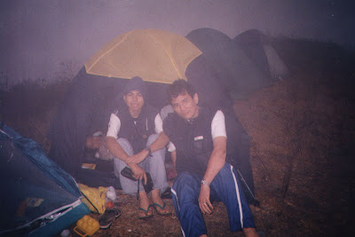
A foggy, very cold and windy evening

After about an hour’s hike, we finally reached the peak of Gulugud Baboy.  And what a peak it was!  From this vantage point high up, we had a spectacular 360 degree view of the ocean, Anilao, Batangas Pier, the narrow 11-km. long, densely forested Maricaban Island, the hat-shaped Sombrero Island, the 1,145-m. high Mt. Makulot and even Mindoro, Mt. Lobo and Mt. Manabo.  Within reach is the similarly grassy and treeless Pinagbanderahan where the Americans were said to have raised their flag (bandera) after the Japanese surrender in World War II.

The gang’s all here
Within minutes, we unloaded our backpacks, paid our guide then went about the necessary business of setting up our tents on the grassy, treeless peak and cooking an early dinner. That done, we settled down to a hearty meal.  It was now late in the day and we were rewarded with a beautiful, fiery sunset.  Simply Heaven!  However, the bitter cold and fog soon began to set in.  We also began to wonder if our other companions could still make it up as they were still in Bauan having dinner.  It would seem recklessly foolhardy for them to try to negotiate that steep and narrow zigzag road at night.  But foolhardy they were as they still pushed on to Anilao and up the steep and treacherous road up to Gulugud Baboy.  We had to guide them by phone.  There were anxious moments when we lost touch of them due to signal dead spots.  Finally, after what seemed an eternity, the faint but welcome glow of flashlights carried by the guys came into foggy view.  We all greeted them with a sigh of relief and, after a narration of their misadventures, helped them set up their tents.  The rest of the night was spent chatting, singing, drinking and making merry.

Trek to Walang Langit Falls (Gloria, Mindoro Oriental)

Crossing the river with a carabao-driven cart

We were all awake by 6:30 AM and soon picked up by our trusty driver Mr. Saez for breakfast at Byahero.  Our guides soon arrived minus Karen who was replaced by Ms. Eleanor “Nhoy” Magsino.  Laden with packed lunch and bottled water provided by Robert, we left by 8 AM, traveling the 14-km. distance to Brgy. Mirayan in 30 mins.. The starting point is beside a swift flowing river.  From hereon, it would be all footwork (and some swimming) through different types of terrain: rivers, mud tracks, steep hills, creeks and boulders.

The short crossing over the fast-flowing river proved to be difficult, more so if it had rained the night before (no wonder we were not allowed to go during my first visit).  Luckily, a carabao-driven cart was also crossing.  Rodel, who would have had a hard time crossing with his polio-stricken right leg, hopped in.  Me and the others followed behind.  Our next hurdle would be just as difficult (and longer), slogging through the muck of a dirt road muddied by previous rains.  This road, built to provide easier access to the falls, had just being started and grading work was going on.   The carabao cart pushed on with its human load and so did we, merrily singing and chatting as we walked.  An opening alongside the road signaled the start of our hilltop trek (and the end of Rodel’s carabao cart ride).  It wasn’t so steep but the muddy trail, plus the intense heat of the sun which penetrated the light forest, made it very tiring especially for the limping but still game Rodel.

Once downhill, we were rewarded, at the foot, by the cool, clear and inviting waters of a smooth-flowing stream.  I lay down by the shallow waters, feeling its cool comfort flow through the length of my body.  I could have stayed that way the whole day but it was not to be as we were only halfway to our goal.  Our sole consolation was that the remaining part of the trek would be all along this meandering stream. The initial portion was along evergreen banks lined with coconut and banana trees, giant ferns and some nipa houses.  Occasionally, we would cut corners by making short, diagonal overland treks.

Soon, we were in for a change of scenery. As we went further down the river, it started to narrow dramatically and began to change to eerie jungle, with massive and very rugged rocky outcrops gradually towering, high and steeply, on both sides of the river.  We also passed some bizarre, weather-sculpted rock formations.  Huge trees, with interlaced, hanging roots and thick branches, hug the river’s edge.  Some, uprooted by typhoons, blocked our path.  Large boulders also jutted out the water.  I was also slowly being drenched by a drizzle from above.  No, it wasn’t raining. Rather, small waterfalls from underground streams in the cliff above were being blown by the wind to create a perpetual drizzle.   I was so engrossed by my surroundings that I failed to notice that, with my huge stride, I had left behind my guides and now was all by my lonesome.  It dawned upon me that I must have made a wrong turn.  I was lost.

May Langit Falls

But not for long.  Soon enough, Exan and Donna came to my rescue. Rather than turn back, I decided to push forward and see what was at its end.  The gorge was getting narrower, so much so that I could touch both sides of the gorge with my outstretched arms.  The river was also getting deeper, waist-high, in my case, and neck-high for the diminutive Donna. Our efforts were rewarded with vistas of two small but beautiful waterfalls: an unnamed one, at our right, and May Langit Falls at the end of the gorge.  Thus fulfilled, we retraced our way back to rejoin our companions.

The way to Walang Langit was via a fork on the river which I somehow missed.  The path through was no less difficult than my previous trek.  Luckily, a huge fallen tree trunk which once blocked the path had been sawn by the municipal government into six-inch sections similar to the tadtaran (chopping boards) of old.  After passing another waterfall, I was dumbstruck by what I finally saw at the gorge’s end, the 100-ft. high torrent of Walang Langit Falls, surrounded, in all its majesty, by equally tall, densely-vegetated cliffs flanking it.  Here, the sun only penetrates the gorge at noon. Simply awe-inspiring.  Only in my dreams can I imagine such a place.

Walang Langit Falls

Much anticipated was a dip in its icy-cold, waist-deep pool. Once acclimatized with the cold, we also indulged in a tingling back massage underneath the fall. Soon all these activities made us hungry and we finally recharged ourselves with a much-needed lunch.  Rodel and I soon finished our photo shoot with a prayer, hoping that our shots in the dim light would come out nice.  Rodel alone used up 3rolls of black and white film by the end of the day.  It was getting late and we had another long hike ahead of us.  Our gear was soon packed (including our garbage).  However, I wasn’t looking forward to this return hike as we were now going to do it in reverse, from heaven back to earth.   We were totally drained once we got back to the dirt road.  The return hike took twice as long and we made it back to our vehicle very late in the afternoon.

As we couldn’t make it to the last Supercat ferry trip back to Batangas City, we decided to stay another night in Gloria.  Sleep was again out of the question as Robert honored us with a small despedida (farewell) party, with our guides, at our cottage.   We left at 2:30 AM for Calapan City, making it to the first fast ferry (6 AM) back to Batangas City and on to Manila.  I was back on “earth” by 9 AM.   Goodbye heaven.

Taytay Falls (Majayjay, Laguna)

Rain, rain go away. Come again another day.”  So moaned this bored and grounded travel writer who was itching to get out of town again.  It was supposed to be the advent of the dreaded El Niño phenomenon again and, usually, mornings always promise to be a bright, sunny day.  However, expectations always turn to gloom as dark clouds always appear in the horizon by afternoon, bursting into rain hours later.  What the heck! I will go get out, rain or shine (shine I hope).

 Lala, the author, Myrna, Ning and Menchie

I did find people with the same mind set from Jesu-Mariae School (JMS), my son Jandy’s school.  Joining me were Mr. Robert Castañeda, Ms. Elvira “Lala” Mañanita, Ms. Myrna Samson, Ms. Leonila “Ning” Boncayao and Ms. Menchie Fortunado.  We decided to do some overnight camping at Taytay Falls in Brgy. Taytay, Majayjay in Laguna.  We all left JMS, after lunch (1:30 PM) on 12 October, a Saturday.  The trip to Majayjay was to take all of 120 kms.. Aside from my passengers, my Mitsubishi Adventure was laden with tents, backpacks, sleeping bags and provisions.  The afternoon skies were again overcast. We traveled via the South Luzon Expressway (SLEX) all the way to Calamba City, then on to the resort town of Los Baños, Bay (the old Laguna capital), Calauan, Victoria, Pila and Sta. Cruz (the provincial capital), turning right at the junction on to a road leading to Nagcarlan, Liliw and finally Majayjay.  There were glimmers of hope as the sun shone most of the way.

Settling in our tents

The last leg was particularly winding but altogether  scenic; passing beautiful mountain scenery (1,470-m. high Mt. Cristobal and 2,177-m. high Mt. Banahaw), lanzones trees laden with ripe and read-to-harvest fruit, and clear, swift flowing rivers with bathing children and washing mothers.  It was truly a scene for a Fernando Amorsolo genre painting. We arrived at Majayjay’s poblacion by 5 PM with hopes dashed as it began to rain. We were truly in for a “wet” reception. We first paid a visit to the home of Mr. Florencio “Flory” Rosales, secretary of town councilor Rey Cube (referred to us by Mr. Manuel “Noli” Canlas, board member of JMS).  Mr. Rosales was more than kind enough to personally guide us towards the staging area for the trek to Taytay Falls, waiving the entrance fee of PhP20 per person.  He also assigned guides to assist us.  From hereon we were on our own.

It was already getting dark when we arrived at the staging area.  Normally the hike to the falls takes just 10mins..  However, this was a different story as we would be trekking in the pitch-black darkness of a rainy, eerie and moonless night.  Luckily, we had flashlights and our guides.  The narrow, two-foot wide concrete path was sandwiched between a mountain spring-fed canal running alongside the mountain on the left and deep, treacherous ravines on the right. G.I. pipe railings kept us on the safe side.  We arrived at the campsite after what seemed an eternity.

Taytay Falls

Our first face-to-face encounter with the falls would have to wait for tomorrow due to darkness but the sound of its onrushing waters would be a constant reminder of its presence.  For the time being, we had other concerns to think about. Beautiful places such as these are not well-kept secrets and the place was teeming with weekend campers from the town and Manila.  We were quite a sorry sight, drenched from head to foot by the rain, muddied, hungry and with no proper place to pitch a tent.  While our kusineras Myrna and Ning hastily prepared our dinner of fried liempo (it would have been barbecued if not for someone forgetting the grille – me), corned beef and steamed rice over my portable stove, Robert and I groped in dark for a less than suitable place (our selected site was rocky) to pitch 3 of our tents.  Once settled in, we attacked, with gusto, our prepared dinner and hit the sack early for a well-deserved but not so fitful sleep.

View of campsite from atop the falls

I woke up very early in the morning with somewhat revived spirits and a sore back (“Pwedeng pang sungka ang likod ko”).  The others soon followed, all in a similar state of mind and body.  As the early morning sun crept in, the beauty of the place slowly emerged.   No rain.  Our campsite was located beside a moderately flowing river whose icy-cold, crystal-clear waters came from the beautiful 30-ft. high waterfall located about 100 m.  away.  Everyone was excited to sample its inviting waters.  But first, my early morning coffee fix and breakfast!  As soon as it was prepared by our ever dependable kusineras, we all transferred all our stuff: tents, backpacks and prepared breakfast, to a more suitable site right beside the falls. Who cares about breakfast in bed when you can’t have it beside a beautiful waterfall!   That done, we soon settled down to a filling repast similar to what we had last night.

Our excitement to have our first dip at the falls soon turned to cowardice as we dipped our toes in the icy-cold waters of the natural pool.  Brrrr!  What the heck!  I bravely dove in and endured the shivering and the sound of my teeth clattering as my body slowly, but surely, adjusted to the temperature. After much goading, the others (Myrna, Ning, Menchit and Lala in that order of bravery) soon followed my lead.   Robert and I also did some exploring of our own by clambering up a well-defined but muddy trail to the top of the falls. It was even more beautiful here (and less crowded).  From here, we had a bird’s eye view of the campsite (our companions look like ants below), creek and the surrounding verdant rainforest.  I could stay here forever.   Back at the campsite and terra firma, we soon had our fill of the falls and its verdant surroundings, packed our tents, backpacks and other gear and soon made our way back to the staging area and our car.