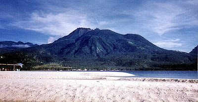
Deer Breeding Farm (Ocampo, Camarines Sur)

With still some daylight up ahead, we opted to visit another of Gov.  Luis Villafuerte’s priority projects: the Deer Breeding Farm in  Ocampo.  Located below Mt. Isarog’s slopes, this experimental breeding farm, started in 1996, has a 60-head herd made up of 5 species of Australian deer (blackbuck antelope, the fallow deer, the chital deer, red deer and elk).

Grazing deer with Mt. Isarog in the background

Here, we decided to go “deer hunting” with our cameras.  This proved quite difficult as the deer were wary of us newcomers, retreating as we approached them.  Luckily, it was feeding time and the deer seemingly ignored us as they went about their meal with gusto.  We also had our fill as we clicked away with our cameras.

The deer up close

Its not everyday that we see deer in the country but it certainly is possible in Camarines Sur.  Satisfied with this unique experience, we decided to call it a day, returned to our van for the return trip back to Naga City and our hotel, dropping off our guides along the way.  That night, I slept soundly, counting deer instead of sheep.

Deer Breeding Farm: Brgy. Sta. Cruz, Ocampo, Camarines Sur

Consocep Resort (Tigaon, Camarines Sur)

After an early morning breakfast at the hotel, Alex, Rick, Jess and I, together with Boyet and Susan, all left on our van for a familiarization tour of Naga City’s favorite getaway from the hustle and bustle of the city: Consoscep Mountain Resort at the foot of Mt. Isarog in Tigaon.  Accompanying us as guides were Ms. Melba Niebres and Ms. Shiela Clara of the Camarines Sur Tourism Office in Pili. The trip, via the Jose Fuentabella Highway, was to take all of an hour.   Past the towns of Pili and Ocampo, we turned left at the intersection leading to the resort.  The 8-km. uphill drive was scenic all the way as we passed abaca plantations and verdant forests.  Turning off our airconditioning, we instead savored the cool caress of its Baguio-like mountain air.  Along the way, we also passed the Parks and Wildlife Office.  Nabontolan Springs are located within its grounds.

Consocep Resort
A welcome arch signaled our entry into Consocep Resort.  This resort, developed in 1989 during the term of Gov. Luis Villafuerte, is located at the 1,800-ft. level of Mt. Isarog.  This extinct, isolated volcano’s vast 101.12-sq. km. (10,112-hectare) base covers Naga City and the towns of Calabanga, Goa, Pili, Tigaon and Tinambac.  The mountain is said to be the home of the legendary Bicolano goddess Aligata and Negritos also live within its dipterocarp forest.  Upon arrival, we parked our van at the park’s spacious lot.
 
Mt. Isarog
From hereon, it would be all footwork.  The appeal of this mountain resort is its fascinating waterfalls.  The resort has 3 major waterfalls: Bulalacao Falls, Kawa-Kawa Falls and Tumaguiti Falls.  There are also 2 smaller ones.  Getting to these falls proved to be easy as we leisurely hiked along cemented, pebbled-washout or cobbled-stoned pathways and stairs (there are said to be 1,394 steps along the trail).
 
Entrance to the resort
The first waterfall we reached, Tumaguiti Falls, was the park’s highest.   Its name was derived from its rain shower-like gush of water.  We weren’t prepared for a wet reception at this fall as we didn’t bring bathing attire or extra clothes.  Boyet didn’t seem to care as he took, with gusto, his first “natural” shower, clothes and all.  We could only watch in envy.
      
Tumaguiti Falls
We soon continued on our way to our next destination: Kawa-Kawa Falls.  Its name was derived from the native word kawameaning “big cauldron.”  Although a David compared to the Goliath-like Tumaguiti Falls, it is still the best known and most popular because of its natural “slide” into a man-made swimming hole so structured as to blend naturally with its surroundings.  Again, Boyet took a natural bath in its refreshing waters while we consoled ourselves by just breathing the cool mountain air and admiring the tall trees and giant ferns.  We also interviewed 47-year old Domingo Saulon, one of the park’s four rangers.
     
Kawa-Kawa Falls
After about 30 mins., we continued on our way to our final destination: Bulalacao Falls, so named because of its rushing cascade. After passing a dressing area and an impressive treehouse, we soon heard the rushing waters of the waterfalls.  But first, we proceeded to its viewing deck.  Quite tired and famished, we partook of the packed Bigg’s Diner packed lunch we brought along: fried chicken and laing (taro leaves with shrimps in coconut cream) cooked in true Bicolano fashion; hot and spicy.   After this hearty lunch, our group proceeded down the steps, to the falls.
      
Bulalacao Falls
What a falls it was!  This third major waterfall truly lived up to its name, as its onrushing waters fell down, in graduated steps, to a deep, inviting pool surrounded by lush foliage.  The temptation to dive in was irresistible and since I had already missed out on two beautiful falls, it would truly be a sin to miss out on this third and last opportunity.  Clad only in my jogging pants, I waded its icy-cold waters for my own “natural” bath.  Boyet, Alex and our guides; Melba and Sheila, soon followed suit.   Susan, Jess and Rick still opted to remain as spectators, watching us as we lolled about the pool.
     
A treehouse at the resort
After 30 mins. of sheer ecstasy, we reluctantly left the falls, drenched as a newborn chick, to make our way back to the park entrance.  The return trip was all slightly uphill and our group was split in two as the others lagged behind.   Reaching the parking lot ahead of them, I took the opportunity, while waiting for the others, to dry myself under the sun.  Soon everyone was accounted for and we all boarded our van for the return trip down the mountain.

The Waterfalls of Mt. Romelo (Siniloan, Laguna)

Mt. Famy in Laguna, the nearest and most accessible mountain trekking destination from Manila.  The mountain, in itself, is no “tall” order being only about 1,100 ft. (335 m.) high.  The charm of the place, aside from its accessibility, lies in its 7 beautiful waterfalls (Ambon-Ambon Falls, Batya-Batya Falls, Buruwisan Falls, Lanzones Falls, Matandang Buruwisan Falls, Sampaloc Falls and Sapang Labo Falls).  It was this charm that made me decide to visit the place.  I brought with me Jandy and Jesu-Mariae School teachers Mr. Roy Trillo and Mr. Arnel Daliva.  We left Manila by 6:30 AM traveling via the C-5 highway to Pasig City, Antipolo City, and the Rizal towns of Cainta, Taytay, Teresa, Morong, Baras, Tanay and Pililla, before crossing the Laguna boundary, to Mabitac and Famy.

Buruwisan Falls

The views along the winding and well-maintained asphalt highway at Mabitac were truly spectacular as we feasted our eyes on the surprisingly forested mountains of the majestic Sierra Madres and the calm, azure waters of Laguna de Bay.  The route here, and in Antipolo City, is full of sharp, Kennon-like zigzag bends.    Asking around at the Caltex station in Famy town, we were beginning to wonder why no one seems to know or even heard about this mountain named after their town.  One even gave us wrong directions to a mountain in Pakil.  The answer is simply because it isn’t there in the first place.  We tried the next town of Siniloan.

Jandy rafting at the falls

Later conversations with Siniloan residents Geronimo and Marilyn Pontipedra revealed that our mountain destination was, due to an erroneous land survey, placed within the territorial jurisdiction of Famy town. Hence, the name Mt. Famy.  In reality, the mountain belongs to Brgy. Macatad in Siniloan.  Here, they call it Mt. Romelo.  Two of the mountain’s 7 waterfalls are another story.  Buruwisan Falls and Ambon-Ambon Falls, according to some travel brochures that I’ve read, are supposedly under the jurisdiction of neighboring Sta. Maria and Pangil towns respectively.  Brgy. Macatad’s residents claim otherwise.   We arrived at the jump-off point by 9 AM and parked our car, for a fee, at a house along the highway.  All four of us registered our names at the store of Ms. Pontipedra and gave a small donation.  Laden with our gear we, at first, refused offers for guides and porters.  This was foolish economy on our part as there were many forks along the trails.  We finally engaged the services of 13-year old Macatad resident Joel Diaz as our guide.   Later, he also became my porter as the heavy weight of my backpack began to tell on my unfit, then 43-year old body.  Who ever said age doesn’t matter?

Camping by the falls

Our destination, Buruwisan Falls, is accessible by two mountain trails: Puting Bato and Pulang Lupa (the shorter route).  I neglected to ask which route we took. The initial part of the trail was through rocky streams and muddy river beds.  We soon entered a light forest and it was uphill and downhill all the way through 2 hills, passing occasional spear grass (cogon) trails.  The most difficult part was clambering up a steep 45-degree grassy incline to the top of the first hill.  Here, two stores offer a welcome relief of cool soft drinks and fresh buko (all for an understandably “steep” price of course) to the victorious climber.  This scene is also repeated on the second hill.   Both hills offer spectacular mountain views and weak Smart and Globe signals.  Beyond the hill, my mobile phone become useless baggage.

It is never lonely along the sometimes muddy trail as it was the peak of the trekking season.  Groups of hikers occasionally passed us by (and vice-versa).  One even rode on a horse (hired for PhP150 one way).  These horses also carry gear and supplies.  Soon after passing the second hill, our spirits were buoyed by the sound of rushing water as we neared our destination.  After three hours of strenuous trekking, we arrived at the campsite in time for lunch.  We pitched our tents below the falls’ rocky overhang (a good shelter from the sun and rain, but quite risky during an earthquake).  I particularly situated my tent‘s opening to face the falls. There were already 6 tents pitched before our arrival.

Lanzones Falls

The 50-ft. high, postcard-perfect Buruwisan Fall is featured in many travel books for the rappelling thrills it offers.   According to Joel, other visitors here even engage in the very dangerous, extreme sport of diving from the top of the cliff down to the falls’ deep pool.  Luckily, no one has, as yet, died from it.  On my part, I just engaged in the safer sport of just swimming in its bracingly cold waters while Jandy paddled along on a floating log.   Our indispensable Joel who continually served us throughout our stay, later guided me to Lanzones Falls, downstream to the right from Buruwisan Falls.  Although half the height of Buruwisan, it was just as spectacular and its shallow pool had surprisingly clearer waters than its predecessor.

Matandang Buruwisan Falls

The waters of the two waterfalls meet to form the majestic but rarely visited Matandang Buruwisan Falls (Binaytuan Falls to others).  Said to be 200 ft. high, its splendor is rarely seen by visitors as its base can be reached only after a very difficult hike.   Joel was one of the lucky ones to have visited it.  I could only view it from the falls’ top.  After an early supper, we retired to our tents for a much needed rest after a hectic day.  Sleep, however, was almost an impossibility as the ground beneath our tents was rocky.  The rubber mat I brought along only provided some relief.  I was also quite unused to roaring sound of the waterfall beside us.

Batya-Batya Falls

We awoke early amidst a slight drizzle, had a hearty breakfast, dismantled our tents and packed our backpacks.  Leaving our gear behind at the store of Joel’s grandmother, we then proceeded, with Joel leading the way, upstream to Batya-Batya Falls.  Getting there was easier said than done as we had to hop among large boulders and twice wade through 5-ft. deep waters, carrying our belongings above our heads.  After a 30 min. hike, we finally reached the falls.  Equally beautiful as the others we visited, it was unique in its own way as its crystal-clear waters fell in tiers.  There were small, deep basins (hence the name, batya which means “basin”) at every drop.  We had the irresistible urge to climb it and all four of us did so.  Joel stayed behind with our stuff.  Climbing it was quite difficult but well worth the effort.  Up the falls was another stream leading to Sampaloc Falls.  It entailed a long hike though.  Four out of seven waterfalls visited already make a good batting average, so we decide to forego a trek to this fifth fall.   With great difficulty, we retraced our steps back down the falls. 

We were back to the store by 10 AM. Here, we changed into dry clothes and started our hike back to my car.   We made it back in a “record” time of 2 hrs., stopping only for rest at the two hilltop rest areas.  After a short talk with Ms. Pontipedra and a late merienda of halo-halo, we left by 1 PM after paying the PhP100 parking fee.  We arrived in Manila by 4 PM, stopping only for a late lunch in Antipolo City.


Taal Volcano: Hike to the Crater Lake (Talisay, Batangas)

Mt. Binintiang Malaki

This Holy Week, I availed of a standing invitation from Ms. Lily Rodrigo-Canlas, president and C.E.O. of Jesu-Mariae School, my son’s school, to stay at the Jesu-Mariae Center in Tagaytay City.  This retreat/seminar center could comfortably accommodate 80 people in dorm-style facilities.  With this center as a jump-off point, I planned to revisit Taal Volcano via the Kayabok Trail on the other side of Volcano Island.  Joining me were my son Jandy and daughter Cheska who’s been egging me to include her in my escapades.  Joining us were 5 of Jandy’s teachers: Mr. Robert Castaneda, Ms. Veneriza “Vener” Trillo, Ms. Theresa “Thet” Quieta, Mr. Joel Fatlaunag and Mr. Erwin Vizcarra.  All, except Robert, are jittery first-timers at the volcano.     

Picnic Grove with Taal Volcano behind us

We left Manila on the morning of March 27 and arrived at the center in time for preparation of a delicious barbecue lunch.  After customary visits to the city’s Picnic Grove (where we went horseback riding) and People’s Park in the Sky (now in a sorry state of disrepair), we returned to the center for a delicious supper and retired early as we had to leave very early in the morning for the volcano trek. 

Cheska horseback riding with Thet

The next day, Holy Thursday, we all awoke by 5 AM, had breakfast, pack our provisions of bottled water, sandwiches and bananas (good trail food) and left the center by 6:30 AM.  From Tagaytay City, we went down to Talisay (Batangas) via the treacherous concrete zigzag road called Ligaya Drive, down to Brgy. Caloocan.  As soon as we arrived at the boat landing station, we were swamped by boatmen hoping for an early kill, this day being a holiday.   Soon, they were trying to pluck our feathers by charging us a cutthroat rate of PhP3,200 just for the trip (with 6 passengers only).  It was soon watered down and we settled at the still horrendous price of PhP2,400 to bring all 8 of us to our destination.
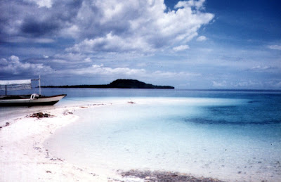
On our way, by boat, to Volcano Island

We left the station by 7 AM on board a big motorized banca.   The trip was smooth all the way as the waters were calm. As we went around the island, the 311-m. high (the island’s highest point) Mt. Binintiang Malaki (translated as “giant leg”), soon hove into view.   This northwest cone, seemingly featured on most Taal Volcano postcards like an island (actually connected to the real Volcano Island), emerged overnight during the 1707 eruption but is now dormant. A dismal sight during the voyage was the presence of numerous fishpens which our boat had to negotiate to get to the other side.

Nearing the homestretch

We landed on the island’s western shore at Brgy. Kayabok by 7:30 AM.  All throughout the trip, the boatman kept egging me to get a guide (at extra cost of course) but we have decided even before the trip to do without one as the Kayabok Trail was definitely well-trodden.  We also refused a lady islander’s rather steep offer to guide us for PhP500.  Anyway, we had all the time in the world even if it meant getting lost in a small island.   Our seemingly concerned boatmen seem to have other things in their minds.  I wonder why.

The Crater Lake seen from a distance

We began the trek on a happy note, following the well-trodden trail up a hill. The sun soon rose brightly on the sky and we began to feel the effects of the intense heat from the morning sun.   As we soon reached the top of the hill, the trail began to fork, leaving us in a dilemma.  All the while, we somehow had a feeling that we were being followed and, soon enough, our boatmen were hollering for us to come back.  We ignored them.  Later, we encountered our huffing and puffing boatmen along the trail.  We were told that we took the wrong turn and they, in all kindness, offered to guide us in the right direction.  Or were they?    It soon dawned upon me that these boatmen were concerned, not with the guide fee (which I consistently refused), but with the fact that they may lose their first big meal ticket (or buena mano) of the day among the winding trails.  We could just as easily have taken our boat ride back to Talisay from the other coastal villages.  With this in mind, they never left us out of their sights after that.

Finally, at the Crater Lake

Vegetation on the island is sparse, consisting mostly of short grass, tall, nettled spear grass (cogon) and thorny brambles.  The treeless trail we trekked was all loose volcanic ash and the ground underfoot was also hot as volcanic rock retains heat both from the sun and the hot magma trapped deep within its bowels.  This, coupled with the sweltering heat of the sun, soon made our tongues hang out.  Our party was soon divided into two as our neophyte mountaineers Vener and Thet began to lag behind.  Cheska, however, proved to be tough and resilient as she kept up with the guys. 

The island within the Crater Lake

We took solace under the small shade of occasional thorny aroma trees (most of the large trees have been blown away by previous eruptions) where we quenched our parched throats and munched bananas as we waited for the stragglers to arrive.  Along the trail we passed by one of Taal’s 47 craters.  This seemingly dormant crater had a flat, cogon-covered bottom.  We also encountered makeshift refreshment stalls selling canned softdrinks (PhP30) and bottled water (PhP20).  After a tiring uphill hike, the shimmering blue-green waters of the crater lake made its appearance like a mirage on the horizon.  It was all downhill after that and, soon enough, we reached the crater lake’s rim.  It was 9 AM and the hike took all of one and a half hours.    It could have been longer.  Our socks and shoes were soon off as we couldn’t wait to dip our tired feet in those inviting waters.  However, the lake’s waters deepen just a few feet from the shore. About 30 m.  offshore is the small, crescent-shaped island.  The lake’s waters are actually dilute sulfuric acid with salts and other minerals such as sodium, boron, magnesium and aluminum added in.   Acidity in the water, measured in pH (the lower the pH, the higher the acidity), is a “whopping” 2.7 (neutral pH is 7.0) with about 3% sulfur.   Sulfurous waters have medicinal qualities and it did wonders for my mosquito-bitten legs.  Our boatmen also took home 1.5-liter bottles filled with this salty and bitter water.  Also as a result of the sulfur deposits, the stones at the lakeshore are coated yellow.

L-R, Vener, the author, Jandy, Thet, Robert, Erwin and Joel

After lolling about the waters, taking our lunch of sandwiches and photo shoots for posterity, we left the lake and retraced our way back to our boat and left the island by 11:30 AM.  Any notions of being in Tagaytay for an early lunch were dashed when our boat engine conked out (obviously out of gas) just a kilometer off the shore of Brgy. Caloocan.   We had to wait for half a hour for a relief boat to ignominiously tow us back to shore.  After paying our boatmen (they had the gall to ask for a “tip”), it was back to our car for the uphill drive back to Tagaytay and a well-deserved lunch.  Back at the Jesu-Mariae Center, we collapsed, dead-tired, on our beds. 

A Boat Tour Around Boracay Island

After lunch at Sea Lovers Restaurant along White Beach, Grace, my kids Jandy and Cheska and I opted to do something we haven’t done before in Boracay – going around the island by pumpboat.  Getting a tour was no problem, there are lots of operators going around White Beach offering this service.  All we had to do was haggle for a low price.  This settled, we boarded our boat along White Beach and were soon on our way.

Crocodile Island

Just off the southeast coast of Boracay, we passed by rocky Crocodile Island, so named because of its crocodile shape from a distance.  It has no beaches but is said to be a good snorkeling area and a popular venue for scuba diving.

The entrance of Crystal Cove

After 20 mins., our boat dropped anchor at the white sand beach in front of the welcome arch of Boracay Crystal Cove atTigwati-an Island.  This 2-hectare, privately-owned island, formerly called Laurel Island, is located just off Tabon Point, east of Boracay.

Resting along the island’s circumferential path

To explore the island and its caves, we paid an entrance fee (P75 per adult and P30 per child).The island had a circumferential cement path and, during our tour, we encountered statues of mythical characters. The island’s chief attraction are its 2 caves.

Posing among statues of mythical characters

One is located on a hill top.  There is also a small, 8-m. long cave at the tip of the island which is liberally covered with yellow and orange polyps.  The kids and I were excited to enter it but Grace opted to stay behind and just wait for our return.  The cave has a natural shallow pool on the side of the beach where we swam through.

One of the island’s caves

Back at our boat, we proceeded directly up north, near Yapak, to our last destination – the 800-m. long, blissfully deserted Puka Shell Beach (also called Yapak Beach). This beach, the island’s second longest, covers half of the northern tip of the island and ends abruptly at Lapuz-Lapuz Cliffs on the island’s extreme northern point. This most primitive and rugged part of Boracay has yellow, less fine sand and a stronger surf and a more abrupt change of depth than at White Beach.  We were careful when we swam there.

The blissfully deserted Puka Shell Beach
This beach was made famous by its heishi and shiny white (sometimes dotted with brown) Puka shells (actually part of the core of a shell), said to be the best in the world due to its luster and whiteness. Also found in Bali (Indonesia) and Hawaii, these shells were collected and stringed into fashion necklaces and bracelets and other jewelry in the 1970s and 80s.  Elizabeth Taylor once appeared in celebrity circles wearing such a necklace.  They are now very rare and the collecting, selling and buying of these shells are now prohibited by law.  However, women still collect, make and sell these jewelry pieces.  The beach also has a fine view of Romblon’s Carabao Island.
 
Boracay Crystal Cove: Tabon Point, Brgy. Caticlan, Malay, Aklan, 5608.  Tel/Fax: (036) 288-7482. Mobile number: (0918) 911-8134.  E-mail: info@crystalcoveisland.net. Website: crystalcoveisland.net and crystalcoveisland.com.

Surviving Mt. Hibok-Hibok (Mambajao, Camiguin)

Mt. Hibok-Hibok

We were now on our fourth day, April 11,  in Camiguin and we felt that our stay here would not be complete without climbing one of Camiguin’s 7 volcanoes (there are more volcanoes than towns in Camiguin).  The king of them all is the 1,250-m.  high Mt. Hibok-Hibok, the island’s only active volcano which, on December 5, 1951, erupted without warning, issuing steaming hot gases and killing 3,000 people who were asphyxiated when huge amounts of oxygen were absorbed in the air.  A glowing avalanche of lava devastated many villages and covered about 10 sq. kms..  More than 30,000 people left the island after the eruption.  

Now, almost half a century later, we were going to test our mettle by climbing this volcano.  Making the climb were  ladies Lulu Siguenza and Rosevie Sevilla and guys Carl Allen, Nubbin Beldia, Henry Chua, Jake San Diego, Randy Ypon, Jandy and I.  We woke up by 7 AM, had our usual Filipino breakfast, dressed up in casual shorts (the ladies wore pants), T-shirts, caps, sunglasses and rubber shoes and sandals, brought our cameras  and were picked up by our usual hired passenger jeepney driven by the ever reliable and friendly Camiguinons Charlie and Rico). We left at 8 AM and arrived, 20 mins. later, at Ardent Hot Spring Resort in Brgy. Esperanza, the take-off point for the climb. 

For provisions we each brought bottled water  (Jandy and I each brought a 1-liter bottle) and 2 loaves of sliced bread and chicken spread bought at the public market. At the resort, we hired the services of Camiguinon guides Hamilton and RV (for the fee of PhP350 each, they also carried our provisions). After about 10 mins. of stretching exercises, we  began out climb at 8:30 A.M..  Hamilton took point while RV took the rear.  We walked through a light forest and a hamlet of two houses and went past a coconut plantation before entering another light forest. The cheerful banter soon gave way to subdued silence as we  made our way up loose soil and  blackened volcanic rocks, grasping at trees and  oftentimes sharp, meter-high spear grass (cogon) for support.  Soon scratches appeared on our hands, arms and legs.  We were also consuming our water at an alarming rate, and I had Jandy to just wet his lips instead and I had to impose water discipline on Jandy, asking him to just wet his lips instead.  Our rest periods were frequent. Carl suggested 2-min. rest period after a 10-min. hike.  Nubbin, on the other hand, suggested the reverse, drawing laughter from all of us.  There’s nothing like a touch of laughter (the best medicine) to make us forget, albeit temporarily, our sore muscles and flagging spirits.

View of White Island

As we went higher up the mountain, the panorama of clear blue sky above, Mt. Tres Marias below, and C-shaped White Island far out into the sea came into view.   An ideal photo opportunity.  We hiked for 2 hrs. and were relieved to enter a gently sloping  light forest.  The tip of volcano still loomed far, far ahead.  From here to the summit it would be a tough scramble on  a steeper, 40-45 degree section over loose rocks, boulders, scree, lava and rock faces.   It was now noon and we decided to have our lunch of bread and chicken spread. We had difficulty washing it down because of our alarmingly low water supply.  We realized how inadequate our provisions were.  Soon they were all gone.   It was also during this rest period that I began to feel pain in my legs.

At the peak of Mt. Hibok-Hibok

We decided to get going at 1 PM in order to make it to the peak by 2 PM.  We estimated a return trip of 3 to 4 hrs., and we didn’t want to be caught by nightfall.  Nobody had thought to bring flashlights.  I was bringing up the rear and, my legs bothered me all too frequently.   When I saw that I was slowing the group down, I told the others to go on ahead and leave me with Jandy.   However, Jandy wanted to join the others so I let him go after getting assurances from the rest that he would be watched and guided carefully.   Soon they disappeared up the trail. 

Nubbin exploring the crater’s rim

During the long wait, I fell into a fitful sleep and was only awakened when they were on their way down the volcano.  Jandy  was accompanied by Lulu, Vi and Henry. According to the group, Jandy was third up the summit, followed by Randy, Carl and Henry.  The women brought up the rear.  All perched precariously on the barely 5-ft. wide knife’s edge on the crater’s rim. After a 30-mins. rest and photo shoot, Jandy, Henry, RV and the women started their descent.  The other guys decided to stay and explore the crater’s rim. It was getting very late and we had to go down as fast as we could before sundown.  Our water supply was now exhausted and we would have to go down the mountain thirsty.

As  the soil  was loose, the descent was slippery all the way and we had to watch our step on loose rocks.  There was also the need to cling to something, but it was painful to just cling to the sharp cogon grass.  Vi made the mistake of grasping at prickly ground ferns.  No one in the group was exempt from bleeding cuts and scratches.   It was also hard on the joints as we sometimes have to slide down the very steep slopes. My knees soon began to ache.  We also had to combat our hunger and thirst.  Jandy wanted to stop and rest, but I had to goad him on as it was getting dark.   RV and V were soon out of sight as Henry, Lulu and Jandy and I  rested, and Carl, Randy and Jake, left behind earlier, soon caught up with us and passed us by.

Relief came in the form of RV bringing our bottles refilled with spring water from the hamlet we passed on our way up.   Our spirits were somehow revived.   It was still a long way off, but now we did not have to contend with thirst.  We reached the Ardent Hot Spring Resort at 6 PM, bedraggled, hungry, thirsty, scarred and weak. It had taken all of 6 hrs. to reach the top and another 3.5 hrs. to make it down.  For 30 mins., we lolled in the therapeutic, but scalding hot, mineral spring waters that gushes forth from the bowels of Mt. Hibok-Hibok into beautifully-designed natural stone swimming pools.  Water temperature reaches as much as 50 degrees and picnickers here boil fresh eggs on the shallow portions. Later, remembering our hunger, we hied off to the restaurant for a well-deserved dinner.  After dinner, we returned to the resort and were all in bed by 8 PM.

White Island (Mambajao, Camiguin)

Mt. Vulcan Daan

On our third day in Camiguin, April 10, Tuesday, we opted to do some island hopping and what better place to go than to White Island.  After lunch, we proceeded to Caves Beach & Dive Resort along Agoho Beach in Brgy. Agoho.  About 1,5 to 2 kms. offshore is the C-shaped, picture-perfect White Island, Camiguin’s pride. Also called Medano Island, it is a small, uninhabited and treeless sandbar with dazzling white, sugar-fine sand.The island’s shape differs depending on the tides and the constantly shifting currents. The island is also accessible from Brgy. Yumbing, at a boat station behind Paras Beach Resort.

Mt. Hibok-Hibok

We hired two pumpboats at PhP250 per boat to ferry our group and we reached the island after a 15-min. boat ride.  The island’s postcard-perfect view was marred by the sight of makeshift stalls and tents doing brisk business selling buko juice, soft drinks, beer and snacks to visitors at the southern end of the island.  It being the Holy Week, I could only sigh in disbelief at the sight.  However, they do provide temporary shelter and good shade from the hot afternoon sun.

Still, nothing can mar the backdrop of picturesque and majestic Mt. Hibok-Hibok and Mt. Vulcan Daan.  The ladies were off to their usual sunbathing while the guys went snorkeling and swimming 150-200 m. off the island.  Later, as the afternoon wore off into evening, we were rewarded by a beautiful sunset.  The island shrinks substantially during high tide, so visit early in the morning or late in the afternoon.  Not visiting the island would be like not visiting Camiguin at all.

Sunset at White Island

Katibawasan Falls (Mambajao, Camiguin)

After an early-morning breakfast at the resort’s restaurant, we left at 8:30 AM for our island tour.  The day before, we contracted our jeepney drivers, Rico and Charlie, to give us a tour around the island for PhP1,500. The 5 towns of Camiguin (Catarman, Guinsiliban, Mahinog, Mambajao and Sagay) are all connected by a 64-km. long, almost all concreted  circumferential coastal road which can be circumnavigated in a 3-hr. drive.  While Jandy and I stayed inside the jeepney, the others sat on the roof, always on the lookout for trees while enjoying the cool breeze.  

Frolicking at the base of the falls

Our first stop was the 76.2-m. (250-ft. ) high Katibawasan Falls. Located 5 kms. southeast of Mambajao, on the 1,420-m. high Mt. Mambajao, a dormant volcano, it is one of the highest waterfalls in the country.  After paying the PhP10 entrance fee, we descended a 67-step concrete stairway, passed a view deck, and beheld one of the most beautiful waterfalls I have so far seen in the country.  The slim waterfall cascades precipitously down  to a rock pool teeming with fresh water shrimps and is surrounded by a massive granite mountain wall swathed with ground orchids, wild ferns, trees and boulders.  Eden reincarnated!

Tall and slim Katibawasan Falls

We were soon down to our swimming attire but hesitated upon finding out that the waters were icy-cold.  What the heck!  Lest I change my mind, I quickly jumped in, shivering for some time until my body temperature adjusted to the coldness.   Jandy and the others soon followed suit.  The rock pool was shallow except at the area were the falls hit the water.  We stationed ourselves at the boulders underneath the falls, feeling the cascading waters massage our backs.  Nature’s hydromassage.  Near the falls is a resthouse for changing and a cottage for overnight stays.

Katibawasan Fall: Brgy. Soro-Soro, Mambajao, Camiguin.

Camiguin or Bust

The island province of Camiguin

I was still deciding on where to go with my son Jandy this Holy Week when my 2 companions from a previous climb up Mt. Makulot – Ms. Lourdes “Lulu” Siguenza, a Warner Bros. advertising executive, and free-lance artist Ms. Rosevie Sevilla – invited me to join them, with some other companions, on a week-long trip to the Northern Mindanao island province of Camiguin, an invitation I simply can’t refuse.  This would be my second trip to Mindanao, the first being in Zamboanga City way back in 1976.  I promptly secured plane tickets for me and Jandy.  

On board the ferry MV Royal Princess

We left Manila on April 8, Palm Sunday, on the 5:15 AM Cebu Pacific flight.  Joining us was Mr. Henry Chua, a Pizza Hut advertising executive and Lulu’s boyfriend.  Upon arrival at Cagayan de Oro City’s Lumbia Airport (Misamis Oriental), we waited an hour for our 8 other companions arriving on the incoming Philippine Airlines (PAL) flight.  On that flight were advertising executives Mr. Carl Allen and Begonia “Goni” Gonzalez of McCann Ericksson, Mr. Jake San Diego of Ace Saatchi, Ms. Tey Abonador of Harrison Communications, Ms. Rose Pantoja and Mr. Nubbin Beldia of Aviacom, Ms. Karen Rosel of Publicis-AMA and Mr. Randy Ypon, a balikbayan from Canada.  Carl and Randy brought along their own diving equipment minus the oxygen tanks which they intend to rent on the island.

Shuttling by jeepney

From the airport, we were picked up by a hired (for PhP2,000) Nissan Urvan to take our party on a 83-km. (1-hr.) trip to the Misamis Oriental ferry port town of Balingoan, the gateway to Camiguin.  Upon arrival, we all boarded the 11 AM ferry MV Royal Princess. Fare was PhP20 per pax  for the 45-min. crossing to Brgy. Benoni in Mahinog.   The boat was filled to the brim with passengers out on holiday, many crowding on the unshaded deck.  The trip was smooth all the way until we reached sight of Benoni. Or so we thought …. We heard a loud crash and were tossed about as the ship hit the pier head-on just when we were docking.  As if it were not enough, the crash was followed by a scraping sound as the ship sideswiped the dock ala Titanic.  What an exciting way to start a vacation!   

Picnic at Digyo Island, Cuatro Islas (Inopacan, Leyte)

On our last whole day stay in Leyte, Jandy and I were invited by Mr. Roy Perez, a medical representative of Astra Zeneca who toured us around Ormoc City, to join him and his family and relatives on a picnic tour of the Cuatro Islas.  We were picked up by Roy after breakfast and, in his car, we traveled the 107-km. distance to Baybay in about 2 hrs.. At the town’s port, we boarded, together with the others, a large outrigger boat rented for our use.
  
On our way to Digyo Island

As the name implies, the Cuatro Islas consists of 4 lovely islands; Apid, Digyo, Himokilan and Mahaba, all of which are bordered by white sand beaches, rich fishing ground and unexplored coral reefs (a total of 287 species).   Though Baybay was our jump-off point, three of the four islands (Apid, Digyo and Mahaba) belong to the town of Inopacan while Himokilan Island is under the jurisdiction of Hindang.

Digyo Island’s beautiful sandbar.  Across is Himokilan Island

Digyo (pronounced as Dijo) Island, our destination, is the smallest,  prettiest and most popular tourist destination of the four.  After 30 mins., our outrigger boat made landfall at the island’s beautiful sandbar of fine, white sand. Good coral growth, ideal for snorkeling, are located at the western part of the island, facing Apid Island. The island is also a nesting site of sea turtles.  While there, I circled the island in about 20 mins.

Digyo’s white sand beach
Big, delicious coconut-cracking crabs called tatus are found in Himokilan Island, the largest of the four islands. Mahaba Island, serviced by outrigger boats, has a viewing deck, kiosks, sari-saristores and restrooms.  Diving and snorkeling equipment, as well as barutos(stiletto-shaped dugout canoes) and glass-bottom boats, can be rented here.