
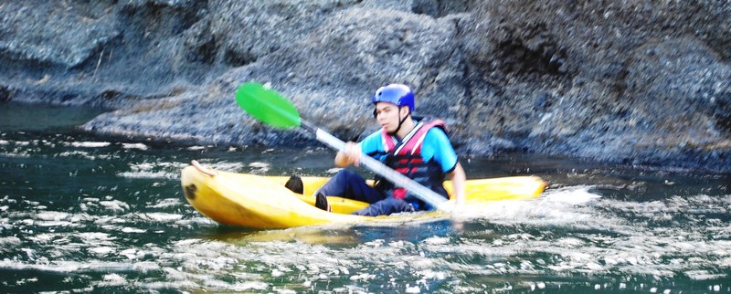
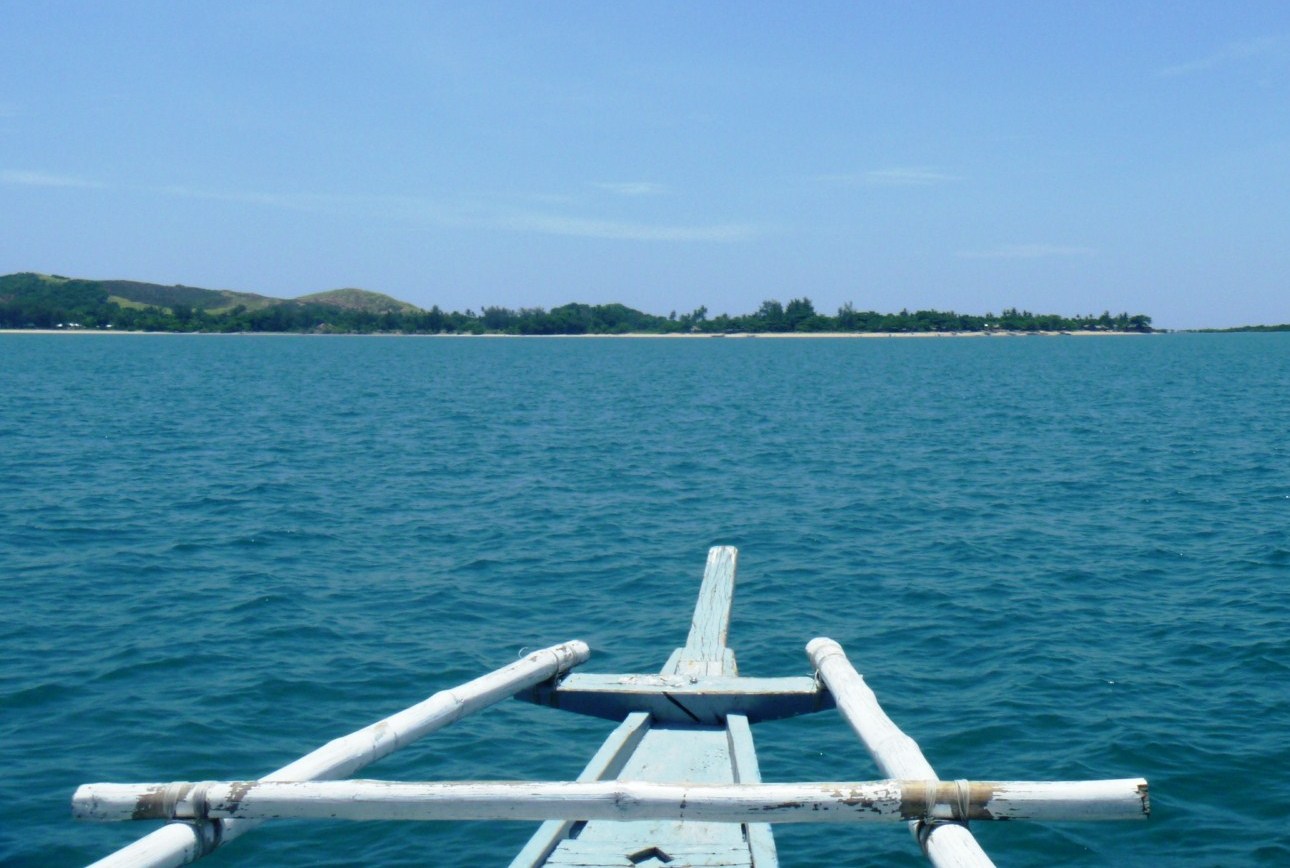
We woke up at 7 AM and, after breakfast at Anna Sophie Hostel, were all driven to the Culasi Municipal Hall where we made a courtesy call on Mayor Joel A. Lomugdang. From the municipal hall, we made the short drive to Culasi Blvd. where we boarded 3 motorized pumpboats that would take us on our day-long excursion to Malalison (also called Mararison) Island, the nearest of the town’s offshore islands (the others are Batbatan Island and Maniguin Island). Joining Jandy and I on the boat were Flord and Maricar.
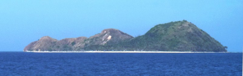
Malalison Island
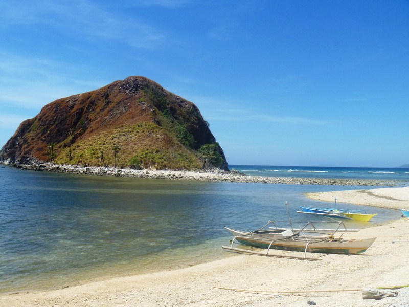
The 4-km. boat ride to this beautiful, 55-hectare, undeveloped, and hook-shaped island took just 20 mins.. On the island is one of the town’s three island barangays with about 700 inhabitants. We landed at the island’s white sand beach, in front of the shell of what used to be the multi-purpose hall, ruined when Typhoon Yolanda (international name: Haiyan) struck the island. Nearby is the island’s signature sandbar which stretches about 100 m. from the beach.
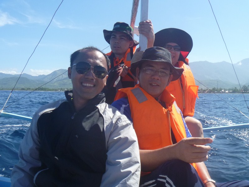
On our way to Malalison Island
As it was still very early for lunch, we decided to trek the raw and rugged beauty of the island, with its hilly and grassy prairie-like landscape (the island has been called the “Batanes of Antique”). Maricar and Clelia decided to just stay behind and swim the time away.
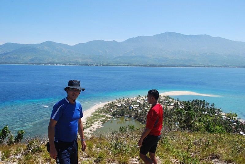
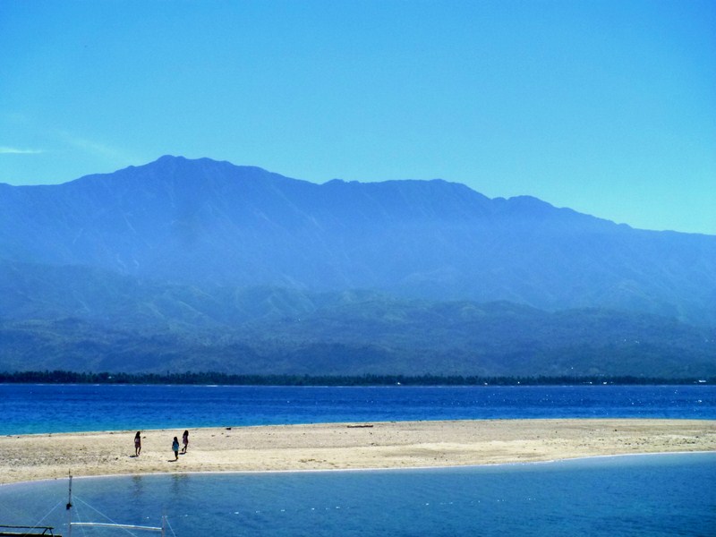
Bird’s eye view oof the fishing village, the sandbar and Mt. Madja-as
The initial trek was very tiring, as it was uphill and, as the terrain was mostly grassland, there were almost no trees to provide shade from the intense heat of the sun. However, the view from the top was spectacular, with the fishing village and its lagoon and sandbar below us and, across the deep blue sea, majestic Mt. Madja-as on the Antique mainland.
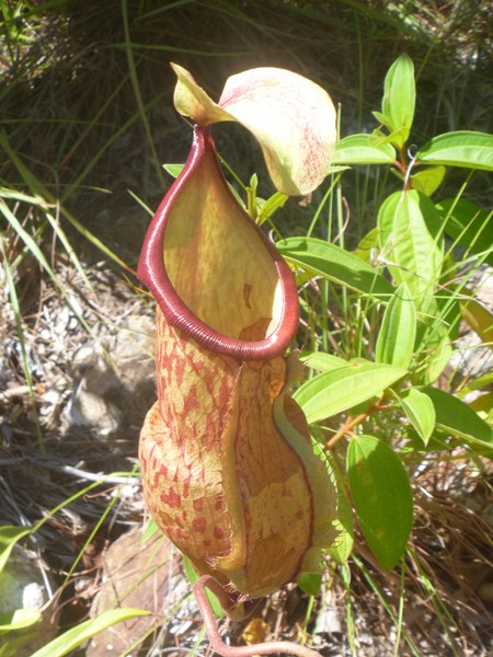
A carnivorous pitcher plant
As we trekked the island’s spine, we observed some of the island’s interesting flora including carnivorous pitcher plants. The downhill trek was not as tiring as the uphill trek but it was quite treacherous as the trail was very steep. At this point, we could espy the island’s white sand cove, Nablag Islet, the typhoon-damaged, roofless shell of the island’s elementary school, and a small grove of pine trees as well as mosquito-repelling eucalyptus and neem trees.
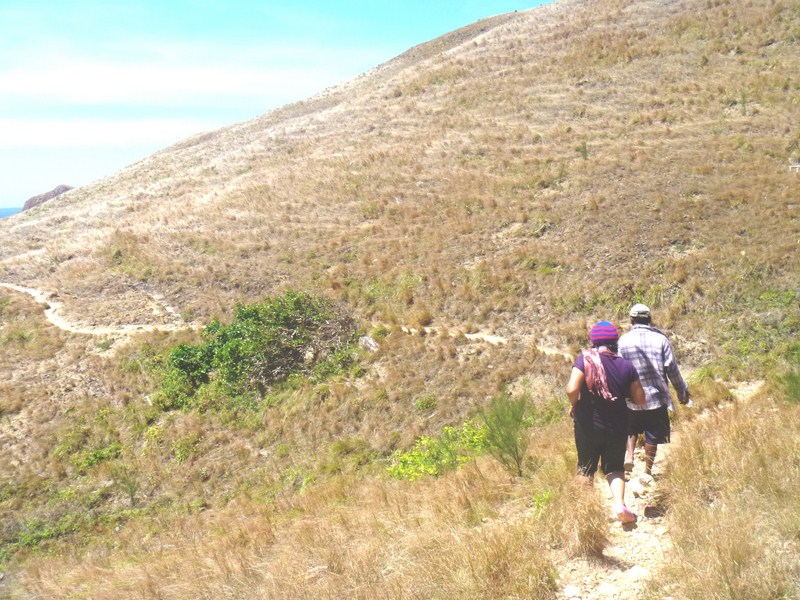
Trekking the Batanes-like landscape
Upon reaching the school, we rested for a while before proceeding on to the cove. Nablag Islet is just across the cove and we can cross it by foot, via a sandbar, as it was low tide, but we decided against it as it was almost noontime and we still had a long return trek ahead of us.
White sand cove and Nablag Islet
From the cove, we again went up a hill, where we again had magnificent views around the island, and down the rock shore where we found two 100-ft. long, sea-sculpted caves. Trekking here was also difficult as we had to traverse slippery and sharp boulders along cliffs and rock formations. Here, Regine slipped and drenched her camera. From this area, we were picked up (or should I say, rescued) by our boat which brought us back to the village.
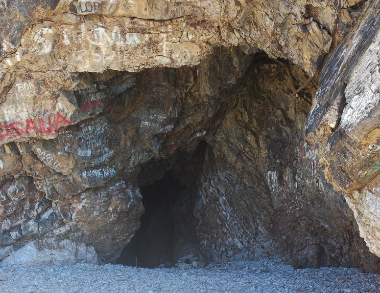
A sea-sculpted cave
At the village, a pumpboat soon arrived, bringing in our packed lunch as well as Mr. Jonathan Jurilla and Ms. Marie Joy R. Sumagaysay, both U.P. Visayas (Miag-ao, Iloilo) Asst. Professors, the latter present during the patadyong weaving demonstration at Bugasong. For the next three days, both were to join us for the rest of the tour.
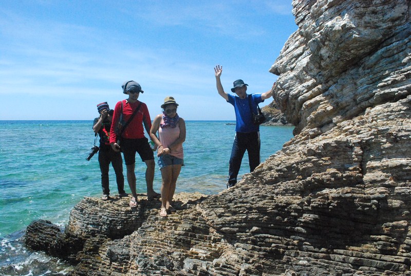
Traversing rock formations along the coast
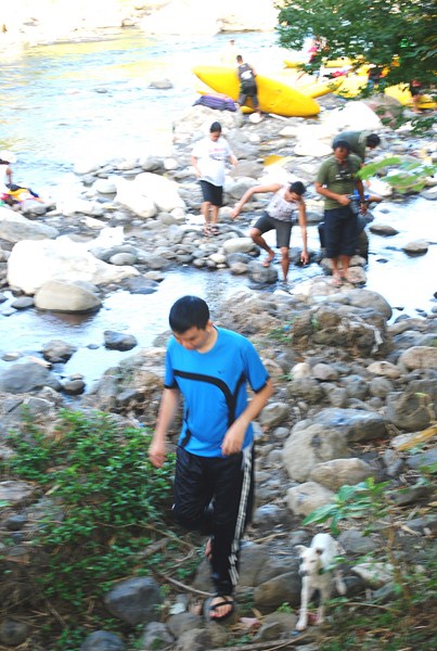
After lunch, Maricar, Regine, Leah, Clelia, Arjay and Marcos left on the boat back to Culasi. Eman, Laurie, Jandy and I decided, while waiting for the boat to return, to go swimming at the left side of sandbar while Flord, Rupert, Arthele, Laurie, Jonathan and Joy whiled the time away under the relaxing shade of a tree.
Mt. Madja-as with the island’s sandbar in foreground
Swimming here was great, as the shore along the sandbar was relatively shallow, the waters crystal clear and we again had the magnificent view of Mt. Madja-as as a backdrop, a scene that reminded me of Camiguin’s White Island and its backdrop of Mt. Hibok-Hibok. Our boat arrived arrived after an hour and a half and the rest of us left the island by 4 PM.
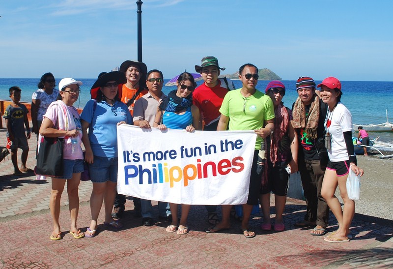
Our media group at Culasi Blvd.
.JPG)
.JPG)
.JPG)
.JPG)
.JPG)
.JPG)
.JPG)
.JPG)
.JPG)
.JPG)
.JPG)
.JPG)
.JPG)
+-+Copy.JPG)


.JPG)
.JPG)
.JPG)
.JPG)
.JPG)
.JPG)
.JPG)
.JPG)
.JPG)
+-+Copy.JPG)
.JPG)


