Takakkaw Falls (Field, British Columbia)

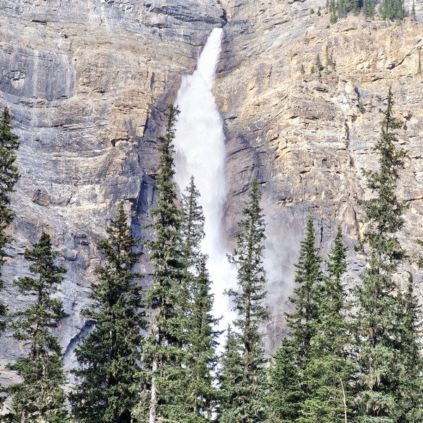
Takakkaw Falls seen from the parking lot

From Emerald Lake, it was a 33-km. (40-min. drive) to the impressive, horsetail type (a water feature where the descending water keeps close contact with the bedrock most of the way down, looking like a horse’s tail) Takakkaw Falls which features a picnic area, basic campsites on a first-come, first-served basis, and washrooms near the parking lot. 

Check out “Emerald Lake”
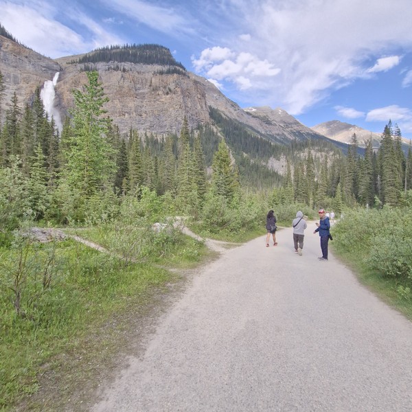
Beginning our hike….

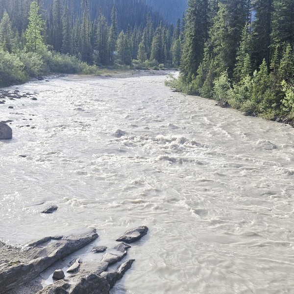
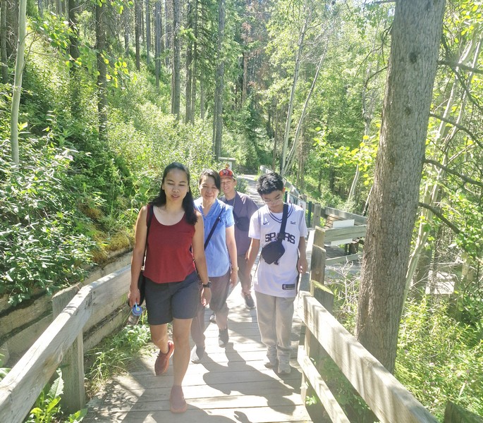
Upon arrival at the parking area and opening our car door, we can already hear the roar of the falls half a mile away. From the picnic area, it was a short, easy 750 m. hike to the base of the falls, crossing a pedestrian footbridge, over the milky, fast-flowing glacial runoff of the Yoho River, to get there.
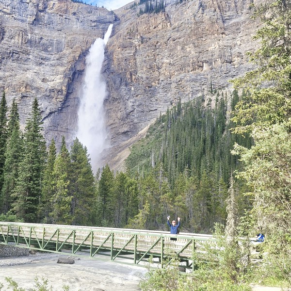
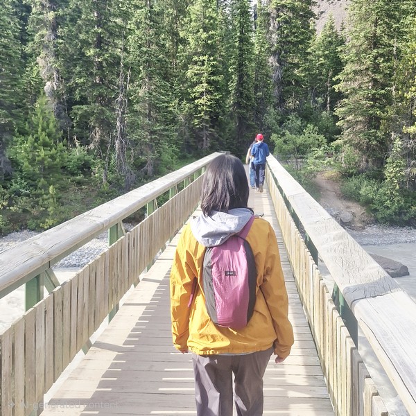
The pedestrian footbridge
Crossing the bridge

The falls created a strong, heavy and chilly mist that dropped the local air temperature significantly and quickly by 10 to 20 degrees near the base compared to the parking area. Even after donning our jackets, bonnets and gloves, we still felt the biting cold. 
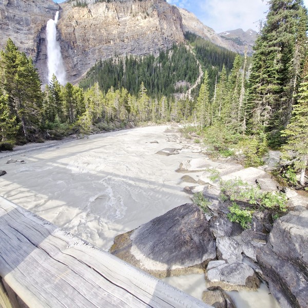
The milky-white Yoho River seen from the bridge
Another view of the Yoho River

The refreshing spray also got us wet (a raincoat or poncho would have been better) and the rocks and gravel near the water got very damp and slick. Occasionally, when the sunlight hit the fine mist at just the right angle (splitting the white light into a bright arc of colors), a rainbow would appear.
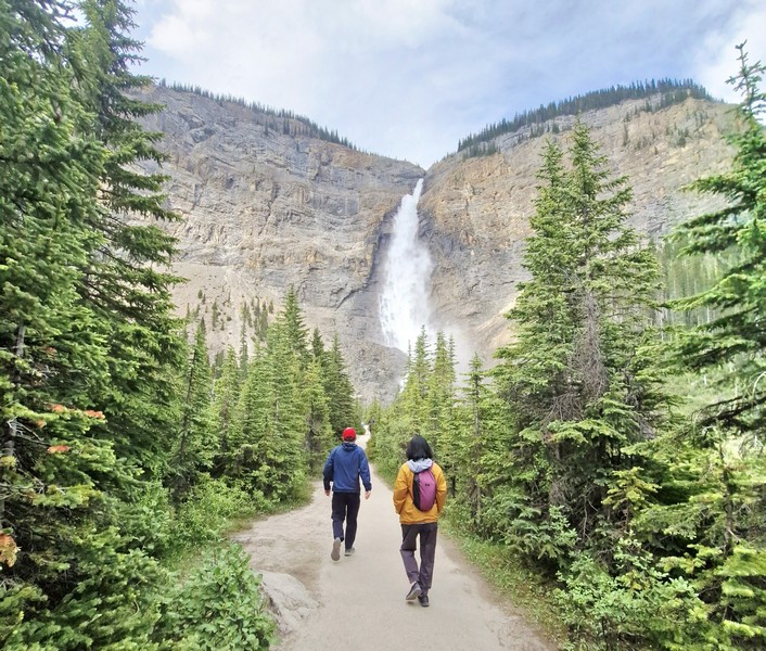
Nearing our destination…..

Takakkaw Falls (also spelled Takkakaw) is fed by the meltwater of the Daly Glacier, which is part of the Waputik Icefield, which keeps the volume of the falls up during the warm summer months.  It is a tourist attraction, particularly in late spring after the heavy snow melts, when the falls are at peak condition.
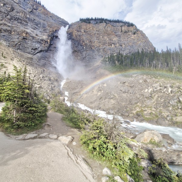
Takakkaw Falls with a rainbow beside it

The total vertical height of Takakkaw Falls has been placed, by various sources, at between 302 m. (991 ft.) and 373 m. (1,224 ft.). In 1985, a survey found that the main drop of the falls is 254 m. (833 ft) high, still making it one of the tallest waterfalls in Canada and easily one of the most dramatic. However, it is often mislabeled as the second tallest waterfall  in Canada (the World Waterfall Database lists about 55 higher waterfalls in Canada).
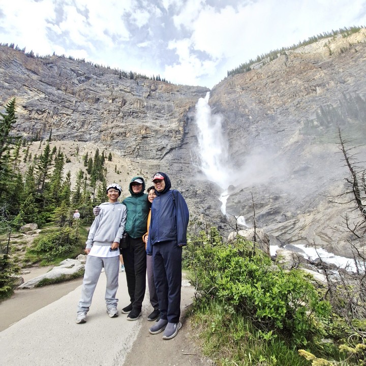
Kyle, the author, Grace and Jandy with the falls in the background

The fall’s name means “it is magnificent” in the Cree language and the name is apt. However, despite the name’s Cree origin, the indigenous Cree people didn’t give the falls this name nor did they historically inhabit this area. Rather, its name was suggested by Sir William Cornelius Van Horne, the head of the Canadian Pacific Railway, and officially adopted in 1904. However, Takakkaw Falls, as well as Yoho National Park, is located on the traditional and unceded territory of the Secwepemc (sah-wep-em) Nation who lived there since time immemorial.
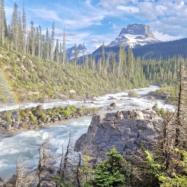
Additional alpine scenery…..

The falls serves as the main trailhead for several scenic alpine hikes, including the demanding but breathtaking Iceline Trail. If you followed the trails down the river below the waterfall, you would find a treasure trove of smaller falls with names as playful as their alpine settings.

Takakkaw Falls: Yoho National Park, Field, British Columbia.  Coordinates: 51°29′59″N 116°28′22″W. The best time to visit the falls is mid-to-late summer (July and August) when peak glacial melt creates a powerful, thundering cascade.

How to Get There: Takakkaw Falls is a 37-km. (30-min.) drive west of Lake Louise and 93 kms. from Banff. It is accessible via the steep, seasonal Yoho Valley Road (typically open mid-June to mid-October). The Yoho Valley Road branches off the Trans-Canada Highway near the village of Field, British Columbia. Due to steep switchbacks and tight curves, this 14 km road is closed to all vehicles over 7.6 m. (25 ft.).
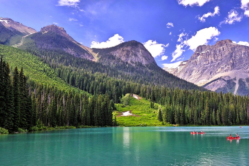
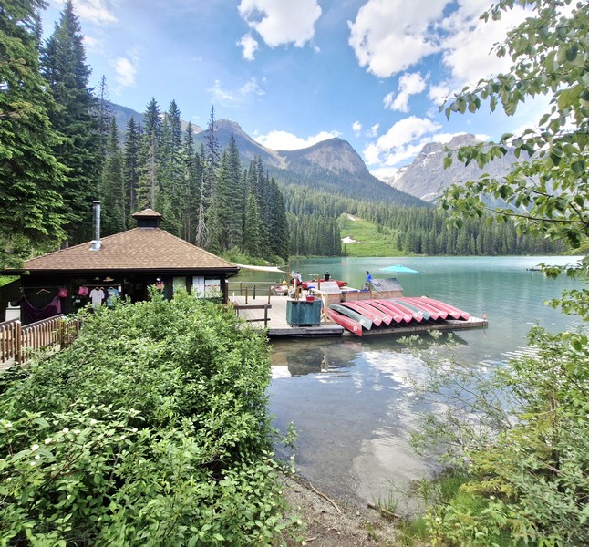
Emerald Lake (Field, British Columbia)

From The Caves National Historic Site of Canada, we headed 98 kms. (a 1.25-hr. drive) northwest, from Banff, Alberta, onto the Trans-Canada Highway (Highway 1), to reenter British Columbia at the town of Field, then turned right onto Emerald Lake Road, to stop by Emerald Lake, a freshwater lake in Yoho National Park, one of the four contiguous national parks in Canada’s Rocky Mountains, along the boundary of British Columbia and Alberta Provinces. The lake is the largest of the 61 lakes and ponds located inside the park.

Check out “The Caves National Historic Site of Canada”

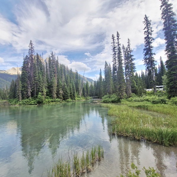
Emerald Lake

The first non-indigenous person to set sight on Emerald Lake was famed Canadian mountain guide Tom Wilson, who stumbled upon it by accident in 1882 when he was led lakeside while rounding up a string of his horses that had gone astray. He gave the lake its name because of its remarkable, vivid, turquoise green-colored waters due to glacial silt (rock flour), different rock type producing the powdered sediment that is suspended in the glacial water, reflecting the entrancing emerald green spectrum of sunlight rather than the blue spectrum seen in Moraine Lake, Hector Lake, Bow Lake and Peyto Lake in neighboring Banff National Park. Earlier that same year, Tom also discovered another lake which he had given the same name (which appeared briefly on the official map) but it was shortly renamed Lake Louise.

Check out “Lake Louise” “Peyto Lake” and “Lake Moraine”

This stunning glacial alpine lake, a scenic natural destination, is the most famous one of and the most admired locations in Yoho National Park.  The majestic mountains of the President Range, named after the President and Vice-President of the coast to coast Canadian Pacific Railway, add to the beautiful of this lake, as well.

Emerald Sports

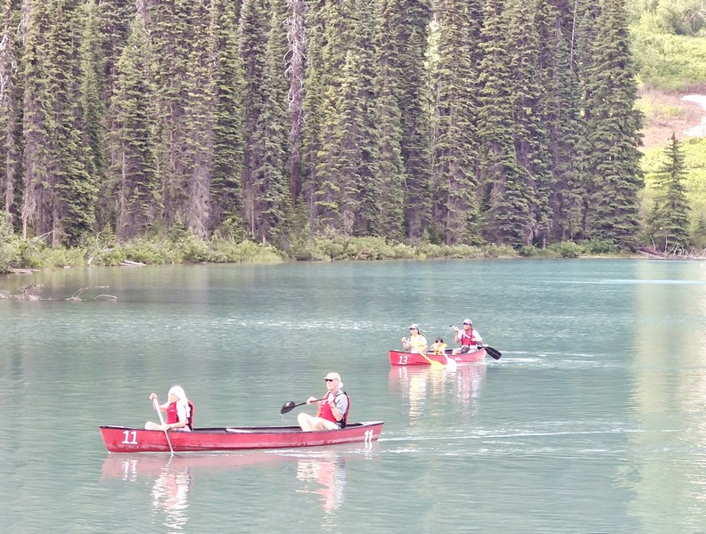
The lake has an unmatched diversity of both activities and landscapes suited to the enthusiastic traveler. Canoeing  and walking are favorite activities here and, during the summer months, fishing is also quite popular. Canoe ($.75 for 1 hour, with a max of 3 people in the canoe) and rowboat rentals are available Emerald Sports (also known as Emerald Sports & Gifts), as are cross-country skis and snowshoes in the winter.

Canoeing at the lake

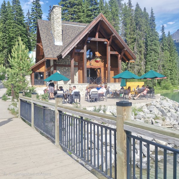
Swimming, though allowed and highly recommended for the experience, is not for the faint of heart as the water is cold due to it being fed by glaciers. The rustic Emerald Lake Lodge is a leisurely delight for those having lunch at Cilantro Café’s lakeside patio. The lodge also offers cabins overlooking the lake and mountains. Near the start of the trail loop are some picnic tables.

Emerald Lake Lodge

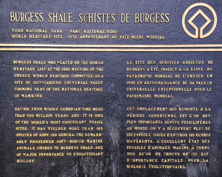
A 5.2-km. (3.2-mi.) flat loop, family-friendly trail circling the shoreline, taking about 1.5 to 2 hours to complete, is one of the least strenuous but most rewarding in the park. From the lake, you can view an incredible breadth of geological features including the world-famous Burgess Shale fossil beds, the Michael Glacier, and an avalanche slope carpeted by meadows, where moose often graze.  Other more advanced hiking trails go in different directions up into the mountains.

Burgess Shale plaque

The lake’s elevation of 1,200 m. (4,400 ft.) above sea level produces a unique selection of flora. Trees found here include western red cedar, western yew, western hemlock and western white pine.  At moist, shady enclaves, you can spot a variety of tiny, fragile wild orchids that survive only in finely balanced conditions. If you’re paying attention, you may be rewarded with a Yellow Lady Slipper, Spotted Orchid, or Calypso sighting.

As animals are drawn to this important water source, Emerald Lake is a fantastic place to see wildlife such as bald eagles, moose, and ospreys as well as waterfowl such as loons and mergansers. Grizzly bears and American black bears are fairly common. However, as many wild animals live in the area and are protected by park law, hunting is prohibited in the park. From November until late April or early May, the lake is frozen due to its 53-degree latitude and moderately high altitude.

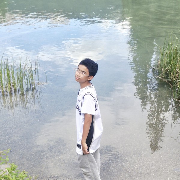
Kyle frolicking by the lake

Emerald Lake: 1 Emerald Lake Rd., Field, Yoho National Park, British Columbia V0A 1G0. Coordinates: 51.444°N 116.531°W.

How to Get There: Emerald Lake is a 50-km. (30-mi.) drive to the west of Golden, a 2.5-hr. drive from Calgary, a 28-km. (35-min.) drive from Lake Louise and 10 kms. (a 15-min.) drive west of the small railway village of Field, in Yoho National Park, near the highway exit to Emerald Lake, which has a park-operated visitor center.  A two-lane paved road, about 9 kms (6 mi.) long, connects the Trans-Canada Highway with Emerald Lake. Parking fills up fast in the summer, so it is best to arrive early in the morning.

Cave and Basin National Historic Site of Canada (Banff, Alberta)

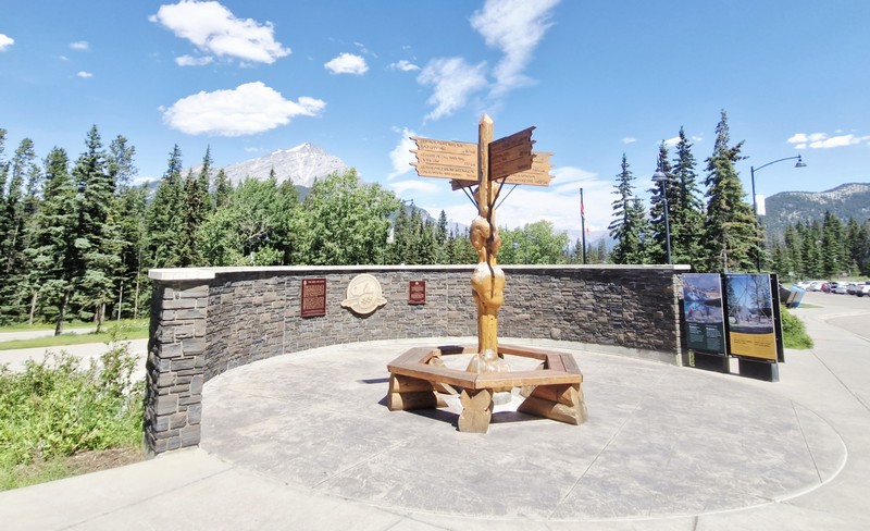
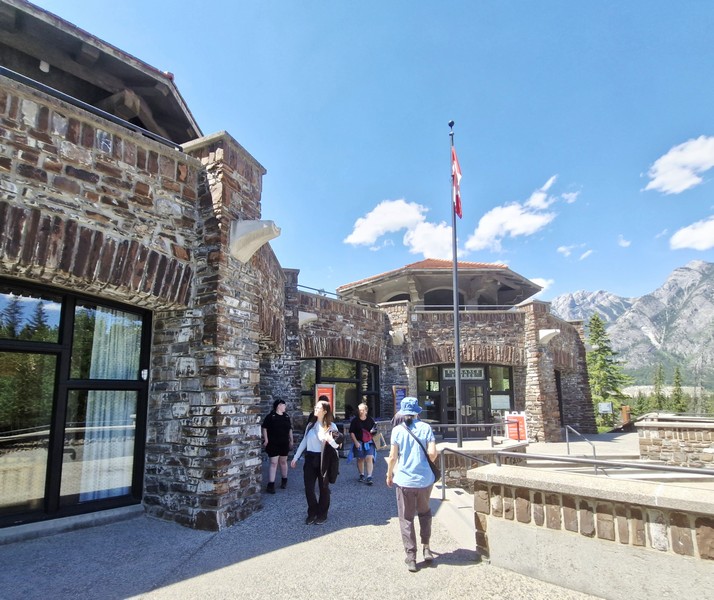
On our first whole day in Banff, we departed Douglas Fir Resorts & Chalets for the short 3.8-km. (10-min.) drive to The Cave and Basin National Historic Site of Canada, the first ever federally protected reserve in Canada and the birthplace of the country’s national park system (now, Canada has 37 national parks, 11 national park reserves, and 1004 national historic sites, 171 of which are administered by Parks Canada). As we arrived in July, well within between June 19 and September 7, 2026 (when Parks Canada waived all entry fees for visitors this summer), our entrance to the site was free.

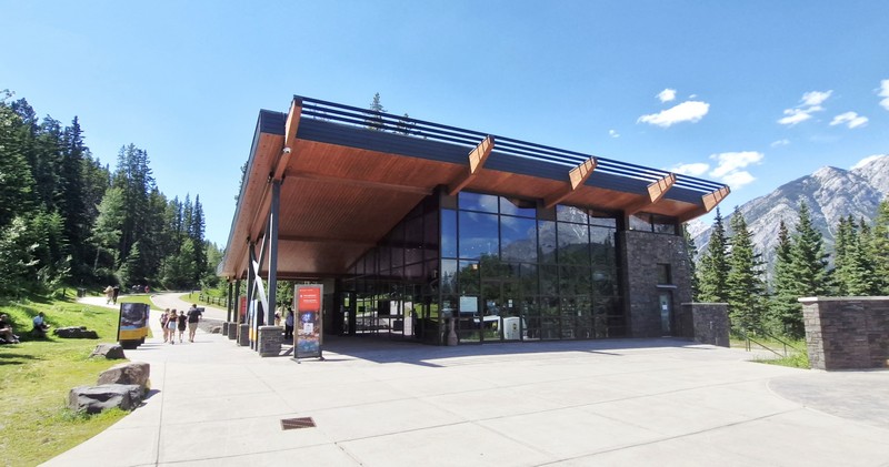
Cave and Basin National Historical Site

A special place for Indigenous Peoples for over ten thousand years (and continues to be so to this day), with important and longstanding cultural significance, it is a gathering place for sharing stories about conservation and the connection between people and the land. Together with Banff National Park, it is part of the traditional territories of the Blackfoot Confederacy, the Îyârhe Nakoda of the Chiniki, Bearspaw, and Goodstoney First Nations; the Tsuut’ina First Nation; and the Métis Nation of Alberta.

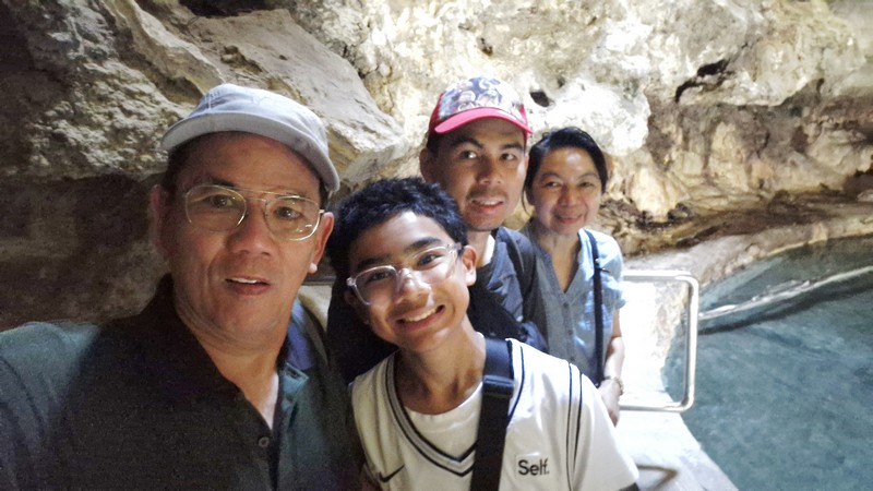
The author, Kyle, Jandy and Grace inside The Cave

Here’s the historical timeline of the site:

  • In 1859, the first written recorded reference to hot springs here was made by James Hector of the Palliser Expedition.
  • In 1875, Joe Healey happened upon the Cave and Basin site long after Indigenous Peoples.
  • In 1883, Frank McCabe and brothers Tom and William McCardell, three Canadian Pacific Railway workers, using a felled tree, descended through the skylight entrance into the cave and the thermal springs.
  • In 1884, they constructed a small cabin nearby with the intention of commercializing the Cave and Basin site. In those days, hot springs were extremely valuable since hot water was not readily available from a tap like it is today. The CPR workers knew this would attract people and wanted to monetize it. Conflicting claims by other parties prompted intervention by the Canadian government headed by John A. Macdonald.
  • In 1885, an order-in-council reserved 26 sq. kms. (10 sq. mi.) around the Cave and Basin, the Banff Hot Springs Reserve. This was the genesis of Canada’s national parks system.
  • In 1886, the Canadian government held an inquiry into the various private claims to settle on compensation. That same year, an artificial tunnel was driven into the Cave and Basin to aid visitation. Its construction, according to articles in the Calgary Herald at the time, was contentious even in 1887.
  • In 1887, a bathhouse, the first structure on the site, was built.
  • In 1904, a new, naturally-heated pool was built as the existing one proved inadequate by 1902,
  • In 1912, bottled water from the Cave and Basin site was sold for its alleged curative powers.
  • In 1914, a stone bathhouse, designed by architect Walter S. Painter, was completed and opened to the public. Many of the early structures were built by detainees held at a World War I Ukrainian Canadian internment camp located nearby. The camp had a significant Ukrainian contingent.  It continued to operate until 1994.
  • In 1924, western mosquitofish were introduced into the hot springs in an attempt to control mosquitos. Tropical fish illegally introduced into the lower springs by local aquarium enthusiasts may have contributed to the extinction of the Banff longnose dace.
  • In 1975, the pools were closed.
  • On November 13, 1981, the Cave and Basin was formally declared a National Historic Site.
  • In 1985, on the anniversary of the order-in-council that established the original reserve around the Cave and Basin, Canada’s national parks system celebrated its centennial. That same year, the pools were also restored.
  • On August 20, 1985, Prince Philip, Duke of Edinburgh and consort of the Queen of Canada, unveiled the National Historic Site plaque.
  • In 1992, the pools were permanently closed. An interpretive center now uses the structures.
  • In 2000, the Committee on the Status of Endangered Wildlife in Canada listed the Banff Springs snail as an endangered species. Cave and Basin hot springs are also notable as the habitat for this snail.
  • In the summer of 2010, First Nations ceremonies and rituals began again in the Cave and Basin. (the Stoney people stopped coming to the Cave once Canadian Pacific Railway workers and settlers arrived in Banff).
  • On September 13, 2013, a permanent exhibit about Canada’s first national internment operations was opened at the Cave and Basin site (it was postponed three months by extensive flooding across southern Alberta), with an address by Jason Kenney, Minister of Employment and Social Development and Minister for Multiculturalism
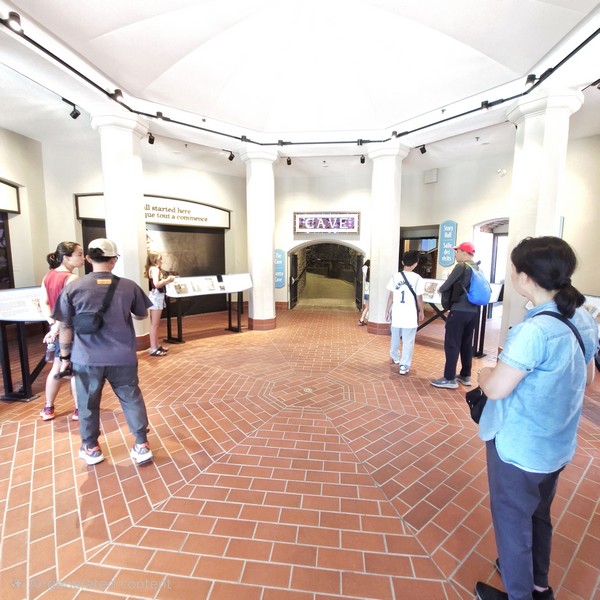
Rotunda

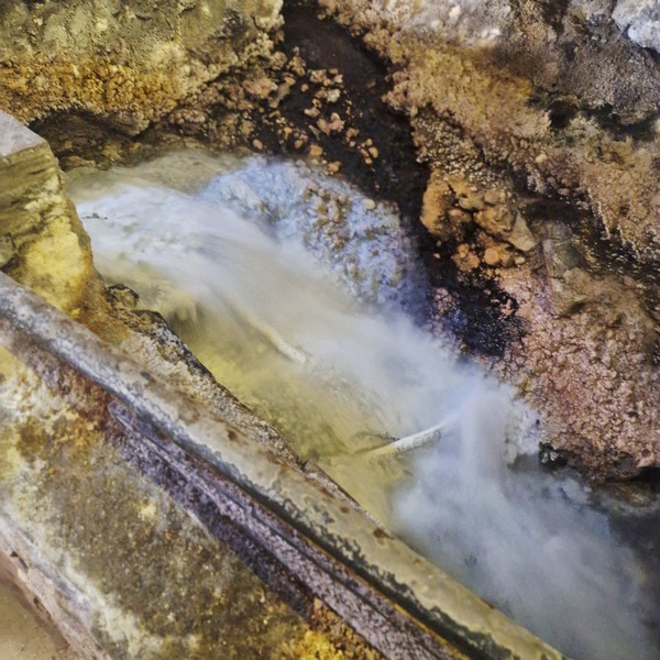
Located within the Canadian Rocky Mountains, at the site of natural thermal mineral springs around which Canada’s first national park, Banff National Park, was established, it is the lowest component of nine sulphurous hot springs clustered, in three groups on the northeast flank of Sulphur Mountain, all located along the Sulphur Mountain Thrust Fault below Devonian limestones.

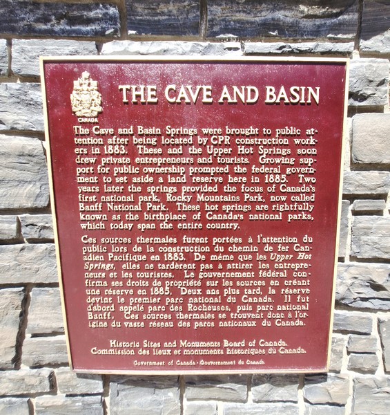
National Historic Site bronze plaque

The mineral spring issues from Sulphur Mountain where surface water penetrates the rock, absorbing minerals and being heated, by geothermal energy, from an estimated depth of 3 kms., to emerge in a cave and in a nearby basin before joining the Bow River drainage system below.

Main Building

At the entrance is a rotunda with interpretative panels commemorating the historic 1883 discovery by railway workers plus the official National Historic Site bronze plaque, unveiled by Prince Philip, Duke of Edinburgh on August 20, 1984, designating the thermal springs as the birthplace of Canada’s national parks system. 

Cave Story Hall

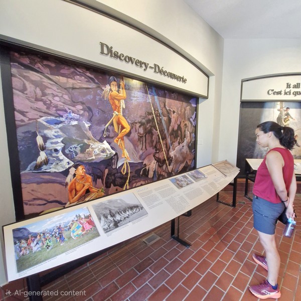
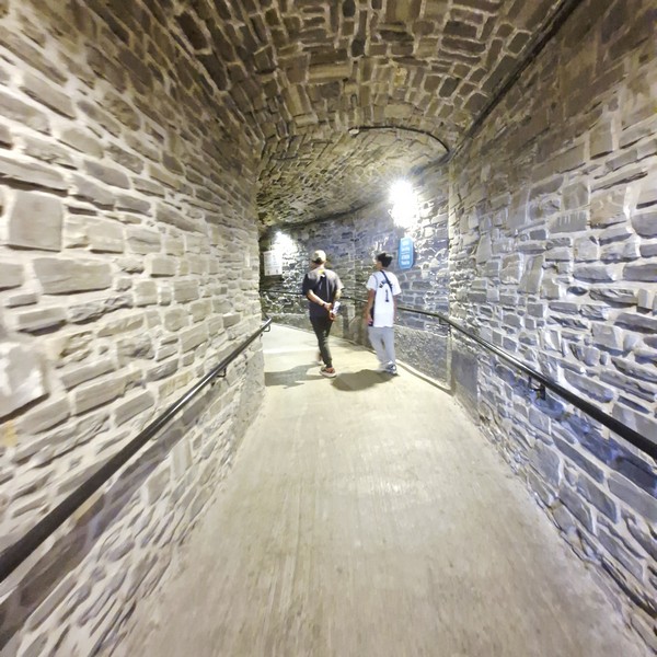
Near the entrance, at the south belvedere of the main building, is a narrow artificial tunnel leading to The Cave, a dimly-lit natural grotto and hot spring.  The tunnel ceiling was low in some places, so I had to mind my head. Before entering the cave, we took time to read the education displays and panels at Cave Story Hall to have a deeper understanding of the impact and significance of what we are seeing when we enter The Cave. 

The oil-based mural of Roland Rollinmud at Cave Story Hall

Near the entranceway and and tunnel of the hall is a remarkable oil-based mural, created by artist Roland Rollinmud (an elder from Stoney Nakoda Nation) and presented to Parks Canada in 2011, depicting Indigenous elders climbing down into the cave through the vent hole on rawhide ladders

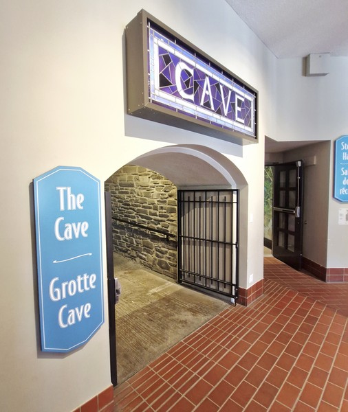
Entrance to The Cave

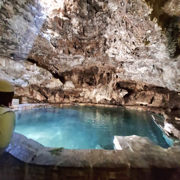
This large hollowed-out cavern, with a steaming mineral pool below, is the only cave large enough to comfortably accommodate groups of people.  A small vent hole, in the rock ceiling, acts as a natural skylight, letting in enough sunlight to reflect off the pool and glisten on the smooth red and white flowstone layers running down the cave walls. You’ll also find stalactites and stalagmites, glacial till and a small trickling waterfall.

The tunnel leading to The Cave

A single elevated platform overlooks the water. There are stanchions in place to make it abundantly clear you enter along the righthand side of the hall in a line that terminates at the platform. After your time on the platform, you exit via the left-hand side of the tunnel. Relatively small, the cave has a single opening at the top that lets in natural light.

The Cave
The source of the spring

Immediately following its “discovery,” almost all of the delicate cave formations had been stripped out thinking it would improve the accessibility and aesthetic. Steam continually rose from the geothermally heated waters, and the earthy mineral scent of hydrogen sulfide filled the air, which kind of makes you second guess wanting to jump in. While the rotten egg smell never goes away, it does become tolerable. 

The original bathhouse now the Interpretive Centre and Museum

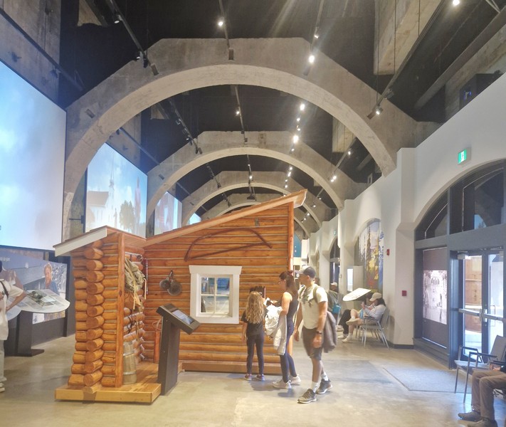
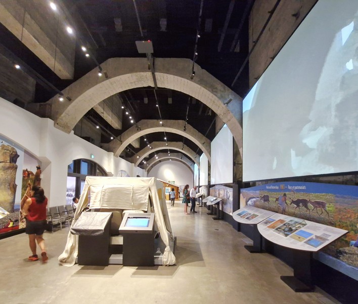
The former original 1887 bathhouse and restored 1916 interior public swimming pool complex for nearly 100 years, built with Classical Revival details, has now been renovated into an Interpretive Centre and Museum. Visitors here can enjoy interactive and interpretive media exhibits, detailing the 1883 discovery of the thermal hot springs by railway workers, and short films that takes you through a journey of Canada’s National Parks, and heritage of thermal waters.

The Basin

On top of the main building are the covered Belvedere Viewing Decks, overlooking the historic site, that offer panoramic views of the surrounding Canadian Rocky Mountains, marshland and mountain ridges.

View of the Canadian Rocky Mountains from the view deck

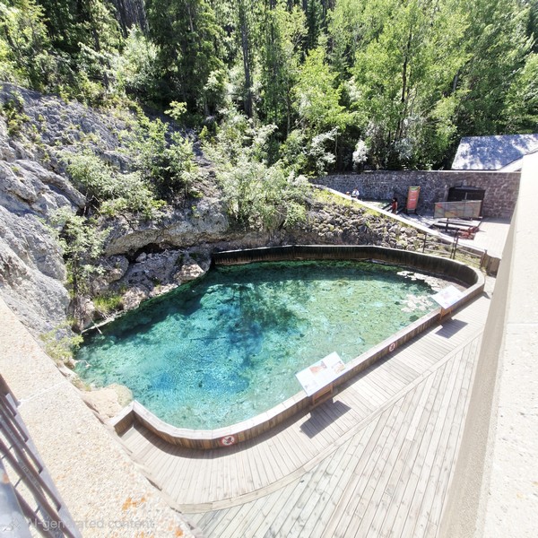
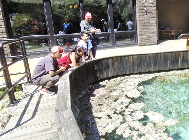
Outside the old pool complex, adjacent to The Cave, is The Basin (a pool of mineral water), the natural springs which flow into the Cave and Basin. It has been rewilded as close to its original state as possible and is now protected. A helpful ranger explained more about the animals that call these thermal pools home. They include tiny fish that have been introduced to these thermal waters (mosquito fish, jewelfish and sailfin molly), damselfly (Argia vivida) larvae that were in among the algae and, if you look closely, you’ll catch a glimpse of the endangered Banff Springs Snail (Physella johnsoni) in the pools.

Bryan, Cheska, Kyle and Jandy searching for Banff Spring Snails among the algae.

These tiny snails that are only found in the Upper Hot, Kidney, Middle, Cave, Basin and Vermilion Lake Springs in this area. All of the thermal pools, except the Banff Upper Hot Springs, a separate facility some 5 kms. (3 mi.) southeast of the Cave and Basin, have been closed off to humans in order to preserve this limited habitat.

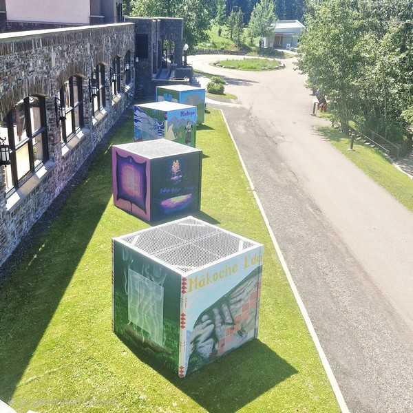
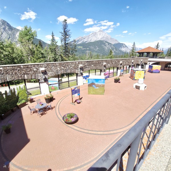
8×8 ft. murals painted on outdoor display boxes
Murals displayed within the building

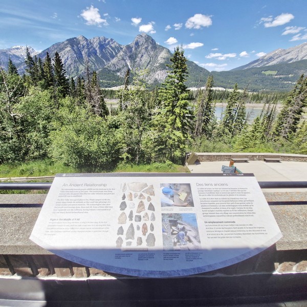
Located around the parking lot and historic bathing pavilion are large 8×8 ft. murals, painted on outdoor display boxes, which were placed during the spring-to-fall visitor season and can be viewed during regular site hours. These rotating large-scale outdoor mural projects were created by indigenous artists, in collaboration with the Whyte Museum of the Canadian Rockies.

Cheska, Grace, Bryan and Kyle at the Discovery Boardwalk

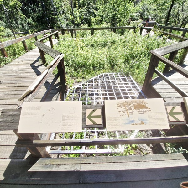
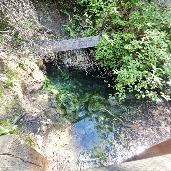
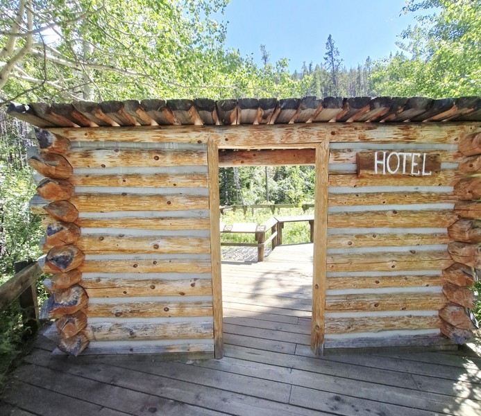
Within the complex are the Discovery Boardwalks that lead you up the hill and through unique marshes created by the natural springs. Along the walk, you’ll encounter the original surface vent hole and, next to it, are vestiges of the log shanty, built between 1883 and 1885, known as ”the Hotel,” so they could stay close and protect it from other prospectors. 

The original vent hole

There are also few other smaller hot pools with bright blue-green waters and filled with pink bacteria and algae.

One of the smaller thermal pools

The boardwalks also feature educational signage, upper views of the Cave and Basin complex, and stunning, sweeping mountain and valley vistas of the Canadian Rocky Mountains. For those with stamina, you can hike along the 7.4-km. round trip Sundance Trail and the 2.7-km. Marsh Loop.

The Hotel

Cave and Basin National Historic Site of Canada: 311 Cave Ave., Banff, Alberta T1L 1K2.  Tel:+1-403-762-1566.  E-mail: caveandbasin@pc.gc.ca.  Admission: $9.00 (adults), $7.50 (seniors) and free for children. Free admission on Canada Day. Open daily, from May 15 to October 15, 9:30 AM to 5 PM. Closed: September 21 to 24, 2026. Coordinates:

How to Get There: It is located about 2 kms. and a 30-min. walk from the town center. Once you cross the bridge, look for the dedicated walking trail. The Cave and Basin Trail will take you all the way there. From Banff, head south on Banff Avenue (the main street through Banff), over the Bow River Bridge to a T-intersection, and then turn right on Cave Avenue and follow the signs. The Cave and Basin parking lot is located at the end of this road. By bus, Roam bus route #4 will take you to the Cave and Basin.

Miners Memorial Park (Drumheller, Alberta)

Miners Memorial Park

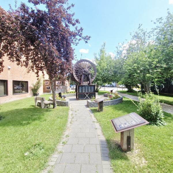
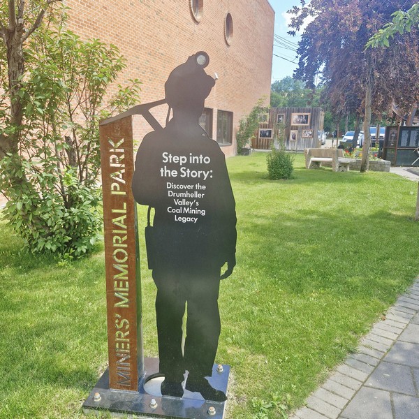
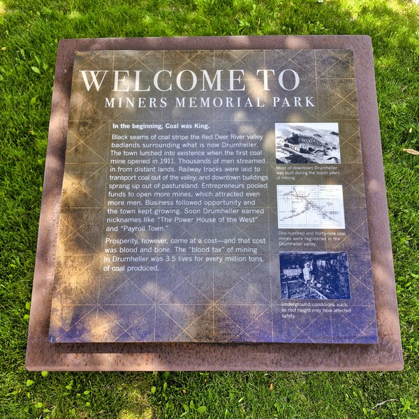
Miners Memorial Park, a small, quiet parkette in downtown Drumheller, honors the region’s rich coal mining history and the miners who “mined the black” in the local Coal Valley. Unveiled on November 10, 2012 by MP Kevin A. Sorenson, and Mayor Terry Yemen (with Bob Moffatt, representing miners, and Randall Myers, representing families who lost loved ones), it commemorates the opening of Newcastle Mine, the first coal mine in Drumheller, in 1911.   In 2025, a new silhouette entrance sign depicting a miner with a headlamp, created by Fred Makowecki of ImageCrafter Signs, was unveiled at the park.

The silhouette entrance sign depicting a miner with a headlamp

A project of the Atlas Coal Mine Historical Society, community members and numerous volunteers, supported by the Building Communities Through Art and Heritage Program, Department of Canadian Heritage, the park grounds features historical information boards detailing the area’s past.

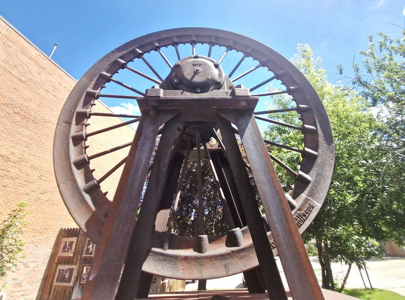
The iron sheave wheel from Atlas Coal Mine #4

The central steel and granite monument, designed by Ontario-based artist James Smith, includes a headframe iron sheave wheel (a large pulley wheel used in mine hoist systems), sourced from the historic Atlas Coal Mine #4 (the last coal mine to close in Coal Valley), that was part of the hoisting system that, in 1979, hauled the last load of Drumheller coal to the surface.

One of a number of historical information boards detailing the area’s past

In 1962, using this same hoisting system, two brothers John and Robert “Babe” Myers were killed when their exit elevator malfunctioned and the brakes did not hold. The 12-ton counterweight hurled to the ground, the cage smashed into the hoist structure then plummeted 400 ft. to the bottom of the shaft instantly killing the two brothers.

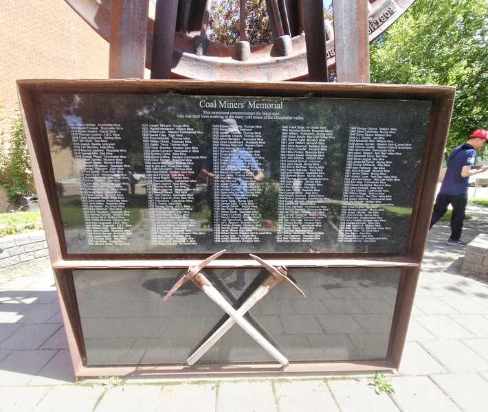
The base with a list of the 207 miners killed. Below it is a pair of crossed pickaxes

The base of the monument features a base with a list, laser-etched in black granite, of the names, year of death and the mine locations of the 207 miners killed in Drumheller‘s mines between 1911 and 1980.  Below it is a pair of crossed pickaxes.

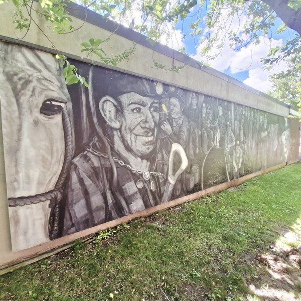
The original mural of the late artist and former miner Marcel Deschenes

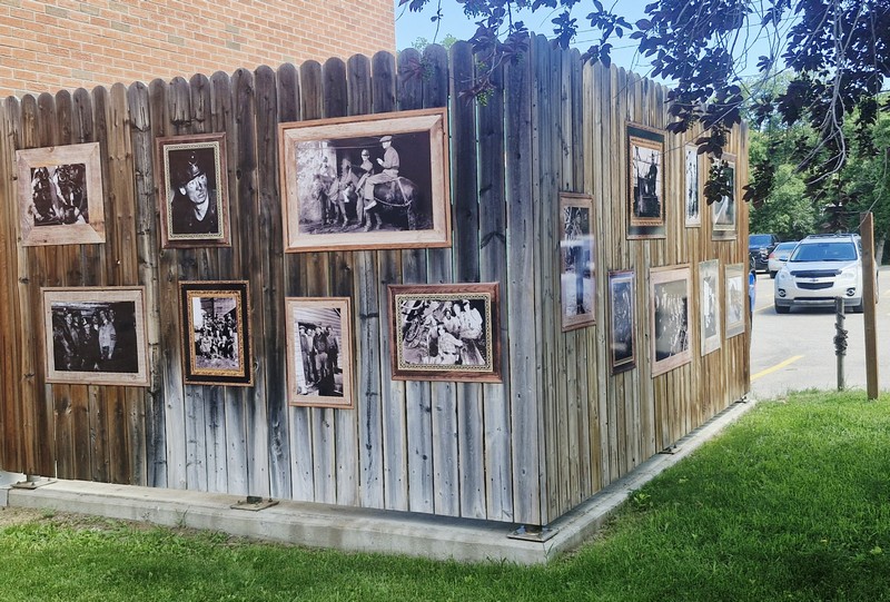
Alongside the monument is a mural, depicting the Coal Valley’s mining heritage, done by artist (a graduate of the Alberta College of Art, now a university) and former miner Marcel Deschenes who lived in East Coulee and passed away in November 2018 at the age of 71.  Black-and-white photos of the fallen miners as well as photos depicting life during the mining years are also mounted on wooden fence picket walls.

Photos mounted on wooden fence picket wall

Miners Memorial Park: 236 Centre St., Drumheller, Alberta T0J 3R0.

How to Get There: The memorial park is located near the Drumheller Municipal Building, as well as near the Drumheller Fire Station.

Badlands Interpretive Trail (Drumheller, Alberta)

Badlands

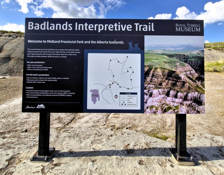
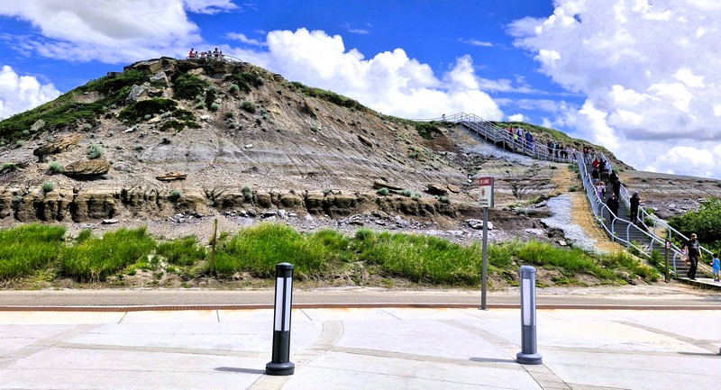
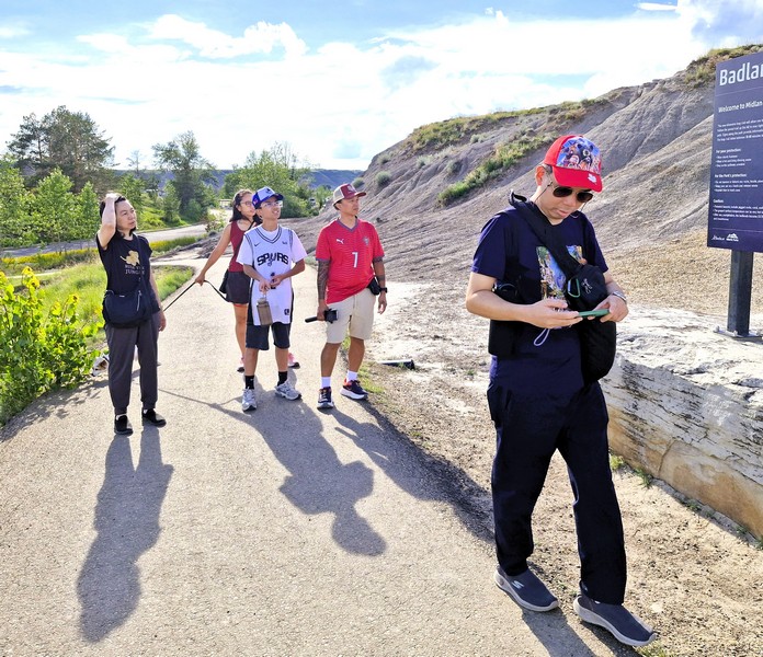
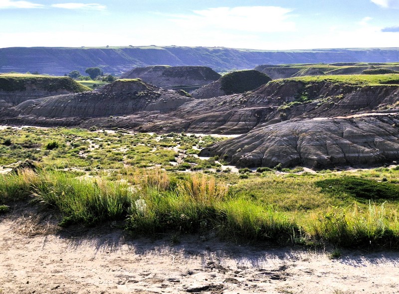
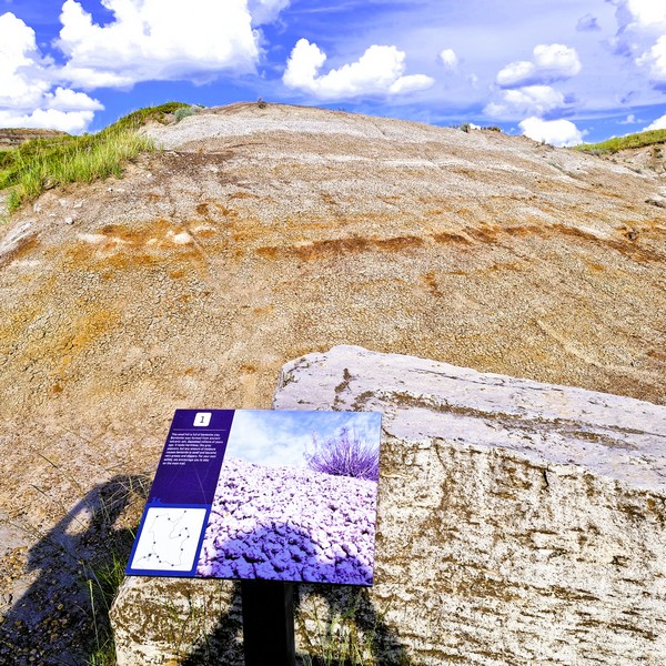
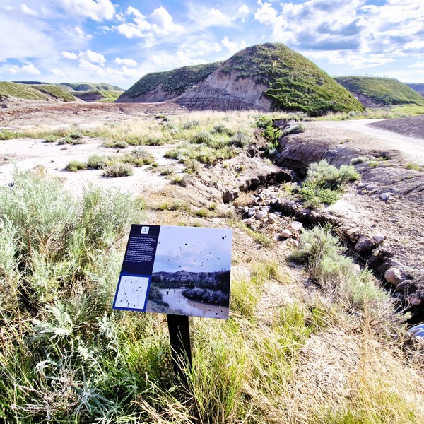
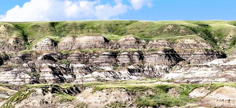
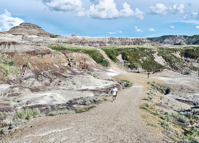
After our tour of the Royal Tyrrell Museum of Paleontology, we tried out the Badlands Interpretive Trail, a 1.4 to 1.6-km. (0.87 mi.) easy loop hiking trail, with about 27 m. (88 ft.) elevation gain, which is used extensively by the museum public and school programs. A trailhead, a few hundred meters east of the museum, marks a 1-km. long loop, where numbered interpretive signs recount the glacial forces that sculpted the badlands from 70-million year-old layers of sedimentary rock.

Check out “Royal Tyrrell Museum of Paleontology”

The Badlands Interpretive Trail

Visitors can enjoy a self-guided tour through the trail, which is a popular destination for those interested in geology, paleontology, and natural history and suitable for all ages, offering stunning views of the surrounding badlands.

The elevated viewing platform

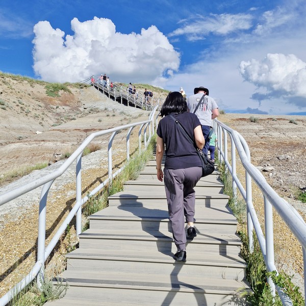
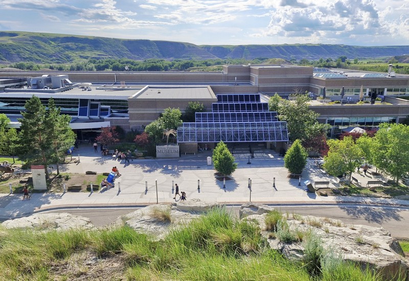
This trail, featuring two stairs, elevated viewing platforms (not fully wheelchair-accessible), and informative signs explaining local fossil history, plants and landscape creation, is part of the Canadian Badlands, an area known for its striking landscapes, including hoodoos, canyons, and coulees. We climbed up the elevated viewing platform just across the museum. Here we had panoramic bird’s eye views of the museum and the eroded valley.

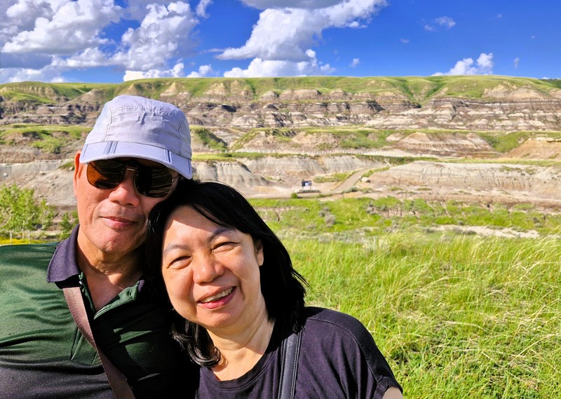
The author and Grace at the elevated viewing platform
The Royal Tyrell Museum of Paleontology seen from the elevated viewing platform

Taking visitors through Midland Provincial Park and connecting to the Trans Canada Trail, the Badlands Interpretive Trail offer us a chance to explore the unique geological formations and rich paleontological history of the Drumheller region.

Grace, Kyle, Cheska, Bryan and Jandy begin their hike…..

One or two kilometers east of this path is another self-guided tour through the remains of the Midland.  After descending the elevated viewing deck, we began our hike on the east side of the Royal Tyrrell Museum of Paleontology parking lot, staying on the marked golden gravel and paved paths to protect the fragile badlands ecosystem. 

Benches, covered with grasses, are formed when sandstone layers are iron-rich, making them resistant to erosion
Small hill full of bentonite clay formed from ancient volcanic ash. Though seemingly harmless, any amount of moisture causes bentonite to swell and become very greasy and slippery.

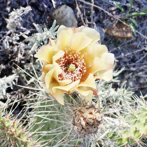
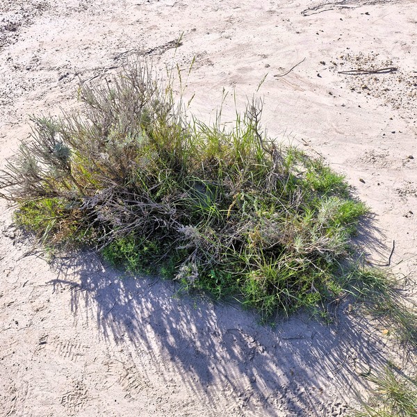
As it was summer, it was the perfect time to look for tough plants that survive despite the hot, dry, and windy desert-like badlands conditions.  They include flowering prickly pear cactuses (which have special stems with thick, waxy skin to trap water and sharp thorns for safety), sage (with strong aromatic leaves, it thrives in dry soil), scarlet mallow (produces bright, hardy flowers during summer months) and small populations of harebell and wild rose which bloom in sheltered or slightly cooler spots.

Prickly Pear Cactus
Sage (Artemisia)

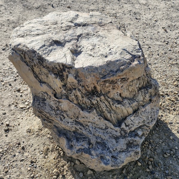
We also encountered a boulder-size fossil of an ancient giant redwood (Sequoiadendron), dating back roughly 72 million years to the Late Cretaceous period, that has been petrified and remains exposed by erosion.  The fossil, existing long before the region eroded into today’s semi-arid badlands landscape, proves the local badlands area once had a warm, moist, subtropical climate comparable to modern-day Florida.

A fossilized tree stump
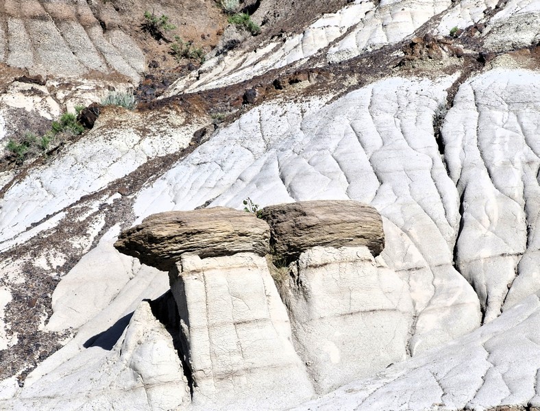
Hoodoos are delicate 5 to 7-m.tall sandstone spires capped with dense rock created by millions of years of wind, water, and frost erosion shaping soft sandstone and shale

If you want a longer walk, the path links up with other trails in the Midland Provincial Park and the wider local river park system. The trail provides educational signage that explains the area’s geology, ecology, and the significance of the dinosaur fossils found in the region.

This channel becomes a rushing, brown-colored torrent during heavy rains, eroding sediment off exposed bedrock surfaces and is ultimately carried away by the Red Deer River
Small metamorphic rock boulders which, unlike the surrounding landscape, do not have their origins in the Late Cretaceous but were carried southwestward, into this area, from the Canadian Shield by the glaciers of the Late Ice Age.

Badlands Interpretive Trail: at 1500 North Dinosaur Trail, Midland Provincial Park, Drumheller, Alberta. Admission is free.

How to Get There: the trail is located northeast and right next to the Royal Tyrrell Museum.

Arashiyama Bamboo Forest (Kyoto, Japan)

Arashiyama Bamboo Forest

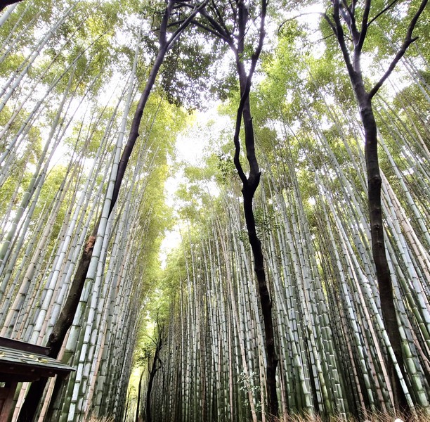
On our last full day in Japan, we were to do a whole day tour Kyoto. Our first destination was the stunning Arashiyama Bamboo Forest which was 61.6-km. (over an hour’s drive) from our hotel. Also called the Sangano Bamboo Grove, is a 16 sq. km. (6.2 sq. mi.), natural bamboo forest  consisting mostly of mōsō bamboo (Phyllostachys edulis).

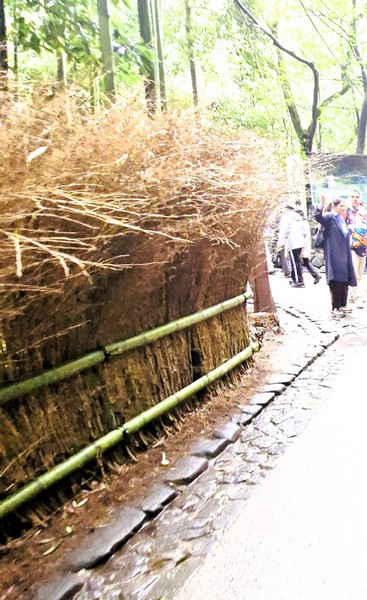
Brushwood fencing (koshibagaki)

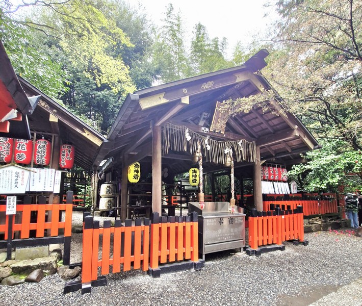
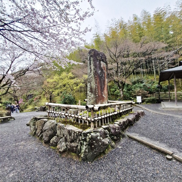
Upon arrival, we made stops at the small Nonomiya Shrine and the Sogenchi Garden of the famous Tenryū-ji Temple. Brushwood fencing (koshibagaki), made from spicebush, are found along the paths through the bamboo forest.

Check out “Nonomiya Shrine” and “Sogenchi Garden”

Nonomiya Shrine

The towering bamboo forest is an almost shocking contrast to the urbanity surrounding it. Growing tall on the edges of Kyoto, the Arashiyama Bamboo Forest, a once tranquil nature spot, is now a series of tourist-packed wooden pathways that weave through the dense thicket of tall bamboo stalks that reach dozens of feet into the sky, creating a canopy.

Sogenchi Garden in Tenryu-ji Temple

However, if you can escape the sounds of camera shutters and boorish visitors, you can still hear the rustling of the leaves; bending, creaking, and swaying of the wood and trunks knocking together as the wind passes through the tightly packed plants, creating a peaceful sound like almost nothing else.

If you can find a time to visit the bamboo forest, when it is relatively empty, the combination of visual beauty and auditory calm can be one of a kind. There is no word, however, on how the place smells.

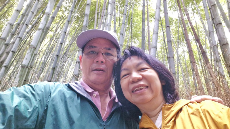
The author and Grace

When the hordes of tourists aren’t drowning it out, the meditative natural noise is so lovely. In fact, Japan’s Ministry of the Environment has designated the location’s aural pleasures as one of the country’s governmentally-recognized “100 Soundscapes  of Japan,” an initiative designed to encourage the local population to get out and appreciate the country’s acoustic wonders.

Adashino Nenbutsu-ji Temple

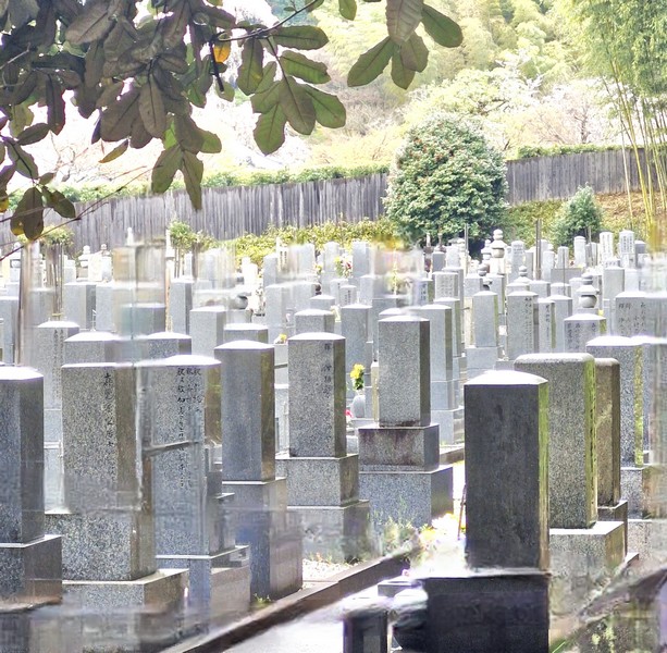
Along the way, we also passed by the Adashino Nenbutsu-ji Temple, a historic burial ground featuring over 8,000 stone statues (rakan) and monuments, representing forgotten or lost souls, surrounded by a peaceful, less crowded bamboo forest. 

Sagano Scenic Railway

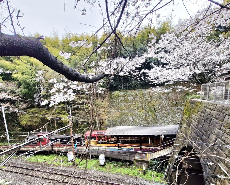
At the end of the forest, we also came across the stunning station of the Sagano Scenic Railway (also dubbed the “Sagano Romantic Train”), a retro-style steam train, with open-air carriages, which takes passengers on a 7.3-km./25-min. journey along the scenic Huzu River Gorge.  

Jinrikisha (Japanese Rickshaw)

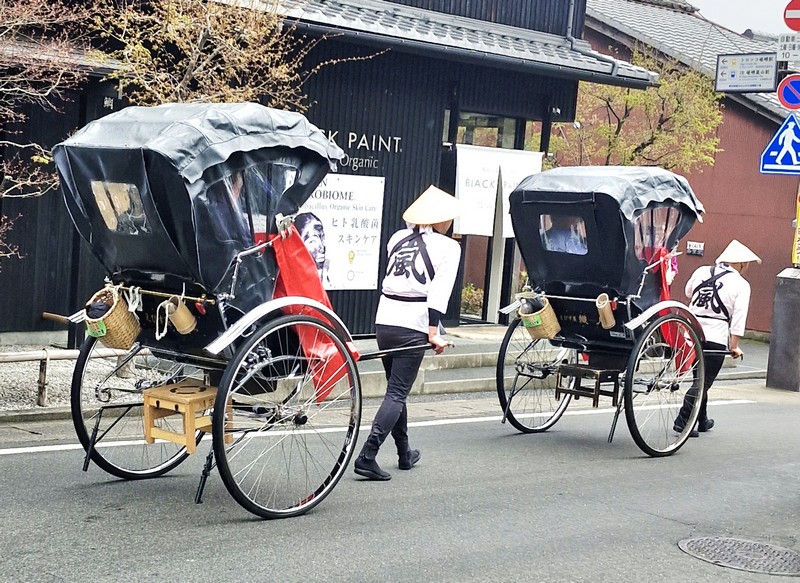
Along exclusive, quieter pathways (closed to general pedestrians), we saw passengers on board jinrikishas (Japanese rickshaws) pulled by personal guides, a luxurious, crowd-dodging alternative to walking.

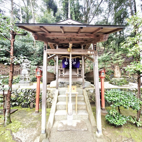
North of Arashiyama is the quirky, small but serene Mikami-jinja Shrine, a highly specialized landmark tucked away near the Sagano area. Built in 1961 by a Kyoto barber, it is the only shrine in Japan dedicated specifically to hair styling, beauty (cosmetics, hair washes, hair growth products, wigs, etc.) and hair health. It is dedicated to Fujiwara Uneme no Suke Masayuki, a historical Kamakura-period (1192 – 1333) hairdresser credited as the founder of the barbering profession in Japan. Their ema (wooden votive tablets) and charms are designed in the shape of a comb.

Mikami Shrine

A highly popular stop for those in the beauty industry or anyone seeking remedies for hair loss and damage, visitors here can opt to have a small lock of hair cut by a priest and offered in a special bag at the shrine’s “hair mound” to pray for hair health. In front of the shrine is Ogura Pond which is famous for its lotus flowers.

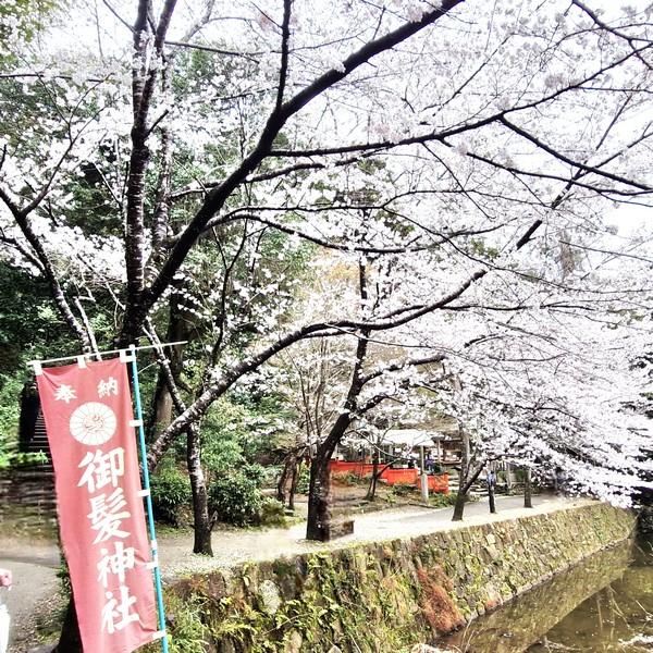
Cherry blossoms in bloom along the Ogura-ike Pond

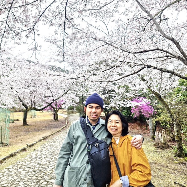
We got a welcome respite from the crowds of the nearby Bamboo Forest by making a left at the T-junction at the top of the hill and soon find ourselves at Kamayama-keon Park. As we arrived during the sakura (cherry blossom) period (late March and early April), the trees were in full bloom. Too bad we couldn’t make our way uphill and to the west as we could’ve seen some fine views down to the Hozu-gawa River and across Kyoto. Troops of wild monkeys are said to occasionally patrol the park.

Kamayama-keon Park

Arashiyama Bamboo Forest: Sagaogurayama Tabuchiyamacho, Ukyo Ward, Arashiyama District, Kyoto, 616-8394 Japan. Tel: +81 75-343-0548. Prior to 2015, there was a charge to access the forest. Coordinates: 35°00′34″N 135°40′00″E.

How to Get There: The Arashiyama Bamboo Forest is situated northwest of Kyoto, near the Tenryū-ji temple and the Nonomiya Shrine. It is only 30 minutes or so from Kyoto city center.

Nunobiki Herb Garden (Kobe, Japan)

Nunobiki Herb Garden

After touring the Ikuta Jinja Shrine and lunch at Yakiniku Like, we proceed to our final Kobe destination which was Nunobiki Herb Garden (Nunobiki Hābu-en), a big 40-acre botanical herb garden (Japan’s largest) located on the 931 m. high Mount Rokkō. 

Sanroku (Bottom) Station

Built in 1991, it grows over 75,000 herbs (200 varieties) and flowers blooming year-round. To get there we were driven just 1.2 kms. (a 5-min. drive) to the Sanroku (Bottom) Station. 

Check out “Ikuta Jinja Shrine”

Nunobiki Ropeway

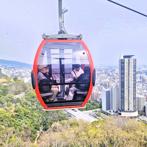
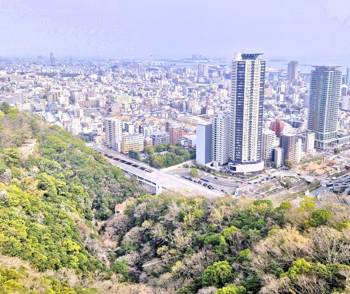
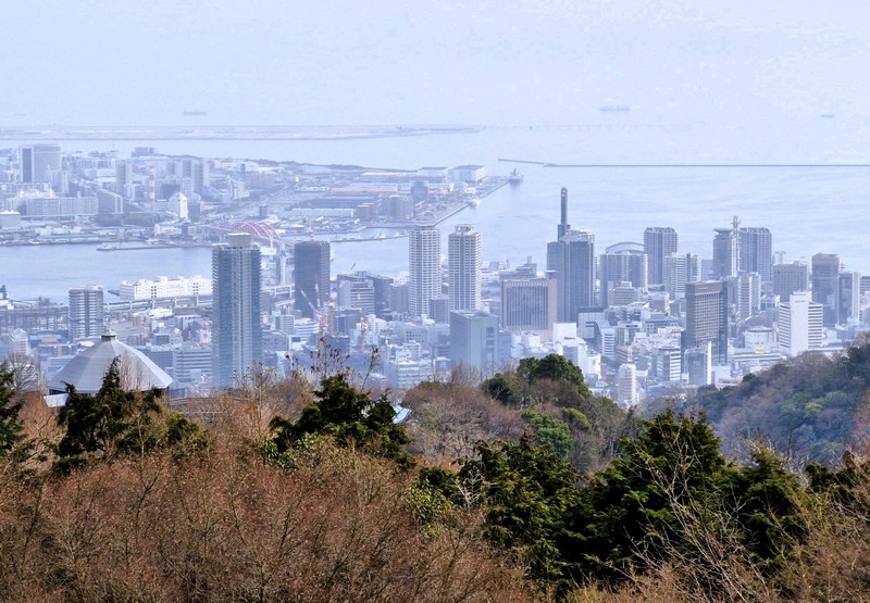
Here, we boarded a cable car for the 10-min. ride to Nunobiki Herb Garden, with sweeping panoramic views of the Kobe city skyline, the 43 m. tall Nunobiki Falls, the surrounding Rokko Mountain Range, Seto Inland Sea and previews of the gardens below. 

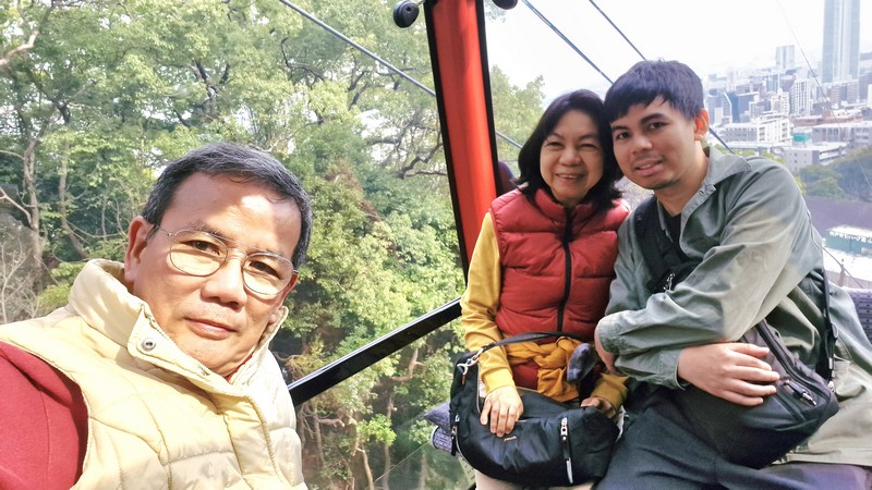
The author, Grace and Jandy inside the gondola
View of Mount Rokko and the Kobe city skyline

Upon arrival at the Sancho (Top) Station, the upper terminal point for the cable car, we then proceeded to the View Rest House, located at an altitude of 400 m., where we were welcomed with many charming garden vignettes with sculptures, sitting areas, carts and flower beds. 

View Rest House

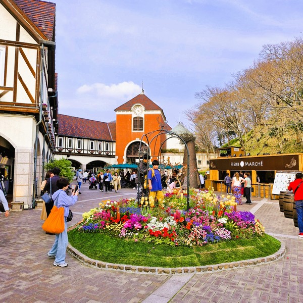
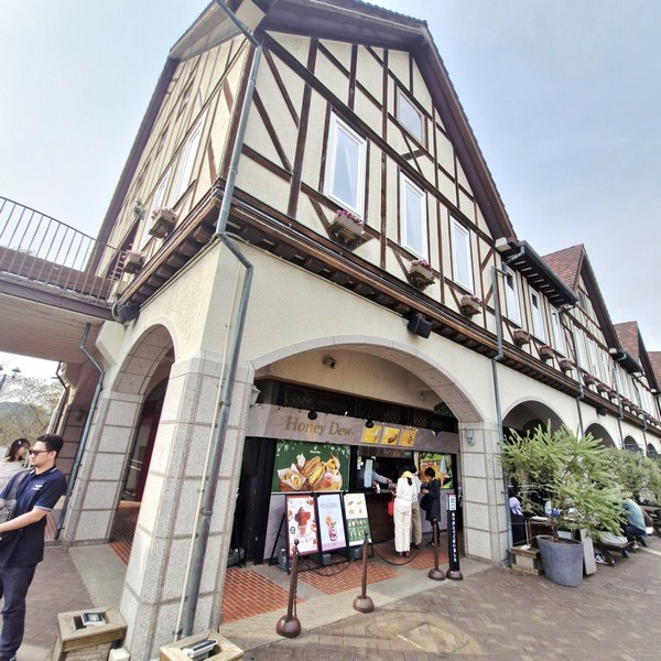
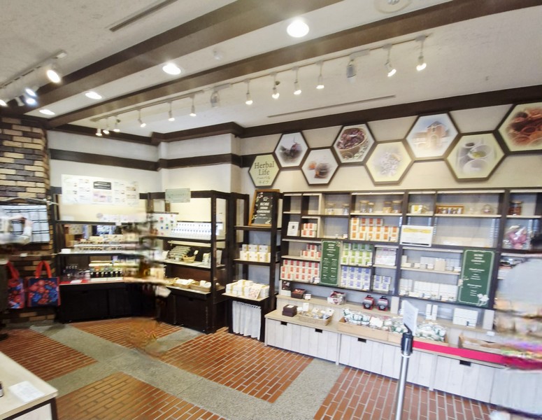
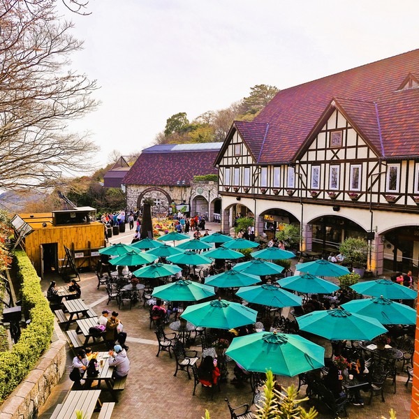
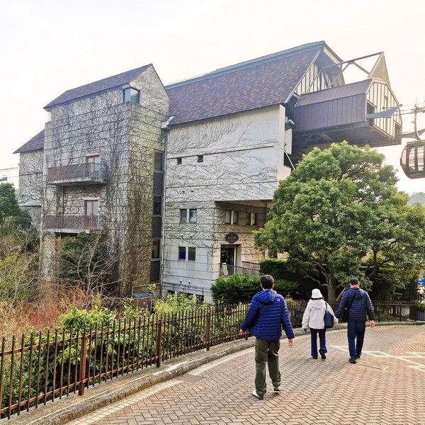
Modeled after the ancient Wartburg Castle in Eisenach, Germany, it has a large gift shop (offering herbal products, essential oils, herb-themed everyday utility items and souvenirs) and a dining option (The Herb Dining) plus access to sweeping outdoor terraces where you can enjoy your meals. There were a few stalls selling burgers, tarts , drinks and soft serve ice cream. We all indulged at the latter. The patio dining area was lined with theme carts (cookery, craft, tea and fragrance).

Herbal Market
The Veranda

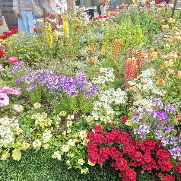
The gorgeous Welcome Garden (View Plaza) is surrounded by a castle gate and the View Rest House. Herbs and flowers are in bloom throughout the four seasons.

Welcome Garden
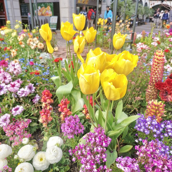
Tulips in full bloom

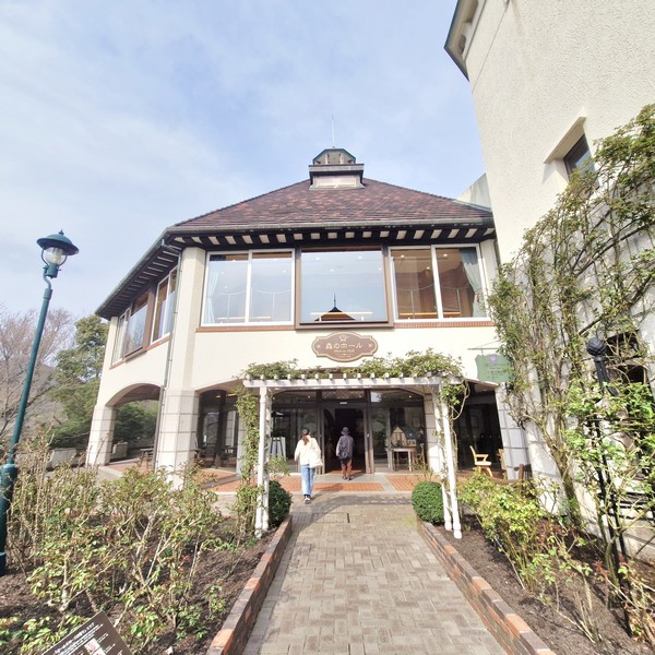
Nearby is the Mori no Hall, a small, wooden concert hall with great acoustics and a popular vernue for concerts and recitals.

Mori no Hall (Concert Hall)

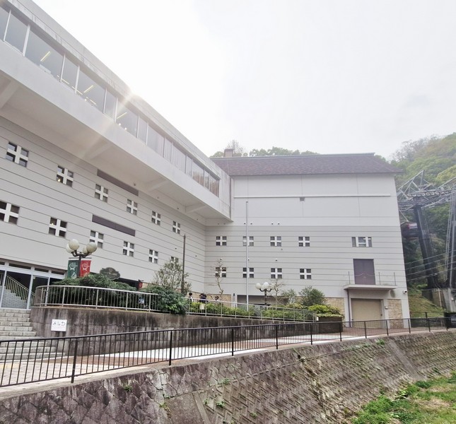
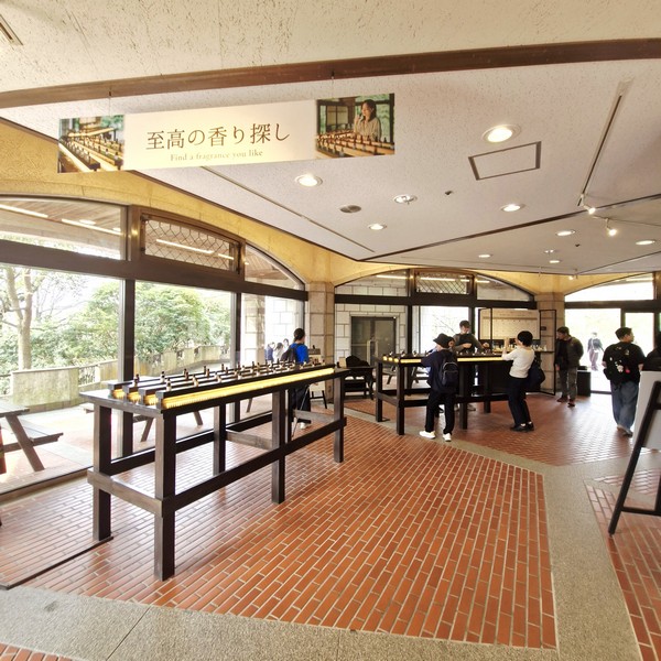
At the Fragrance Museum, at the ground floor, the historical aspects of fragrance are displayed and explained. Here, you can experience the scent of different natural essential oils.

Fragrance Museum

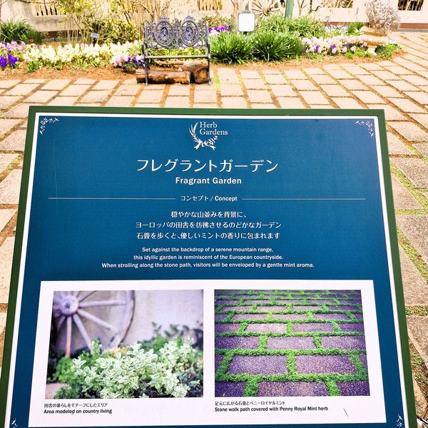
Fragrant Garden, set against the backdrop of a serene mountain range, this idyllic garden is reminiscent of the European countryside. When strolling along the stone path, visitors will be enveloped by a gentle mint aroma.

Fragrance Garden
View Plaza

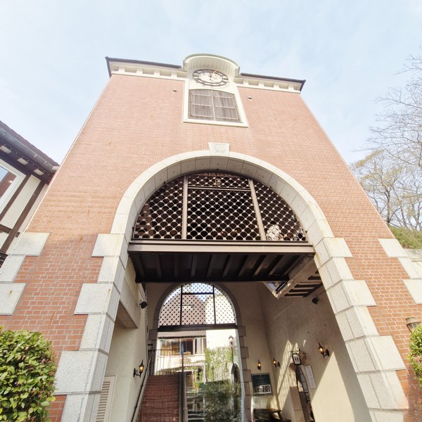
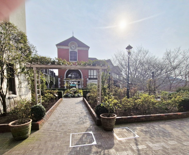
At the back of the hall, after the Clock Tower, is the Rose Symphony Garden, a central area with approximately 60 types of fragrant roses (mainly English roses), of assorted colors and shapes that change according to each variety, and other flowers.

Clock tower
Rose Symphony Garden

Instead of taking the cable car all the way back to the Sanroku (Bottom Station, we decided to walk downhill, from the summit, all the way to Kaze no Oka Mid Station, passing through twisting pathways and its 12 distinct, extensive, seasonally-themed areas while enjoying aromatic and scenic views. 

Herb Museum

The first themed area we passed was the Herb Museum.  Like a living encyclopedia, it has around 100 varieties of herbs.  Here, we learned about the attributes of herbs, how to use them and living with herbs. There is a guided tour of the garden every day.

Kitchen Garden Potager

Further down is the Kitchen Garden “Potager,” a kitchen garden that features the mixed planting of vegetables and herbs. Its theme is a “stylish and practical kitchen garden” that you can also enjoy at your own home.

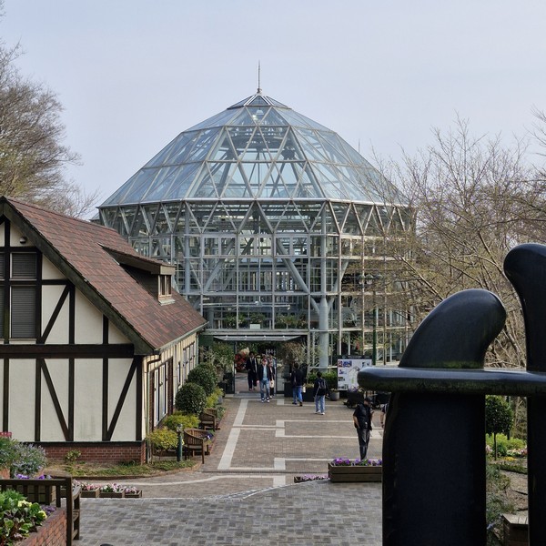
Glass House

From here, a pathway leads down to the Glass House which features a spice museum, a herbal foot bath (behind the Glass House), café lounge, terraced restaurant (The Veranda, offering herb-infused treats) and tropical, fragrant, and citrus-themed plants, including a special, illuminated “rose garden.”

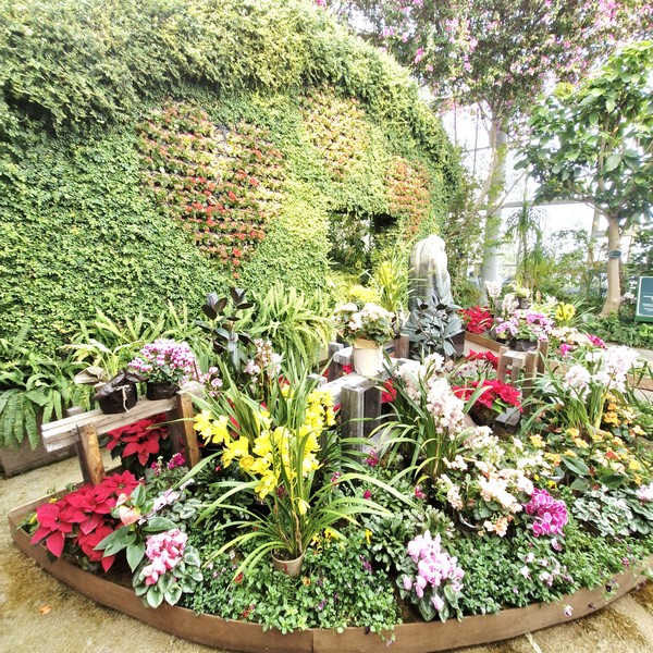
Wall Mural Flower Bed

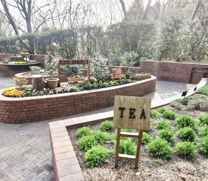
It provides visitors with the pleasure of planting, observing and smelling the scents of mainly tropical plants such as spices and fruits (guavas, bananas, passion fruit, papayas, etc.) grown in a climate-controlled environment. Also within this garden is a sculpture entitled “Statue of Mother and Child” presented by the Italian city of Terni, as well as a colorful wall mural flower bed.

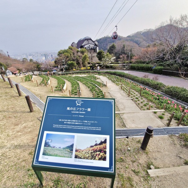
Lavender Garden

The Lavender Garden, ever enticing with its refreshing fragrance and lovely lavender flowers (which is known as the “Queen of Herbs”), holds a lavender-picking event every June. 

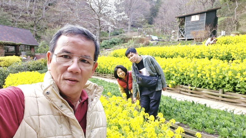
The author, Grace and Jandy at the Four Seasons Garden

At the Four Seasons Garden, specially designed with pretty herbs and flowers arranged according to season, you can get a sense of each season by the roses and other flowers in full bloom covering the area.

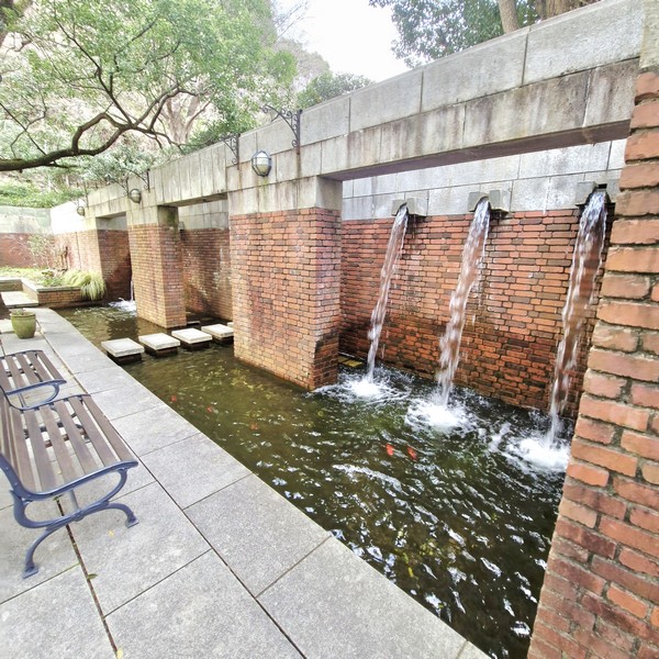
Waterfall Patio

The Waterfall Patio, a waterside zone based on the image of Nunobiki Falls, has a tiered flower bed that continues on to the garden below as an expression of the flow of water from the waterfall. The waterside is inhabited by a variety of living things.  Egg-laying, by the forest green tree frog, a precious species, can be observed during the rainy season.

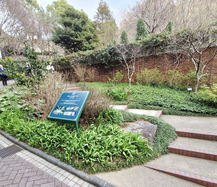
Oriental Garden

The Oriental Garden cultivates useful plants (plants for use in foods, medicine and craftworks) indigenous to Japan and Asia. The garden also provides observation and learning that includes the methods of using each plant.

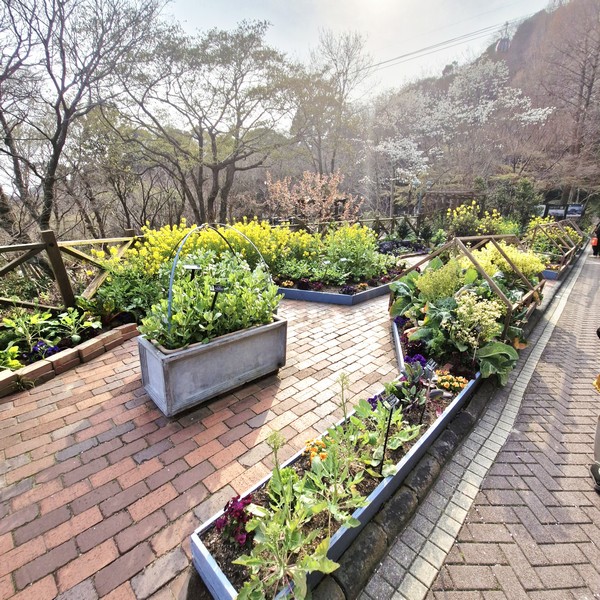
The Kaze no Oka Flower Garden, at the southern end of the garden, features colorful seasonal flowers and herbs spread across the hill. The garden is situated in a perfect location that offers views of the Kobe landscape. The Lily Garden, which blooms in summer, offers visitors the chance to enjoy the fragrance of lilies. 

Fruit Garden

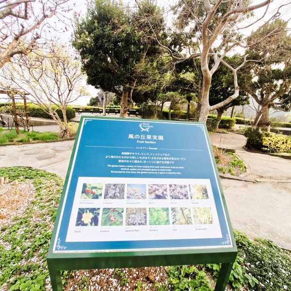
The Fruit Garden bears a variety of well-known fruits such as citrus, kiwi, pineapple guava, apples to exotic fruits.

Kaze no Oka Mid Station

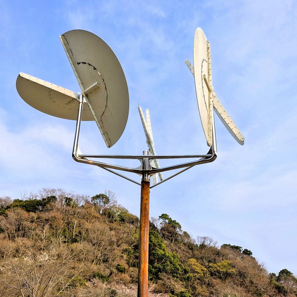
At the lower end of the garden, near the Kaze no Oka Mid Station, is a Recreation Area with hammocks, gift shop, play equipment (free to use) and the “White Constellation,” a wind sculpture, by Japanese sculptor Susumu Shingu, installed in 1991. Planted with mountain cherry blossoms and lilies, it also has a superb view of Kobe.

White Constellation (Susumo Shingu, 1991)

Nunobiki Herb Garden : 1 Chome-4-3 Kitanocho, Chuo-ku Ward, Kobe, Hyogo Prefecture 650-0002 Japan. Tel: +81 78-271-1160.  Website: www.kobeherb.com. Open daily, 10 AM – 5 PM. Admission: 2,000 yen/adult (admission ticket + round trip ropeway).  Coordinates: 34°42′55″N 135°11′32″E.

How to Get There: The garden is accessed via a scenic 5-minute Shin-Kobe Ropeway gondola lift from Shin-Kobe station in downtown Kobe.

Meriken Park (Kobe, Japan)

Meriken Park

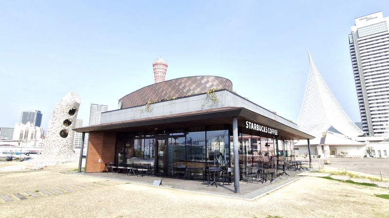
Our third whole day in Japan was spent on a day tour of Kobe which was just a 37.1-km. (40-min. drive) from Osaka.  Our first stopover was at Meriken Park, a nice waterfront park located in Kobe’s port area.  The park’s name was derived from the word “American,” which was commonly translated as “Meriken” during the Meiji era. Upon arrival, we first had breakfast at a stylish, 2-storey Starbucks outlet, with its ship-inspired design. Opened in 2017, it featured hishibuki (traditional diamond-patterned metal plates meant to evoke the feeling of a ship’s cabin) and offered stunning waterfront views of Kobe Harbor from its large glass walls and second floor outdoor balcony.

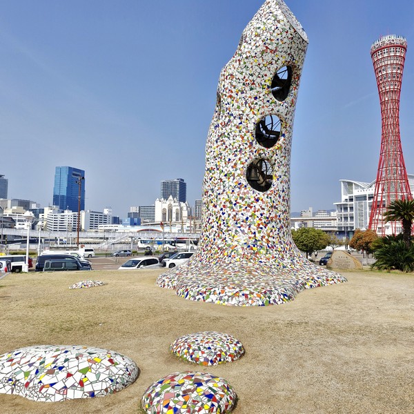
Beside the Starbucks store is the Bell of Hortensia, a colorful, modern mosaic sculpture. Installed on June 19, 1990, it represents the Hydrangea macrophylla, Kobe’s official flower.  It was established to commemorate the opening of the first Kobe Fashion Festival in November 1989, which was part of the World Fashion Festival ’89. When it was first installed at the “symbol monument of the fashion city of Kobe,” the bell was rung but, after the Great Hanshin earthquake, which devastated the park, it has not been rung.

Bell of Hortensia
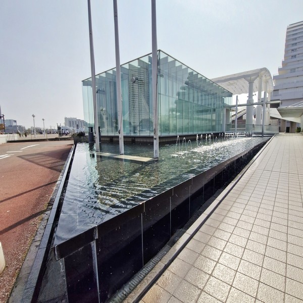
Kobe Maritime Museum

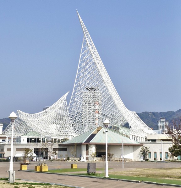
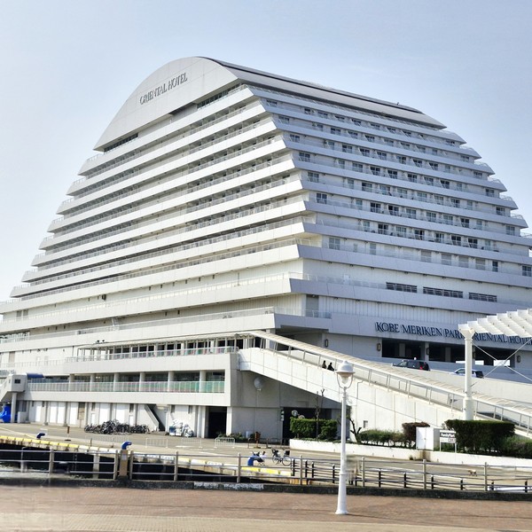
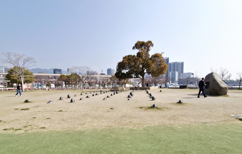
Built on an outcropping of reclaimed land, this waterfront park, a popular spot for locals and tourists, is covered in grassy lawn and open courtyards and is dotted with a collection of modern art installations and fountains. Meriken Park, the location of the Hotel Okura Kobe, Sannomiya Ferry Terminal (where the Jumbo Ferry, connecting Kobe, Shodoshima, and Takamatsu, and the Miyazaki Car Ferry, departs and arrives) and the wave-shaped Kobe Meriken Park Oriental Hotel, is home to some of the city’s more iconic contemporary architecture such as the red Kobe Port Tower and Kobe Maritime Museum.

Kobe Meriken Park Oriental Hotel

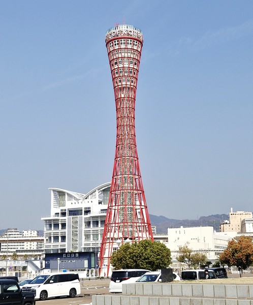
To the west of the Maritime Museum stands the 108 m. (354 ft.) high Kobe Port Tower, a unique, red-painted steel structure completed in 1963, was designed by the Nikken Sekkei Company to look like a tsuzumi, a Japanese drum. A symbol of the port and the city, it is the first tower built using a pipe lattice.  The tower has a total of 8 layers and is surrounded by 32 red steel staves as a symbol of welcome for vessels returning to the shore. It has five observation decks, approximately 100 m. above ground, including an open-air rooftop deck and a revolving cafe and bar.

Port of Kobe Tower

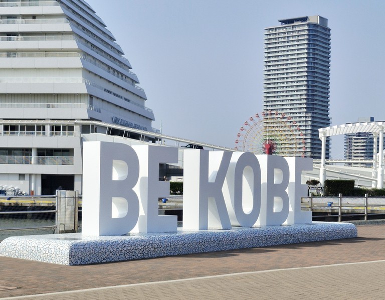
The “Be Kobe” Monument, installed in 2017 to commemorate the 150th anniversary of the opening of Kobe Port, is a popular photo spot.  The phrase “Be Kobe,” introduce in 2015 (the 20th anniversary of the Great Hanshin earthquake), is a civic pride message that expresses the idea that the chrm of Kobe lies in its people, inspired by those who work hard for the city’s recovery.

Be Kobe Sign

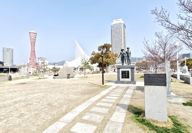
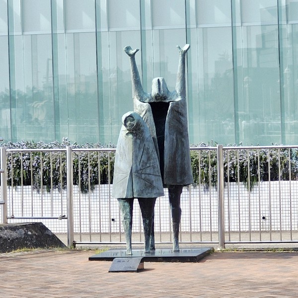
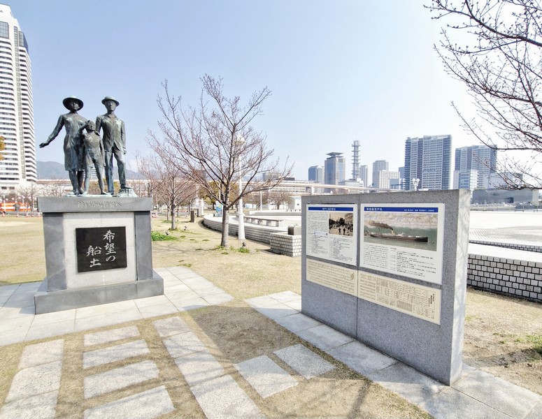
Kobe Port was once Japan’s most important departure point for overseas immigrants and the famous Kobe Port Emigrants Memorial Statue (also known as “Set Sail for Hope” or “Memorial Statue of Emigrants Boarding the Emigrant Ship”) honors the thousands of Japanese citizens who emigrated from Kobe Port, for new lives abroad, particularly to Brazil, in the early 20th century.

Kobe Port Emigrants Memorial Statue

Erected in 2001, it also serves as a reminder of the “National Kobe Emigrant Camp” history, where families awaited ships to travel abroad.  This bronze monument, erected in 2001, features a family (two adults and a child gazing out at the sea), symbolizing the departure.  The main statue is titled “Hope’s Departure.” The statue is seen as a bridge connecting Japan and the destination countries of immigrants, symbolizing international exchange and pioneering spirit.

Meriken Theatre Monument

The unique Meriken Theatre Monument, erected in 1987, commemorates Kobe as the location of the first public movie screening in Japan.  A popular photo spot, it was designed to look like a cinema screen and theatre seats. 

Kobe Kaientai Monument

The Kobe Kaientai Monument, a notable abstract sculpture, commemorates the Kobe Kaientai, a historical naval group active at the end of the Edo Period.

Save Northern People (Kaneichi Futakuchi)

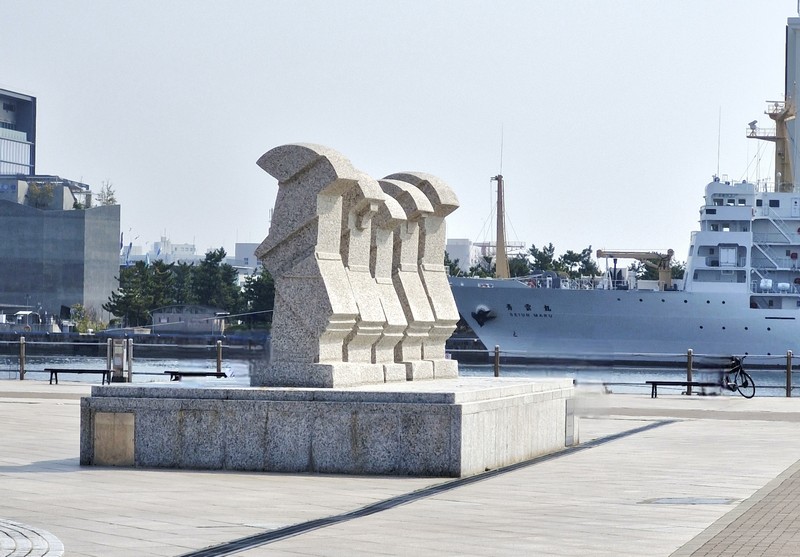
“Save Northern People,” a notable abstract, human-shaped bronze sculpture created by sculptor Kaneichi Futakuchi, was a winner of the Port of Kobe Anniversary Commemorative Award.  It is often interpreted as a tribute to those who left Kobe in search of a better life far away.

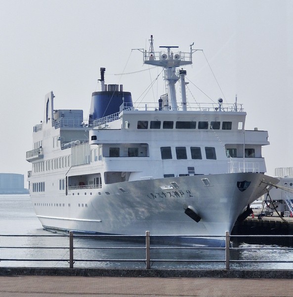
Sannomiya Ferry Terminal
A ship docked at the harbor

Meriken Park: 2 Hatobacho, Chuo-ku, Kobe-shi, Hyogo-ken, 650-0042.

How to Get There: Meriken Park is about a 10-minute walk south of Motomachi Station, on the JR Kobe Line, or just across the sightseeing cruise terminal from Kobe Harborland.

teamLab Botanical Garden (Osaka, Japan)

teamLab Botanical Garden

After our Tempozan Ferris Wheel ride and early dinner at Tempozan Harbor Village, we again boarded our van for 19-km. (25-min.) drive to experience the new interactive outdoor art exhibit of teamLab, an international art collective, at the 240,000 sq. m. Nagai Botanical Garden, an outdoor botanical garden in Nagai Park that opened in 1974.

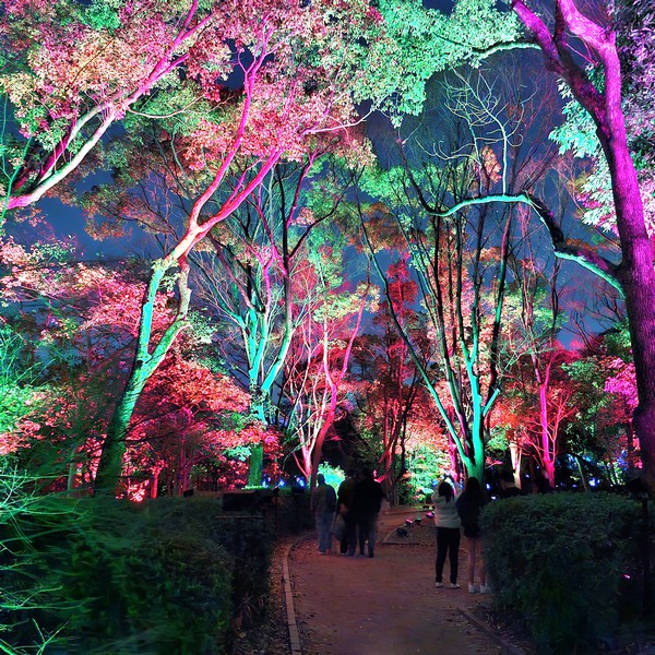
Taking the light show out of the hustle and bustle of the city streets and into a more natural setting, teamLab aims to explore an environment where human perception expands from the artwork itself to the environment. Their stunning, immersive nighttime installation transformed the natural landscape into an interactive digital canvas.

From our drop-off point, it was still a long walk to the entrance. Nestled among the forests and fields of the botanical garden were a variety of illuminated exhibits, ranging in size and scope from subtle illuminations embedded in the grass to completely awe-inspiring radiant pillars that dance in the wind and reach into the sky. Once we entered the grounds, it felt like we were transported to a world, miles away from Osaka. Deep, meditative music filled the air as we walked through the wide pathway flanked by towering bald cypress trees.

The Resonating Trees Exhibit

While subtle at first, we began to notice that the lights illuminating the trees rose and fell in brightness, depending on your proximity to them. This is our first hint that this was more than just a walk in the garden—we were a part of the exhibit. We didn’t find any velvet ropes or “do not touch” signs here.  Instead, we were encouraged to see how our interactions, within this unique “ecosystem,” would influence our surroundings.

As we walked through the garden of The Resonating Trees Exhibit, the trees shone brightly. When we passed close by, the trees changed color and emitted a unique musical tone. This wave of light and sound continuously spred outward to the surrounding trees. If light approached from a distance, it signified the presence of other people or wildlife, turning the ecosystem into an active canvas. Because the artwork interacted directly with nature, the display shifted in response to the wind, rain, and the natural seasonal changes of the trees.

Sculptures of Dissipative Birds in the Wind

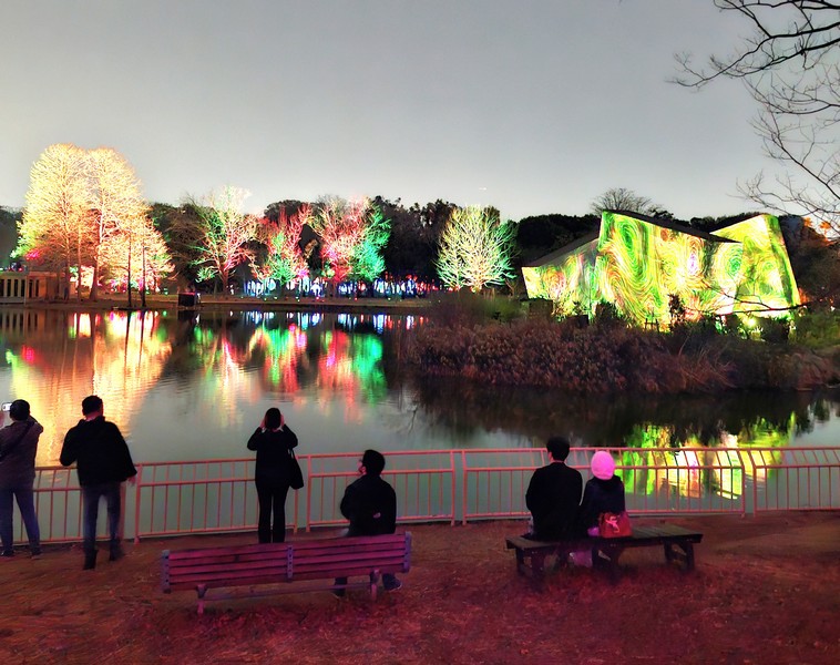
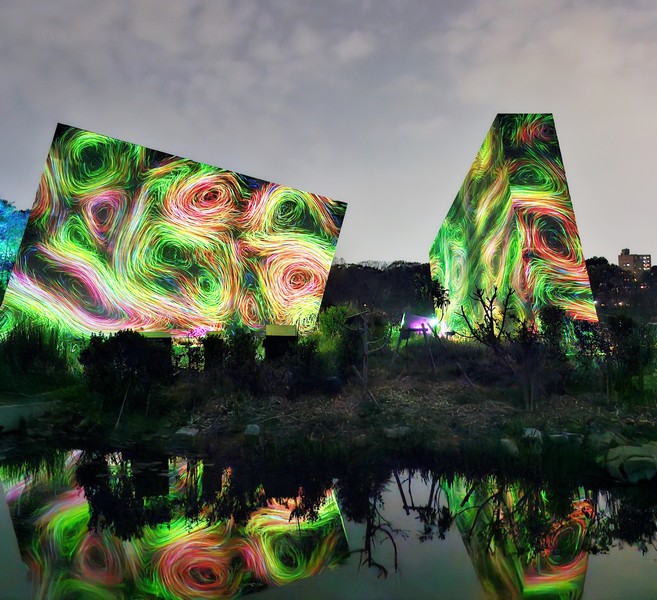
Rounding a corner, we saw The Sculptures of Dissipative Birds in the Wind installation, widely considered the signature and most spectacular open-air piece of the permanent exhibition.  It brings the invisible forces of nature—the wind and the physical flight of the birds—to life. Standing tall, on the edge of the lake, looking not unlike Van Gogh’s Starry Night coming to life here in Japan, the flowing swirls of color react to the flight paths of any passing birds that live in Nagai Park, further adding to the layers of interactivity throughout the gardens.

Lines and swirling patterns of bright, shifting light (in vibrant gradations of red, blue, green, and yellow) trace flight paths across the night sky and the installation’s structures. Because it reacts continuously in real time to actual wind speeds and the movement of the ecosystem, no two movements are ever exactly the same. Every second of the display is completely unique.  

Resonating Microcosms in the Common Camellia Garden Exhibit

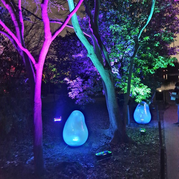
Continuing along the pathway, through the trees, and the sights continued to change with the landscape at The Resonating Microcosms in the Common Camellia Garden Exhibit. Small, waist-high glowing eggs fill the forest around the camelia garden, which foreshadows the absolutely overwhelming mass of 10 ft. tall orbs in the eucalyptus garden. During the day, their mirrored surfaces reflect the surrounding environment but, after sunset, they come alive.  

Getting lost amongst these luminous ovoid sculptures was a highlight for us, putting a smile on our face.  As we walked among them or when the wind blew, the ovoids react, glowing in up to 61 distinct colors and emitting unique sounds. When we pushed one ovoid or when it responded to its surroundings, it echoed out to the neighboring ovoids, creating a continuous, rippling wave of light and sound throughout the entire garden.

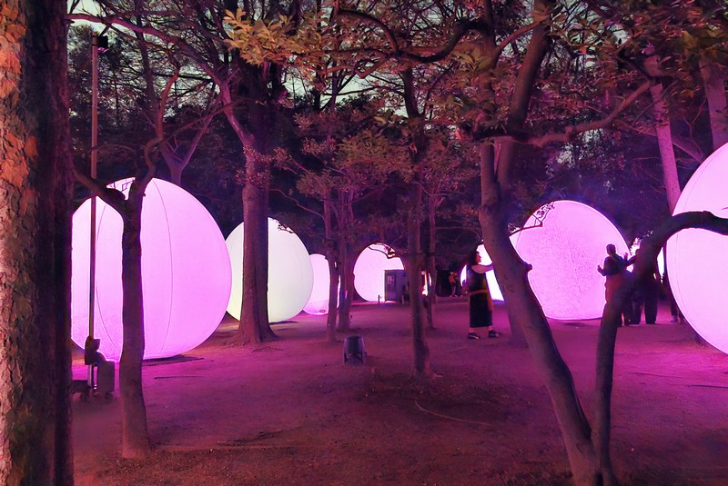
Forest of Autonomous Resonating Life – Eucalyptus

At the Forest of Autonomous Resonating Life Exhibit, the densely packed, standing ovoids of light are autonomous. When an ovoid was pushed over, by people moving through or blown down by the wind, it rose back up as the color of its light changed and emitted a tone specific to that color.

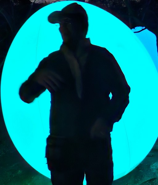
The author

The surrounding ovoids responded one after another, continuously changing to the same color and emitting the same tone. When the wind was not blowing and the people nearby were not interacting with the ovoids, their lights began to blink slowly.

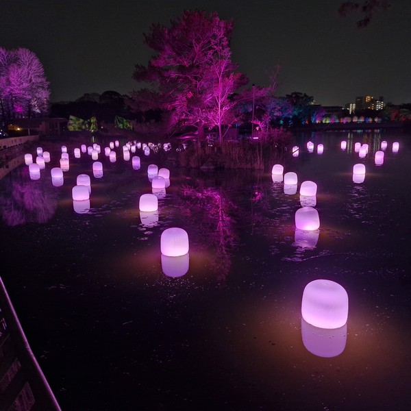
Floating Resonating Lamps on Oike Lake

At the Floating Resonating Lamps on Oike Lake – Fire Exhibit, each of the lamps on the Oike Lake’s surface floated autonomously. When we stood still near a lamp, or when the wind blew a lamp, it shone brightly and produced a tone.

The light of that lamp spred to nearby lamps, one by one, as they resonated with the same tone, continuing on to the trees on the islet in the center of the lake. If light approached from the other side, it signified the presence of people there, making them more aware of the existence of others in the same space. When the wind was not blowing and people were not nearby, the lamps began to blink slowly.

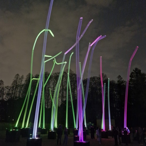
Pillars That Dance with the Wind

At the Pillars That Dance with the Wind Exhibit, the installation challenged the traditional notion that human structures must be solid and stable (like concrete). Instead, the pillars were soft, flexible, and defined entirely by their environment. The pillars changed in number, movement, and height based on the wind, rain, and humidity. They also interacted dynamically with visitors who walked near or touched them, creating patterns that were never repeated. Because the artwork relied so heavily on real-time environmental data, strong winds or heavy rain could cause the installation to be temporarily closed for safety.

teamLab Botanical Garden: Nagai Park, 1-23 Nagaikoen, Higashisumiyoshi-ku Ward, Osaka. Nighttime only; hours vary by season (usually opens from dusk, roughly 7 PM to 7:30 PM, until 9:30 PM with last entry at 8:30 PM). Admission: ~¥2,000 to ¥2,200 for adults (prices can fluctuate slightly depending on peak or off-peak seasons), with discounts available for students and children. Tel: 06-6699-5120. Website: teamlab.art/e/botanicalgarden/

How to Get There: Take the Osaka Metro Tanimachi Line to Nagai Station, a 10-min. walk on the Midosuji subway line. Take exit 3 and walk east through Nagai park to access the admission gates. From Exit 1 or 2, it is a brief 10 to 15-minute walk into Nagai Park to reach the botanical garden entrance. Via the JR Railway, it can also be reached via the JR Nagai Station, a 12-min. walk, on the JR Hanwa line (take the East Exit and walk east through Nagai park to access the admission gates).  Via the Kintetsu Railway, it is 15-min. walk from Harinakano Station on the Kintetsu Minami-Osaka line. Take the West Exit and walk through Nagai park to access the admission gates.

Tempozan Ferris Wheel (Osaka, Japan)

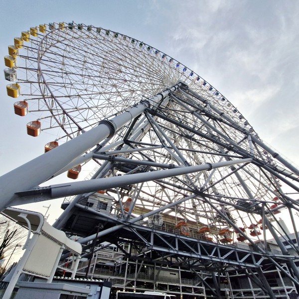
Tempozan Ferris Wheel

After admiring the Osaka skyline from the Kuchu Keien Observatory at the Umeda Sky Building, we had some free time to explore the Osaka Aquarium Kaiyukan (one of the largest aquariums in the world), a 13.9-km./20-min. drive away but, as we arrived late, we decided to try out the nearby Tempozan Ferris Wheel.

Check out “Umeda Sky Building“

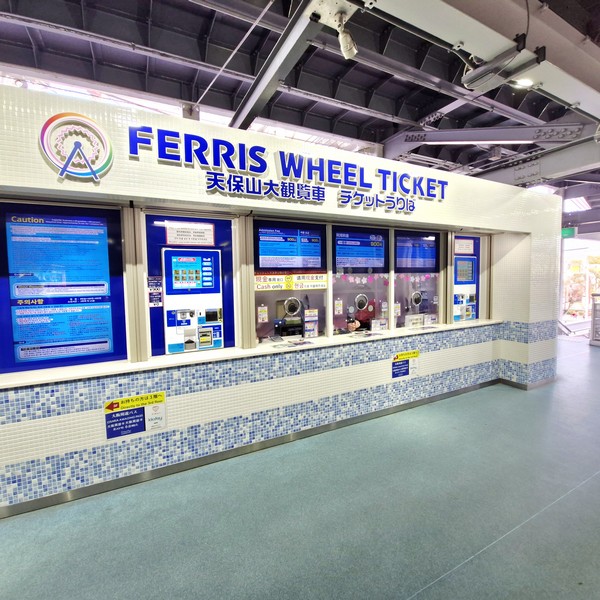
Ticket Office

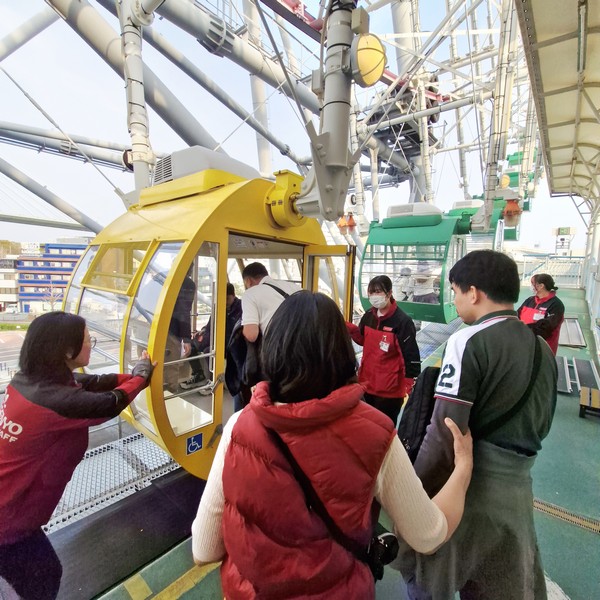
After paying the admission fee, we boarded two of its 60 airconditioned gondolas (three are barrier-free, allowing wheelchair users to board directly, while 8 gondolas have seats and floors that are see-through, giving you a 360° view of the scenery around your feet). During the ride, commentary is provided in both Japanese and English.

Boarding our gondola

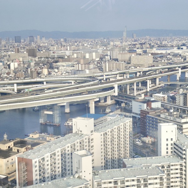
This 112 m. tall (367 ft.)  Ferris wheel  has a height of 112.5 m. (369 ft.) and diameter of 100 m. (330 ft.). Opened to the public on July 12, 1997, it was then the tallest Ferris wheel in the world.  During our fantastic, 17-minute aerial journey, we were offered a view of Osaka Bay and surrounding areas, including Mount Ikoma to the east, Akashi Kaikyō Bridge to the west, Kansai International Airport to the south, and the Rokko Mountains to the north.
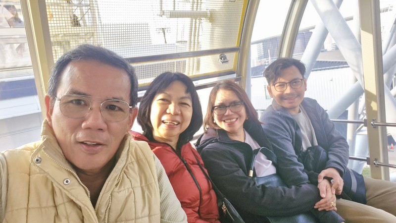
The author, Grace, Nenette and Miguel

The wheel has colored LED lights, another popular attraction, that provide a weather forecast for the next day. Orange lights indicate a sunny day, green lights a cloudy day and blue lights indicate rain. Illuminating Osaka Port, they have now become one of Osaka’s nighttime attractions.

The Osaka skyline
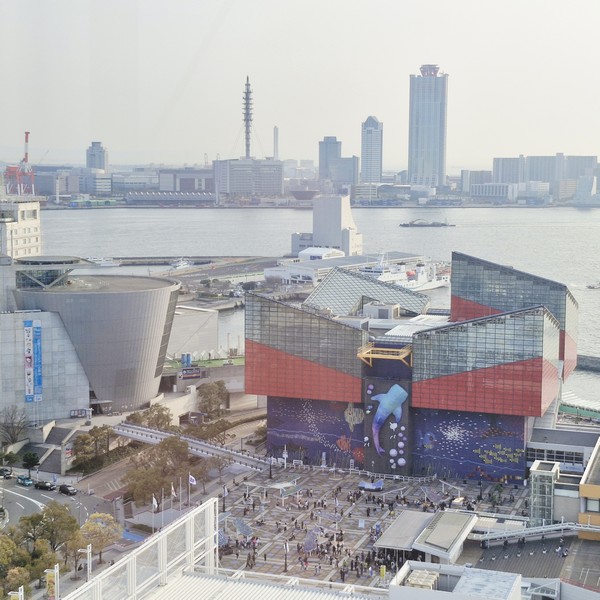
Osaka Aquarium Kaiyukan

Tempozan Ferris Wheel: 1-1-10 Kaigan-dori, Minato-ku, Tempozan Harbor Village, Osaka-shi, 552-0022, Japan. Tel: +81 6-6576-6222. Open daily, 10 AM-10 PM (last entry 9:30 PM). Admission: JPY900 per person (3 years old and above). Coordinates: 34°40′N 135°26′E.
How to Get There: It’s about a 5-minute walk from Osakako Station on Osaka Metro Chuo Line.