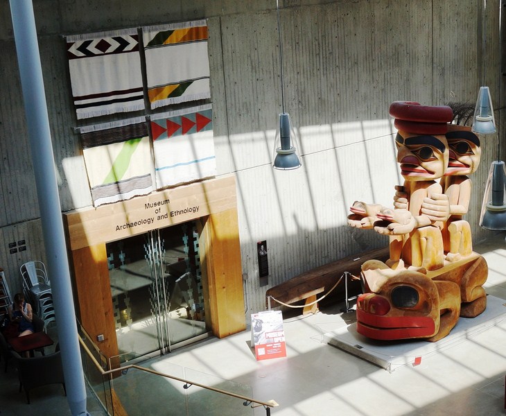
Museum of Archaeology and Ethnology (SFU, Burnaby, British Columbia, Canada)

Museum of Archaeology and Ethnology

On our 8th day in Vancouver, Jandy and I and decided to visit Simon Fraser University (SFU) and its Museum of Archaeology and Ethnology (MAE),  From Holdom Station, we took the Millenium SkyTrain to Production Way Station where we boarded the No. 145 bus.
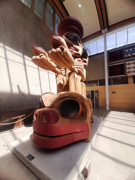
Frog Constellation (James Hart)

Upon alighting at the SFU transit loop, next to the Blusson Building (there was a big sign outside identifying it), we walked over to the nearby Saywell Building.
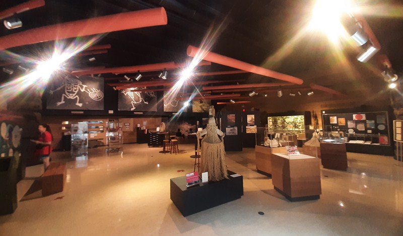
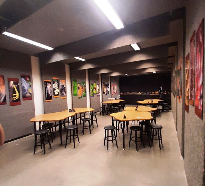
Museum exhibits

Entering the building, we noticed that finding the museum was a challenge which can be as much of an experience as exploring the museum itself.
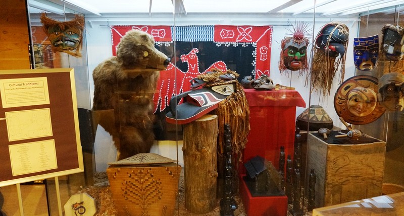
The Cultural Traditions Exhibit

We had to ask a student for directions.   The museum was actually one floor below, in a courtyard beside the museum entrance. Taking the stairs down, we were greeted huge, wonderful wooden frog carving called Frog Constellation.
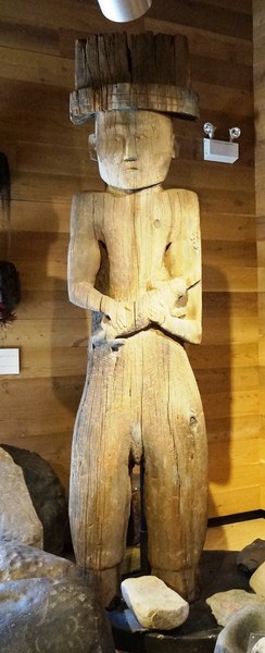
Coast Salish Housepost

Carved in 2005 by Haida artist James Hart, a chief from Haida Gwaii, he is one of the most accomplished artists currently working in the Northwest Coast style.  The carving is his tribute to a small shamanic piece carved by an unknown Haida artist on the Northwest coast in the 1870s.
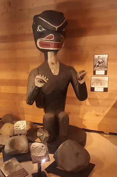
Bella Coola Mortuary Figure

The small but well-curated Simon Fraser University Museum of Archaeology and Ethnology (MAE) collects, researches, and exhibits archaeological and ethnological artifacts from around the world with a focus on British Columbia.
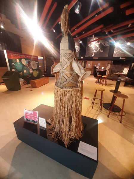
Barkcloth Mask

The MAE is closely affiliated with the Department of Archaeology at Simon Fraser University. Archaeological collections arising from excavations and other research by faculty, staff, and students are housed in the museum.
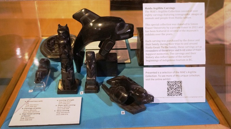
Argillite carvings, from prominent Haida artists, featuring iconographic images of animals and people from Haida culture.  Displayed on totem poles, serving wear or as statues, they are part of a collection of over 80 pieces donated to the university by a private donor in 2011.

In scope or depth, this museum doesn’t compare to the anthropology museum at the University of British Columbia.  On the other hand, it’s free (though you can make a donation). Though small, it was filled of information with artifacts explained in great detail.  We probably spent an enjoyable 30-40 minutes or so in this gorgeous little museum.
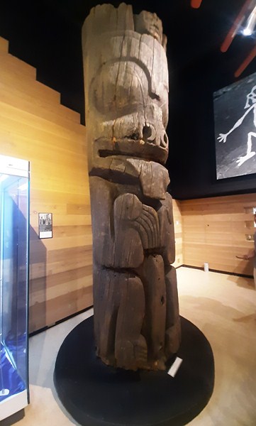
Haida Mortuary Pole

The Northwest Coast Monumental Sculptures (“Totem Poles”) Exhibit displays monumental cedar sculptures from the northern, central and south coast of British Columbia, exhibited here through the generosity of the Royal BC Museum in Victoria, that illustrate the varied artistic traditions of the First Nations of the BC Coast. The centerpiece of the Museum’s collection is the giant aforementioned “Frog Constellation.”
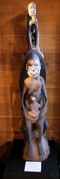
Figure from Palembei Village, Sepik River Region, Papua New Guinea

Displays include First Nations carved poles, monumental sculptures illustrating the varied artistic traditions of the First Nations of the BC coast.  There are also canoes, ceremonial regalia, woven baskets, etc.
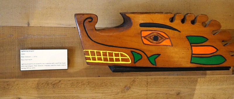
Lightning Serpent (Peter Webster, ca. 1970s, cedar)

The NAMU Profile: 9,700 Years of Human Occupation Exhibit, their most remarkable permanent exhibit, is a profile section of an excavation trench from the 1977 field school at the Namu site on the British Columbia central coast, an archaeological record that spans nearly 10,000 years.
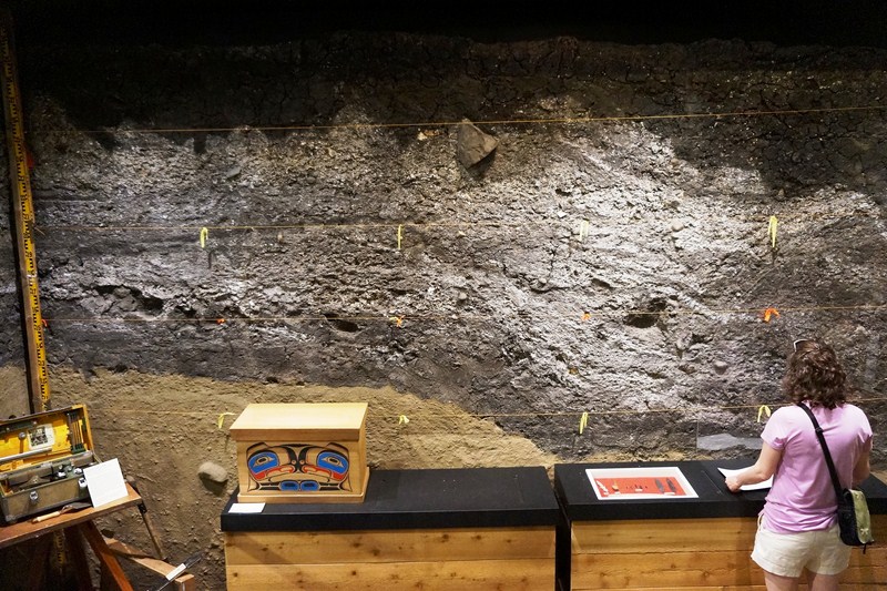
Profile Section of Excavation Trench
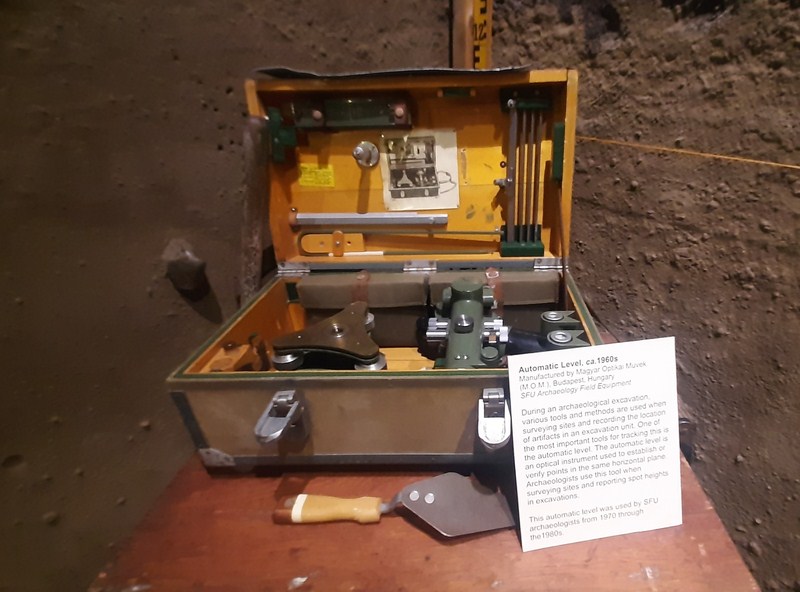
Automatic Level ca. 1960s

The profile section that is on display in the museum represents about 5,000 years of cultural and natural accumulations.   Evidence of nearly continuous use at the site has been found and separated into six general periods of use.
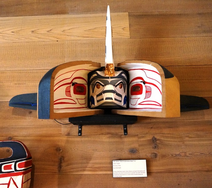
Killer Whale/Wolf Transfornmation Mask (Pat Amos, 2012, cedar)

The profile on display shows Periods 2 (6000 BP – 5000 BP) through 5 (3500 BP – 2000 BP).  Though the profile on display was removed in 1977, excavations at the site continued in 1978 and 1994; many of the artifacts from these excavations appear in more than just the Namu exhibit itself.
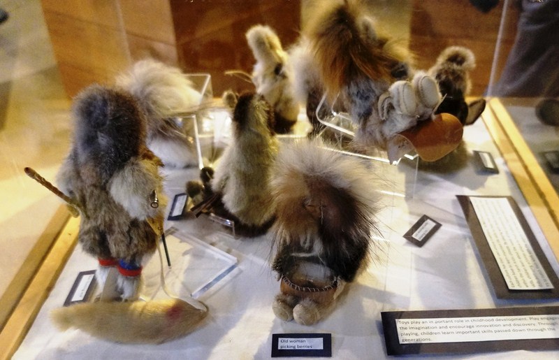
Inuit Dolls

The Rock Art: Petroglyphs and Pictographs Exhibit includes the museum’s collection is rock art from the Lillooet area of BC.  Looking up, we also found stunning photographs, taken in 1972 by Philip Hobler, of the Jump-Across-Creek rock art.
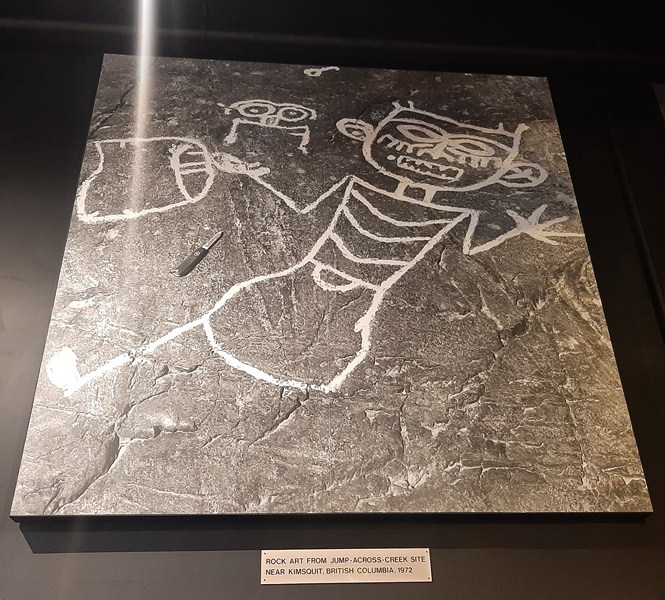
Jump-Across-Creek rock art (Philip Hobler)

The photographs are complimented by the large carved stones, on display near the front door, which were collected between 1929 and 1960 from the Lillooet area, from the mouth of Eleven Mile Creek.
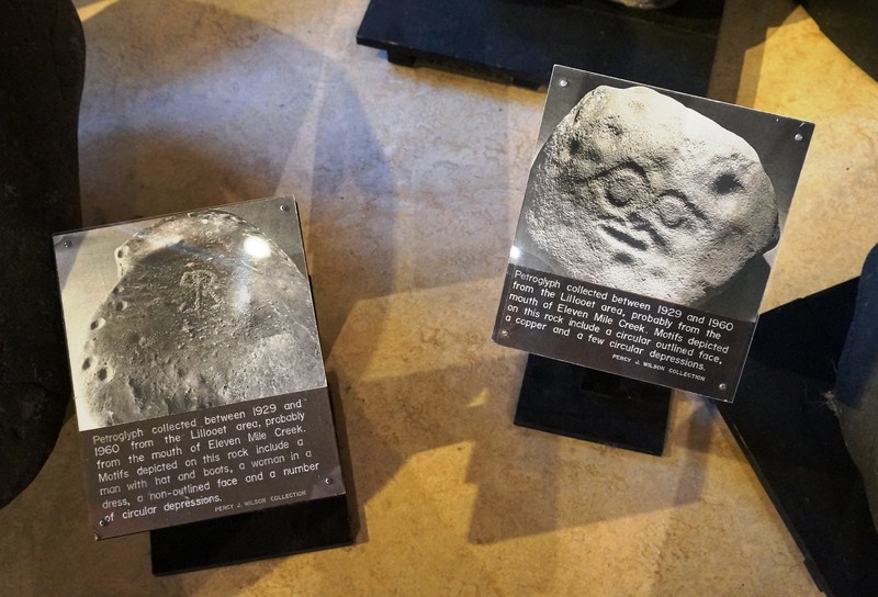
Petroglyphs

The designs were pecked or ground into the rock, either by a piece of sharp stone, by chiseling the rock using a hammerstone to deliver blows to a stone chisel, or by abrading the surface of the rock with a piece of harder stone. Motifs depicted on this rock include a number of faces, anthropomorphic figures and numerous lines and depressions.
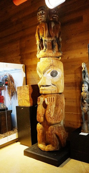
Tsimshian Pole Section (Kitsegukla, 1953)

The Cultural Traditions Exhibit displays objects that showcase the rich history, cultural traditions and enduring vitality of the indigenous First Nations living in the Pacific Northwest Coast which extends from the Northern California coast to the Alaskan Panhandle.
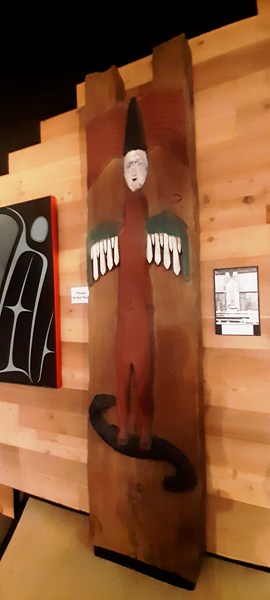
Salish House Post from House at Quamichan

The Hunt and Gather: An Interactive Geocaching Activity, an interactive exhibition, incorporates objects and artifacts, museum displays and puzzles in a fun “treasure hunt” game meant to celebrate the diversity of the Museum’s collections.  In addition to learning about Geocaching, this exhibit is a fun, informative and interactive way to explore the museum.
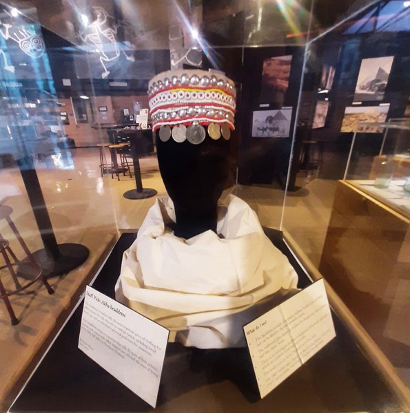
Headdress worn by women of the Akha hill tribes of Northern Thailand which is adorned with five coins (the Indian rupee in the middle is relatively valuable); red, white, blue and yellow plastic beads and aluminum-like balls.  Stitching on the inside is done by machine.

The collection includes artifacts from around the world — masks from Africa; Indonesian shadow puppets; bamboo scrolls from Asia; spears and atlatls from various continents and periods of history; tiny Bolivian dolls and West Coast artifacts. Not a large collection but well worth the time to look at everything.
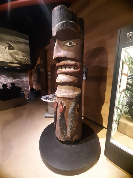
Nuu-Chai-Nuulth House Post

There were also a number of temporary exhibits.  The “Into the World: A journey through the photographic collection of the SFU Museum of Archaeology & Ethnology” gives a glimpse into the fascinating world of archaeology and ethnology through the extensive photographic collection of our museum.
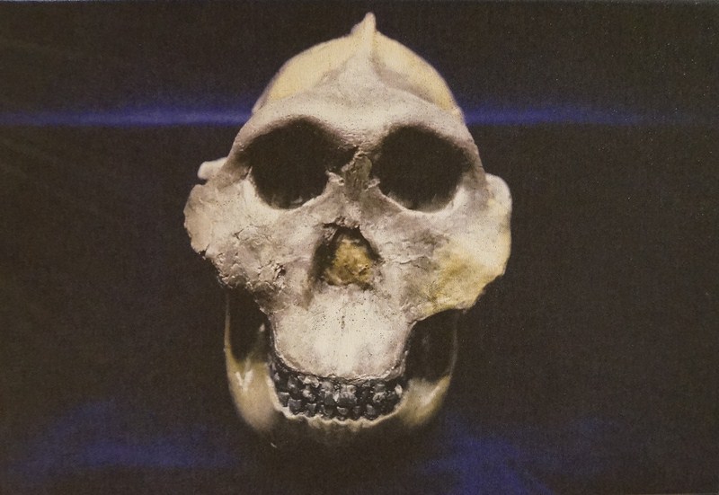
Into the World: A journey through the photographic collection of the SFU Museum of Archaeology & Ethnology

“The Franklin Exploration,” a bilingual travelling pop-up exhibit, from the Vancouver Maritime Museum, on the archaeology of the HMS Erebus and HMS Terror, was developed by Parks Canada and the ROM.
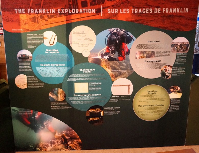
The Franklin Eploration

“Beyond The Mask: The Fluidity of the West African Experience,” created by Jazmin Hundal and Melissa Rollit, features eight out of the dozens of masks from the region of West Africa housed at the SFU Museum of Archaeology and Ethnology that stand out in their ability to convey something essential about the human experience.
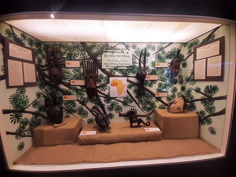
Beyond The Mask: The Fluidity of the West African Experience

“Canoes, Waterways, Lifeways” offer insights into the history of Pacific Northwest Coast canoes by showing how different styles were built and used in the various territories within the region. Sometimes, especially in the case of older styles, models are all we have to learn from.
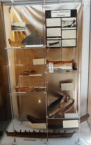
Canoes, Waterways, Lifeways

“Historic Glass,” created by Kristen McLaughlin, focuses on a selection of historic glass bottles from the collections that have been in use in Canada since the late 1800s into more modern times. These tell us more about the medicine, beverages, food, and glass-making methods of the past.
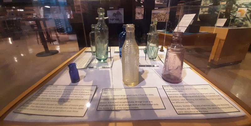
Historic Glass

“Aksum’s Treasures: Reminders of an Ancient Civilization,” created by Jurian ter Horst, uses contemporary photographs to tell the stories of the treasures (granite monoliths, several churches, etc.) in the ancient town of Aksum, Ethiopia
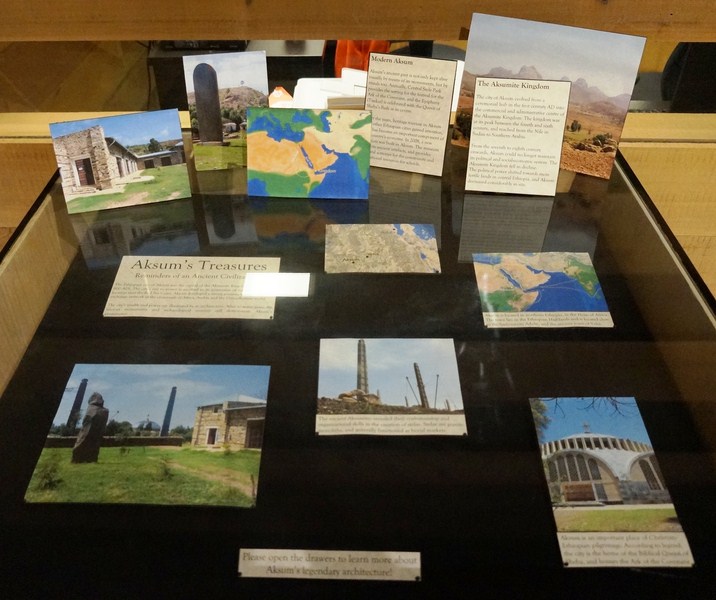
Aksum’s Treasures: Reminders of an Ancient Civilization

“Plains Regalia,” created by Tiinesha Begaye and Hilary Pennock for SFU’s 50th anniversary in 2015, is an exhibit of a magnificent Plains beaded costume purchased from an antique shop in Calgary in 1972 by Dr. Roy Carlson.
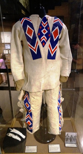
Beaded Buckskin Regalia (Alberta)

Hilary and Tiinesha cleaned the costume, repaired the beading, modified a mannequin to conservation standards, mounted the costume on the mannequin and wrote the interpretive text for the large display.
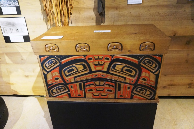
Bentwood Chest (Larry Rosso, 1975)

“Pacific Northwest Bentwood Boxes,” created by Dr. Barbara Winter, features often elaborately carved and painted Bentwood boxes and chests created by Northwest Coast artists which speaks to the cultural longevity of indigenous peoples of this area.
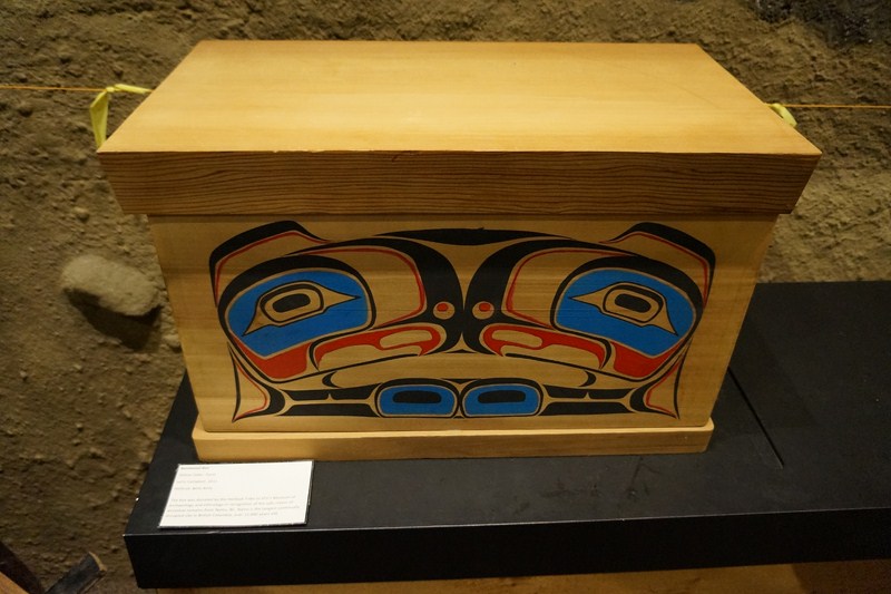
Bentwood Box (Larry Campbell, 2011)

“Asmat Shields,” created by Sarah Fox and Jennifer Halliday, features shields, topped with an image of the ancestor the shield was created to represent, that were originally created for use in reprisal raids by the Asmat of Indonesia. Due to traditional headhunting practices being outlawed, the shields are now created as art pieces.
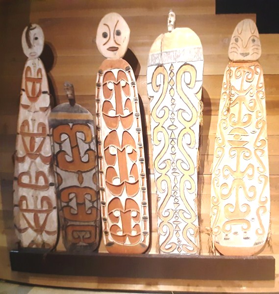
Asmat Shields (Jamasji)

“Ancient Writing,” created by Duncan McLeod, showcases a collection of a variety of different texts from China, to Indonesia and the Middle East, offering insights of ancient cultures from the texts they left behind, in all their assorted forms.
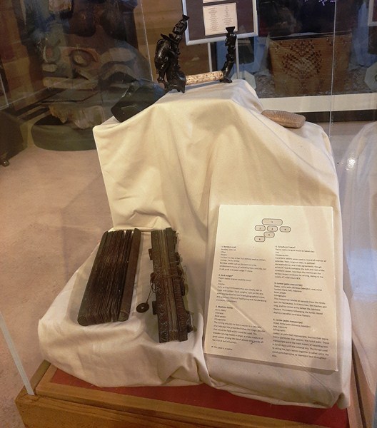
Ancient Writing

Museum of Archaeology and Ethnology: Northeast corner of the Academic Quarter, Saywell Atrium, off Saywell Hall, 8888 University Drive, Simon Fraser University, Burnaby, British Columbia  V5A 1S6. Tel: (778) 782-3325 and (778) 782-3135. E-mail: museum@sfu.ca.  Website: www.sfu.ca/archaeology/museum.html. Admission is free. Open Tuesdays to Thursdays, 10 AM to 2 PM.

How to Get There:

By Public Transportation:

  • #95 bus: From the Burrard Street SkyTrain Station downtown by way of Hastings Street
  • #144 bus: From Metrotown Station
  • #145 bus: From Production Way SkyTrain Station
  • Millennium SkyTrain Line – get off at Production Way, then take #145 bus.

By Car:

  • From Trans-Canada Highway (Highway 1) — take the Gaglardi Way Exit 37.
  • From Lougheed Highway (Highway 7) — turn (north) onto Gaglardi Way.
  • From Hastings Street (Highway 7A) going east — take the right lane exit onto Burnaby Mountain Parkway.

The closest parking lot to the museum is the North Parking Lot. It is paid parking.
Victory Square (Vancouver, British Columbia, Canada)

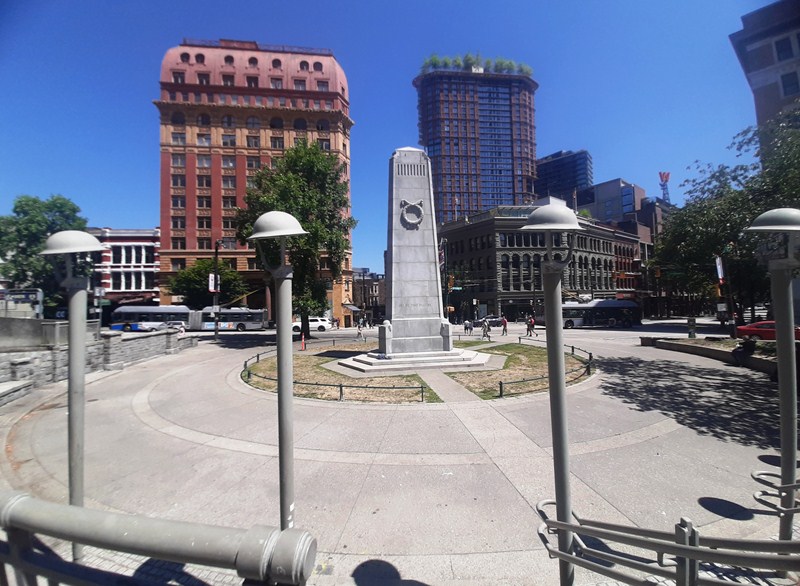
Victory Square and Cenotaph

Victory Square, bordered by West Hastings Street to the northeast, West Pender Street to the southwest, Cambie Street to the southeast, and Hamilton Street to the northwest, stands at the intersection of the old Granville town site (AKA Gastown) and the CPR Town site, which was the downtown-designated land grant obtained by the Canadian Pacific Railway (CPR) as part of the deal to locate the terminus and thereby found the city (the corner of Hastings and Hamilton is the northern tip of the CPR Townsite).

Check out “Gastown”

Hastings Street Side

The site of the Cenotaph is significant. In 1914, because of the strong royalist sentiment in the city, it was at tables at the foot of the old courthouse steps where enlistees signed up for the First World War.  The maple trees on the Pender Street side of the park are the oldest street trees in the city, planted in 1897.

Hamilton Street Side

It was, at one time, the grounds of the city’s provincial courthouse, which was torn down in 1911–13 when the new Francis Rattenbury-designed courthouse along Georgia Street was opened (now the Vancouver Art Gallery). The term is also used to refer to the neighborhood immediately surrounding the square.

Check out “Vancouver Art Gallery”

Pender Street Side

Here’s the historical timeline of the square:

  • On February 13, 1886, an area of 3,600 sq. m. (0.9acres) out of the1.9 sq. km. (480 acres) allotted to the CPR was held aside as “Government Square.” The southwest corner of Hamilton and Hastings Streets is where L. A. Hamilton drove the first survey stake to commence laying out the street system for the city.
  • On 27 April 1924, the Victory Square Cenotaph was unveiled by His Worship William Reid Owen (Mayor of Vancouver), in the presence of an assemblage of 25,000 persons; naval, military and civilian, and including the Old Contemptibles, 7th British Columbia, 29th Vancouver (its chaplain, Major Cecil C. Owen M.B.E., V.D., D.D., dedicated the cenotaph), 72nd Seaforths, 2nd Canadian Mounted Rifles, 47th New Westminster, and 102nd North British Columbian Battalions, CEF, and others.

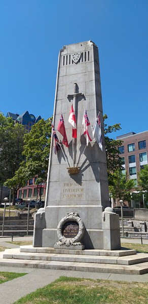
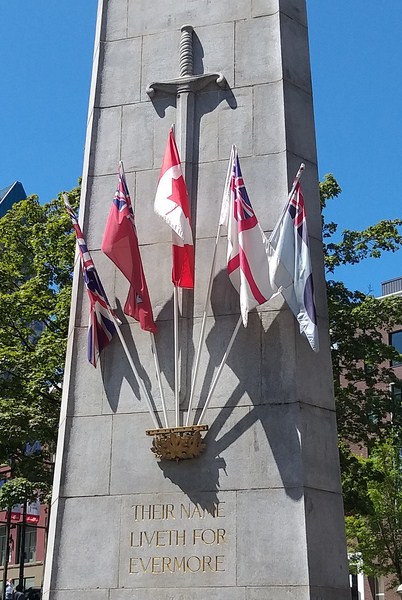
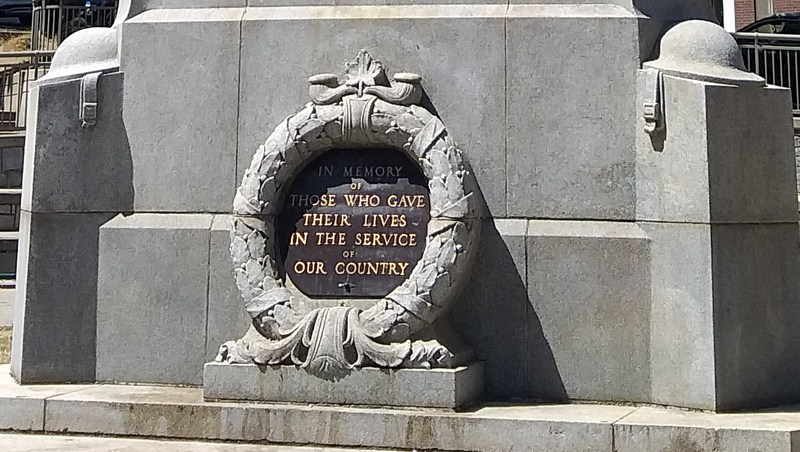
Pillar at Hastings Street side is decorated with a long sword and is engraved with the inscription “Their name liveth forevermore”and is kept continuously banked high with wreaths of flowers and adorned with national flags

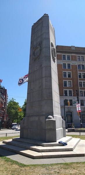
The approximately 9.1 m. (30 ft.) tall, triangular (its shape conforms to that of the square) Victory Square Cenotaph , the Vancouver war memorial, was designed thus by Maj. G.L. Thornton Sharp (architect, town planner and park commissioner).  The 24-man (12 represented the Canadian Club of Vancouver and 12 the Civic War Memorial Committee) Vancouver War Memorial Committee, under the chairmanship of pioneer F.W. Rounsefell, Esq. (with J.R.V. Dunlop, of the Canadian Club, as honorary secretary), were the public-spirited sponsors.

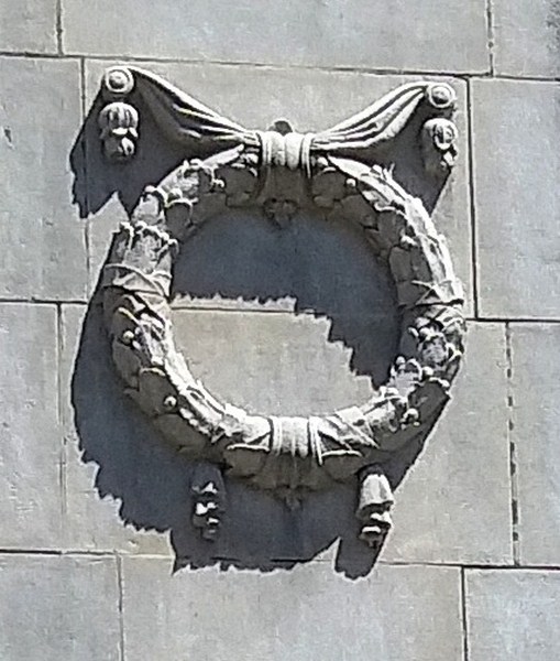
Wreath at the base of the Hastings Street side

The word “cenotaph” (an empty tomb in memory of one buried elsewhere) is derived from the Greek word kenos (meaning “empty”) and taphos (meaning “tomb”).  The focus of the city’s annual Remembrance Day services, the Cenotaph lies at the foot of a gentle slope on the northern side of the square, on a plaza flanking Hastings Street. It is so placed that, when approached from the east, it appears in the distance centrally at the end of busy Hastings Street.

Wreath at Pender Street side

Made with gray Nelson Island granite (supplied by the Vancouver Granite Co., Ltd.), cost $10,666 and was erected by contractors Stewart who died from the effects of an accident whilst preparing the memorial) and Wylie. The pillar is engraved with suitable inscriptions and is kept continuously banked high with wreaths of flowers and adorned with national flags.

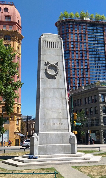
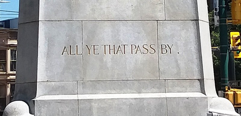
Inscription at Pender Street side that reads “All ye that pass by”

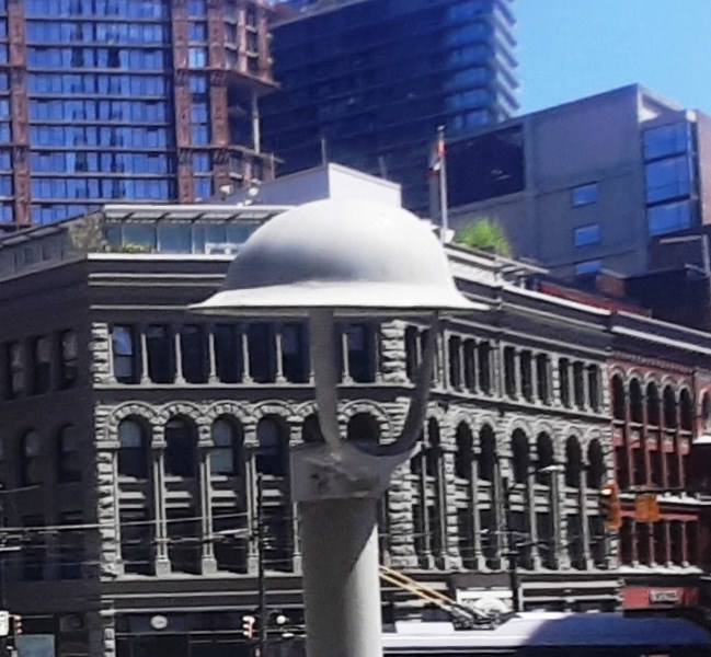
The stone ornamentations include one long sword and two wreaths (one of laurels, the other of poppies), both entwined with maple leaves.  The three corner buttresses are adorned by a stone replica of the steel helmet, as used in the war of 1914–1918.  The numerals “1914–1918,” at the base of the front, surrounds a larger wreath of laurels.

World War I helmet

A receptacle of three bronze maple leaves has slots that hold the staffs of the Union Jack, the Canadian Red Ensign, the Flag of Canada, the White Ensign, and RCAF Ensign, always flying, which are placed there by the Royal Canadian Legion and the Royal Commonwealth Ex-Services League, and renewed four times each year.

Sun Tower

One monument side faces busy Hastings Street (engraved inscription: “Their name liveth for evermore” and, within a stone wreath, “1914–1918″), the others Pender (engraved inscription: “All ye that pass by”) and Hamilton Streets (engraved inscription: “Is it nothing to you“). It is so placed that, when approached from the east, it appears in the distance centrally at the end of Hastings Street.

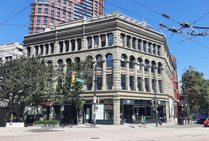
Flack Block (Copp Building)

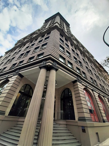
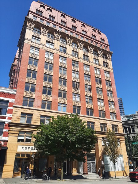
Several historic buildings adjacent to Victory Square include the 13-storey, 53-m. (175 ft.) high, Second Empire-style Dominion Building (completed in 1910); the four-storey, Romanesque Revival-style Flack Block (or Copp Building, completed in 1900) and the 17 storey, 82 m. (269 ft.) high, Beaux-Arts-style Sun Tower (completed in 1912).

Dominion Building

Victory Square: Vancouver, British Columbia, Canada.

Barnet Marine Park (Burnaby, British Columbia, Canada)

Barnet Marine Park

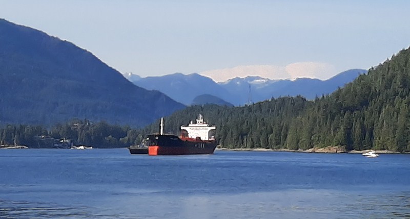
On our fourth day in Vancouver, we drove 6.6 kms. to Barnet Marine Park, a small but beautiful and popular waterfront park, where we were to enjoy an afternoon outdoor picnic with family while sitting back taking and watching the action on the south shore of the spectacular, tanker-dotted Burrard Inlet (here’s a map of the picnic area).

A tanker at Burrard Inlet

As it was a sunny weekend, the main parking lot was already filled so we parked at the overflow parking above the highway right next to the Air Mountain Bike Park.

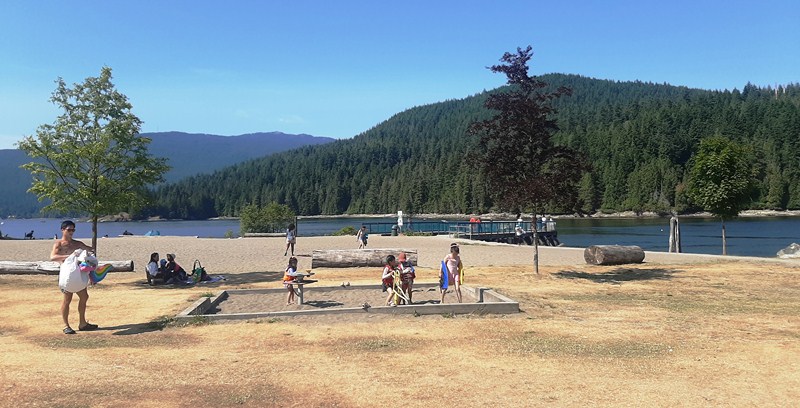
Located right along the north end base of Burnaby Mountain and across Burrard Inlet from Cates Park and Vancouver’s North Shore, on an important harvesting, gathering and processing site for the Coast Salish peoples, as well as the site of a century-old logging mill camp, this spectacular foreshore park, Burnaby’s only official saltwater beach, is perfect for a stroll and has ocean and mountain views. Although small in size, the park feels large as it is long and narrow, stretching for about 1.5 kms. along the waterfront.


Barnet was formerly a thriving logging community of the North Pacific Lumber Company (later the Barnet Lumber Company), one of the largest sawmills in the British Empire.  Established in 1889 (at the site of a new C.P.R. station), David MacLaren (the owner) named it “Barnet” after his wife’s family.

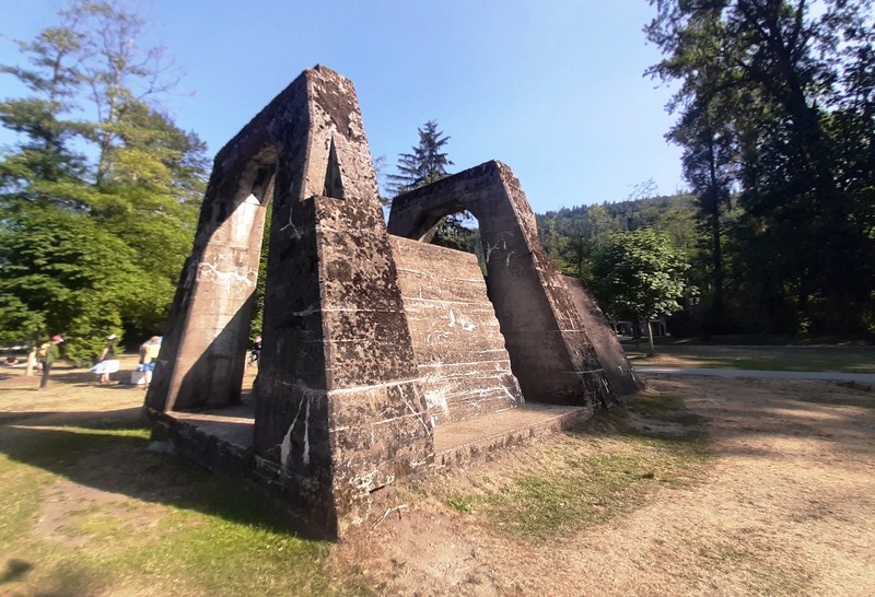
Foundation of Mill Wood Scrap Burner

Due to the Great Depression, the mill closed in 1931 and reopened in 1939 as the Kapoor Sawmills.  Destroyed by fire in 1946, plans to rebuild the mill to its former scale never materialized.  The community started to fade when the small replacement mill was finally dismantled in 1958.

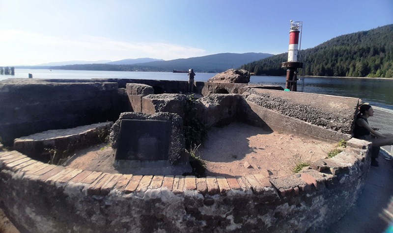
Mill Wood Scrap Burner

Here, you can still see traces of the once prosperous mill such as the mill’s scrap burner as well as the concrete and brick foundations nearby.

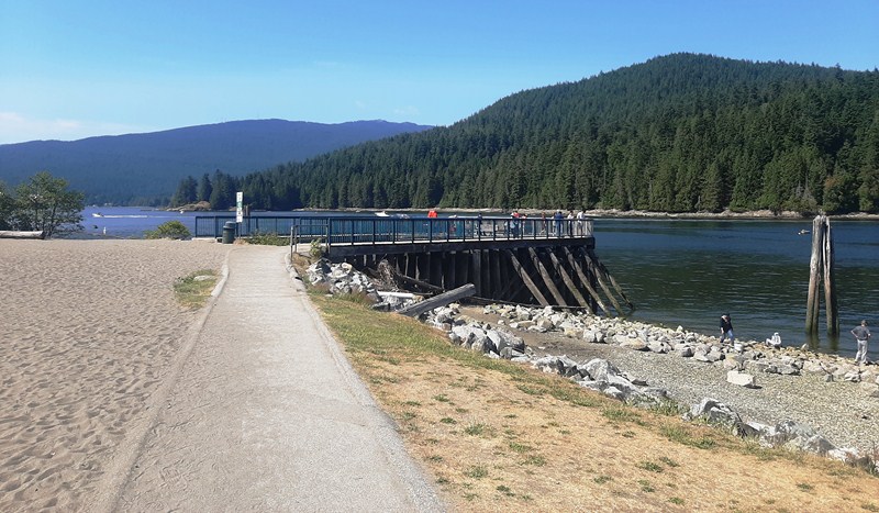
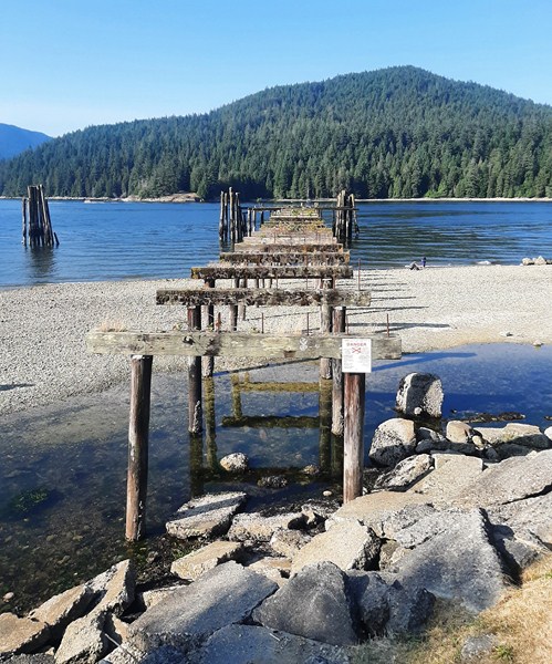
Remains of Old Wharf

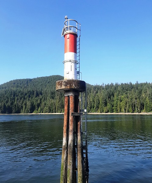
On the water are the remains of the old wharf (where processed timber bound for American and Asian ports was loaded), its pylons now nesting sites for birds.

Aside from the picnic (some in the shade) site, it has a designated dog off-leash area  allowing our dog Luffy to get some exercise. We had to keep your dog leashed everywhere else in the park (you also have to pick up after your dog and drop our waste bag in the designated bins). For sanitary reasons, they aren’t allowed on the beach. The sandier beach areas of the off-leash dog area are at the far west end of the park.

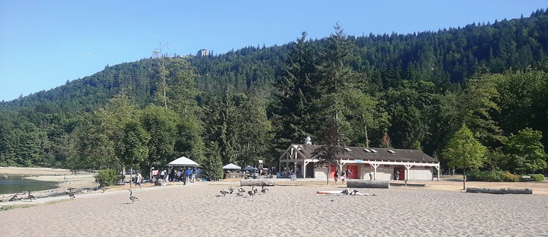
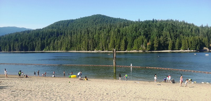
Sandy Beach

Rocky Beach

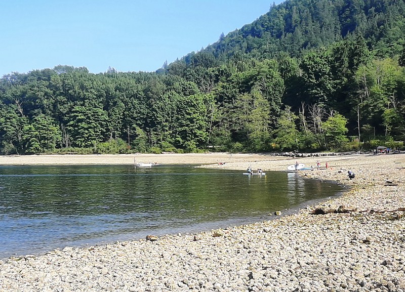
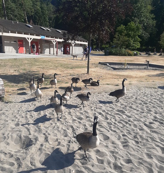
Along the shore are both rocky and nice sandy (at the far western end) beaches. The most popular beach is at the far eastern end as it’s closer to the parking lots and has both grassy and sandy areas.  Wildlife to be found here includes seals, crabs, geese and herons.

Geese

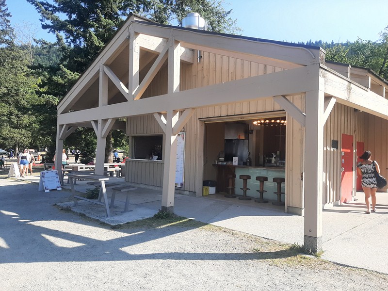
To enjoy a relaxing meal or a quick bite, there’s Park Cafe. Propane barbeques and charcoal and open-flame barbeques are also allowed at this park (you have to use the on-site ash pits to safely dispose of hot ashes).

Park Cafe

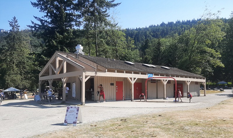
Accessible washrooms and changing rooms are located in the concession building, open year-round.  There are also outdoor showers for swimmers.

Concesson Building

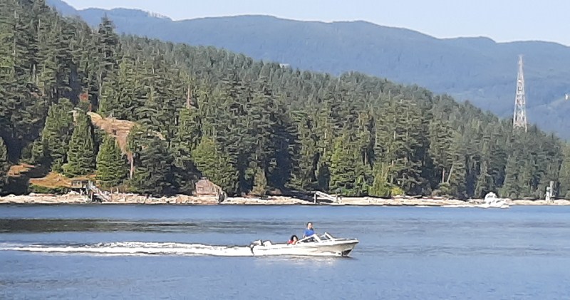
Barnet Marine Park is an excellent spot to enjoy fishing from shore (just make sure you have a license). To explore the sheltered waters of Indian Arm or the Burrard Inlet, you can launch canoes, kayaks and sailing craft on the rocky or sandy beach.

Motorboat at Burrard Inlet

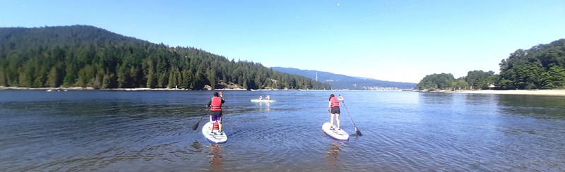
On the rocky beach, Cheska, Bryan and Kyle went paddleboarding but they had to carry everything down to the beach.

Bryan (with Kyle) and Cheska paddleboarding off the rocky beach

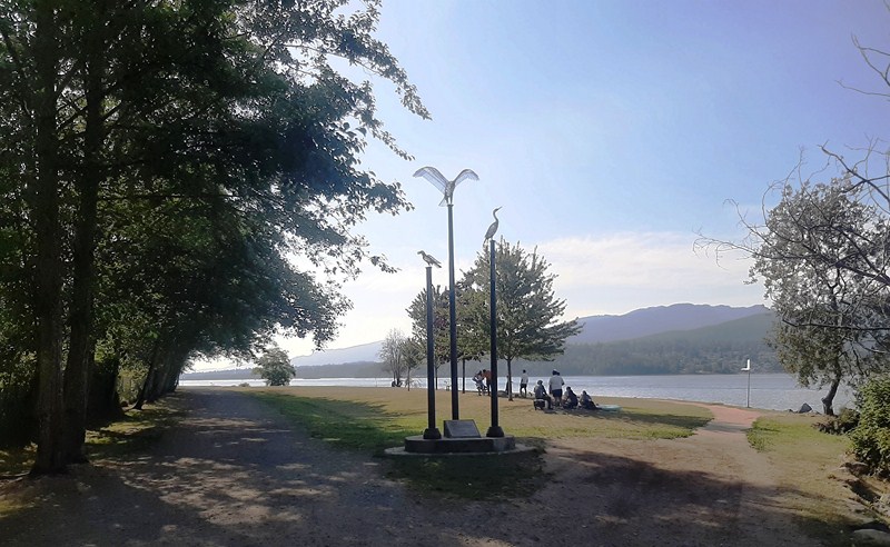
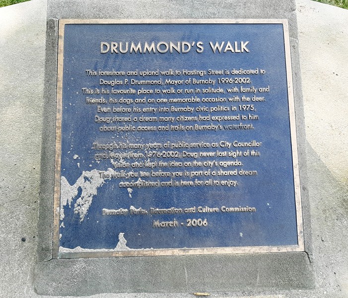
Trails here are either paved or crushed limestone, with benches available throughout. I traversed the length of Drummond’s Walk, a peaceful foreshore and upland walk named after former Mayor Douglas P. Drummond (1996-2002) in April 2006.

Start of Drummond’s Walk

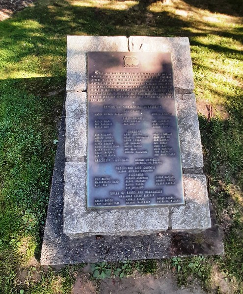
Plaque

It was his favorite place to exercise. This flat and easy trail, suitable for all ages and fitness levels, runs 1,5 kms. from one end of the park to the other.

Drummond’s Walk

Along the path, I encountered grassy lawns and a large and impressive off-leash dog zone that includes multiple waterfront beaches. Here’s a map showing all the paths in the park.

Watching tankers go by at Drummond’s Walk

Barnet Marine Park: 8181 Barnet Rd, Burnaby, BC V5A 3G8, British Columbia. General inquiries: 604-294-7450. E-mail: parksrecandculture@burnaby.ca. Website: www.burnaby.ca/explore-outdoors/parks/barnet-marine-park. Open from 7 am and closes at dusk between April and October. During May to September, the closing time changes with the increase in daylight hours. Park Café is open Friday to Sunday on ‘good weather’ days in the summer, 11:30 AM -6:30 PM.  If the weather looks wet and cold, call 604-297-4888 to confirm if the café is open. Since January 1, 2022, smoking has been banned in all City parks and multi-use paths.

Parking: the main parking lot (download map) is located on the south side of the rail line. The north (beach) side of the rail line is pedestrian only. Don’t park on the rail line. There are 6 accessible parking stalls located east of the park entrance, closest to the beach. Additional accessible parking stalls and surface parking are available to the east and west of park entrance on a first come, first served basis.

Additional parking is available farther to the west of the park entrance and on the other side of Barnet Rd where the Mountain Air Bike Skills Course (an incredible bike skills park located just across the Barnet Highway, it features an outdoor wood pump track for beginners to advanced mountain bikers that’s free to the public) is located. Accessible parking stalls at beach levelare available Monday to Friday, 9 AM-7 PM until September 1, 2023 (excluding statutory holidays). To check availability and obtain access, call park staff at 604-319-7083. Due to safety and operational concerns when the park is very busy, all beach-level parking (including accessible parking) are not available on weekends and statutory holidays.

How to Get There: The park is about 10 kms. (a 30-min. drive) from downtown Vancouver, and a 10-min. drive from Port Moody. Travel east on Hastings Street. Keep left on Inlet Dr/Barnet Rd and turn left onto the park at Takeda Drive. Get directions.

Beaty Biodiversity Museum (Vancouver, British Columbia, Canada)

Beaty Biodiversity Museum

The Beaty Biodiversity Museum, a natural history museum located on the campus of the University of British Columbia (UBC), lies parallel to one of the main walking routes of the university campus.  This C$50-million museum, as well as the Biodiversity Research Centre, are located in the Beaty Biodiversity Centre housed in a 11,520 sq. m. (124,000 sq. ft.), four-storey building designed by Patkau Architects in 2009 and built by Scott Construction.

It formed the final side of a landscaped quadrangle created by the 2006 construction of the Aquatic Ecosystems Research Laboratory.  The museum has a theater and 1,900 sq. m. (20,000 sq. ft.) of collections and exhibit space.  First opened to the public on October 16, 2010, it has since received over 35,000 visitors per year.The museum was selected by Georgia Straight as among the “Best of Vancouver” for 2013.

Its collections, divided into six main sub-collections (the Cowan Tetrapod Collection, the Marine Invertebrate Collection, the Fossil Collection, the Herbarium, the Spencer Entomological Collection and the Fish Collection) and over 500 permanent exhibits, are mostly displayed in cabinet windows and shadow boxes, although a few are shown through alternative displays like in-ground “excavations” that under glass that visitors can walk on. Most items are accompanied by a description card which briefly outlines details like the species and provenance information.

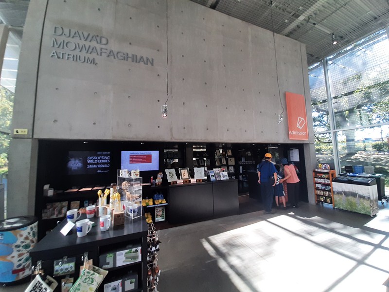
Djavad Mowafaghian Atrium

The collections, including over two million specimens collected between the 1910s and the present, focus, in particular on the species of British Columbia, Yukon, and the Pacific Coast.The space also includes a “family zone,” with juvenile reading materials and a teaching collection in a Discovery Lab.

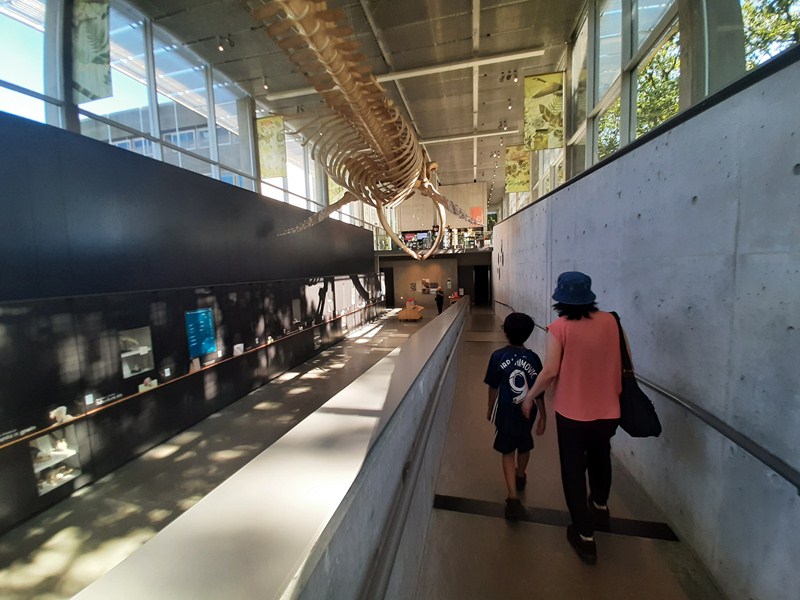
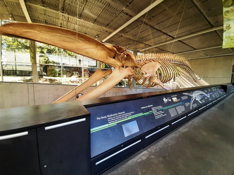
Skeleton of Blue Whale

The museum was named after Ross and Trisha Beaty, UBC alumni who donated C$8 million in funding to support its creation. The Biodiversity Centre also received C$16.5 million from each of the BC Knowledge Development Fund and the Canadian Foundation for Innovation, C$3 million from the Djavad Mowafaghian Foundation, and C$6 million from the university.Dr. Wayne Maddison was the founding director was and the current director is Dr. Quentin Cronk of the Department of Botany.

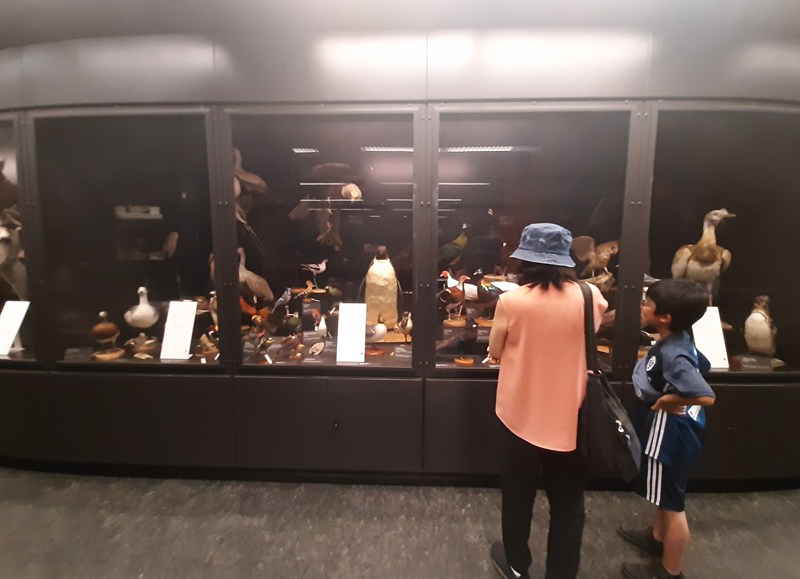
Grace and Kyle checking out the Taxidermy Exhibit

Designed in the interests of sustainability, the building has a green roof and a reed water garden to reduce pollutants and improve drainage of storm water from the building. Except in some of its laboratories, the centre does not have air conditioning.  Instead, through the facility’s concrete walls and by the use of sunshades on the outside of the building, the temperature level is mediated by natural ventilation.
To reduce the building’s use of electricity (which also assists in the preservation of some light-sensitive collections), natural lighting is also optimized. The centre also includes several “recycling hubs” and facilities for the composting of organic waste material.

We entered the museum through the glass-walled, two storey high Mowafaghian Atrium which, in addition to the museum’s gift shop and the Niche Cafe, houses the museum’s signature piece and most prominent display – a magnificent 26-m. (85-ft.) long skeleton of a female blue whale. Canada’s largest, it was found buried in Tignish, Prince Edward Island.  Suspended over a descending ramp by which the main collections are accessed, the display is a “see-through box” whose façade windows have “steel mesh brises-soleils.”

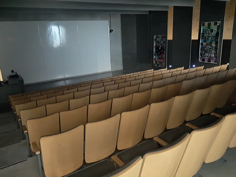
The largest skeleton exhibit in the world suspended without external framework for support, it is one of only 21 blue whale skeletons on public display worldwide. A Discovery Channel documentary, called Raising Big Blue, was first aired in Canada on June 5, 2011 and is frequently screened at the museum’s Allan Yap Theater. It featured the process of recovering, transporting and displaying the whale.  Scout Magazine included the museum’s blue whale exhibit in  list of “1,000 Cool Things about Vancouver.”

Allan Yap Theater

The Cowan Tetrapod Collection, founded in 1943, was named after Dr. Ian McTaggart-Cowan (its first curator).  Originally named the “Cowan Vertebrate Museum,” it is the second largest collection of birds, mammals, reptiles and amphibians in British Columbia.

Taxidermy Exhibit

Combining several pre-existing collections including the K. Racey Collection (over 4,200 birds and mammals), the zoological collections of W.S. Maguire and J. Wynne and the HR Macmillan ornithological collection, it contains over 40,000 items,over 39,000 items of which have been indexed in VertNet, a “collaborative project funded by the National Science Foundation that aims to make biodiversity data free and openly accessible on the web from publishers worldwide.”

They represent over 2,500 species of vertebrates – 18,000 mammals from 540 species, 17,500 birds and 7,000 bird eggs, and 1,600 reptiles and amphibians. The collection holds extensive, representative samples of nearly all species and most subspecies of British Columbia‘s terrestrial vertebrates and marine mammals.

The collection includes older specimens dating back to 1849, as well as rare specimens such as the red panda, the endangered Vancouver Island marmot, and even extinct species such as the passenger pigeon. Although mainly used for research, the collection also holds teaching specimens used by educators, artists, and others throughout the Lower Mainland.

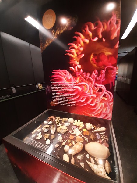
The Marine Invertebrate Collection, started in the 1940s with alcohol-preserved specimens collected by Dr. C. McLean Fraser and Dr. Ian McTaggart Cowan, was primarily used for teaching purposes and eventually grew to several thousand specimens encompassing the major lineages of invertebrate animals.

Marine Invertebrate Collection

In 2006, due to the donation of the Alice Stein collection (consisting of thousands of shells and corals) by Kelly Norton, the collection was expanded and, in the following year, was further expanded with a large donation of shells from Evelyn Hebb Killiam.

Both donations, representing mostly tropical species, include some spectacular examples of global marine biodiversity, such as giant clams and some rare species of cowries.  Items in the collection, not yet been fully catalogued, represent the “major lineages of animals” and include cnidarians, mollusks, annelids, echinoderms, crustaceans, and sponges.

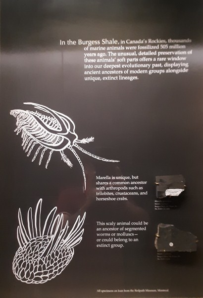
Burgess Shale

The Fossil Collection, part of the Pacific Museum of Earth, Department of Earth, Ocean and Atmospheric Sciences, UBC,was began by Dr. Merton Yarwood Williams (co-founder of the UBC Department of Geology) in 1924.  An initial acquisition of specimens from local mining engineer William John Sutton was exhibited in the Geological Sciences Centre beginning in 1971 and was curated by Joe Nagel (curator from 1971 to 1995).

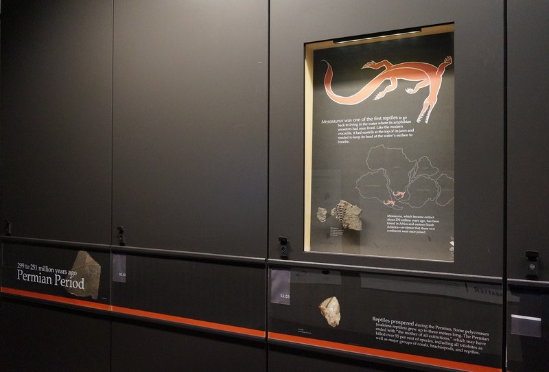
Permian Period

However, due to financial constraints, the exhibit was closed in 1995. In 2003, the collection became part of the holdings of the Pacific Museum of the Earth but, during its recataloguing process, is being housed in the Beaty Biodiversity Museum.

Comprising over 20,000 items, the Fossil Collection, is highlighted by its stromatolites (rock formations consisting of blue-green algae dating back 500 million years, some of the oldest extant fossils) and examples of the Burgess Shale. In 2018, the museum added, to its permanent exhibitions, 3 casts of early Cretaceous Period  dinosaur trackways from Peace Region area of British Columbia.

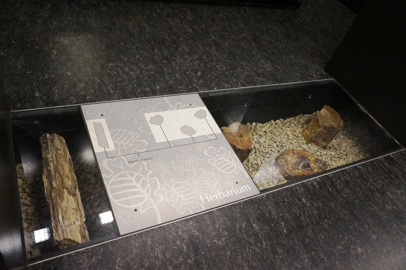
The Herbarium, the largest in Canada west of Ottawa, contains more than 650,000 specimens which are used to help researchers identify the plants, describe new species, and track changes in diversity over time. Among the Herbarium’s holdings are 498 type specimens.

In ground “excavation” where visitors can walk on at the Herbarium

Among the oldest collections at UBC, it was established in 1912 by John Davidson (at that time the BC provincial botanist) whose collection of mostly vascular plants was housed in downtown Vancouver at the Botanical Offices on West Pender Street (relocated to the university campus in 1925). This collection is critical to the identification, monitoring, and conservation of plant biodiversity in British Columbia, and is an important resource for scientific research and education.

It has five major collections.  The first, vascular plants of British Columbia (flowering plants, conifers, ferns, and their relatives) as well as Hawaiian plants, tropical prayer plants, and cyanolichens, comprises 223,000 vascular plants and their relatives. Two-thirds of the vascular plants collection is Canadian (45% from British Columbia and 22% from other provinces and territories) while 16% are American (9% from Hawaii and the Pacific coast and 7% from the other states) and 17% from other countries.

The second collection, the most comprehensive of any herbarium, particularly in its coverage of the northeast Pacific Ocean species, consists of 85,000 macroscopic algae (mostly seaweeds).  The third collection, of 242,000 internationally recognized bryophytes (mosses, liverworts and hornworts), is the largest in Canada.

The fourth collection, of 16,000 fungi, includes the largest research collection of macrofungi of British Columbia.  The last collection, of 40,000 lichens , is among the largest in western North America.


The Spencer Entomological Collection, the second-largest entomological collection in western Canada, was begun by Dr. George Spencer  (1888-1966) in the 1920s.  Including specimens from as early as the 1830s, it was not a university-recognized collection at the time of its creation but, by the time of Spencer’s retirement in 1958, it comprised over 300,000 items.

In 1953, it was officially founded as a university collection. In 1958, Dr. G.G.E. Scudder assumed the curatorship of the collection and, in his 40 years in that role (from 1958 to 1999), doubled the size of the collection.

Now comprising over 600,000 items (over 500,000 pinned insects, 25,000 on slides, and 75,000 in alcohol), the collection, a number of which have not yet been indexed, focuses on the spectacular insect diversity of British Columbia and Yukon.  In 2003, Dr. Wayne Maddison became the collection’s director and he enlarged the collection of jumping spiders into one of the world’s best through field work in tropical and temperate regions.

The collection has “particularly strong holdings of Hemiptera (true bugs), Odonata (dragonflies and damselflies), Siphonaptera (fleas) and Anoplura and Mallophaga (lice).” It also includes 350 books and other printed materials relevant to the study of entomology.

There are also numerous holotype specimens, such as the plant hopper Achrotile distincta, which Dr. Scudder discovered in 1959 in the Cariboo-Chilcotin and described as a new species in 1963. It also holds historical specimens of species that have disappeared from the province, such as the Limenitis archippus (viceroy butterfly), last collected in Lillooet in 1930.

Fish Collection

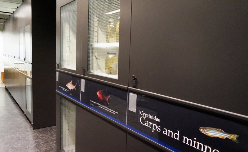
The Fish Collection, begun by Dr. C. McLean Fraser, the first head of UBC’s Department of Zoology, the third largest fish collection in Canada.  It holds over 850,000 specimens, over 2,300 of which are included in FishBase, a web-based global fish relational database containing information on practically all fish known to science. The first to index the museum’s collection, FishBase is supported by a research consortium that includes the UBC Fisheries Centre.

They include whole fish stored in alcohol, skeletons, cleared and stained fish, fish X-rays and over 50,000 DNA and tissue samples, with particular strengths in freshwater and nearshore marine species. Locations covered include Canada, the Aleutians, the Malay Archipelago, Mexico, the Galapagos Islands, Panama, and the Amazon River Basin.

Some specimens date back as far as 1904, but cataloguing didn’t begin until 1945. Used in conservation efforts, environmental assessments, and numerous research projects, particularly by the Native Fishes Research Group, the collection has also served as an educational resource in training some of Canada’s leading fish biologists. Dr. Murray Newman was the collection’s first curator and Dr. Wilbur Clemens, G.V. Wilby, Dr. Casimir Lindsey, Dr. Norman Wilimovsky, and Dr. J. Donald McPhail each, over the decades, greatly expanded the collections.

The collection holds 11 holotype specimens (original specimens that were used to describe new species) as well as representatives of pairs of stickleback species, what may be the youngest fish species on Earth, that evolved only recently in British Columbia’s lakes.  The collection has been used in environmental assessments, conservation efforts, and numerous research projects, as well as in educating and training some of Canada’s leading fish biologists. Its specimens have also been used to document regime shifts in the Bering Sea, the formation of new species, and the extinction of others.

The Allan Yap Discovery Lab

Beaty Biodiversity Museum:  2212 Main Mall, Point Grey, University of British Columbia V6T 1Z4, Vancouver, British Columbia.  Tel: 604-827-4955. Fax: 604-822-0686.  Open Tuesdays to Sundays, 10 AM – 5 PM.  Admission: C$14 (regular), C$30-45 (Family)  and free (students, staff and faculty).  E-mail: info@beatymuseum.ubc.ca.  Website:
www.beatymuseum.ubc.ca
.   Coordinates: 49.2636°N 123.2514°W


Stanley Park (Vancouver, British Columbia, Canada)

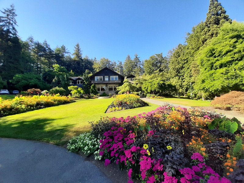
Stanley Park

The 405-hectare (1,001-acre) Stanley Park, a public park  that makes up the northwestern half of Vancouver‘s Downtown Peninsula, is surrounded by waters of  Burrard Inlet and English Bay. Bordering the neighborhoods of West End and Coal Harbour to its southeast, the park is connected to the North Shore via the Lions Gate Bridge. The park’s easternmost point is marked by the historic lighthouse on Brockton Point.

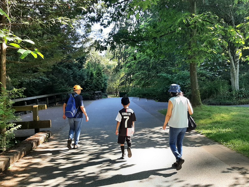
Jandy, Kyle and Grace strolling at Stanley Park

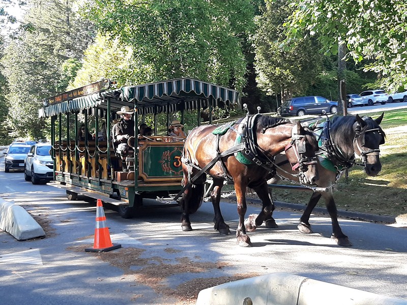
Stanley Park, while it is not the largest of its kind, is about one-fifth larger than New York City’s 340-hectare (840-acre) Central Park and almost half the size of London’s 960-hectare (2,360-acre) Richmond Park.  The pak is best toured via horse-drawn carriages.

Horse-Drawn Carriage

Originally known as Coal Peninsula, the land was originally used by Indigenous peoples for thousands of years before British Columbia was colonized by the British during the 1858 Fraser Canyon Gold Rush. One of the first areas to be explored in the city, it was, for many years after colonization, also be home to non-Indigenous settlers. The future park, with its abundant resources, was set aside for military fortifications to guard the entrance to Vancouver Harbor.

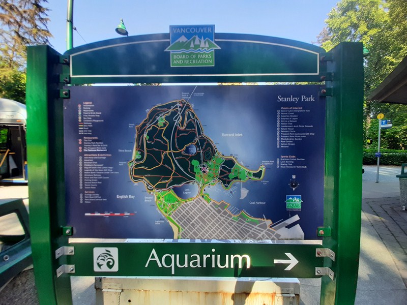
Stanley Park Map

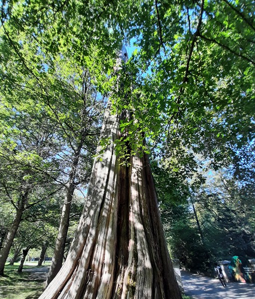
Much of Stanley Park remains as densely forested as it was in the late 1800s, with about a half million trees (cedar, fir, hemlock, etc.), some standing as tall as 76 m. (249 ft.) and hundreds of years old. Thousands of trees were lost (and many replanted) after three major windstorms that took place in the past 100 years (the last in 2006).

One of the park’s cedar trees

Here’s the historical timeline of Stanley Park:

  • In 1886, when the city incorporated, the land was later turned into Vancouver’s first park and the Vancouver city council successfully sought a lease of the park which was granted for $1 per year.
  • In September 1888, Lord Stanley, 16th Earl of Derby, a British politician who had recently been appointed Governor General, opened the park in his name.
  • On June 18, 2014, based on reviews submitted, Stanley Park was named “top park in the entire world” by TripAdvisor.

Unlike other large urban parks, Stanley Park is not the creation of a landscape architect but, rather, the evolution of a forest and urban space over many years. Under the influence of then superintendent W.S. Rawlings, most of the manmade structures present in the park were built between 1911 and 1937. Additional attractions, such as a polar bear exhibit, the Vancouver Aquarium and a miniature train, were added in the post-war period.

Stanley Park is home to one of the largest urban colonies of great blue heron (classified as a species at risk in British Columbia) in North America.  As far back as 1921, the birds have been documented nesting in various locations in Stanley Park. Since 2004, the Stanley Park Ecology Society has been monitoring the heronry in Stanley Park.  In 2013, an estimated 156 young Pacific great blue herons were fledged from the colony. Since monitoring started in 2007, the highest number of great blue herons fledged in a year was 258 (in 2007) and the lowest number was in 2011 with just 99 of the birds fledged.

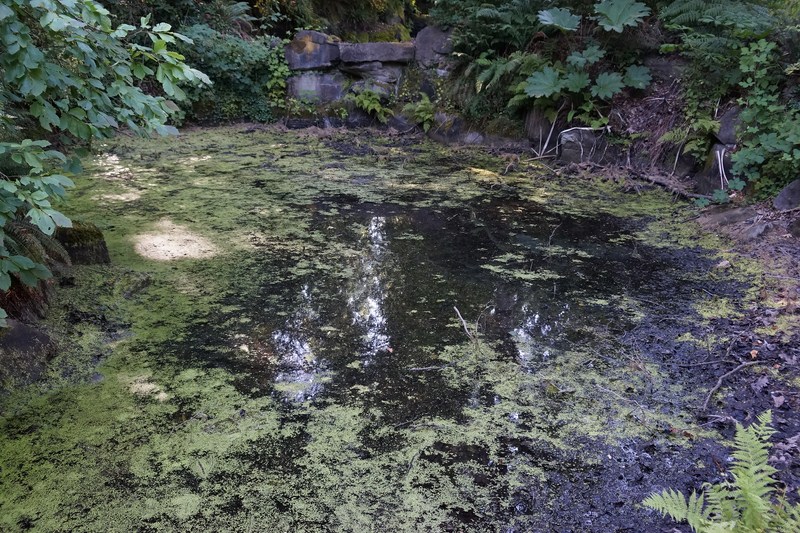
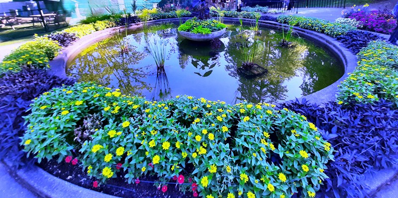
A water feature at the park

Stanley Park also has children’s playgrounds, sandy beaches, gardens, tennis courts, an 18-hole pitch and putt golf course, a seaside swimming pool, a water spray park, forest trails, lakes, and among many other attractions.  It also has a large number of monuments, including statues, plaques, and gardens. Among these are the Japanese Canadian War Memorial, a cenotaph which has two rows of Japanese cherry (Prunus Shirotae ) trees, and statues of poet Robert Burns, Olympic runner Harry Jerome, and Girl in a Wetsuit.

Attractions found east of the causeway are:

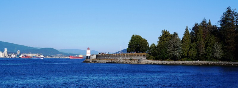
Brockton Point Lighthouse

The square lighthouse at Brockton Point , designed by Thomas Hayton Mawson, was built in 1914 to replace one built in 1890. Painted white with a red horizontal stripe, has a red lantern and an arched base with a walkway underneath.

Brockton Oval

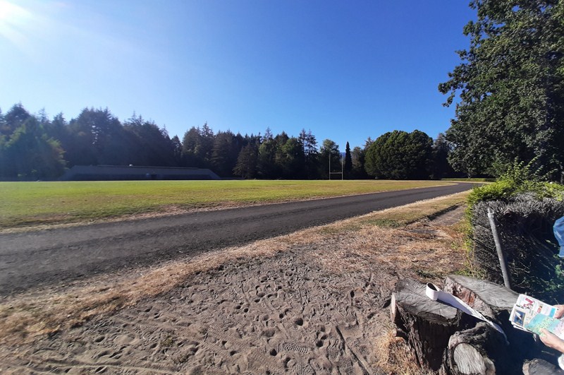
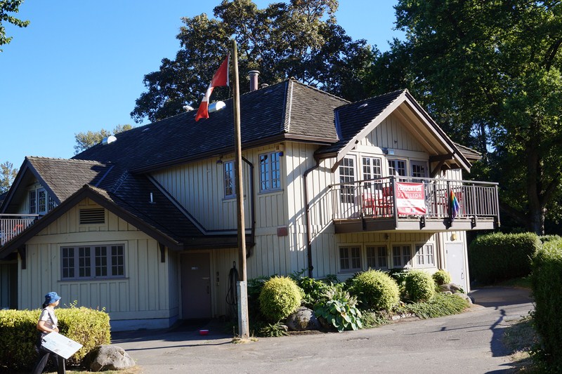
The fields of Brockton Oval has, since 1891, been used for athletics (including an oval running track), track sports, rugby and cricket. Brockton Oval Clubhouse, also known as the Cricket & Rugby Pavilion, was built in 1927.

Brockton Pavilion

The Nine O’Clock Gun, an 1816 naval cannon located near Brockton Point, is the oldest manmade landmark in the park.  Fired for first time in 1898, this tradition has continued for more than 100 years. Fired every day at 9 PM, the cannon was originally detonated with a stick of dynamite, but is now activated automatically with an electronic trigger.

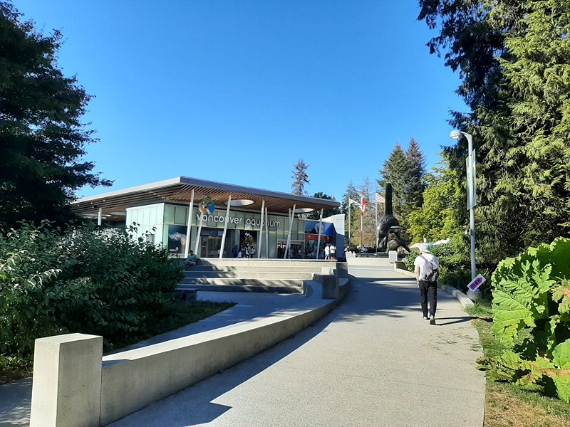
Vancouver Aquarium

Vancouver Aquarium, the largest in Canada and one of the five largest in North America, was opened in 1956.  It houses a collection of marine life that includes dolphins, belugas, sea lions, harbour seals, and sea otters. In total, there are approximately 300 species of fish, 30,000 invertebrates, 56 species of amphibians and reptiles, and around 60 mammals and birds. The aquarium is also home to a 4D theatre.

Check out “Vancouver Aquarium”

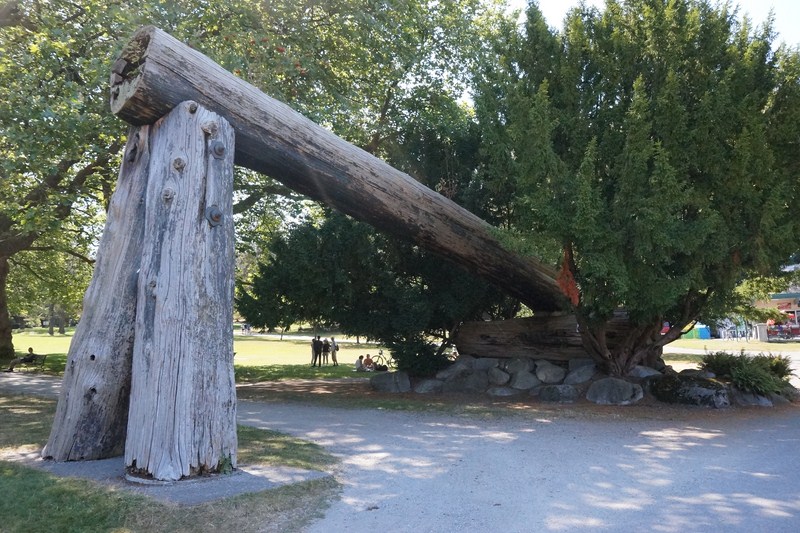
Lumberman’s Arch, a children’s play area, water spray park and picnic area near the aquarium, the Lumberman’s Arch generally refers to a large clearing and picnic area on the park’s northeastern shore. There is also a Lumberman’s Arch landmark located across from the concession stand. The arch is a timber-and-stump structure erected in 1952 (a single log propped up by two others).

Lumberman’s Arch

It replaced the original arch that was built by lumber workers in 1912 as organized labor’s contribution to the celebration of a visit by the Duke of Connaught. The 1912 arch was a copy of the Parthenon’s front, using whole trees for the columns and gable, and was originally located on the Duke’s carriage route at Homer and Pender Streets before it was moved to the park. It was torn down in 1947 after succumbing to rot.

Beaver Lake, nestled in the forest northwest of Lumberman’s Arch, this is a restful space nestled among the trees. Almost completely covered with water lilies (introduced for the Queen’s Jubilee in 1938) and home to beavers, fish, and water birds, as of 1997, the surface area of the lake was just short of 4 hectares (10 acres), but the lake is slowly shrinking in size. Beaver Creek – one of Vancouver’s few remaining free-flowing streams, joins Beaver Lake to the Pacific Ocean and is one of two streams in Vancouver where salmon still return to spawn each year.

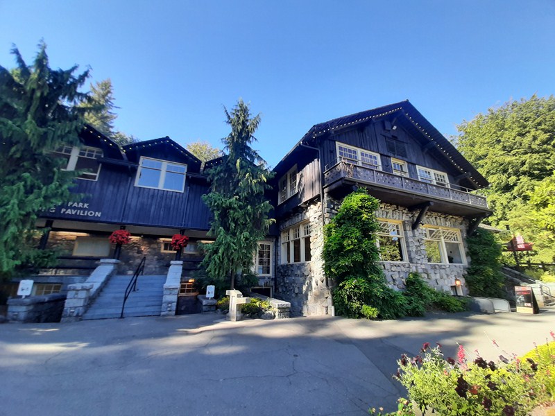
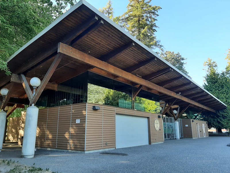
Stanley Park Pavilion

Stanley Park Pavilion, located at Brockton Point, is now home to Stanley’s Park Bar & Grill.  Built in 1911-12, it was designed by Otto Moberg. Architect Percy Underwood designed the addition, 1946–50, on the pavilion’s west side. It is close to the Vancouver Aquarium.  The Rose Garden,  located south of the Stanley Park Pavilion, was developed in 1920-21.
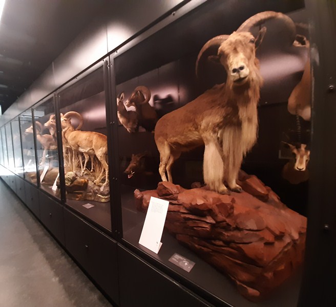
The Rose Garden

The Rock Garden, developed in 1911-1920 using stones excavated when the pavilion was built, encircles part of the Stanley Park Pavilion. The windstorm of 2006 revealed traces this long-forgotten rock garden which had once been one of the park’s star attractions and one of its largest man-made objects by area. Soon after its discovery, a section that encircles part of the Stanley Park Pavilion was restored (the garden had originally extended from Pipeline Road to Coal Harbour).

Stanley Park Railway, first started in 1947, is a diminutive steam train that pulls passenger cars on a circuit through the woods. In 1964, a new train and track opened. Located behind the Stanley Park Pavilion, the 508 mm. (20 in.) narrow-gauge, rideable miniature railway, with different seasonal themes, is a Vancouver tradition, especially for families with young children. The original railway featured a child-sized train. The current adult-sized railroad, opened in 1964 in an area leveled by Typhoon Freda, has an engine that is a replica of the first transcontinental passenger train to arrive in Vancouver in the 1880s.

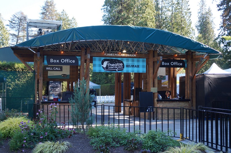
James Pollard Pavilion

Located in front of the Stanley Park Pavilion is Malkin Bowl, a “shell” stage modeled after the Hollywood Bowl in Los Angeles.  It was built in 1934 by former mayor W.H. Malkin  in honor of his late wife. On July 8, 1934, Malkin Bowl hosts its first concert, a free performance by the Vancouver Symphony that draws 15,000 people. It was rebuilt after a fire in 1982.  In summer, the outdoor theatre (James Pollard Pavilion) features events by Theatre Under the Stars and Live Nation (with their Concerts in the Park series).

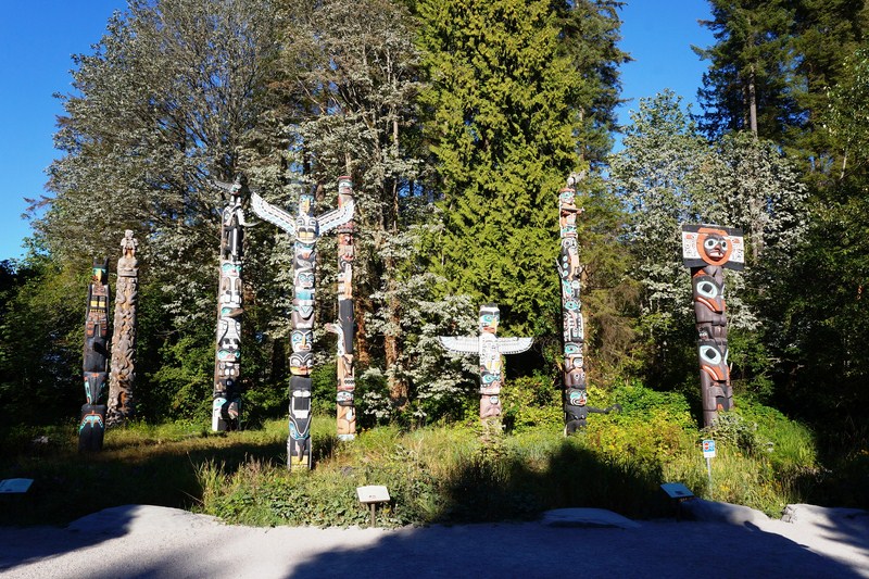
Totem Poles

The totem poles at Brockton Point is the most visited tourist attraction in British Columbia.  Many of the original poles were moved to museums in order to preserve them. Several replicas were commissioned or loaned to the park board between 1986 and 1992. Nearby is the Legends of the Moon Café.

Legends of the Moon Cafe

Attractions found west of the causeway, in an area that includes Lost Lagoon and Prospect Point (a lookout at the highest point in the park located by the Lions Gate Bridge) include:

The Lost Lagoon, designed by Thomas Hayton Mawson, is a captive 17-hectare (41-acre) freshwater lake.  Located near the Georgia Street entrance to the park, it is a nesting ground to many bird species, such as Canada geese, and ducks. Its Jubilee Fountain was purchased to commemorate Vancouver’s 50th anniversary in 1936.  On the south shore of Lost Lagoon is the Lost Lagoon Nature House. Formerly a boathouse, it is run by the Stanley Park Ecology Society.

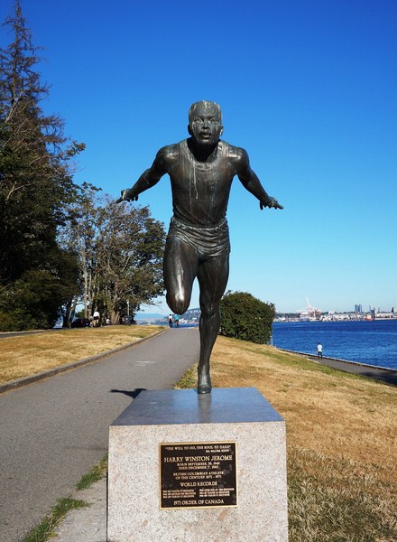
The 2.7 m. (9 ft.) bronze Statue of Harry Jerome (a local Olympic runner), located by Brockton Point, depicts the sprinter with his chest thrust forward into the finish tape. Sculpted by Jack Harman in 1986, it was unveiled in 1988.

Harry Jerome Statue

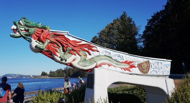
Replica of Figurehead of RMS Empress of Japan was cast, in 1960, from the original carving of the figurehead, restored in 1928, of what was once the fastest ship on the Pacific that operated between 1891 and 1922.

Replica of Figurehead of S.S. Empress of Japan

The Pitch and Putt Golf Course, built in 1932, is a par 3 course that takes 1–3 hours to complete. Architect Percy Underwood designed the Golf Course Ticket Booth, 1953-55.

Ted and Mary Greig Rhododendron Garden was not dedicated until 1989.  The shrubs here were donated in 1965.  The rhododendrons are planted in a roughly circular form around the pitch and putt golf course near Lost Lagoon. The best time of year to visit is March–May and the peak is usually early May.

The slightly hidden Two Spirits Sculpture is found just west of the crossroads of trails that enter into Stanley Park from the swimming pool located at Second Beach. The sculpture was created in the mid-1990s and depicts the silhouetted head of an aboriginal person against its own image. The sculpture was chiseled into a stump that remains from one the large trees in the area.

The  Air India Flight 182 Monument  and playground, located in Ceperley Meadow, near Second Beach, commemorates the victims of the  Air India Flight 182 bombing.  Built in 2006 and dedicated in 2007, the federal government spent approximately $800,000 to build the memorial and playground.
The  Chehalis Cross, a memorial commemorating the eight people who died when the Chehalis tugboat sank off Stanley Park after colliding with the MV Princess Victoria in 1906, is located west of Brockton Point.

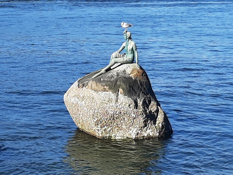
Girl in Wetsuit

The  Bust of David Oppenheimer, a memorial bust of David Oppenheimer (Vancouver’s former mayor, 1888–91), is located at the English Bay entrance and was cast in 1911. The Statue of Girl in a Wetsuit, located by Brockton Point, represents Vancouver’s dependence on the sea.  It was created by Elek Imredy and unveiled on June 10, 1972.

The Sculpture of  Lord Stanley, created by Sydney March, was unveiled in 1960 and is located at the Coal Harbour entrance to the park.

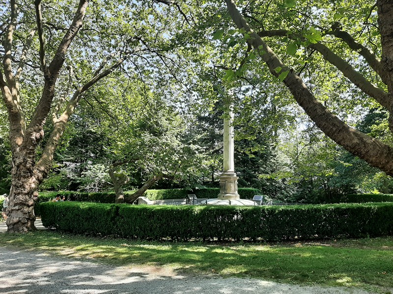
The Japanese Canadian War Memorial, a large ceremonial column built by 1921 with private donations in memory of Japanese Canadians who gave their lives in World War I. The impressive monument, located near the Vancouver Aquarium, is joined by two rows of Japanese cherry trees (Prunus Shirotae) planted along an axial approach. The best time to view is fall and spring.
Check out “Japanese Canadian War Memorial”

Canadian-Japanese War Memorial

The SS Beaver Plaque, a commemorative cairn, located on the seawall below Prospect Point, next to the Windstorm Monument and the Prospect Point Café, commemorates the SS Beaver which ran aground on the rocks below Prospect Point in 1888. One of the walking beams from the original ship is also displayed at Prospect Point (unveiled in 1941).

The Warren G. Harding Memorial, commemorating Warren G. Harding‘s (the former 29th US president) visit to the park in the 1920s, a week before his death, it was designed by Charles Marega and unveiled in 1925. It is located between the Stanley Park Pavilion and Malkin Bowl.

The Air Force Garden of Remembrance, established by the Women’s Auxiliary to Air Services in 1948, commemorates the airmen who gave their lives in the World War II. A variety of plaques are placed throughout the shade rock garden, flagstone steps, path, small stream, and pond. A wooded area located on a knoll just west of the Stanley Park Pavilion, in 2019, the Park Board initiated plans to relocate the Garden of Remembrance to Queen Elizabeth Park.

Frances E. Willard Bush and Plaque, commemorating the 100th anniversary of the birth of Frances E. Willard, an American suffragist known for her efforts in winning the vote for women, was placed in 1939. A white camellia tree was planted too, but only a stump remains. It is located in the Rock Garden.

The  HMS Egeria Benchmark, located west of the Nine O’Clock Gun, notes a reference point used by the Royal Engineers in 1863 during their survey of Burrard Inlet and the Royal Navy survey ship, HMS Egeria, in 1898.

Hallelujah Point

Hallelujah Point, on the grass near the Nine O’Clock Gun, marks the site used by the Salvation Army.  The name derives from the Hallelujahs that could be heard across Coal Harbour during the Army’s meetings here.

The James Cunningham Plaque, inlaid cliffside on the seawall near Siwash Rock, is in remembrance of Jimmy Cunningham, the master stonemason who directed construction of the seawall for years. Stones were left out of the seawall near this spot, where Cunningham’s ashes were laid to rest.

The Stanley Park Centennial, located off the seawall on a knoll between Beaver Lake Trail and Lions Gate Bridge, has a plaque placed in 1988 to commemorate the official opening of the park, and marking the spot where Chaythoos once was.

A long-standing tradition in the park has been to plant oak trees to commemorate various persons and events. The first reported example was an oak tree planted at Brockton Oval by the Duke of York in 1901. Over the years other trees have been planted to recognize:

  • Brockton Point Association – planted by this association in 1902, this oak is still thriving in its location at the northeast corner of the Brockton Oval.
  • Canadian Forestry Corps– located by the Warren G. Harding Memorial, the corps is commemorated by a plaque and three oak trees from Windsor, England.
  • King Edward VII– this monarch is commemorated by an oak and plaque near Brockton Pavilion.
  • Queen Elizabeth II– Her Majesty Queen Elizabeth II is commemorated by a plaque and oak tree, planted in a small grassed area near the golf course.
  • John DrainieMemorial – The Canadian Shakespearean actor and broadcaster John Drainie is commemorated by a plaque and dogwood tree in the Shakespeare Garden.
  • Peter Z. Caverhill – also located by the Warren G. Harding Memorial, this memorial consists of a plaque and commemorative fir tree.
  • William ShakespeareGardens – located near the Rose Garden Cottage, this garden consists of a relief statue and trees and plants mentioned in the Bard’s plays. Created in the 1930s.

Inside the park are also more than 27 kms. (17 mi.) of forest trails patrolled, on horseback, by members of the Vancouver Police Department whose Mounted Unit’s youth outreach includes offering guided tours of the stables and the ‘Collector’s Trading Card Program,’ which encourages children of all ages to approach a constable on horseback and request a card.

Most of the forest trails bear the names of individuals who were instrumental in the city’s or Stanley Park’s early history:

  • Avison Trail – named after Henry Avison, Stanley Park Superintendent, 1888-1895
  • Eldon Trail – named after G. Eldon, Park Board Superintendent, 1896-1909
  • Lees Trail – named after A.E. Lees, Park Commissioner, 1902-1917
  • Merilees Trail – named after Harold Merilees, General Manager of Tourism Vancouver in the 1960s
  • Rawlings Trail – the longest trail, named after W.S. Rawlings, the Park Board’s longest serving Superintendent
  • Tatlow Trail – named after R.G. Tatlow, Park Commissioner, 1888-1905
  • Thompson Trail – named after C.W. Thompson, Park Commissioner, 1937-1938; 1940-1942
  • Tisdall Trail – named after C.E. Tisdall, Park Commissioner, 1904-1909; 1926-1934

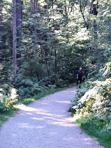
A park trail

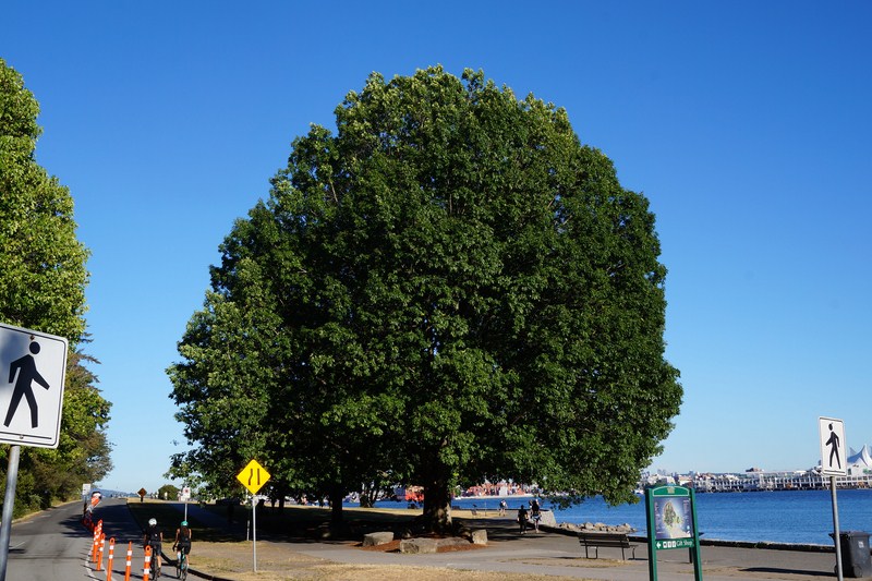
The near-century-old  Vancouver Seawall,  which can draw thousands of people to the park in the summer, is popular for walking, running, cycling, inline skating and even fishing (with a license).  It has two paths, one for skaters and cyclists (goes one-way in a counterclockwise loop) and the other for pedestrians. Walking the entire loop around Stanley Park takes about two hours while biking takes about one hour.

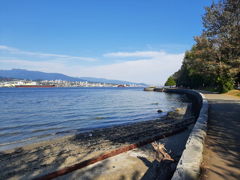
Vancouver Seawall

Based on the view that it is already saturated, the park board has banned the erection of any further memorials to ensure that Stanley Park is kept in a more natural state.

The Vancouver Centenary Cairn

Stanley Park: Vancouver, British Columbia, Canada. Coordinates: 49.30°N 123.14°W. Open daily.

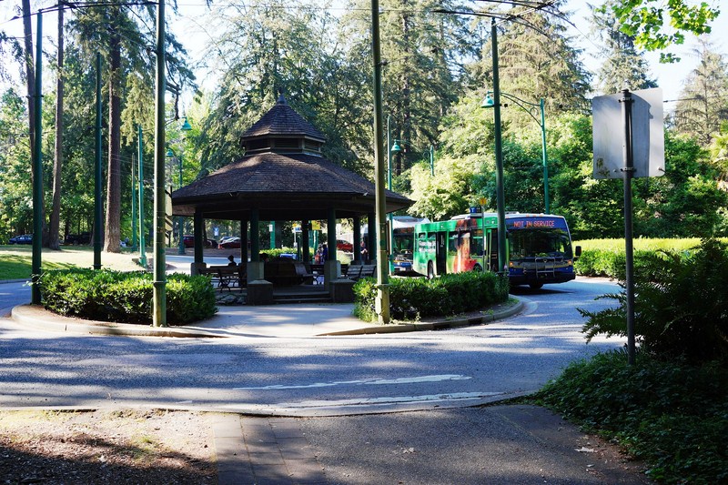
The Bus Loop located just up Pipeline Road from the traffic circle, next to the Miniature Train and Air Force Garden of Remembrance

How to Get There:There is a bus loop in Stanley Park and only one public bus (No. 19 Stanley Park) goes to the loop year round.

Vancouver Chinatown (British Columbia, Canada)

Vancouver Chinatown, Canada’s largest

On our 35th day in Vancouver, Jandy and I returned (the first was in August 10 when we visited the Dr. Sun Yat Sen Classical Chinese Garden and Park) to Vancouver Chinatown, Canada‘s largest Chinatown, which is home to important cultural heritage assets and many community organizations with deep historical roots in Vancouver and Canada.

Check out “Dr. Sun Yat Sen Classical Chinese Garden and Park”

Across 130 years of change, the district, one of the most significant urban heritage sites in Canada, has experienced recent decline as newer members of Vancouver’s Chinese community dispersed to other parts of the metropolitan area.  However, it still maintains a strong community and cultural identity.

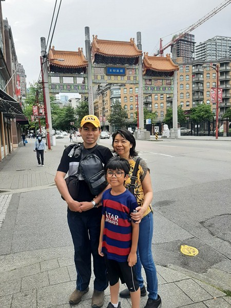
Jandy, Kyle and Grace at Vancouver Chinatown

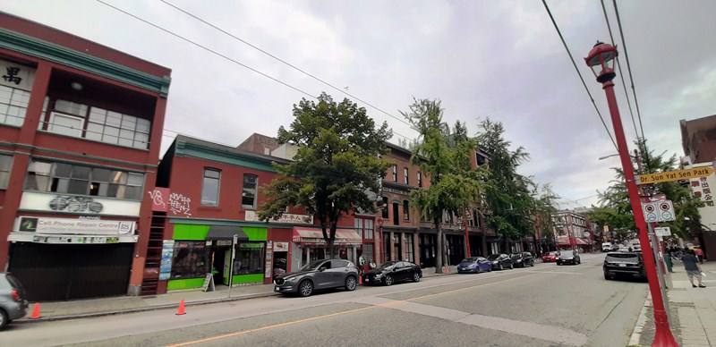
Centered around Pender Street, this popular tourist attraction is one of the largest historic Chinatowns in North America.  Its approximate borders, as designated by the City of Vancouver, are the alley between Pender and Hastings Streets, Georgia Street, Gore Avenue and Taylor Street.  Unofficially, the area extends well into the rest of the Downtown Eastside.

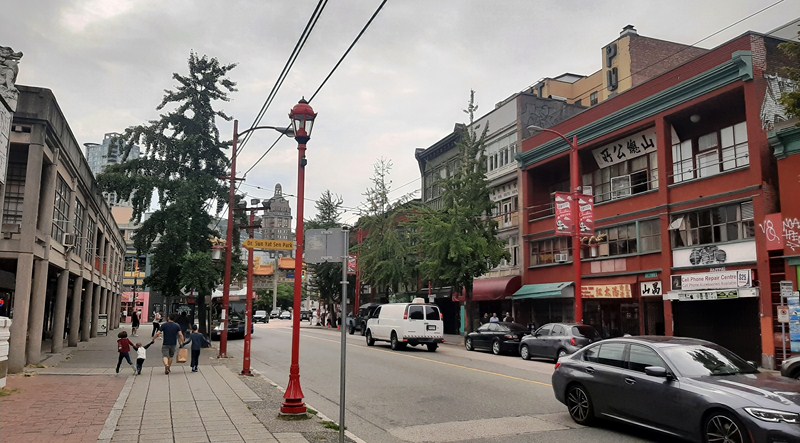
East Pender Street

The principal areas of commercial activity are Main, Pender and Keefer Streets. Chinatown is surrounded by Gastown to the north, the Downtown financial and central business districts to the west, the Georgia Viaduct and the False Creek inlet to the south, the Downtown Eastside and the remnant of old Japantown to the northeast, and the residential neighborhood of Strathcona to the southeast.

Due to the large ethnic Chinese presence in Vancouver (especially represented by mostly Cantonese-speaking multi-generation Chinese Canadians and first-generation immigrants from Hong Kong), the city has been referred to as “Hongcouver.”  In recent years, however, most immigration has been Mandarin-speaking residents from Mainland China.

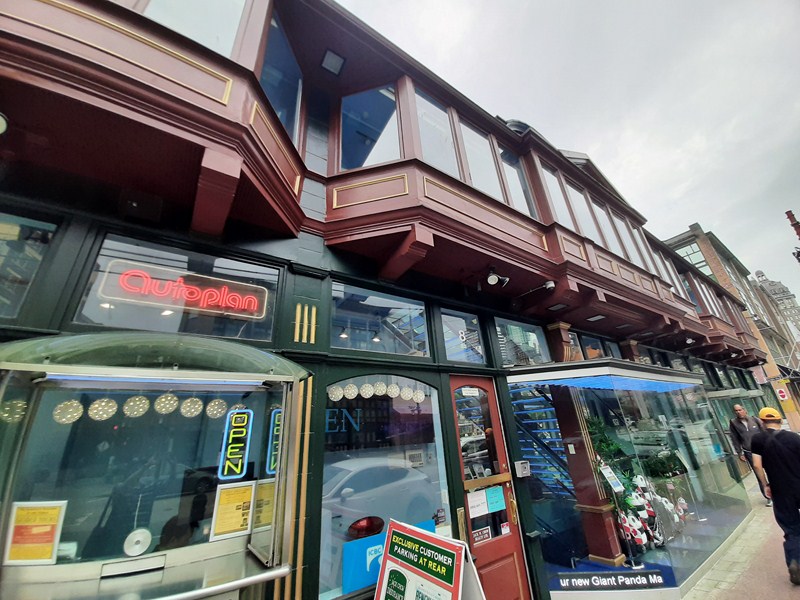
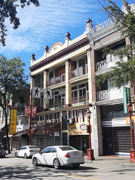
In 2011, the neighborhood was designated a National Historic Site of Canada.  Many of the substantial buildings here were built in a distinct “Chinatown architectural style,” with vertical proportions, four storeys (with one or more of the upper floors featuring recessed balconies and others fully glazed) and with a classical metal cornice.

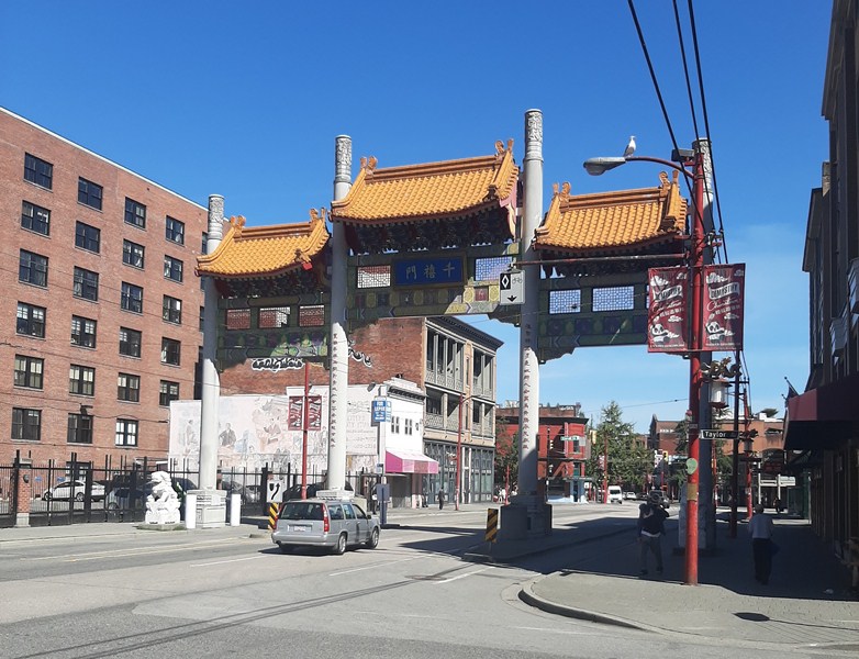
Vancouver Chinatown Millennium Gate

Our tour of Chinatown began when we entered the Chinatown Millennium Gate which straddles Pender Street, near the intersection with Taylor Street.  It marks the western boundary of Chinatown.  Designed by local architect Joe Y. Wai (1940–2017), whose work and contribution can be seen throughout Chinatown.

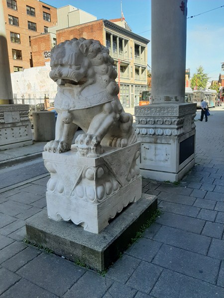
One of two guardian lions at the gate

The gate was approved on September 20, 2001 and erected in 2002 at the same site as a temporary wooden arch built to celebrate the 1901 royal tour by the Duke and Duchess of Cornwall and York. The Millennium Gate recalls gates you may find at the entrances to villages in southern China. On the eastern face are Chinese characters which read “Remember the past and look forward to the future.”

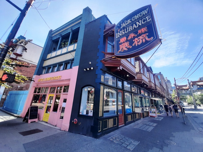
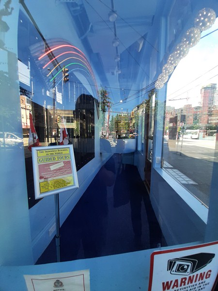
Past the gate, at the right, is the Sam Kee Building (8 West Pender Street) credited, by the Guiness Book of World Records, as “The world’s shallowest (not the narrowest) freestanding building in the world.” The building’s namesake, the Sam Kee Company, was run by successful business leader Chang Toy, one of the wealthier merchants in turn-of-the-20th-century Chinatown.

Sam Kee Building

One of the largest Chinese merchant firms in Vancouver, the company, established in 1888, manufactured charcoal, operated a herring saltery in Nanaimo and contracted Chinese labor to various industries. It also imported and exported food products to and from China, served as agents for the Blue Funnel Steamship Line and possessed sizable real estate holdings throughout Greater Vancouver.

The narrow 1.8 m.(6 ft.) side of the building

In 1903, Chang Toy bought the standard-sized lot for the building. The lot was the previous home to Shanghai Alley, an early Vancouver red light district which collaboratively hosted 105 brothels with Canton Alley. However, in 1912 the city widened Pender Street, expropriating (which Toy’s lawyers negotiated a fair market price) all but 6 ft. of the Pender Street side of the lot. In 1913, he hired architects Bryan and Gillam to design this narrow steel-framed free-standing building for offices, business and bath houses on the remaining narrow 6-ft. strip, costing just $8,000 to erect.
View of the room at the narrow side of the building

To maximize use of the property, the building basement (such basements in Vancouver were once common and zoned as “areaways”), much wider than the rest of the building, extended under the sidewalk and housed public baths. On the ground floor were shops while offices were located above. In the 1980s, the building was rehabilitated for Jack Chow and completed in 1986. Designed by Soren Rasmussen Architect, the glass prisms that were set in a tight grid across the sidewalk to light the basement, were replaced with modern glass.

Chinatown Heritage Alley (Shanghai Alley)

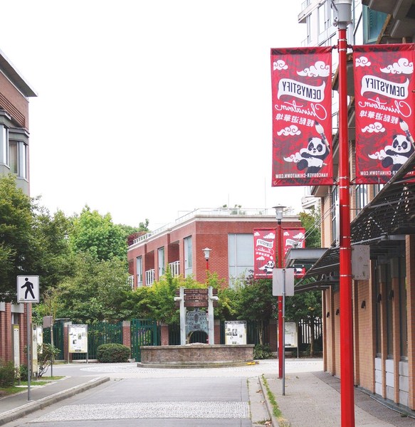
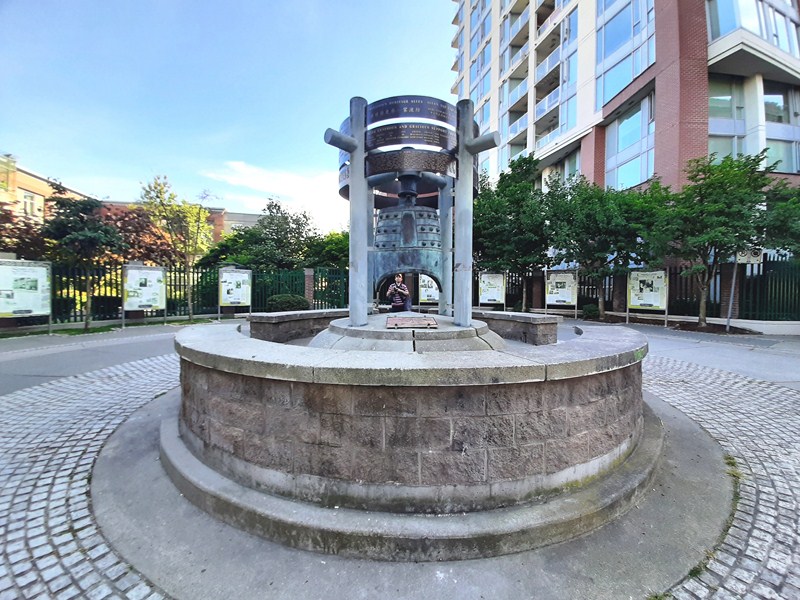
At the end of Shanghai Alley (or Chinatown Heritage Alley), near West Pender Street, is the Allan Yap Circle.  Here, hangs a replica Western Han Dynasty bell, a gift to Vancouver from sister city Guangzhou and a symbol of the historic connection between the two cities and their urban settlements, which was dedicated on June 26, 2001.

Allan Yap Circle

Also on this corner is S.U.C.C.E.S.S., created in Vancouver in 1973 to assist new Canadians of Chinese descent to overcome language and cultural barriers. The organization is now one of BC’s largest social services organizations with locations also in Taiwan and Korea.

Across the Sam Kee Building is the Chinese Freemasons Building (3-9 West Pender Street).  Originally the site of a Methodist church (in 1888, the first to minister to the Chinese community in Vancouver) from 1889 until 1907 when the Chee Kung Tong (a traditional Chinese fraternal organization which provided welfare assistance to the earliest Chinese immigrants during the Fraser Canyon Gold Rush of 1858) constructed the current building. In 1920, the organization adopted the English name the Chinese Freemasons in order to forge links with European Freemasonry.

Chinese Freemasons Building

Like many overseas organizations, it was deeply involved in Chinese politics. The building was even mortgaged to help fund Dr. Sun Yat-Sen’s (whose efforts the Freemasons supported to bring democracy to China) 1911 rebellion. The building also served as the original home of the successful business, Modernize Tailors, one of many tailors (a profession available to Chinese Canadians in an era of employment restrictions in the area). After a fire in 1975, the building was repaired and, in the early 2000s, a careful restoration was completed by Joe Wai for the Wong family.

Facing the Freemason Building is the two-storey, brick Chinese Times Building (1 East Pender Street).  Commissioned by successful businessman and community leader Yip Sang, it was designed in 1901 by architect W.T. Whiteway. From the 1930s to 1990s, the building was home to The Chinese Times, an important source for local and Chinese political news, managed by the Chinese Freemasons.

Chinese Times Building

When the newspaper moved in, a mezzanine floor was added to accommodate the typesetters who used the 5,000 different Chinese characters to create each edition. Since the typesetters sat all day, the ceiling is only 6 ft. high.  Through the ground floor windows, the printing presses could be viewed and men gathered to read the paper pasted to the Carrall Street wall.

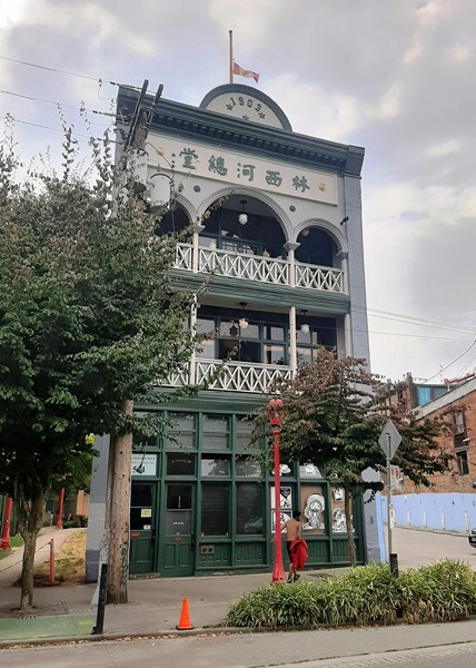
Around the corner, from Sam Kee Building, is the Lim Sai Hor (Kow Mok) Benevolent Association Building (525-531 Carrall Street).  The earliest surviving association building, it was constructed in 1903 for the Chinese Empire Reform Association (focusing to bring about political reform in China, its members included Chang Toy, Yip Sang and Alexander Won Cumyow, the first person of Chinese descent born in Canada), the most influential association in Chinatown at the time. At its height (it faded with the fall of the Qing Empire and the emergence of the Dr. Sun Yat-Sen-led republic in 1911), the building housed a school and published a newspaper.

Lim Sai Hor Kow Mock Benevolent Association Building

In 1926, the newly formed Lim Sai Hor (Kow Mok) Association rented the space and, in 1945, bought the building to serve as headquarters for its members (defined by the common surname Lim or Lam). In 2017, a rehabilitation project restored the exterior balcony details, lighting and other distinctive features that reflect the exchange between China and Canada, influencing the traditional village house style and blending it with modern western design trends. The use of green as an accent color in the interior and exterior is a nod to the members’ surname which means “forest.” The building also houses an ancestral altar, built in 1993 and used by society members.

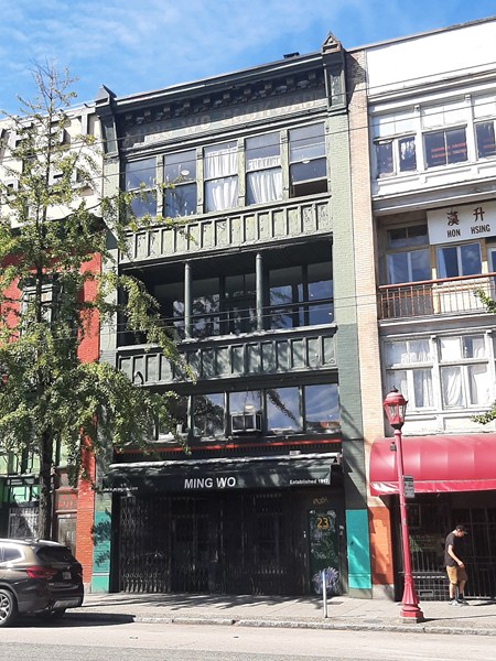
The four-storey, brick Ming Wo Building, at 23 East Pender Street, was designed by W.H. Chow, the only identified Chinese-Canadian architect practicing at the time, and built in 1913 for Wong Soon King, a real estate developer and co-founder of the Chinese Board of Trade. 

In 1917, opened as Ming Wo Hardware store, making it the oldest retail outlet in Chinatown and one of the oldest in the city. The company was founded by Wong Chew Lip, who moved to Canada from Kwong Chow (Canton) in southern China about 1908.  The Wong Chew Lip family descendants lived above the store. The company supplied Chinatown’s businesses and evolved into a restaurant supply business that has numerous cookware stores in Metro Vancouver.

Ming Wo Building

The use of space within the building conforms to the representative pattern in Chinatown.  On the ground floor are the retail space while on the upper floors are offices, meeting rooms and small residential rooms designed to accommodate “married bachelors.” In the first third of the twentieth century, organizational tenants included the Kong Chow Benevolent Association and the Hong Kong Club.

Yue Shan Society Building

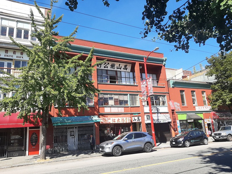
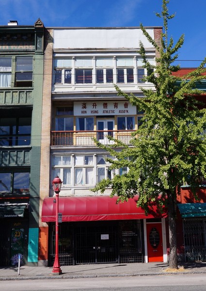
Further along East Pender Street is the three-storey, brick Yue Shan Society Building (33-39 East Pender Street).  Designed in 1920 by architect W.H. Chow (who also designed many others for the community from 1908 to 1922), it became home, in 1943, to the Yue Shan Society, an organization formed in 1894 for people from Poon Yue County near Guangzhou. The Society also owns the two-storey brick Hon Hsing Athletic Association Building to the right (dating to 1889) and the three-storey residential building at the rear of the property facing Market Alley.

Wong’s Benevolent Association/Hon Hsing Athletic Club Building

The Wong’s Benevolent Association/Hon Hsing Athletic Club Building, at 29 East Pender Street, was designed by architect R.J. MacDonald and built 1910 for the Wong’s Benevolent Association.  It is home to the Hon Hsing Athletic Club, a Chinese martial arts (a crucial element of intangible cultural heritage in Chinatown and a fundamental part of the performance of the lion dances that anchor the annual Chinese New Year Parade) school established in 1938.

Wing Sang Company Building

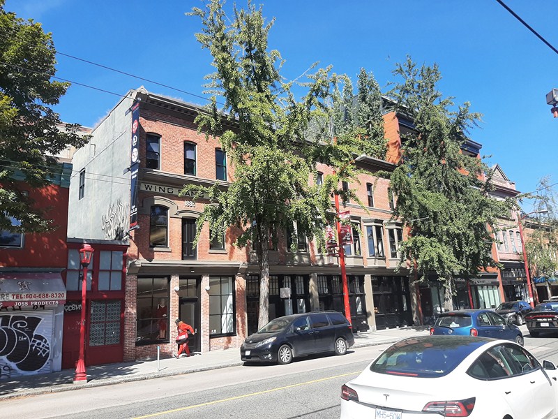
The two-storey, brick Wing Sang Building, at 51 East Pender Street, part of the Yip family complex, is the oldest (built in 1889) standing building in Chinatown.  It served as the office and ticket agency of Vancouver businessman Yip Sang (instrumental in a number of social endeavors, including bringing the CBA to Vancouver and establishing a Chinese hospital, and he was a lifetime governor of the Vancouver General Hospital).

Founded in 1888, the Wing Sang Company was engaged in a variety of enterprises including labor contracting and a trans-Pacific import and export business, and was the Canadian Pacific steamship ticket agency for travel to China. The door, on the second floor, opened to the upstairs warehouse (goods were hoisted in and out through that door). In 1901, the complex grew to accommodate a growing family and business with an expansion on top and besides the original building. The family residence was located at the upper floors while the ground floor was home to a variety of businesses, including a saloon and a cigar store. In 1912 a six-storey building, facing Market Alley, was added to the complex to accommodate the growing extended family. Today, this building houses offices and the Rennie Museum.

The Chinese Benevolent Association of Vancouver (CBA) Building, at 104 -108 East Pender Street, was built in 1909 by Vancouver’s branch of the CBA (formed in 1895). Its architectural style, a good example of the influences from southern China, features recessed balconies, ornate ironwork and decorative tiles. .

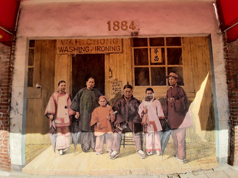
Wah Chong Family (1884)

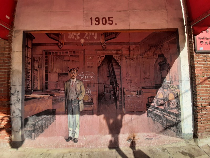
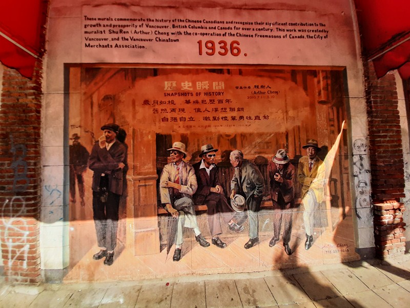
Snapshots of History, a three-panel mural that decorates the side of a building at 490 Columbia Street (northwest corner of Pender & Columbia), was installed in 2010 by Shu Ren Cheng. One panel depicts the 1884 Goon family.

Silk Merchant (1905)

Men in Barbershop (1936)

The other two panels of the mural feature a reproduction of a 1905 photo of a silk merchant in Chinatown and a rendering of a 1936 photo of men sitting outside a barber shop at Carrall and Pender.

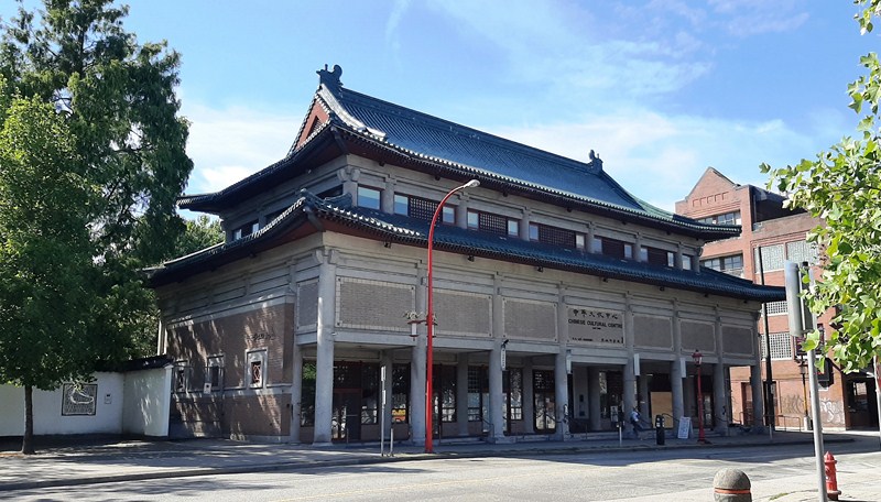
Chinese Cultural Centre Museum and Archives

The Chinese Cultural Centre Museum & Archives, at 555 Columbia Street, provides a home for Chinese heritage and culture. A competition-winning design by James K.M. Cheng Architects and Romses Kwan & Associates, the concrete building, built in 1986, incorporates the elements of traditional Chinese post and beam architecture. The Museum and Archives building, built in 1998 as the home to the Chinese Canadian Military Museum, was designed by Joe Wai in a style inspired by the Ming Dynasty, with its flared eaves, screened windows and tile roof.

The Chinese Railroad Workers and Chinese Veterans Memorial, at the Chinatown Memorial Plaza, at the northeast corner of Keefer Street and Columbia Street, recognizes those who built the Rocky Mountain and Fraser Canyon portions of the Canadian Pacific Railway (1881-1885) and those who fought in World War II (1939-1945). On Remembrance Day, a ceremony for Chinese Canadian veterans takes place at the site.

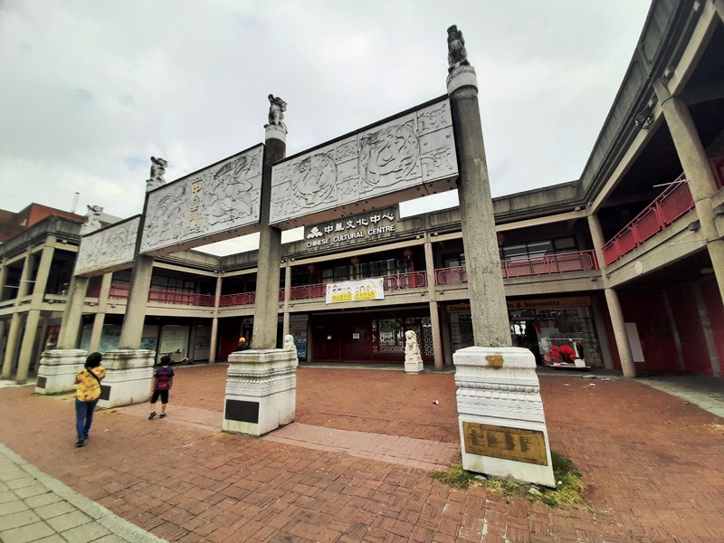
China Gate

The China Gate, next to the Chinese Cultural Centre, facing Pender Street, near the intersection with Carrall Street, was donated to the City of Vancouver by the Government of the People’s Republic of China and was originally on display during the Expo 86 world’s fair. After being displayed at its current location for almost 20 years, the gate was rebuilt and received a major renovation of its façade employing stone and steel. Funding for the renovation came from government and private sources.  On October 2005, during the visit of Guangdong governor Huang Huahua, the renovated gate was unveiled.

Wong’s Benevolent Association (Mon Keang School)

Back at East Pender Street is the Wong’s Benevolent Association (Mon Keang School) Building, at 121 East Pender Street.  Originally a two-storey building developed in 1908 by Loo Gee Wing, in 1921, it became the headquarters for Wong’s Benevolent Association, a newly amalgamated association that was formed out of three existing organizations, who had the top floor removed and replaced with two new storeys designed by architects G.L. Southwell and J.A. Radford.

In 1925, the Mon Keang School, teaching the Chinese language and customs to the tousang (children born in Canada to Chinese parents) was established on the second floor. In 1947, after the repeal of the Chinese Immigration Act and the reunification of many families, the school began offering the first high-school level Chinese classes in Canada. Today, Saturday morning Cantonese classes are again offered in the school room.

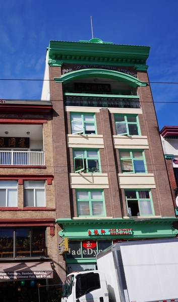
Mah Society of Canada Building

The Mah Society of Canada Building, at 137-139 East Pender Street, was constructed in 1913 with ground floor retail and three floors of rental rooms. In 1921, the Mah Society purchased this building for the purpose of mutual assistance for people with the family name Mah or Ma (to this day, people with this surname are invited to stay here if they don’t have a place to live or if they need introductions for where to find work), providing the society with a steady revenue stream.

An extra floor was added for an assembly hall as well as lounge and socializing space for residents. In 2017, the society undertook an extensive restoration and upgrade.  New windows were added to match the originals and the elaborate cornice, with its lanterns, and the restaurant’s storefront were reinstated. The Mah Society of North America’s building continues to provide much needed affordable housing in the neighborhood.

The Chin Wing Chun Tong Society of Canada Building, at 158-160 East Pender Street, was designed by R.A. McKenzie for the society (popularly known as the Chan Society) in 1925.  Its impressive assembly room follows the Arts and Crafts style. Today, a faithful recreation of the original 1950s neon sign for the Sai Woo Chop Suey restaurant (which operated here from 1925 to 1959) advertises the modern reincarnation of the restaurant.

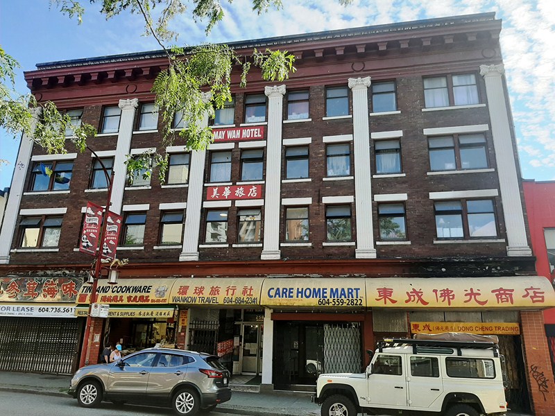
May Wah Hotel

The May Wah Hotel, at 254-262 East Pender Street, with its impressive classical pilasters designed by W.F. Gardiner, was started in 1913 and opened in 1915 as the Loyal Hotel. After four name changes, it was renamed the May Wah in 1980. More than 100 low-income seniors, mostly women, as well as a few businesses call the single-room occupancy (SRO) hotel home. Today, the Vancouver Chinatown Foundation operates the building as affordable and seniors housing for the neighborhood.

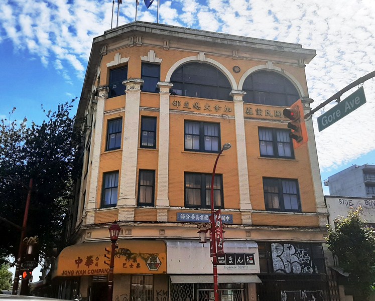
Kuomintang Building

Seemingly orphaned on the corner but the other side of Gore Avenue (529 Gore Avenue) is the Kuomintang Building, once the site of society buildings and wholesale grocers and built in 1920 by W.E. Sproat for the Kuomintang (Chinese Nationalist League of Canada). The design once featured an open balcony on the Gore Avenue façade, and a corner pagoda on the roof. During a restoration in the 1980s, the balconies were closed. The fictional American Steam Cleaners was located in the Kuomintang Building.

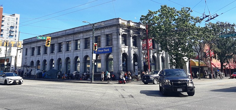
The Royal Bank of Canada Building, at 400 Main Street (Westminster Avenue until 1910) cor. Hastings Street, was built around 1907 as the East End Branch of the Royal Bank of Canada. In 1947, the building was extended east along Hastings Street to the lane to designs by the Royal Bank’s Montreal-based former chief architect, S.G. Davenport. In 1975, an addition was built to the south along Main Street (on the site of the former Merchants Bank).

Royal Bank Building

An early use of reinforced concrete for the structural frame, it was faced with cut ashlar stone on both principal elevations. A good example of Beaux-Arts Classicism, its façade features Classical Ionic columns along Main Street, pilasters along Hastings Street, a continuous entablature above the columns (including a frieze and cornice), arched ground-floor windows and rectangular second-floor windows.

Carnegie Public Library

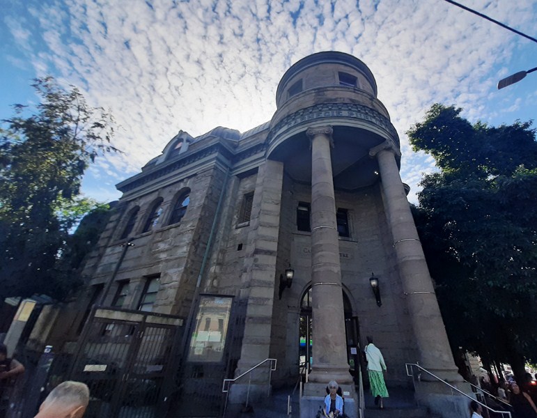
Across is the Romanesque Revival-style Carnegie Public Library (410 Main Street cor. Hastings Street). One of the many Carnegie Free Libraries built with money donated by philanthropist Andrew Carnegie, it was Vancouver’s main library from its official opening in 1903 until 1957, when a new library was built on Burrard St. The building also operated as the Vancouver Museum. The building has a curved staircase within the portico and stained-glass windows with panels commemorating William Shakespeare, John Milton, Robert Burns, Sir Walter Scott, and Sir Thomas Moore

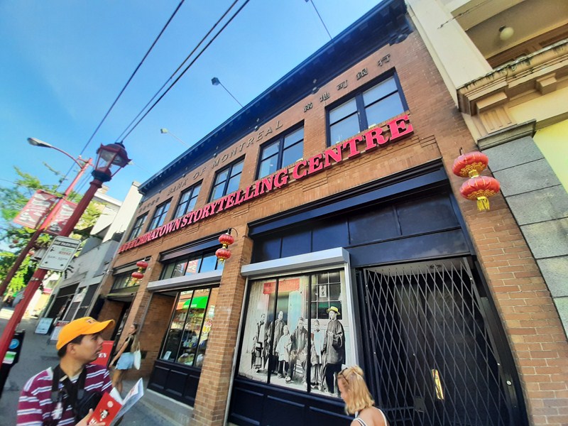
Bank of Montreal Building

The Bank of Montreal Building, at 601 Main Street cor. Broadway Street, was built in 1929 and was designed by architects J. J. Honeyman and George Curtis – partners who had ties to the bank and who were responsible for designing many of its branches in Vancouver during the 1920s and 30s. Built with stone and yellow or brownish bricks from the Clayburn Brick Plant in Abbotsford, British Columbia, its small size and single-storey stature would be emblematic of the bank’s attempt to create an image.

Chinatown: Vancouver, British Columbia.

Dr. Sun Yat-Sen Classical Chinese Garden and Park (Vancouver, British Columbia, Canada)

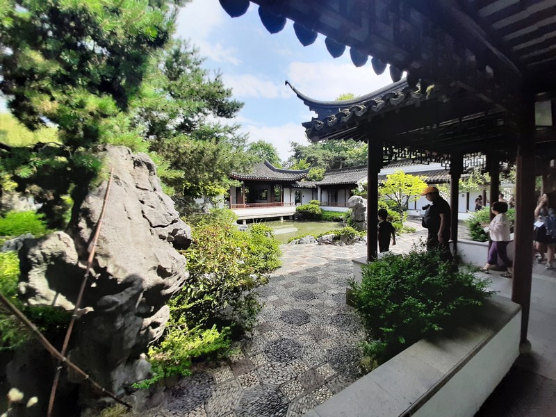
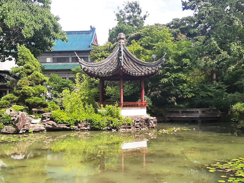
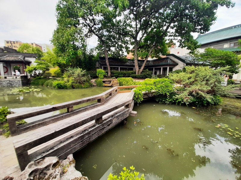
Dr. Sun Yat-Sen Classical Chinese Garden

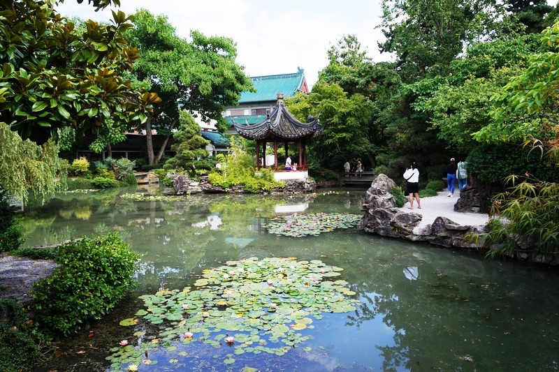
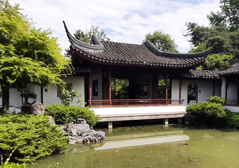
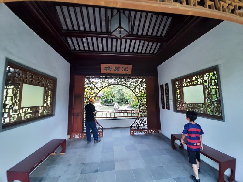
On our 30th day in Canada, Grace, Jandy, Kyle and I visited the tranquil Dr. Sun Yat-Sen Classical Chinese Garden,  the first full scale classical Chinese Garden (which strives to achieve harmony and a balance of opposites by employing the philosophical principles of Feng shui and Taoism) in all of Canada.

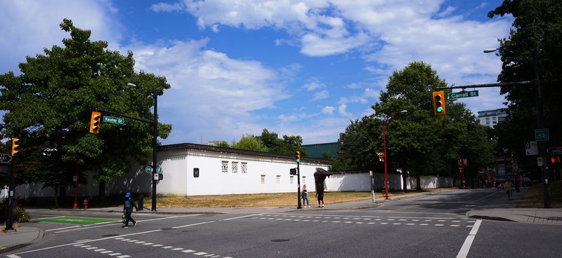
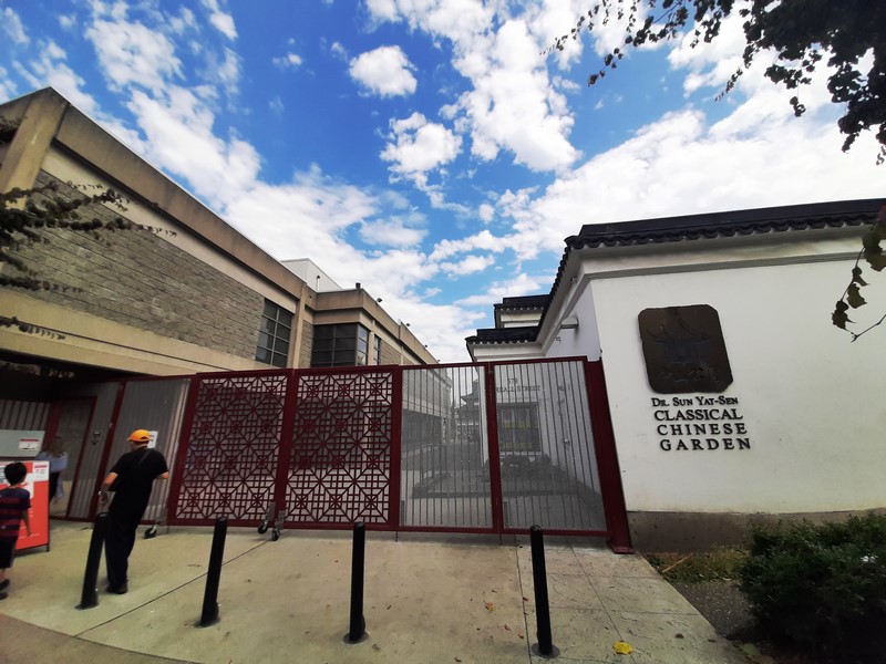
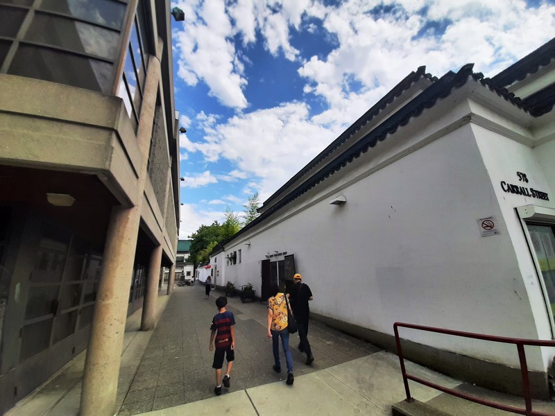
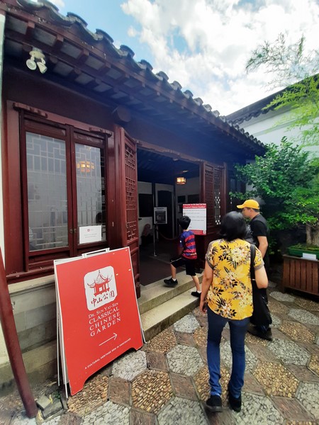
From Holdom Station, we took the Millennium Line SkyTrain to Commercial-Broadway Station then took the Expo Line train to the Stadium-Chinatown SkyTrain Station.  From here, it was just a short 600-m. walk, via Keefer Place, to the Garden.  We entered the Garden through a whitewashed wall behind the Chinese Cultural Center and passed through a doorway marked Yi Yuan (“Garden of Ease or Lingering Garden.”

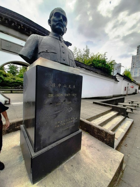
Both the garden and the park were named in honor of Dr. Sun Yat-Sen (1866-1925), a Western-educated nationalist leader (considered the “father of modern China”) who, while traveling the world to raise awareness of, and funding for, the Chinese nationalist movement (as well as to hide from the Empress), stayed, for extended periods, in Vancouver on three occasions (1897, 1910 and 1911).

There are accounts of Dr. Sun Yat-Sen staying at the Hotel Pennsylvania (412 Carrall St.) and also the Chinese Freemasons Building (5 West Pender St.) in Chinatown.

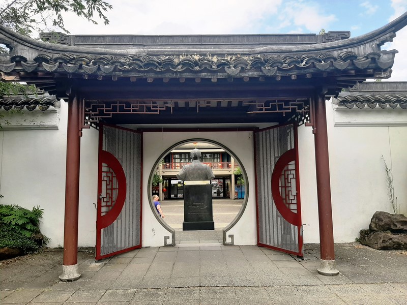
Bust of Dr. Sun Yat Sen

The significant presence of Chinese nationalists in British Columbia (in the early 1900’s, Chinese in Vancouver donated more money per capita than any other North American city) helped finance the Xinhai Revolution that overthrew the Ch’ing/Qing Dynasty in 1911. Subsequently, Sun Yat Sen became the first president of the Republic of China.

The site of both, where Vancouver’s Chinatown first began, at the edge of False Creek, was once home to Chinese association buildings including a sawmill, brothels, opera house, opium factory and, until 1920, the Great Northern Railway train station. In the late 1960’s, plans were underway for a freeway to go through Chinatown but these plans were thwarted and part of the reclaimed land was then designated for a Chinese Cultural Centre and an adjoining park and Chinese garden.

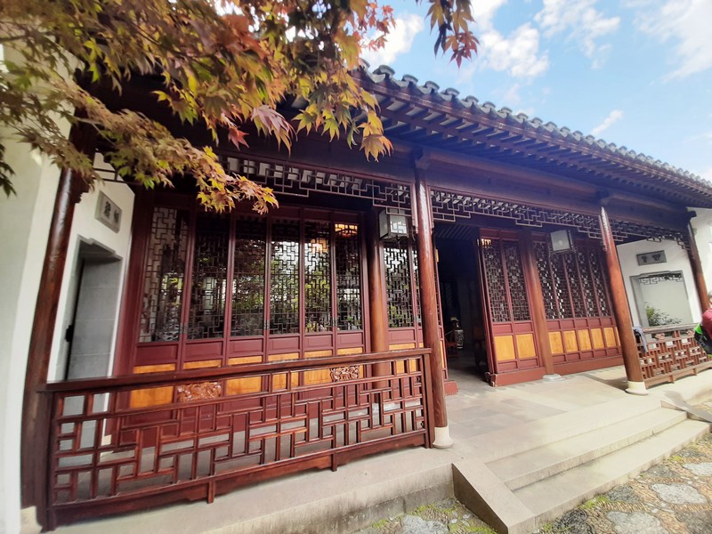
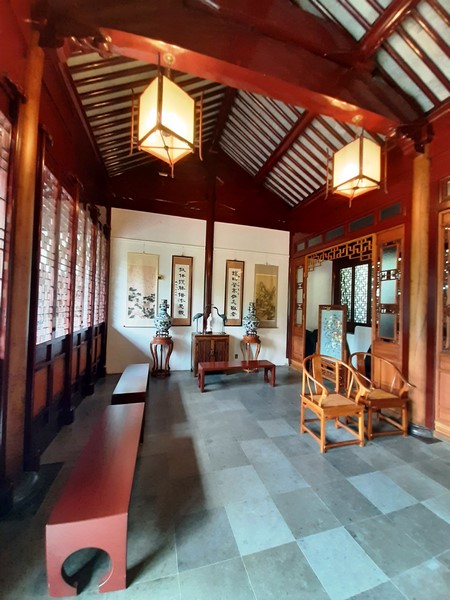
China Maple Hall

Anticipating the costs to continually maintain a Classical Chinese Garden, the area was divided into two spaces.  In 1976, the planning and fundraising for the park and garden began with the Dr. Sun Yat-Sen Classical Garden located just west of the public Dr. Sun Yat-Sen Park.  The park and garden covers just over 2.5 acres, with the Classical Garden covering approximately 1/2 an acre.

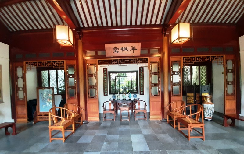
China Maple Hall – Interior

The outer park was designed by Vancouver architect Joe Wai and  landscape architect Donald “Don” Vaughan, working with the Suzhou team to ensure authenticity but still accommodate Vancouver’s building code and current technological requirements.  The inner garden, conceived by Wang Zu-Xin as the chief architect, was built with the help of experts from the Landscape Architecture Company of Suzhou, China.

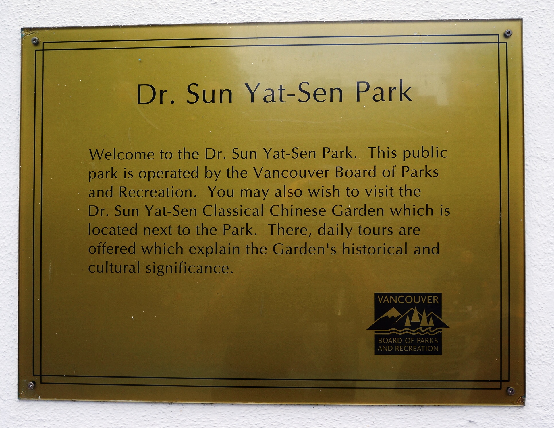
The larger free Dr. Sun Yat-Sen Park (a public park built in a Chinese style, with mostly North American materials) administered by Vancouver Parks Board, was completed in 1983.

The smaller Dr. Sun Yat-Sen Classical Chinese Garden, requiring admission fees, was completed in 1986, expanded in 2004 and is managed by the non-profit, Dr. Sun-Yat Sen Classical Chinese Garden Society. These two separate entities are linked by the artificial pond.

The mandate of this freely accessible public park and garden is to “maintain and enhance the bridge of understanding between Chinese and western cultures, promote Chinese culture generally and be an integral part of the local community.”  Embodying the Taoist philosophy of yin and yang (where every element-light, texture, vegetation is balanced and symbolic), this home garden offers serenity, history and great chi.

Of the three types of Classical Chinese Gardens (the Imperial Garden, the Monastery Garden and the Scholar Garden), the Dr. Sun Yat-Sen Classical Chinese Garden is a “scholars” (who often became the Ming Dynasty emperor’s senior administrators) garden, the first built outside of China.

Tai Hui rocks amidst foliage

The characteristically small scholars’ gardens, adjoining the scholar’s residence, were surrounded by high walls (to prevent distraction from the outside world and to provide a peaceful space for scholarly reflection on philosophy and truth) and have no single vantage point where one can obtain a total view of the garden.

Water lilies

This small intimate garden-home, a registered museum and one of Vancouver’s top tourist attractions, is ideal for people who don’t want to do a lot of walking and is a recommended place to visit year-round (especially if you take the guided tour).  It features beautiful pavilions, covered walkways, a jade green pond with koi fish, and a collection of 150-year-old miniature trees.

The guided tour

Purposely designed as a series of unfolding scenic vistas (like displaying multiple landscape paintings), the garden has winding walkways and corridors that ensure the entire path cannot be seen. The zigzag paths have a dual purpose.  First, they slow one’s steps so that the garden can be fully appreciated and, second, they ward away evil spirits.

Weeping willows

The project, a joint collaborative effort funded by the Chinese and Canadian governments, the local Chinese community and other public and private sector sources, was built, at a cost $5.3 million, in 13 months (March 1985-April 1986) by a team of 52 Suzhou artisans (e.g. masons, carpenters, painters, carvers, tilers) arranged by the Suzhou Garden Administration from China.

It  was constructed using 14th century methods (no glue, screws or power tools were used). The materials, tools and techniques used to construct the garden were almost identical to those used in the Ming Dynasty.

Jade Water Pavilion

Modeled after private gardens in the city of Suzhou (because the winter climate in Vancouver is similar), Chiangsu province in China, 70% of the same plant varieties are found in the garden as in its Suzhou counterparts. The garden opened on April 24, 1986, in time for Expo 86. The Garden’s China Maple Hall was built to signify the friendship cooperation between Canadians and Chinese.

Moon Gate at Jade Water Pavilion

Much of the architectural components (carved woodwork; the limestone rocks; the courtyard pebbles; and the roof tiles fired in China’s Imperial Kilns) came from China. They were prepared in Suzhou packed into 965 wood crates and brought to Vancouver in 70 steel containers.

Wooden beams and columns at China Maple Hall

The wood all came from China – the Chinese fir for the structural components; camphor for the curved rafters (whose scent also helps repel insects); gingko wood for the screens and nan wood (a species used in China for over 2000 years) for the columns of the China Maple Hall and Scholar’s Study. The floor tiles are made of pebbles form riverbeds in China and broken Chinese porcelain.

Floor Tiles

In order to emphasize seasonal changes (especially the “awakening” in spring), the plants were chosen for their symbolism, their season, their blossom schedules, the mood they create and the space they define. In contrast to western gardens, plants do not have a dominant role and are used sparingly and are meant to complement the garden.

They are also selected to invoke the symbolic, historical, and literary meaning of each plant and to provide color through all the seasons. Winter-flowering plum depicts renewal and rebirth; the bamboo symbolizes resiliency and flexibility; the ginkgo represents China; the maple represents Canada; and the pine symbolizes steadfastness and longevity.

Chinese Banyan tree (Ficus Retusa)

The Dr. Sun Yat-Sen Classical Chinese Garden also has a collection of penjing (an art form dating back to the 8th Century AD and a precursor to Japanese bonsai and suiseki) plants (landscapes in small trays/bowls) that were donated by a Hong Kong benefactor in 1992.  To ensure that there is a sense of relationship and balance among all the garden’s elements, all the plants are regularly and carefully pruned.

Orange Jasmine (Hurraya painculata)

The architecture of the beautiful pavilions, courtyards, covered walkways, terraces, corridors, bridges and viewing platforms is based on and evokes the Classical design of the Ming Dynasty (1368-1644). Symbolic motifs of plants and animals are incorporated into the floors, tiles, windows and door pulls. The 45 intriguing leak windows each have a different lattice pattern from the other.

Leak Windows

Those along the corridors maintain privacy and allow light and air to come into the garden. The symbolic, circular Moon Gate represents heaven and perfection. It is important that the architecture, such as the Ting (Yun Wei Ting or “Cloudy and Colorful Pavilion”) and rocks and pebbles, are seen and not hidden by overgrown trees or bushes.

Leak Window

The key elements of a Chinese Classical Garden, used to reflect Confucian ideals as well as the Tao (Dao) principles of yin (having more ephemeral, feminine qualities) and yang (being more solid, permanent and masculine), are architecture, rocks, water, plants and calligraphy.

Craggy, weathered, water-worn and unique limestone rocks, symbolizing nature’s rugged landscape and force (yang), are found only at the bottom of Suzhou’s famous Lake Tai (Tai Hui) and imported to the site.  Strategically placed and juxtaposed against delicate foliage, they are intended to represent “false mountains” (with multiple crevices for the good spirits to live in), concealing and revealing park elements.  The Yun Wei Ting gazebo perches atop one such mountain.

Water, representing the ‘yin’ of nature and the flow of life, offers stillness, sound, a reflection of the sky, and helps to unify the other elements. A Classical Chinese Garden is centered on a pond.  Large ponds are made purposely opaque, with a clay liner so that it can reflect the surrounding and create a sense of tranquility.  The jade color symbolizes purity.

Both water and rocks are important integral elements.  Trees, plants and the fish and turtles that live in the garden, all have symbolic connotations and purpose.  Throughout the garden, bats (representing good fortune, they are in the design of the door handles and roof’s drip tiles), dragons and phoenixes are represented in objects.

Items are carefully placed to ensure a flow of positive energy (ch’i/qi) and to create harmony. The garden exemplifies the balance between opposites, with white walls topped with dark roof tiles; floor tiles, with smooth stones, contrasting with rough porcelain; and flexible bamboo located next to rigid rocks.  The north side of the garden, exhibiting yin qualities, with rounded designs in the leak windows and floor tiles, contrasts with the south side of the garden which has yang qualities, with more straight-edged patterns.

Calligraphy is an integral part of a Chinese Garden and some of the top Chinese scholars in Canada contributed their works for the signs, couplets and poetry which add insight and mood.  To add diversity, the Sun Yat-Sen Classical Garden uses four different styles of script. What the words say and how they are written were carefully selected.

Dr. Sun Yat Sen Park plaque

One of the scrolls in the Main Hall states “An exquisite garden built in Vancouver to commemorate the accomplishments of the past ages” Even the sign at the main entrance way to the public park is significant as it is a carved version of calligraphy by Madam Sun Yat-Sen.  For its pavilions, the Garden uses poetic names such as “Cloudy and Colorful Pavilion,” “Study of the Four Seasons” and “Hall of One Hundred Rivers.”

Wooden bridge over lily pond at Dr. Sun Yat Sen Park

Over the years, the Garden, truly a place of urban Zen, has received several honors and designations.  It was named one of Vancouver Heritage Foundation’s “Places That Matter,” and the “World’s Top City Garden” by National Geographic in 2011 and was voted “Canadian Garden of the Year” by the Canadian Garden Tourism Council in 2012.

Moon Gate at Dr. Sun Yat Sen Park

The Dr. Sun Yat-Sen Classical Chinese Garden was used as the backdrop for many episodes of Season 4 of Falling Skies and also appears in Season 5 Episode 1 of Psych, titled “Romeo and Juliet and Juliet.”  It was also the site of a calligraphy task during the second episode of The Amazing Race Canada 1.

Jandy, Kyle and Grace at Dr. Sun Yat Sen Park

The wheelchair accessible and family friendly (entry includes a scavenger hunt for children) Garden, a unique venue for cultural programming and events, including concerts, festivals, exhibitions, author readings, receptions, and educational programs, offers free guided tours (which provide perspectives on Chinese culture, life during the Ming Dynasty, architecture and plants) and complimentary sips of traditional Chinese tea as well as one of a kind finds at the Eight Treasures Shop.

Pathway at Dr. Sun Yat Sen Park

Dr. Sun Yat-Sen Classical Chinese Garden: 578 Carrall cor. Keefer St., Chinatown, Vancouver, British Columbia V6B 5K2.  Tel: 604-662-3207.  Open Wednesdays – Sundays, 10 AM to 4 PM (last entry time at 3 PM).  Admission: $16 (adults), $12 (students age 6-17 or over 17 with valid student I.D.), $13 (seniors) and $32 (family, 2 adults and up to 3 children under the age of 17).

How to Get There: Chinatown-Stadium Sky Train. From downtown, you can walk directly down Pender Street going East and you will find the Garden.

Granville Island (Vancouver, British Columbia, Canada)

Granville Island

The 14 hectare (35-acre) Granville Island, a peninsula (originally used by the Musqueam First Nations as a fishing area)and shopping district in the Fairview neighborhood, across False Creek from Downtown Vancouver, is under the south end of the Granville Street Bridge.

Granville Island Ferry Dock

Granville Island Marina

In the 20th century, the peninsula was an industrial manufacturing area named after Granville Leveson-Gower, 2nd Earl Granville. Technically a sandspit and not an island, the neighborhood sits just south of the downtown peninsula, right under the Granville Bridge.

Artsclub Theater Company

Waterfront Theatre

The Improv Centre

It includes a public market, an marina, a hotel, the False Creek Community Centre, as well as various performing arts theatres including the Arts Club Theatre Company, Carousel Theatre, Arts Umbrella, Axis Theatre Company, Boca Del Lupo, Carousel Theatre for Young People, Ruby Slippers Production Company, and the Vancouver Theatre Sports League.

Cheska and Grace strolling along Duranleau Street

Jandy, Grace and Cheska at Tap & Barrel – Bridges Restaurant

Granville Island was used as the finale of the film Mission: Impossible – Ghost Protocol (2011). The Vancouver International Children’s Festival, the Vancouver Fringe Festival and the Vancouver Writers Fest are all held here.

Festival House

Gallery

One of the best ways to get to Granville Island is one of the adorable mini-tugboat ferries that crisscross False Creek. False Creek Ferries and Aquabus, favorites among young and old, provide ferry service from Granville Island to Downtown Vancouver, Yaletown, False Creek, the West End, and Vanier Park.

Boat Rentals

Waterbike Rental

Other water transportation options include a water taxi service to Bowen Island provided by English Bay Launch. WESTCOAST Sightseeing and Vancouver Trolley Hop-On, Hop-Off services both have stops located at Granville Island.

Artisan District

Artisan District

Between 1998 and 2011, the Vancouver Downtown Historic Railway operated between Granville Island and Science World. The streetcar is now permanently shut down.

The old streetcar tracks. The railway between Granville Island and Olympic Village Station was discontinued in 2012 after the City of Vancouver decided to end its $100,000 annual subsidy for the volunteer-related service. For 15 years, it ran on weekends and holidays, from May to October, carrying 133,000 passengers over its lifespan.

Once you’re there, the biggest attraction on Granville Island is the year-round Granville Island Public Market.  For the food-focused, a walking tour of the market can be a great way to get an insider’s insight.

Granville Island Public Market

Established in 1979 as a location where farmers and other food vendors could sell to consumers, it operates in an enclosed facility where customers can purchase, in endless rows of stalls, fresh produce, meat, smoked salmon, exclusive teas, gourmet foods, baked goods, seafood, cheeses and other products, many locally sourced.

Granville Island Public Market

Attracting both local residents and tourists, the market generally has 50 vendors including retail food vendors that sell a range of items from Mexican, Asian, Greek and deli food to candy and snacks. The market includes a “kids market” designed for children.

Tap & Barrel – Bridges Restaurant

My Island Cafe

Often described as a “food lover’s paradise,” an impromptu picnic is easily picked up between vendors offering cheese, charcuterie, bread and fresh produce. The popular food court, at the end of the market building, is where you’ll find something casual but already put together. If you prefer restaurants, there are some great restaurants offering seafood down there and there’s nothing like dining by the waterfront.

Dalbergia Wood and Fine Objects

Amy Stewart Art and Shira Gold Photography

The area is home to an artisan sake maker (the first in Canada), a spirits distillery, and two breweries.  Granville Island Brewing Co. is the name of a beer company which originated on Granville Island in 1984, but whose main base of operations was moved to Kelowna, British Columbia, some time later.

Granville Island Brewing

JN Glass

In 2009 it was purchased by Molson’s Brewery and continues to brew small batches of its varieties at the Granville Island brewing original site, and offers beer tasting and tours of their brewing facilities.

Pressure Group 6 (1982) by Barry Cogswell. A Corrosion-resistant weathering steel sculpture along path S.E. of Community Center

Ocean Concrete is the longest-established tenant on the island, having set up shop there in 1917. In 2014, OSGEMEOS (Portuguese for THE TWINS), consisting of brother duo Gustavo and Otavio Pandolfo, revamped the concrete silos with their ongoing mural project, ‘Giants’.

Materna Ceramics Studio

The Liberty Distillery

Canada’s only hammock shop, the Hamuhk Hangout Place, has been operating on Granville Island since 1995.In the early 1900s, Granville Island was home to factories, plants and sawmills. Things are a little different today—Granville Island is both a locals’ favorite and a huge draw for visitors. The Granville Island Public Market acts as a hub of activity, but it’s also one of the city’s most important cultural districts with theatres, artisan workshops and craft studios.

Railspur Park Playground

Granville Island, with a mix of unique crafts, skilled artisans, outdoor outfitters and deluxe gourmet stores, is one of the best places in the city to purchase souvenirs for back home. At the Net Loft Building, check out the stores for First Nations artworks, B.C. wines, and other unique gifts.

S&R Apron Co.

Performance Works

Along Railspur Alley and the far end of the island, you can peek into artisan studios where glassblowers, potters, jewellers and even a broom maker ply their crafts.  Outside of the market, catch a show at one of the many theatres on the island, browse an art gallery show, or appeal to your outdoorsy side with a kayaking or paddleboarding tour.

Kids Market

Craft Council of British Columbia

Granville Island: Vancouver, British Columbia, Canada.Website: www.granvilleisland.com. Coordinates: 49°16′15″N 123°08′03″W.

Lynn Canyon Park (Vancouver, British Columbia, Canada)

Lynn Canyon Park

On our 27th day in Canada, our whole family (Grace, Jandy, Cheska, Bryan, Kyle and I, with dog Luffy) decided to visit the 250-hectare (617-acre) Lynn Canyon Park, one of the gems of the  District of North Vancouver’s Parks system and a great place to learn about North Vancouver’s eco-system.


This public park, operated by the  District of North Vancouver, is located on the unceded territory of the Sḵwx̱wú7mesh (Squamish) and səlilwətaɬ (Tsleil-Waututh) Nations people who called the Lynn Creek area Kwa-hul-cha, referring to a settlement in the area.

Bryan and Cheska on their way to the Lynn Canyon Cafe and Ranger Station

When settlers moved to North Vancouver, they began to log the old growth forests as part of Vancouver’s growing logging industry. The Lynn Valley area, along with Lynn Creek and Lynn Canyon were renamed after sapper John Linn (1846-1876), a British pioneer and member of the Royal Engineers who, in 1869, moved his family onto 65 hectares of land on the mouth of the Lynn Creek near Burrard Inlet.

Lynn Canyon Cafe and Ranger Station

While the creek has been dubbed Fred’s Creek after fellow pioneer Fred Howson, the name Lynn, a corruption of the original spelling, soon became the common designation.  Lynn Valley Park and Canyons, as it was known in the 1950s, soon gave way to the current Lynn Canyon Park.

Waterfall seen on the way to the suspension bridge

In 1912, after the bulk of the Lynn Canyon’s old growth forests were logged by the Lynn Valley Lumber Company under Julius M. Fromme, the McTavish Brothers donated a 5 hectare piece of land around the newly constructed Lynn Canyon Suspension Bridge in the hopes that a park would attract people to the real estate development.

Bryan (with Luffy) and Cheska crossing the Lynn Canyon Suspension Bridge

The  District of North Vancouver added another 4 hectares to create the original Lynn Canyon Park. On September 14, 2012, the park was formally opened.  In 1991, the District of North Vancouver added another 241 hectares to the park, making it one of the largest and most popular parks in Metro Vancouver.

View of Lynn Creek from the suspension bridge

This forested park features stunning creek and waterfall views and hiking trails through the temperate rainforest, a relatively rare ecosystem that extends along the coast of Alaska and British Columbia down to northern California. In the rainy months of the year, mist rises from the canyon and the creek rises dramatically.

Grace and the author at Lynn Canyon Suspension Bridge

Rangers are on site in July and August to offer walking tours and information about the area’s flora and fauna. For advanced hikers, there are trails that lead directly to Grouse or Seymour Demonstration Forest, in addition to nice cycling trails.  Due to its natural landscape many TV series such as Stargate SG-1 and Stargate Atlantis used the area for filming.

Cheska and Grace hiking the dirt trail

From Holdom Station, we took the SkyTrain to Gilmore Station, then took Bus 28 to Phibbs Exchange and, finally, the 20-min., 4-km. Bus 227, from Bay 12 Station, to the Westbound Peters Road@Duval Station.  From there, it was just a short walk to the entrance of Lynn Canyon Park.

Moss-covered trees

Past the entrance, we passed by the Lynn Canyon Ecology Centre (has over 80 informative nature videos, on a large screen, about the plants and animals of the temperate rainforest and environmental issues, plus a nature-themed gift shop) on the left and Lynn Canyon Cafe (they serve fresh siphon coffee, lattes and more, crepes for breakfast and burgers, hot dogs, pasta, fish and chips for lunch) on the right.

A large boulder amidst tall stands of trees

A very popular area for hiking, we tried the 2.6-km. Lynn Canyon loop trail (one of 7 easy hiking trails), open year-round, which is generally considered a relatively easy route to hike (though not wheelchair or stroller friendly), taking an average of 50 mins. to complete.

In this free, self-guided adventure, there are three major attractions along this loop – the  Lynn Canyon Suspension Bridge, Twin Falls and the 30-Foot pool. Dogs are welcome here, but must be on a leash so we did just that for Luffy.

While exploring the trail that was surrounded by second growth western red cedar, Douglas-fir, and Western hemlock trees draped with moss, we encountered a lot of people. Although there are quite a number of wooden stairs (a bit challenging for beginners), it was still a great family friendly trail, with lots of options for different level hikers. There were multiple photo-worthy stops along the route, especially as it was summer.

The first major attraction we encountered was the  Lynn Canyon Suspension Bridge.  On the way to the bridge, we espied a small, thin waterfall.  The bridge was used in Disney’s Descendants (as part of Auradon) that leads to Lynn Canyon’s 30 Foot Pool (used as the Enchanted Lake).  The bridge was also featured in the MacGyver episode “The Invisible Killer.”

Though not as long as the one at the widely-advertised Capilano Suspension Bridge, this 40-m. (130-ft.) long, wooden plank suspension bridge, built in 1912, is a good one and a different experience than its complement, offering a rustic and jiggling adventure, and the views from it are equally spectacular.

The author

If you want to see a suspension bridge but don’t want to pay for the one at Capilano Suspension Bridge, then this is the place to go as it’s less commercial and some people actually prefer it. About 50 m. (167 ft., the height of a 15-storey building) above the beautiful clear pools and rivers of Lynn Creek, it was just wide enough for two people to pass each other. Originally, visitors paid 10 cents (later reduced to 5 cents) to cross the bridge. Today, it’s free to cross the bridge.

The 30 Foot Pool

On the north side of the suspension bridge, the trail to the left lead us northwest through the park and a short walk took us to the popular 30-Foot pool, one of the most popular locations among tourists and locals and a safe place to swim compared to some of the river’s other sections. It was a very large area, with great spots for a picnic, and featured a beautiful swimming hole.

Visitors getting ready to dive, off rocks, into the 30 Foot Pool

As it was summer, a number of visitors were taking a quick refreshing swim to cool off. Others were also jumping off rocks and into the water (it looked extremely dangerous).  However, even in the summer months, the water is almost always extremely cold. If you are looking for a quiet place to sit by the river, this is the spot.

L-R: the author, Jandy, Grace, Cheska, Kyle and Bryan (with Luffy)

Beginning at the 30-Foot pool, we ascended one big flight of stairs and ended up at the start of the trail heading to the Northern region of the park, the Seymour Demonstration Forest and Rice Lake entrance (another beautiful location for walking around and fishing) which is about a further 20-min. walk away.

Stair leading up to the northern part of the park

As we did not wish to venture into these areas, we took the wooden boardwalks and trails that loops back towards the Lynn Canyon Suspension Bridge.

East of the suspension bridge is Twin Falls  which can be accessed from either side of the suspension bridge.  If we did not cross the bridge from the main entrance, we could have proceeded east, past the Lynn Canyon Café, and followed the trail down towards the river.

Twin Falls Bridge

Twin Falls is less accessible than the 30-Foot pool and not as popular among visitors but we still wanted to get to Twin Falls so, right after the bridge, we headed south (south is right and north is left) followed a series of boardwalks, steps and staircases to Twin Falls. There was a sign that pointed us in the right direction.

View of Lynn Creek from Twin Falls Bridge

In less than 20 mins., we descended down to Twin Falls Bridge where we had a beautiful view of  Twin Falls, below the bridge, which is not large or high but rather just a section of rapids that drop a bit just under the bridge.   The hike back up the canyon took us up two large flights of wooden stairs back up the canyon on the other side (just a short walk back to where we started).

Twin Falls below the bridge

A diverse hiking experience along wooden stairs and boardwalks, the river and dirt trails, Lynn Canyon truly is a nice place for everyone.  Here, you can take your time hiking and enjoy the fresh air.  Even late in the day, the sun stayed with us most of the time.

From Twin Falls Bridge, ascending another flight of stairs

Lynn Canyon Ecology Center: 3663 Park Road, North Vancouver, British Columbia V7J 3G3, Canada.  Tel: 604-990-3755.  Email: ecocentre@dnv.org.  Website: www.ecologycentre.ca and www.lyncanyon.ca.  Open Mondays to Fridays, 10 AM to 4 PM, and weekends, 12 noon to 4 PM. Coordinates: 49°20′02″N 123°01′03″W. Walk in visits are accepted if space is available (maximum 15 people inside at a time). Proof of Vaccination required for ages 12 and up. Masks required for ages 5 and up. Admission is free but donations are accepted (suggested $2 per person).

How to Get There: the nearest bus stations are Eastbound Peters Rd @ Duval Rd. (a 492 m./7-min. walk), Northbound Lynn Valley Rd. @ Burrill Ave. (a 715 m./10-min. walk) and Northbound Underwood Ave. @ Evelyn St. (a 1.219 km./16-min. walk). Buses leave Lonsdale Quay about once every 15 mins. on weekdays (or 30 minutes on weekends and holidays). The ride on Bus #228, from Lonsdale Quay, takes just over 30 mins.

Port of Vancouver Discovery Centre (British Columbia, Canada)

Port of Vancouver Discovery Center

The exciting, high tech Port of Vancouver Discovery Centre, serving multiple arms of the Port Authority, offers a space that converts from visitor Discovery Centre to education centre, to town hall meeting space, to event venue, and at times, all in the same 24 hours.

Entrance

Located on the waterfront at Canada Place, below Fly Over Canada, at the north end of the pier, it is one of the facility most used spaces and a great place to learn about Canada’s largest and busiest port in a fun and interactive wayas well as engage in the stories and ideas that have shaped the port city.

Through the integration of interactive panels, projection mapping surfaces, digital informational kiosks, and broadcast-quality equipment, Eos Lightmedia helped transform the Port of Vancouver Discovery Centre into a highly flexible space, working with the Vancouver Fraser Port Authority as well as designers Waddell & Conder, content producers Burnkit, Resolve Design for the history wall, and fabricators Three Dimensional Services to design, supply and integrate the layers of lighting, audiovisual, software and controls technology.

It features interactive touch screens; animated graphics and informative videos; historical artifacts and ship models; west-facing views of Vancouver harbor and access to the Canada Place promenade.

The stunning historical display case spanning the length of the facility

The Discovery Centre is also the venue for a school program designed especially for local elementary students in grades four to six, who use interactive, projection driven benches with embedded touch sensors that provide hands on education about the busy goings on of Canada’s largest port. Eos Lightmedia’s custom control software allows facilitators of the space to change the vocabulary and content to make it suitable for both younger and more mature student groups.

With hundreds of square feet of projection mapped surfaces for interaction and digital informational kiosks, here you can experience the sights and sounds of a busy harbor while learning about Canada’s largest and most diversified port.

St. Roch

You can also learn about early port development; trade, innovation and shipbuilding; harbor operations today; working on the waterfront; environmental programs; and facts and statistics.  In contrast to the cutting edge technology, there’s also stunning historical display case, spanning the length of the facility, that is replete with artifacts from the ports long history in the city.

A Regal Heritage

The entire atmosphere of the room can also change, from its public setting, to a sleek professional meeting room setting with just a click of a button on the facility’s sophisticated control system.

SS Beaver

The interactive touch panels break apart into bench seating for over 100 and, for the Port Authority’s many meetings, announcements, and group functions, the large digital map wall becomes the presentation screen for keynote speakers.

Pacific Gateway

Broadcast quality lighting and audio equipment also allows for events to be live-streamed, in high definition, with professional results without the need for off-site equipment rentals.

Shipbuilding for the Wars

Within the center, every function has its own custom lighting look controlled by DMX over the dedicated exhibit network within the space. The central control system links the benches, their projectors, and the audio systems, automatically turning on and off with a preset, adjustable schedule. The facilities operations team can also instantly recall the various ‘scenes’ within the center.

The Container Revolution

Port of Vancouver Discovery Centre: 100 The Pointe, 999 Canada Place, Vancouver, British Columbia. Admission is free. Open daily, 8 AM to 8 PM. Download the Port of Vancouver community map to follow along during the virtual harbout tour.