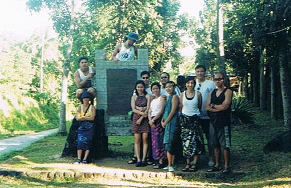
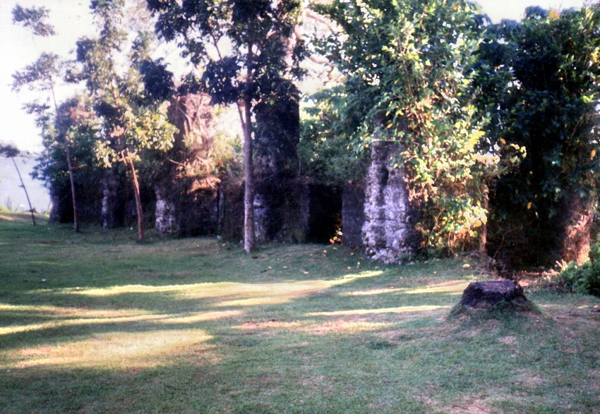
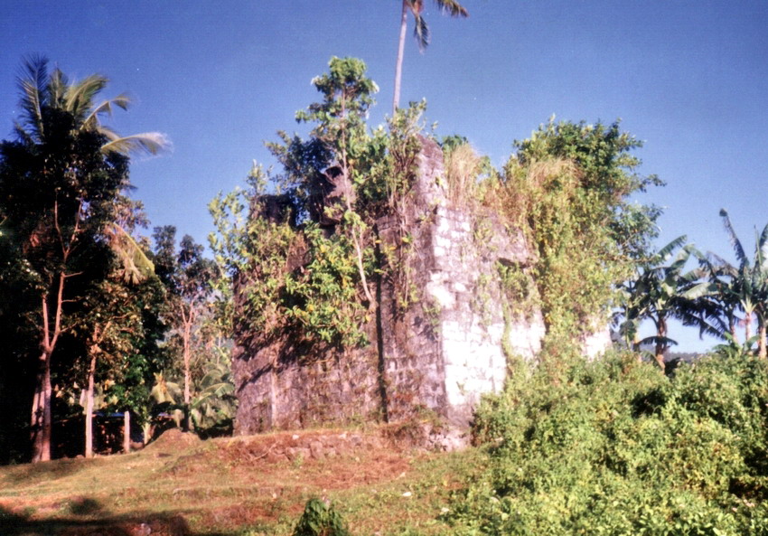
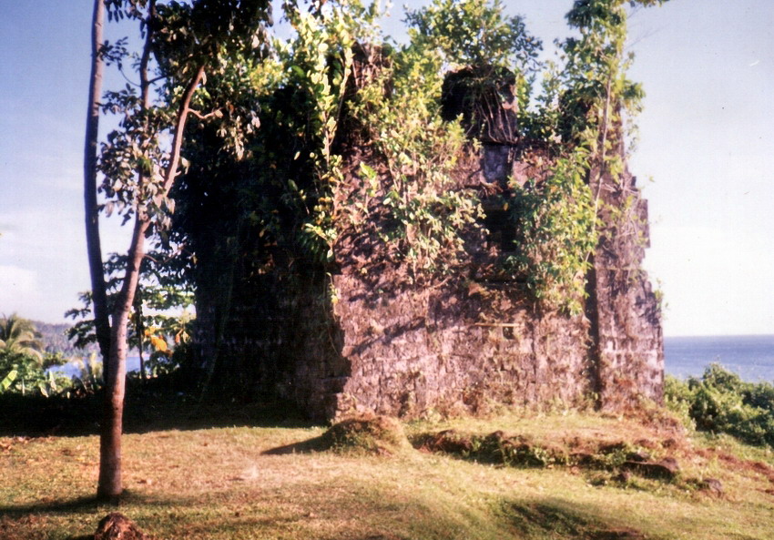
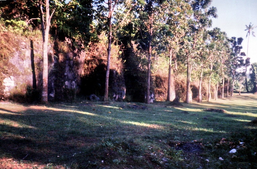
Dambana ng Kagitingan (Pilar, Bataan)

The Memorial Cross

Come Holy Week, I was invited by Jandy’s teacher Ms. Veneriza “Vener” Trillo to vacation at their home at Morong in Bataan.  That being the case, I also planned to make a stopover at the Dambana ng Kagitingan in Pilar.  Its giant cross, on the 553-m. high Mt. Samat, stands as a mute symbol of the heroic World War II resistance put up by Filipino-American forces against the invading Japanese 60 years ago.  A visit to Bataan is certainly meaningless without seeing it.  On this pilgrimage, I brought along my son Jandy, his classmate Jeff Agtonong, teachers Mr. Erwin Vizcarra and Mr. Ronnie Boy Lansangan plus Ms. Marianne de Guzman,  Ronnie’s friend. 

Mt. Samat

We left Manila very early in the morning (4 AM) of April 17 (Holy Thursday), taking the longer (150.40 kms. from the Balintawak flyover) route along Bataan’s east coast instead of the shorter Subic Bay Metropolitan Authority (SBMA) route.  Normally it would take 3 hrs. tops to travel the said distance, but hey, this is Holy Week and heavy traffic is the rule and not the exception.  It was everywhere, from the North Luzon Expressway (NLEX), then being widened, all the way up to Lubao in Pampanga.  The Lubao section (then being rehabilitated) was the worst, with over an hour wasted.  After Lubao, it was smooth driving all the way as we entered Bataan, the Roman Superhighway and the Angel Linao Highway, to Pilar town. Along the way, we passed the entrance to Dunsolan Falls, located along Mt. Samat’s western slope, and Mt. Samat Inn.  Upon reaching the Mt. Samat turn-off, it was a steep drive up a 7-km. long winding asphalt road.  We finally reached the shrine by 10 AM.

The colonnade of Dambana ng Kagitingan

The shrine, at the end of the road, is located just 70 m. below the mountain’s peak.  It was built at a cost of PhP7 million (including access roads) and was opened on April 9, 1974, the anniversary of Bataan’s fall (Araw ng Kagitingan).  Our pilgrimage to the shrine was done nearly 30 years after the fact. Today, the Araw ng Kagitingan held at the shrine usually features wreath-laying ceremonies, remembrance of the Death March and tributes to World War II veterans, whether dead or still living. 

The base of the cross

Immediately above us, reached by a long flight of stairs, is the shrine’s marble-capped colonnade.  It has an altar, an esplanade and a museum.  The shrine’s 12 relief columns, done in marble, depict historical events and important battles that took place in Bataan. The altar, used for religious services, has a stained-glass mural behind it. There are also statues of war heroes, two bronze urns (symbolic of the Eternal Flame of Freedom) and 18 bronze insignias and flagpoles with colors of USAFFE division units.  What struck the eye; however, were the two huge panels on the north and south walls inscribed with accounts of the Battle of Bataan in relief.   The colonnade’s basement museum, reached by a spiral stairway, displays an array of authentic World War II American and Japanese weapons (rifles, machine guns, mortars, shells, bayonets, etc.), uniforms (helmets, boots, belts, etc.), old photos, news clippings and, in the center of the dimly-lit hall, a scaled 3-D model of the Bataan peninsula indicating important battle sites.

The museum

Upon finishing our museum tour, we crammed our necks up to look at our ultimate destination: the towering Memorial Cross.  From the colonnade, we made the long but leisurely walk up the 14-flight zigzagging footpath (paved with bloodstones from Corregidor Island) on the mountain slope to the cross.  Once up, I found out that we could have drove all the way up to a parking lot beside it.  Some exercise (in futility?) it turned out to be as I later walked down the winding road to fetch the car.  The cross was huge, 91.8 m. high to be exact. Built in 1968 with steel and reinforced concrete, it stands on an 11 meter high platform capped with nabiag na bato slabs sculpted with bas reliefs depicting significant battles and historical events.  Above this base, the cross is finished with chipped granolithic marble. Its 30 m. wide arms (15 m. on each arm) rise 74 m. from the base and can be reached by an elevator. 

View of the shrine from the Memorial Cross
We failed to make it to the last morning trip up the viewing gallery at the cross’ arms as it was now lunchtime.  We had to wait another hour, becoming the second batch up that afternoon.  The 18-ft. by 90-ft. viewing gallery has a 7-ft. high clearance. It was pleasantly cool and windy up there, quite a different scenario from 6 decades ago when the area reeked with smell of death and the intense heat of battle. The views, nevertheless, were spectacular.  From the gallery, we could view the sea, mountains, forests (somewhat denuded at certain areas) and distant Manila, located 126.34 kms. northeast.  The cross is finished with luminous material and can be seen on a clear night as far away as Manila across Manila Bay.    

Biak-na-Bato National Park (Bulacan)

Biak-na-Bato National Park

I got an invitation from Jesu-Mariae School (JMS), my son Jandy’s school, to join an outbound education demonstration tour for teachers at Biak-na-Bato National Park in Bulacan sponsored by Lakbay Kalikasan and I promptly accepted.  Five JMS teachers were to accompany me – Ms. Ofelia “Openg” E. Bermas, Ms. Maritess H. Dimaranan, Mr. Robert V. “Rob” Castañeda, Mr. Joel P. Fatlaunag and Mr. Ronnie Boy R. Lansangan.   

The Balaong River

We left Manila fittingly on April 9, Araw ng Kagitingan, and were picked up, by 5 AM, at the EDSA Shrine by a Lakbay Kalikasan-chartered airconditioned tourist bus.  In all, there were 48 of us from different schools.  Our Lakbay Kalikasan hosts were Ms. Rosa-Vina S. Prudente (Team Leader and Lecturer), Mr. Ryan Viado (Team Leader 1), Mr. Roger Quizol (Team Leader 2), Ms. Hanna Garcia, Mr. Bobby Estrebillo and Mr. Joel Garalde.  We arrived at Biak-na-Bato by 9 AM after a 3-hr. trip (including waiting for latecomers, a stopover for breakfast and calls of nature) via the North Luzon Expressway (NLEX), exiting at Sta. Rita/Baliwag Exit.  Then, from the National Highway, we headed towards Plaridel and Baliwag. At a Y intersection 7 kms. from San Ildefonso, we took the road to the right then,  about 1 km farther, another right at another intersection leading straight to Biak na Bato.

Yungib 2 Cave

This 2,117-hectare National Park, site of Gen. Emilio Aguinaldo’s Biak-na-Bato Republic, covers a large part of San Miguel de Mayumo and parts of San Idelfonso and Doña Remedios Trinidad (DRT).  Its attractions are its series of 16 major caves, some unexplored, that lies at the rocky foothills of the Sierra Madre Mountains. The park is bordered by a small mountain range (the 432-m. high Mt. Nabio, the 422-m. high Mt. Susong Dalaga and the 380-m. high Mt. Silid) in the east and the Balaong River in the west.   It also has low, 140-m. high, rolling hill lands.  Also within the park are Brgys. Biak-na-Bato, Kalawakan and Sibul. The park has two areas: the easily accessible Front Country and the undeveloped and hard to reach Back Country.  

Yungib 3 Cave

It seemed that we weren’t literally going for a walk in the park as our bus entered the Back Country. There are 3 trails leading to the Back Country and its rarely-visited caves.  The trail we chose was well-marked. It starts directly across the Balaong River from the park entrance and proceeds over hills towards Mt. Silid.  We are to explore several semi-caves and at least one pit cave.  From a trail branch to the top of Bahay Paniki Cave, we can also explore 2 more caves without spelunking gear.

Yungib 1 Cave

Reality meets history at this trail as we were going to walk under the blazing heat of the sun through an unpaved, poorly shaded and dusty trail as our Katipunero ancestors did over a century ago.  No pain, no gain.  However,we had the luxury of doing some stretching exercises before our hike. Accompanying us was park guide Mr. Patricio Garcenilla.  Our nostalgic 2-hr. trek took us to 4 caves – Yungib 2, Yungib 3, Tangapan Cave and Yungib 1. The first 3 were naturally lighted and all had at least 2 entrances.  In every cave, we were given a historical overview of what each cave served.  Yungib 2, the so-called Pagamutan (“infirmary”), was, in the past, the nearest cave from the battlefield. Here, in this makeshift hospital, our Katipunero ancestors sought medical help for battle wounds.  Yungib 3, on the other hand, served as the Katipuneros’ storage for weapons, food and other war necessities.

Tangapan Cave

Tangapan (“meeting place”) Cave, near the third trail’s start, was where Gen. Aguinaldo first made contact with other revolutionaries.  Its well-lit main chamber is accessed by a front and back entrance.  A small tunnel, leading to the river, requires the use of helmets and lights for exploring.  Our final destination, Yungib 1, was the longest and the darkest of the four.  Called the “Ambush Cave,” here our Katipunero ancestors would lie in ambush as they waited for pursuing Spanish soldiers.  They escaped via a rear entrance.  We also made our “escape” via the same route, watching our heads as we groped in the dark.  In all 4 caves, we all said a prayer dedicated to our brave ancestors prior to departing. 

Gen. Aguinaldo Cave

After this nostalgic travel through time, it was back to our bus for a short drive to the developed Front Country.  The parking area before the entrance was filled with food stalls selling just about anything from snacks, maps and even souvenirs made from Biak-na-Bato limestone.  This time, we hiked along paved trails straddling the river to our designated picnic area.  Along the way, we passed (but didn’t explore) the Gen. Aguinaldo Cave and Cuarto-Cuarto Cave. Gen. Aguinaldo Cave, also called Biak-na-Bato Cave, was Aguinaldo’s headquarters in 1897 and site of the republic. The Pact of Biak-na-Bato was also signed here.

Bahay Paniki Cave

Once at the picnic area, we pigged out, kamayan style, on a feast of pork adobo, inihaw na talong (eggplant), tokwa (tofu), rice, and a salad of diced tomatoes, onions and salted eggs, all washed down with soft drinks or bottled water. Just when we felt like dozing off, a whistle blew signaling the start of more trekking.  Whatever we ate seemed to disappear as we traversed the paved, up-and-down (mostly up) trail to Bahay Paniki (“House of Bats”) Cave.  This easy-to-explore and well-lit cave is located upstream from the river.  Probably the largest cave in the area, it has a rather deep natural indoor swimming pool fed by an underground stream.  Thousands of fruit bats fly in and out from dawn and dusk.  The presence of these bats also meant the presence of guano (bat droppings), a sure source of income for the inhabitants.  However, it was a cause of concern for those of us who wanted to swim.  What the heck!  A number of us (including me), with or without life vests, dove in and enjoyed the cool waters.

Lakbay Kalikasan: G/F Balai Lakbay, 2 Alondras St., Mira-Nila Homes, Tandang Sora Ave., Quezon City, Metro Manila.  Tel: (632) 932-7818 to 19.  Mobile number: (0917) 500-4796. Website: www.lakbaykalikasan.com.

A Calesa Tour of Intramuros (Manila)

After Jandy and I finished touring Fort Santiago and its Rizal Shrine, a calesawas waiting outside for us.  During our absence, my daughter Cheska, always the adventurer, took a fancy for a ride in that horse-pulled contraction and was able to convince Grace to hire one (for PhP200).

It surprised me that the 4 of us were able to fit in a carriage with a backseat made to seat just 2 passengers comfortably.  Jandy and later Cheska took turns on the driver’s seat.  Our driver, Boy Javier, rode shotgun.  Grace and I, plus one of our kids, just managed to squeeze (or should I say contort) ourselves at the back.  We all took it good-naturedly and proceeded in high spirits on our nostalgic 1-hour tour which took us from the fort to Manila Cathedral, Plazuela de Sta. Isabel, San Agustin Church, around the walls and gates of Intramuros and back.  Boy, quite familiar with Intramuros’ history, acted as our tourist guide.

During the Spanish era, Intramuros was breached by eight main gates or puertas: Aduana (Pasig River), Almacenes, Isabel II (Pasig River), Sta. Lucia (Manila Bay), Sto. Domingo, Parian (landward), Postigo del Palacio (Manila Bay) and Real (landward).  The last three were main gates of the original 16th century fortifications. When the Americans took over the 67-hectare walled city, two of the eight gates, Aduana and Almacenes, were torn town to make way for wharves, warehouses and vehicular access. 


The Postigo del Palacio, along Calle Postigo (from the Spanish word meaning “door latch”), was built in 1783 and was the private gate of both the archbishop and the governor-general, who would use it whenever they wanted to enter or leave the city incognito.  Our National Hero Jose Rizal was led to his December 30, 1896 execution through this gate from his cell in Fort Santiago.


The Puerto Real (Royal Gate), built in 1663, was the gate reserved for the governor for his stately entrance or exit.  It was originally located at Calle Real del Palacio (now Gen. Luna St.), at the right side of Baluarte de San Diego facing Bagumbayan.  It was destroyed during the British invasion of 1762.  Later, it was transferred from to its present site along Muralla St. and was made narrower and lower.  Civil and religious parades that used to pass the old gate were later rerouted to Puerto del Parian.  Two spiral staircases lead to the ramparts.  Its interior holds a collection of church silver.  Musical performances take place in the Puerto Real Gardens.

Puerta del Parian, the official gate of the governor after the British invasion, links the city with the bustling Chinese ghetto (Parian de Arroceros, one of Intramuros’ earliest concentrations of Chinese merchants) outside the walls. 


Puerto de Isabel II, at Magallanes Drive, diagonally across the Bureau of Immigration, was built as a storage arsenal and was the last gate built by the Spaniards in Intramuros.  Opened in 1861 to ease the traffic between Intramuros and Binondo, flanking it are vaulted chambers which served as soldiers’ barracks and arsenals for storing munitions.  A bronze statue of Queen Isabel, which once stood in front of Malate Church, was unveiled in 1860 at Plaza Arroceros (now Liwasang Bonifacio) but was moved next to the restored gate for the 1975 state visit of Prince (and later King) Juan Carlos de Bourbon of Spain.  Today, its vaulted chambers house a series of seven restaurants and cafes: Aposento, Café Provencal, Capone Bistro, E-hive, Pancake House, Starbucks Café and Tamayo Café.  The open area outside are reserved for chairs and tables.
Puerto de Santa Lucia, built in the 18th century, has two side chambers.  One chamber has steps leading to a dungeon-like cell that served as a septic tank.  The gate led directly to Malecon Drive, a popular promenade ground, through an excavated and restored cobblestone bridge.

  
Intramuros had a total of 10 bulwarks or baluartes : six of which were in Intramuros proper (Dilao, San Andres, San Diego, San Gabriel, Sta. Lucia and Sto. Domingo) and the rest in Fort Santiago.  Three ravelins or revellins (Bagumbayan, Parian and Recoletos), four mini-bulwarks or baluartillos (San Eugenio, San Francisco, San Juan and San Jose) as well as two redoubts or  reductos (San Francisco and San Pedro), were added to strengthen weak areas and serve as outer defenses


Baluarte de San Gabriel, once Intramuros’ most important defense to the north, faced the settlements of San Gabriel and Parian, both heavily populated by Chinese merchants, traders and transients.  After the British invasion of 1762, its bulwarks were renovated by Spanish Engineer Miguel Antonio Gomez to strengthen its defense.


Baluarte de San Andres, formerly known as Baluarte de San Nicolas y Carranza, still has its original lookout tower (logarita), bombproof powder magazine (built in 1733, it contains military artifacts on display), stable house, drainage and foundation.  A reconstructed guardhouse overlooks the powder magazine.    Today, there are 3 commercial establishments within it: Mas y Mas Music Lounge (opened July 28, 2000) at the far end, Creole Café inside the powder magazine and Ciudad Fernandina (opened December 1999) at the site of the former stable house.

Baluarte de Dilao was also called at different times as San Lorenzo, San Francisco de Dila, San Fernando de Dilao or simply Dilao (after the Japanese suburb it faced across the moat).  Part of the original fortification of Intramuros in 1592, it was constructed to reinforce the intermediate space of the walls between Parian and Real called frente de tierra.  Reduced to rubble during World War II, its reconstruction in 1984 was based on the original 1773 plans of Engr. Dionisio O’Kelly.


Baluarte de San Diego was known as the Fundicion or foundry.  The noted blacksmith, Panday Pira (who built the six lantakas or bronze cannons of Sulayman’s bamboo-palisaded fort), forged cannons for the Spanish at the site.   It was the only bulwark facing the sea (although part of it has now been reclaimed and is now the Port Area) and was built and designed by Jesuit Fr. Antonio Sedeno from 1586 to 1587 as a circular fort called Nuestra Senora de Guia, the first stone fort of Manila.  It was renovated in 1593 to join the walls of the city.  The old fort was of poor quality and it soon fell into disrepair.  In 1979, high walls of three concentric circles were discovered and excavated, part of the original fort’s round tower.  In 1644, construction of the present baluartewas started and was completed between 1653 and 1663.  This subterranean arsenal storage also served as dungeons for the Spanish military’s prisoners.   Shaped like an ace of spades it was formerly covered with a big mound of earth. Its walls were breached by the British cannon fire in 1762.  After the British occupation, its walls were restored and strengthened.  It was again damaged during the 1863 earthquake and destroyed in 1945 during the liberation of Manila.  It was again restored from 1979-92 after the archaeological excavation of the old fort.
       
Both are now major attractions in Intramuros.  It being so, we all made a stopover here.  Preparations for a wedding were then in progress, with the ceremonies to be held at the left of the entry and the reception at the right.  The old fort was accessible via a spiral stone stairway.  From the bulwark, we had a bird’s eye view of the city as well as the 18-hole Club Intramuros golf course.  The old fort is close after 6 P.M. to discourage lovers’ trysts.  


Ravellin de Recoletoswas so named because of its proximity to the Agustinian Recollect Church.  It served as defense to fill the gap between Baluarte de San Andres and Baluarte de Dilao.  The original entrance was sealed off and a new one opened in 1941 to make way for new Victoria St..  It is now converted into the Aurora Gardens (named after the late wife of Commonwealth Pres. Manuel L. Quezon).

       
Revellin de Real de Bagumbayan, also built in 1663, was used as prison cells during the American period and was later converted into the Manila Aquarium just before World War II.  During the Japanese Occupation, it was used as barracks and was damaged during the liberation of Manila in 1945.  It was restored in 1969 and additional works were done in 1982. The Manila Aquarium was maintained until its closure in 1983.  It was reopened in 1990 with the name Acuario de Manila.  It has an impressive collection of Philippine fishes on display.  The moat that separated it from the gate is now a garden of tropical greens and coconut palms.  It serves as a venue for performing art presentations.   
     
Revellin del Parian, the defensive bastion or outwork of Puerto Parian, was named after the Parian de Arroceros across which lived the Chinese living outside across the moat. It was built in 1603 soon after the Chinese uprising (October 3, 1603, St. Francis Day) and its cannons were hereafter aimed at them. The ravelin was used as a defense line between the curtain walls of Baluarte de San Andresand the Parian Gate.  Its vaulted chambers were built in 1739 to house soldiers and military supplies.  The entire defense works were completed in 1782 and it was restored, after World War II damage, from 1967-82.       Archaeological excavations of the site yielded 17th century artifacts and Japanese Occupation mass graveyards.  Some of the gruesome World War II findings include finger bones clutching an unexploded grenade or clinging to a rusty bayonet.
       
Baluartillo de San Jose, known as “No. 1 Victoria Street”, served as Gen. Douglas MacArthur’s headquarters in 1941.  A tunnel-like passage built in with a drainage canal emptying out into the moat, its primary use was to transport ammunition to Reducto de San Pedro.

       
Reducto de San Pedrois an independent pentagonal structure built outside the walls.  A powder magazine during Spanish times, it had its own stockpile of cannon balls deposited in recessed ledges at the entrance.  A ramp on one side of the structure leading to the parapet made their transport easier.  Gun emplacements looked out.  During the pre-World War II period, it was an office of the USAFFE.        

During our tour, Grace and I could not help but notice the proliferation of fine-dining restaurants and cafes inside portions of the ancient walls, vaulted chambers and some fortifications, notably at Baluarte de San Andres and Puerta de Isabel II, all built in the name of “adaptive re-use,” a concept wherein the past is adapted to keep it as a living part of its newer environs.  Here, the argument between conservationists (notably the Heritage Conservation Society, an NGO) and the Intramuros Administration.  The first is  concerned by this commercial invasion of Intramuros’ past while the latter concerned with the task of preserving it by any and all means.      In these days of national budget deficits and cuts and the Asian financial crisis, economic imperatives have necessarily come into the picture.  A great deal of funding is needed in the restoration and preservation (and later, the operation) of historic sites such as Intramuros.  That is a given.   On one side of the coin, the IA is hoping that revenues earned from these restaurant and café endeavors would help in the economic revitalization of Intramuros by creating new jobs, promoting heritage tourism, increasing the area’s property value and, in the long run, attracting new investments.  In short, they are hoping that this economic base will eventually support Intramuros’ preservation.  “Revitalized” historical districts usually cited include Clarke Quay in Singapore, Covent Garden in London and the Cartagena de Indias Fortifications in Colombia.     On the other side of the coin, conservationists and moralists are concerned that these new constructions will violate the IA charter by debasing the structural integrity of the historic walls.  The IA charter states that “all walls, fortifications and gates are special zones subject to specific rules and regulations regarding allowable and prohibited uses, specific building requirements and architectural standards”.   They also contend that these restaurants and cafes endanger Intramuros’ unique historical atmosphere as well as damage the morals of students studying in the nearby schools and universities.     As architects, Grace and I are doubly concerned with how these new commercial developments may compromise Intramuros’ structural, as well as, aesthetic integrity.  Just the same, we are also pragmatists who believe, especially in these days of economic uncertainty, that these are viable ways of making restoration and preservation pay for itself.     However, it is our hope that, with proper monitoring of building regulations and violations, a compromise might be struck between the two sides.  

Revisiting Fort Santiago (Manila)

After our lunch at Toho Restaurant in Chinatown, Grace, Jandy, Cheska, Dad, Mom and I drove to Intramuros and parked the car at Fort Santiagojust across the Manila Cathedral.  Being a weekend, there was a steady stream of visitors, including foreigners, all strolling leisurely. With Jandy, I planned to revisit the fort, our last visit being  way back March 1, 1993 when Jandy was just 6 years old.   

Upon entry, we were ushered into the well-kept Plaza Moriones, a public promenade that was fenced off by the Spanish military in 1864.   It now has beautiful landscaping, a flagpole and a fountain. To the right is the Almacenes Reales (Royal Warehouses) where goods brought in by the galleons were stored.  We passed by the Administrative Office, a refreshment kiosk and the picnic area (at its back is the archaeological excavation of the Artilleria de Maestranza, the foundry which cast cannons and ammunition during Spanish times) before reaching the moat and, across it, the fort’s main gate. 
       
The original gate was built in 1714, destroyed during the American liberation and was restored in 1983.  Its stone carvings were done by Zacarias Salonga.  Above the gate is a wooden equestrian relief carving of St. James (Santiago Matamoro, after whom the fort was named) slaying the Moors done by Wilfredo Layug (a distant relative?). Guarding its flanks are Baluarte de San Miguel (Manila Bay side) on the left and the Medio Baluarte de San Francisco (Pasig River side) on the right.
      
Immediately upon entry is Plaza Armas, the fort’s main square and probable site of the palisaded fort of Rajah Sulayman.  On its left are the ruins of the Spanish Barracks and the Rizal Shrine and on its right is the renowned Dulaang Rajah Sulayman, an outdoor theater built on the site of the old barracks.  It has a 3-dimensional stage built amidst the fort’s adobe walls.  Next to the theater is the Postigo de la Nuestra Senora del Soledad (Postern of Our Lady of Solitude) used as a passage to the Pasig River.
    
Fronting Plaza Armas, on the right, is the Casa del Castellano, site of the fort commander’s residence and now occupied by a terraced garden.  Below it is a dungeon/cellar where food supplies were kept.  On the left, is the Baluarte de Sta. Barbara, strategically located to overlook both the Pasig River and Manila Bay.  Started as a wooden platform in 1593, storage vaults and the bombproof powder magazine where added in 1599.

       
Almost destroyed in the fighting of 1945, Sta. Barbara has since been landscaped and now contains a memorial park known as the Shrine of Freedom. Its Memorial Cross marks the common grave of 600 World War II victims found there.   On its Pasig River side are the Falsabragas de Sta. Barbara and Media Naranja, 2 false walls which protected the main bulwark when heavily bombarded from the river.
On our way out we noticed the brass shoeprints (many of them now missing) installed during the 1998 centennial to trace the path of National Hero Jose Rizal when he walked from his cell to Bagumbayan for his execution (7:03 A.M., December 30).  After exiting the fort’s gate, it was back to Plaza Moriones and some more time travel.  Past the Wall of Martyrs, the American Barracks Ruins and the picnic grounds is the Baluartillo de San Francisco Javier. Built by Gov.-Gen. Sabiniano Manrique de Lara, it protected the old postern gate when the first Governor’s Palace was located inside the fort until 1654. It kept military supplies.  Its Reducto de San Francisco Javier, added in 1773, now houses the Shrine of Nuestra Senora de Guadalupe.
       
Restored in 1985, the Baluartillo’s 10 chambers now house the Intramuros Visitors Center (IVC).  It consists of an information center, a photo gallery exhibiting the Walled City’s past and present, an audio-visual chamber (where “The Sanctuary of the Filipino Spirit”, an 18-min. video-documentary on Intramuros, is shown), a restaurant/coffee shop and souvenir shops.

Sunken Cemetery (Catarman, Camiguin)

From Cotta Bato, we made a short drive to the Sunken Cemetery, site of the community cemetery which sank during the 1871 eruption.  After paying a PhP2 entrance fee, we proceeded down the hill to secluded, brown-sand Sabang Beach.  About 200 m. offshore is the huge concrete white cross which was built from 1997 to 1999 to replace another installed further offshore in 1982.  

Cross at Sunken Cemetery

Sunken Cemetery (6)

Connecting the cross with the shore is a nylon rope from which is tethered a boat for crossing.  We paid PhP10 each for the two-way trip.   According to the boatman, years ago, gravestones were still visible during low tide.  Now they can no longer be seen.  Every year, on May 1, a fluvial procession is held there.  The islanders row out to offer flowers and floating candles to the dead.

View from Sunken Cemetery

From our vantage poin at its terracet, we had a panoramic view of Mts. Vulcan Daan and Tres Marias. Scattered along Mt. Vulcan Daan’s northwestern slope is a winding trail with life-size, white-washed cement figures of the 14 Stations of the Cross depicting the passion death and resurrection of Jesus Christ.

Sunken Cemetery (12)

The last station is a sepulcher carved out of volcanic rock.  During Holy Week, a Panaad is held for religious retreat and penitence.  It features a 2-day, 64-km. trek around the island, from Brgy. Benoni to the Stations of the Cross.  The sun was just setting when we returned to shore and a well-deserved rest back at the resort.  

Sunken Cemetery (9)

Sunken Cemetery (4)

Sunken Cemetery: Brgy. Bonbon, Catarman, Camiguin

Old Guiob Church Ruins (Catarman, Camiguin)

From Sto. Nino Cold Spring, a 30-min. drive brought us to the ruins of the old Gui-ob Church (Cotta Batto) in Catarman.  This coral and stone-hewn church, Camiguin’s version of Albay’s Cagsawa Ruins, is located 16 kms. from Catarman and 20 kms. from Mambajao proper.  It was built in 1623 as the parish of San Roque  before it was half buried by lava flows during the May 1, 1871 eruption of the 838-m. high Vulcan Daan (locally called Tandang Bulkan) which destroyed the town. 

Old Gui-ob Church (Cotta Batto)
Old Gui-ob Church (1)
Old Gui-ob Church (11)
Old Gui-ob Church (7)

Within its thick, century-old adobe walls is a makeshift chapel.  A short distance away is the bell tower and a moss and vine-covered convento, reminiscent of the Spanish era.  Viewed in the late afternoon sun, all three made nice subjects for a photo shoot.

Old Gui-ob Church (4)
 Old Gui-ob Church (5)
Old Gui-ob Church (8)
Old Gui-ob Church (9)
Old Gui-ob Church (10)
Old Guiob Church Ruins: National Highway, Brgy. Bonbon, Catarman, Camiguin.

Underground Cemetery (Nagcarlan, Laguna)

Underground Cemetery

Jandy and I left San Pablo City early in the afternoon of Easter Sunday.  It was just a short 14-km. drive from the city to Nagcarlan, passing by the tuba and lambanog-producing town of Rizal (formerly a barrio of Nagcarlan called Pauli).  Along the way, you can’t help but notice bamboo scaffolding linking coconut trees used by tuba gatherers.  Nagcarlan is Laguna’s vegetable garden and is the  biggest supplier of sweet lanzones (harvested  September to November) to Manila.  

Legend has it that the town’s name was a corruption of the name of Ana Kalang, a rich and generous benefactress much love by the townspeople.  Her name was eventually corrupted by speech to the more mellifluous Nanang Clara and Nang Clara before it became Nagcarlan.  In time, the town bore that name.   

Our first stop, before reaching the poblacion, was the Underground Cemetery, the first and only one of its kind in the country.  We parked our car at the service station opposite it. From this vantage point, I couldn’t help but admire its restored scrollwork-decorated octagonal red brick walls and  elaborate wrought iron gates.  Upon entering, we were ushered into an  enclosed circular garden surrounded by 240 above-ground crypts similar to Manila’s Paco Cemetery.  At the opposite end of the red tiled walkway is a dome-like chapel atop a hillock.  Quite spooky.

Entrance to Underground Cemetery

The first thing we saw upon entering the chapel is the Sto. Entierro, the glass bier of the dead Christ, at this time enshrouded.  The planked ceiling was water-damaged and in dire need of repair.  We were welcomed by the caretaker who narrated the history of the place.

An exclusive burial ground for Spanish friars, the cemetery was built in 1845 by Franciscan Fr. Vicente Velloc (or “Belloc” as spelled by some artifacts or documents). The crypt was a secret meeting place of Katipuneros in the 1890s and the historic Pact of Biak-na-Bato was first planned here by Pedro Paterno and Gen. Severino Taino in 1897.

In 1898, Emilio Jacinto, the “Brains of the Katipunan,” was captured here after being wounded in an encounter in Mahabang-Tanaw in Majayjay.  The Underground Cemetery was made into a National Shrine on August 1, 1973 by virtue of Presidential Decree No. 260 and again by Exec. Order No. 1505 on June 11, 1978. 

Still in use until 1981, the chapel was built in a strange arabesque style and has blue and  white tiles.  We went down the  stairs leading down to the underground crypt which contain tombs and burial plaques. I was, however, not allowed to take pictures or videos.   According to the caretaker, Fr. Velloc  also  built an  underground passage leading to 5 underground chapels where he was said to have held solitary masses.  Very spooky indeed.  It is also said to have continued all the way to Mt. Banahaw. The passage was then sealed off and its location now unknown.  Our visit ended, we signed the customary guest book and left.

Nagcarlan Underground Cemetery: open Tuesdays to Sundays. Admission is free.  Donations are needed and welcomed.

41st Division P.A. USAFFE Shrine (Tagaytay City, Cavite)

After my jobsite inspection at La Residencia de Laguna and lunch in Tagaytay City, Jandy and I went out of our way to visit the Residence Inn Zoo.  Along the way, we made a stopover at the 41st Division P.A. USAFFE (United States Armed Forces in the Far East) Shrine, beside the City Hall and Tagaytay Convention Center.

Check out “Residence Inn Zoo

41st Division P.A. USAFFE Shrine

Within the shrine are marble walls etched with the names of all 6,000 servicemen of the 41st Division, Philippine Army, under the command of Brig.-Gen. Vicente P. Lim.  Coming from Cavite, Batangas, Laguna, Tayabas (now Quezon) and Palawan, these men mobilized on Tagaytay Ridge on August 1941.  Here, they set up camp and trained for war, prior to joining the ensuing Battle of Bataan. A bas-relief sculpture also helps tell the heroic story of the defenders of Bataan and Corregidor.

The bas-relief sculpture

41st Division P.A. USAFFE Shrine: Km. 59, Emilio Aguinaldo Highway, Brgy. Kaybagal South, Tagaytay City, Cavite.

Leyte Landing Memorial (Palo, Leyte)

From the Sto. Nino Shrine & Heritage Museum, we were next driven 12 kms. to the next town of Palo where we visited our final destination, the Leyte Landing Memorial along Red Beach, 2 kms. north of the Palo town center.  Marking the spot of Gen. Douglas MacArthur’s Leyte landing, this beautifully landscaped memorial was established in 1973.

Leyte Landing Memorial
The memorial contains the 7 bronze statues (1.5 times bigger than lifesize) of MacArthur (taller than the others to create perspective, it was designed by the late National Artist Leandro V. Locsin), Pres. Sergio Osmeña, Sr., Brig.-Gen. CarlosP. Romulo, Gen. Richard K. Sutherland (MacArthur’s Chief of Staff), Adm. Thomas C. Kinkaid followed by two staff members, standing on a shallow, man-made lagoon.
 
Red Beach

Fifty meters away is the Philippine Commemorative Rock Garden of Peace, designed by Renato L. Punzalan and built in 1994 for the 50th anniversary of the landing.  It has messages of peace from leaders of different countries etched in stone slabs indigenous to these countries.  These are set around a bronze sculpture of the Eternal Flame of Peace.

Rock Garden of Peace

Leyte Landing Memorial: Brgy. Candahug, Palo, Leyte.

Raffles Hotel (Singapore)

On our fourth and last day in Singapore, I undertook, after breakfast at the hotel. another lone city tour, this time the famous Raffles Hotel along Beach Road, Singapore’s equivalent to our Roxas Boulevard but no longer flanked by the sea due to land reclamation.  I decide to just walk for the exercise.

Raffles Hotel

Reminiscent of our very own The Manila Hotel, this hotel has played host to famous authors Noel Coward, Rudyard Kipling (who once said, “Feed at the Raffles”) and Somerset Maugham, film stars Charlie Chaplin, Douglas Fairbanks and Mary Pickford, Alfred Hitchcock and Elizabeth Taylor, and royalty and world leaders.

Raffles Hotel - Lobby

This Grand Old Lady of the East, one of the last great 19th-century hotels, was established by the Armenian Sarkies Brothers in 1887 and, in 1987, was designated as a National Monument. In March 1989 it was closed for an extensive major $160-million renovation and restoration program to bring her back to her former 19th-century glory. The original cast-iron verandah at the main building’s front, removed in 1919 to make way for an extension, was faithfully reconstructed, complete with the lovely stained glass.

Raffles Hotel - Lobby

The hotel was reopened in September 1991. Today, it has 104 tastefully appointed – and now airconditioned – suites, each with a unique décor that recreates the heyday of the 1920s using period furnishings and amenities. Eighteen of the State Rooms are housed in the hotel’s Bras Basah Wing, built in 1904. The lobby features three magnificent Persian rugs, all handwoven in the early 1930s by master craftsman Saber. The hotel has also acquired a collection of 70 pieces of Oriental carpets, all used to their best advantage, at public areas, staterooms and suites.

Raffles Hotel - Lobby

Raffles also has 11 food and beverage outlets, all maintaining the turn-of-the-century ambiance. They include Raffles Grille, Tiffin Room (serves the famous curry tiffin), Empress Room, Empire Café, Raffles Courtyard, Ah Teng’s Bakery, Seah Street Deli and Doc Cheng’s. Singapore’s ethnic cuisine, as well as Raffles’ signature dishes, are also featured at the cooking classes of Raffles’ Culinary Academy.

Raffles Hotel - Lobby

The hotel’s elegant architecture is complemented by many courtyards and gardens that occupy over a quarter of the estate and host more than 50,000 plants comprising 82 species of trees, palms, ferns, shrubs and flowering plants. The Palm Court, a garden for residents, still retains its tropical charm. The Palm Garden, on the other hand, features a beautiful ornamental cast-iron fountain dating back to the 1890s. The Lawn, an outdoor function area, is flanked by a lily pond and a timber pavilion.

Civilian War Memorial

Also near the hotel, within the War Memorial Park, is another famous iconic landmark – the Civilian War Memorial, designed by the late Singapore architect Leong Swee Lim (1935-2002) of Swan and MacLaren Architects. Unveiled on February 15, 1967, its 4 identical, 70 m. high pillars represents the shared experiences and unity of the 4 major races of Singapore – Chinese, Malay, Indian and other races. The remains of the unidentified war victims are said to be buried beneath the monument.

Changi International Airport

From the hotel, I dropped by the office of DP Architects Pte. at the Golden Mile Complex where I visited friends Oliver “Papot” Venegas and Felipe “Philip” Carrillo.  After this, I retraced my way back to the hotel. Once packed, we all checked out of the Cockpit Hotel and, by noontime, boarded our van for our transfer to Changi International Airport where we were to take our Singapore Airlines flight to Bangkok (Thailand).

Raffles Hotel: 1 Beach Rd., Singapore 189673.  Tel: 6337 1886.