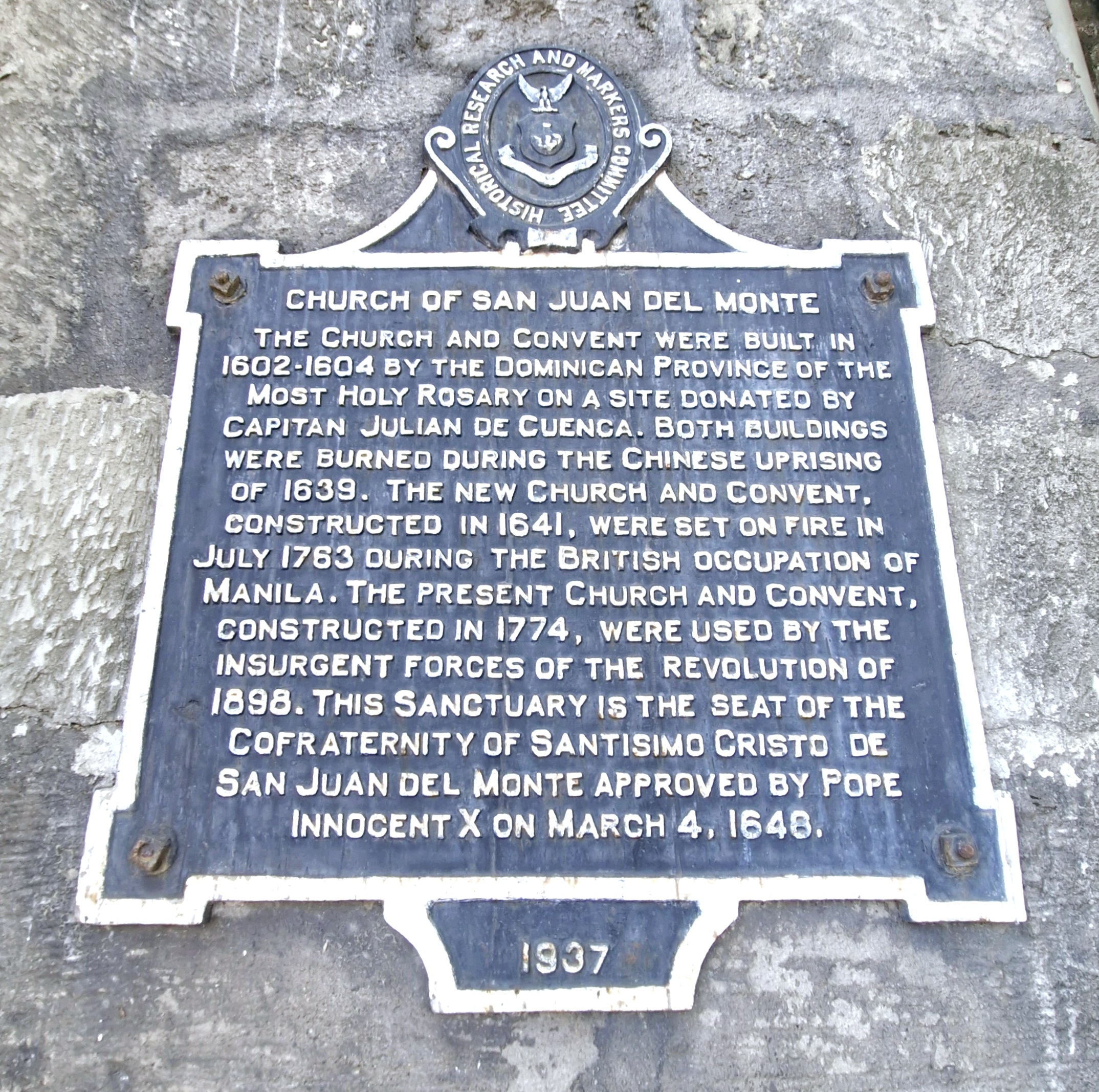
The interactive and engaging, 5,000-square meter A: Museum – Immersive Art Universe, the Philippines’ largest digital art museum, is a popular destination for families, friends, and dates. It is a collaboration between the Philippine Amusement and Entertainment Corporation (PAEC), Ayala Malls, and South Korea’s APLAN Company. Established in 2021, PAEC, which curates and operates the museum, is regarded as the largest creator and operator of interactive and educational indoor attractions in the Philippines.

Beautiful and massive and designed to ignite curiosity and wonder, it features an immersive digital experience where Classical art comes to life through interactive installations and cutting-edge technology. The exhibits here are designed to be visually stunning and are popular for capturing highly Instagrammable photos and sharing experiences.
It also features immersive digital art installations including a ball pit and motion light and motion installations and digital versions and reproductions of classic art works of famous artists such as Vincent Van Gogh, Claude Monet, Wassily Kandinsky and Pablo Picasso, offering visitors a 2-hour, immersive experience where they have an active role in the experience, with interactive elements and a focus on creating memorable and photo-worthy moments.

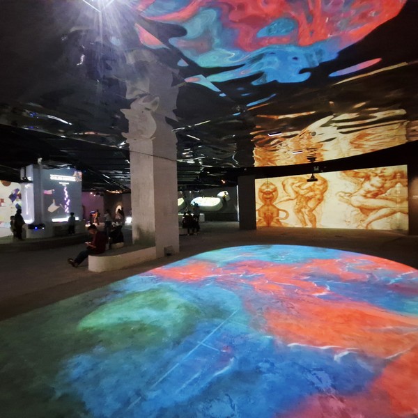
Here, we explored, in a series of mesmerizing spaces that blur the lines between time, space, and imagination, and carefully curated to celebrate the fusion of art and technology, timeless masterpieces that transcend generations and cultures, engaging with art in a way that is both unique and profound. There are 12 immersive, multi-thematic digital art rooms. The moment we entered the dynamic and futuristic Teleport Gallery, a new world appeared as we are led through time and space, giving us a quick look at artistic movements, from ancient to contemporary, modern art, where past and present blend into a powerful experience of change.

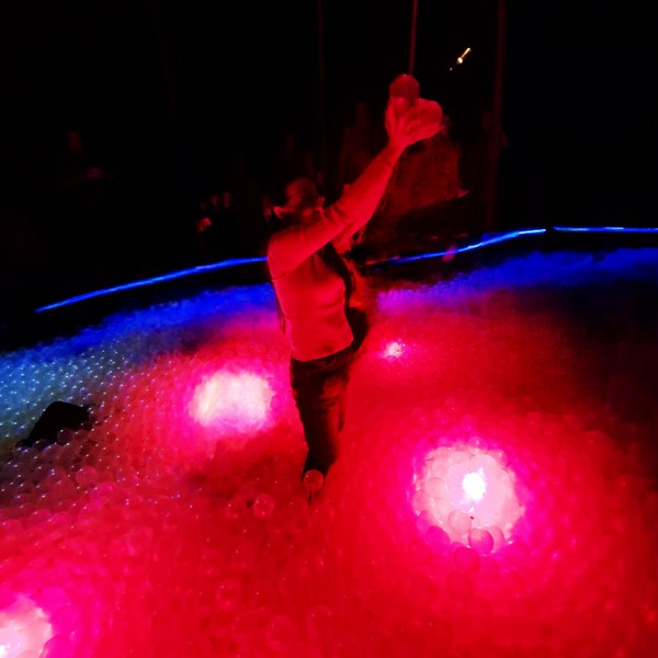
At the fascinating Portal of Lights, we marveled at an interplay of light and music. Here, a laser shows syncs perfectly with the music, creating vibrant shapes. The ball pool, like a portal leading to another dimension, is filled with a red glow, casting a mystical aura—where reality melts away and the extraordinary appears.
At the magical Art Reflow, we directly engaged with digital installations. Here, paintings came alive with the touch of our single fingertip, with the masterpiece shifting fluidly, as if the paint is moving, constantly reshaping the artwork in a dynamic dance of creativity.
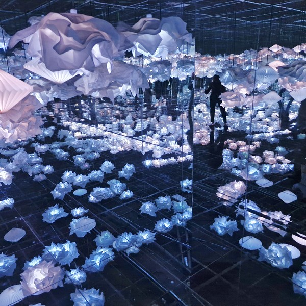
Infinite Blossoms, with light, color, and form coming together to create a dreamlike scene, was a magical experience where nature and art blend in perfect harmony. As the calming melody filled the air, elegance meets wonder as we were drawn into a world similar to Claude Monet’s Water Lilies (a series of about 250 Impressionist oil paintings of his water garden in Giverny, France, created during the last 31 years of his life), creating blooming masterpieces.
Color Sonata, an enchanting space where music and art come together in perfect harmony, we can play a piano to change or influence the colors and visuals of the digital artwork in real-time. When our fingers struck the piano keys, Russian painter Wassily Kandinsky’s paintings shifted before our eyes, with each chord and note breathing life into his work, crafting a magical, responsive experience where music and color merge seamlessly.
At the Cosmos Voyage section, we explored the infinite possibilities of art. Here, we envisioned ourselves stepping inside and passing through a black hole, where not even light can’t escape, leaving behind the limits of time and space, and opening the door to a whole new dimension of art, discovering the infinite artistic possibilities.

At the timeless beauty of Eternal Touches, a lasting expression of art, light and shadow merged as we explored timeless works that have survived through ages. From classic brushstrokes to the bold energy of modern artists, their influence reaches across time and cultures, emerging to create a powerful, quiet moment.
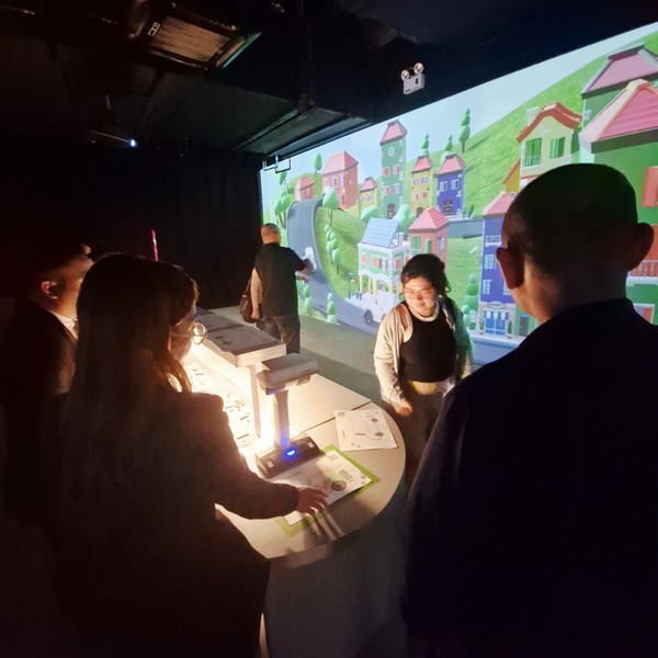
At Drive Your Dream, an imaginative realm where dreams transform into reality, is a highlight of the museum’s immersive digital art. Experience. Here, we unleashed our creativity on a blank digital canvas as we designed the car of our dreams. As soon as we pressed the scan button, our imaginative creation came to life on a large screen, becoming the heart of the captivating Village, thus creating lasting memories.
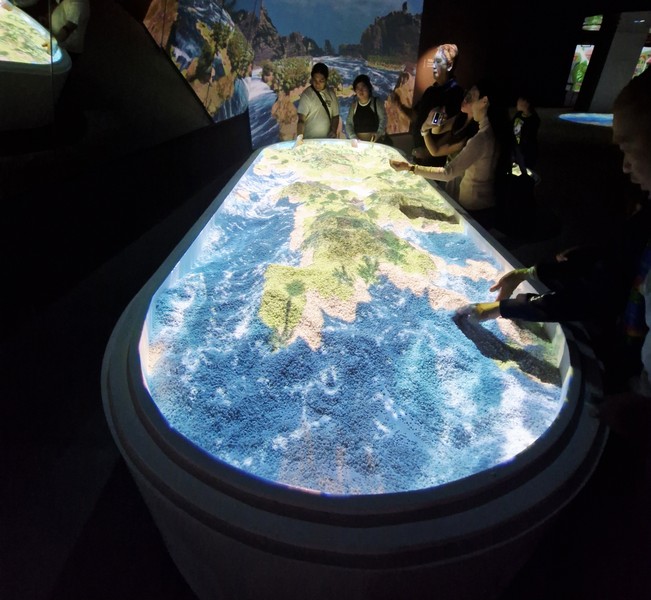
At the Floor Canvas, projection mapping is blended with motion sensing technology as our footsteps rippled across digital water, transforming the walkway into a responsive canvas. At Cubist Portrait, another digital art installation, our portraits were fragmented and reassembled in a Cubist style digital image with the ability to interact with the different elements within it.
At Stream of Heaven, an advanced form of interactive storytelling, we “walked” on clouds in a digital heaven. At the Stellar Chamber, we experienced the “weightless realm” though cutting-edge technology that creates multi-sensory experiences. Here, we entered a world of weightlessness where gravity disappears and the boundaries of time and space where blurred.
A: Museum was a mind-blowing, modern and interactive way to experience timeless classics, leaving us with unforgettable memories as we delved into an extraordinary world of artistic innovation. This immersive media art exhibit revolutionizes art by merging the past, present, and future with cutting-edge technology, showcasing various art forms reimagined through modern technology and the boundless creativity of artists. Truly, a one-of-a-kind artistic experience that combined visual works, music, and interactive moments. More than just a venue—it’s an artistic odyssey through emotions and beauty.
A: Museum – Immersive Art Universe: 3rd Floor, Building B, Ayala Mall Manila Bay, Diosdado Macapagal Ave. cor. Aseana Ave., Paranaque City. Mobile number: (0954) 987-4572. E-mail: amuseumeternaltouch@gmail.com. Open daily, 12 noon to 9 PM (last entry: 7 PM). Admission: Php899/pax.