
.jpg) |
| The road to Besao |
Come early morning, on our second day in Sagada, the skies were now clear of rain and the sun was coming up. I decided to take a walk up the road to Besao to work up an appetite for breakfast at Ganduyan Inn. Jandy was still asleep so I went out on my own. I also wanted to check out what’s changed in the town since our first visit in 1998 (http://firingyourimagination.blogspot.com/1998/04/v-behaviorurldefaultvmlo.html). I noticed that some of Sagada’s old familiar inns and restaurants were still around.
.jpg) |
| Sagada Guesthouse & Resto |
One of these is the Sagada Guesthouse and Resto. Located just past the new municipal hall, they offer a variety of rooms with varying price ranges and amenities: single (PhP150) and double (PhP300) with common bath, 3-pax rooms with private bath (PhP600), rooms with private bath and kitchen and one with cable TV (PhP1,200). It also has a ground floor coffee shop.
.jpg) |
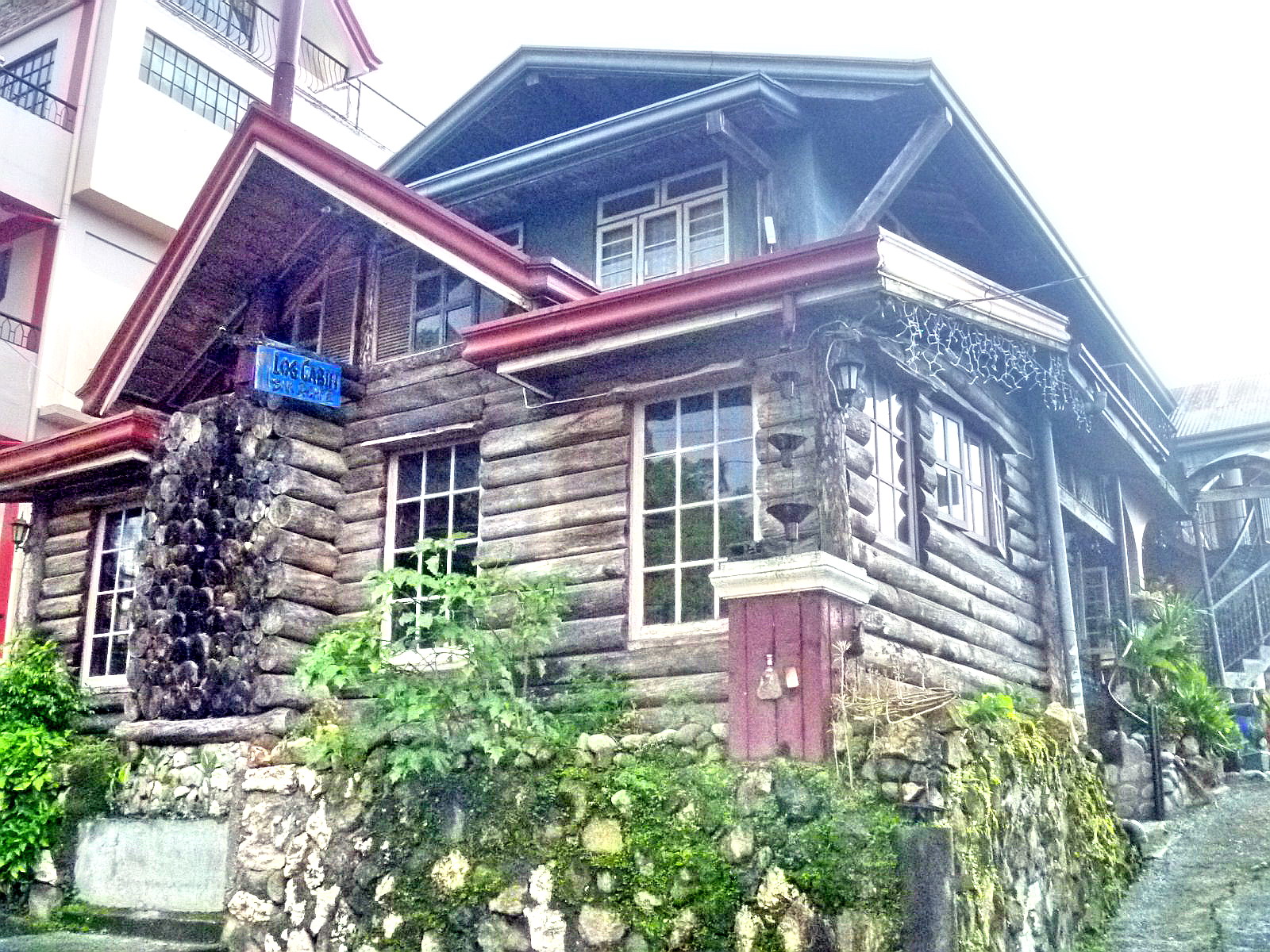
| Log Cabin Restaurant |
Another familiar Sagada landmark is the Log Cabin Restaurant, a log-cladded restaurant still popular with foreigners. Its broad menu still offers consistently good, reasonably-priced and hearty meals, including exceptional European-inspired pasta dishes (bolognese and pesto), vegetables, adobo dishes and salads, all prepared by the local French chef.
.jpg) |
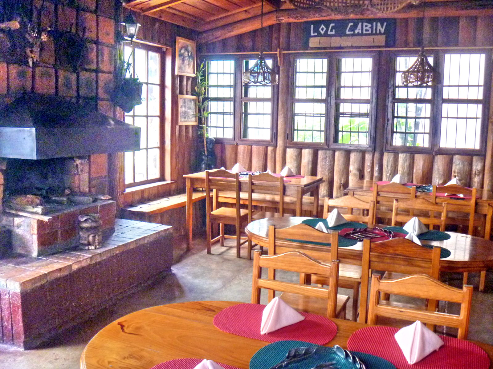
| Log Cabin dining area |
They also have an impressive wine list (Hardys Shiraz, Doublebay, Jacob’s Merlot, Loins Chattel Savvingon, Sta. Rita Cabernet, Lindimans Shiraz, Blasseagle, Antaras Chile, etc.) to choose from, a fireplace and a wide selection of recorded music. For PhP350, they offer a multi-course buffet on Saturday nights. You would have to book one day in advance and pay a PhP100 deposit. For guests, it has an upstairs room with private bath and balcony (PhP800).
.jpg) |
| Strawberry Cafe |
There are also new players in food and accommodation. Across the Log Cabin is the no frills, corrugated G.I and log-cladded Strawberry Cafe. They offer fast food such as arroz caldo (chicken and rice stew) and mami (chicken or pork noodle soup), both for PhP45. Further off is the 2-storey Alapos View Inn, which also has a coffee shop, and Ganduyan Inn 2.
.jpg) |
| Alapos View Inn |
Past a lane to the left side of the road is the Sagada Homestay which offers 6 rooms, one of which has a private bath (PhP700) while the 5 others (PhP250/pax) share 4 bathrooms. The ground floor has a large dining room and kitchen for the use of guests. A separate 2-bedroom, 4-pax cottage with bath and kitchen rents for PhP1,500.
.jpg) |
| Sagada Homestay |
Continuing further down the road, past the town, would have brought me to Lake Danum in Besao but I’ve already worked up an appetite for breakfast and so I made my way back to Ganduyan Inn.
Alapos View Inn: mobile numbers (0921) 327-9055 and (0918) 332-3331.
Log Cabin Restaurant: mobile number (09320) 520-0463 (Dave Gulian)
Sagada Guesthouse & Resto: mobile number (0919) 300-2763.
Sagada Homestay: mobile numbers (0919) 702-8380, (0918) 717-3524 and (0919) 498-2181. E-mail: sagadahomestay@yahoo.com.


.jpg)

.jpg)
.jpg)
.jpg)
.jpg)
.jpg)
.jpg)


