Rufino Pabico Ancestral House (Daet, Camarines Norte)

Rufino Pabico Ancestral House

The Pinyasan Street Dancing and Marching Band Parade, along Vinzons Ave., had now passed us by and, before leaving, Lee, TJ, Bernard and I decided to drop by the two-storey, maroon and white  Rufino Pabico ancestral house, the only remaining relic of early 20th century architecture in Daet.

Check out “Pinyasan Festival 2011

On hand to welcome us was the 75 year old Francisco Pabico Timoner, the grandson of the original owner. Mr. Timoner, I would later learn, is a retired General Manager of  the Camarines Norte Electric Cooperative (CANORECO) and a acquaintance of my father-in-law, Mr. Manuel L. Sta. Maria, retired Deputy Administrator of the National Electrification Administration (NEA).

Francisco Temoner at the grand staircase

Built in 1917 and the scene of high-society balls in the 1930s, the grand Rufino Pabico house was still well-preserved.  Within its well-manicured front yard is an octagonal fountain.  Like many typical bahay na bato (stone houses), it has a masonry ground floor and a wooden second floor.  Arches are predominant in front; from the ground floor colonnaded front porch, with its fluted square columns, all the way up to its second floor sliding capiz (oyster shell) windows, its arches decorated with intricate lacy (calado) woodwork.  That same woodwork can also be found above the windows and in the eave fascias. Between the window sill and the floor are ventanillas with sliding wooden shutters for additional ventilation.

The well-preserved interiors

The interiors are just as well preserved.  The grand stone staircase, with its marble steps, still has its rococo-style carvings while the alternately dark and  light-hued hardwood floor still retain their shine.  The ceiling is covered with wood carvings.  All these are complemented by a Cornish piano, pre-war chandeliers, wall paintings, vintage family photos and antique wooden furniture including silohiya (wickerwork)-covered chairs.  Novelties here include a now-unused wood-fired stove and a free-standing antique, enamel-covered cast iron bathtub.

According to Mr. Timoner, during World War II, the house was used as a headquarters for the Japanese Imperial Army and, later during the Liberation, by American forces.  In 1995, a strong typhoon partially destroyed the house but it was soon restored to its original look. The house hit the limelight when it was featured in an article at the Philippine Daily Inquirer, written by our media colleague Amadis Ma. Guerrero.  Since then, it has been included in the list of places to see in Daet as well as in the province.  On June 19, 1997, the house was conferred the “Provincial Cultural Treasure Award,” as indicated by a plaque installed at the porch wall.   During the 2009 Pinyasan Festival, the Daet Kiwanis Club, the Daet Senior Citizens Federation and Reina Daetena hosted the Grand Tertulia de Daet at this house.

Rufino Pabico Ancestral House: Vinzons Ave., Poblacion, Daet, Camarines Norte

Pinyasan Festival 2011 (Daet, Camarines Norte)

Pinyasan Street Dancing Competition

My last visit to Camarines Norte literally hit two birds with one stone as we covered the 150th birth anniversary of National Hero Jose Rizal (June 19) and the Pinyasan Festival (June 15-24) which coincided with Daet‘s 428th foundation anniversary and the quadricentennial of its St. John the Baptist parish.  Daet Mayor Tito Sarion, who was a town councilor in 1993, started the town’s Pinyasan Festival. Back in the1990s, while attending a Philippine Travel Mart Convention, Tito conceived of the idea of promoting a local festival in honor of the Formosa pineapple, the sweetest variety among home-grown pineapples in Camarines Norte and a major fruit product. The festival has significantly boosted the popularity of the pineapple (its other potentials then only known by local farmers and traders) and fortified industries related to it.   Today, foreign firm Sunzu Agri-Development, Inc. has a pineapple processing plant at Brgy Caayunan in Basud while another newly-established agro-industrial firm (Flora Farms Integrated, Inc.) in Brgy. Pamorangon in Daet has ventured into the production of food and other products derived from pineapple. There is also a Pineapple Island Resort-Hotel (Calasgasan, Daet), a new bus firm (Pineapple Gold Express) and countless newly created food recipes that include pineapple as ingredient.  Neighboring Basud town and local cooperatives, with the help of the local government and national agencies, have created new fiber products and the popular pineapple pie,  a contribution to the One Town One Product (OTOP) program, harnessing local creativity in to exploring product possibilities extracted from the fruit and sustaining a now major industry.

Mayor Tito Sarrion

This year is the 19th edition of the festival and this would be my first Pinyasan. Our three-day (June 17-19) visit to Daet didn’t extend to June 23, the day of the Grand Float Parade, but we did get to see the Miss Pinyasan/Miss Daet 2011 beauty contest and the Street Dancing and Best Marching Band Competition the next day. We had just returned from our Calaguas Islands tour when Bernard, Lee, TJ and I were invited to cover the beauty contest’s Coronation Night.   From the Bagasbas Lighthouse Resort (where we were booked), we were brought first to the Terrace Grille for dinner.  Here, we espied the candidates and guest Ms. Universe runner-up Ms. Venus Raj as they were about to leave and met up with Daet Mayor Tito Sarrion.  The pageant proper was held at Provincial Gym.  Ms.  Abigail “Abby” Ortega was crowned as Miss Pinyasan.  Runners-up were Ms. Renei Victoria Almoneda (Miss Daet, also Best in Swimsuit, Festival Costume Design and Evening Gown), Ms. Nicole Anne C. Gange (Miss Tourism and Miss Photogenic), Ms. Princess Joy Burce (First Runner-up), and Ms. Erika Bianca “Ekaa” Lasay (Second Runner-up).

Miss Pinyasan/Miss Daet 2011 winners
The next day, all four of us had our lunch at the K Sarap Snack Bar along Vinzons Ave.  Right after lunch, we went out along the Vinzons Ave. (and, later, to the First Rizal Monument) to watch the Street Dancing and Best Marching Band Competition.  The winners of the Miss Pinyasan (minus First Runner-up Ms. Burce) and town officials in a float (led by Mayor Sarrion) also joined the parade.  There were also a number of karetelas bedecked with pineapples and flowers.  The winners of the Street Dancing Competition were Barangay Cobangbang (first), Barangay 7 (second) and  Barangay Lag-on (third).  In the elementary school level, the Best Marching Band Competition winners were Talisay Elementary School (first), Daet Elementary School (second) and Gregorio Pimentel Elementary School (third), while at the high school level, the winners were St. Francis Parochial School (first), Tulay na Lupa National High School (second) and San Roque National High School (third).
 
Best Marching Band Competition

First Rizal Monument (Daet, Camarines Norte)

First Rizal Monument

One of the highlights of our last visit to Camarines Norte (aside from the Pinyasan Festival) was the celebration of our National Hero Jose Rizal’s 150th birth anniversary. Daet figures prominently in this nationwide celebration because it is the site of the first and oldest monument erected in honor of Rizal (though he never set foot in the town) in the country (antedating, by 14 years, the more famous one built in Luneta in 1912) and in the world.

Check out “Pinyasan Festival 2011

Last June 19, some 1,500 youth of the province, all belonging to various schools and organizations, joined a mass floral offering at the First Rizal Monument, all vowing to keep the libertarian ideals of Rizal alive and to help contribute in nation-building.  A history forum, with Prof. Danilo M. Gerona of the Ateneo de Naga University, was also held there.

Plaque

The monument, at the corner of Justo Lukban and Magallanes Iraya Sts., at Rizal Square, Kalayaan Park (the park was said to be the site where the Katipuneros held their ground during the April 14-18, 1898 uprising), in front of the old municipal hall (now the Daet Heritage Center), is a 3-tiered, 20-ft. high stone pylon designed by Lt.-Col. Antonio Sanz, a soldier-artist and revolutionary head of the local government, and Lt.-Col. Ildefonso Alegre.  It was built through the financial contributions of the townsfolk of Camarines Norte and the Bicol region.  Oral accounts say that the base contains a time capsule containing the list of contributors to the project while some quarters and treasure hunters believe that there were buried treasures around it.

The groundbreaking for the construction of this sparsely decorated but impressive and majestic monument, near the bank of the Daet River, was done on December 30, 1898 (just two years after Rizal’s death), in observance of the first-ever Rizal Day (the first province to do so), decreed on December 20 by then Pres. Emilio Aguinaldo, and completed sometime in February 1899, shortly after the outbreak of the Philippine-American War. Its foundation is believed to have been made with mortar and coral stone taken from the demolished old Spanish jail where many patriots, in April 1898, were tortured and executed. The monument is rather unique as it does not bear a sculpted image of Rizal, unlike other monuments today.

Inscribed on the square podium, surmounted by a two-level triangle (the last one tapering off to a point), are Rizal’s popular novels, “Noli Me Tangere 1886” and “El Filibusterismo 1891,” and “Morga 1889,” a tribute to Antonio de Morga, author of Sucesos de las islas Filipinas, an important book on the Spanish colonization of the Philippines written in 1609 and later annotated by Rizal. Ironically, the Rizal Monument came to be known as “Morga Monument.”  On the sides of the triangle is a five-pointed star, an eight-rayed sun and the Spanish phrase A Jose Rizal (“to Jose Rizal”) and at the top used to be the all-seeing eye.  The front face contains a black metal plaque, from the then National Historical Commission, declaring it a National Historical Landmark in 1961. The monument has pronounced Masonic elements possibly because Rizal, Emilio Aguinaldo, Sanz, Gen. Vicente Lukban (head of Revolutionary forces in the Bicol Region) and many of the financial contributors were Masons. Today, the image of the First Rizal Monument is incorporated in the provincial and municipal (of Daet) insignias.

The Busig-on River (Labo, Camarines Norte)

Nipa palms along the Busig-on River

We left Quinamanukan Island by 3:15 PM, the mainland just a 30-40 min. boat ride away.  Upon reaching the mainland, our boat made its way inland via the wide but sometimes shallow Busig-on River (the province’s longest river system), its muddy banks lined with nipa and coconut palms and backdropped by the 997 m. high Mt. Balagbag (known as the “Sleeping Giant”).  Every now and then, small, outrigger-less and high-bowed bancas would pass us by.  After negotiating a bend in the river, we finally reached port by 4:30 PM.  Amable Miranda of the Camarines NorteTourism Office was already waiting for us there.  After dining on angko, a local delicacy I bought and shared with the others, Amable drove us to Tabea Reichan Restaurant at Vinzons town proper where we had our “late” lunch.  After picking up our luggage at the Municipal Guest House along Bagasbas Blvd. in Daet, Amable drove us to the nearby, upscale Bagasbas Lighthouse Resort, Daet’s premier resort, where we were to stay (my second) for two days.

Tabea Reichan Restaurant: Poblacion (just across the municipal hall), Vinzons, Camarines Norte

Bagasbas Lighthouse Hotel Resort: Bagasbas Blvd., Daet, Camarines Norte.  Tel: (054) 441-5855.  Mobile number: (0916) 520-6783.  E-mail: info@bagasbaslighthouse.com. Website: www.bagasbaslighthouse.com.

Quinamanukan Island (Camarines Norte)

While we dining on the boat, we were merrily on our way to our next destination: the low, flat and heavily wooded, 6-hectare and footprint-shaped Quinamanukan Island, off Brgy, Sula in San Miguel Bay.

Quinamanukan Island

We were within sight of the island and its 1,000 m. long white sand beach by 1:30 PM but we had to circle it for half an hour, looking for a suitable landing site, with the boatman carefully steering the boat away from the delicate coral reef. We were welcomed by Mr. Samuel Pajarin, the island’s caretaker, who led us to his hut on the island’s opposite shore, we having to make a short hike through a well-marked trail through a forest to get there.  While Samuel was making coffee for us, I donned a diving mask and snorkel to explore the stunning and impressive submarine gardens (stony, whip and soft coral, black coral, etc.) of the island’s 200-hectare marine sanctuary, a breeding spot for different kinds of colorful tropical fish. The island is also ideal for scuba diving as it has drop-offs going down to 1,000 m.

Pinagkastilyuhan Island (Camarines Norte)

Pinagkastilyuhan Island

After returning to our campsite from our hilltop trek, we proceeded to pack up our stuff as we were to have our lunch at the mainland in Vinzons town.  We shoved off and said goodbye to Tinaga Island by 11 AM but it seems our hunger for islands to explore hasn’t been sated.  With some extra gas to burn and lots of enthusiasm, in spite of the overcast skies, we leisurely made our way to the privately-owned (by a Dr. Valencia) Pinagkastilyuhan Island (also called Cinastilyohan Island), making a brief stopover to photograph some goats sheltering on rocky outcrops on another island.  After a 30 min. trip, we made soon espied Pinagkastilyuhan Islandbut couldn’t make landfall as the water was too shallow for the boat to navigate.

Wading shallow waters to get to the island

Thus, we had to disembark from the boat some distance from the shore, me, Bernard, Karla, Lan, Debbee and Angel having to wade through ankle deep to sometimes waist deep waters to get to shore.  It was already drizzling when we arrived, prompting Lee decided to stay behind in the boat to avoid drenching his camera.  I was the first to make it to shore, the others soon following my lead.  The sand, though not as white as in Mahabang Buhangin, was just as fine and inviting.  However, prior to exploring the island, Debbee had to get clearance from the island’s lady caretaker, it being a privately-owned island.    We went maybe a fourth of the way around the island, where two islands beckon offshore.  The nearest seemed reachable but wading towards it was impossible as, halfway there, the water already reached up to my neck.  So near yet so far.   

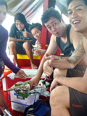
Dining, kamayan style, on grilled fish

After some photo ops, we returned to where we landed and waded back to the boat.  While we were gone, Lee wasn’t idle, buying 5 large pieces of fish and a squid, from some passing fishermen, for the rock-bottom price of PhP100.  As soon as we raised anchor, Lee had this fresh catch grilled by the boatmen on a portable stove.  It was now noontime and time for lunch and, soon enough, we were dining on this feast, kamayan style, which we complemented with leftover fried rice.  

The Church Bells of Paracale

The bells of Paracale Church

Our longest stopover was at the Church of Our Lady of Candles in Paracale, my second such visit.  However, my visit here was notable as this was my first time to climb a church bell tower (and two at that at each end of the facade). The towers were approached by first climbing a steep stair from the nave to the choir loft and, from there, another less steep stair, but with a very low opening, to the towers.  The left belfry has two medium-sized bells bells  while the right belfry has two big and older (circa 1888) bells and a small bell. One of the newer bells had a recognizable signature stating that it was cast in 1920 by the Hilarion Sunico Foundry (the foundry has made 176 bells since 1872 and its last known bell was cast in 1937).  Some of the bells have visible cracks and all are colored blue-green possibly due to oxidation.  The towers had panoramic views of the municipal hall and town proper as well as the mountains beyond.

Labo Town Proper (Camarines Norte)

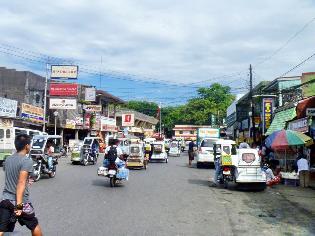
About 15 kms. out of Daet, we again made a short stopover at the busy, 648.84 sq. km. (more than 25% of the province’s total land area) and first-class municipality of Labo (2010 population: 92,041, the province’s most populous) where Bernard and I bought some shades at the market.

Labo town proper

Labo town proper

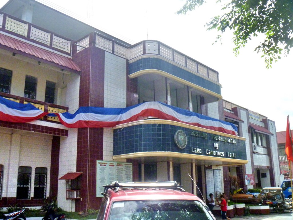
From the market, I walked over to the nearby Church of St. John the Apostle and Evangelist and the modern, 2-storey municipal hall for my own photo ops.

Labo Municipal Hall

Labo Municipal Hall

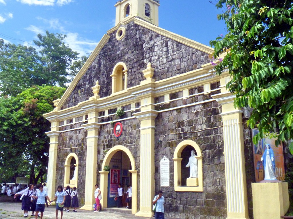
The church was built in 1890 by Fr. Sotero Martin (parish priest from 1891 to 1894).

Church of St. John the Evangelist & Apostle

Church of St. John the Apostle and Evangelist

AUTHOR’S NOTES:

The church has a 2-level, Baroque-style coralstone facade with a triangular pediment with a centrally located, semicircular arched statued niche and topped by a square bell tower.

The lower level has a centrally located, semicircular arched main entrance flanked by fluted pilasters (topped by urn-like finials) and semicircular arched statued niches.

Church of St. John the Apostle and Evangelist: Brgy. Burgos, Labo 4604. Tel: ()54) 447-6325. Feast of St. John the Apostle and Evangelist: May 6.

Labo Municipal Hall: National Highway, Labo 4604. Tel: (054) 721-7412.  E-mail: inquiries@labo.gov.ph. Website: www.labo.gov.ph.

Back to Camarines Norte

Municipal Guest House

For the third time this year, I was again invited to visit Daet, in Camarines Norte, this time to cover its Pinyasan Festival as well as the 150th birth anniversary of Jose Rizal, the town being the site of our National Hero’s first monument.  I was joined by event organizer Mr. Bernard Supetran, professional photographer Mr. Lee Llamas, travel writers Mr. Timothy Jay “TJ” A. Ibay of What’s On and Ms. Karla Marcia Rey, and travel blogger (and Karla’s boyfriend) Mr. Orlando “Lan” Cajigal.   We all left via a 9 PM airconditioned bus at the Philtranco terminal in Pasay City, all sitting at the rear of the bus.  This was to be my first long-haul bus (8-9 hrs.) trip to Daet, my first being by plane to Naga City (plus a 2-hr. van drive back to Daet) and the two others by van.

Surfer’s Dine Inn

Our 6 AM arrival at Daet was heralded with a crash as our bus’ roof  scraped the low ceiling of the bus shed.  Poor bus driver (salary deduction).  Our trusty driver from the Provincial Tourism Office, Mr. Amable Miranda, was on hand at the terminal to pick us up with a van.  We were first brought to Surfer’s Dine Inn, along Bagasbas Blvd., for an early Filipino breakfast (mine was pork chops). Here, we were met by Provincial Tourism Officer and good friend Atty. Debbee Francisco.  Amable then brought us to the Municipal Guest House, also along Bagasbas Blvd., where we freshened up and rested for a short while.   We were all slated to go overnight camping at Tinaga Island, one of the famed Calaguas Islands.  This was to be my second visit and the first for the rest.We left Bagasbas by 8 AM for the leisurely drive to Minaongan Fish Port in Paracale, bringing along just enough personal necessities for our overnight camping (plus some borrowed pillows and blankets from the guesthouse).  The national highway unusually passed through the gated property (which was closed at night) of the modern Cathedral of the Most Holy Trinity (consecrated on  September 1, 1984).  Here we made a brief stopover for photo ops.

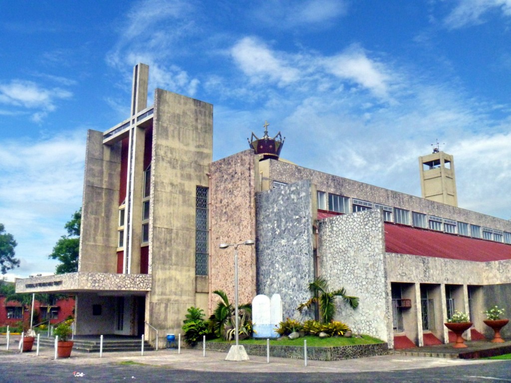
Cathedral of the Most Holy Trinity

Cathedral of the Most Holy Trinity

Return to Tinaga Island and Mahabang Buhangin (Camarines Norte)

Mahabang Buhangin Beach

We finally arrived at Minaogan Fish Port in Paracale by 10 AM.  Here, a motorized outrigger boat, much smaller than the 25-pax boat I used during my first visit (which was grounded with a damaged propeller), was made available for our use.  Ms. Genelyn Angel S. David, a member of Debbee’s staff, also joined us here.  As it was still low tide, we had to wade the shallow waters to get to the boat, Debbee accidentally dipping (and ruining) her mobile phone while doing so. We were on soon our way, the 2-hr. boat trip being uneventful as the sea was calm.

My second Mahabang Buhangin sunset

We arrived at Tinaga Island by noontime, making landfall at the famed white sand of Mahabang Buhangin.  Lunch was still a long way off as the supplies had to be unloaded, followed by food preparation and cooking.  While waiting for lunch, we set the 4 Coleman dome tents provided for us.  Lunch was ready by the time we were done and we all feasted, kamayan style, on fried chicken, steamed rice and grilled squid.   After this late repast, we rested for a while or chatted.  Later, in the afternoon, Karla, Lan, Angel, Debbee and I plus 2 young island boys, both brothers, who acted as our guides, made our way along the beach to the base of a hill on the previously unexplored (by me) south side of the island.  From here, it was all uphill and downhill, along a well-marked trail, through a thick forest and, finally, through cogon (spear) grass.  Here, we had a somewhat obstructed view of Mahabang Buhangin Beach.  After some photo ops, we made our way back to the beach where Lee had already set up his camera, eagerly awaiting the sunset.  Though not as unobstructed by clouds as during my first visit, it was still just as spectacular.

Mahabang Buhangin viewed from the south hill

While waiting for lunch, we set the 4 Coleman dome tents provided for us.  Lunch was ready by the time we were done and we all feasted, kamayan style, on fried chicken, steamed rice and grilled squid.   After this late repast, we rested for a while or chatted.  Later, in the afternoon, Karla, Lan, Angel, Debbee and I plus 2 young island boys, both brothers, who acted as our guides, made our way along the beach to the base of a hill on the previously unexplored (by me) south side of the island.  From here, it was all uphill and downhill, along a well-marked trail, through a thick forest and, finally, through cogon (spear) grass.  Here, we had a somewhat obstructed view of Mahabang Buhangin Beach.  After some photo ops, we made our way back to the beach where Lee had already set up his camera, eagerly awaiting the sunset.  Though not as unobstructed by clouds as during my first visit, it was still just as spectacular.

Footprints in the sand

Back in our camp, dinner was already being prepared and soon we were dining, with flashlights, on grilled pork chops, laing and steamed rice.  Too early for sleeping, we chatted away till 11 PM when we decided to call it a night and retire to our tents.  Come morning, we awoke to a delicious breakfast of longanisa, fried egg, coffee and fried rice.  The weather that morning, however, was overcast and soon it started to drizzle.  Typhoon Egay had now made landfall.  Still, this did not dampen our spirit for adventure and Lee, Angel, Karla, Lan, TJ, Debbee, Bernard and I hiked along the beach to the north side of the island where Lee did a fashion shoot, at the beach and among rock formations, with Angel as model.  After the shoot, Lee and Angel made their way back to the camp while rest of us made our way up the hill, first through a light forest, then out into a grassy clearing where we had a panoramic view of Mahabang Buhangin Beach.  Further up, we had  360 degree view of both Mahabang Buhangin and nearby offshore islands. Below us was another white sand beach.  Thus sated, we made our way down the hill to the beach and back to the camp.