Sunset Viewing at Pucio Point (Libertad, Antique)

From our spelunking tour of Maanghit Cave, we again returned to Libertad town proper on our van but, instead of dropping down, we were just handed bilaos of kakanin and then proceeded on our way to Pucio Point, where, hopefully, we could make it in time to catch the sunset.  The westernmost point of Panay Island, Pucio Point is located at the Libertad-Buruanga (Aklan) border.

Pucio Point

The author at Pucio Point

The 13 km. travel distance seemed short but we would be traveling along a very narrow and dusty barangay road along the coast.  Again, our motorcycle escorts led the way to make sure there wouldn’t be any road delays, and Tony Liakhovetsky hitched a ride with one of them.

The colorful drum and lyre marching band

The colorful drum and lyre marching band

The Flores de Mayo-like parade

The Flores de Mayo-like parade. I noticed the discrepancy in heights

Just the same, unavoidable delays do happen but it came in the form of a delightful Flores de Mayo-like parade of children, the pairs of boys (some shorter than the girls they’re escorting) and girls of which were dressed in barong tagalogs and evening gowns, respectively.  Leading the way was a children’s drum and lyre marching band, all suitably dressed in striking blue and white uniforms.  We waited for them to pass us by before continuing on our way.

The view deck at Pucio Point

The view deck at Pucio Point

An array of kakanin from Brgy. Tinigbas

An array of kakanin from Brgy. Tinigbas. These were brought to Pucio Point

We arrived at the Pucio Point with still some time to spare, giving us enough time to feast on the kakanin which we brought along, washed down with fresh buco juice as well as bottles of ice tea and water. Below us, a large, motorized outrigger boat was moored along the shore. We were in for a beautiful sunset as there were only a few clouds on the horizon to block the view.

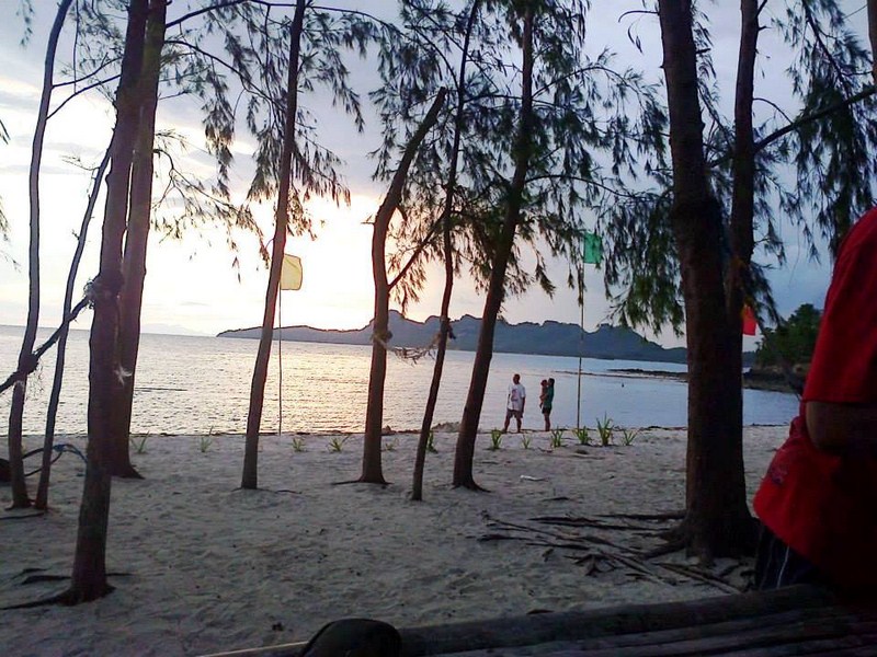
The magnificent sunset at Pucio Point

The magnificent sunset at Pucio Point

Flord in a U.P. Oblation pose, sihouetted against the setting sun

Flord in a U.P. Oblation-like pose, sihouetted against the setting sun

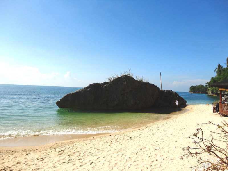
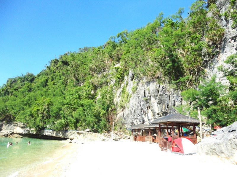
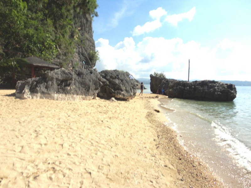
Pucio Point has two huge rock formations with the concrete viewing deck built on top of the nearer of the two to the shore.  As such, the second rock formation in front of the view deck provided an interesting foreground subject that complements the beautiful sunset in the background.  Flord made the great effort to climb down the view deck, wade across and then climb up this rock formation just to pose on top, with the setting sun behind his back.

Spelunking at Maanghit Cave (Libertad, Antique)

After our banig making demonstration, we again boarded our van as we headed for Brgy. Union, the jump-off point for our hike to Maanghit Cave, located inland, 4 kms. north of Libertad. The  cave entrance is located near the river.

Trekking the well-trodden trail to Maaghit Cave

Trekking the well-trodden trail to Maaghit Cave

The local word maanghit, meaning “having a foul odor,” comes from the foul smell of the huge deposits of guano (bat droppings) which fall on the cave’s floor and are mined by the townspeople.  That said, we were in for a muddy and slippery tour.

Bungan-Bungan Spring

The blue lagoon at Bungan-Bungan Spring

Series of pools at Bungan-Bungan Spring

Series of crystal clear pools at Bungan-Bungan Spring

Upon arrival, we were all assigned local guides equipped with hard hats and flashlights.   No hard hats for us though. It’s a good thing Jandy and I wore hats to protect our heads.  Just 5 mins. into our hike, along a well-trodden trail through a light forest,we arrived at Bungan-Bungan Spring.  It has a blue lagoon and a series of small pools of crystal clear water walled in with stacks of river rocks.

Entering the low cave entrance

Entering the low cave entrance

Into the recesses of the cave

Into the recesses of the cave

We again proceeded on our trek to the cave, passing as well as hopping over a number of forest trees felled by the fury of Typhoon Yolanda (international name: Haiyan) which struck the town.  After about 20 mins., we espied the low and wide cave entrance on the rock face which we accessed via carved steps and rope railings.

Flowstone formations

Flowstone formations

Maanghit Cave is not big nor is it deep (just about 250 m. in depth) and it would just take us a few minutes to explore the cave until its terminus.  How I wish we carried Petromax lamps, not the flashlights we brought, to light our way better as well as illuminate the stalactite and stalagmite formations which, somehow, still continuously drip water.

A stalactite and stalagmite bout to meet (in a million years) to form a column

A stalactite and stalagmite about to meet (in a million years) to form a column

Though largely unseen, the sounds of bats congregating on the ceiling could easily be heard. Near the cave entrance are two small sinkholes where, when lighted, you hear and see running water, evidence of a small underground river within the cave itself.

A sinkhole with flowing water underneath

A sinkhole with flowing water underneath

After our spelunking tour of Maanghit Cave, we made our back to Bungan-Bungan Spring where we washed off the guano and its smell from our bodies. We then continued on our way back to Brgy. Union where we again boarded our van for the trip back to town.

A Leisurely and Fast-Paced Cruise of the Bugang River (Pandan, Antique)

We had barely caught our breath, upon our return to Malumpati Spring, when we were told to assemble at the dam area.  Here, three bamboo rafts awaited us, to quietly cruise, downstream, the 3 to 4-km. length of the Bugang River. Unique modes of transportation here, these rafts, only assembled when needed, were manned by 3 BCBTO polemen to steer the raft – one standing in front and two at the rear.

The bamboo rafts waiting for us at the dam

The bamboo rafts waiting for us at the dam

Cruising a quiet stretch of the Bugang River

Cruising a quiet stretch of the Bugang River

Jandy, Eman and I rode in one raft.  Through this scenic cruise, we appreciated this river’s rich ecosystem of diverse and lush flora and fauna as we snake along the clear, emerald green waters of the river.  The hour-long raft trip took us along a surreal landscape of decades-old trees (some of them gnarled), mangroves, coconut trees, bamboo groves and nipa palms that lined the banks all along the turquoise water’s edge. Some of the trees were felled by the fury of Typhoon Yolanda International name: Haiyan) which also struck the town.

The colorful rocks underneath the clear waters

The colorful rocks underneath the clear waters

Negotiating a bamboo fish trap

Negotiating a bamboo fish trap

We sometimes had to duck to avoid hitting overhanging tree branches along the way but, altogether, the river cruise produced a calming effect on me.  Where the water level was shallow and the current slow, we could clearly see, right through the bottom, the colorful stones and rock formations underneath. Dipping my feet at the river’s cool waters was an extreme delight.

A gnarled tree along the river bank

A gnarled tree along the river bank

A grotesque tangle of tree roots

A grotesque tangle of tree roots

At some part of the river, some rapids would form, something our expert polemen could negotiate with ease and precision. At the other parts of the river, we passed under a number of bamboo or wooden bridges and encountered small islands, a number of grazing carabaos along the river bank and some unsightly bamboo fish traps.

A river bank spectator

A river bank spectator

Banks lined with nipa palms

Banks lined with nipa palms

On our arrival at Manlonggong Point, beneath the Guia Bridge, we alighted from our bamboo rafts and transferred to smaller bancas manned by one boatman each. I only had time to rub some suntan lotion before boarding my banca.  Jandy rode on another one.

Transferring to small bancas at Manlonggong Point

Transferring to small bancas at Manlonggong Point

Racing towards the sea on my banca

Racing towards the sea on my banca

This time, we were to paddle, the rest of the river’s length, out towards the Bugang Estuary facing Pandan Bay. Pandan riverfolk waved and cheered us along the river bank as Jandy and I, as well as the others, paddled furiously towards this finish line.

Merienda at Cocco Beach Bar & Restaurant

Merienda at Cocco Beach Bar & Restaurant

Our boat race ended at the Bugang River Estuary Fishport and, from there, we again boarded the van for the short drive to Le Palme Beach Resort.  Here, we were to have a merienda of kakanin, bibingka and buko juice at its Cocco Beach Bar and Restaurant facing the white sand beach of Pandan Bay.

Check out “Resort Feature: Le Palme Beach Resort

Le Palme Beach Resort: Brgy. Zaldivar, Pandan, Antique. Tel: (036) 278-9037. Mobile number: (0912) 335-5293.  E-mail: support@lepalmebeachresort.com  and lepalmebeachresort@yahoo.com.  Website: www.lepalmebeachresort.com.
Trekking Along the Bugang River (Pandan, Antique)

We all awoke by 7 AM and had breakfast at Pandan Beach Resort.  After breakfast, the others boarded the van while Clelia and I joined resort owner Gigi Bautista in her car bound for Malumpati Spring, the main source of the Bugang River. I had been here twice before (the second time for Jandy) and the place still looks the same, save for the new zipline facility and wall climbing and rappelling tower of Pandan Adventure Boot Camp.

Bamboo rafting at Malumpati Spring

Bamboo rafting at Malumpati Spring

One of the cleanest inland bodies of water in the country, the Bugang River stretches from Brgys. Guia to Sto. Rosario and ends at Brgy. Zaldivar.  Here, we were to experience a real sense of adventure on the river – trekking, rafting and paddle boating.

The Bugang River

The Bugang River

The river, ranked first among the cleanest inland bodies of water in the region for three consecutive years,  has also won 3 awards – the “Dangal Ng Ilog” Award during the 1st National Summit on the State of Philippine Rivers in 2005; the “Hiyas ng Turismo” Award from the Gawad Pangulo sa Kapiligiran on December 6, 2006 (Iloilo City); and the “International Green Apple Environmental Award for Environmental Best Practice, Local Authorities and Ecotourism Category” from the Green Organization (an independent, non-political and non-profit UK ecology group) in the United Kingdom in 2011.

Start of the trek along the river's edge

Start of the trek along the river’s edge

The local government of Pandan, in an effort to preserve and protect the Bugang River while promoting it as a tourist attraction, has established the Bugang Community Based Eco-Tourism Organization (BCBTO). They spearheaded the Bugang River Cultural, Nature and Adventure Tour to help visitors foster an appreciation for the beauty of nature and develop better understanding of the locals’ practices through activities like rafting and paddle boating along the Bugang River. In 2006, the International Green Apple Environment Awards for Environmental Best Practice awarded this initiative with the Gold Winner in the Local Authorities and Ecotourism Category.

The rope ferry

The bamboo raft

Upon arrival at the spring, some of us, including Jandy, took a dip at the bracingly cold waters of the spring, others went rafting and some went shopping for souvenirs.  The arrival of Mr. Reynaldo Perez, the Malumpati Safety Officer and Operations Manager of the Pandan Adventure Boot Camp, signaled the start of exploration of the head waters of the river which are actually a pair of deep springs, one of which is the major source of the municipality’s water supply.  He assigned to us BCBTO guides Ria Dondon and Jomar Dionela and, together with Ms. Gigi, our tour narrator, we started our hike from the spring, across the bridge and past the Pandan Water District pumping station, into the dense forest.

Crossing a bamboo bridge

Laurie crossing a bamboo bridge

The trek, along the river’s edge, was not too difficult, but we did have to ford a stream as well as cross a bamboo bridge. Clelia and Leah also tried riding a bamboo raft moored along the river.

The smaller, still unfathomed spring

The smaller, still unfathomed spring

The river truly lived up to its reputation as the cleanest river in the country as you can actually see the marine plants, said by marine biologists to be endemic to the river, underneath the clear, turquoise waters.  There were, however, also a number of unsightly bamboo fish traps on the river. The end of the trek brought us, after 45 mins., to the smaller of the 2 springs which has been measured, by British divers, to a depth of nearly a hundred feet (30 m. or more) without finding the bottom. However, swimming wasn’t allowed here.
Crossing a swinging bridge on the return trek

Crossing a swinging bridge on the return trek

We returned to Malumpati Spring via a different route, passing through small settlements, a marker of the Kyoto Gyosei High School (who did reforestation along the Malumpati Watershed for 10 years) as well as crossing a much longer and swinging bamboo bridge.

Malalison Island (Culasi, Antique)

We woke up at 7 AM and, after breakfast at Anna Sophie Hostel, were all driven to the Culasi Municipal Hall where we made a courtesy call on Mayor Joel A. Lomugdang.   From the municipal hall, we made the short drive to Culasi Blvd. where we boarded 3 motorized pumpboats that would take us on our day-long excursion to Malalison (also called Mararison) Island, the nearest of the town’s offshore islands (the others are Batbatan Island and Maniguin Island). Joining Jandy and I on the boat were Flord and Maricar.

Malalison Island

Malalison Island

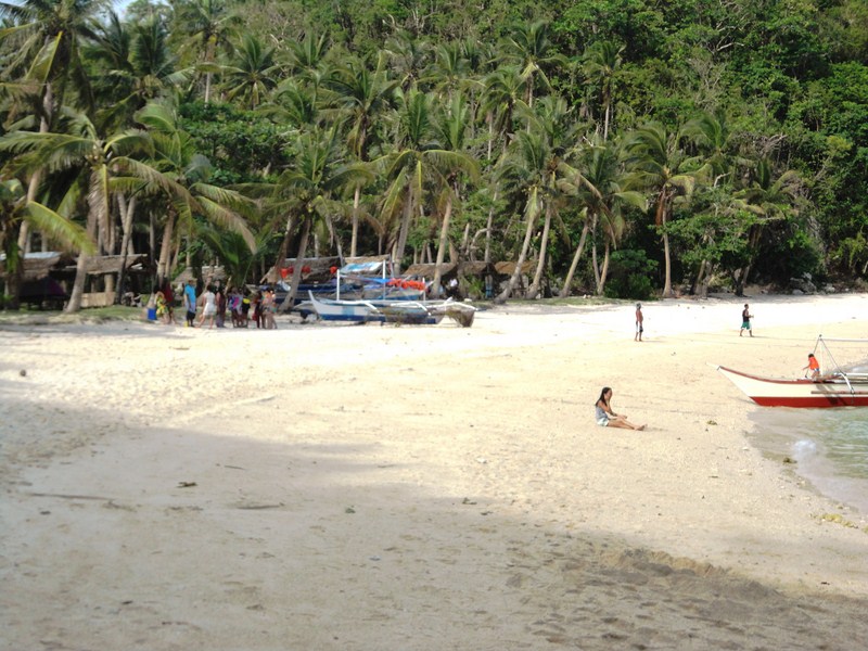
The 4-km. boat ride to this beautiful, 55-hectare, undeveloped, and hook-shaped island took just 20 mins..  On the island is one of the town’s three island barangays with about 700 inhabitants.  We landed at the island’s white sand beach, in front of the shell of what used to be the multi-purpose hall, ruined when Typhoon Yolanda (international name: Haiyan) struck the island.  Nearby is the island’s signature sandbar which stretches about 100 m. from the beach.
On our way to Malalison Island

On our way to Malalison Island

As it was still very early for lunch, we decided to trek the raw and rugged beauty of the island, with its hilly and grassy prairie-like landscape (the island has been called the “Batanes of Antique”).   Maricar and Clelia decided to just stay behind and swim the time away.

View of the fishing village, the sandbar and Mt. Madja-as

Bird’s eye view oof the fishing village, the sandbar and Mt. Madja-as

The initial trek was very tiring, as it was uphill and, as the terrain was mostly grassland, there were almost no trees to provide shade from the intense heat of the sun.  However, the view from the top was spectacular, with the fishing village and its lagoon and sandbar below us and, across the deep blue sea, majestic Mt. Madja-as on the Antique mainland.

A carnivorous pitcher plant

A carnivorous pitcher plant

As we trekked the island’s spine, we observed some of the island’s interesting flora including carnivorous pitcher plants.  The downhill trek was not as tiring as the uphill trek but it was quite treacherous as the trail was very steep.  At this point, we could espy the island’s white sand cove, Nablag Islet, the typhoon-damaged, roofless shell of the island’s elementary school, and a small grove of pine trees as well as mosquito-repelling eucalyptus and neem trees.

Trekking the Batanes-like landcape

Trekking the Batanes-like landscape

Upon reaching the school, we rested for a while before proceeding on to the cove.  Nablag Islet is just across the cove and we can cross it by foot, via a sandbar, as it was low tide, but we decided against it as it was almost noontime and we still had a long return trek ahead of us.

White sand cove and Nablag Islet

White sand cove and Nablag Islet

From the cove, we again went up a hill, where we again had magnificent views around the island, and down the rock shore where we found two 100-ft. long, sea-sculpted caves.  Trekking here was also difficult as we had to traverse slippery and sharp boulders along cliffs and rock formations.  Here, Regine slipped and drenched her camera.  From this area, we were picked up (or should I say, rescued) by our boat which brought us back to the village.

A sea-sculpted cave

A sea-sculpted cave

At the village, a pumpboat soon arrived, bringing in our packed lunch as well as Mr. Jonathan Jurilla and Ms. Marie Joy R. Sumagaysay, both U.P. Visayas (Miag-ao, Iloilo) Asst. Professors, the latter present during the patadyong weaving demonstration at Bugasong.  For the next three days, both were to join us for the rest of the tour.

Traversing rock formations along the coast

Traversing rock formations along the coast

After lunch, Maricar, Regine, Leah, Clelia, Arjay and Marcos left on the boat back to Culasi. Eman, Laurie, Jandy and I decided, while waiting for the boat to return, to go swimming at the left side of sandbar while Flord, Rupert, Arthele, Laurie, Jonathan and Joy whiled the time away under the relaxing shade of a tree.

Mt. Madja-as with sandbar in foreground

Mt. Madja-as with the island’s sandbar in foreground

Swimming here was great, as the shore along the sandbar was relatively shallow, the waters crystal clear and we again had the magnificent view of Mt. Madja-as as a backdrop, a scene that reminded me of Camiguin’s White Island and its backdrop of Mt. Hibok-Hibok.  Our boat arrived arrived after an hour and a half and the rest of us left the island by 4 PM.

Our media group at Culasi Blvd.

Our media group at Culasi Blvd.

Kayaking the Tibiao River (Antique)

Upon our return to the barangay hall of Tuno, we again boarded our van and were brought to the banks of the Tibiao River where the river kayaks and the staff of Tribal Adventure Tours were waiting for us.  This was to be the last stage of our day-long Tibiao Eco-Adventure Tour – actual kayaking at the Tibiao River.

The Tibiao River

The Tibiao River

The swirling Tibiao River, rising on the slopes of Mt. Madja-as, plunges with over 1,000 m. on its short run to the ocean. With 23 kms. of rocky, narrow but navigable, grade 3-4 rapids, it is being promoted by the Department of Tourism as a whitewater kayaking destination.

All ready to go

All ready to go

The usual is a pleasant 8-km. (one-day) excursion as access to the upper section is difficult.  Put-in is at Igpitoy and ends at a spot called Tigbaboy.  The river has many chutes, playable holes, eddies and waves, a number of small drops with substantial and nearly continuous, grade 3 rapids and no really dangerous spots except in very high, grade 4 water.

Jandy's kayaking run

Jandy’s kayaking run

There weren’t enough kayaks for all of us so it was just Jandy, Arjay, Arthele, Clelia, Jonathan, Laurie, Leah, Marcos and Regine on the kayaks, all wearing the required life vests and helmets.  After being instructed on the basic kayaking skills, it was off to the waters for them on their short, maneuverable kayaks.

Jandy back on land after kayaking run

Jandy back on dry land after kayaking run

We observed their kayaking run from the vantage point of the 80-m. long hanging bridge suspended above the Tibiao River. This usually serves as a finishing line in kayaking-slalom competitions.

How To Get There: Tibiao is located 73 kms. from San Jose de Buenavista, 12.6 kms. from Barbaza, 17 kms. from Culasi and 89 kms. from Brgy. Caticlan (Malay, Aklan).

Bugtong Bato Falls (Tibiao, Antique)

After our orientation at Zipline Inn, we again boarded our van for the drive to the barangay hall of Brgy. Tuno where we secured the services of local guides Arnel Vicente and Marialyn Benito for our trek to the 7-tiered Bugtong Bato Falls, so called because it is perched in the midst of a lone rock.  The first three waterfalls, with heights up to 150 ft., are easily accessible.

The trek begins ....

The trek begins ….

Zipline Inn owner Ms. Ofelia Gaal also joined us on this hike to her property.  According to her, it just takes her 25 mins. to get to the falls  but I figured it would take me much longer with my mobility issues due to osteoarthritis.  We just brought along our essential gear – cameras, water, hats, etc.

Passing rice terraces on the way to the falls

Passing rice terraces on the way to the falls

Another bucolic scene

Another bucolic scene

The hike, through a craggy mountain trail, took us past streams, lush forests, beautiful rice terraces and over two bamboo suspension bridges.

Crossing a bamboo footbridge

Crossing a bamboo footbridge

Hiking through this incredible countryside was worthwhile and a treat by itself, even without the falls at the end of the trail.  Along the way we also encountered some grazing cows as well as a number of fallen trees,  visual evidence of the destruction wrought by Typhoon Yolanda (international name: Haiyan) on the town.

The first waterfall and its swimming hole

The first waterfall and its swimming hole

Surprisingly, in under 40 mins., we arrived at the beautiful falls and our prize for completing the hike – its inviting swimming hole.  It is thus with great anticipation that we dipped our tired bodies in its cool, refreshing water.  In my excitement though, I forgot to remove my belt bag with my cellular phone in it.  A total loss.  Oh well.

Steps with rope leading to the second tier

Steps with rope leading to the second tier

After a while, we decided to try out the second waterfall.  Getting there entailed a short but steeper climb up a staircase with a stout nylon rope to assist us, much too challenging for Maricar who decided to stay behind.  Once up there, it offered another cool, inviting swimming hole for us to swim in.

The second tier of the falls

Father and son at the second tier of the falls

The third fall, visible from here, was a different story as it was accessible only by swimming across this second swimming hole and then climbing another nylon rope up the slippery side of the waterfall.  Tricky to say the least. Still, I admit to being envious seeing the others do it.  If only I were 20 years younger.

Steps and rope from second to third tier of falls

Steps and rope from second to third tier of falls

Only Clelia and Rupert, as well other visiting foreign tourists, attempted this.  The third falls offers the smallest but the most beautiful of the three swimming holes, said to have deep blue waters.

Katahum Tours: Tibiao, Antique.  Mobile numbers: (0919) 813-9893 and (0917) 631-5777. E-mail: flord@tibiaofishspa.com. Website: www.katahum.com.

How To Get There: Tibiao is located 73 kms. from San Jose de Buenavista, 12.6 kms. from Barbaza, 17 kms. from Culasi and 89 kms. from Brgy. Caticlan (Malay, Aklan).

Back to Bugasong (Antique)

From Floring’s Carinderia, we boarded our van for the drive to the  poblacion of Bugasong where Mr. Jose Allan Sanchez Bartolo, the station manager of Hot FM Bugasong 102.9 and Municipal Consultant on Special Concerns, joined us.  He invited us to have merienda at Dandansoy Restaurant where we were treated to a big bowl of lomi (PhP130), good for 4 people, and their signature buco batchoy (PhP35). At the latter, the cooked batchoy is mixed with fresh buco inside the coconut shell to fuse both of their flavors, producing a unique blend that is nothing short of exotic and tasty.

Dandansoy Restaurant

Dandansoy Restaurant

The restaurant, which also serves breakfast, lunch and dinner, also offers sisig (PhP60), fried chicken (PhP35), pansit (bihon or guisado), lumpia, pork chop and spaghetti.    Their breakfast menu consists of either longganisa, tocino, beef tapa, bangus, corned beef, hotdog, adobo, pork chop, fried chicken or lumpia; all served with garlic fried rice and egg (PhP45-50).  A band sometimes plays come nighttime.

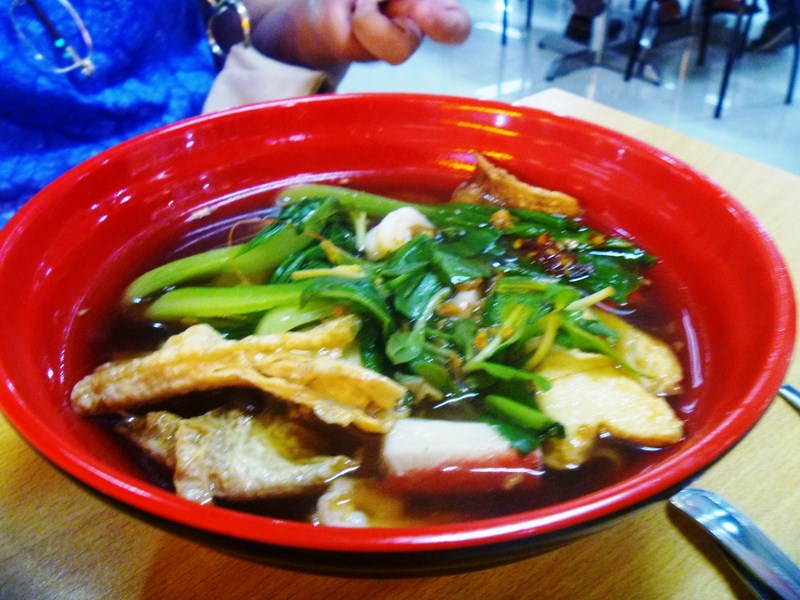
A big bowl of lomi

A big bowl of lomi

The restaurant's signature buco batchoy

The restaurant’s signature buco batchoy

As we still had a few minutes of daylight left, we left the restaurant and boarded our van to catch the sunset at the 200 m. high Estaka Hill.  Located at the heart of the town, it was, during the early Spanish era, a refuge of Bugasongnons during attacks of Moro pirates.  The hill is accessed via concrete steps carved at the side of the hill. On top of the hill is a modern view deck, built by the local government, that can be accessed via a concrete staircase.

The view deck on Estaka Hill

The view deck on Estaka Hill

Media group at the view deck

Media group at the view deck

Overlooking the entire poblacion, the view deck, with its two octagonal, umbrella-like roofs, has a panoramic view of the South China Sea on the west, the mountains in the east, the historic Arong Hill to the south, and the barangays of Cubay and Paliwan to the northwest.  Too bad, we missed the sunset. It would have truly capped a day filled with  food, adventure and education.

View of town from Estaka Hill

View of town from Estaka Hill

Dusk over the South China Sea

Dusk over the South China Sea

From Bugasong, we returned to Tibiao where we were to stay overnight at the UA Hometel, located within the University of Antique.

Check out “Hotel and Inn Review: UA Hometel

Dandansoy Restaurant: Rizal St., Brgy. Ilaya, Bugasong, Antique.  Mobile number: (0926) 331-3324. Open daily, 7 AM – 10 PM.

How To Get There: Bugasong is located 43 kms. from San Jose de Buenavista, 12.4 kms. from Laua-an and 17.3 kms. from Patnongon.

Tibiao Eco-Adventure (TEA) Park (Antique)

Jandy and I left our group to join 5 students (4 ladies, including a Korean, and a lone guy) of UP Visayas (Miag-ao, Iloilo) who were going to try out ziplining at the Tibiao Eco-Adventure (TEA) Park, so we decided to join them when they do.

Tibiao Eco-Adventure Park

Tibiao Eco-Adventure Park

The Fear Buster Tower

The Fear Buster Tower

All seven of us were dropped off by our van driver at the park entrance, beside the uphill road leading to Kayak Inn.  Opposite the park entrance, across the road, is their Fear Buster Tower, seemingly a wall climbing facility.

The park's zipline gear

The park’s zipline gear

A damaged kayak left hanging by the booth

A damaged kayak left hanging by the booth

The TEA Park is noted for its two 1-km. long ziplines, said to be the longest in the whole of Panay Island.  Aside from wall climbing and ziplining, the park also offered river kayaking but their kayaks were all damaged on the boulder-strewn Tibiao River and one could be seen hanging by the booth.

Jandy being suited up

Jandy being suited up

The zipline staging platform

The zipline staging platform

This would be Jandy’s second try at a zipline (the first was in Corregidor Island) and I can’t remember how many times I’ve tried it.  From what I see, it would be the first for the students so I let all of them suit up and have their first crack at it.  After all five have finished with their run, it was Jandy’s turn on the line, with me the last to go.

Jandy taking off

Jandy taking off

The Tibiao River with rice terraces in background

The Tibiao River with rice terraces in background

The nearly 45 second adrenalin rush traversed great views of the valley, lush forests and the beautiful Tibiao River flanked by some nice rice terraces.  Once on the other side with Jandy, we had to go up steps carved on a hill to get the next jump-off point, another steel tower set on a raised platform, for the zipline ride back to our initial staging point.

Steps leading to the next staging area

Steps leading to the next staging area

The second staging platform

The second staging platform

Tibiao Eco-Adventure (TEA) Park: Butong, Brgy. Tuno, Tibiao, Antique. Zipline Rate: PhP300/pax.

How To Get There: Tibiao is located 73 kms. from San Jose de Buenavista, 12.6 kms. from Barbaza, 17 kms. from Culasi and 89 kms. from Brgy. Caticlan (Malay, Aklan).

A Fun-Filled, Family Day in Corregidor

After breakfast at La Playa Restaurant, we all weighed the activity options available for us on the island and they had quite a few – ziplining, ATV (All-Terrain Vehicles), swimming (beach or swimming pool), hiking and sea kayaking.  We opted to try the first two. A ride at the ROCKet Zipline, a first for everyone except me (I’ve tried it twice before in previous visits to the island) would set us back PhP100 each. The zipline system actually originated in Europe and and was used to cross mountain ranges.

 Check out “Launch of ROCKet Zipline

Jandy and I donning our gear

Jandy and I donning our gear

We proceeded to the zipline’s jump-off point, 40-ft. high, amphitheater-like ravine just outside the Corregidor Inn. I took first crack at it, donning a seat harness which was strapped around the waist and thighs, then was clipped into a double-pulley system with a backup line. Once suited up, I walked to the edge where I stood on a raised platform then was unceremoniously shoved down  the 655-ft. long free-fall cable line.

Check out “Hotel and Inn Review: Corregidor Inn

Ready, get set ........

Ready, get set ……..

Go .........!!!!!!!

Go ………!!!!!!!

Propelled by gravity, I literally flew through the air, so to speak, as I sped past nearby trees, spreading my arms wide and turning around to face the sea, as I was cheered on by my family.  Near the end, 2 brakes slow down your travel as I approached the 16-ft. high receiving platform at South Beach where a guide assisted me in getting off the zip-line system.

Grace

Grace

Marve

Marve

Cheska

Cheska

Then it was Grace’s turn to try out this  25-second adrenaline rush which traversed just about half of the narrowest point of the island.   She was followed by Marve, Cheska and, lastly, Jandy. Truly a nice, first-time experience for all of them.  I wished it were a longer ride but this was not possible, as I would end up in the sea.

Marve, Kyle and Cheska on their ATVs

Marve, Kyle and Cheska on their ATVs

And they're off .....!!!!!

And they’re off …..!!!!!

It just so happened that the receiving platform at South Beach was conveniently located beside the parking area for the ATVs.  There were 10 4-wheeled, off-road ATVs for us to rent (at PhP500/hr. or PhP300 for 30 mins.).  We picked out two ATVs and Cheska and Marve took first crack at it.  But first, they had to don helmets, knee guards and elbow guards plus listen to our guide as he instructed us on how to use it.

Grace

Grace

Marve

Marve

Soon, both were off to the man-made, winding and bumpy dirt track especially blazed through the grassy field for that purpose.  Grace took over from Cheska followed by Jandy while  I took over from Marve.  It all fun, especially for Jandy who rode the longest.  It was my second time to ride an ATV, but I was still wary driving it over rocks, thinking I would topple over.

Jandy

Jandy

Cheska

Cheska

We soon had our fill after nearly an hour and we were already hungry, so we hied off back to La Playa Restaurant where we had a very late lunch.

Sun Cruises, Inc. (SCI) – Reservation Office: CCP Terminal A, CCP Complex, Roxas Blvd., Manila.  Tel: (632) 831-8140 and (632) 834-6857 to 58.  Fax: (632) 834-1523.  E-mail: suncruises@magsaysay.com.ph.

Sun Cruises, Inc. (SCI) – Sales Office: 21/F,  Times Plaza Bldg., Ermita, Manila.  Tel: (632) 527-5555 local 4511 and 4512.  Fax: (632) 527-5555 local 4513.  E-mail: sales@suncruises.com.ph.