Emerald Lake (Field, British Columbia)

From The Caves National Historic Site of Canada, we headed 98 kms. (a 1.25-hr. drive) northwest, from Banff, Alberta, onto the Trans-Canada Highway (Highway 1), to reenter British Columbia at the town of Field, then turned right onto Emerald Lake Road, to stop by Emerald Lake, a freshwater lake in Yoho National Park, one of the four contiguous national parks in Canada’s Rocky Mountains, along the boundary of British Columbia and Alberta Provinces. The lake is the largest of the 61 lakes and ponds located inside the park.

Check out “The Caves National Historic Site of Canada”
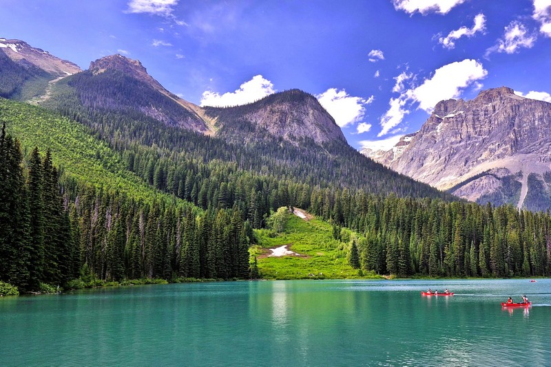
Emerald Lake

The first non-indigenous person to set sight on Emerald Lake was famed Canadian mountain guide Tom Wilson, who stumbled upon it by accident in 1882 when he was led lakeside while rounding up a string of his horses that had gone astray. He gave the lake its name because of its remarkable, vivid, turquoise green-colored waters due to glacial silt (rock flour), different rock type producing the powdered sediment that is suspended in the glacial water, reflecting the entrancing emerald green spectrum of sunlight rather than the blue spectrum seen in Moraine Lake, Hector Lake, Bow Lake and Peyto Lake in neighboring Banff National Park. Earlier that same year, Tom also discovered another lake which he had given the same name (which appeared briefly on the official map) but it was shortly renamed Lake Louise.

Check out “Lake Louise” “Peyto Lake” and “Lake Moraine”

This stunning glacial alpine lake, a scenic natural destination, is the most famous one of and the most admired locations in Yoho National Park.  The majestic mountains of the President Range, named after the President and Vice-President of the coast to coast Canadian Pacific Railway, add to the beautiful of this lake, as well.
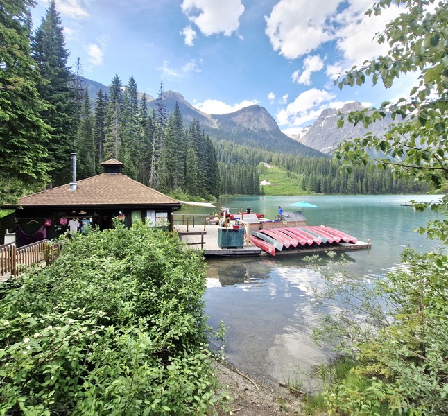
Emerald Sports

The lake has an unmatched diversity of both activities and landscapes suited to the enthusiastic traveler. Canoeing  and walking are favorite activities here and, during the summer months, fishing is also quite popular. Canoe ($.75 for 1 hour, with a max of 3 people in the canoe) and rowboat rentals are available Emerald Sports (also known as Emerald Sports & Gifts), as are cross-country skis and snowshoes in the winter.
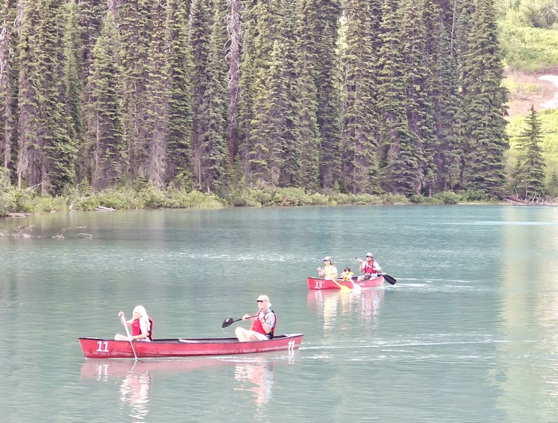
Canoeing at the lake

Swimming, though allowed and highly recommended for the experience, is not for the faint of heart as the water is cold due to it being fed by glaciers. The rustic Emerald Lake Lodge is a leisurely delight for those having lunch at Cilantro Café’s lakeside patio. The lodge also offers cabins overlooking the lake and mountains. Near the start of the trail loop are some picnic tables.
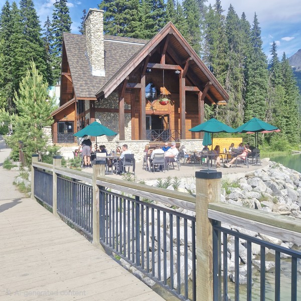
Emerald Lake Lodge

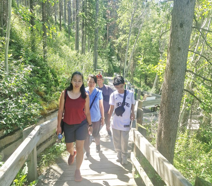
A 5.2-km. (3.2-mi.) flat loop, family-friendly trail circling the shoreline, taking about 1.5 to 2 hours to complete, is one of the least strenuous but most rewarding in the park. From the lake, you can view an incredible breadth of geological features including the world-famous Burgess Shale fossil beds, the Michael Glacier, and an avalanche slope carpeted by meadows, where moose often graze.  Other more advanced hiking trails go in different directions up into the mountains.
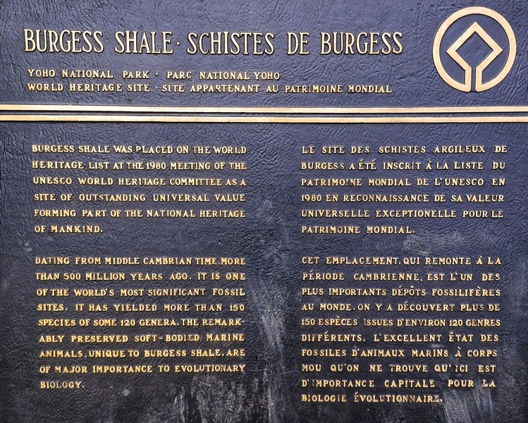
Burgess Shale plaque

The lake’s elevation of 1,200 m. (4,400 ft.) above sea level produces a unique selection of flora. Trees found here include western red cedar, western yew, western hemlock and western white pine.  At moist, shady enclaves, you can spot a variety of tiny, fragile wild orchids that survive only in finely balanced conditions. If you’re paying attention, you may be rewarded with a Yellow Lady Slipper, Spotted Orchid, or Calypso sighting.
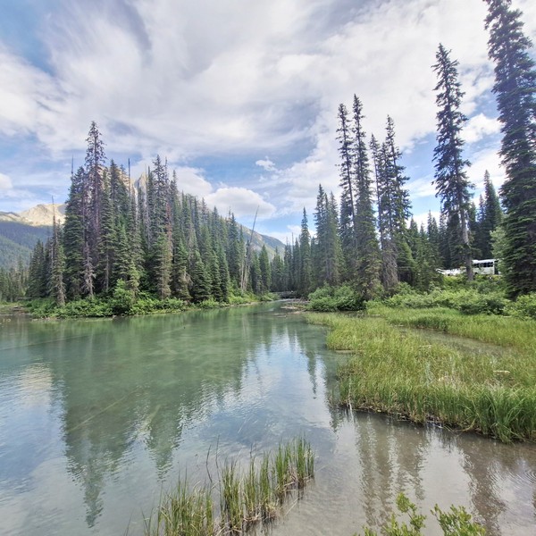
As animals are drawn to this important water source, Emerald Lake is a fantastic place to see wildlife such as bald eagles, moose, and ospreys as well as waterfowl such as loons and mergansers. Grizzly bears and American black bears are fairly common. However, as many wild animals live in the area and are protected by park law, hunting is prohibited in the park. From November until late April or early May, the lake is frozen due to its 53-degree latitude and moderately high altitude.
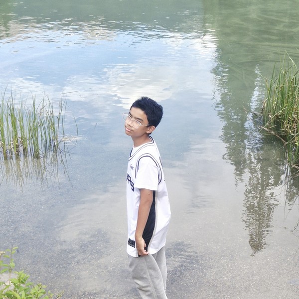
Kyle frolicking by the lake

Emerald Lake: 1 Emerald Lake Rd., Field, Yoho National Park, British Columbia V0A 1G0. Coordinates: 51.444°N 116.531°W.

How to Get There: Emerald Lake is a 50-km. (30-mi.) drive to the west of Golden, a 2.5-hr. drive from Calgary, a 28-km. (35-min.) drive from Lake Louise and 10 kms. (a 15-min.) drive west of the small railway village of Field, in Yoho National Park, near the highway exit to Emerald Lake, which has a park-operated visitor center.  A two-lane paved road, about 9 kms (6 mi.) long, connects the Trans-Canada Highway with Emerald Lake. Parking fills up fast in the summer, so it is best to arrive early in the morning.
Cave and Basin National Historic Site of Canada (Banff, Alberta)

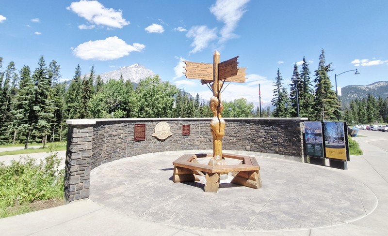
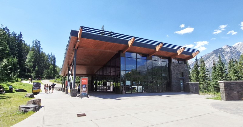
On our first whole day in Banff, we departed Douglas Fir Resorts & Chalets for the short 3.8-km. (10-min.) drive to The Cave and Basin National Historic Site of Canada, the first ever federally protected reserve in Canada and the birthplace of the country’s national park system (now, Canada has 37 national parks, 11 national park reserves, and 1004 national historic sites, 171 of which are administered by Parks Canada). As we arrived in July, well within between June 19 and September 7, 2026 (when Parks Canada waived all entry fees for visitors this summer), our entrance to the site was free.

Cave and Basin National Historical Site

A special place for Indigenous Peoples for over ten thousand years (and continues to be so to this day), with important and longstanding cultural significance, it is a gathering place for sharing stories about conservation and the connection between people and the land. Together with Banff National Park, it is part of the traditional territories of the Blackfoot Confederacy, the Îyârhe Nakoda of the Chiniki, Bearspaw, and Goodstoney First Nations; the Tsuut’ina First Nation; and the Métis Nation of Alberta.

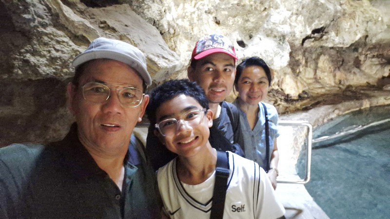
The author, Kyle, Jandy and Grace inside The Cave

Here’s the historical timeline of the site:

  • In 1859, the first written recorded reference to hot springs here was made by James Hector of the Palliser Expedition.
  • In 1875, Joe Healey happened upon the Cave and Basin site long after Indigenous Peoples.
  • In 1883, Frank McCabe and brothers Tom and William McCardell, three Canadian Pacific Railway workers, using a felled tree, descended through the skylight entrance into the cave and the thermal springs.
  • In 1884, they constructed a small cabin nearby with the intention of commercializing the Cave and Basin site. In those days, hot springs were extremely valuable since hot water was not readily available from a tap like it is today. The CPR workers knew this would attract people and wanted to monetize it. Conflicting claims by other parties prompted intervention by the Canadian government headed by John A. Macdonald.
  • In 1885, an order-in-council reserved 26 sq. kms. (10 sq. mi.) around the Cave and Basin, the Banff Hot Springs Reserve. This was the genesis of Canada’s national parks system.
  • In 1886, the Canadian government held an inquiry into the various private claims to settle on compensation. That same year, an artificial tunnel was driven into the Cave and Basin to aid visitation. Its construction, according to articles in the Calgary Herald at the time, was contentious even in 1887.
  • In 1887, a bathhouse, the first structure on the site, was built.
  • In 1904, a new, naturally-heated pool was built as the existing one proved inadequate by 1902,
  • In 1912, bottled water from the Cave and Basin site was sold for its alleged curative powers.
  • In 1914, a stone bathhouse, designed by architect Walter S. Painter, was completed and opened to the public. Many of the early structures were built by detainees held at a World War I Ukrainian Canadian internment camp located nearby. The camp had a significant Ukrainian contingent.  It continued to operate until 1994.
  • In 1924, western mosquitofish were introduced into the hot springs in an attempt to control mosquitos. Tropical fish illegally introduced into the lower springs by local aquarium enthusiasts may have contributed to the extinction of the Banff longnose dace.
  • In 1975, the pools were closed.
  • On November 13, 1981, the Cave and Basin was formally declared a National Historic Site.
  • In 1985, on the anniversary of the order-in-council that established the original reserve around the Cave and Basin, Canada’s national parks system celebrated its centennial. That same year, the pools were also restored.
  • On August 20, 1985, Prince Philip, Duke of Edinburgh and consort of the Queen of Canada, unveiled the National Historic Site plaque.
  • In 1992, the pools were permanently closed. An interpretive center now uses the structures.
  • In 2000, the Committee on the Status of Endangered Wildlife in Canada listed the Banff Springs snail as an endangered species. Cave and Basin hot springs are also notable as the habitat for this snail.
  • In the summer of 2010, First Nations ceremonies and rituals began again in the Cave and Basin. (the Stoney people stopped coming to the Cave once Canadian Pacific Railway workers and settlers arrived in Banff).
  • On September 13, 2013, a permanent exhibit about Canada’s first national internment operations was opened at the Cave and Basin site (it was postponed three months by extensive flooding across southern Alberta), with an address by Jason Kenney, Minister of Employment and Social Development and Minister for Multiculturalism
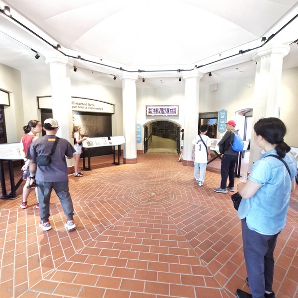
Rotunda

Located within the Canadian Rocky Mountains, at the site of natural thermal mineral springs around which Canada’s first national park, Banff National Park, was established, it is the lowest component of nine sulphurous hot springs clustered, in three groups on the northeast flank of Sulphur Mountain, all located along the Sulphur Mountain Thrust Fault below Devonian limestones.

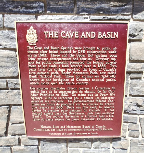
National Historic Site bronze plaque

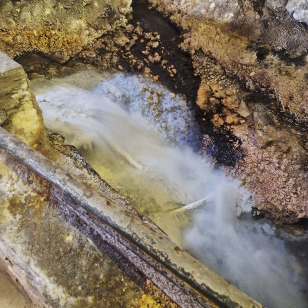
The mineral spring issues from Sulphur Mountain where surface water penetrates the rock, absorbing minerals and being heated, by geothermal energy, from an estimated depth of 3 kms., to emerge in a cave and in a nearby basin before joining the Bow River drainage system below.

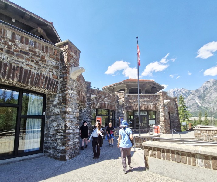
Main Building

At the entrance is a rotunda with interpretative panels commemorating the historic 1883 discovery by railway workers plus the official National Historic Site bronze plaque, unveiled by Prince Philip, Duke of Edinburgh on August 20, 1984, designating the thermal springs as the birthplace of Canada’s national parks system. 

Cave Story Hall

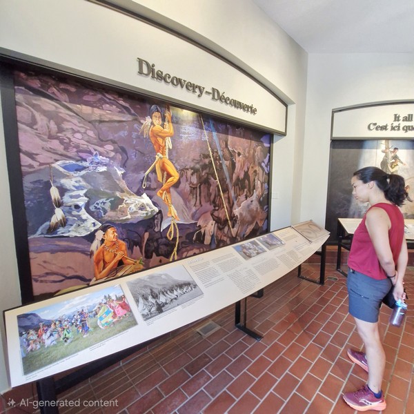
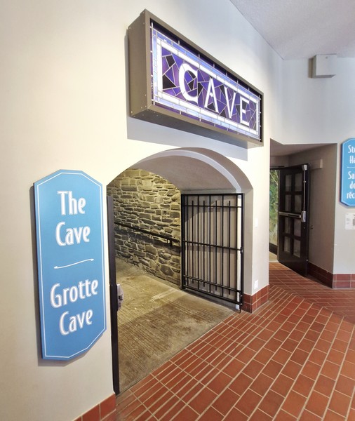
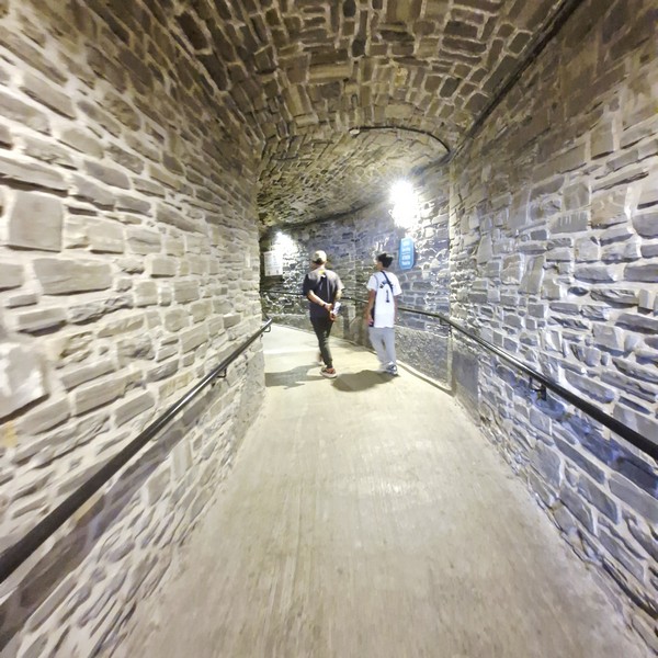
Near the entrance, at the south belvedere of the main building, is a narrow artificial tunnel leading to The Cave, a dimly-lit natural grotto and hot spring.  The tunnel ceiling was low in some places, so I had to mind my head. Before entering the cave, we took time to read the education displays and panels at Cave Story Hall to have a deeper understanding of the impact and significance of what we are seeing when we enter The Cave. 

The oil-based mural of Roland Rollinmud at Cave Story Hall

Near the entranceway and and tunnel of the hall is a remarkable oil-based mural, created by artist Roland Rollinmud (an elder from Stoney Nakoda Nation) and presented to Parks Canada in 2011, depicting Indigenous elders climbing down into the cave through the vent hole on rawhide ladders

Entrance to The Cave

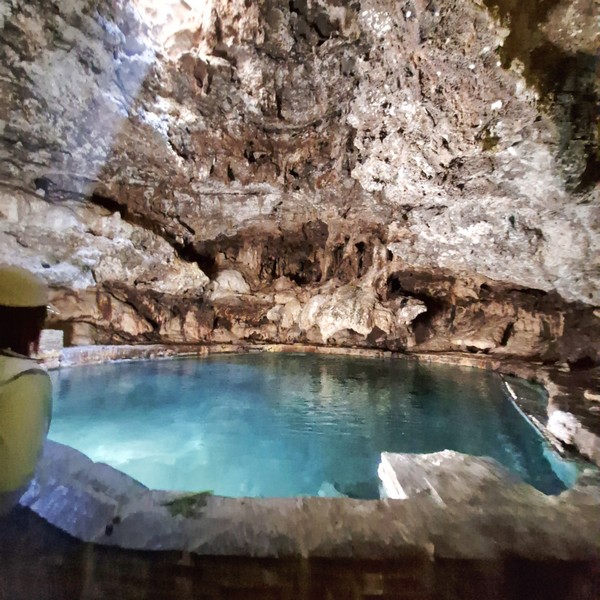
This large hollowed-out cavern, with a steaming mineral pool below, is the only cave large enough to comfortably accommodate groups of people.  A small vent hole, in the rock ceiling, acts as a natural skylight, letting in enough sunlight to reflect off the pool and glisten on the smooth red and white flowstone layers running down the cave walls. You’ll also find stalactites and stalagmites, glacial till and a small trickling waterfall.

The tunnel leading to The Cave

A single elevated platform overlooks the water. There are stanchions in place to make it abundantly clear you enter along the righthand side of the hall in a line that terminates at the platform. After your time on the platform, you exit via the left-hand side of the tunnel. Relatively small, the cave has a single opening at the top that lets in natural light.

The Cave
The source of the spring

Immediately following its “discovery,” almost all of the delicate cave formations had been stripped out thinking it would improve the accessibility and aesthetic. Steam continually rose from the geothermally heated waters, and the earthy mineral scent of hydrogen sulfide filled the air, which kind of makes you second guess wanting to jump in. While the rotten egg smell never goes away, it does become tolerable. 

The original bathhouse now the Interpretive Centre and Museum

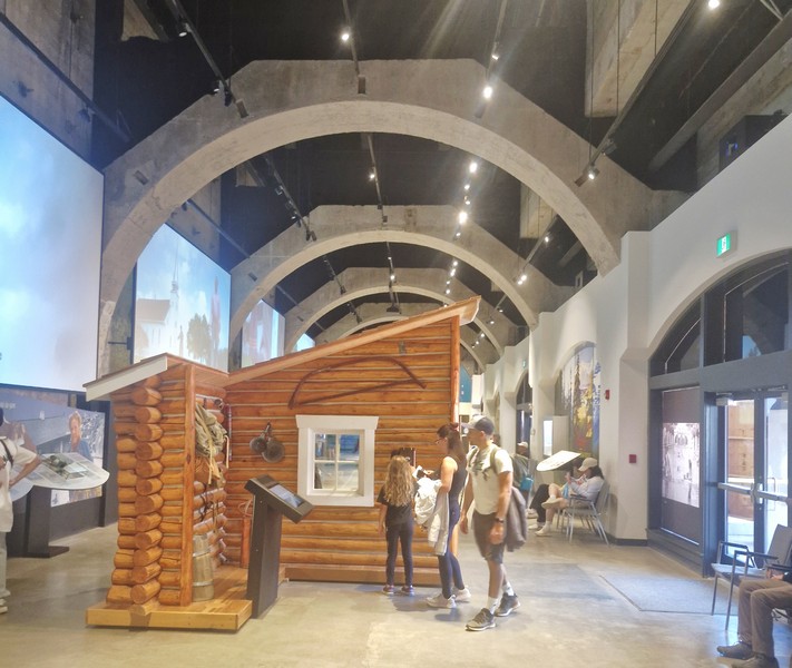
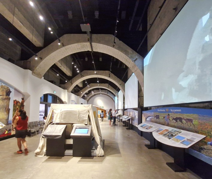
The former original 1887 bathhouse and restored 1916 interior public swimming pool complex for nearly 100 years, built with Classical Revival details, has now been renovated into an Interpretive Centre and Museum. Visitors here can enjoy interactive and interpretive media exhibits, detailing the 1883 discovery of the thermal hot springs by railway workers, and short films that takes you through a journey of Canada’s National Parks, and heritage of thermal waters.

The Basin

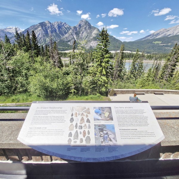
On top of the main building are the covered Belvedere Viewing Decks, overlooking the historic site, that offer panoramic views of the surrounding Canadian Rocky Mountains, marshland and mountain ridges.

View of the Canadian Rocky Mountains from the view deck

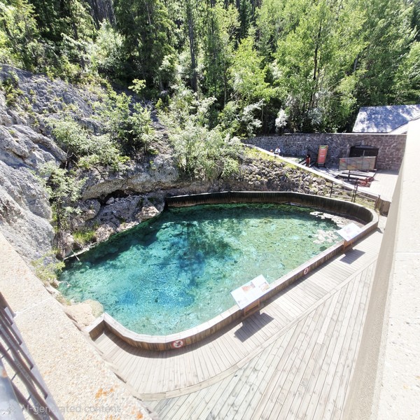
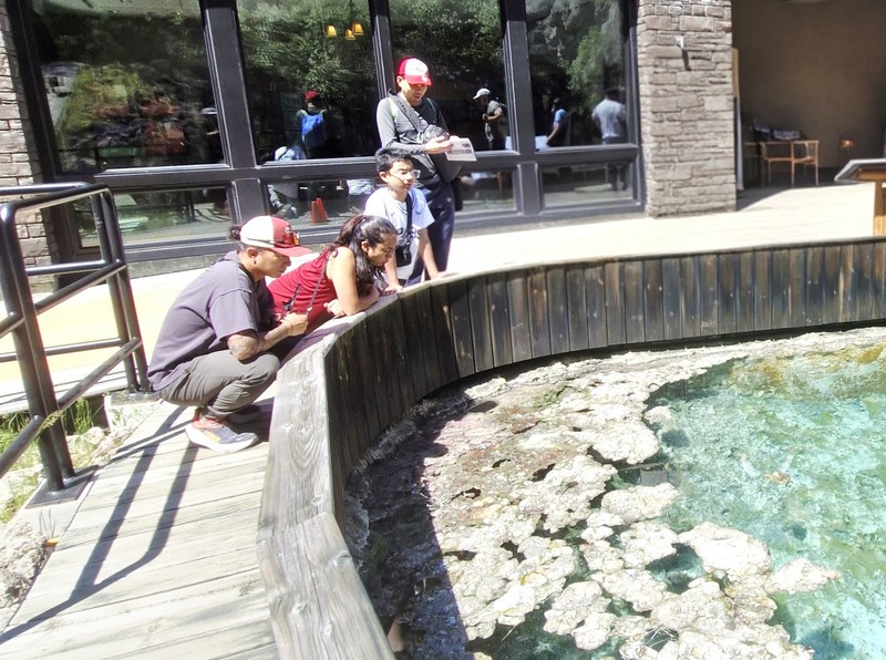
Outside the old pool complex, adjacent to The Cave, is The Basin (a pool of mineral water), the natural springs which flow into the Cave and Basin. It has been rewilded as close to its original state as possible and is now protected. A helpful ranger explained more about the animals that call these thermal pools home. They include tiny fish that have been introduced to these thermal waters (mosquito fish, jewelfish and sailfin molly), damselfly (Argia vivida) larvae that were in among the algae and, if you look closely, you’ll catch a glimpse of the endangered Banff Springs Snail (Physella johnsoni) in the pools.

Bryan, Cheska, Kyle and Jandy searching for Banff Spring Snails among the algae.

These tiny snails that are only found in the Upper Hot, Kidney, Middle, Cave, Basin and Vermilion Lake Springs in this area. All of the thermal pools, except the Banff Upper Hot Springs, a separate facility some 5 kms. (3 mi.) southeast of the Cave and Basin, have been closed off to humans in order to preserve this limited habitat.

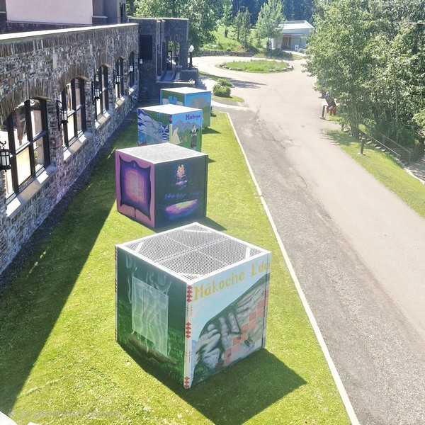
8×8 ft. murals painted on outdoor display boxes
Murals displayed within the building

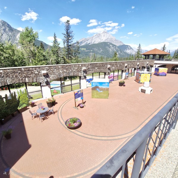
Located around the parking lot and historic bathing pavilion are large 8×8 ft. murals, painted on outdoor display boxes, which were placed during the spring-to-fall visitor season and can be viewed during regular site hours. These rotating large-scale outdoor mural projects were created by indigenous artists, in collaboration with the Whyte Museum of the Canadian Rockies.

Cheska, Grace, Bryan and Kyle at the Discovery Boardwalk

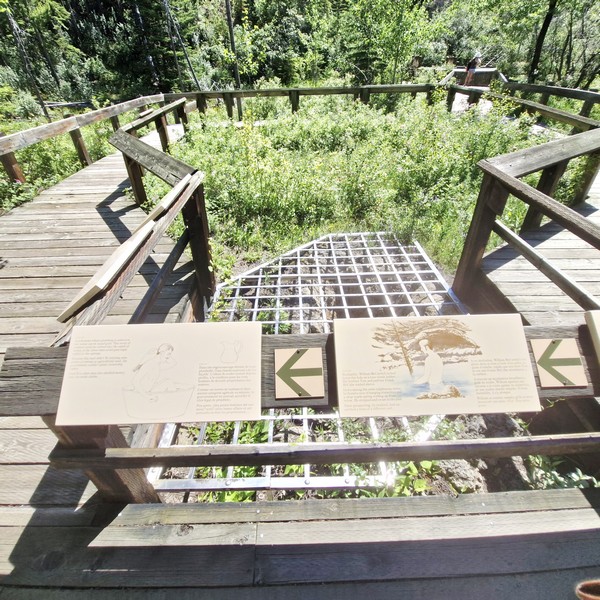
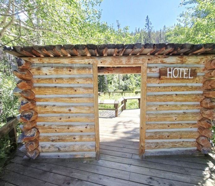
Within the complex are the Discovery Boardwalks that lead you up the hill and through unique marshes created by the natural springs. Along the walk, you’ll encounter the original surface vent hole and, next to it, are vestiges of the log shanty, built between 1883 and 1885, known as ”the Hotel,” so they could stay close and protect it from other prospectors. 

The original vent hole

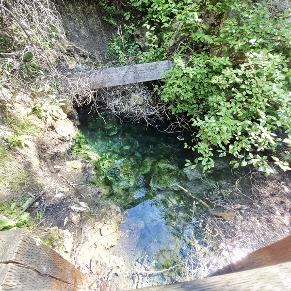
There are also few other smaller hot pools with bright blue-green waters and filled with pink bacteria and algae.

One of the smaller thermal pools

The boardwalks also feature educational signage, upper views of the Cave and Basin complex, and stunning, sweeping mountain and valley vistas of the Canadian Rocky Mountains. For those with stamina, you can hike along the 7.4-km. round trip Sundance Trail and the 2.7-km. Marsh Loop.

The Hotel

Cave and Basin National Historic Site of Canada: 311 Cave Ave., Banff, Alberta T1L 1K2.  Tel:+1-403-762-1566.  E-mail: caveandbasin@pc.gc.ca.  Admission: $9.00 (adults), $7.50 (seniors) and free for children. Free admission on Canada Day. Open daily, from May 15 to October 15, 9:30 AM to 5 PM. Closed: September 21 to 24, 2026. Coordinates:

How to Get There: It is located about 2 kms. and a 30-min. walk from the town center. Once you cross the bridge, look for the dedicated walking trail. The Cave and Basin Trail will take you all the way there. From Banff, head south on Banff Avenue (the main street through Banff), over the Bow River Bridge to a T-intersection, and then turn right on Cave Avenue and follow the signs. The Cave and Basin parking lot is located at the end of this road. By bus, Roam bus route #4 will take you to the Cave and Basin.

Badlands Historical Center (Drumheller, Alberta)

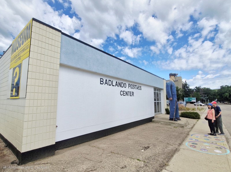
Badlands Historical Center

The fascinating, one-storey Badlands Historical Centre, Drumheller’s original museum, was founded in the 1950s.  This off-beat museum, with an outdoor dinosaur sculpture & other unique displays, was designed to showcase the rich history and geological significance of the Badlands region.

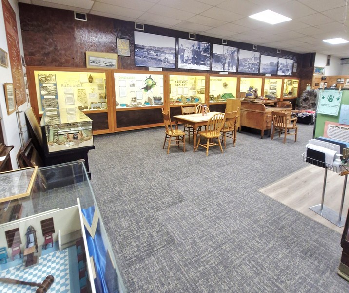
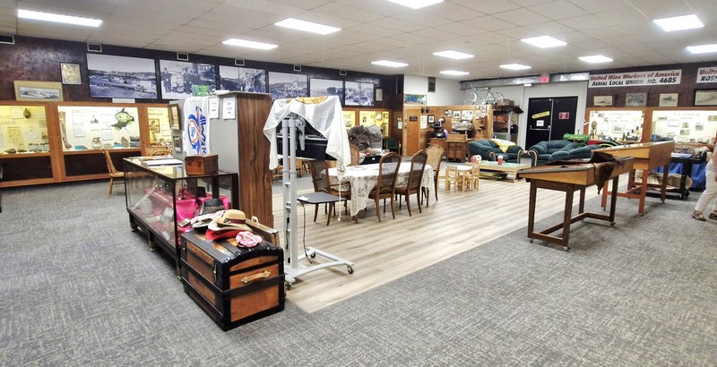
The main gallery

Located in the heart of downtown Drumheller, this off-beat, community-run local museum is distinct from the larger Royal Tyrrell Museum of Paleontology. It features informative displays and exhibits that detail the area’s prehistoric past, including dinosaur fossils and the unique landscape shaped by erosion.

Check out “Royal Tyrrell Museum of Paleontology”

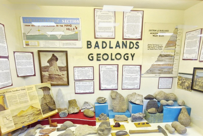
Badlands Geology
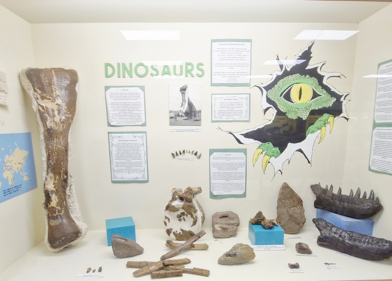
Dinosaurs
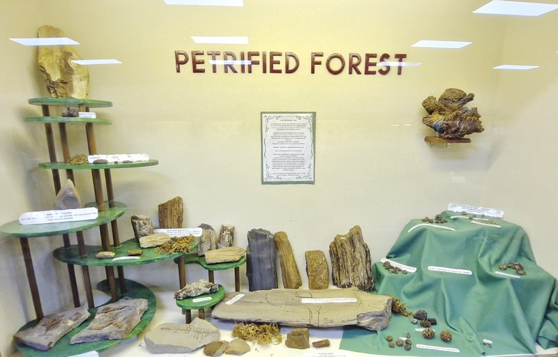
Petrified Forest

Here, you can learn, in a neat retro setting, about the Valley’s rich history, from dinosaurs to its indigenous peoples, pioneering to coal mining and more. The center serves as an entry point to discover the captivating natural beauty and history of the surrounding landscape.

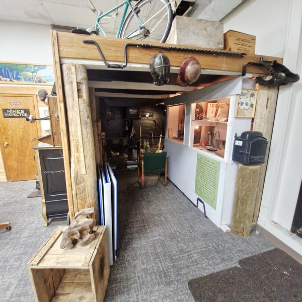
When Coal Was King

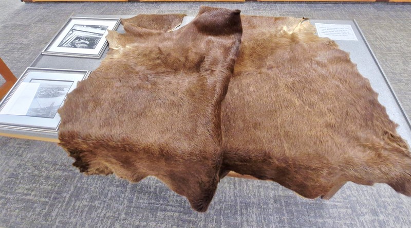
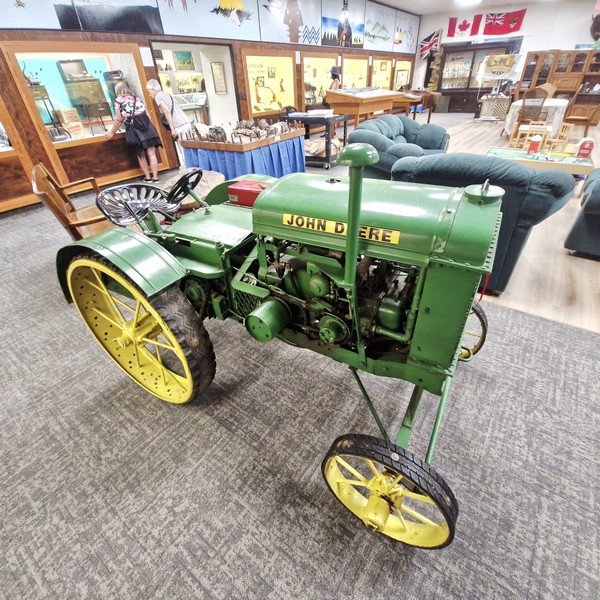
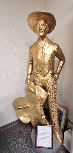
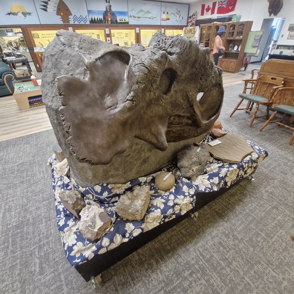
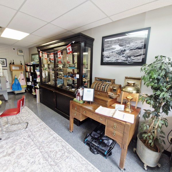
On display at the main gallery are an awesome Pachyrhinosaurus skull (fondly called Pachioni); tanned horsehides; a statue of Tom Three Persons (rodeo legend) a large coprolite; a half scale, 1927 John Deere Model D tractor; office and home furniture; and old office equipment (National cash register, typewriters, etc.); old photos; old newspaper clippings, and movie posters.

Tanned Horsehides
Half Scale Model D 1927
Statue of Tom Threeperson
Pachioni the Pachyrhinosaurus

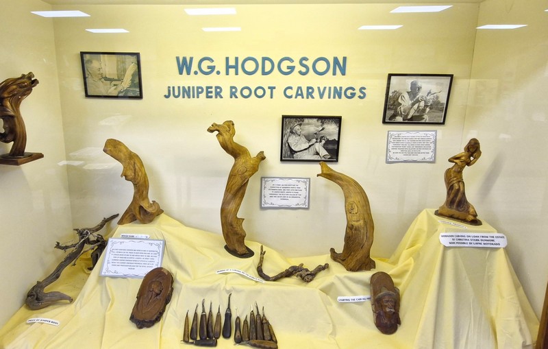
“W.G. Hodgson Juniper Root Carvings” features works of Alberta rancher and self-taught wood worker Wolfgang G. Hodgson.

W.G. Hodgson Juniper Root Carvings

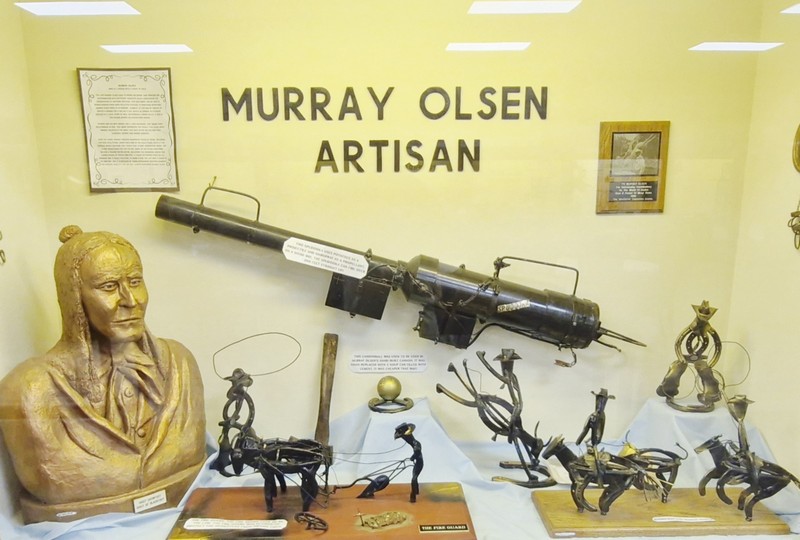
“Murray Olsen: Artisan” spotlights Murray James Olsen who is often credited, with Tig Seland, with building the various iconic roadside dinosaur sculptures that now decorate the streets of Drumheller.

Murray Olsen Artisan

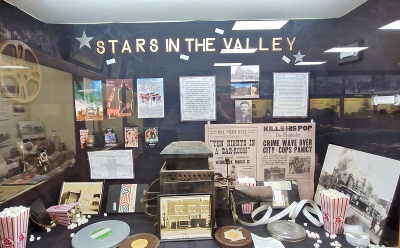
“Stars in the Valley” features major movies done or partially shot in the unique badlands landscape of Drumheller such as Superman (1978), Unforgiven (1992), Shanghai Noon (2000), Knockaround Guys (2001), Brokeback Mountain (2005), Ghostbusters: Afterlife (2021), The Revenant (2015), and Rat Race (2001).

Stars in the Valley

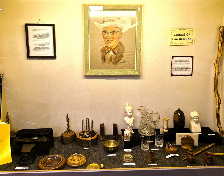
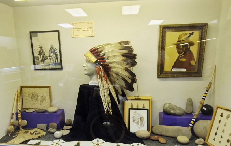
The private collection of pioneer Lawrence A. Duncan includes art (“Art by L.A. Duncan”), frontier antiques (“Curios of L.A. Duncan), regional fossils and indigenous Indian artifacts from the around the Red Deer River valley (“Indigenous Collection of L.A. Duncan”). 

Curios of L.A. Duncan
Indigenous Collection of L.A. Duncan

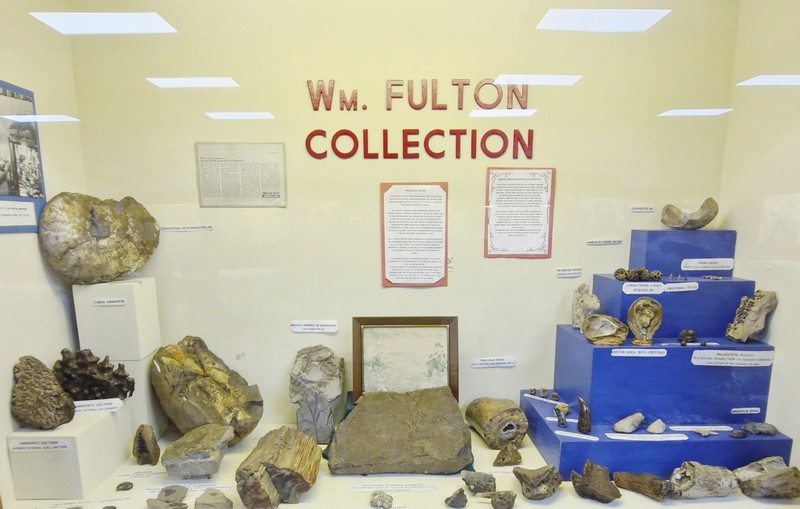
The fossil collection of William M. Fulton includes heavily crystallized petrified wood, amber fossils, an oyster shell with crystals, large fossil cones of sequoias, seeds of Carpolithus fultoni bell (gingko), crocodile teeth, a dinosaur toe bone, Tyrannosaurus rex teeth, a dinosaur bone with marrow replaced with crystals, a branch imprint in sandstone, a Champosar tail vertebrae, ammonites, and a dermal scute from an Ankylosaur.

WM. Fulton Collection

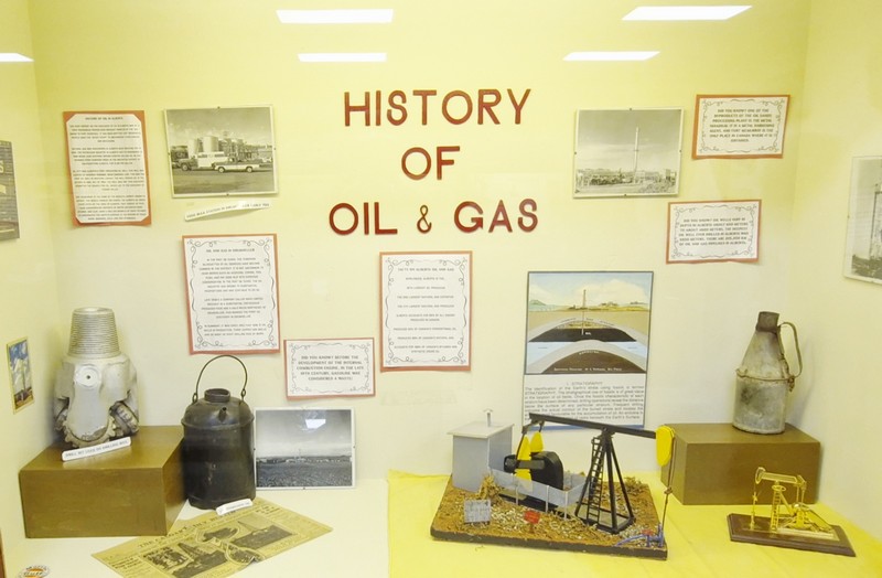
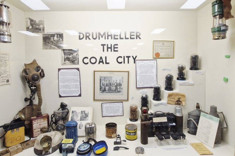
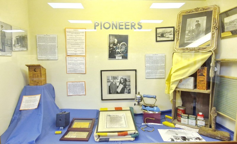
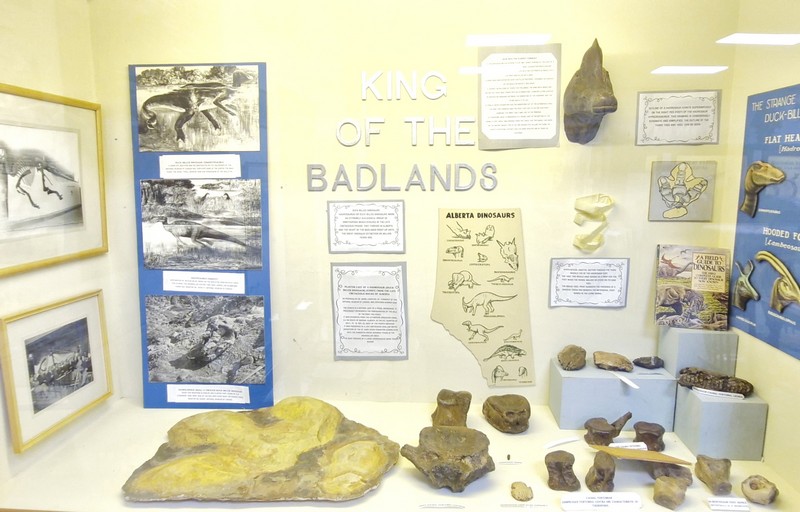
Other informative displays include the “King of the Badlands;” “Dinosaurs;” “Petrified Forest;” “Native Culture;” “Pioneers,” “Badlands Geology,” “Agriculture of the Past,” “C.A. (Charlie) Smith,” “Drumheller First Responders,” “Drumheller the Coal City,” and “History of Oil and Gas.”

History of Oil and Gas
Drumheller the Coal City
Pioneers
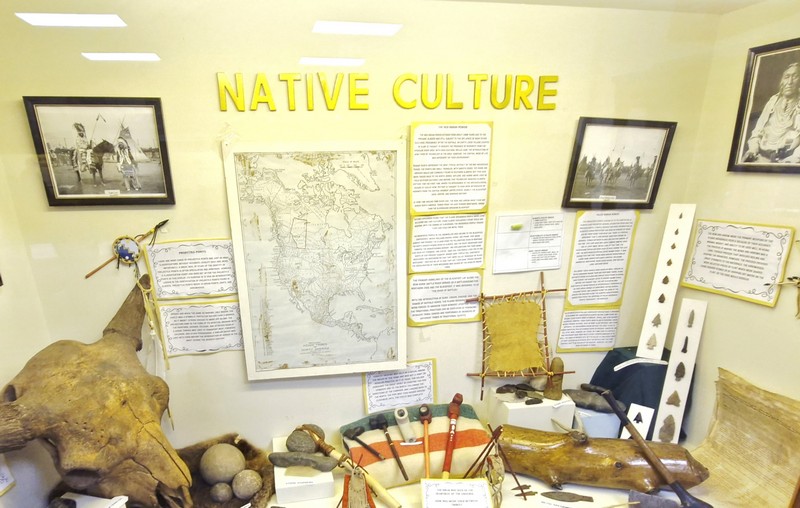
Native Culture
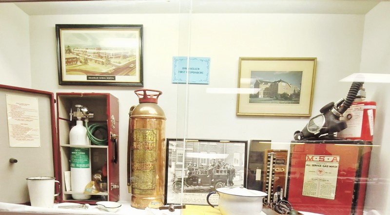
Drumheller First Responders
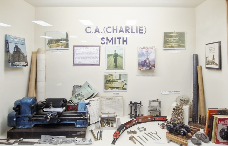
C.A. (Charlie) Smith
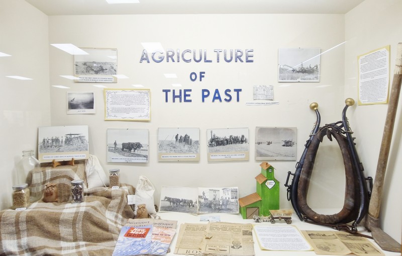
Agriculture of the Past
King of the Badlands

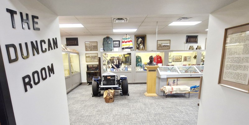
Adjoining the main gallery is the dedicated Duncan Room which was named after local resident Lawrence “Larry” A. Duncan, a self-educated and gifted entrepreneur who was active in the development of American and Canadian mining and petroleum services for over 50 years.

Duncan Room

Born in 1890 in Charlottetown, Prince Edward Island, he was an Albertan since 1908. He was actively involved in the excavation of dinosaurs, professional photography, the Alpine Club of Canada and the Alberta Mineral Society (formed in 1931). He founded Canada’s oldest lapidary firm as well as the Calgary Rock and Lapidary Club in 1959.

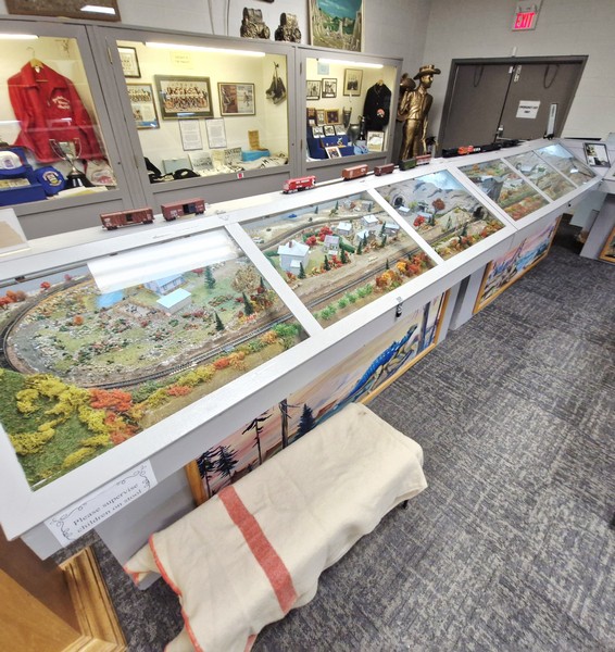
Scaled model of a village, train station and railway tracks

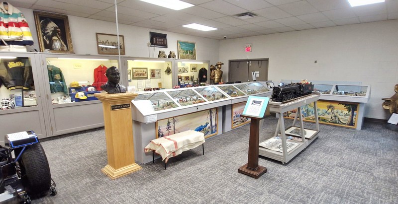
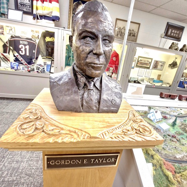
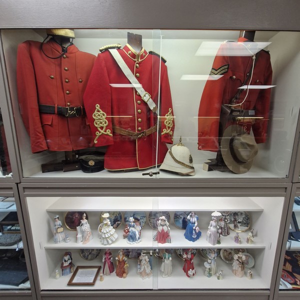
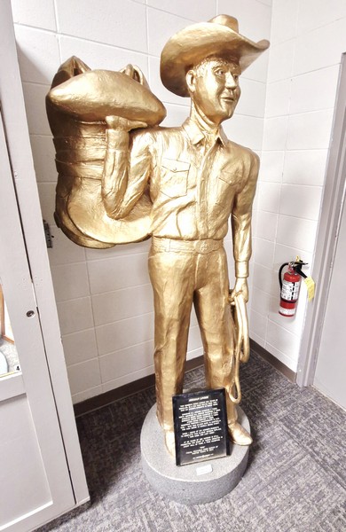
On display here are Royal Canadian Mountain Police (RCMP) uniforms, medals and insignia; a statue of Herman Linder (a Canadian rancher, rodeo promoter and competitor); a bust of politician Gordon E. Taylor (1910-2003); a scaled model of a village, train station and railway tracks; rock samples; firefighting equipment (fire extinguishers, gas masks, etc.); old photos; artwork; and porcelain figurines.

Bust of Gordon E. Taylor
Royal Canadian Mounted Police (RCMP) uniforms and porcelain figurines
Statue of Herman Linder

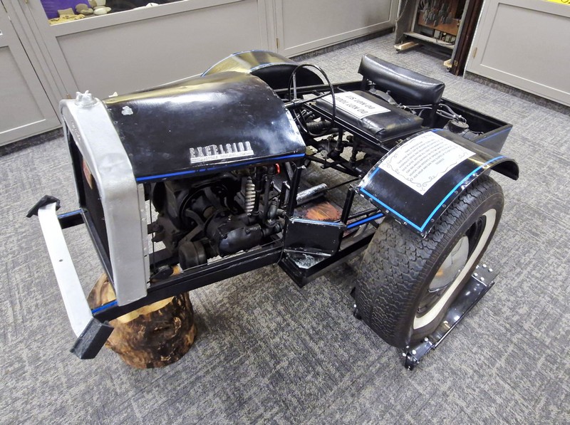
A magnificent car, hand-built by Murray Olsen, uses a hydraulic drive and requires no supports of skid drives, defying all logic. The car balances entirely on two wheels and can operate at speeds of up to 5 miles per hour and can take slopes of up to 45 degrees.  

Two-Wheeled Car

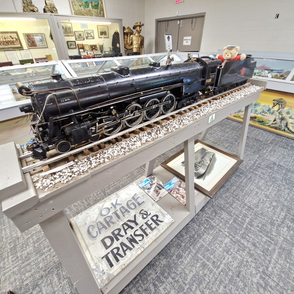
The scaled replica of a No. 6015, made by Charlie Smith, has a steam engine that weighs over 400 kgs. and, when running, can carry up to 7 people.

No. 6015 Train Model (Charlie Smith)

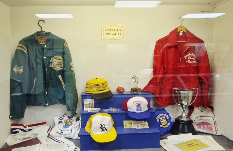
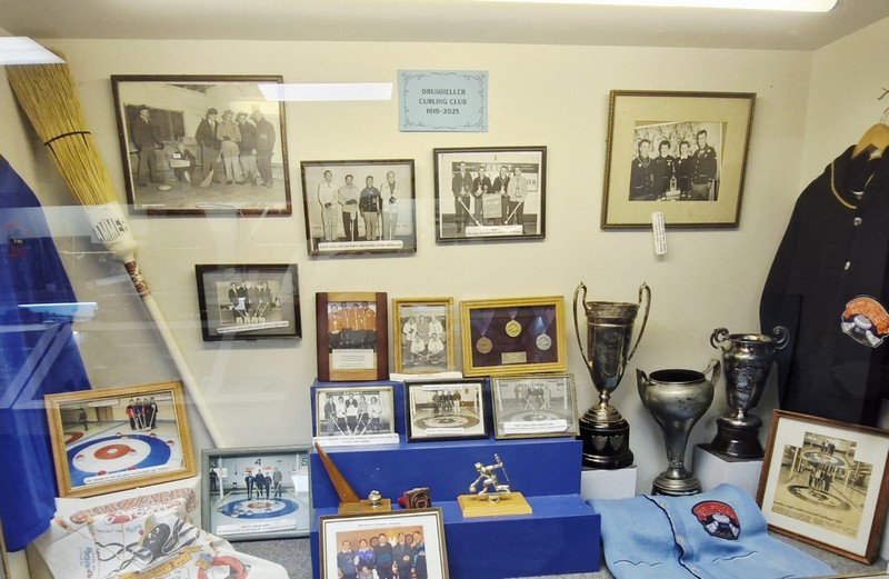
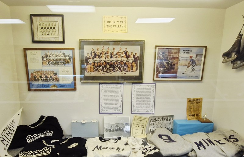
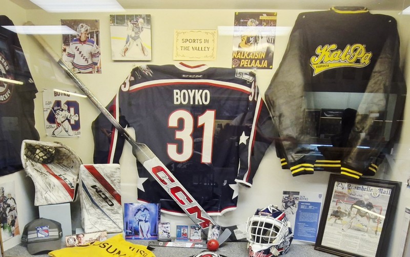
Informative displays include “Baseball in the Valley,” “Drumheller Curling Club 1919 – 2025,” “Hockey in the Valley,” and “Sports in the Valley.”

Baseball in the Valley
Drumheller Curling Club 1919 – 2025
Hockey in the Valley
Sports in the Valley

Visitors can also explore educational resources, participate in guided tours, and learn about the indigenous cultures that have inhabited this area. Its gift shop sells select dinosaur fossils. amethyst and peacock ore (bornite) samples ($20), bags, jewelry as well as other souvenirs.

Gift Shop

Badlands Historical Center: 335 1st Street East, Drumheller, Alberta T0J 0Y0.  Tel: 403-823-2593.  E-mail: badlandshcinfo@gmail.com and badlandshistoricalcentre@gmail.com. Website: www.badlandsmuseum.wordpress.com. Open Mondays to Saturdays, 9 AM to 5:30 PM, and Sundays,10 AM to 5 PM. Admission: $20/person.

Miners Memorial Park (Drumheller, Alberta)

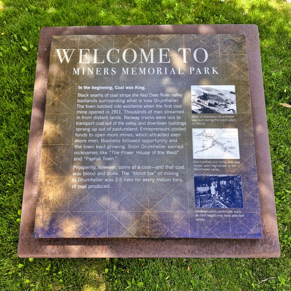
Miners Memorial Park

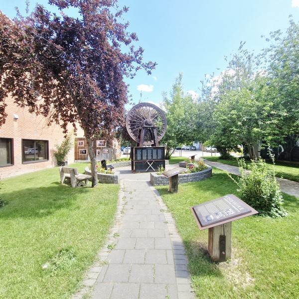
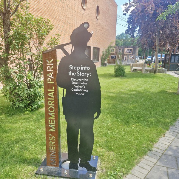
Miners Memorial Park, a small, quiet parkette in downtown Drumheller, honors the region’s rich coal mining history and the miners who “mined the black” in the local Coal Valley. Unveiled on November 10, 2012 by MP Kevin A. Sorenson, and Mayor Terry Yemen (with Bob Moffatt, representing miners, and Randall Myers, representing families who lost loved ones), it commemorates the opening of Newcastle Mine, the first coal mine in Drumheller, in 1911.   In 2025, a new silhouette entrance sign depicting a miner with a headlamp, created by Fred Makowecki of ImageCrafter Signs, was unveiled at the park.

The silhouette entrance sign depicting a miner with a headlamp

A project of the Atlas Coal Mine Historical Society, community members and numerous volunteers, supported by the Building Communities Through Art and Heritage Program, Department of Canadian Heritage, the park grounds features historical information boards detailing the area’s past.

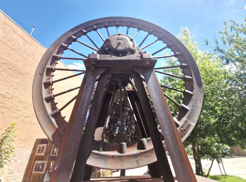
The iron sheave wheel from Atlas Coal Mine #4

The central steel and granite monument, designed by Ontario-based artist James Smith, includes a headframe iron sheave wheel (a large pulley wheel used in mine hoist systems), sourced from the historic Atlas Coal Mine #4 (the last coal mine to close in Coal Valley), that was part of the hoisting system that, in 1979, hauled the last load of Drumheller coal to the surface.

One of a number of historical information boards detailing the area’s past

In 1962, using this same hoisting system, two brothers John and Robert “Babe” Myers were killed when their exit elevator malfunctioned and the brakes did not hold. The 12-ton counterweight hurled to the ground, the cage smashed into the hoist structure then plummeted 400 ft. to the bottom of the shaft instantly killing the two brothers.

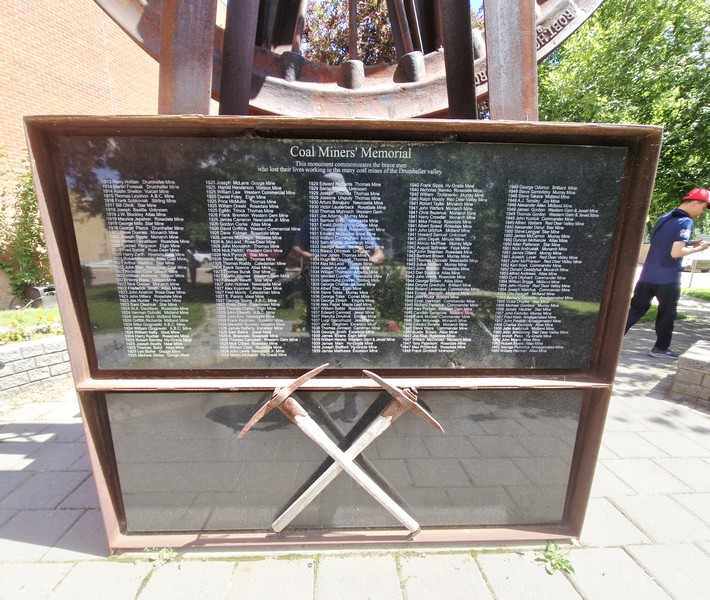
The base with a list of the 207 miners killed. Below it is a pair of crossed pickaxes

The base of the monument features a base with a list, laser-etched in black granite, of the names, year of death and the mine locations of the 207 miners killed in Drumheller‘s mines between 1911 and 1980.  Below it is a pair of crossed pickaxes.

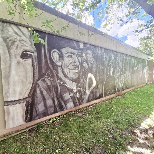
The original mural of the late artist and former miner Marcel Deschenes

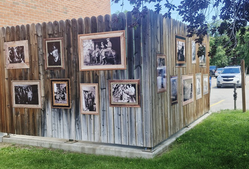
Alongside the monument is a mural, depicting the Coal Valley’s mining heritage, done by artist (a graduate of the Alberta College of Art, now a university) and former miner Marcel Deschenes who lived in East Coulee and passed away in November 2018 at the age of 71.  Black-and-white photos of the fallen miners as well as photos depicting life during the mining years are also mounted on wooden fence picket walls.

Photos mounted on wooden fence picket wall

Miners Memorial Park: 236 Centre St., Drumheller, Alberta T0J 3R0.

How to Get There: The memorial park is located near the Drumheller Municipal Building, as well as near the Drumheller Fire Station.

Badlands Interpretive Trail (Drumheller, Alberta)

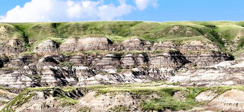
Badlands

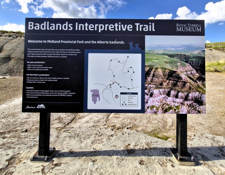
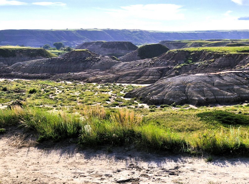
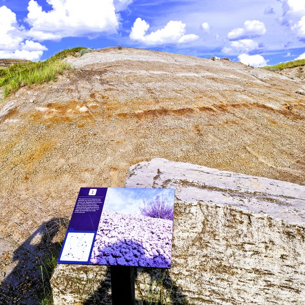
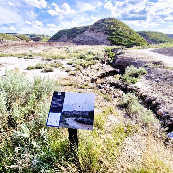
After our tour of the Royal Tyrrell Museum of Paleontology, we tried out the Badlands Interpretive Trail, a 1.4 to 1.6-km. (0.87 mi.) easy loop hiking trail, with about 27 m. (88 ft.) elevation gain, which is used extensively by the museum public and school programs. A trailhead, a few hundred meters east of the museum, marks a 1-km. long loop, where numbered interpretive signs recount the glacial forces that sculpted the badlands from 70-million year-old layers of sedimentary rock.

Check out “Royal Tyrrell Museum of Paleontology”

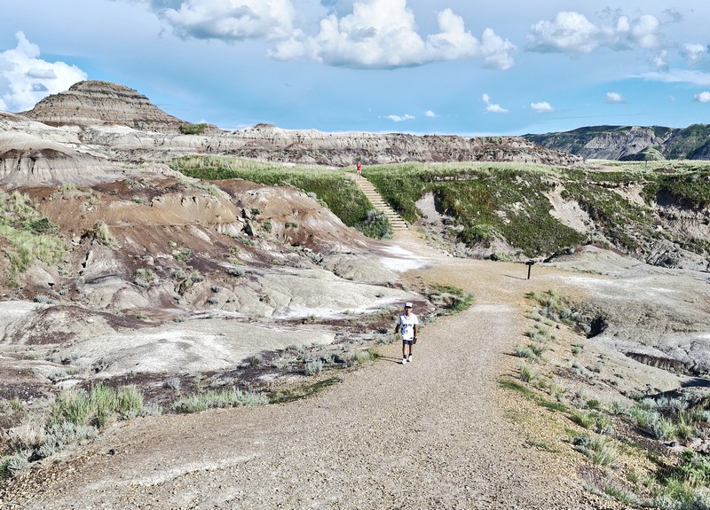
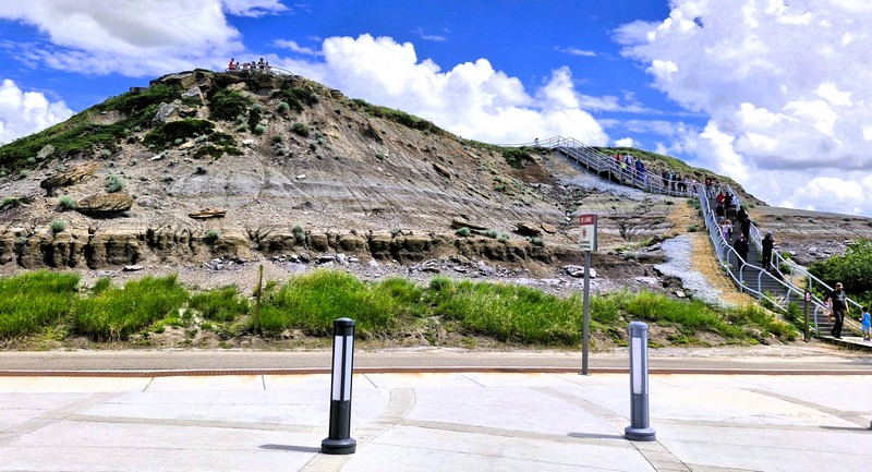
The Badlands Interpretive Trail

Visitors can enjoy a self-guided tour through the trail, which is a popular destination for those interested in geology, paleontology, and natural history and suitable for all ages, offering stunning views of the surrounding badlands.

The elevated viewing platform

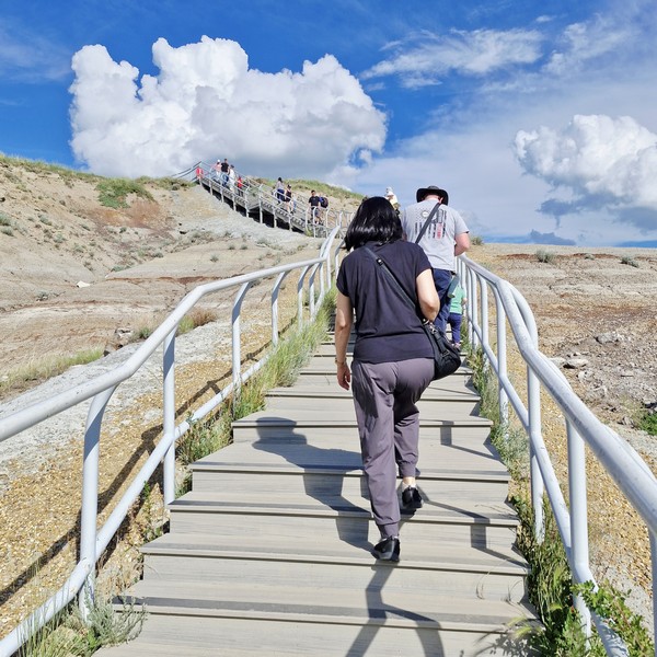
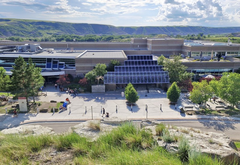
This trail, featuring two stairs, elevated viewing platforms (not fully wheelchair-accessible), and informative signs explaining local fossil history, plants and landscape creation, is part of the Canadian Badlands, an area known for its striking landscapes, including hoodoos, canyons, and coulees. We climbed up the elevated viewing platform just across the museum. Here we had panoramic bird’s eye views of the museum and the eroded valley.

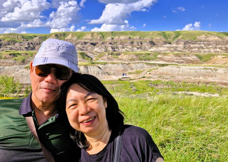
The author and Grace at the elevated viewing platform
The Royal Tyrell Museum of Paleontology seen from the elevated viewing platform

Taking visitors through Midland Provincial Park and connecting to the Trans Canada Trail, the Badlands Interpretive Trail offer us a chance to explore the unique geological formations and rich paleontological history of the Drumheller region.

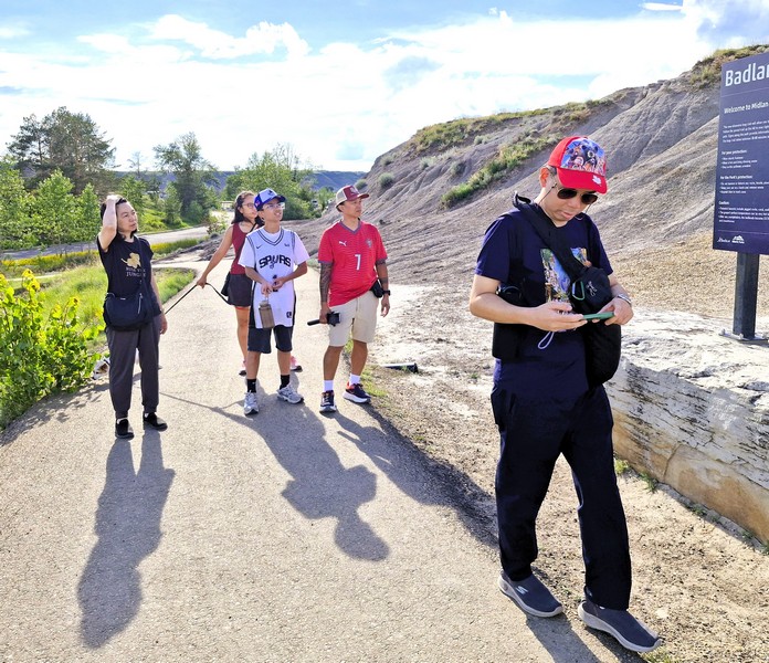
Grace, Kyle, Cheska, Bryan and Jandy begin their hike…..

One or two kilometers east of this path is another self-guided tour through the remains of the Midland.  After descending the elevated viewing deck, we began our hike on the east side of the Royal Tyrrell Museum of Paleontology parking lot, staying on the marked golden gravel and paved paths to protect the fragile badlands ecosystem. 

Benches, covered with grasses, are formed when sandstone layers are iron-rich, making them resistant to erosion
Small hill full of bentonite clay formed from ancient volcanic ash. Though seemingly harmless, any amount of moisture causes bentonite to swell and become very greasy and slippery.

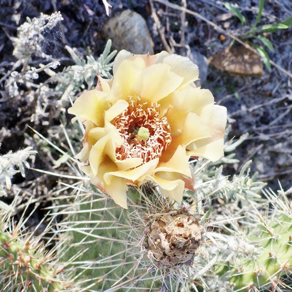
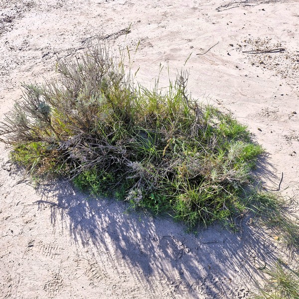
As it was summer, it was the perfect time to look for tough plants that survive despite the hot, dry, and windy desert-like badlands conditions.  They include flowering prickly pear cactuses (which have special stems with thick, waxy skin to trap water and sharp thorns for safety), sage (with strong aromatic leaves, it thrives in dry soil), scarlet mallow (produces bright, hardy flowers during summer months) and small populations of harebell and wild rose which bloom in sheltered or slightly cooler spots.

Prickly Pear Cactus
Sage (Artemisia)

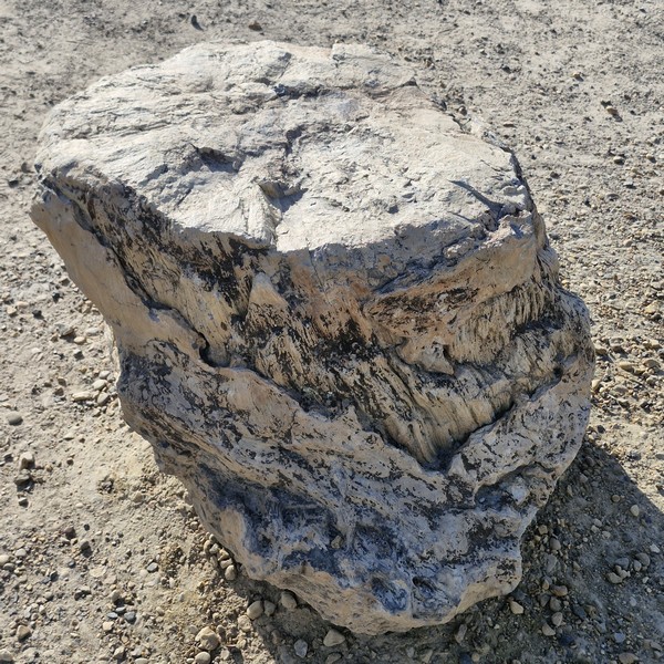
We also encountered a boulder-size fossil of an ancient giant redwood (Sequoiadendron), dating back roughly 72 million years to the Late Cretaceous period, that has been petrified and remains exposed by erosion.  The fossil, existing long before the region eroded into today’s semi-arid badlands landscape, proves the local badlands area once had a warm, moist, subtropical climate comparable to modern-day Florida.

A fossilized tree stump
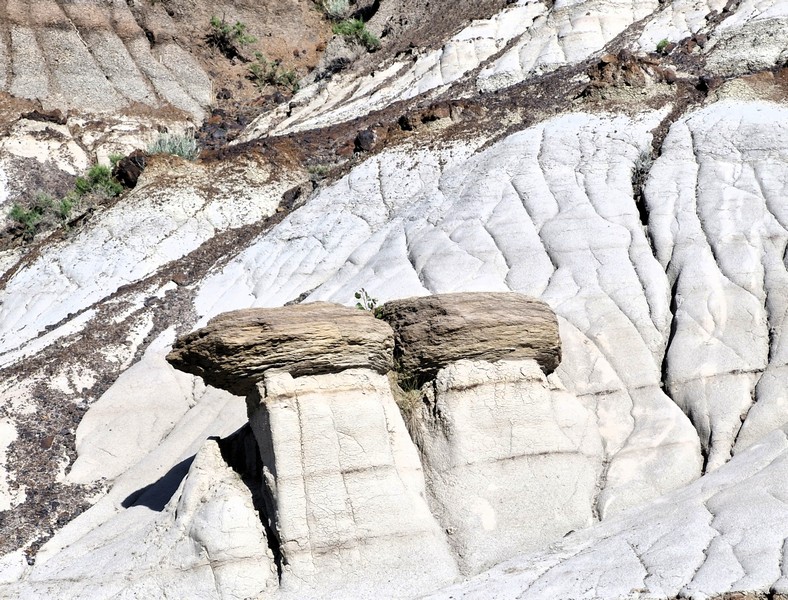
Hoodoos are delicate 5 to 7-m.tall sandstone spires capped with dense rock created by millions of years of wind, water, and frost erosion shaping soft sandstone and shale

If you want a longer walk, the path links up with other trails in the Midland Provincial Park and the wider local river park system. The trail provides educational signage that explains the area’s geology, ecology, and the significance of the dinosaur fossils found in the region.

This channel becomes a rushing, brown-colored torrent during heavy rains, eroding sediment off exposed bedrock surfaces and is ultimately carried away by the Red Deer River
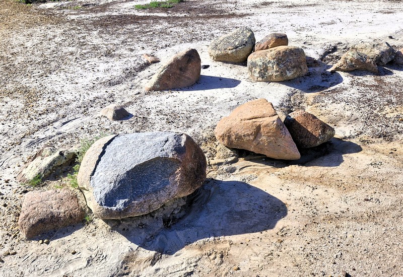
Small metamorphic rock boulders which, unlike the surrounding landscape, do not have their origins in the Late Cretaceous but were carried southwestward, into this area, from the Canadian Shield by the glaciers of the Late Ice Age.

Badlands Interpretive Trail: at 1500 North Dinosaur Trail, Midland Provincial Park, Drumheller, Alberta. Admission is free.

How to Get There: the trail is located northeast and right next to the Royal Tyrrell Museum.

Garry Point Park (Richmond, British Columbia, Canada)

Garry Point Park

This 30-hectare (75-acre) Garry Point Park, a public open-air coastal park situated on the Sturgeon Banks of  the Fraser River, was opened in 1989. This popular picnic destination, at the southwestern side of Richmond, near Steveston, is fringed by a sandy, log-strewn shimmering and expansive waterfront, the park’s main appeal. Located next to the Salish Sea, it offers gorgeous and relaxing panoramic views of the Fraser River’s South Arm; the low-rise silhouettes of Vancouver Island and the Gulf Islands and the sunset from across the water.

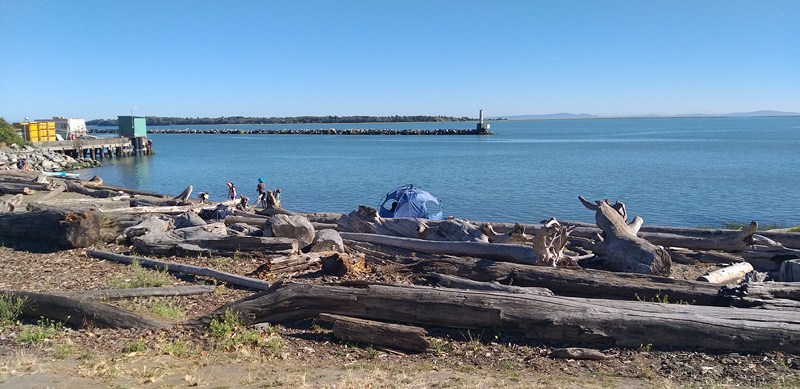
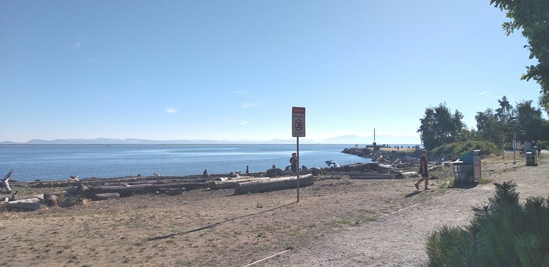
The park’s southern edge has a string of small, log-strewn sandy beaches backed by tangles of driftwood logs where you can sit and watch the fishing boats, tugs and pleasure vessels coming in and out through the fast-moving waters of the Steveston Harbor.

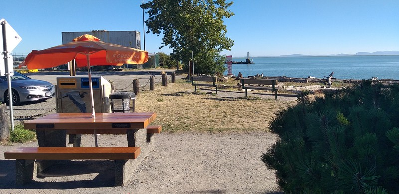
It features a modern sculpture (Steveston Fishermen’s Memorial), a Japanese garden (Kuno Garden), beach access, good washrooms, a picnic area and plenty of benches. The area was used as a location for filming of the Netflix series Midnight Mass.

The gently rolling grassy areas of Garry Point’s are also ideal for spreading out an impromptu picnic blanket. At the eastern edge of the park are two seasonal concession stand counters -Timothy’s Frozen Yogurt (for sweet treats) and local legend  Pajo’s (serves delicious fish and chips).

The park’s understated flora includes colorful bluebells, vibrant azaleas and, every April, the park’s Cherry Tree Garden, undertaken in 2000 during the 35th anniversary of the friendship of the cities of Wakayama, Japan and Richmond, British Columbia.  It features more than 250 carefully cultivated cherry trees that form a canopy over a walkway, making this a magnet for cherry blossom fans. During Garry Point’s annual Pacific Rim Kite Festival, in June, you can watch and kite flying, typically flown from a buggy or a board, taking full advantage of the unobstructed breezes.

Dogs are allowed in the park, but they must be leashed; and feeding wildlife and picking plants is not permitted. Dotted around the park are several well-written plaques, some with excellent black and white photos that transport you right back to the Richmond of yesteryear.

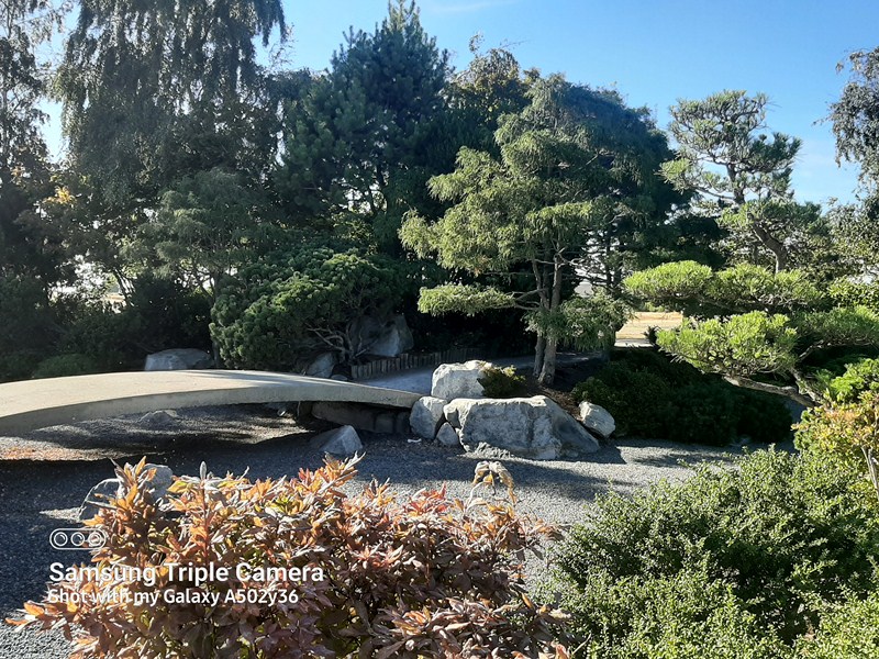
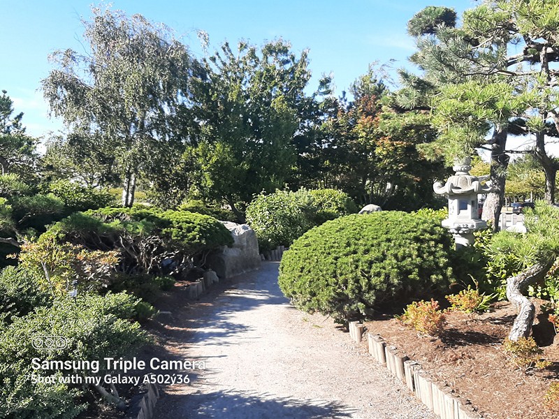
Kuno Japanese Garden

Near the entrance of the park is Kuno Garden, a Japanese garden established in 1989 by the local Japanese community in celebration of the centenary of Gihei Kuno, the first Japanese immigrant from Wakayama, Japan who arrived here in 1888, one of many thousands who fuelled Steveston’s fishing industry.

Donated to the city as a part of the centennial project, it is filled with Japanese horticultural features, symbolic stone structures, lantern and rock carefully placed to achieve the ultimate state of Zen.

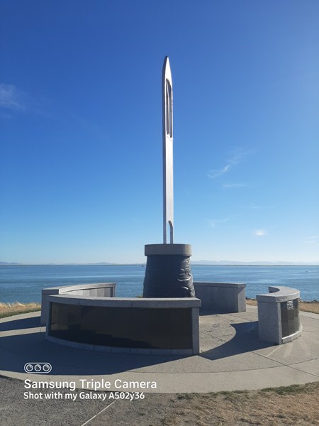
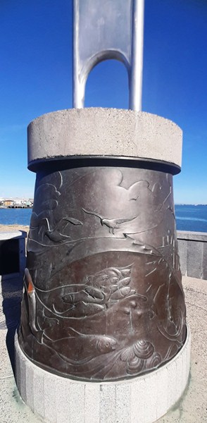
Steveston Fishermen’s Memorial

The striking, 25-ft. high, aluminum, bronze and stone Steveston Fishermen’s Memorial, towering over the waterfront, recalls the importance of fishing. Shaped like a giant fishing net needle, it’s a stirring public art reminder of those who have been injured or lost their lives to the industry over the years. Its base is engraved with the names of hundreds of fishermen who lost their lives for their communities. Created by artists George Juhasz and Georg Schmerholz, it was unveiled to the public in 1996.

Along the park’s circuit trail is Scotch Pond, a historic moorage site on the north end of the park that is an evocative reminder of the past.  Home of the Scottish Canadian Cannery, it is one of more than a dozen similar operations that once dotted the Steveston shoreline. Built in 1899, there are still remnants of the raised wooden walkway that once led across the water to this cannery as well as a large, barn-like structure, on piles, that  once housed a busy, family-run boatworks that was constructed here in 1905

Garry Point Park: 12011 Seventh Ave., Richmond, British Columbia V7E 4X2. Open 2 hours.  Tel: (604) 244-1208.

How to Get There: Garry Point Park is a short stroll from the centre of Steveston Village; reach it on foot via a wide walkway that runs alongside the Gulf of Georgia Cannery National Historic Site. Steveston is easily reached by public transit.

Steveston Tram Museum (Richmond, British Columbia, Canada)

Steveston Tram Museum

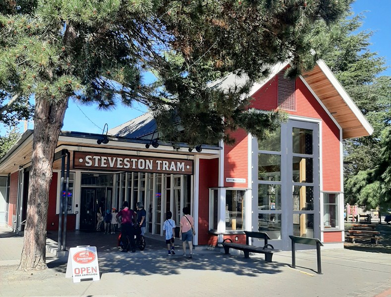
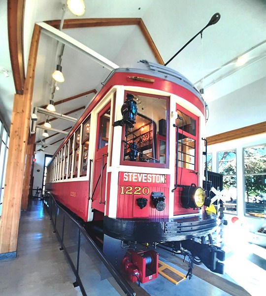
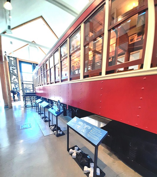
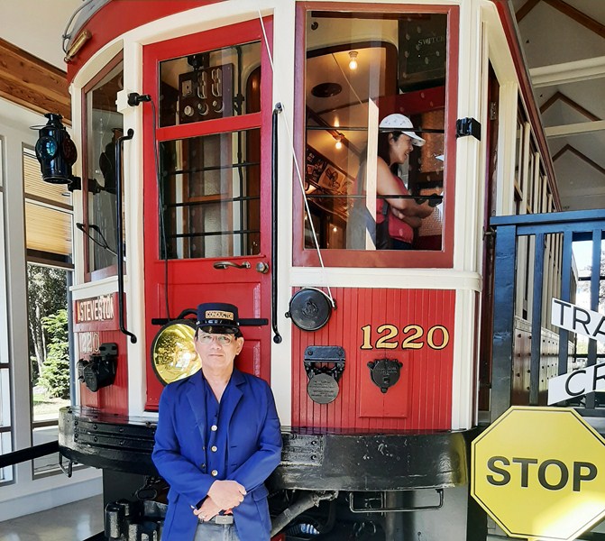
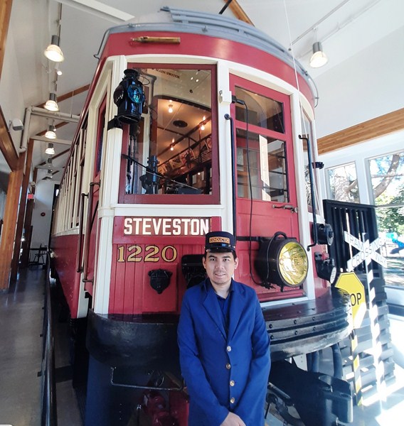
The Steveston Tram Museum, housing the beautifully restored Tram Car 1220, one of the original trams that ran on Richmond’s interurban rail system and the largest artifact in the Richmond Museum Collection, allows visitors to experience authentic Interurban rail travel and learn about early 20th century transportation.

The left side of the museum

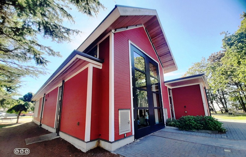
The bright red, 2,370 sq. ft.  museum, opened in May 2013 across the street from where the Steveston Station (which burned down in 1928 and replaced by a simple tram stop shelter in 1929) once stood, was designed by Birmingham & Wood Architects and built by Scott Special Projects Ltd., around the original tracks of the BC Electric Railway (BCER) Interurban Network.

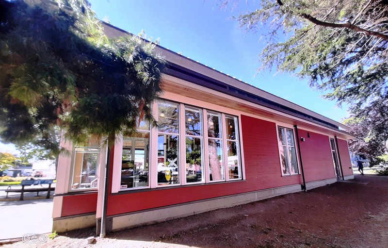
The large windows at the right side of the museum

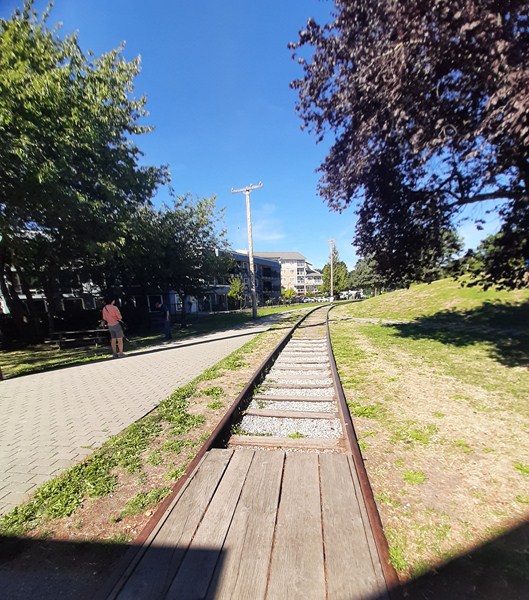
For 55 years, it provided an important economic and social connection between Richmond and the rest of the Lower Mainland. Today, you can still spot the original railroad path and power poles around the tram.

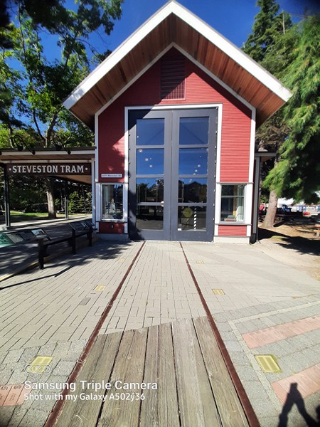
the Heritage Train Tracks at the rear of the museum

The building has 27-ft. high windows, a winch system to allow the tram  to be pulled out of the building for special events, and public art created by artist Mia Weinberg, a 1994 graduate of Emily Carr University of Art and Design, which will be integrated into the floor of the outdoor platform at the main entrance of the building.  It also has a community meeting room and had a restoration space (now converted into a programming space after the restoration was completed).

Heritage Train Tracks

Here’s the historical timeline of the BC Electric Railway Interurban Network:

  • In 1902, rail connection in Steveston started when the Lulu Island railway, owned by the Canadian Pacific Railway (CPR), ran freight and passenger steam trains to the area.
  • In 1905, the CPR leased the rail line to the BC Electric Railway Company (BCER), who electrified it for tram use. This was part of the BCER’s establishment of an Interurban railway network that would connect different communities throughout the Lower Mainland, otherwise difficult to reach.
  • In 1913, BCER added 28 1200-class tram cars bought from the St. Louis Car Company in Missouri (USA). Among them was Tram Car 1220.
  • By the 1940s, it had grown to 72 cars and 140,000 annual passengers

Tram Car 1220

Tram Car 1220, nicknamed the “Sockeye Special,” was discovered in a Mitchell Island warehouse in 1992.  Serving the local residents of Steveston to Marpole (located in south Vancouver), it was made of sturdy steel and wood, it was painted bright red.

The tram car could carry up to 64 seated passengers at a time.  They ran from the BC Electric Building at the southwest corner of Carol and Hastings Street to Steveston Village.

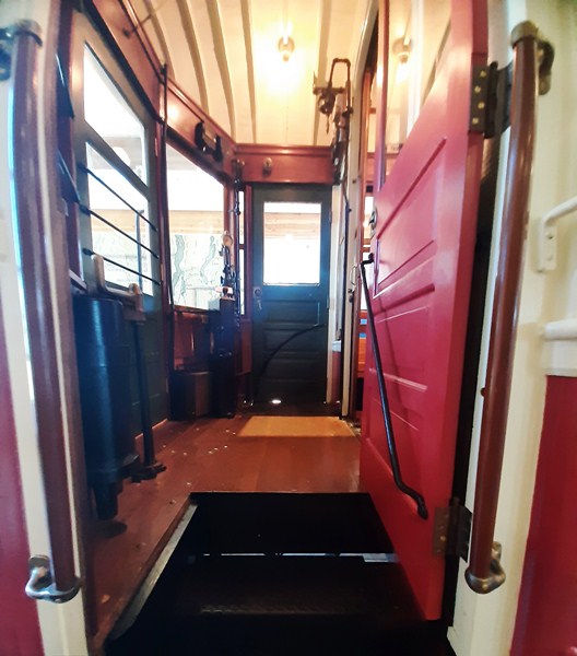
Tram entrance

On February 28, 1958, Tram Car 1220 made its final voyage between Marpole and Steveston, marking the end of an era for the Richmond community and for transportation history in BC.

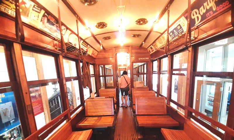
Tram interior which looks like a glowing, wood and glass jewelry box. Beyond is the smoking area

After decades of being off the tracks, the City of Richmond acquired Tram Car 1220 and, on May 3, 2013, opened the Steveston Tram Museum which was inspired by the architecture of the first Steveston Tram Station.

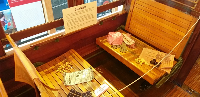
A mini display.  On Saturday, the last train of the night (12 AM) leaving Vancouver carried Steveston revelers who strewed peanut shells from the snacks they’d bought from the station. Not surprisingly, this last-nigh service was locally known as the “Peanut Special.”

Five years later, after a painstaking, three-year, $400,000 restoration starting in 2016, the tram made an exciting return to its former glory.

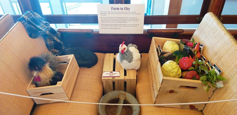
Another mini display showing chickens, a milk churn and crates of vegetables that sometimes rode alongside passengers

Tram Car 1220 is one of only seven remaining BC Electric Railway cars, five of them in BC in various states of functionality (most of the interurbans ended up being burnt at the railyard under the Burrard Street Bridge).  Several “sister” trams are located in Metro Vancouver, as well as one in Ottawa (Car 1235 at the Canada Science and Technology).

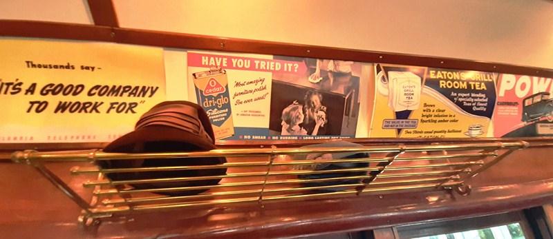
Vintage advertisements, lining the tram;s interior, of products such as Eaton’s Tea, Dri-Glo, Barq’s and even Goodwin’s “corn dodger” shoes

In Metro Vancouver, you can visit the other surviving BCER cars at the Burnaby Village Museum (Tram 1223) or the Fraser Valley Heritage Railway Society  in Surrey where they offer hour-long rides around Cloverdale aboard Car 1225. 

Check out “Burnaby Village Museum” 

The author donning an motorman’s costume and cap

Jandy

When we entered the tram, a male costumed Heritage Interpreter dressed as a tram conductor immediately greeted us and walked us through, pointing out things that we would never have noticed – the smoking half of the tram with no ashtrays, the screws on the outside that are all aligned, etc.

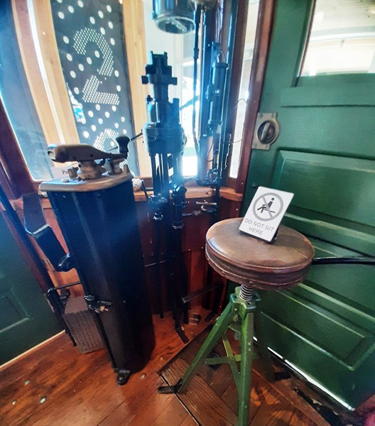
The mechanical controls and the tiny motorman’s stool

The restoration inside was exceptional – from the rattan seats, graffiti to the match striker plates (where you can strike up a light) at the smoking section.

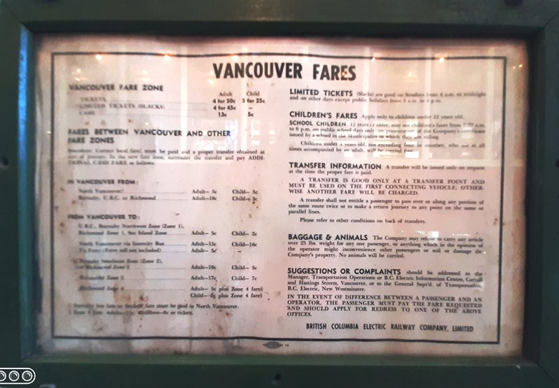
Vancouver Fares

Exhibits and child-friendly interactive displays also showcase this piece of Richmond history. One exhibit highlights the impact that trams had on Richmond and the Lower Mainland. It includes an extensive timeline on the history of trams which is complimented with footage of trams travelling through Richmond.

Interactive Tram Map

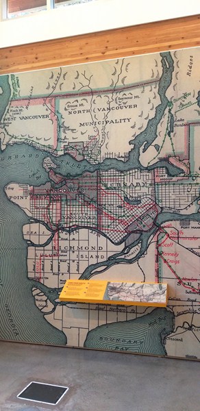
There is also a huge interactive map of all the tram routes that ran through Metro Vancouver.  Push buttons light up the five main lines and the stations that operate on them.

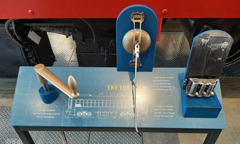
Brake lever, bell cord and conductor’s coin changer

Another interactive aspect of the exhibit is a display explaining how conductors would operate the trams with the ability to use the bell and handbrake that were onboard trams.

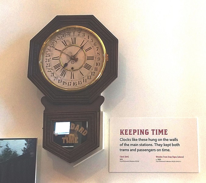
Main Station Clock

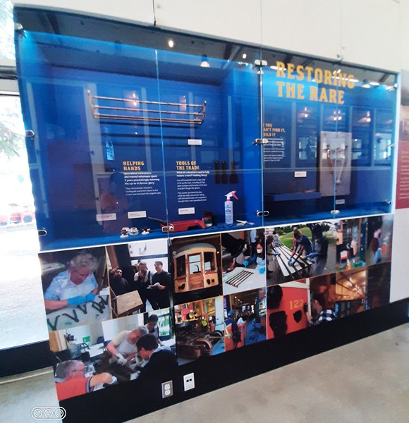
Another display on the tram car’s restoration process highlights the efforts of volunteers and paid professionals to bring the car to its past glory. Visitors can also dress up as a conductor.

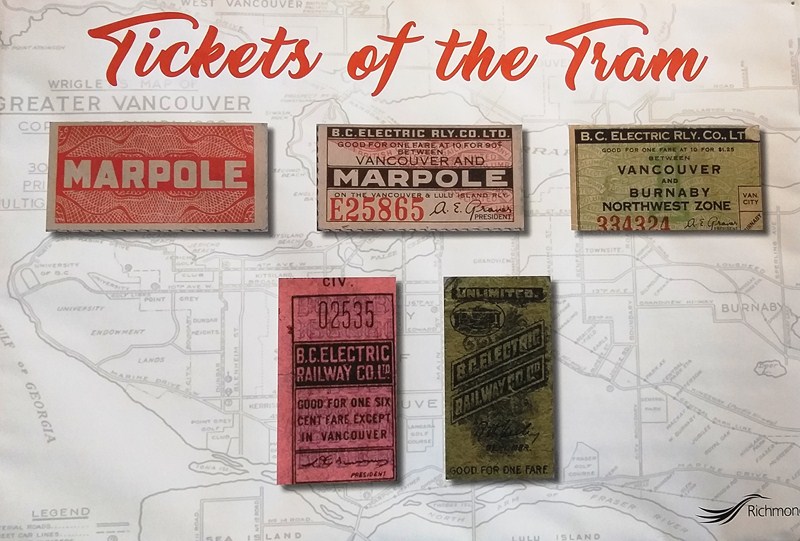
Tickets of the Tram

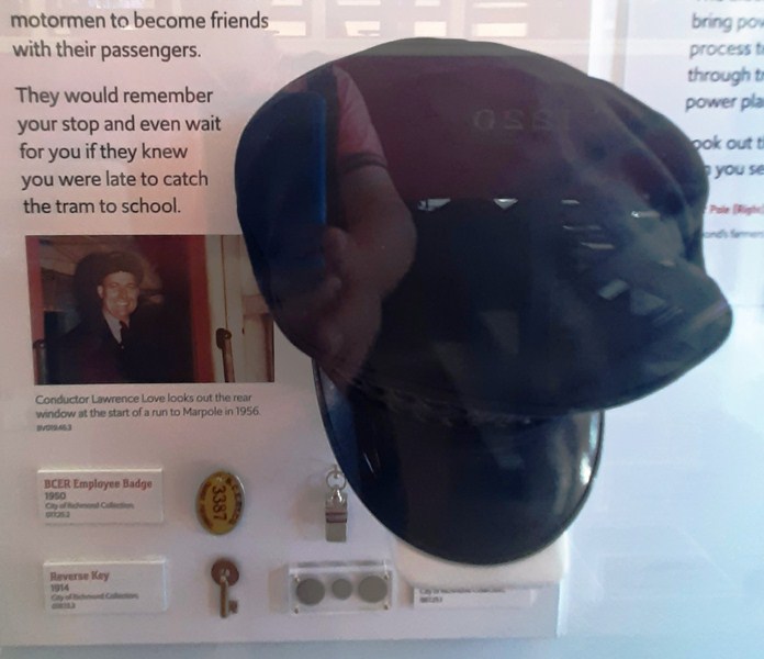
Evocative artifacts on display include rail spikes, tram tokens, a 1950 employee badge, a 1914 tram whistle and a handsome clock of the type that would have hung on the wall of every station along the network.

1953 motorman’s cap, BCER employee badge, reverse key

Also on display are faded signs from several old stations (Steveston, Trucks and Woodward’s); a 1950s hat worn by a motorman (AKA tram driver); a fare poster from the line’s final years (an adult one-zone fare was just 13c), a brake lever, bell cord and conductor’s coin changer.

Restoring the Rare

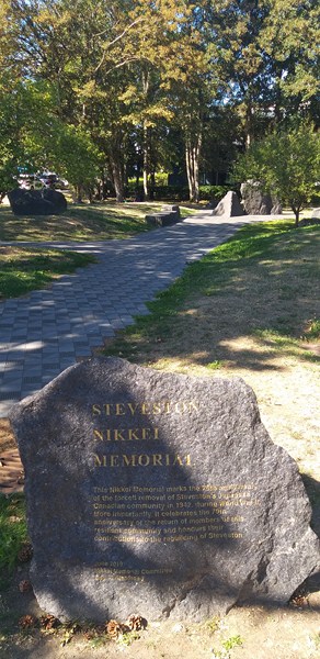
Adjacent to the museum is the Steveson Nikkei Memorial, a public art and contemplative garden space unveiled on June 22, 2019, that honors the 75th anniversary of the evacuation, relocation, and internment of 2,500 Japanese Canadians from Steveston during World War II.  It further celebrates the rebuilding of the Steveston community following their return from internment in following the war. 

Steveson Nikkei Memorial

Steveston Tram Museum: 4011 Moncton St., Richmond, British Columbia V7E 3A8.  Tel: 604-238-8081.  E-mail: interurban1220@richmond.ca. Open Tuesdays to Sundays, 12 to 4 PM (Spring, January 3 to May 19); daily, 10 AM to 5 PM (Summer, May 20 to September 4)  and Tuesdays to Sundays, 12 to 4 PM (Fall/Winter, September 5 to December 31). Closed on statutory holidays.  Admission is free.


CN Station Historic Site (Fort Langley, British Columbia, Canada)

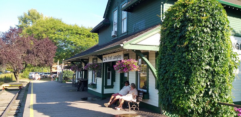
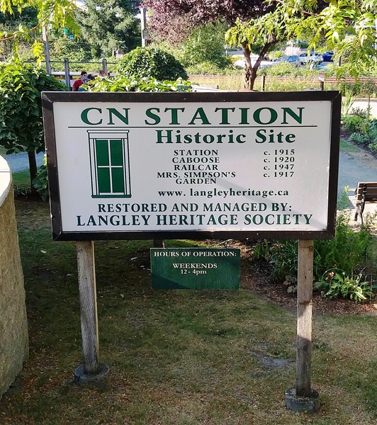
CN Station Historic Site

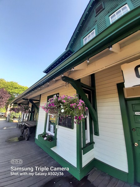
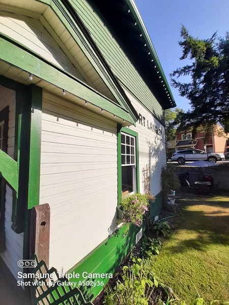
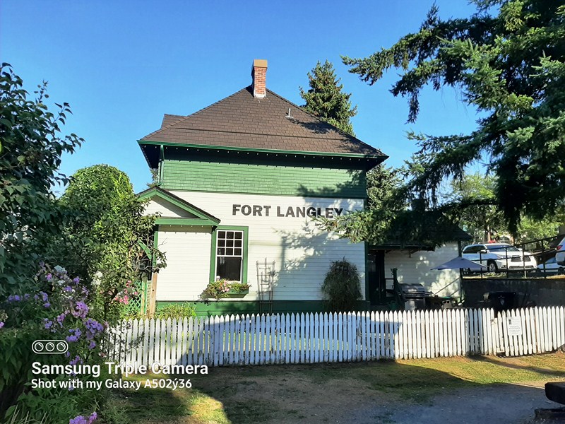
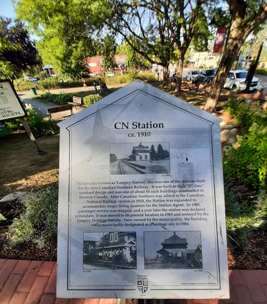
Fort Langley’s CN Station (historically known as “”Langley Station”), built in 1915 for the Canadian Northern Railway (CNoR) as agriculture expanded and new settlement drew people into the Fraser Valley, was absorbed by the Canadian National Railway in 1918 and was expanded to accommodate larger living quarters for the Station Agent.

Wooden waiting platform

Its life as a passenger station spanned the steam through diesel eras until 1980. The station, originally located 240 m. to the west, was used full time until 1972 when it was reduced to a flag stop. In 1980, passenger service was completely terminated and, for a time, the station stood empty.

In 1983, the station was moved to its present location, two blocks east, by volunteers of the Langley Heritage Society (a volunteer, non-profit organization).  After it was moved, the station underwent a two year restoration by Heritage Society members.  On February 27, 1984, the building was declared as a Municipal Heritage Site. In 2001, the Langley Heritage Society received a B.C. Heritage Society Award of Honor for the restoration project.

Built to a standard 3rd Class Type design (plan 100-29), this is one of the few remaining stations like it in western Canada (there were 85 such buildings built), and the only surviving Class C station (a total of twelve stations were built within a twelve mile stretch of Langley) from this era in the Langley region.

The 3rd Class station design, developed for the CNoR by influential architect Ralph Benjamin Pratt, is distinguished by its hip roof, a unique feature that branded the station as CNoR constructions. The building’s main floor accommodates an office and waiting room while the upper level contains living quarters for the station master.

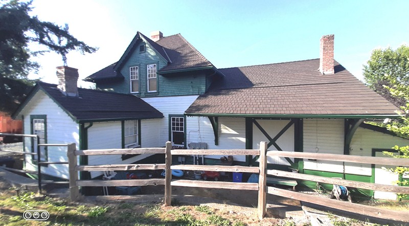
The station also has a sizeable, single-storey wing that serves as a baggage are..  It is now owned by the Township of Langley and is maintained and operated by the Langley Heritage Society through an innovative partnership,

Historical plaque

The recreated station garden, featuring 37 varieties of perennials (from alyssum to zinnia), were maintained much like Station Master Richard Simpson (who sold train tickets, handled freight and sent & received telegrams, earning $45 per month in 1918 and also working 60 hours a week) and his wife Mary did from 1918 to 1929, when annual garden competitions happened between stations.  Using original plant cuttings and seeds, it is now a recreation of what would have been there in the early twentieth century.

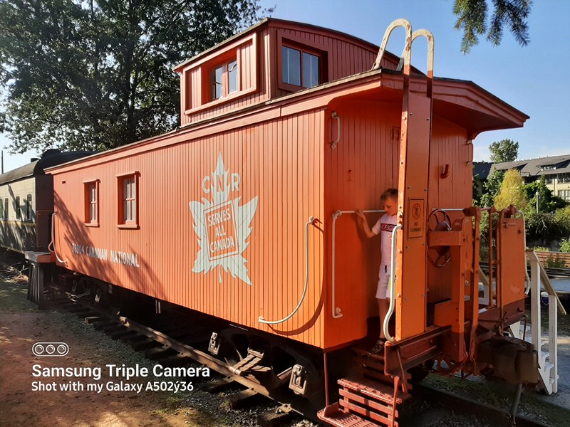
Wooden caboose (ca. 1920)

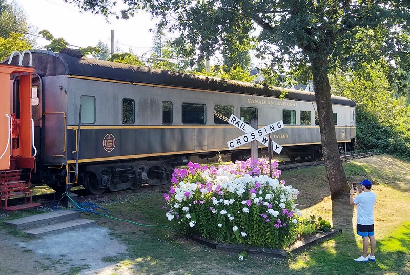
A wooden caboose, added beside the station, houses the 1950s era Glen Valley model railway.  A 1947 railway car, purchased and renovated in 1997 by the Langley Heritage Society, was renamed E. & E. Taylor, honoring Fort Langley residents Evelyn and Egbert Taylor, who dedicated much time to development of the railway station, as did the late Bays Blackhall who ran station operations for many years.  Inside is telegraph station for kids and a gallery  of the local Fort Langley Artists Group (FLAG) in the baggage room (they have displays on weekends and holidays in summer).

1947 Railway Car

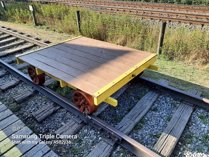
A section of track, donated by CN In 2004, was installed in front of the station to accommodate the velocipede, on loan from the B.C. Farm Machinery and Agricultural Museum.

Speeder trailer at the section of track

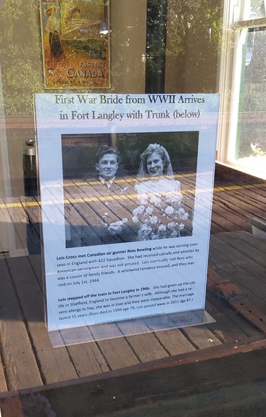
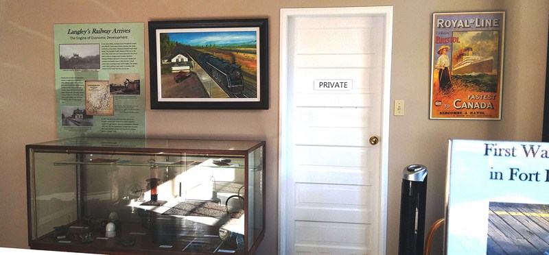
The station’s freight room displays many other fascinating objects and archival images while station waiting room houses a weathered trunk that belonged to Lois Bowling, the first British war bride (she married Canadian air gunner Ross Bowling on July 1, 1944) to arrive (in 1946) in Langley after the Second World War.

Portrait of Ross Bowling and Lois Cross

This well designed and visually pleasing, two-storey, wood frame station was built with a broad roof overhang and eave brackets typical of train stations from the early twentieth century. It also had station signage, wood drop sidings; dormers; 9-over-1 double hung sash windows on both main and second level on all four facades and chimneys (1 straight and 1 using salmon brick with a flair to its design).

General Waiting Room

The wooden passenger platform runs the length of front of building.  Inside is a ticket master office, with original finishes, a Baggage room and residence for station master (currently for caretaker).

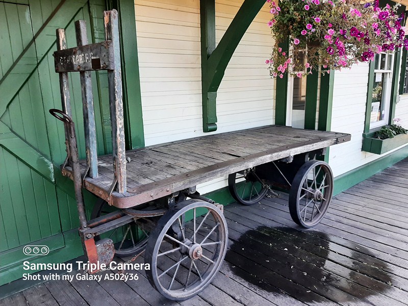
Luggage Wagon

The station, representing an important part of the transportation network that spawned and encouraged the growth of Fort Langley, is now a symbol for the Township of Langley as a heritage conservation pioneer.  It is also part of the Fort Langley Walking Tour and is a popular location for wedding and graduation photographs. 

Train shed

CN Station Historic Site: 23245 Mavis Ave. cor. Grover Rd., Fort Langley, Langley Township, British Columbia V1M 2S3, Canada.  Tel: (604) 513-8787. E-mail: info@langleyheritage.ca,  Website: www.langleyheritage.ca. Open Thursdays to Sundays, noon until 4 pm (summer, until Thanksgiving).  Admission is free but a $20 donation is appreciated. Mail to: Langley Heritage Society, Box 982, Fort Langley, B.C..

How to Get There: from Vancouver, it is a 35-min, (38.8-km.) drive via the Trans Canada Highway/BC-1E. From the Expo line exit at Surrey Central Station, catch the #501 Langley Centre bus at bay #4. Get off at Walnut Grove Park and Ride (about 30 mins. on the bus) and transfer to a C62 Langley Centre Via Fort Langley Community Shuttle Bus at bay #2 and get off at the corner of 96th Ave. and Glover Rd. (about 22 mins. on the bus) The village is located along both sides of Glover Rd. – mostly to the north.

BC Farm Machinery Museum (Langley, British Columbia, Canada)

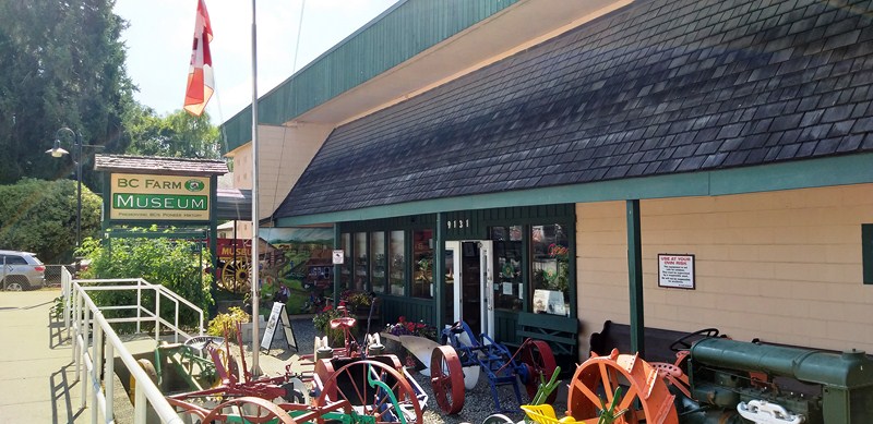
The BC Farm Machinery Museum, housing British Columbia’s largest collection of pioneer and agricultural artifacts, acquires, collects, restores, preserves, and provides a means for displaying, for students and the general public, those articles of farm machinery and pioneer life of a historical nature which demonstrate the trend of agricultural development in the province of British Columbia.

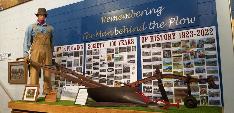
High Cut Plow

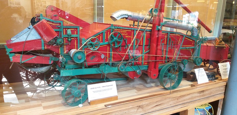
1910 Rumely – Ideal Separator

The museum had its beginnings on May 23, 1953 when Bruce Coleman, on behalf of his family, presented his late father Robert Alfred J. Coleman’s donation of an award-winning, single high-cut walking hand plow (its mold board, share and the angle of its beam shaped on the anvil of the late Alex Ross of Bruce County, Ontario, in 1900) to the University of British Columbia (UBC), with Dr. Norman McKenzie, president of UBC accepting the acquisition on behalf of the university.

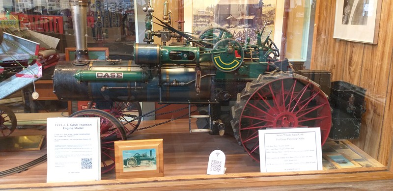
1915 J.I. CASE Traction Engine Model

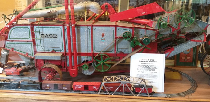
1918 J.I. Case Threshing Machine

It started a planning process to establish an Agricultural Museum in the Fraser Valley. In February 1958, a meeting with a group of industry leaders was held in the hospitality room of the Fraser Valley Milk Producers Association (FVMPA) Fifth Avenue plant.

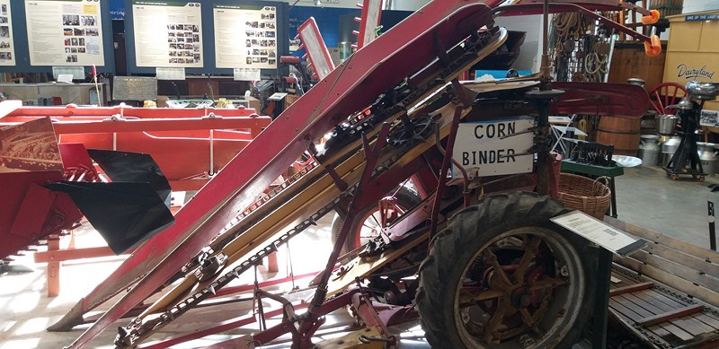
Corn Binder

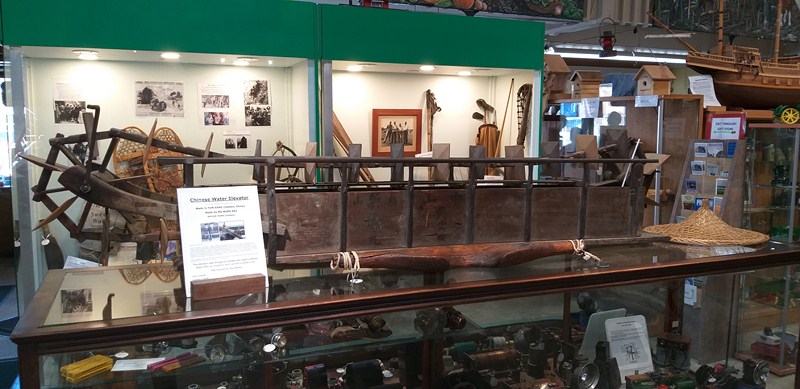
Chinese Water Elevator

That evening, a British Columbia Farm Machinery Association was being formed (it received a Certificate of Incorporation on  June 24,1958) with a goal of funding and operating a museum to be located on the Endowment Land on Point Grey. After the Association was formed, the location was switched to Fort Langley instead of UBC.

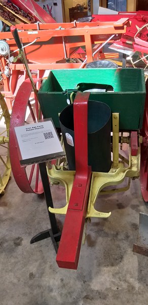
Iron Age Early Potato Planter

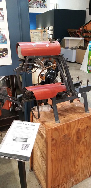
Felins Tying Machine

On November 19, 1966, the museum was officially opened, in an 8,000 sq. ft. building (it included display space, an archives room, and a work shop for repair and restoration of exhibits), by Sir Robert Bellinger, Lord Mayor of London and, within a very short time, a second building had to be erected to house a growing collection of agricultural artifacts.

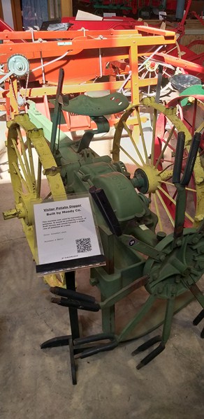
Victor Potato Digger

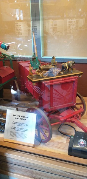
Water Wagon and Pump

On September 23, 1978, Phase Two and Three (the Steam Room) were officially opened by R.H. McClelland, the Minister of Health and Welfare.

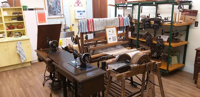
Textiles

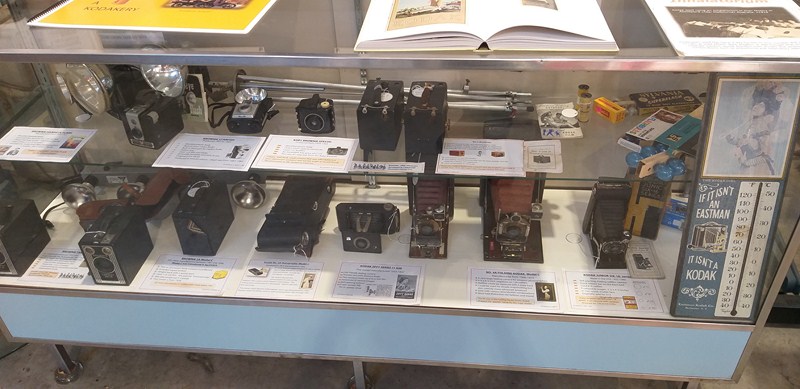
Old Cameras

Since 1990, when federal funding dried up, the BC Farm Museum Association has been run entirely by volunteers and will continue to do so for the foreseeable future.

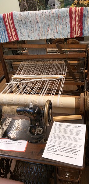
Loom

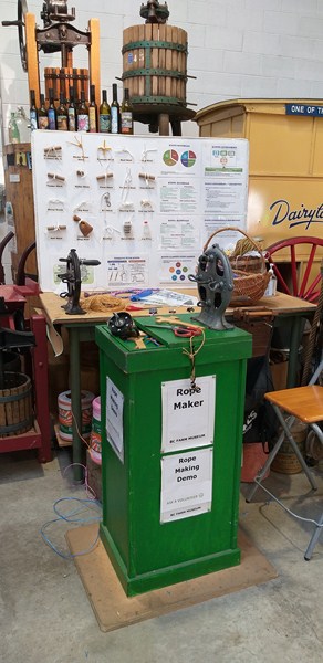
A 1920s rope making machine

The exterior of the museum was quiet and nondescript but, once we entered the rustic building, we were truly amazed at the size of the facility as well as the mind boggling amount of farm machinery, agricultural hardware and early farm living contraptions.

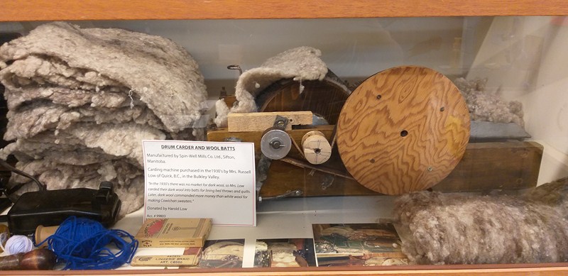
Drum Carder and Wool Batts

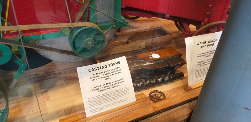
Casting Forms

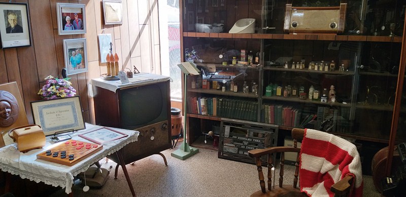
The very broad collection of over 6,100 historical artifacts and farm-related implements (from field to kitchen items), in several different rooms, two buildings and an outdoor exhibit area, is devoted to the development of farm machinery in British Columbia.

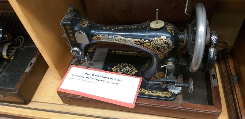
Hand Crank Sewing Machine

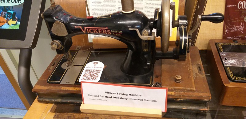
Vickers Sewing Machine

They have wonderful exhibits of early farming equipment  such as tractors,  a a hand-wrought plow, a threshing machine, tomato separator by sizes, corn binder, early windmills (that pump water and produce light), a 1910 Rumely-Ideal separator, steam and gas tractors,  a sail reaper, threshers, a potato digger, and others. .

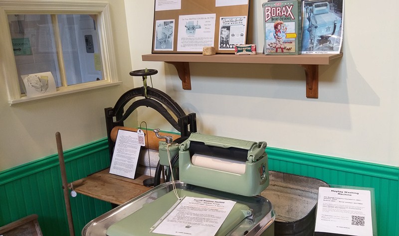
Maytag Washing Machine and Mangle

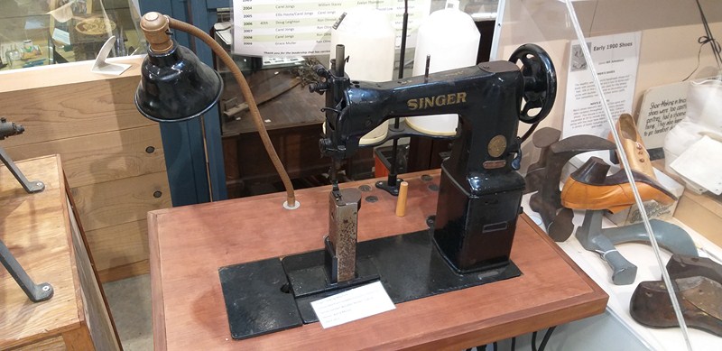
Singer Sewing Machine

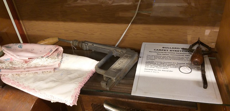
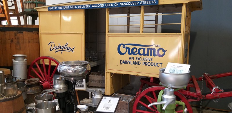
Articles of pioneer life of a historical nature include a 1920s rope making machine,horse buggies, a train exhibit, an old wringer wash machine, a milk delivery truck (the last one to deliver milk in Vancouver), carriages and buckboards, an egg sorting machine, several wooden ice boxes (the early refrigerators), blacksmith making hooks, sewing machines, looms, a Bullard’s carpet stretcher, old cameras, 

Bullard’s Carpet Stretcher

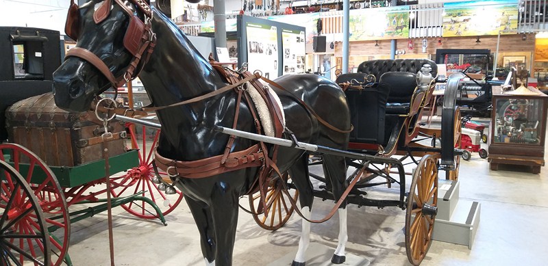
Rowlett Carriage

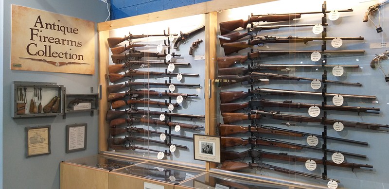
The Antique Firearms Collection displays shotguns (W.H. Pollard 12-gauge shotgun; Belgian 12-gauge, double barrel shotgun; Hopkins & Allen 12-gauge, double barrel shotgun; etc.), rifles (Winchester Model 1895, Mauser Model 1878, single shot rifle; Stevens single shot rifle; Westley Richards improved Martini-Henry rifle; Vetterli rifle; Remington cal. 22 rifle; 1883 Martini-Henry rifle; etc.), revolvers (British Bulldog revolver; etc.), a ca. 1895 pistol owned by George Turnbull (North Beresford, Saskatchewan) and a flintlock pistol.

Antique Firearms Collection

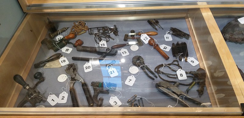
Gun Display Parts and Pieces

Also on display here are a clay pigeon trap, a World War I helmet, bullets, a tobacco can, powder flask, bullet molds, shot pouch, awls and a display of parts and pieces of a gun.

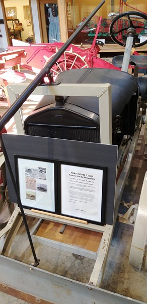
Ford Model T with Tractor Kit and Snowplow

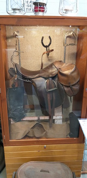
World War 1 Military Saddle

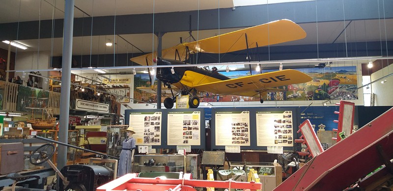
Hanging from the ceiling is a vintage Skyway Tiger Moth crop sprayer plane, BC’s first crop duster, which was converted by Art Seller.

The Skyway Tiger Moth Sprayer

In 2017, five new murals by local artists were unveiled. Hay’s Room was built in memory of Dr. Ken Hay, a founding member of the BC Farm Machinery Museum Association in 1958.   A research library, with over 10,000 books, pamphlets and manuals of historical information, is also available.

Hay’s Room

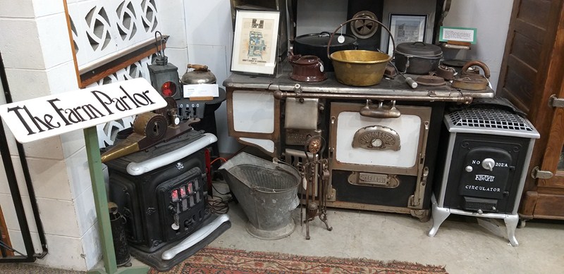
The Farm Parlor

The BC Farm Machinery Museum, a great place to spend the afternoon, was definitely worth a visit.  The friendly volunteers were knowledgeable and willing to share stories related to the items on display.  Though there wasn’t much in the form of interpretative displays, the sheer volume of items was still a sight to behold.

Milk Delivery Wagon

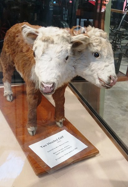
Two Headed Calf born in Brooks, Alberta (southeast of Calgary).  It lived for three weeks in 1980

BC Farm Machinery Museum: 9131 King St., Langley, British Columbia V1M 2R6. E-mail: bcfm@telus.net.  Website: www.wcra.org and www.bcfma.com.  Tel: (604) 888-2273.  Open Open daily from April 1, 2023 until September 30, 2023 (closed for the winter season), 10 AM to 4:30 PM.  Admission is free.  Facebook: https://www.facebook.com/farmmuseumbc/

Engine No. 374 (Vancouver, British Columbia, Canada)

CPR Engine 374

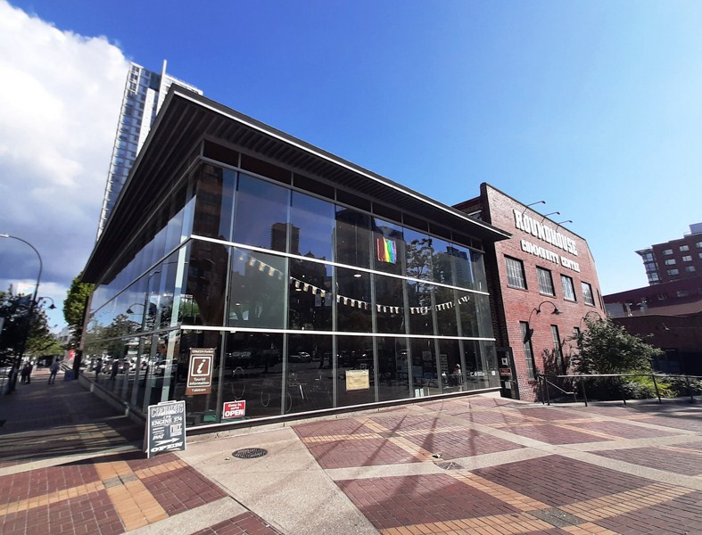
After buying shoes at  MacArthur Glen Designer Outlet, Grace, Jandy, Kyle and I again boarded the SkyTrain from Templeton Station to Yaletown-Roundhouse.  Upon arrival at the station, we just walked about 250 m. to get the Engine 374 Pavilion, along the shores of False Creek in Yaletown.

CPR Engine 374 Pavilion

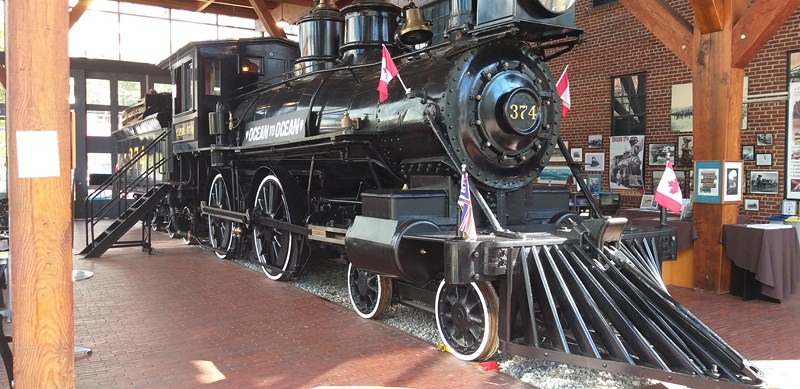
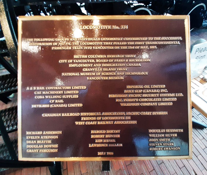
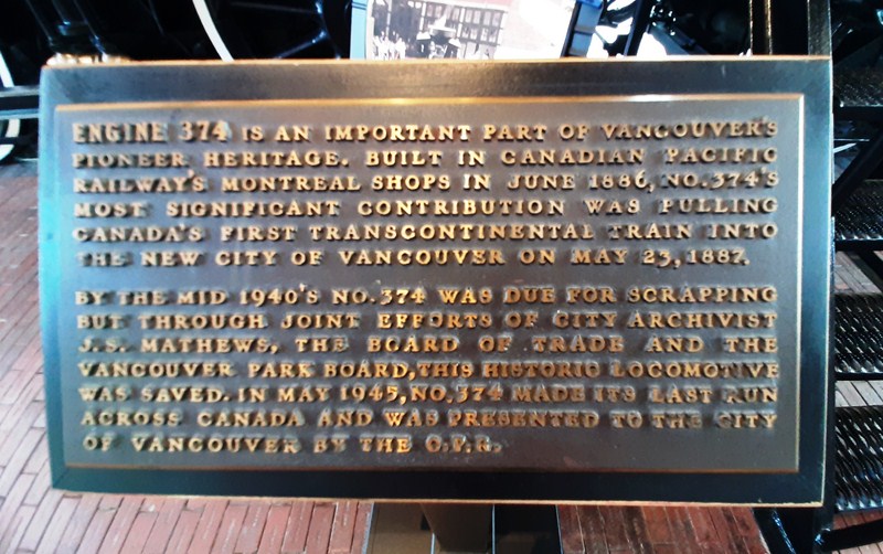
It houses a static display of historic Engine No. 374, a Canadian Pacific Railway (CPR) steam locomotive that pulled the first transcontinental train (carrying 150 passengers) that arrived in Vancouver on May 23, 1887, finally joining Canada from the East Coast to Vancouver on the West Coast.

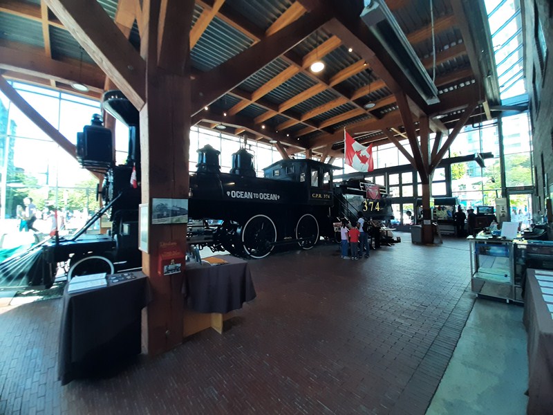
CPR Engine 374 Pavilion interior

This ten months after sister Engine No. 371 brought the first train to cross Canada into Port Moody on July 4, 1886, roughly 32 kms. (20 mi.) to the east.

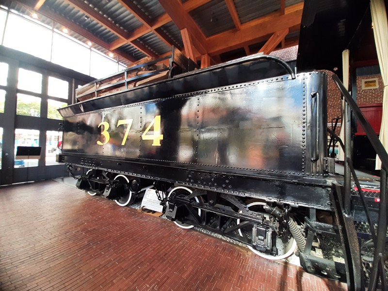
CPR Engine 374 Tender

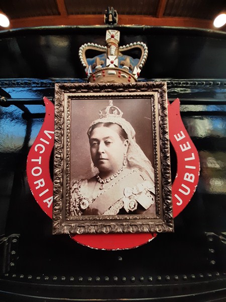
Portrait of Queen Victoria at the rear of the tender

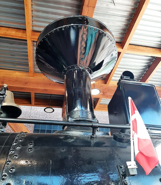
It was renumbered three times – 374 until 1907, 92 until 1909, 245 until 1913, 158 until 1945.  Originally, it was equipped with a “diamond” smokestack but, when it got to British Columbia, it was swapped for a familiar “sunflower” stack.

Sunflower smoke stack

Engine No. 374 was built in May 1886 by the Montreal shops of CPR, one of eight (371 to 378) similar steam locomotives (with 4-4-0 wheel arrangement and having 69-in. driving wheels) built that year.  In the 1890s, the 69” drive wheels were replaced with 62” ones for better traction.

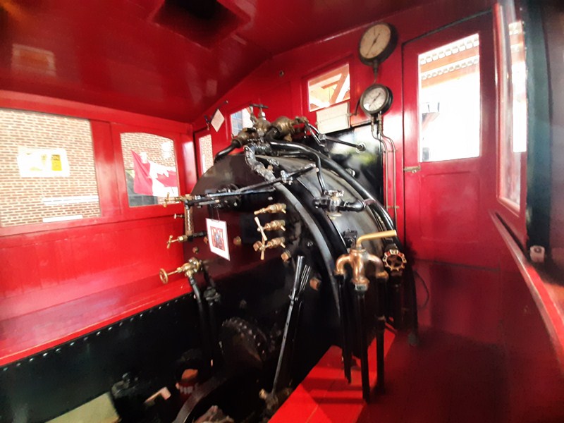
Driver’s Compartment

While No. 371 was scrapped in October 1915, No. 374 was completely rebuilt in September 1914 and continued in service until July 1945.

Because of its historical significance, upon its retirement, it was donated to the City of Vancouver on August 22, 1945.  It was placed  on display on a section of track in Kitsilano Beach Park, remaining there until 1983.

Due to exposure to the salt air and a lack of upkeep, it suffered greatly. In 1963, a vain attempt was made to move it into the former aircraft hangar (now the Community Music School) in Vanier Park.

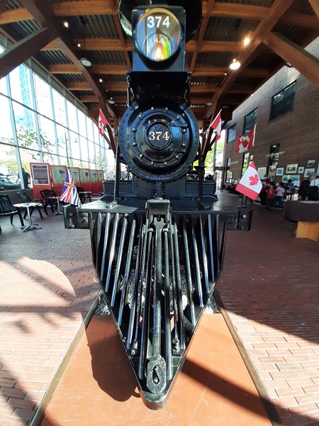
Cowcatcher and headlight

In 1981, the West Coast Railway Association (WCRA), a group of railway enthusiasts, launched an effort to restore the engine.

Locomotive Whistle

The locomotive was moved from Kitsilano and placed in a warehouse in Granville Island where dedicated volunteers restored it to its former glory.   In 1985, the engine was transported North Vancouver’s Versatile Shipyards for final restoration in time for Expo 86.

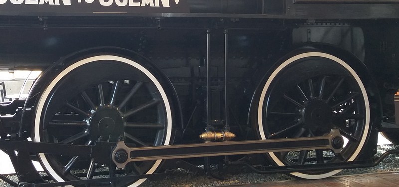
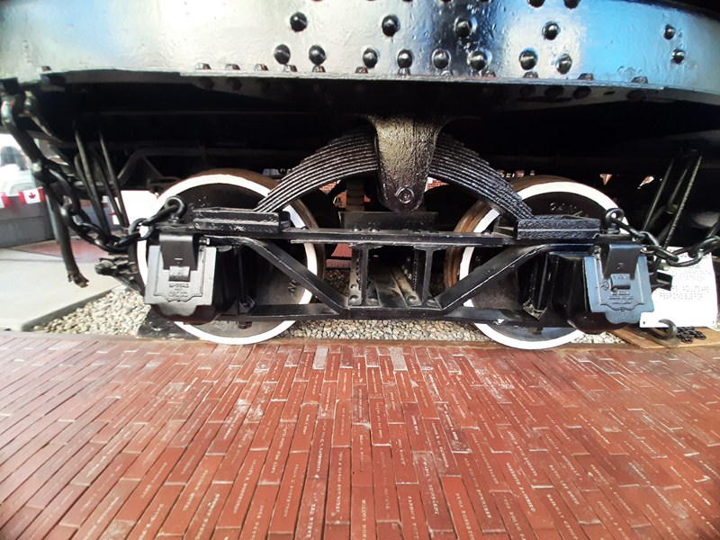
Running Gear

On February 13, 1986, the refurbished Engine No. 374 was transported to the renovated former CPR Drake Street Roundhouse  where it was put on display on the turntable and became a prime attraction.

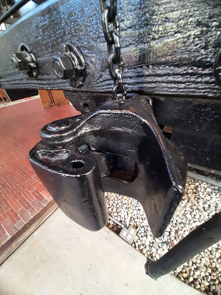
Coupler

After the Expo, the engine was placed inside the Roundhouse.  In May 1988, volunteers were allowed access to examine, clean and polish the engine and set up arrangements for a public opening.
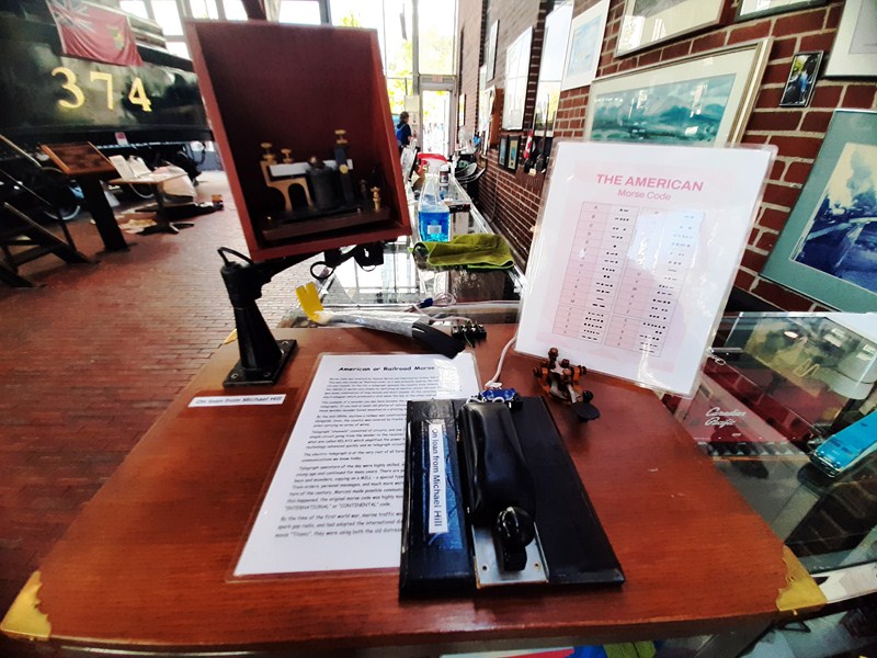
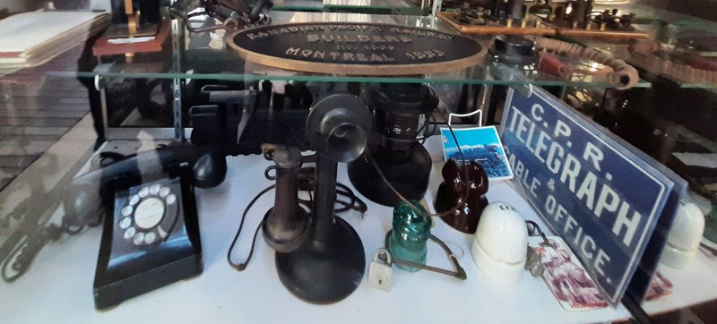
Telegraph Set

In 1988, the Expo 86 site, including the Drake Street Roundhouse, was sold to Concord Pacific, and, in the course of the False Creek North Development Plan, the developer agreed to convert and expand the buildings to comprise the Roundhouse Community Centre (designed by Baker McGarva Hart and completed in 1997).

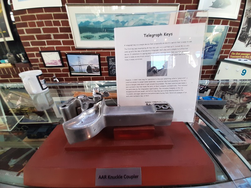
AAR knuckle coupler or Janney are semi-automatic form of  railway coupling that allows rail cars and locomotives to be securely linked together without rail workers having to get between the vehicles

Before the Roundhouse was converted, successful fundraising efforts were undertaken by the Vancouver Parks Board and the Lions Club, among others, to build a new building adjacent to the Roundhouse house Engine No. 374. The new building was inaugurated on August 22, 1997.

Old telephones and signages

Part of the floor of the building consists of 20,000 “Heritage” bricks which are engraved with the names of individuals who bought one brick (for $19.86 each), which raised funds (totaling $400,000) through the unique Heritage Brick Program sponsored by Imperial Oil Limited.  You can climb on board the cab and ring the bell.

Heritage bricks with names of donors

Here are the engines’ specifications:

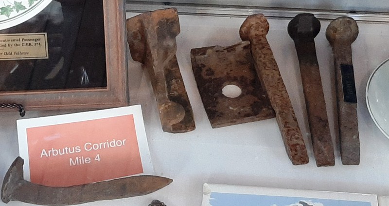
Arbutus Corridor railroad spikes

The pavilion, now a central feature of the Yaletown area redevelopment, is staffed entirely by volunteers from the West Coast Railway Association and, on average, sees roughly 41,000 visitors per year as of 2015.

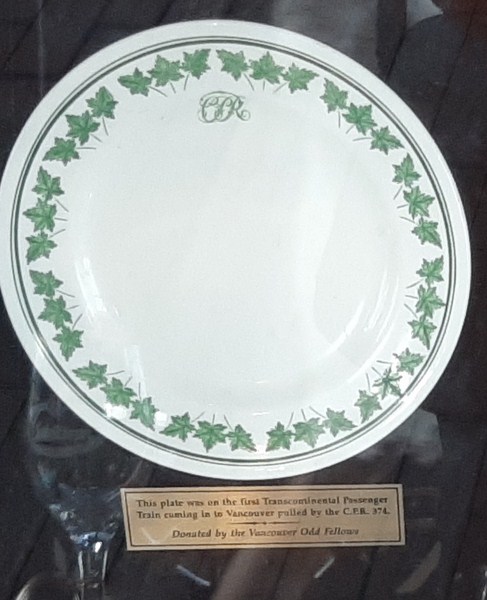
Plate used in CPR Engine 374

An anniversary celebration is held annually on the Sunday before Victoria Day.   The WCRA also runs the Railway Museum of British Columbia up in Squamish.

Check out “Railway Museum of British Columbia:  CN Roundhouse and Conference Center,” “Railway Museum of British Columbia: Pacific Great Eastern Car Shop” and “Railway Museum of British Columbia: Railyard”


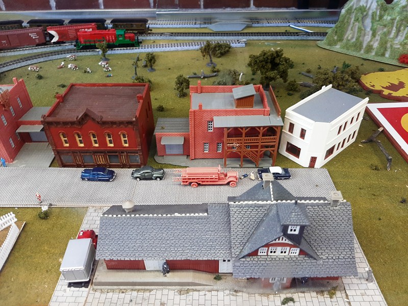
Miniature railway village

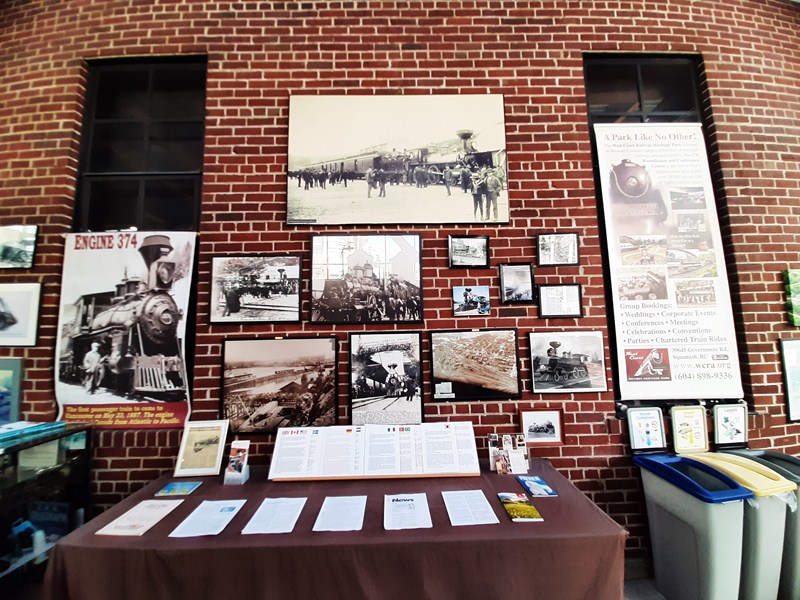
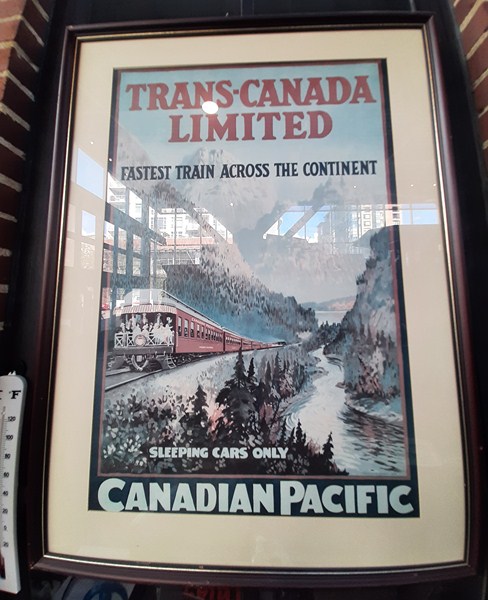
Also on display old CPR Engine 374 photos and posters; a miniature railway village; model trains; old telegraph set, signages; old telephones, fine china used on the train; Arbutus Corridor railroad spikes; AAR Knuckle Coupler; etc.

Old photos

Canadian Pacific Poster

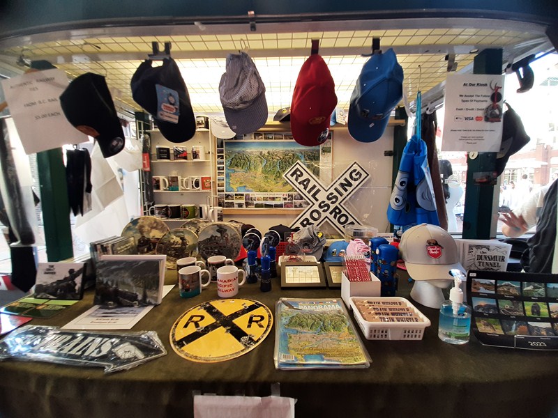
There’s also a gift shop selling souvenir Tshirts, mugs, plates and caps; train whistles; postcards; etc.

Gift Shop

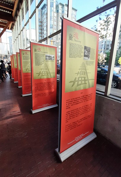
The “Chinese Legacies: Building the Canadian Pacific Railway” Exhibit, circulated by the Revelstoke Railway Museum, explores the story of the Chinese laborers during the construction of the Canadian Pacific Railway’s transcontinental line, in the 1880s, the lasting impact it had on their lives, as well as their contribution to Canadian national development.

Chinese Legacies: Building the Canadian Pacific Railway

Engine 374 Pavilion: 181 Roundhouse Mews, Vancouver, British Columbia V6Z 2W3. E-mail: info@wcra.org. Website: www.wcra.org. Tel: (604) 713-1800.  Open Wednesdays to Sundays, 10 AM to 4 PM during the summer and 11 AM to 3 PM in the winter.  Admission is free.