Reunification Palace (Ho Chi Minh City, Vietnam)

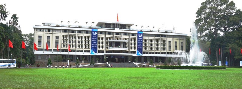
The Reunification Palace

The Reunification Palace

From the St. Francis Xavier Church in Chinatown, we next moved on to the Reunification Palace, one of the most fascinating sights in Ho Chi Minh City. On February 23, 1868, the foundation for a residence was laid on this site for by Adm. Pierre de la Grandiere, the French governor-general of Cochinchina. It was completed in 1873. Gradually, it expanded to become Norodom Palace (Dinh Norodom).

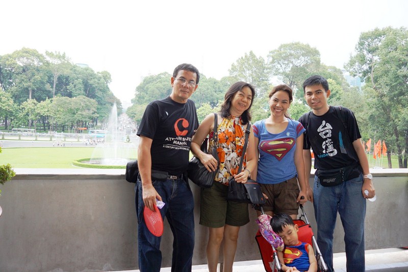
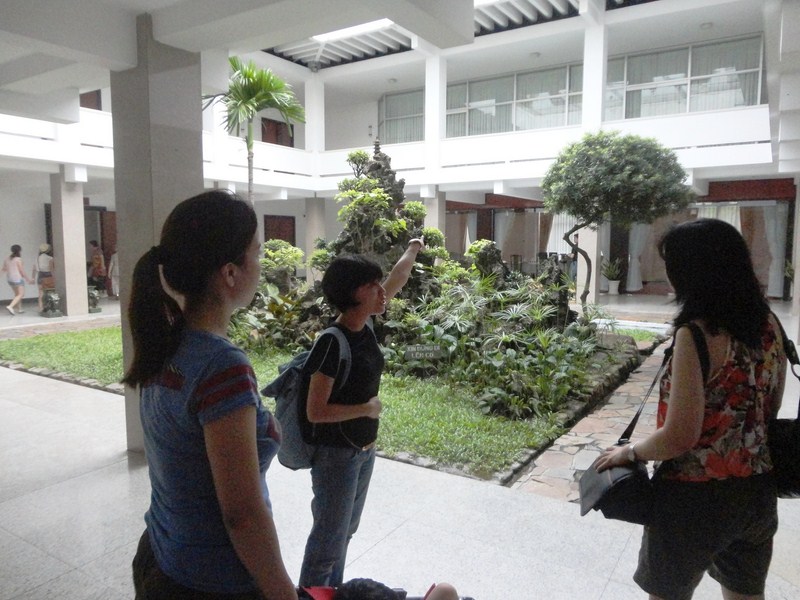
The author, Grace, Cheska, Jandy and a sleeping Kyle at the balcony

The author, Grace, Cheska, Jandy and a sleeping Kyle at the balcony

When the French departed, the palace became home to the unpopular South Vietnamese President Ngô Đình Diệm. On February 27, 1962, 2 pilots (Nguyễn Văn Cử and Phạm Phú Quốc) on two A-1 Skyraider (A-1D/AD-6 variant) aircraft of Diem’s own air force bombed the palace, almost destroying the entire left wing, in an unsuccessful attempt to kill him.

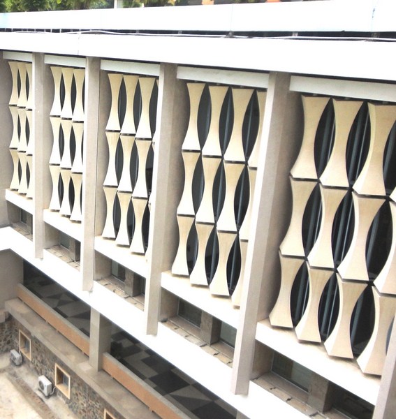
Sun canopies that evoke tall bamboo

Sun canopies that evoke tall bamboo

As it was almost impossible to restore the palace, Diệm ordered it demolished and commissioned a new residence to be built in its place. This time it had a sizeable bomb shelter in the basement. Diem did not get to see his dream house as he, together with his brother and chief adviser Ngô Đình Nhu, were killed by his own troops on November 2, 1963.

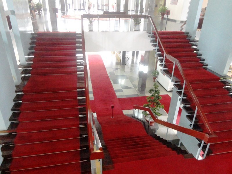
Main central stairway

Main central stairway

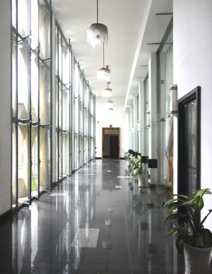
A grand corridor

A grand corridor

The newly completed building was inaugurated on October 31,1966 by General and later president Nguyễn Văn Thiệu, the chairman of the National Leadership Committee and head of the military junta, and was named Independence Palace (Dinh Doc Lap). It served as Thiệu’s home and office.

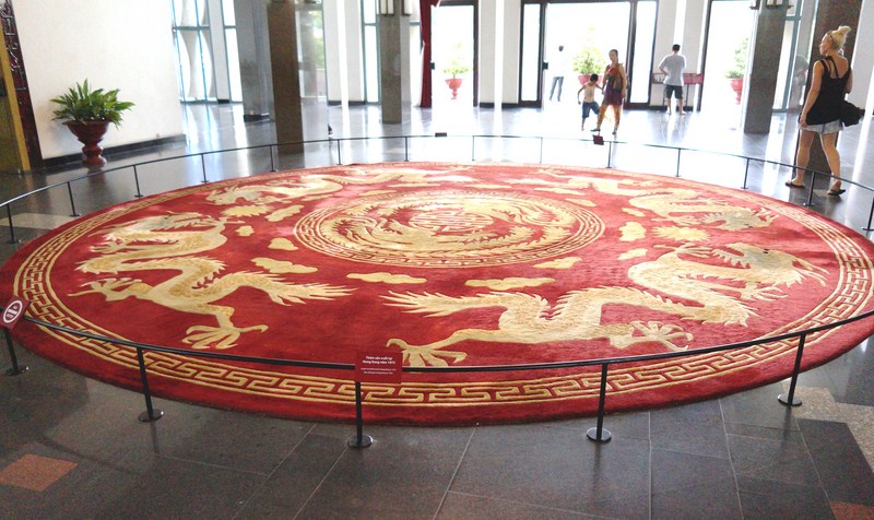
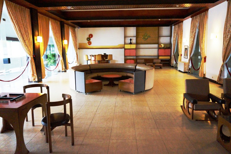
Lobby with a Hong Kong-made (1973) circular carpet

Lobby with a Hong Kong-made (1973) circular carpet

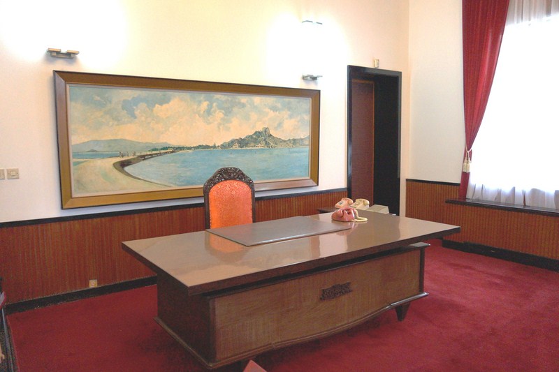
The Presidential Office

The Presidential Office

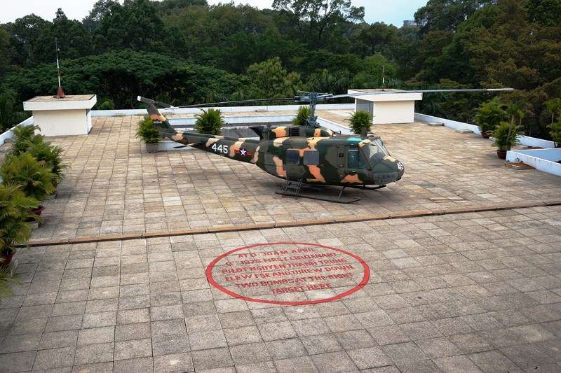
On April 8, 1975, Nguyễn Thanh Trung, a pilot of the Vietnam Air Force and an undetected communist spy, flew an F-5E aircraft from Biên Hòa Air Base and bombed the palace, causing no significant damage. On April 21, 1975, prior to the Fall of Saigon, Thieu hastily fled the palace and went into exile.

After a day of bombardment, the North Vietnamese were ready to make their final push into Saigon. On April 30, 1975, 10:45 AM, a Russian-made  North Vietnamese Army T-54/55 (No. 843) tank of Tank Corps 203, 2nd Army, crashed through its wrought-iron gates, a dramatic scene recorded by Australian photo journalist Neil Davis and shown around the world. After crashing through the gates, a soldier ran into the building and up the stairs to unfurl a Vietcong flag from the balcony at 11:30 AM.

In an ornate reception chamber, Gen. Dương Văn Minh, who had become head of the South Vietnamese state only 43 hours before, waited with his improvised cabinet. “I have been waiting since early this morning to transfer power to you,” Minh said to the Vietcong officer who entered the room. “There is no question of your transferring power,” replied the officer. “You cannot give up what you do not have.” At 3:30 PM, Minh broadcast over the radio, stating “I declare the Saigon government…completely dissolved at all levels.” The dissolution of the South Vietnamese government effectively ended the Vietnam War.

Designed by Paris-trained Vietnamese architect Ngô Viết Thụ, this outstanding example of typical, strikingly modern 1960s architecture was built on a block of 12 hectares bordering four streets: Nam Ky Khoi Nghia in the front (the main entrance is open to Le Duan Boulevard), Huyen Tran Cong Chua in the back, Nguyen Thi Minh Khai on the right and Nguyen Du on the left.  Its external sun canopies evoke the shape of tall bamboo.  Its spacious rooms open onto grand corridors grouped around a monumental central staircase.

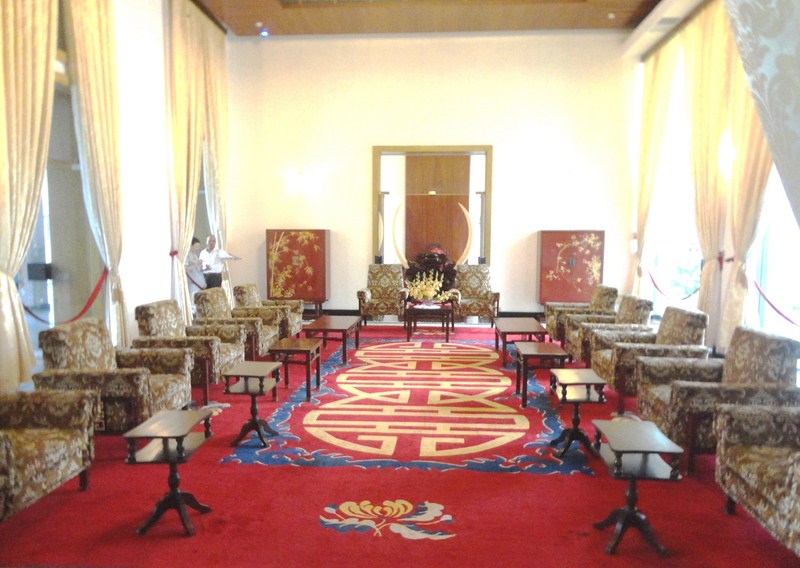
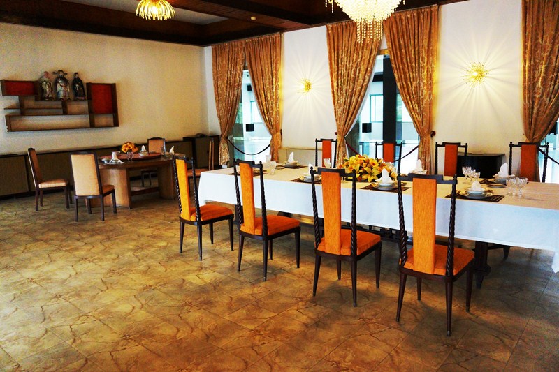
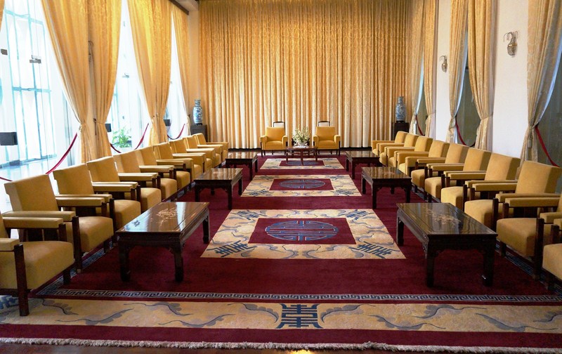
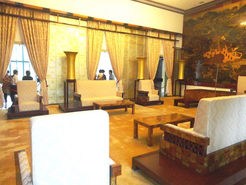
Presidential Reception Room

Presidential Reception Room

Following the liberation of Saigon, the Palace became the headquarters of the Municipal Military Administrative Committee. In 1975 the building was renamed Truong Thong Nhat to commemorate the national reunification. Before 1975, access to the palace and some surrounding areas was prohibited to the public. Today, the palace has become a famous tourist attraction in HCMC, hosting, on average, about 700-1,000 tourists per day (2,500-3,000 on Sundays).

Vice-President's Reception Salon

Vice-President’s Reception Salon

The 5-storey, handsomely-designed building consists of 95 rooms and chambers, each decorated, according to its function, with the finest modern Vietnamese arts and crafts.  Merging classic 1960’s architecture with the principles of feng shui and Chinese calligraphy, the design of the building is said to represent the Chinese character Hung which means “the nation to be prosperous forever.” It features two exhibition rooms, a 33-room guesthouse, bomb shelter, Catholic chapel, helipad and numerous entertainment facilities.

Ambassadors Chamber

Ambassadors Chamber

The ground floor has various meeting rooms including a room with a boat-shaped table that was often used for conferences. In the back of the building are the president’s living quarters (check out the model boats, horse tails and severed elephants’ feet). Upstairs are a grand set of reception rooms used for meeting foreign and national dignitaries.  A room called Phu Dau Rong was where Pres. Nguyen Van Thieu received foreign delegations. The upstairs office with maps was actually just a decoy.

The private apartments

The private apartments

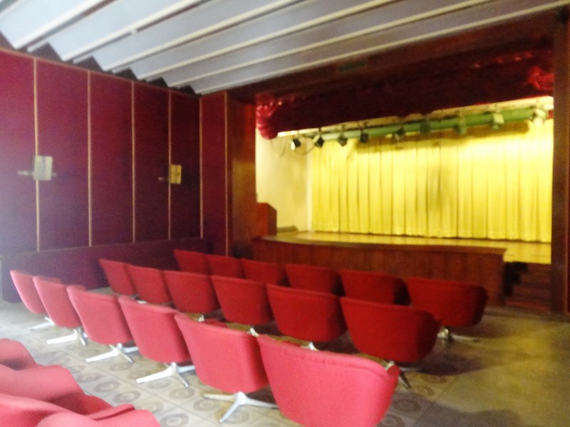
On the third floor is a shagadelic card-playing room , complete with a round leather banquette, a barrel-shaped bar, hubcap light fixtures and groovy three-legged chairs set around a flared-legged card table. There’s also a cinema and a rooftop nightclub, complete with a terrace with a heliport where a helicopter similar to that used for the evacuation of Pres. Thieu before the Viet Cong arrived is parked. From the balcony is a nice view of the surrounding park. The fourth floor, used for dancing, even had a casino.

First Lady's Reception Room

First Lady’s Reception Room

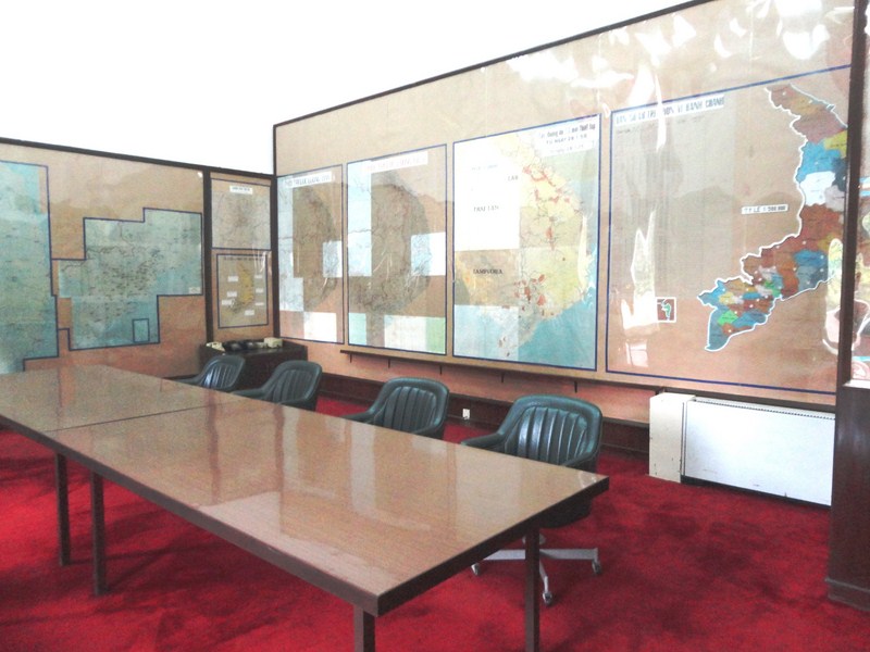
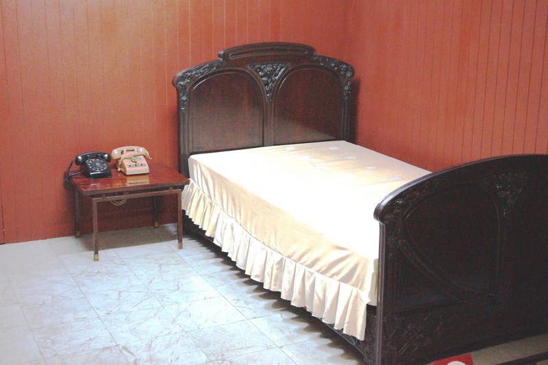
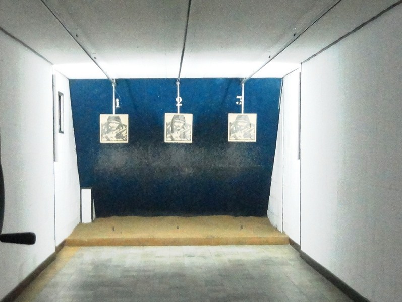
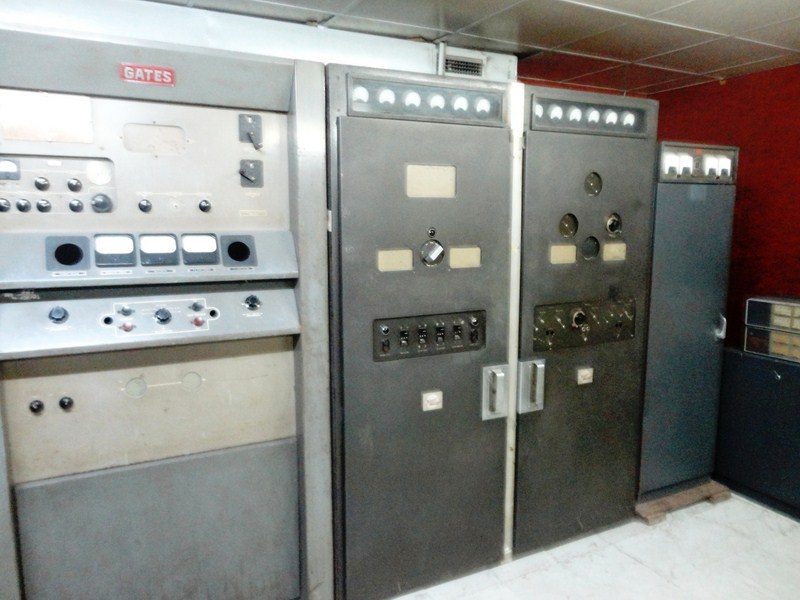
The most interesting part of this 4,500 sq. m. building is probably the eerie basement’s extensive command center which contains a network of tunnels, a telecommunication center, mobile radio section, a spare radio station, the President’s bedroom, a large kitchen, a shooting range and a war room, full of ancient 1960s and 1970s phones, radios and office equipment.

The Game Room

The Game Room

Cinema

Cinema

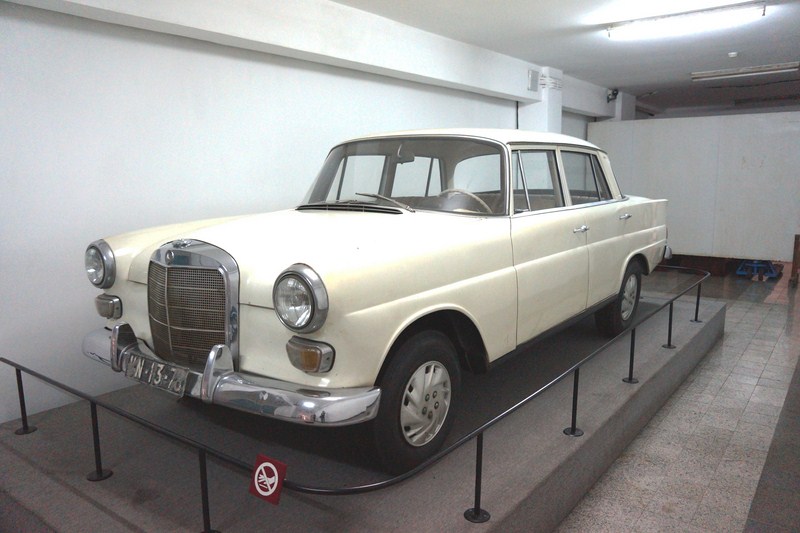
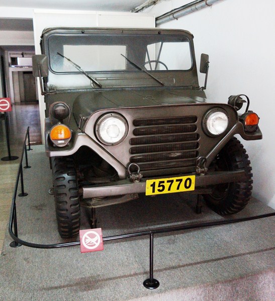
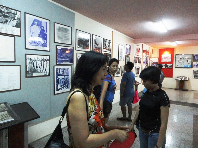
Also on display are a Mercedes Benz 200 W110 car and a XE Jeep M151A2, a gallery with historical pictures on the walls (including many photos of US soldiers and personnel making a mad dash for the departing helicopters during the Fall of Saigon) and the best map of Vietnam you’ll ever see pasted on the wall, all supposedly left exactly as it was found when the North took over.  It made me feel like I was on the set of “MASH.”

National Security Council Chamber

National Security Council Chamber

President's bunker bedroom

President’s bunker bedroom

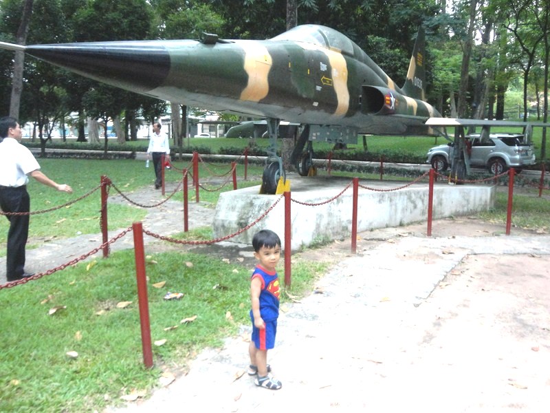
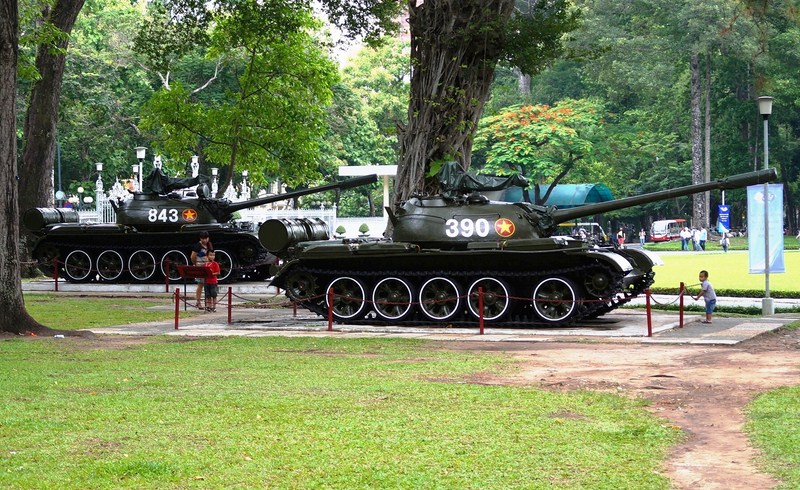
Outside, on the parade ground, is a F-5E fighter plane (similar to the one which bombed the palace on April 8, 1975) as well as a Russian-made T-54/55 tank (Tank 843) and a Chinese-made T-59 tank (Tank 390), both identical to the armored vehicles that broke through the palace gates.

Mercedes Benz 200 W110

Mercedes Benz 200 W110

XE Jeep M151A2

XE Jeep M151A2

The Reunification Palace may not be the most opulent of palaces but it is interesting to see because of its place in history. The very nice grounds, surrounded by immense lawns and high trees in its gardens, provide an airy and open atmosphere, a peaceful respite in the heart of a bustling area.

Target practice range

Target practice range

Photo gallery at the bunker

Photo gallery at the bunker

The eerie feeling of the empty hallways and the smell of damp air of the basement’s dark and forbidden, maze-like bunker system truly has a surrealistic quality to it. A time warp, it’s as if time has stood still since morning of April 30, 1975 (except for new gates).

Heliport.  The circle marks the spot where Nguyễn Thanh Trung bombs fell

Heliport. The circle marks the spot where Nguyễn Thanh Trung’s two bombs fell

1960s communication equipment at the bunker

1960s communication equipment at the bunker

Still, it is well worth the time to visit this section of the Reunification Palace, the real heart of it all. The cracked old furniture, fixtures and fittings are very kitsch and don’t feel out of place on the set of a 1960’s James Bond movie or even an Austin Powers film. This fantastic place, one of the best museums I have ever seen in my life, has to be visited for the history and architecture alone. A must see in HCMC.

Kyle in front of a F-5E Freedom Fighter

Kyle in front of a F-5E Freedom Fighter

T-54 Tank (Tank 843) and T-59 Tank (Tank 390)

T-54 Tank (Tank 843) and T-59 Tank (Tank 390)

Reunification Palace: 135 Nam Kỳ Khởi Nghĩa, Bến Thành, Quận 1, Hồ Chí Minh, Vietnam.  Tel:+84 8 3822 3652. Open daily (so long as official receptions or meetings aren’t taking place), 7:30AM to 11:30AM and 1 to 5PM. Admission: adult (VND15,000) and children (VND2,000). English- and French-speaking guides are on duty during opening hours (prices are ‘up to you’). Some rooms in the palace are available for hire for meeting and banquets.

Church of St. Francis Xavier (Ho Chi Minh City, Vietnam)

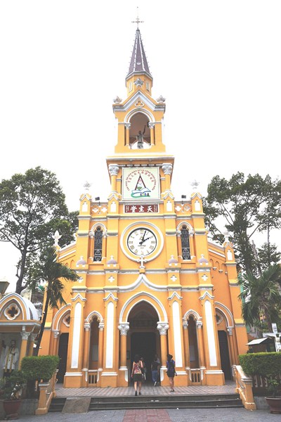
St. Francis Xavier Church

St. Francis Xavier Church

From Thien Hau Pagoda, we again boarded our van and proceeded to Church of St. Francis Xavier, one of the most popular attractions in Ho Chi Minh City. Located at the center of Cho Lon (Chinatown), this pleasing light-caramel and white painted church, built for the Chinese in Saigon, exudes a sleepy, tropical feel.

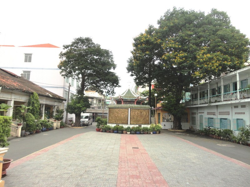
The spacious church compound

The spacious church compound

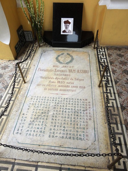
In 1898, Fr. François Xavier Tam Assou (1855–January 24,1934), a Chinese-born vicar apostolic (delegate of the pope) of Saigon, was sent to Cho Lon by the local bishop to take care of the city’s Chinese Christians. His first act was to build a church for them and construction of the church began on December 3, 1900, the Feast of St. Francis Xavier, when Lucien-Émile Mossard (October 24, 1851-February 12, 1920), Bishop of Saigon, placed the first stone for the church.

Tomb of Fr. François Xavier Tam Assou

Tomb of Fr. François Xavier Tam Assou

On January 10, 1902, the church was inaugurated and dedicated to St. Francis Xavier (whom Fr. Tam was named after). After that, Fr. Tam also built a school, a kindergarten, a boarding house, and houses for rent in the church. In 1990, the church steeple and the sanctuary were refurbished.

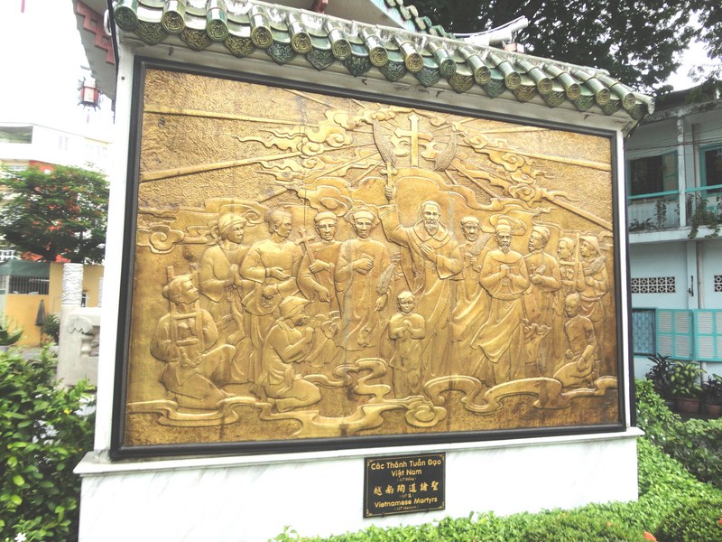
Plaque commemorating Vietnamese martyrs

Plaque commemorating Vietnamese martyrs

However, any discussion of this church’s history needs to include its darker side. On November 2, 1963, then South Vietnamese President Ngo Dinh Diem and his brother Ngo Dinh Nhu were seized inside this church.  They sought refuge here in a doomed effort to escape a coup attempt after fleeing the Presidential Palace (now the Reunification Palace) through a secret tunnel network.

When their efforts to contact loyal military officers (of whom there were almost none) failed, Diem and Nhu agreed to surrender unconditionally and revealed where they were hiding. Another version states that an informant recognized the brothers as they walked across the church’s courtyard on the morning of the 2nd. The coup leaders sent an M-113 armored personnel carrier to the church and, around 10 AM, the two were taken into custody while they were praying inside.

The plan was to transport them to the Vietnamese Joint General Staff Headquarters, then exile the brothers to a new country, far from Southeast Asia. However, before the vehicle reached central Saigon, the zealous and angry soldiers had killed Diem and Nhu by shooting them at point-blank range and then repeatedly stabbing their bodies. Diem was subsequently buried in an unmarked grave not far from the US ambassador’s residence. What followed was a political scandal, an attempted cover-up and an international investigation that ended with no one being prosecuted for the killings.

When news of the deaths was broadcast on radio, Saigon exploded with jubilation. Portraits of the two were torn up and political prisoners, many of whom had been tortured, were set free. The city’s nightclubs, which had closed because of the Ngos’ conservative Catholic beliefs, were reopened. Three weeks later the US president, John F. Kennedy, was assassinated. As his administration had supported the coup against Diem, some conspiracy theorists speculated that Diem’s family orchestrated Kennedy’s death in retaliation.

The church compound (which can be accessed even when the church is closed), covering a large area, offered a good space for us to stroll around. An interesting plaque here commemorates Vietnamese  martyrs. This Gothic-style church is somewhat unique in that it’s decorated with horizontal lacquer boards and wood panels with inscriptions much like the surrounding Chinese style temples.  Pretty red lanterns adorn the church walls.

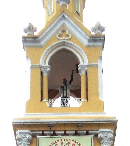
Statue of Fr. François Xavier Tam Assou at the church steeple

Statue of Fr. François Xavier Tam Assou at the church steeple

The centrally located, 38 m. high tower has a peculiar statue of Fr. Tam and his tomb is located at the entrance wall of the church. The church is often called Cha Tam (Father Tam) Church (Nha Tho Cha Tam).

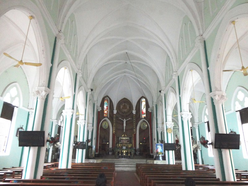
The rib vaulted church interior

The rib vaulted church interior

The mint green and white interior, with its rib vault ceiling, is decorated with images of the Stations of the Cross, while holy water is dispensed from huge clam shells. A pew in the church is marked with a small plaque identifying the spot where President Ngo Dinh Diem was seized.  Today, the church, one of Saigon’s more active, is far removed from the brutality of yesteryears and has a very active congregation of 3,000 ethnic Vietnamese and 2,000 ethnic Chinese parishioners.

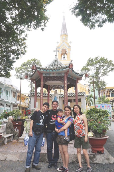
L-R: Jandy, the author, Kyle, Cheska and Grace

L-R: Jandy, the author, Kyle, Cheska and Grace

Cha Tam Church: 25 Học Lạc St.,  District 5, Hồ Chí Minh, Vietnam. Tel: +84 8 3856 0274. Open daily, 7 AM – 12 noon, 2 – 6 PM and 7 – 9 PM. Masses, in both Vietnamese and Chinese (Mandarin), are held daily.

Balete Pass Tourism Complex (Santa Fe, Nueva Vizcaya)

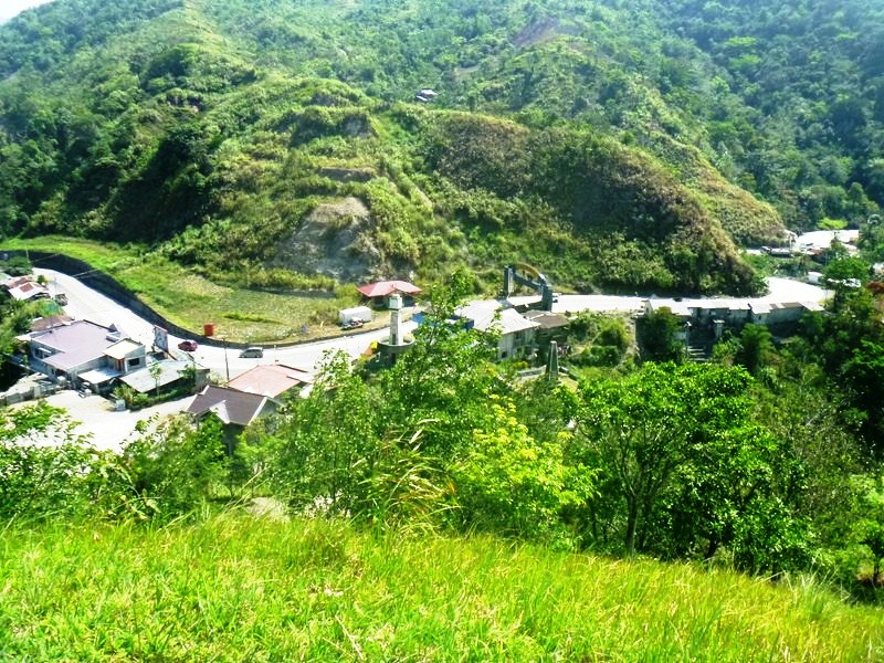
After breakfast at Mrs. Gaddi’s Restaurant and some pasalubong shopping, we all boarded our Toyota Grandia van for our 6-hour return trip to Manila.  Along the way, we made a stopover at Balete Pass Tourism Complex, near the Nueva VizcayaNueva Ecija border, driving all the way up to the view point at the summit which is around 3,000 ft. (910 m.) in elevation.

Balete Pass

Balete Pass

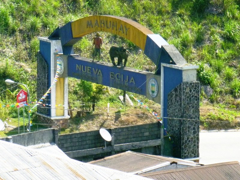
Nueva Ecija Welcome Arch

Nueva Ecija Welcome Arch

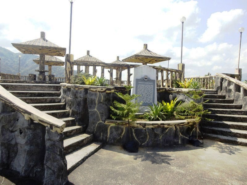
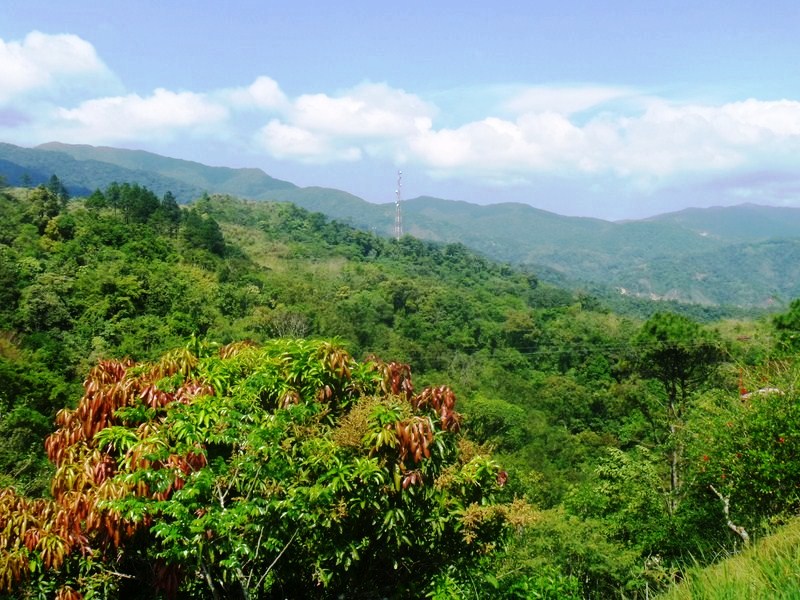
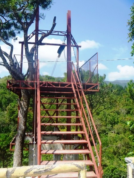
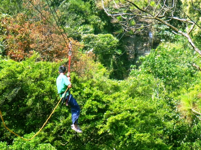
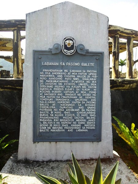
The viewpoint has a number of picnic sheds and a plaque installed by the National Historical Institute.  An 800 m. long  zipline facility, currently being built was, according to Mr. Regie Catalbas, the complex manager, to open in a few weeks time. At the view deck, we had panoramic views of the Caraballo Sur  and the Sierra Madre Mountain Ranges as well as the headlands of both the Cagayan River and the Pampanga Valleys.

Balete Pass Tourism Complex

Balete Pass Tourism Complex

Balete Pass, also called Dalton Pass, is a gateway to the Cagayan Valley, and the Ifugao Rice Terraces. The headwaters of the Digdig River originate just south of the pass. Balete Ridge starts two miles to the west-northwest of the pass, with a high point at the 5,580 ft. high Mt. Imugan and extends 9 miles to the east-southeast, where it ends at the 4,600 ft. high Mt. Kabuto.

View of Caraballo Sur and Sierra Madre Mountains

View of Caraballo Sur and Sierra Madre Mountains

Zipline platform

Zipline platform

Zipline dry run

Zipline dry run

The pass was the site of the “Battle of the Skies,” fought in 1945, between the pursuing 25th U.S. Army and Filipino guerillas (under the command of Maj.-Gen. Charles L. Mullins) and the Japanese 10th Division (under the command of  Lt.-Gen. Yasuyuki Okamoto), the rear guard of the Japanese Army retreating to the river mouth to the north.  About 7,750 Japanese soldiers, 285 Filipino guerillas and 685 Americans soldiers, including Brig.-Gen. James L. Dalton II (after whom the pass was initially named), the assistant division commander who died from a sniper’s bullet, were killed in the battle.  The Americans took the Balete area on May 31, 1945.

Plaque installed by National Historical Institute (NHI)

Plaque installed by National Historical Institute (NHI)

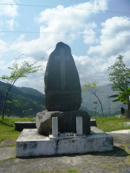
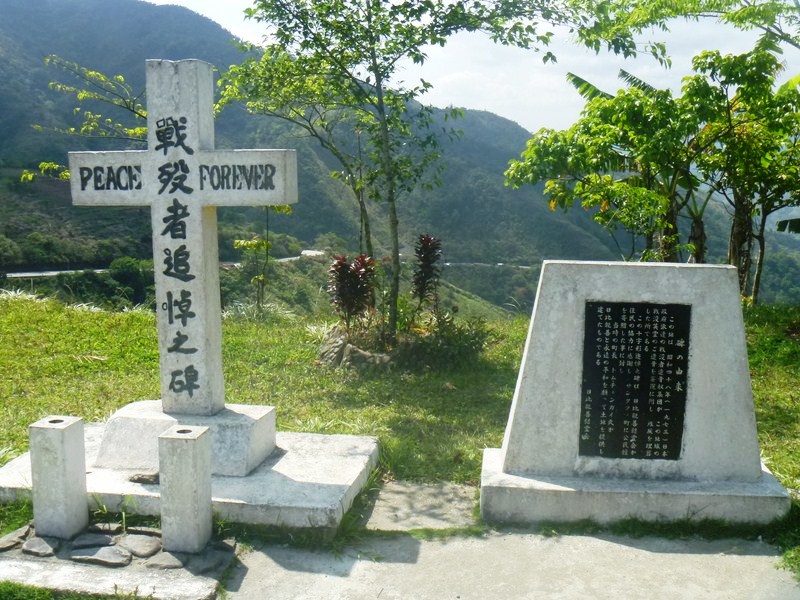
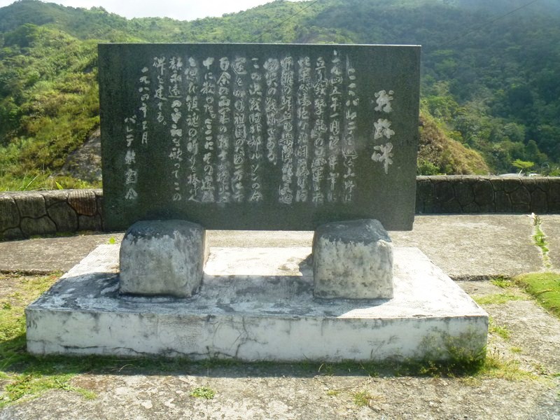
There are three memorials, representing 3 nationalities (American, Japanese and Chinese), at the site.  We passed by two of these shrines.  The first shrine we visited was the Japanese shrine and monument.  Established by families and fellow soldiers of the fallen, it has several plaques, engraved stones and a cross with the inscription “Peace forever.”

Japanese Shrine (1)

Japanese Shrine (2)

Japanese Shrine

Japanese Shrine

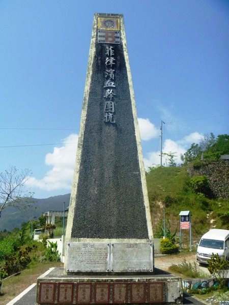
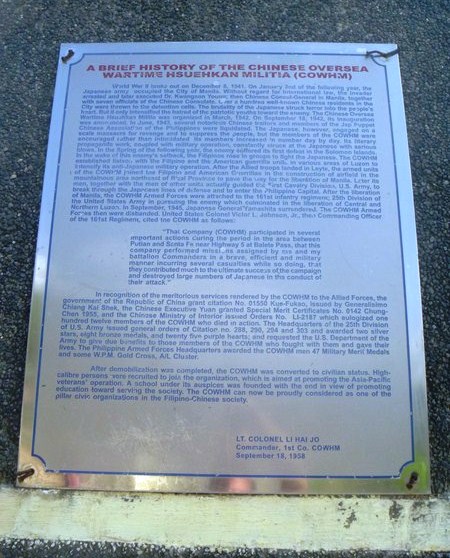
Just below the Japanese shrine is the Chinese shrine dedicated to the 8 Chinese Overseas Wartime Hsuehkan Militia (COWHM) soldiers ho died at Balete Pass, fighting with the Americans and Filipinos. The memorial has extensive text about the origins of the COWHM and a small marker plaque, dedicated on May 7, 2001, for each of the 8 soldiers who died.

Chinese Shrine

Chinese Shrine

The memorial plaque reads: “Dedicated to the memory of our 8 comrades-in-arms, who fought alongside Allied liberating army (25 Division, 161 Infantry) and paid the supreme sacrifice during mop-up operations in the summer of May 1945, against retreating Japanese forces at Santa Fe, Nueva Vizcaya. May their brave heroic efforts in fighting for freedom serve as a shinning model for all peace loving men and women for all times to come. Ex-Chinese Overseas Wartime Hsuekan Milita (EX-COWHM).”

Chinese Shrine plaque

Chinese Shrine plaque

The American shrine, the one shrine we didn’t visit, has a simple 12-ft. high obelisk and a bronze plaque at the base of the monument area that reads “Erected in honor of those soldiers of the 25th Division who sacrificed their lives in winning this desperate struggle.  In taking this pass 7,403 Japs counted killed. 2,365 US Army 25th Divison killed and wounded. May 13, 1945.”

Lookout tower for Region 2

Lookout tower for Region 2

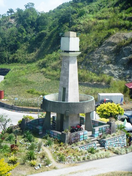
Behind it, just behind the memorial ridge line, is the small, unrelated DPWH/Perez Park, a memorial park with a lookout tower for Region 2, a 150 mm. Japanese howitzer and, directly behind the gun, the entrance to a large natural cave presumably used by the Japanese.

The Mansion (Baguio City, Benguet)

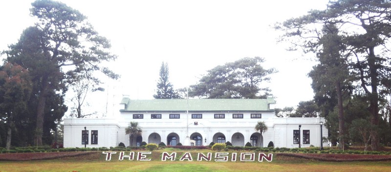
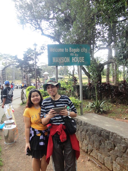
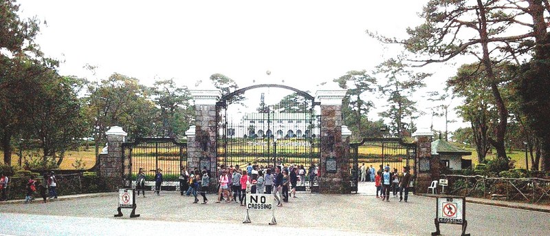
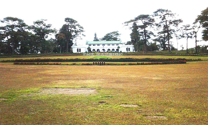
At the end of the Pool of Pines was The Mansion (formerly called the Mansion House), the Philippine president’s palatial official summer residence and, easily, one of the most visited and photographed landmarks of Baguio City.  Consisting of an elegantly designed, Spanish Colonial Revival-style main building and a guest house, it was designed by French-educated, New York based American architect William E. Parsons and started in 1907 to be the official summer residence of U.S. Governor-Generals.

The Mansion

The Mansion

The site selected was Outlook Point at the edge of the Pacdal Plateau.  Its name is derived from the New England summer ancestral home U.S. Governor-General William Cameron Forbes in the family-owned Naushon Island near the Massachusetts coast, under whose administration the original Mansion House was built. On March 21, 1908, at the onset of summer, the household of Governor-General James Francis Smith moved into the Mansion House. From March 19 to April 28, 1910, the meeting of the Second Philippine Legislature was held at the Mansion House.

Mansion House (24)

With the inauguration of the Philippine Commonwealth in 1935, the Mansion House, along with Malacañan Palace, was turned over to the Philippine president. The High Commissioner to the Philippines Paul V. McNutt, the successor to the Governor-General as the highest American official in the Philippines and representative of the United States Government, then built The American Residence, completed in 1940 at Camp John Hay.

Almira and Jandy along C.P. Romulo Drive

Almira and Jandy along C.P. Romulo Drive

During the Second World War, the Mansion House was badly damaged due to constant bombing and strafing but, in 1947, it was rebuilt at a cost of PhP80,000 and improved, with additional guest rooms and conference rooms constructed. Since then, it has served as the holiday home and working office for each President of the Philippines during his or her visits to Baguio City.

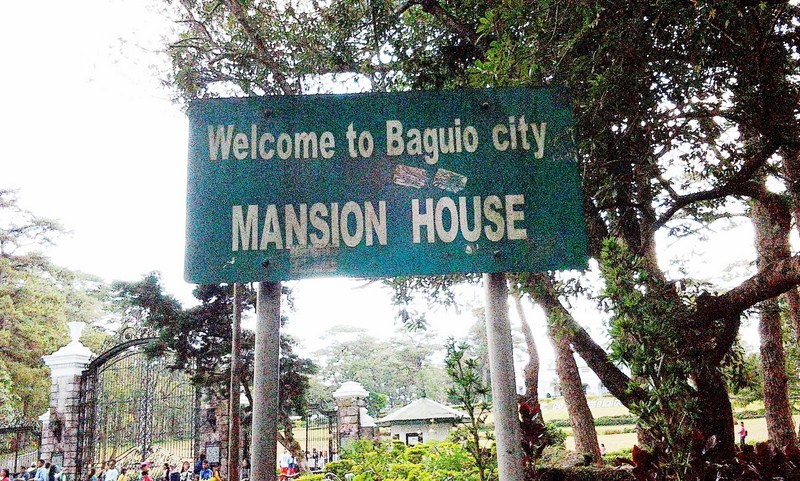
The tall and ornate iron gates of The Mansion

The tall and ornate iron gates of The Mansion

The Mansion House was also used as the venue of important events. In 1947, it served as the seat of the second session of of the United Nations Economic Commission for Asia and the Far East (ECAFE). The next year, it was the site of the second session of the Food and Agriculture Organization (FAO) and, in 1950, the first meeting of the Southeast Asian Union (SEAU), more commonly known as the Baguio Conference of 1950, was conceived and convened by President Elpidio Quirino.

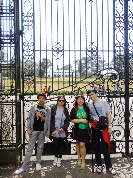
Albert, Melissa, Almira and Jandy posing in front of the gate

Albert, Melissa, Almira and Jandy posing in front of the gate

Parts of the Mansion House are open to tourists. As always, there were lots of tourists taking turns posing in front of its tall and ornate, main gate, still one of the most photographed sections of the property. Made of ornate ironwork, the front gate was earlier falsely reported as a replica of one of the main gates at Buckingham Palace in London. A contingent of Philippine Marines maintains the security of this large compound and we saw some of them manning the guardhouse at the vicinity of the entry gate.

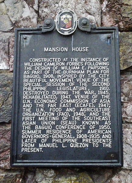
The plaque, in English, installed by the National Historical Institute

The plaque, in English, installed by the National Historical Institute

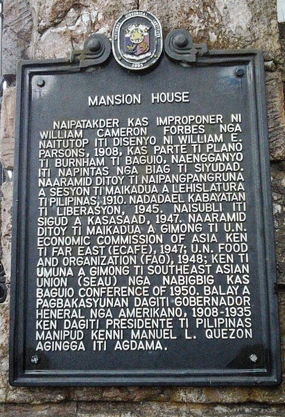
Mounted on the gate posts are 2 historical markers unveiled by President Gloria Macapagal-Arroyo and the National Historical Institute (now the National Historical Commission of the Philippineson December 30, 2008 (the centenary of the Mansion House), one in English and the other containing the text translated in Filipino, both detailing the structure’s history.  On January 16, 2009, the board of the National Historical Institute, through Resolution No. 1, s. 2009, declared the Mansion House as a National Historical Landmark.

The NHI plaque, this time in Tagalog

The NHI plaque, this time in Tagalog

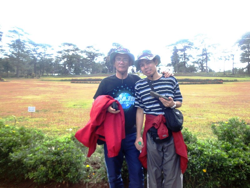
Some official government vehicles entered the compound by passing through a great circular driveway. Within the compound and adjacent to the Mansion is a two-story building which serves as the official residence of the Philippine President. Nearby is a small amphitheater. As the President was not in residence, Jandy, Almira, Albert, Melissa and I, as well as other tourists, were allowed to enter a little past the gates, posing in front of its beautiful gardens and well-manicured lawn, also a favorite site for sightseeing and picture taking.

The author and Jandy

The author and Jandy

Tourists can also visit the Mansion House’s museum, a branch museum of  the Malacañang Museum (now the Presidential Museum and Libraryestablished on May 18, 2010 by virtue of Executive Order No. 880.  The museum  houses presidential memorabilia and works of art collected over its years by former presidents.

The beautiful gardens and well-manicured lawn of The Mansion

The beautiful gardens and well-manicured lawn of The Mansion

The Mansion: C.P. Romulo Drive (formerly a part of Leonard Wood Rd.), 2600 Baguio City, Benguet.

A Walking Tour of Shota Rustaveli Avenue (Tbilisi, Georgia)

Shota Rustaveli Avenue

Shota Rustaveli Avenue

Shota Rustaveli Avenue, the central avenue in Tbilisi formerly known as Golovin Street, was built in the 19th century when M. S. Vorontsov was ruler of Georgia, was divided into two parts – Palace Street and the Golovin Avenue. In 1918, it named after medieval  Georgian poet Shota Rustaveli, author of the immortal poem “The Knight in the Panther’s Skin.”

The author (in blue jacket) walking among sea of Georgians all in dark-colored jackets

The author (in blue jacket) walking among a sea of Georgians, all in dark-colored jackets and overcoats (photo: Ms. Riva Galveztan)

A popular place for walking, I strolled along Rustaveli to soak up the bustling, cosmopolitan atmosphere of Tbilisi’s main thoroughfare which is lined with Oriental plane trees  (Platanus orientalis) and strung with a handsome mix of modern and 20th-century architecture, with a contrasting European/Russian (Neo-Classical) look, such as important governmental, public, cultural, and business buildings as well as various cafes, shops, restaurants and other entertainment places.

Oriental plane trees lining the sidewalks

Oriental plane trees lining the sidewalks

This fine, stately avenue, which leads off to the northwest, is one of the best architectural and tourist centers of Tbilisi.  However, it is spoilt by the amount of traffic roaring up and down it these days. There are a number of pedestrian underpasses, but people here also cross the road with great nonchalance, waiting on the centre line until there’s a gap.

Freedom Square

Freedom Square

Rustaveli Avenue (Rustavelis Gamziri in Georgian or Rustaveli Prospekt in Russian) starts at Freedom Square and extends for about 1.5 kms. before it turns into an extension of Kostavas Kucha (Kostava Street).  Also branching out from this square are five other streets – Pushkin Street, Leselidze Street, Shalva Dadiani Street, Galaktion Street, and Leonidze Street. At its far end is the Freedom Square Metro Station at Rustaveli 6 where I alighted and started my stroll.

Bronze statue of St. George slaying the Dragon

Bronze statue of St. George slaying the Dragon (photo: Ms. Riva Galveztan)

Freedom Square, first called Yerevan Square was, later in the Soviet period, renamed after Lavrentiy Pavlovich Beria and then after Vladimir Lenin. In the center of Freedom Square (once occupied by a monument to Lenin which was symbolically torn down in August 1991) is the Monument of Freedom and Victory, a fountain with a very tall 40 m. high column topped by a bronze statue of St. George slaying the Dragon, a gift, unveiled on November 23, 2006, of famous Georgian sculptor Zurab Tsereteli to his native city.

Tbilisi Sakrebulo (City Assembly)

Tbilisi Sakrebulo (City Assembly)

The entire southern line of the square is occupied by the main Pseudo Moorish-style facade of Tbilisi Sakrebulo (City Assembly), a former town council building built in 1880 by German architect Peter Stern.  Its third storey, with a clock tower, was built between 1910 and 1912. This attractive building, with stripes of sandy green and white and mauresque stucco, now houses, at the eastern side of the ground floor, a well- equipped tourist information office, with plenty of free booklets, maps and helpful English-speaking staff, plus outlets of Burberry, Chronograph and Chopard.

Tbilisi National Youth Palace

Tbilisi National Youth Palace

The Tbilisi National Youth Palace, erected n 1802, was rebuilt many times, the last time from 1865-1868 when the building was enlarged by architect O. Simenson who added an arcade in front. From 1844 to 1917, the building was the residence of the Russian vice-regent in the Caucasus.  On May 26, 1918, during the meeting of the Transcaucasian Seim, the Georgian delegation left the hall and, in the adjacent White Hall, proclaimed Georgia a sovereign country.

Plaque commemorating the May 26, 1918 declaration of state independence

Plaque commemorating the May 26, 1918 declaration of state independence

At one time, Josef Stalin installed his mother here.  On May 2, 1941, during the Soviet period, it served as the Pioneers’ Palace, housing the Soviet youth organization and a Museum of Children’s Toys. Still used for youth activities, it is the best place to find classes and displays of Georgian folk dance and the like.  Around the palace is a well-kept garden, the back part of which faces Ingorokva Street. Aleksey Yermolov, the former Caucasian commander-in-chief, paid special attention to this garden, planting two large plane trees. In the past, the garden belonged to a princess of the Orbeliani family.

Old Parliarment Building

Old Parliarment Building (photo: Ms. Riva Galveztan)

Beyond the National Youth Palace is the Parliament Building, easily the most dominating building along Rustaveli Avenue.  Designed by architects Victor Kokorin and Giorgi Lezhava, it was built as a U-shaped block in 1938 (on the site of the Alexander Nevsky Cathedral, built in the 19th century for the Russian army), it’s very solid portico of tuff was built by German prisoners-of- war and the building was opened in 1953. Its 16 columns symbolize the 16 Soviet republics.

National Gallery

National Picture Gallery

The National Picture Gallery (Blue Gallery), built in 1885,  was erected by the German architect Zalzman as the “Temple of Glory” to commemorate the victory of the Russian troops over the Persians. The trophy cannons recaptured from the Persian army, stood in front of the building in the last century.

School No. 1

School No. 1

Immediately beyond the Parliament Building is the High School No. 1, founded in 1802 as the first European-style high school in Transcaucasia.  It educated many of the leading figures of recent Georgian history, including Merab Kostava, Zviad Gamsakhurdia, Tengiz Sigua and Tengiz Kitovani.

Plaque commemorating the March 9, 1956 massacre at the former Communications Building

Plaque commemorating the March 9, 1956 massacre at the former Communications Building

A good example of Russian Neo-Classicism, it has statues of Ilia Chavchavadze and Akaki Tsereteli (1958) in front.  It houses the Museum of Education. A plaque here commemorates those killed by the Soviet security forces on March 9, 1956.

Tblisi Marriot Hotel

Tblisi Marriot Hotel

Past the school, Rustaveli Avenue bends to the left and I found myself in front of the Tbilisi Marriott Hotel (No. 13), one of the massive constructions of the 20th century.  Elegantly emphasizing the avenue’s bend, this building, opposite the Ministry of Transport and Communications, was designed by ethnic Armenian architect Gavriil Ter-Mikelov in 1915 as the Hotel Majestic.

Lobby of the Tblisi Marriot Hotel

Lobby of the Tblisi Marriot Hotel (photo: Ms. Riva Galveztan)

Later, it was renamed as Hotel Tbilisi.  During the 1991-1992 Civil War, the hotel was burned and was later restored and reopened in 2002 as the luxurious Marriott Hotel.

Rustaveli State Academic Theater

Rustaveli State Academic Theater

Next to the hotel is the famous, splendid Rustaveli State Academic Theater (No. 17), one of the most beautiful buildings along the avenue. Designed by architects K. Tatishev and Alexandre Shimkevich in the French Neo-Classical style from 1899 to 1901, in the past it housed the Actors’ Society Club.

Rustaveli State Academic Theater - facade detail

Rustaveli State Academic Theater – facade detail

Its ornate architecture involves the forms and motives of the Late Baroque Period, with mirror windows and a large portal. The theater was refurbished from 1920 to 1921, for the new Rustaveli Theatre Company, and was refurbished again from 2002 to 2005. Since 1921, the theater has carried the name of Shota Rustaveli, Georgia’s national poet.  In 2006, a Hollywood-style “Walk of the Stars” was begun in front.

Rustaveli State Academic Theater - facade detail

Rustaveli State Academic Theater – facade detail

It now houses a first-class theater, a large concert hall, a large and small ballroom, a small foyer, marble staircases, classical statues and a number of big and small rooms for the Actors’ Society Club. It has three stages – a main stage (about 800 seats), a smaller stage (300 seats) and a Black Box Theater (182 seats) for experimental performances. The Kimerioni (Chimera) Cafe-Bar, at the lower floor of the theater, has  frescoes  painted in 1919 by prominent Georgian painters Lado Gudiashvili and  David Kakabadze, theater set designer Serge Sudeikin as well as Sigizmund Valishevski (he was called Ziga in Tbilisi) and Moise and Iracly Toidze.  Nearby is the Theatrical Institute.

Opera and Ballet Theater

Paliashvili Opera and Ballet Theater

Not far from the Rustaveli State Academic Theater, along the north side of Rustaveli, is the elegant Paliashvili Opera and Ballet Theater (No. 25).   Formerly the Public Theater, it was first built in 1851 but burned down on October 11, 1874.  The present Moorish-Eastern style building was designed by architect Viktor Schroter and built from 1880 to 1896.

Z.Paliashvili Opera and Ballet Theatre

Z.Paliashvili Opera and Ballet Theater – intricate molding

In 1937, the theater was renamed in honor of Zakaria Paliashvili, one of Georgia’s greatest composers. It too burned down in 1973 but was rebuilt in 1977. Its towers, arches, turrets, stained glass windows, ornaments and intricate molding at the front entrance were all laboriously and meticulously made with special care.

Z.Paliashvili Opera and Ballet Theater - window ornamentation

Z.Paliashvili Opera and Ballet Theater – window ornamentation

The theater hosted, at different times, opera singers such as Fedor Shaliapin (who said “I was born twice: for life – in Kazan, for music – in Tbilisi”), Sergei Lemeshev, Vano Sarajishvili, Zurab Sotkilava, Paata Burchuladze, Jose Carreras and  Montserrat Caballe; and ballet dancer Vakhtang Chabukiani.

Kempinski Hotel

Kempinski Hotel

Nearing the end of Rustaveli Avenue, I espied another monumental building – the former Georgian branch of Marxism-Leninism Institute. Designed by architect A. Shukin and built in 1938, its frieze is decorated with bas reliefs made by Iakob Nikoladze. Since 1993, the Constitutional Court has had its sittings there. Today, it is now home to a 200-room hotel, 50 apartments and 8 penthouses designed by Alexey Shuyev and managed by Kempinski Hotels. The new building, incorporating the historic main façade, features a domed hotel lobby and an octagonal courtyard.

Georgian National Academy of Sciences Building

Georgian National Academy of Sciences Building

Just at the end of Rustaveli is the Georgian National Academy of Sciences, a pompous building designed by architects K. Chkheidze and M. Chkhikvadze in 1953.  It has a beautiful, low Italian-style colonnade; a solemn, angular tower revetted with Bolnisi tuff.

Tower of the Georgian National Academy of Sciences Building

Tower of the Georgian National Academy of Sciences Building

Between its columns is a through arcade where you can go to the lower station (which has an oval design) of the cableway leading to the upper plateau of Mtatsminda. On the steps of the academy artists and craftsmen sell their works.

Statue of Shota Rustaveli

Statue of Shota Rustaveli

My walking tour of Rustaveli Avenue was completed upon reaching the monument to the poet Shota Rustaveli, made by a sculptor K. Merabishvili.

David Gareja (Udabno, Georgia)

(All photos courtesy of Ms. Riva Galveztan)

After finishing our GNTA-sponsored tour of the Georgian countryside the day before, Riva and I again hired our trusted Georgian guide Sopho Makashvili to again tour us, this time to David Gareja (sometimes spelled Davit Gareja), the rock-hewn Georgian Orthodox monastery complex located in the Kakheti region of Eastern Georgia, After breakfast, the next day, we again met up with Sopho at Meidan Square and all three of us boarded the Mercedes Benz Vito panel van of our driver Giorgi.

David Gareja

David Gareja

The complex was founded in the 6th century by St. David Garejeli (who came with pupil Luciane), one of the Thirteen Assyrian monks from Mesopotamia who arrived in Georgia at the same time to strengthen Christianity. Many monasteries in modern Georgia are named after the Assyrian Fathers. David was drawn to the desolation and purity of Kakheti. Luciane and Dodo, another of David disciples, expanded the original Lavra monastery and also founded two other monasteries – Dodo’s Rka (literally, “the Horn of Dodo”) and Natlismtsemeli (“the Baptist“).

Lavra Monastery

Lavra Monastery

Under the guidance of the 9th-century Georgian saint Ilarion, the monastery also saw further development.  Its convent was particularly patronized by the Georgian royal and noble families.  After he abdicated the throne, the 12th-century Georgian king Demetre I (the author of the famous Georgian hymn Thou Art a Vineyard) chose David Gareja as a place of his confinement.

Tomb of David Garejeli

Tomb of David Garejeli

For many centuries, despite its harsh environment, the monastery remained an important center of religious and cultural activity and, at certain periods, it owned extensive agricultural lands and many villages.  The renaissance of fresco painting chronologically coincides with the general development of the life in the monasteries. From the late 11th to the early 13th centuries, the economic and cultural development of David Gareja reached its highest phase, with new monasteries (Udabno, Bertubani and Chichkhituri) being built and old ones being enlarged and reorganized.

The refectory of Udabno Monastery

The refectory of Udabno Monastery

With the downfall of the Georgian monarchy, the monastery suffered a lengthy period of decline. In 1265, it was devastated by the Mongol army.  Later restored in the early 14th century by Giorgi V the Brilliant, it was sacked by Timur and survived the Safavid Persian attack of Shah Abbas I on Easter night of 1615 when over 6,000 monks were massacred and the monastery’s unique manuscripts and important works of Georgian art were destroyed.  The monastery was resurrected under Onopre Machutadze, who was appointed Father Superior of David Gareja in 1690.
The frescoes of David Gareja

The frescoes of David Gareja

After the violent Bolshevik takeover of Georgia in 1921, the monastery was closed down and remained uninhabited. In the years of the Soviet War in Afghanistan, the monastery’s territory was used as a training ground and military firing range for the Soviet army because of its supposed resemblance to the hills of the Afghan war zone. As a result, it inflicted damage to the unique cycle of murals in the monastery. After the restoration of Georgia’s independence in 1991, the monastery life in David Gareja was revived. The monastery remains active today and serves as a popular destination of tourism and pilgrimage.
Grafitti and shelling damage

Wall murals pockmarked by shelling

There are two options to get to this isolated and once restricted area – either via Sagarejo (with a road in an acceptable state) or via Rustavi.  We went there via the latter. From Tbilisi, we were driven southeast, to the half-desert slopes of 2,432 m. (7,979 ft.) high Mt. Gareja, passing by Udabno, a village inhabited by 200 families, mostly Svans who moved here in the beginning of  the 1990s because of an ecological disaster.  The silence here feels inherent, with a lot of the concrete houses empty and their doors broken. The village’s Oasis Club Restaurant, a watering hole frequented by visitors, was closed for the winter.

The village of Udabno

The village of Udabno

The road we travelled on was in a very bad state, washed out to bare rock in some places, but easily traversed by 4-wheel drive vehicles.  It goes through a vast and bleak, semi-arid but very dramatic landscape of scrub grasslands and hills occasionally interspersed with salt lakes (a refuge for migratory birds), truly one of the most memorable places I have ever visited.

A pair of saltwater lakes along the dirt road

A pair of saltwater lakes along the dirt road

There’s not much living here in this stretching steppe besides birds of prey and the rare lone shepherd tending his flock of sheep. I imagined, at one point several thousand years ago, it must have been covered in forest before early man chopped the trees down in search of iron ore and wood, forever changing its micro climate.

Grazing sheep

Grazing sheep

After some 60–70 kms. and 2 hours of driving, we finally arrived at David Gareja.  It snowed the day before, but it was sunny during our visit.  Still, blustery winds made it seemed we were in sub-zero temperatures.  The complex consists of hundreds of hermit cells, churches, chapels, refectories and living quarters hollowed out of the rock face.  It has been subject to a border dispute between Georgia and Azerbaijan.

The author at David Gareja

The author at David Gareja

Part of the complex is located in the Agstafa Rayon of Azerbaijan with a border fence literally built into the hillside. The area is also home to protected animal species and evidence of some of the oldest human habitations in the region. David Gareja is actually named for 12 monasteries in the immediate area but we were to only visit the monasteries of Davit Lavra (the only inhabited one today) and Udabno.

The modest interior of Lavra Monastery's chapel

The modest interior of Lavra Monastery’s chapel

Our van was parked in a small lot in front of the fully functional main monastery of Lavra which has undergone substantial renovation.  Sopho, Riva and I were accompanied by Giorgi.  Here, we visited most of its rooms.  The rooms not allowed for tourists are clearly marked with “no entrance” signs, in both English and Georgian.  Inside the church we saw the tomb of St. David Garejeli. Outside the monastery is dry rock in reds, yellows and even pale blues stretching across the landscape.

Hiking to Udabno Monastery

Hiking to Udabno Monastery

The trail leading to the second monastery of Udabno (meaning “desert” or “wilderness” in English), high up on a bluff on the other side of the hill, was rather very steep, uneven and difficult, involving some scrambling over loose dirt and rocks in places. Luckily, I wore good and comfortable hiking shoes as well as brought my trekking pole (actually a monopod). Spraining your ankle would be really bad news here. The tough but manageable hike up took over an hour.

Remains of an uncompleted Soviet-era monorail

Remains of an uncompleted Soviet-era monorail

During our hike, we were joined by newly-arrived Polish couple Adrian Siesicki and Katarzyna Siesicka who hired a taxi to get to David Gareja.  Along the way, we passed what remains of an uncompleted monorail started during Soviet times to carry passengers all the way up to the caves on the southern side.  After zigzaging up the bottom half of the hill, our trail more or less followed the monorail’s line. Once on top, we had a wonderful view towards both Georgia and Azerbaijan, a vast valley 300 m. below that stretches away for miles. The view from here was worth the climb alone.

The Georgian side

The Georgian side

The Azerbaijan side

The Azerbaijan side

On our way back, we saw many of the troglodyte churches of Udabno Monastery consisting of numerous caves carved into the rock, beside which are sheer unguarded drops. There are no guardrails. Some are more destroyed than others but still contain traces of faded frescoes depicting angels, apostles, etc. from the 11th to 14th centuries, some just a few feet within cave walls.

A fresco-adorned niche

A fresco-adorned niche

Frescoe of an angel

Fresco of an angel

Some are even found on exterior surfaces. The old monk’s refectory has a strangely carved rock along the floor that was once a low table.  The wall above has a 10th century depiction of The Last Supper.

The strangely carved low rock table at the refectory

The strangely carved low rock table at the refectory

Frescoe of The Last Supper

Fresco of The Last Supper

The descent provided us with great views of the surrounding landscape.  Along the way, we passed by “David’s Tears,” the only spring in the area.  This system of crevices, a unique hydro technical system used to collect the maximum amount of water during periods of rain (only 20-30 liters of water can be collected diurnally), was cut by the monks across sheets of rock on a steep mountain slope.

Davids Tears

The system of crevices at David’s Tears

The high artistic skill of David Gareja’s frescoes (a celebrated Georgian school of fresco painting and manuscript illustration flourished here), an indispensable part of world treasure, has undergone nearly a thousand years of noticeable graffiti which has, together with erosion due to wind and sand and Russian artillery fire, taken its toll on some of the images which are unprotected by doors and open to the elements.

Grafitti on the walls

Grafitti on the walls

The story of how the monks came to live here is really fascinating and the great thing about the hauntingly historic, simple but charming David Gareja complex is that there has been little or no attempt to exploit it for tourism. What we saw was raw Nature without virtually any kind of facilities, thereby enjoying the peace, quiet, and remoteness of the place. It further proves my point – if you want to see amazing places with very few other tourists around, come to Georgia. According to a long held belief, they say that visiting David Gareja three times is equal to a pilgrimage to Jerusalem.  In that case, I am already a third of the way to the Holy City.

The author, Riva, Kasha, Adrian and Sopho

The author, Riva, Kasha, Adrian and Sopho

David Gareja: Mt. Gareja, Udabno, Georgia. During the hot season, bring lots of water and beware of red, blunt-nosed poisonous vipers. Public toilets (a small house with a red roof), some 100 m. before the entrance, are very basic. The lunar, semi-desert landscape turns green and blooms with flowers in early summer.

The Mercedes-Benz Vito panel van we used

The Mercedes-Benz Vito panel van we used

How To Get There: From April 14 to October 15, there is an inexpensive (25 GEL) daily tour, via a direct marshrutka (shuttle bus) of Gareji Line, going from and back to Tbilisi.

Qatar Airways has daily flights from Diosdado Macapagal International Airport (Clark, Pampanga) to Tbilisi (Republic of Georgia) with stopovers at Hamad International Airport (Doha, Qatar, 15 hrs.) and Heydar Aliyev International Airport (Baku, Azerbaijan, 1 hr.). Website: www.qatarairways.com.

Uplistsikhe Cave Complex (Georgia)

We were already through with the first day of our 3-day GNTA-sponsored tour of the Georgia countryside, our last destination being the Stalin State Museum in Gori.  We still had a lot of daylight left, so we decided to continue on to the ancient, rock-hewn and now abandoned town of Uplistsikhe (literally meaning “the lord’s fortress”), located in Shida Kartli, a suburb just 14 kms. (a 20-min. drive) east of Gori.

Uplistsikhe Cave Complex

Uplistsikhe Cave Complex

Uplistsikhe is remarkable for the unique combination of various styles from rock-cut cultures of the region, most notably from Cappadocia in Anatolia (now modern Turkey) and Northern Iran, and the co-existence of pagan and Christian architecture. Built on the high rocky sandstone massif along the left bank of the Mtkvari River, the area was identified by archaeologists as one of the oldest urban settlements in Georgia, containing various structures dating from its founding in the Late Bronze Age (around 1,000 BC) to the Late Middle Ages (13th century AD). Its natural sandstone rock easily lent itself to various kinds of treatment, making it possible to create complex decorative compositions.

The Mtkvari River

The Mtkvari River

Strategically located in the heartland of ancient kingdom of Kartli (or Iberia as it was known to the Classical authors), the town’s age and importance as a major political and religious center of the country (between the 6th century BC and the 11th century AD) led medieval Georgian written tradition to ascribe its foundation to the mythical Uplos, son of Mtskhetos, and grandson of Kartlos.

The tourist complex

The tourist complex

Early in the 4th century, with the Christianization of Kartli, Uplistsikhe seems to have declined in its importance, losing its position to Mtskheta and, later, to Tbilisi, new centers of Christian culture. During the Muslim conquest of Tbilisi in the 8th and 9th century, Uplistsikhe reemerged as a principal Georgian stronghold, becoming the residence of the kings of Kartli, during which the town grew to a size of around 20,000 people and evolved into an important caravan trading post along the Silk Road.  However, a Mongol raid in 1240 destroyed large parts of the town, marking the ultimate eclipse of the town.  It was virtually abandoned and, only occasionally, in times of foreign intrusions, used as a temporary shelter.

The start of our hike

The start of our hike

The approximately 4-hectare Uplistsikhe complex, tentatively divided into 3 parts, consists of a south (lower), middle (the largest) and north (upper) part. The middle part, containing the bulk of Uplistsikhe’s rock-cut structures, is connected to the southern part via a narrow rock-cut pass and a tunnel. Narrow alleys and, sometimes, staircases radiate from the central “street” to the different structures.

The Theateron (Theater)

The Theateron (Theater)

The ornate ceiling carved with octagonal Roman-style designs

The ornate ceiling carved with octagonal Roman-style designs

Most of the caves are devoid of any decorations. However, some of the larger structures have coffered, tunnel-vaulted ceilings, with stone carved in imitation of logs, as well as niches, which may have been used for ceremonial purposes, in the back or sides. Archaeological excavations in the area since 1957 (when only the tops of a few caves were visible) have uncovered numerous artifacts from different periods, many of which are in the safekeeping of the National Museum in Tbilisi.  Most of the unearthed artifacts include gold, silver and bronze jewelry, plus samples of ceramics and sculptures.

Sopho and Pancho performing "Romeo and Juliet" at the Theateron

Sopho and Pancho performing “Romeo and Juliet” at the Theateron

The earthquake in 1920 completely destroyed several parts of the most vulnerable areas and the stability of the monument remains under substantial threat, prompting the Fund of Cultural Heritage of Georgia, a joint project of the World Bank and Government of Georgia, to launch a limited program of conservation in 2000. Since 2007, the Uplistsikhe cave complex has been on the tentative list for inclusion into the UNESCO World Heritage program. Originally, the city had about 700 caves but, today, only 150 remain.

Round pits thought to have been used for corn storage or for sacrificial purposes

Round pits thought to have been used for corn storage or for sacrificial purposes

We all arrived at Uplistsikhe at around 4 PM, paid the entrance fee and started our 2-hour exploration of the 40,000 sq. m. Shida Qalaqi (“Inner City”), which is less than half of the original whole, by hiking about 5 m. up the rocks (opposite the toilets and cafe at the entrance), then following the rock-cut path to the left. Steps, with metal railings, lead us up through what was the main gateTo the right, sitting under a corrugated roof, is the excavated main tower of the Shida Qalaqi’s defensive walls.

Tadpole-shaped pits that may have been ovens for baking bread

Tadpole-shaped pits that may have been ovens for baking bread

We observed many round pits dug in rock, thought to have been used for corn storage or for sacrificial purposes, while tadpole-shaped pits may have been ovens used for baking bread.  Scattered throughout the city are narrow circular holes, of different depths, cut in the ground to hold several prisoners.

Inspecting a wine cellar

Inspecting a wine cellar

We also noticed a wine cellar, a pool for water storage and a wine press where grapes are crushed, allowing the juice to run down a chute into another container.  During the hike, we made short stops in between to admire the beautiful view of the river and the whole surroundings.

A wine press

A wine press

Ahead of us, overlooking the Mtkvari River, is the Theateron (Theater), probably a temple from the 1st or 2nd century AD where religious mystery plays may have been performed.  This cave has a pointed arch, carved in the rock above it, and an ornate, tunnel-vaulted ceiling carved with octagonal Roman-style designs resembling three-dimensional plaster work.  Behind the stage are dressing rooms.

The Temple of Makvliani

The Temple of Makvliani

Returning towards the main gate, we turned left to wind your way up the main street. Down to the right is the large pre-Christian Temple of MakvlianiWith an inner recess behind an arched portico, the open hall in front has stone seats for priests.

Tamaris Darbazi (Hall of Queen Tamar)

Tamaris Darbazi (Hall of Queen Tamar)

A little further up, on the left, is the big hall known as Tamaris Darbazi (Hall of Queen Tamar), almost certainly a pagan temple (though Georgia’s great Christian Queen Tamar may have used it later).  Behind two columns cut from the rock is a stone seat dating from antiquity. The hall has loggias on three sides.  The ribbed stone ceiling, cut to look like wooden beams, has a hole to let smoke out and light in. An open area, to its left, has stone niches along one side, thought to have once been a pharmacy or dovecote. To the right of Tamaris Darbazi is a large cave building, probably a pagan sun temple used for animal sacrifices and, later, converted into a 3-naved Christian basilica.

The 3-naved Christian basilica

The 3-naved Christian basilica

Near the summit of the hill is the Uplistsulis Eklesia (Prince’s Church), a picturesque triple-church Christian basilica built with stone and brick in the 9th -10th centuries over what was probably Upliistsikhe’s most important pagan temple. Inside the simple interior are some candlelit icons but no frescoes (they have been whitewashed).

Uplistsulis Eklesia (Prince’s Church)

Uplistsulis Eklesia (Prince’s Church)

Outside, we again had breathtaking views of the river and the Caucasus Mountains. On our way back, we entered a dark, 40 m. long tunnel with a long flight of metal stairs, behind a reconstructed wall beside the old main gate, running down to the Mtkvari River, an emergency escape route that could also have been used for carrying water up to the city.

The simple church interior

The simple church interior

Our visit to this lovely place with an interesting history was unique in that we really had full access to the whole site (elsewhere most of this would all be fenced off) so we really got the feel of this city literally cut into the mountainside by soaking up its history and rustic charm. Well off the beaten track, but definitely worth a visit. The memory of this lovely ancient cave city would linger in my mind long after I have gone home.

Exiting down the 40 m. long tunnel

Exiting down the 40 m. long tunnel

Uplistsikhe: Shida Kartli, Gori, Georgia.  Open 11 AM – 6 PM. Admission: 3 GEL.

Qatar Airways has daily flights from Diosdado Macapagal International Airport (Clark, Pampanga) to Tbilisi (Republic of Georgia) with stopovers at Hamad International Airport (Doha, Qatar, 15 hrs.) and Heydar Aliyev International Airport (Baku, Azerbaijan, 1 hr.). Website: www.qatarairways.com.

Jvari Monastery (Mtskheta, Georgia)

It was the first day of our Georgian Countryside Tour, sponsored by the Georgian National Tourism Administration and, after breakfast, Buddy, Pancho, Melissa, Riva and I proceeded to Meidan Square where we met up with our affable Georgian guide – Ms. Sopho Makashvili.  GNTA also provided us with a white Mercedes-Benz Sprinter panel van and a driver.

The Jvari Monastery complex

The Jvari Monastery complex (photo: Ms. Riva Galveztan)

Our first destination was to be Jvari Monastery in the town of Mtskheta, just a 22 min. (20.6-km.) drive up north via the Tbilisi-Senaki-Leselidze Highway.  Even from the main road, the church was already visible from afar as it is perched on top of a hill (the highest in the town) with splendid hues of orange, yellow, red and green. With its 1:7 size proportions, Jvari Monastery also looked like a head on the shoulders of the rock it was built on. We drove up almost to the monastery where there’s a small lot where cars can park for free.

Jvari Monastery seen from afar

Jvari Monastery seen from afar (photo: Ms. Riva Galveztan)

According to traditional accounts, in the early 4th century, a large wooden cross, symbolizing the fall of paganism and rise of Christianity in Georgia, was erected over a pagan temple by Saint Nino, a female evangelist credited with converting King Mirian III of Iberia to Christianity. Pilgrims from all over the Caucasus were drawn to the cross after it was reportedly able to work miracles.   In 545, just north of the cross, a cruciform church, known as the Small Church of Jvari, was built. Between 586 and 605, the larger and present”Great Church of Jvari” was constructed directly above the site of the wooden cross by Erismtavari Stepanoz I, the Presiding Prince of Kartli (Iberia).

The Church of the Holy Cross

The Church of the Holy Cross (photo: Ms. Riva Galveztan)

During the Soviet period, the church was preserved as a National Monument, but access to it was very difficult due to tight security at a nearby military base. After the independence of Georgia in 1991, the building was restored to active religious use in 1996. In 2004, the monastery, together with other monuments of Mtskheta, were placed on the UNESCO World Heritage List, by the World Monuments Fund, as part of the “Historical Monuments of Mtskheta” and, in 2009, was added to the UNESCO List of World Heritage in Danger.

The ruins of the Small Church of Jvari

The ruins of the Small Church of Jvari (photo: Ms. Riva Galveztan)

Entrance to the monastery is free of charge. The monastery complex is rather small and it was once fortified as remnants of a stone wall and a gate, built in the late Middle Ages, still survive to this day.  From a viewpoint, we were rewarded with stunning views of of Mtskheta (the old capital of the ancient Kingdom of Iberia), with Svetitskhoveli Cathedral in its very heart; the Saguramos mountains and the amassing confluence of the the Aragvi and the Mtkvari (Kura) Rivers.

View of Mtskheta, the Saguramos Mountains and the confluence of the Mtkvari and Aragvi Rivers.

View of Mtskheta, the Saguramos Mountains and the confluence of the Mtkvari and Aragvi Rivers (photo: Ms. Riva Galveztan)

This picturesque view of these two rivers, “that are mixed like two sisters,” was described by the Russian classic poet Mikhail Yuryevich Lermontov (October 3, 1814 – July 27, 1841) in his poem “Mtsyri.” They say that when it is not very rainy, you can see clearly that both rivers have water of different colors: blue and dark blue.

The southern facade

The southern facade (photo: Ms. Riva Galveztan)

The Church of the Holy Cross, a domed tetraconch, is an early example of a “four-apsed church with four niches,” a church design found in the architecture of Georgia, Armenia and Caucasian Albania. Often referred to as a “Hripsime-type plan” (after its best known example, the church of St. Hripsime in Armenia),  this church had a great impact on the further development of Georgian architecture, serving as a model for many other churches. Three-quarter cylindrical niches, between the 4 apses, are open to the central space and 3 rows of squinches affect the transition from the square central bay to the base of the dome’s drum. The ruins of the Small Church of Jvari are still visible beside the church.

Bas-relief of the Ascension of the Cross

Bas-relief of the Ascension of the Cross (photo: Ms. Riva Galveztan)

The church is also the first Georgian church where reliefs take a significant place in the décor of its external facades which is decorated with varied and exceptional bas-relief sculptures  with Hellenistic and Sasanian influences, some of which are accompanied by explanatory inscriptions in Georgian Asomtavruli script. The fine proportions and remarkable technique of these relief sculptures distinguishes it from the sculptures from earlier bas-relief carving common in the region.

Bas relief of Adarnase I of Iberia

Bas relief of Adarnase I of Iberia (photo: Ms. Riva Galveztan)

The entrance tympanum, on the southern façade, is adorned with a relief of the Glorification of the Cross and also shows an Ascension of Christ. On the facet of the drum of the dome is a figure of an unidentified person, possibly the architect.  An inscription on the eastern facade mentions the principal builders of the church as Stephanos (patricius), his brother Demetre (hypatos) and son Adarnase (hypatos). Over the centuries, its stone blocks have been degraded, suffering damage from acidic rain, wind erosion and inadequate maintenance which all play a part in deteriorating the monastery.

Replica of the cross of St. Nino

Replica of the cross of St. Nino (photo: Ms. Riva Galveztan)

Before we entered the church, the women had to cover their heads with scarves and a second one to wrap around the waist as a skirt (there were scarves available for visitors to quickly borrow). However, it seems that it is not very strictly enforced. We were also allowed to take photos inside the church but we avoided using our camera’s flash.

Sopho, Pancho and Consul Buddy inside the Church of the Holy Cross

Sopho, Pancho and Consul Buddy inside the Church of the Holy Cross (photo: Ms. Riva Galveztan)

The rather rough and simple interior didn’t have any impressive frescoes or richly decorated altar, just the usual gorgeous icons (including one of St. Nino) and a huge, carved wooden cross (a replica of the original cross of St Nino) on its original octagonal base, but its simplicity suggested some peace and quiet. The inner height also made the church look very spacious. The high windows at the top of the church allows light to come through and cascade across.

The author lighting a candle

The author lighting a candle

On our way down the hill, we passed the monument of Russian poet Mikhail Lermontov on the right side and made a short stopover at the Tree of Wishes. A Georgian tradition, The pilgrims come there to fasten cloth ribbons or small pieces of canvas over its branches, with the hopes that their wishes will be granted.

Icon of St. George slaying the dragon

Icon of St. George slaying the dragon

The place, with its unique history, tranquility  and unforgettable views, was truly fabulous.  Though not large or ornate, the lovely Church of the Holy Cross is very attractive in a strong, simple way and an iconic site in the history of Georgian Orthodox Christianity. Many couples get married here.

The Tree of Wishes

The Tree of Wishes (photo: Ms. Riva Galveztan)

Georgia National Tourism Administration: 4, Sanapiro St, 0105, Tbilisi, Georgia. Tel: +995 32 43 69 99. E-mail: info@gnta.ge. Website: www.georgia.travel; www.gnta.ge.

Qatar Airways has daily flights from Diosdado Macapagal International Airport (Clark, Pampanga) to Tbilisi (Republic of Georgia) with stopovers at Hamad International Airport (Doha, Qatar, 15 hrs.) and Heydar Aliyev International Airport (Baku, Azerbaijan, 1 hr.). Website: www.qatarairways.com.

The Cave City of Vardzia (Georgia)

From Akhaltsikhe, it was a fantastic drive up to Vardzia, with old castles and churches along the way. Soon, we espied the wide-mouthed caves gaping at us from across the valley as we drove in. Vardzia, on the left bank of the Mtkvari River, 30 kms. from the town of Aspindza, was excavated from solid rock along the slopes of the Erusheti Mountain during the second half of the 12th century. The caves, stretching along the cliff for some 500 m., rises up to 19 tiers.

The Cave City of Vardzia

The Cave City of Vardzia

Four distinct building phases have been identified at Vardzia. The first phase, during the reign of Giorgi III (1156-1184), was when the site was laid out and the first cave dwellings excavated; the second between Giorgi’s death and the marriage of fabled queen Tamar, his successor, in 1186 (when the Church of the Dormition was carved out and decorated); the third from that date until Tamar’s victory at the Battle of Basian (circa 1203), during which time many more dwellings as well as the defenses, water supply, and a complex irrigation network ( to water fertile, terraced farmlands on the outside slopes) were constructed.

The author and Riva

The author and Riva

The fourth phase was a period of partial rebuilding, after the devastating earthquake of 1283 literally ripped the place apart, shattering the mountain slope, destroying more than two-thirds of the city and exposing the hidden innards of the remainder. Vardzia escaped the onslaught of the Mongol invaders in the 1290s and the monastery community persisted until it was sacked by the Persians, under Shah Tahmasp I, in 1551.  After the Ottoman takeover in the 16th century, the site was largely abandoned.

The steep uphill path to the cave city

The steep uphill path to the cave city

The greater Vardzia area includes also the early 11th-century church at Zeda Vardzia and the 10th to 12th-century rock village and cave churches of Ananuri. The main lower site, carved from the cliff’s central stratum of tufaceous breccia at an elevation of 1,300 m. above sea level, is divided, into an eastern and a western part, by the Church of the Dormition. In the eastern part of the complex are 79 separate cave dwellings, in 8 tiers, with a total of 242 rooms, including 6 chapels, “Tamar’s Room,” a meeting room, reception chamber, pharmacy and 25 wine cellars (185 wine jars sunk into the floor document the importance of viticulture to the monastic economy).

Steel ladders facilitate access to caves

Steel ladders facilitate access to caves

In the western part, between the external bell tower and the large main church, are a further 40 houses, in 13 tiers, with a total of 165 rooms, including 6 chapels, a refectory with a bakery, other ovens for baking bread, and a forge. Beyond the bell tower, the complex rises to 19 tiers, with steps leading to a cemetery. Infrastructure includes access tunnels, water facilities and provision for defense. It is assumed that the only access to this mountain stronghold was via a hidden tunnel whose entrance was near the banks of the Mtkvari River.

Walkways connecting the caves

Walkways connecting the caves

The Church of the Dormition, the central spiritual and monumental focus of the site, is sometimes known as the Church of the Assumption, which corresponds with the Orthodox Feast of the Dormition.  It dates to the 1180s and was erected by Tamar  to house the icon of the Virgin of Vardzia after receiving divine help in her campaigns. It has an important series of wall paintings. Similarly carved from the rock, with walls reinforced in stone, the church is 8.2 m. (27 ft.), 14.5 m. (48 ft.) long and has a height of 9.2 m. (30 ft.).

The Church of the Dormition

The Church of the Dormition

The wall paintings of the church and narthex, not frescoes but executed in secco, are of crucial significance in the development of the Medieval Georgian mural painting.  Ascribed to Rati Surameli, eristavi of Kartli, portraits of him, as well as royal founders Giorgi III alongside her niece  Tamar, are commemorated on the north wall. Tamar lacks the ribbon that is the attribute of a married woman.  Her inscription includes the formula “God grant her a long life.” Giorgi, on the other hand, does not.  The paintings are dated to between Giorgi’s death in 1184 and Tamar’s marriage in 1186.

Frescoes (1)

Frescoes (3)

At the vaults and upper walls are episodes, in a sequence, from the life of Christ (Annunciation, followed by the Nativity, Presentation in the TempleBaptismTransfigurationRaising of LazarusTriumphal Entry into JerusalemLast SupperWashing of the FeetCrucifixionHarrowing of Hell,AscensionDescent of the Holy Spirit and Dormition).

Frescoes (5)

Frescoes (7)

At a lower level, more accessible as intercessors, are paintings of saints and stylites. On the sanctuary’s rear wall, behind the altar, are Twelve Church Fathers while  in the narthex are scenes of the Last JudgmentBosom of Abraham, Angels bearing a Medallion with the Cross, and 3 scenes from the life of Saint Stephen.  Other paintings were lost during the 1283 earthquake.

Frescoes (9)

Since 1985 the site has formed part of the Vardzia Historical–Architectural Museum-Reserve, which includes 46 architectural sites, 12 archaeological sites, and 21 sites of monumental art.  In 1999, the extended area of Vardzia-Khertvisi, now part of a state heritage reserve, has been submitted for future inscription on the UNESCO World Heritage List as a Cultural Site.  In 2007, it was resubmitted as a mixed Cultural and Natural Site.

Tadpole-shaped pits that may have been ovens for baking bread

Tadpole-shaped pits that may have been ovens for baking bread

The Refectory

The Refectory

From 2012, conservation of the wall paintings in the Church of the Dormition was carried out by the Courtauld Institute of Art in conjunction with the National Agency for Cultural Heritage Preservation of Georgia and Tbilisi State Academy of Arts. Today, the place is maintained by a small group of zealous monks.  About 300 (out of 6,000) apartments and halls can be visited and, in some tunnels, the old irrigation pipes still bring drinkable water.

The premises of the monks

The premises of the monks

Upon arrival, Ruby opted to stay behind at the parking lot (she has been to Vardzia before) while Riva and I walked up a path whose initial approach leads steeply uphill for 30-40 m. up.  It was not easy climbing, but we wore good shoes and I brought along my trekking pole (actually a monopod).  As we went through the caves at Vardzia, we walked up and down very steep, narrow and low corridors and stairs, most deformed with time.   Some of the balconies we passed by were also not fenced (truly not for the faint of heart).  We sometimes went through tunnels in near total darkness.

A narrow passageway

A narrow passageway

Though the earthquake destroyed a significant part of this cave city carved into the mountainside, what remains was still an unbelievable sight and quite unique and truly amazing to behold.  Vardzia looks like it was taken directly from the pages of Lord of the Rings. All I can really say was “Wow.” Walking around and seeing the caves, and the connections between them, was truly mind blowing. The views of the valley are interesting and unbelievable, and the combination of architectural buildings and the caves is astonishing. The most surprising part of our visit was the lack of other visitors. For about 2 hours, Riva and I explored the caves and paths on the mountain but we encountered less than 20 people!

View of the valley from the 2-arch portico of the Church of the Dormition

View of the valley from the 2-arch portico of the Church of the Dormition

Vardzia: Samtskhe-Javakheti, Georgia.  Open daily (except Mondays), 10 AM – 7 PM.  Admission: 3 GEL (adults), 1 GEL (students), 2 GEL (group of 10 person or more).

Ticket Office

Ticket Office

How To Get There: From Tblisi, take a marshrutka (minibus) from Digomi Bus station to Akhaltsikhe. Travel time is about 3 to 4 hours and fare is 12 GEL. From Akhaltsekhi, take another marshrutka to Vardzia.  Travel time is an hour and costs 6 GEL. For Vardzia, the taxi (worth it if you are a group of 3 to 4 people that can share the fare) is the easiest mode of transport while a marshrutka the second best option. The last marshrutka from Akhaltsikhe for Vardzia leaves at 1:20 pm. Be there 10 minutes earlier as, once full, the marshrutka will depart earlier. The marshrutkas operate 3 times a day. Leave Tbilisi by 7 AM so that you can reach Akhaltsikhe by 10 AM and catch the marshrutka leaving for Vardzia at 10:30 AM and return to Akhaltsikhe via the last marshrutka at 3 PM. The last marshrutka for Tbilisi from Akhaltsekhi departs at 7 PM.

Taxi hired from Akhaltsikhe

Taxi hired from Akhaltsikhe

Qatar Airways has daily flights from Diosdado Macapagal International Airport (Clark, Pampanga) to Tbilisi (Republic of Georgia) with stopovers at Hamad International Airport (Doha, Qatar, 15 hrs.) and Heydar Aliyev International Airport (Baku, Azerbaijan, 1 hr.). Website: www.qatarairways.com.

Punta Cruz Watchtower (Maribojoc, Bohol)


Earthquake-damaged Punta Cruz Watchtower

Earthquake-damaged Punta Cruz Watchtower

From Hinagdanan Cave, we returned to our airconditioned coaster for the 22 min./21.7-km. drive, via Carlos P. Garcia Ave and Tagbilaran North Road, to Maribojoc where we were to watch the sunset at the Spanish-era Punta Cruz Watchtower, located at the most westerly point of Bohol.

DSC05176

Built in 1796 as a defense against pirates, the Castillo de San Vicente, as it was called then, has ramparts shaped in a perfect isosceles triangle over which rises a short hexagonal tower.  From its windows at the top, coast watchers can see as far as Cebu, Siquijor, and Mindanao.

Plaque installed by National Historical Intitute

Plaque installed by National Historical Intitute

Maribojoc was severely hit by the 7.2 magnitude earthquake on October 15, 2013.  Many houses were destroyed or damaged and its historical Spanish Church of the Holy Cross was completely destroyed.  The watchtower also sustained significant damage, especially on its upper portion. Inscriptions on top of the main entrance were destroyed.

The viewing deck and cross

The viewing deck and cross

Sunset at Punta Cruz

Sunset at Punta Cruz

Before the earthquake, the watchtower and the sunset was the only thing that appealed to visitors.  Today, Punta Cruz watchtower is no longer directly along the sea. From the view deck in front of its time-weathered wooden cross, we saw that the old coastline has receded some 50 to 100 m., a result of 400 hectares of sea-bed being lifted more than a meter due to tectonic uplift.

New coastline at the left

New coastline at the left

New coastline at the right

New coastline at the right

Bohol actually added more land to its area when the water permanently receded as wider coastlines were exposed. The high tide mark had changed such that the tidal flat (hunasan) dried out and the shoreline widened.  No longer submerged by seawater, exposed brain corals and branching coral recruits within the Punta Cruz Marine Sanctuary started bleaching.

Our media group

Our media group

How to Get There: From the Tagbilaran Integrated Bus Terminal in Dao, take a bus going to Tubigon.  These pass along Punta Cruz.  Upon dropping off at Punta Cruz, walk down, for about 500 m., to the watch tower.