Quezon Bridge (Manila)

Quezon Bridge

The 447 m (1,467 ft) long 22.50 m and (74 ft) wide Quezon Bridge, a combined arch and prestressed concrete girder bridge, connects the Manila districts of Quiapo (it is also commonly known as “Quiapo Bridge” since it connects the Quiapo area to the heart of Manila proper) and Ermita across the Pasig River in the Philippines.

Structural members underneath the bridge

The bridge, which replaced the Puente Colgante, the first bridge built over the Pasig River and first steel suspension bridge in Southeast Asia, was constructed in 1939 under the supervision of the engineering firm Pedro Siochi and Company. Immediately behind the bridge is the Manila Post Office Building.

The murky Pasig River underneath the bridge

Named in honor of Manuel Luis Quezon, president of the Philippines at the time of its construction, Quezon Bridge was designed as an Art Deco style arch bridge and was inspired from the design of Sydney Harbour Bridge. Rebuilt in 1946, after World War II, its last major structural repair was done in 1996.

NOTES:

On April 10, 2014, the bridge was affected by a fire that razed a community of shanties underneath the bridge.

After months of construction work, the bridge was strengthened, without entirely closing Quezon Bridge to traffic, by replacing damaged structural components, performing sand blasting, installing carbon fiber and applying epoxy on the deck slab.

The "Real" Bagbag Bridge? (Calumpit, Bulacan)

On our way to Pulilan, I was on the lookout for the Bagbag Bridge, site of, according to Wikipinino.org:

“the first battle between Filipino and American soldiers during the retreat of Aguinaldo to the Ilocos Region and of the longest battle during the Filipino-American Wars (sic) led by Gen. Gregorio del Pilar on April 25, 1899.  The bridge commemorates the bravery displayed by the Filipinos as they victor (sic) in the battle against the American forces.”

Bagbag Bridge

Upon crossing a concrete bridge, I espied the much lower, similarly concreted bridge on the right.  This old, now disused bridge was impassable as one span has fallen into the river.  I guess I got the right bridge as pictures at the the Bulacan provincial government website depicts it as such.  However, looking at it, it begs the question “Was it the actual bridge that was the site of that battle?”  “We’re Filipino forces really victorious in that battle?”  First, let me state the facts, on the Battle of Calumpit, as I researched it at “Philippine-American War, 1899-1902” (written by Arnaldo Dumindin).

After taking Quingua (now Plaridel), Calumpit, only 8 kms. (5 miles) north of Malolos, became the next American objective. Gen. Antonio Luna, however, was nowhere near the town as he left for Guagua to punish Gen.  Tomas Mascardo, the military commander of Pampanga, for leaving his post to inspect troops (others say to attend a fiesta or visit a girlfriend) at Arayat (Pampanga). 

Gen. Mascardo, with around 21,000 men under his command at the time, had been supposed to strengthen the defense of the Calumpit–Apalit Line by providing reinforcements in the area when needed.  Luna took most of the defending cavalry and the artillery with him, leaving Gen.  Gregorio Del Pilar to counter the advancing American troops. Aguinaldo had ordered Luna to retreat and burn the railway bridge spanning the Bagbag River, but Luna ignored the order.

However, on April 23, 1899, Gen. Del Pilar did cut the iron girders of the railway bridge, with the intention of making the bridge collapse once the enemy’s armored artillery transport train, with 6 pounders and rapid fire guns, passed over it. However, the section of the bridge prematurely collapsed, under its own weight, before the train had reached it. Chinese porters pushed the train to the mouth of the river.  

Col. Frederick Funston, with 6 men, crawled, under heavy fire, across the ironwork of the bridge and, upon reaching the broken span, dropped into the water and swam to the opposite shore, where Filipino trenches were located. Upon reaching the opposite bank, they charged the trenches and killed 25 Filipinos.  Other troops promptly repaired the bridge to let their supply wagons cross over the river.

By nightfall of April 25, Luna had returned from Guagua with only Filipinos in the barrio of Sta. Lucia holding out against the Americans in the Bagbag sector. Gen. Luna tried to fight and repulse the Americans, but he was eventually forced to retreat, destroying bridges as his troops fell back to slow the American advance.

Based on this research, the bridge in question was actually a railway bridge made of iron, not concrete.  The bridge in the recent photo I took was probably a more recent replacement but the location may be the same.  Here’s an actual photo taken of the damaged railway bridge, then being repaired by American troops, taken after the battle.  Aside from the difference in the materials used, I also noticed that the bridge supports are also different in size and shape.

Second, there was no Filipino victory in this battle.  Probably, the victory being referred to was the April 23, 1899 (not April 25) Battle of Quingua (now Plaridel) where the same Gen. Gregorio del Pilar, with 700 to 1,000 men, halted the advance of 62 Scouts plus a troop of the 4th Cavalry, all led by Maj. James Franklin Bell; or of their subsequent halting of the cavalry charge of Col. John M. Stotsenberg (who was killed together with 6 of his men).  This all happened in Quingua, not Calumpit.  In spite of these small victories, the Americans still triumphed in the end and took the town. 

This moment in history deserves a second look ……..

Cagraray Island (Bacacay, Albay)

From Viento de Mar Beach Resort, we made our way back to the Bacacay municipal hall where we our driver and the Isuzu Crosswind was waiting to bring Bernard and I to the 5-hectare, Class “AAA” Misibis Resorts, Estate and Spa.  Opened in late 2009, this resort is located on the southeastern tip of Cagraray Island and is being touted as the “Boracay of Bicol.”   The island itself is an eco-tourism destination with rich limestone deposits, waterfalls and 28 caves (ancient burial jars were found in 2 of these caves).  Joining us as guide was Mr. Patricio Bechayda, the Fishery Law Enforcement Team (FLET) officer of Bacacay.

Sula Channel

This 71-sq. km., low island is a 20-km. (45-min.) drive from the town.  The fine, white sand Misibis Beach (Brgy. Misibis), one of the town’s 11 white sand beaches, is located on the island’s southeast corner. From the mainland, we crossed over the narrow Sula Channel  to the island via the newly-built,  2-lane Sula Delta Bridge.  Built at a cost of PhP150 million, this bridge is 265 m. long, has 5 spans and was built with modular steel paneling (Delta) with steel decking.  Prior to its construction, motorized bancas and cable cars on a hill, both used to transport people, and barges (for cars) were used to cross over to the island.  During bad weather, the placid Sula Channel was used in olden times as a sanctuary by Acapulco (Mexico)-bound galleons.

Sula Delta Bridge

Past the bridge, the road is lined with eco-friendly solar cell-powered street lamps.  Along the way, we made a short stopover at a covered concrete view deck with a fantastic view of Lagonoy Gulf and the islands of Rapu-Rapu, San Miguel and Agutaya.  We also passed a roadside fishpond with 3 native-style cottages raised on stilts, all connected to the shore by a wooden footbridge.

Bernard and Mang Patricio at the view deck
View of the islands of Lagonoy Gulf

We didn’t have time and the permit (the resort charges a substantial entrance fee) to explore the resort’s 37 luxurious, Asian-inspired villas, swimming pools and small beach.  Instead, we dropped by the 100-hectare Misibis Bay Eco-Park, part of the Misibis Bay Complex just adjacent to and outside the perimeter fence of the beachfront property.

The Eco-Park’s Information Hut

Past its gate is the Information Hut (with its man-made waterfall) and the picturesque, open-air mini-amphitheater, perched on the edge of a cliff, with its stunning backdrop of a shimmering bay and  its surrounding greenery.  The amphitheater was featured in the 5th leg, Philippine pit stop of the 4th season of The Amazing Race Asia which was won by a team from the Philippines.  It was also a shooting venue for the telenovela Dulo ng Walang Hanggang.

The mini-amphitheater

Further up the hill is the Eco-Energy Park Adventure Zone.  It has 4 different zip lines, an obstacle course and a towering climbing wall for adrenaline junkies.  Each zip line differs from the other in length, speed, duration and view.  However, all are exclusively for the use of resort guests.

The Adventure Zone

Eco-Energy Park Adventure Zone: open Mondays to Fridays, 8-11 AM and 1-5 PM; Saturdays, 8-11 AM and 1-3 PM.  Holidays by special arrangement.  Admission: PhP25/pax.

The Iconic Bridges of the Singapore River

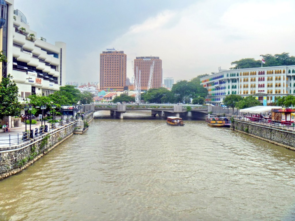
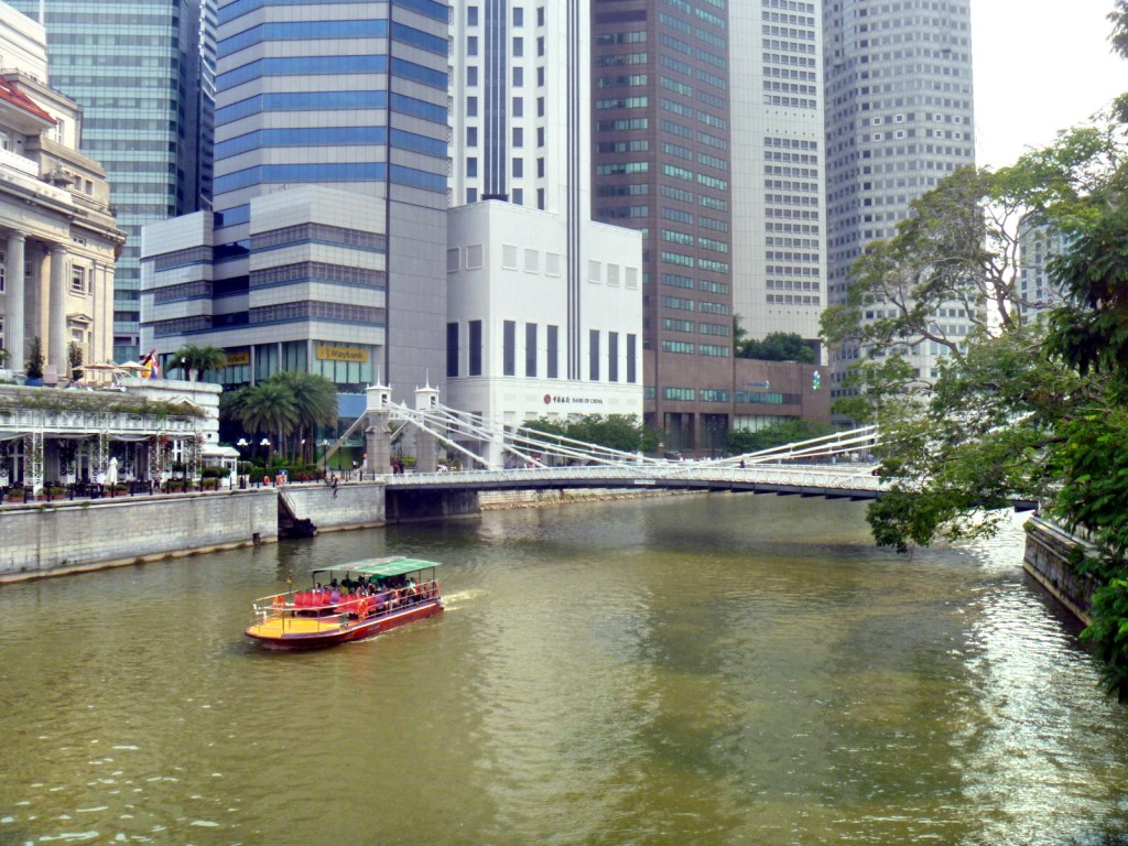
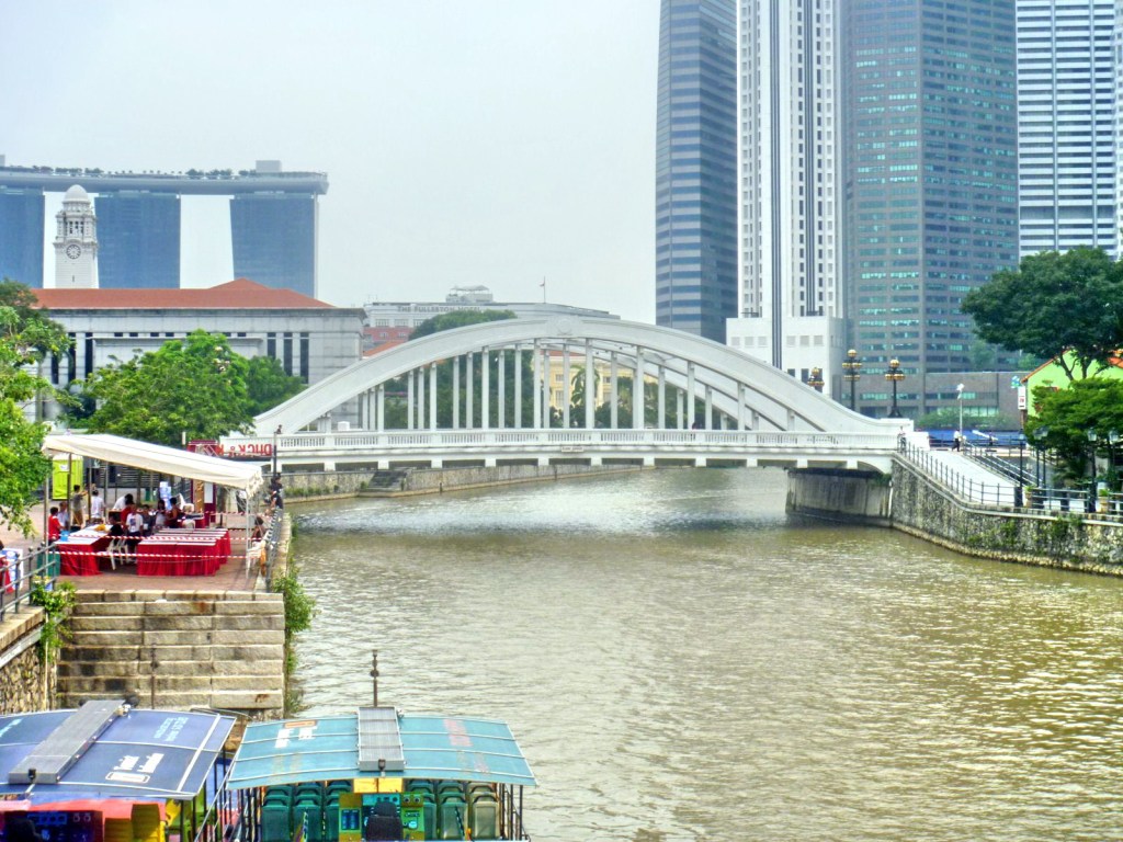
Upon reaching the end of South Bridge Rd., Jandy and I were now at the banks of the historic 6-km. long (19,690-ft.) long Singapore River. Here, we viewed a  number of pedestrian and vehicular bridges that span this river, serving the needs of Singaporeans and visitors alike by connecting residential, commercial and entertainment areas.  They also add history (rickshaws, ox carts, cattle, horses, etc. used to pass here), high technology and color to the Singapore skyline. Three of these bridges – Anderson Bridge, Cavenagh Bridge and Elgin Bridge – were, on November 3, 2008, selected for conservation as part of the Urban Redevelopment Authority’s expanded conservation program. The Anderson Bridge and the newer Esplanade Bridge also forms part of the Singapore Grand Prix‘s Marina Bay street circuit which debuted on September 28, 2008.

Singapore River

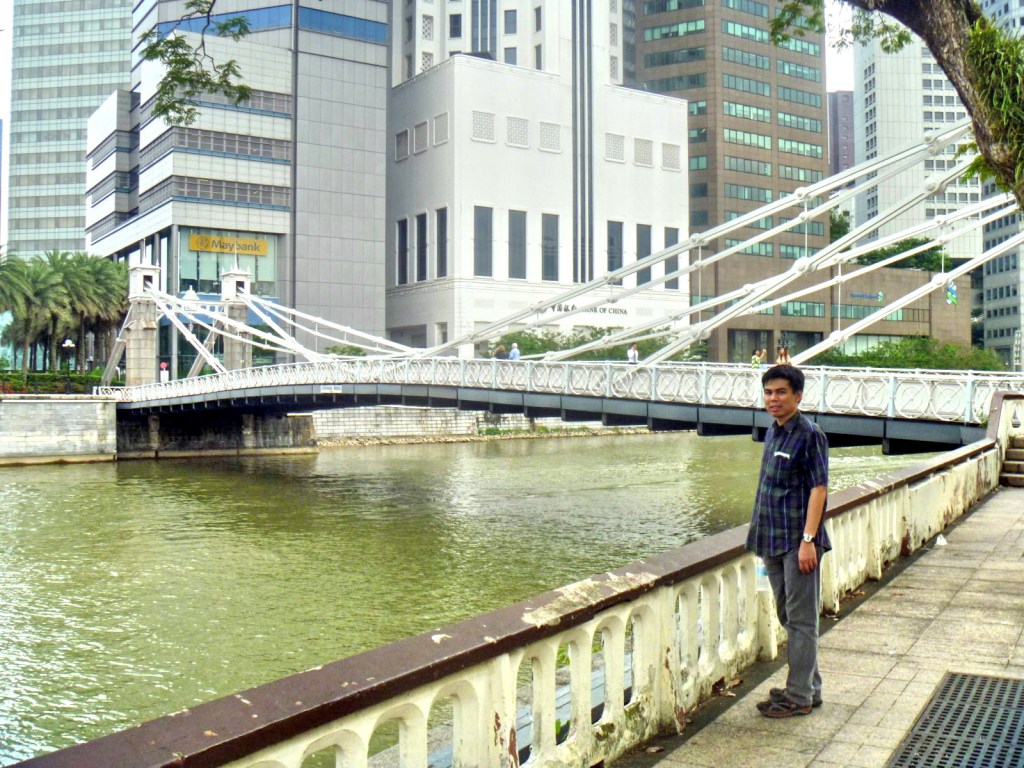
The Cavenagh Bridge, opened in 1870 (the third bridge to be built in Singapore) to ease access between the civic district on the north bank and the commercial district (now Raffles Place) on the south bank , is the oldest among the original bridges spanning the Singapore River.   It spanned the lower reaches of the Singapore River in the Downtown Core. Before this bridge was built, people could only get to the 2 districts via a detour over Elgin Bridge or by paying 1 duit (¼ cent) for a boat ride across the river.  Originally known as the Edinburgh Bridge (to commemorate the visit of the Duke of Edinburgh), it was renamed in honor of Maj.-Gen. William Orfeur Cavenagh, the last India-appointed Governor of the Straits Settlements (1859-1867). His family’s coat-of-arm scan still be seen atop the sign at both ends of the bridge.

Cavenagh Bridge

Cavenagh Bridge, originally designed as a drawbridge, is also Singapore’s first and only steel suspension bridge, with elaborate suspension struts. During construction, numerous steel rivets were used and steel casting methods commonly used during that era were employed. Its parts were manufactured by P & W MacLellan, Glasgow Engineers (Scotland ) at a cost of S$80,000, built and tested in Glasgow to withstand a load 4 times its own weight, shipped to Singapore in parts and it reassembled by Indian convict labor. Subsequently, in the late 1880s, the bridge became overloaded due to the flourishing trade on the Singapore River and vehicular traffic volume overtook the capacity of the bridge.  Added to this was its low draught which was insufficient for the passage of boats during high tide.

Cavenagh Bridge

The bridge was  eventually spared from demolition by conversion to a pedestrian bridge.  In the 1990s, lighting was added to accentuate its architectural features at nightfall. It now complements the renovated Fullerton Hotel (formerly the Fullerton Building) beside the bridge. At the southwest abutment of the bridge are sculptures of a family of Singapura cats (kucinta or drain cats), recognized as one of the smallest breeds of cats in the world. At both ends of the bridge are preserved police notices  restricting the passage of vehicles that weighed beyond 3 CWT (152 kgs. or 336 lbs.), including cattle and horses.

Anderson Bridge

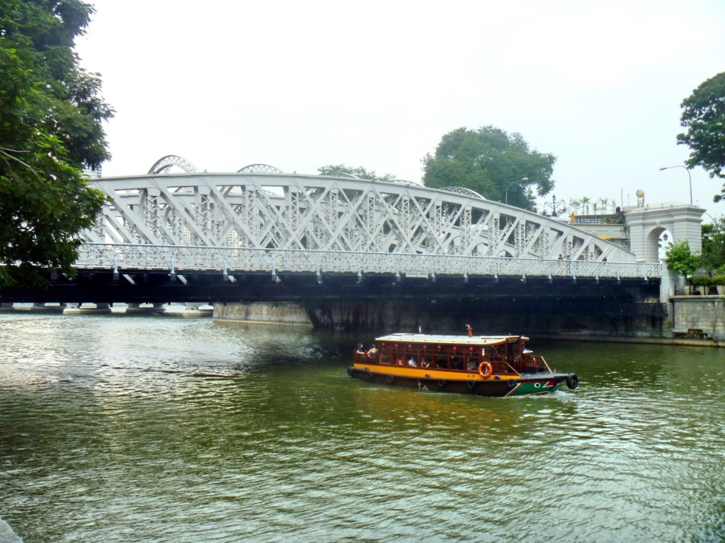
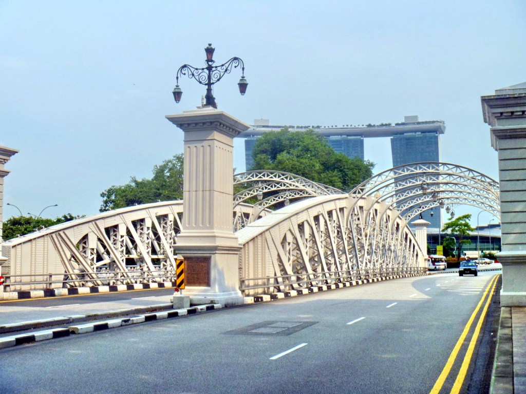
Cavenaugh Bridge’s replacement was the century-old Anderson Bridge, near the river’s mouth, which provided sufficient clearance for vessels to pass under during high tide. Connecting the financial district directly to City Hall, this bridge is also located near the Fullerton Hotel and the former Merlion Park.  An excellent combination of intricate plaster and metalwork, this elegant bridge has 3 steel arches with supporting steel ribs across them, 2 rusticated archways and a fluted pier on each end.  The abutments were built by the Westminster Construction Company Limited. Started in 1908, it was officially opened on March 12, 1910 by Sir John Anderson (Governor of the Straits Settlements and High Commissioner for the Federated Malay States from 1904–1911) after whom the bridge was named. During the 1942-1945 Japanese Occupation, the severed heads of criminals were hung on the bridge as a warning to discourage citizens from breaking the law.

Anderson Bridge – Western Approach

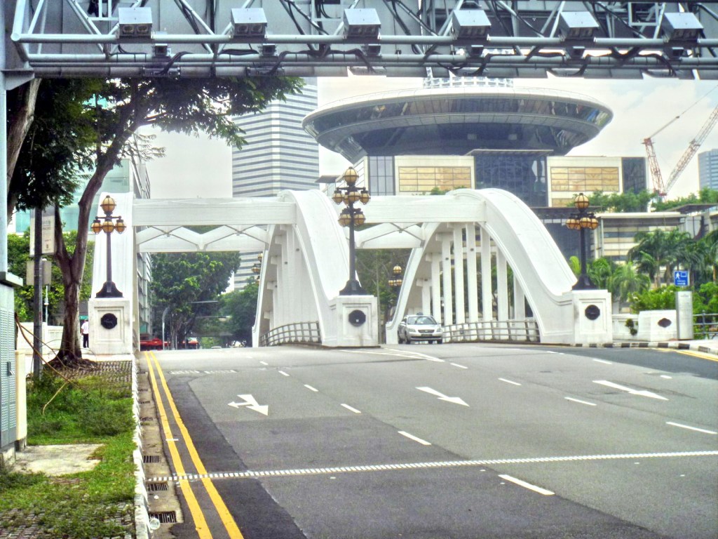
The slightly younger, concrete Elgin Bridge, a vehicular bridge in the Boat Quay area linking the Downtown Core to the Singapore Planning Area located within Singapore’s Central Area, was named after India governor-general (March 21, 1862-November 20, 1863) Lord James Bruce, the 8th Earl of Elgin.  Elgin Bridge is believed to have existed, as early as 1819, at its current location as an unnamed footbridge linking the Chinese community, on the southern side, to the Indian merchants of High St. on the northern side.  As this was the first bridge across the river, the two roads leading to it were named North Bridge Rd. and South Bridge Rd. accordingly.

Elgin Bridge

In 1822, this footbridge was replaced by the Presentment Bridge, a wooden drawbridge (also called the Monkey Bridge, as its narrowness limited the number of people crossing at a time, therefore using it required some agility) was built by Lt. P. Jackson. In 1843, a wooden footbridge, built by John Turnbull Thomson replaced the drawbridge (also called the Thomson Bridge).  In 1862, an iron bridge was built but, in 1925, the iron bridge had to make way for the new, existing bridge which was opened to traffic by Sir Hugh Clifford, Governor of the Straits Settlements, on  May 30, 1929.

Elgin Bridge – Approach

At one end of the bridge is the crest of the Singapore Municipal Commission. Its elegant cast iron lamps, on both sides of the bridge, were designed by the Italian sculptor Cavaliere Rudolfo Nolli whose signature graces the bronze plaques beneath the lamps, each with a lion standing in front of a royal palm tree engraved on it. Elgin Bridge is known as thih tiau kio in Hokkien, meaning “iron suspension bridge.”

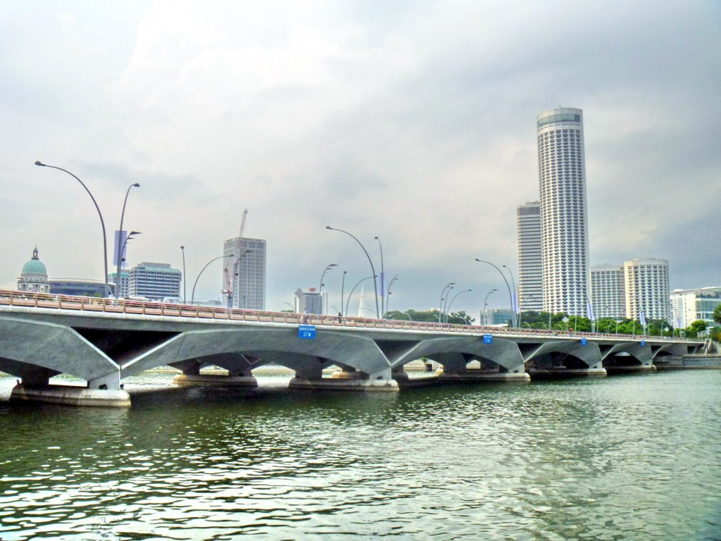
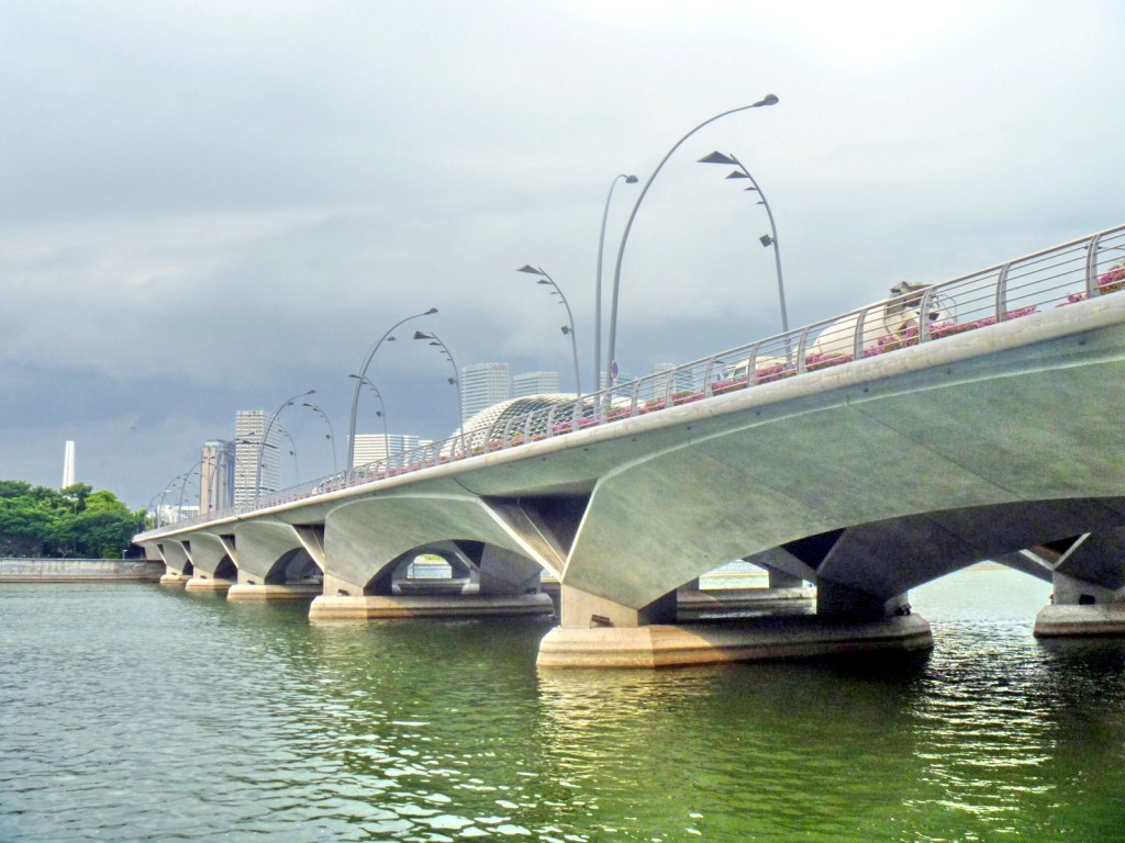
Esplanade Bridge

The 260 m. (850-ft.) long, 70 m. (230-ft.) wide, low-level concrete arched Esplanade Bridge, a vehicular and pedestrian bridge along Esplanade Drive, in front of the mouth of the Singapore River, was built, from early 1994-1997, to provide faster access between Marina Center and the Shenton Way financial district.  After completion, it was found out that the bridge blocked views of the iconic Merlion statue from the Marina Bay waterfront, causing the statue to be transferred from the back to a more prominent place at the front of the bridge.

Esplanade Bridge

The Esplanade Bridge has 7 spans and supports two 4-lane carriageways and walkways along both sides.  The bridge offers panoramic views of Marina South, the rest of  Marina Bay and both sides of the Singapore River.  As such, it is often subject to occasional road closures during National Day and New Year’s Eve and the street lamps along it are shut off to allow spectators, pedestrians and revelers who pack all 8 lanes of the bridge a pleasant and unadulterated view of the fireworks.

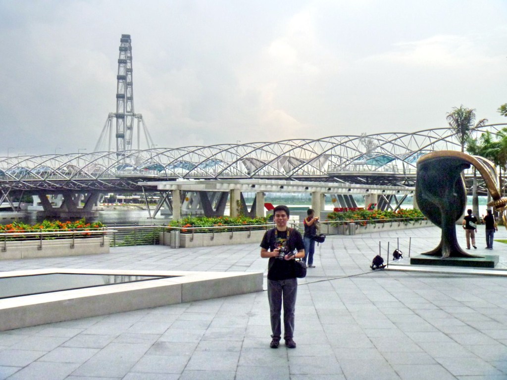
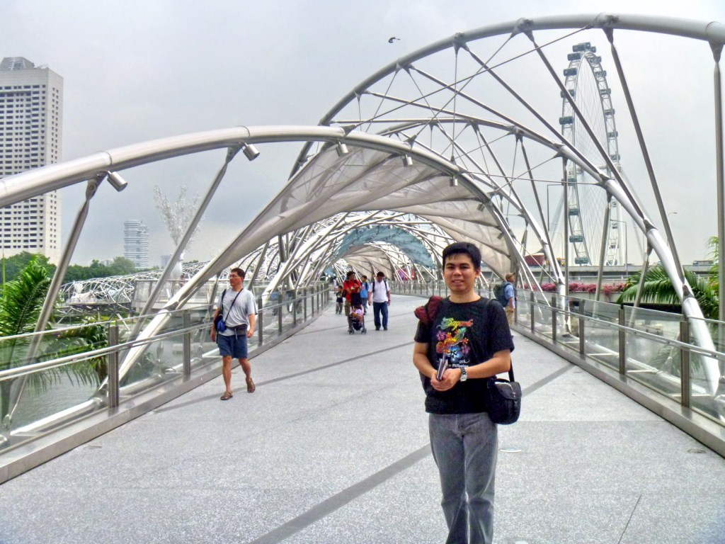
Helix Bridge

The Helix Bridge, next to Bayfront Ave., was opened on July 18, 2010.  Previously known as the Double Helix Bridge, it is the world’s first curved bridge. This 280 m. (918-ft.) long pedestrian bridge is (Singapore’s longest) is located beside the Benjamin Sheares Bridge and is accompanied by the Bayfront Bridge, a vehicular bridge. The Helix Bridge links the hotels, commercial buildings and shops of Marina Center with Marina South in the Marina Bay area (a body of water formed through land reclamation at the mouth of the Singapore River).

Helix Bridge – Approach

The bridge has 5 strategically located viewing platforms sited at strategic locations.  They provide stunning views of the Singapore skyline and events taking place within Marina Bay. The bridge also functions as a gallery where children’s paintings and drawings are exhibited for public viewing.  The bridge is illuminated at night by a series of lights that highlight the double-helix structure, thereby creating a special visual experience for the visitors. Pairs of colored letters “C” (cytosine), “G” (guanine), “A” (adenine) and “T” (thymine), representing the bases of DNA, are lit up in red and green.

Helix Bridge – Approach

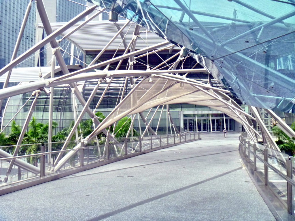
The Helix Bridge was designed by an international consortium including the Cox Group of Australian architects, Arup engineers, and Singapore’s Architects 61 and was fabricated and erected by TTJ Design and Engineering.  The bridge’s design features a series of connecting struts that hold together two spiraling steel members that resembles the structure of DNA (the building blocks of life), symbolizing life and continuity, renewal, abundance and growth, with the aim of attracting happiness and prosperity to Marina Bay.

Helix Bridge – Detail

It used approximately 650 tons of duplex stainless steel and 1,000 tons of carbon steel tubes to create the bridge’s major and minor helix that spirals in opposite directions. To provide shade for pedestrians, canopies made of fritted glass and perforated steel mesh were incorporated along parts of the bridge’s inner spiral.

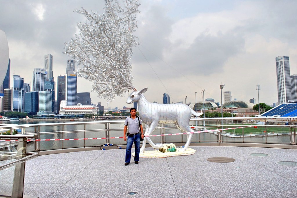
View of Marina Bay From Helix Bridge

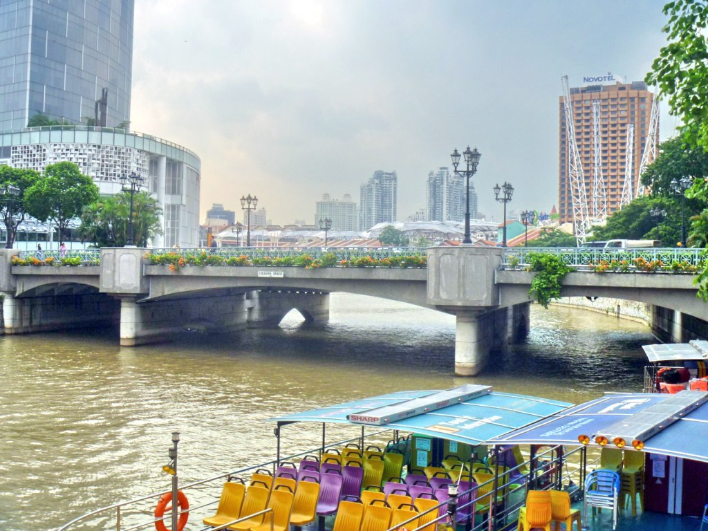
The Coleman Bridge, a vehicular bridge linking Hill St. and New Bridge Rd., near Clarke Quay, was the second bridge built across the Singapore River and the first built in masonry.  Part of the bridge demarcates a boundary between the Downtown Core and the Singapore River Planning Area, both located within the Central Business District. It first started out as a 9-arched brick bridge, built in 1840, designed by and named after Irish architect (Singapore’s first) George Drumgoole Coleman (1795–1844). It was referred to as the New Bridge, lending its name to New Bridge Road, the roadon its southern end.

Coleman Bridge

In 1865, the brick bridge was replaced by one made of not well constructed wood and, in 1886, an ironbridge was built to replace it. Considered one of the most attractive spanning the Singapore River, this iron bridge, however, was unable to cope with the increasingly heavy traffic flow between New Bridge Road and Hill Street and was finally demolished in 1986 and was replaced by the present concrete bridge. However, in recognition of its historical significance, the new bridge incorporated several features of the iron bridge such as the decorative lamp posts and iron railings. The Coleman Bridge is known, in Cantonese, as yi ma lo khiu (“the bridge at the second road”).

Higatangan Island (Naval, Biliran)

Shifting Sandbar

Come Monday, I decided to do some island hopping with a 1-day excursion to the 5 sq. km. Higatangan Island in neighboring island province of Biliran.  I was accompanied by Jandy and a guide and translator, Mr. Narciso “Noknok” T. Villamor, a product specialist from Pharmacia & Upjohn referred to me by my sister-in-law Paula.  After a very early and heavy breakfast, we left Tacloban City on Noknok’s car by 8:30 AM, bringing with us a picnic basket packed for us by Paula.  Along the way, we passed by the Leyte towns of Palo, Sta. Fe, Alangalang, Jaro, Tunga, Carigara, Capoocan and Leyte before stopping for a photo session at Biliran Bridge over the narrow Biliran Strait which connects the island to Leyte.  After crossing the bridge, we continued on to Biliran town and then to Naval.  The road going there was surprisingly smooth all the way.

Biliran Bridge

After a 2-hr. (123-km.) trip, we finally arrived at Naval, the provincial capital and largest town, by 10:30 PM.  We first parked our car at the parking area of the town’s church where Noknok, a former seminarian himself, had some priest friends.  We then hailed a tricycle, loaded our bags and picnic basket and proceeded to the port.  There was only one scheduled, 25-30-pax boat going to Higatangan Island which was to leave by 12 noon.  The boat would return to Naval at 7 AM, the next day.  Fare was PhP15 per person for the 1-hr. trip.  The boat was still loading people and large sacks when we arrived at 11 AM.  We took our seats near the prow and while waiting we befriended Ms. Bebie Balatero, a lot agent working in Naval and a resident of the island.  She willingly agreed to guide us around the place.  From the port we could espy, from a distance, Dalutan Island and Capinahan Island, all within the jurisdiction of Almeria town. Dalutan, we were told, has a small stretch of white sand beach naturally pocked by sea-sculpted boulders on both sides.

Higatangan Island

We departed the port at 11:45 AM and arrived at the island a little before 1 PM, landing at the cresent-shaped white sand beach of Brgy. Libertad, one of the islands 2 barangays (the other is Mabini).  A short distance away was a beautiful white sandbar which extends 200 m. to sea.  It periodically shifts; found near Higatangan’s tip one day and near the other the next day, thanks to the action of wind and changes in sea currents.  The beach has a number of picnic huts and the island’s only resort, Limpiado Higatangan Beach Resort.  The late owner of the inn, Fidel Mahinay Limpiado, Sr. (who was born on April 24, 1892 and passed away on May 25, 1981) was the founder of the Higatangan Evangelical Church of Christ, the first Protestant church  and mother of all UCCP churches in Northern Leyte.

Limpiado Higatangan Island Beach Resort

Jandy was excited about swimming and snorkeling at the beach, even under the hot noontime sun, and was soon down to his trunks.  Noknok and I soon followed suit.  We also got one picnic hut for ourselves and our things.  All of us took our first dip in and around the sandbar.  Later, I decided to comb the beach for shells and was able to pick a presentable spider conch.  Fearing a nasty sunburn (what little sunblock lotion I had was reserved for my son), I rested at the picnic hut and couldn’t help but notice a man talking continuously, without letup, to a boy who was reading a magazine and seemed oblivious to what the man was saying.  Later on, the boy left but the man kept on talking, if only, to himself. Noknok noticed him too.  Anyway, I thought to myself, he wasn’t hurting anybody and so, I ignored him and left him to his own devices.

After 30 mins. of delightful swimming and beachcombing, we remembered that we haven’t eaten lunch and we all settled down to partake of what Paula packed for us.  In the picnic basket was spaghetti, a lechon manok, sliced roasted lechon, rice plus my favorite tipay (scallops baked with garlic).   In addition, we had ripe mangoes for dessert and bottled water and canned soft drinks to wash it all down.  We invited Bebie plus the manager of the inn to join us and pretty soon, although shyly at first, were also partaking our fare.

Higatangan Island is memorable to the late Pres. Ferdinand E. Marcos.  On November 1943, Fidel Limpiado and his family provided refuge  and saved the life of Marcos, a guerilla leader.  Together with his eldest son Ranulfo, they ferried Marcos from Higatangan to Manorabe, Sorsogon in a sailboat, eluding Japanese Navy patrols.  They were, however,  caught in a typhoon and were stranded in Camandag, Sto. Nino in Samar.  The rest is history.  On May 10, 1978, a grateful Marcos, now president of the Republic, together with First Lady Imelda Marcos and daughter Irene, visited Fidel and granted his requests.  The island was declared as a tourist spot.  Higatangan High School was opened immediately and a 9-km. circumferential road, post office, medical clinic and 4 windmill-powered water systems were also built.  Today, a hill is named after the late president and it offers a panoramic view of Samar, Leyte, Cebu and Masbate.

It was getting late in the afternoon, and since there was no regular return trip to Naval, Bebie  offered to look for a boat willing to take us back to Naval.  And off she went, looking for a certain Linda.  In the meantime, we all returned to the inn for an invigorating shower, packed our things and waited at the picnic hut for our boat.  The same boat that ferried us to the island, now empty, soon arrived and docked near the sandbar.  They offered to bring us back to Naval for the cutthroat price of PhP700.  Before its arrival, we were able to meet Linda who agreed to accompany and tour us in her boat around to the western side of the island before going back to Naval. We settled on Linda’s price of PhP450.

While waiting for the boat, we couldn’t help but notice that same strange Shakespearian character again talking to himself at the adjoining hut.  We three were soon aboard the boat, together with Bebie, Linda and Linda’s daughter, when our boatman soon arrived.  Lo and behold!!!  It was our same, strange Shakespearean character!  Noknok and I swallowed hard and started to pray ….  So off we went.  Our apprehension soon turned to admiration as we noticed how our boatman, incidentally and, somewhat unfairly, named Gunggung, handled our seemingly fragile craft.  I was seated next to him and soon was the focus of all his senseless chatter.  Later on, he was singing a ditty.  Both chatter and song were in Cebuano. I took it all goodnaturedly.  Later on, I learned that he had a wife and two children but was separated from his wife.  Poor fellow.

We soon rounded the island’s end and approached the island’s western side.  It was a totally different story round here.  Instead of endless white sand beaches, we were introduced to a surrealistic world of short stretches of beach punctuated by magnificent and grotesque rock formations topped by dense undergrowth, all products of the constant battering forces of wind and waves against these rock walls.  Looking down at the sea, we were surprised to see how clear the waters were at this area.  We could see, in great detail, numerous large corals as well as bright blue starfish.  It has a good potential as a dive site.  After about 30 mins., we finished circumnavigating the island and soon headed back for Naval.  Our trip was uneventful for the next half hour.  It started to rain and Jandy took to wearing a raincoat supplied by Linda.

Pretty soon, the waves became choppy and Jandy was screaming with every high wave that lifted the banca.  I took it calmly (I’ve seen worst during an excursion in Calapan City, Mindoro Oriental), trusting in Gunggung (and in God) as he capably rode the banca through the waves.  Noknok later told me that, this being his first time in such a situation, this prodded him to pray to God, and all the saints for that matter, for deliverance.  The choppiness ceased as we neared Naval.  Pretty soon, Naval harbor came into view and we breathed a sigh of relief.  We, including Linda, were so engrossed with relief that we failed to notice that Gunggung didn’t cut the engines to slow down the boat. We hit the shore with a crash, almost knocking us off our feet and into the now shallow shoreline.  There’s nothing like ending our trip with a bang! Gunggung inspected the boat and reported no damage to the boat’s superstructure except for a crumpled propeller.  I gladly paid Linda her fee plus an extra PhP50 for all her trouble, thanked her and Bebie and then parted ways.  We took a tricycle back to the church, loaded our stuff and left Naval by 6 P.M..  We were back in Tacloban by 8 PM.

San Juanico Bridge (Tacloban City, Leyte)

After breakfast at the Filamor Residence, Grace, Jandy, Cheska and I, together with Manny, Paula, Mark, Nenette, Daddy, Mommy and Cheska’s new friend Kookie Bal left for our tour of Tacloban City.  We secured the services of a guide and a van at the Department of Tourism Region 8 office.  Our first destination was to be the San Juanico Bridge, the longest bridge in the country as well as Southeast Asia.   At the foot of the San Juanico Bridge is the 15-hectare, Japanese-funded multi-million peso National Maritime Polytechnic, a  merchant marine training school and the most modern graduate institution for seamen in Asia.  

Posing along the San Juanico Bridge
 
We finally made our way midway up the bridge and made a short stopover.  Here, we had a panoramic view of the San Juanico Strait, located between the islands of Leyte and Samar.  It is considered the narrowest but most navigable strait in the world.   The strait has a number of beautiful islets.     The San Juanico Bridge, which crosses this strait, is also called the Marcos Bridge.  Inaugurated on July 2, 1973 and located 10 kms. from Tacloban City, it is a major link in the 3,000-km. Pan-Philippine Highway.  
 
San Juanico Strait
 
This impressive S-shaped bridge, said to be the most beautifully designed bridge in the country, is 2,162.4 m. (7,092 ft.) long, 10.62 m. wide with 43 spans and towers 41 m. above the sea at its highest point.    The S-shaped structure on the Samar side had to be adopted to make use of the importance of the existing islet, the Cabalauan islet that lies in the middle of the strait.  This islet serves as resting point and provides added support to the massive structure soaring over the swift currents of the strait.