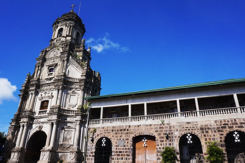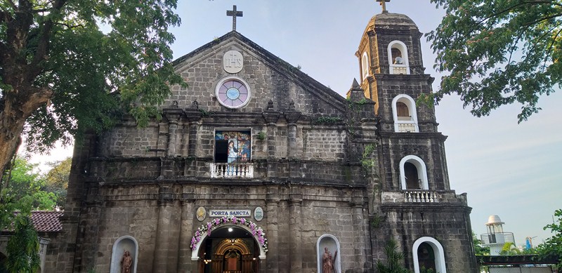
Church of Our Lady of the Light
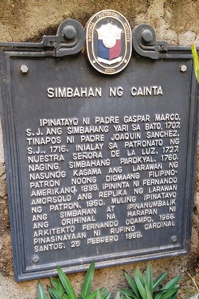
This town’s original church (at the time was under the patronage of Saint Andrew the Apostle), designed by Fr. Juan de Salazar, S.J., was first constructed in stone by Jesuit Fr. Gaspar Marco in 1707 and completed in 1716, during the time of Joaquin Sanchez, S.J, while he was still the parish priest.
In 1727, a painting of Our Lady of Light was brought in from the Kingdom of Sicily and was chosen as the new patroness of the church and, by 1760, the church was officially declared a separate parish.
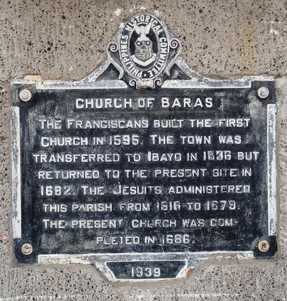
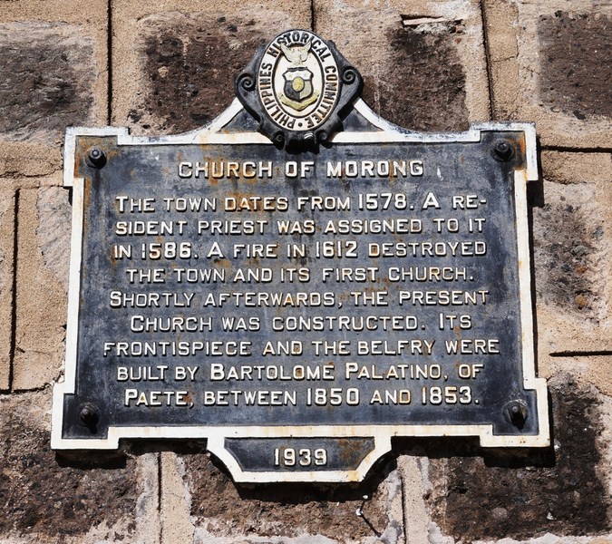
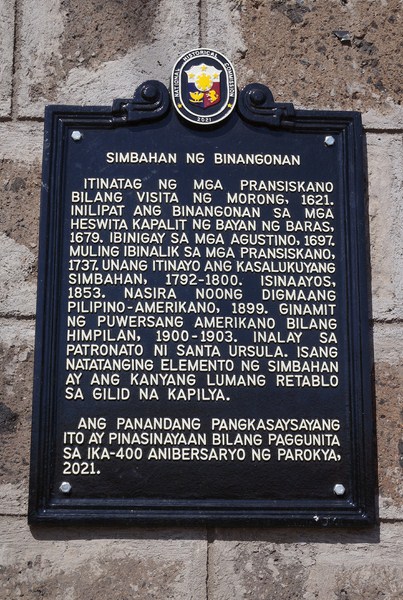
NHI plaque
On February 23, 1853, the church building was damaged by an earthquake, both its roof and one wall collapsed while the walls of the parish rectory or convent sustained cracks. By 1884 the parish had been named Our Lady of Light (Virgen ng Caliuanagan or Madre Santissima del Lumen in Tagalog and Spanish languages), as attested in the August 5, 1884 letter by Don Mariano de San Juan (the pastor of Cainta) to Fray Pedro Payo, O.P., the Archbishop of Manila.
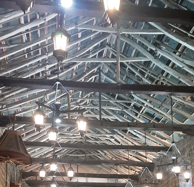
Church transept
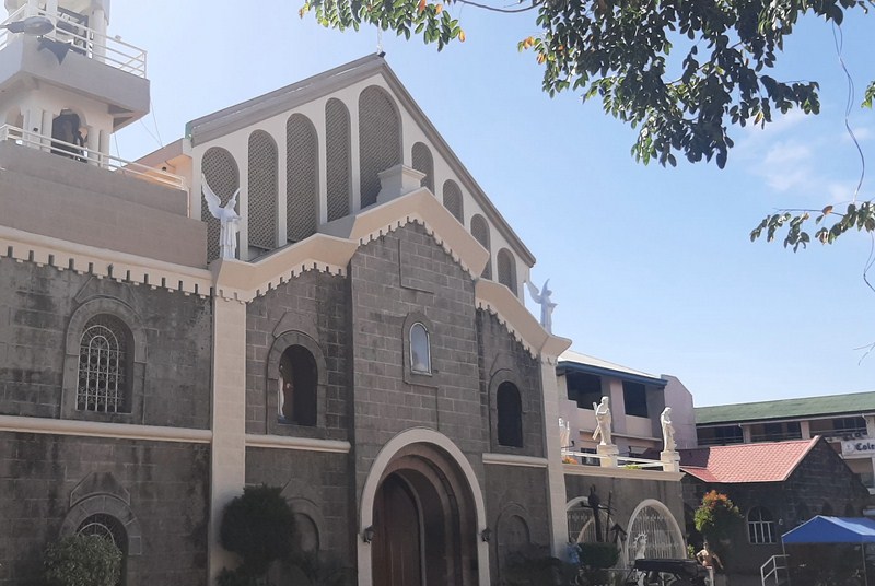
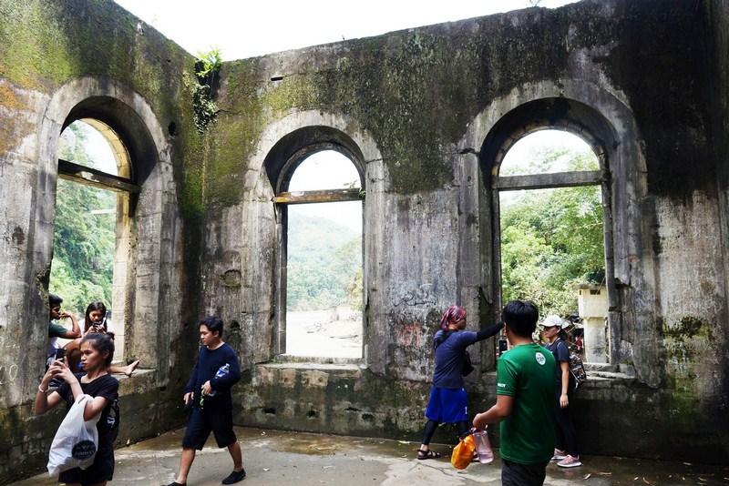
In March 1899, during the Filipino-American War, the church and parish rectory, including the venerated Marian image within, were burned down. The stones from the church walls were later used to build roads. The monogram of the Holy Name of Jesus “IHS” (Latin: Iesus Hominum Salvator), attached at the top portion of the church’s façade, was the only mark left of its Jesuit beginning.
For 67 years, the church was left in ruins, without any significant restoration. On June 10, 1966, after Archbishop of Manila Rufino Cardinal Santos gave permission for the church’s reconstruction on February 15, 1965, the reconstruction of the church began. The facade was kept untouched. When one of the beams collapsed, the reconstruction was halted and further study was conducted to determine if it could withstand earthquakes.
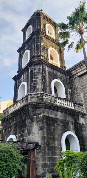
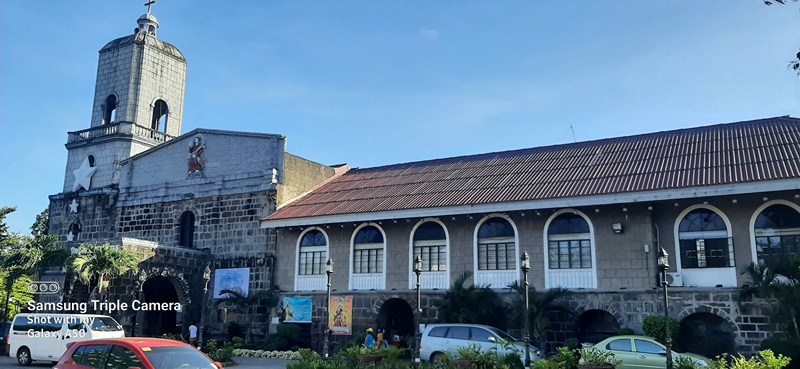
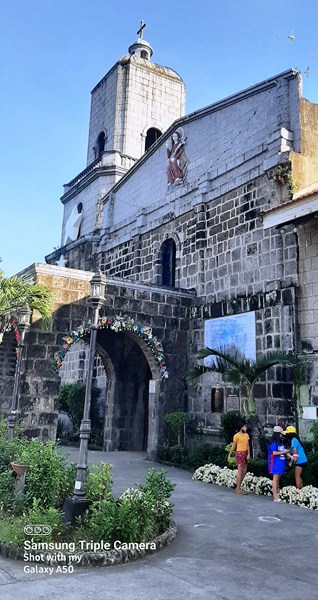
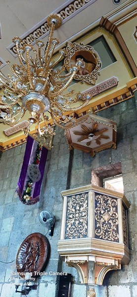
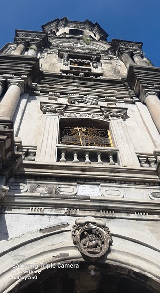
The four-storey bell tower
On June 15, 1967, reconstruction resumed and it was completed and blessed by Rufino Cardinal Santos on February 25, 1968. In 1975, the administration of the parish was turned over, by the CICM Missionaries, to the Archdiocese of Manila, with Monsignor Alfredo Santa Ana, HP, as its first diocesan parish priest. Until 1998, the church was the sole parish in the entire municipality of Cainta.
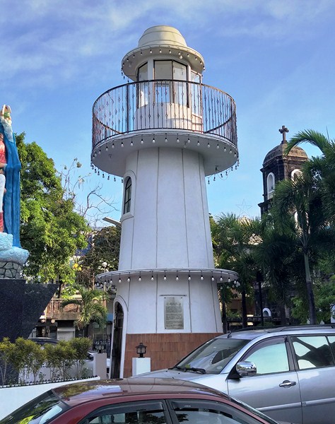
Parola ng Panampalataya
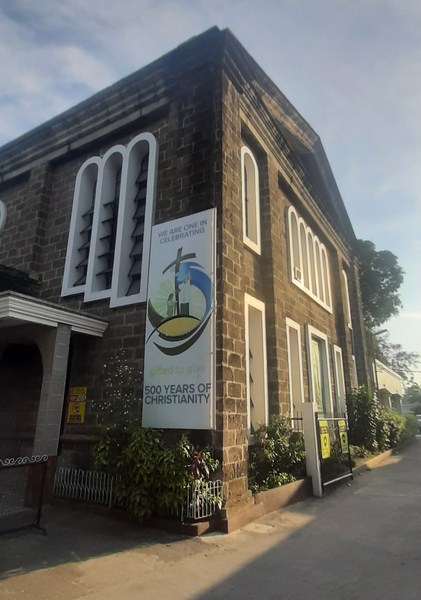
In 2007, the church was declared as a historical site by the National Historical Institute (NHI), now the National Historical Commission of the Philippines (NHCP), for its significant role during the Philippines-American War.
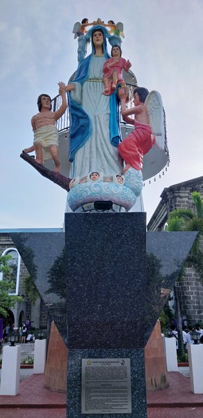
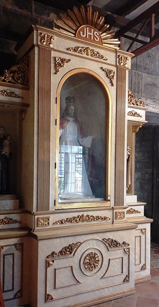
Statue of Our Lady of Light
On December 1, 2007, the newly renovated altar and the new historical marker of the church were blessed. On December 1, 2012, an episcopal coronation, coinciding with the parish fiesta, was performed by the local bishop with the assistance of Ms. Henrietta De Villa, former ambassador to the Vatican.

Statue of Padre Pio of Pietrelcina
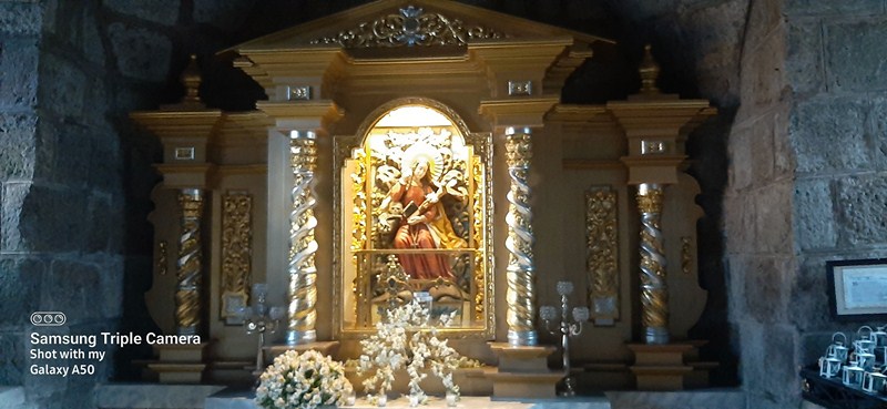
After the burning (during the Filipino-American war in 1899) of the original enshrined icon of the Blessed Virgin Mary (a painting of Our Lady of Light brought to Cainta in 1727 from Ferrara, Italy by Fr. Bartolommeo Cavanti, SJ.), the venerated Marian image was recreated by Philippine National Artist Fernando Amorsolo.
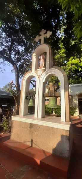
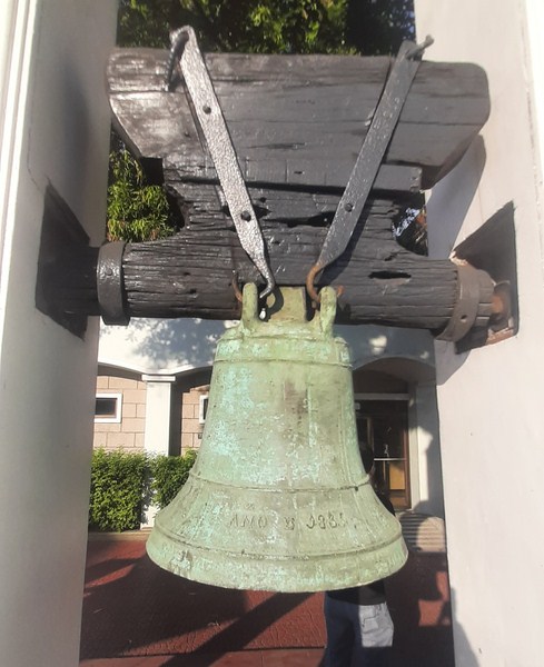
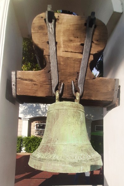
Old church bells
On December 6, 2017, the image was granted the papal bull of canonical coronation by Pope Francis and it was crowned on December 1, 2018, the first Marian image in Philippine history to be pontifically crowned as an artistic painting. On the same day as its canonical coronation, the parish church was consecrated and elevated into a Diocesan Shrine.
Bell inscribed with “Ano D 1835 – N.TRA SENORA D LALVZ” (Year 1835 – Nuestra Senora de la Luz”)
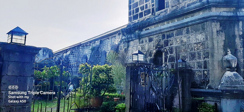
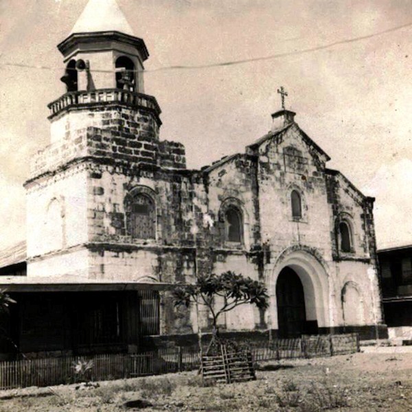
The original church, including the sacristy and rectory, measured approximately 44 m. (144 ft. long), 15 m. (48 ft.) wide and 11 m. (36 ft.) high. Made of stone and limestone (calycanto), its roof was tiled and had a dome (media naranja), transepts (crucero) and five buttresses (contrafuertos).
Old bell inscribed with “S. ANDRES APOSTOL – SIENDO CURA EL PRESVITERO D. AGUSTIN MENDOSA – SE PVNDIO ESTA ESQVILA MAYO 15 D 1847” (“St. Andrew the Apostle – When Don Agustin Mendosa was parish priest – who built this small bell on May 15, 1847”
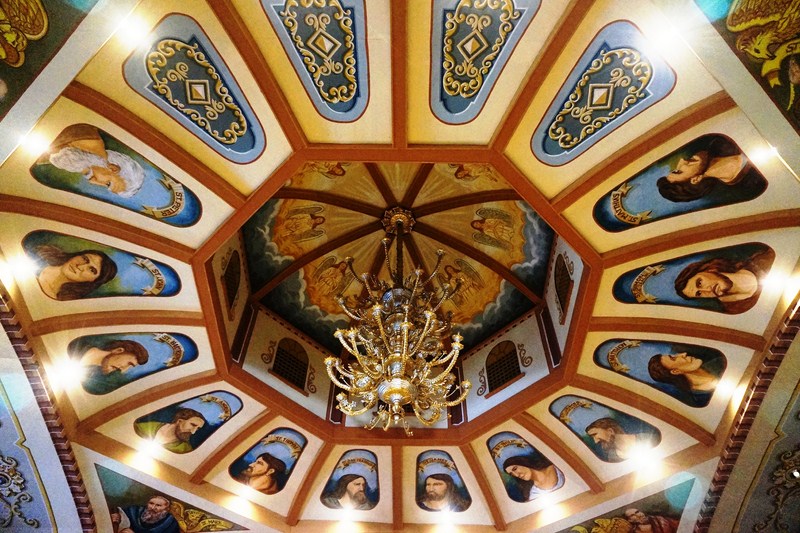
The nave’s spacious presbytery had windows and skylight (claraboya) while the belfry had four bells, two of which were small bells rung by rotation (esquitas). The baptistery, with an arched ceiling, was situated at the bottom of the belfry.
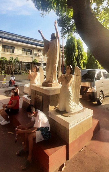
Statue of Resurrected Christ
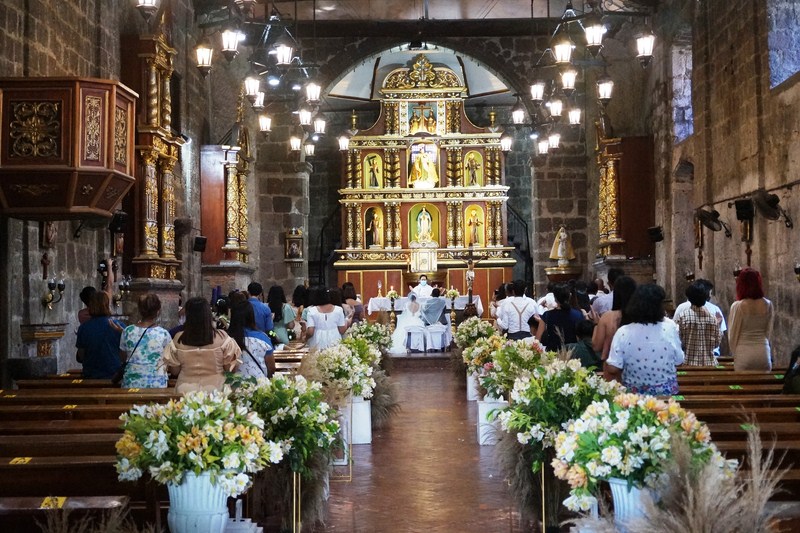
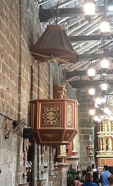
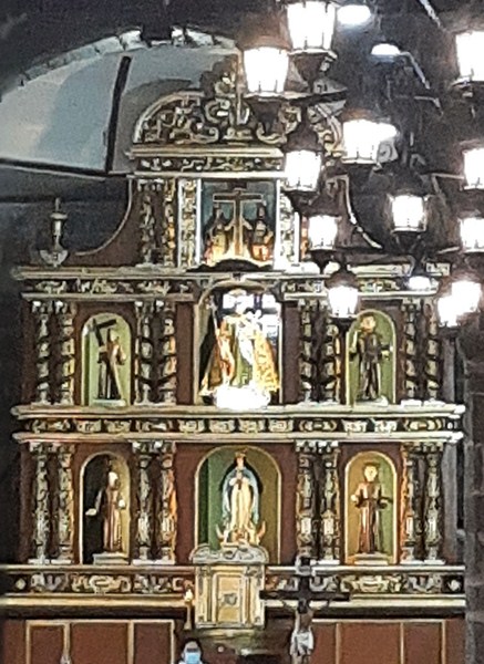
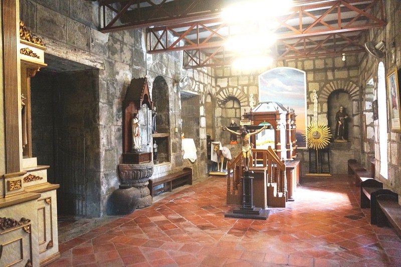
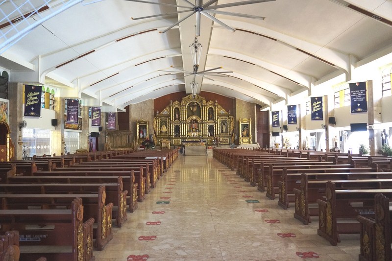
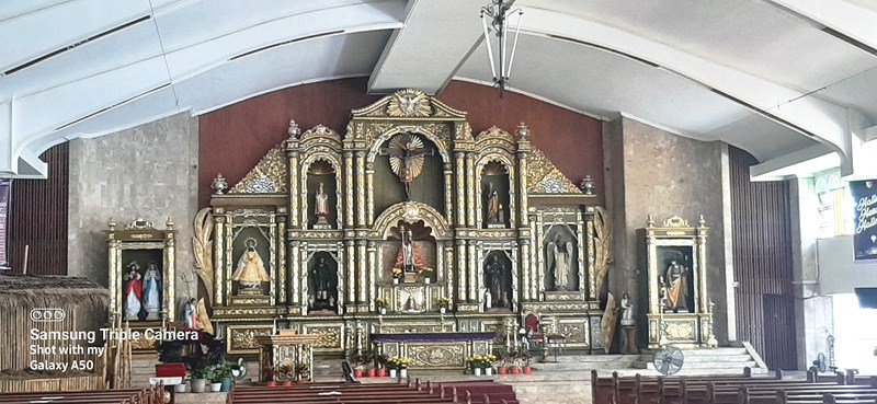
Flooring was made of wood. It also had a choir loft, communion rail, pulpit and three doors. Five retablos are found inside the church, with the original picture of the Our Lady of Light enshrined at the central niche.
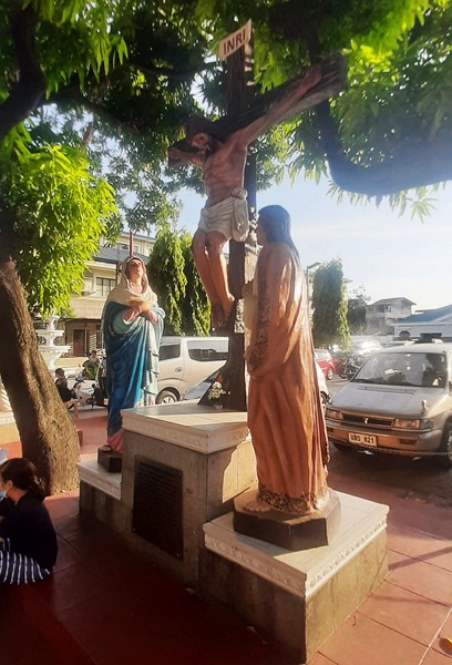
Statue of the Crucifixion
The sacristy measured approximately 8.2 m. (27 ft.) long, 7.3 m. (24 ft.) wide and 5.5 m. (18 ft.) high. The parish rectory, with a kitchen, two brick chimneys, four rooms and offices, measured approximately 37 m. (120 ft.) long, 15 m. (48 ft.) wide and 7.3 m. (24 ft.) high.
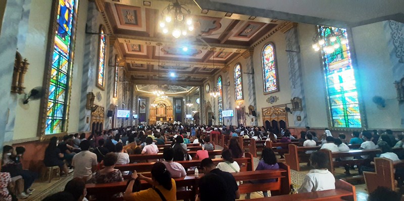
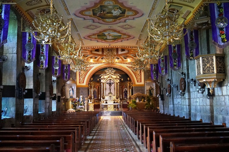
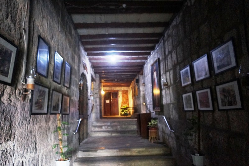
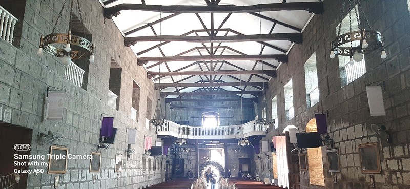
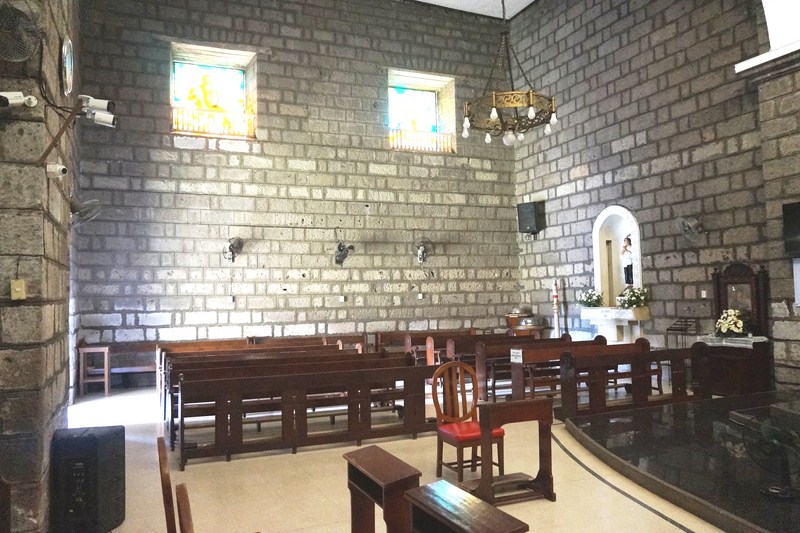
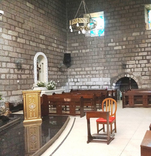
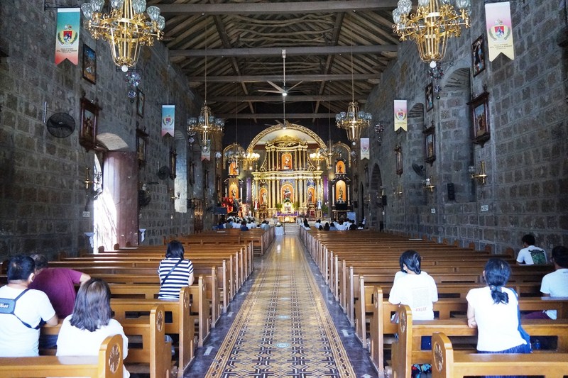
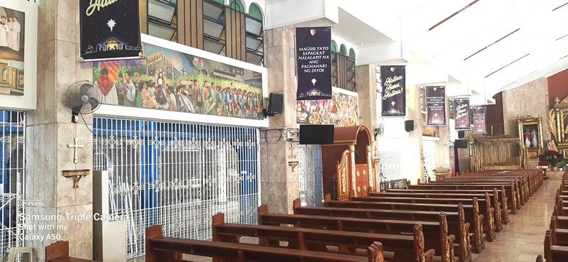
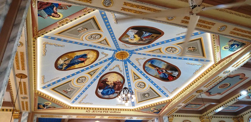
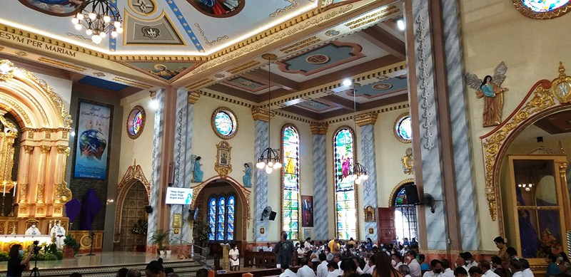
Church interior
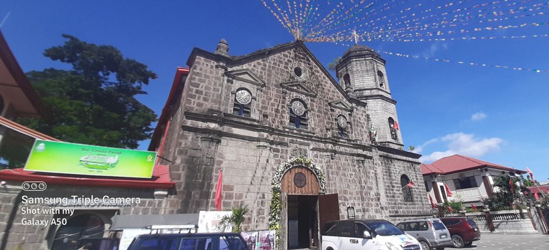
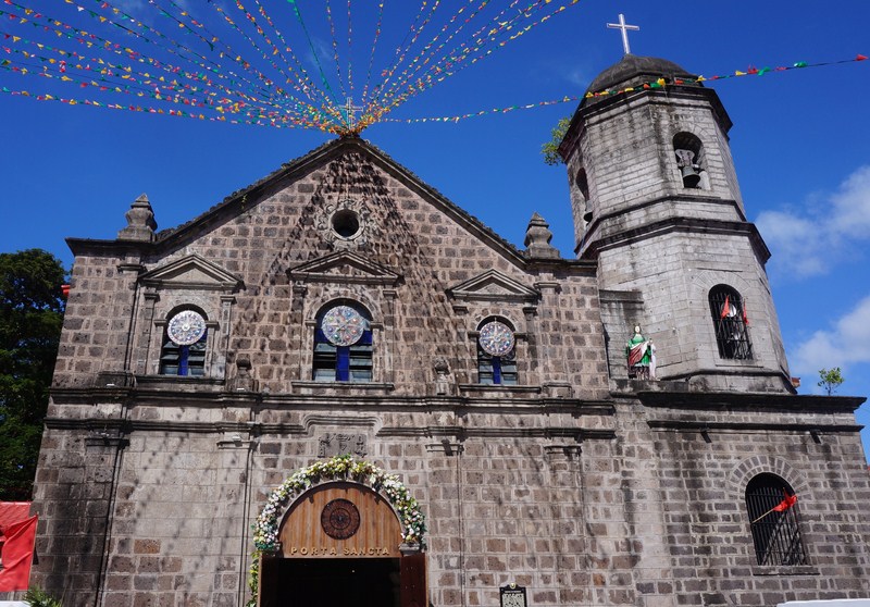
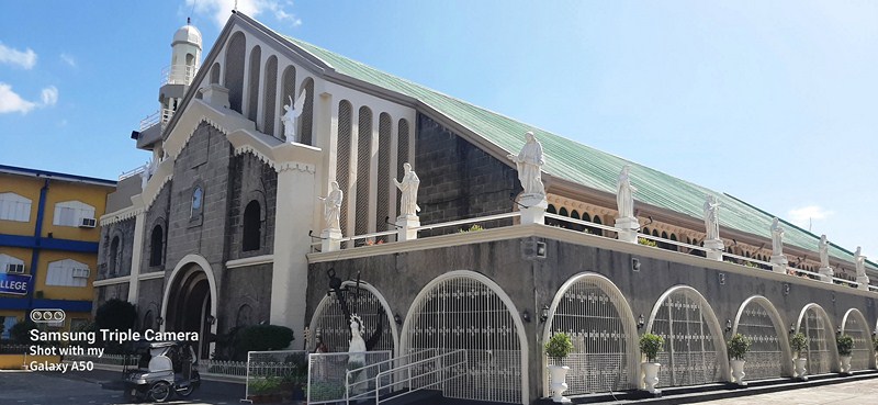
The larger reconstructed church measures 68 m. (223 ft.) long, with a transept 42 m. (138 ft.) wide, and with walls 10.5 m. (34.4 ft.) high. It has a semicircular arch main entrance and four lateral doors.
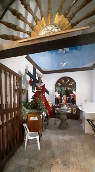
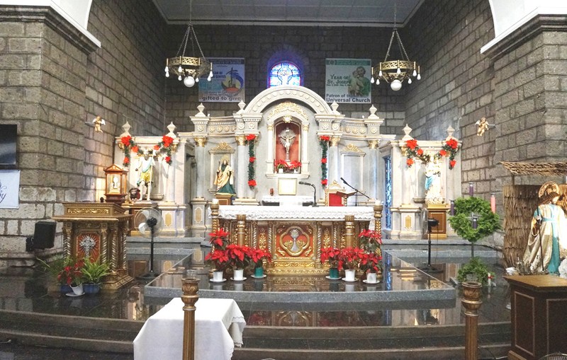
There are separate chapels for the Blessed Sacrament and for Our Lady of Light and Saint Andrew, both enshrined at the sides of the sanctuary.
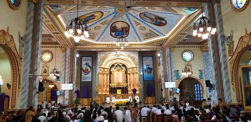
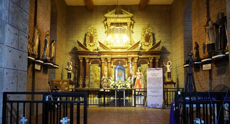
Main altar
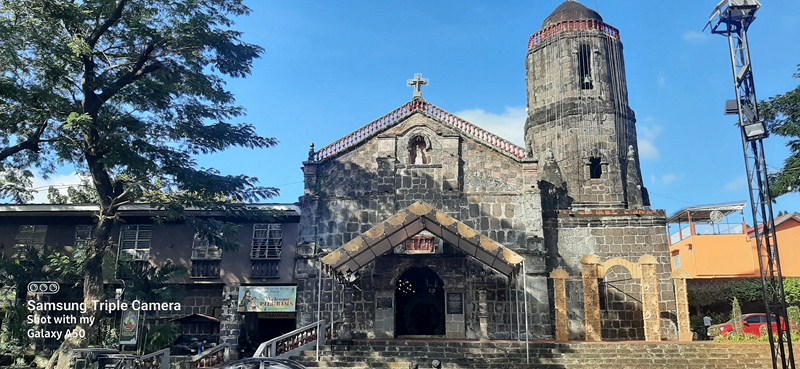
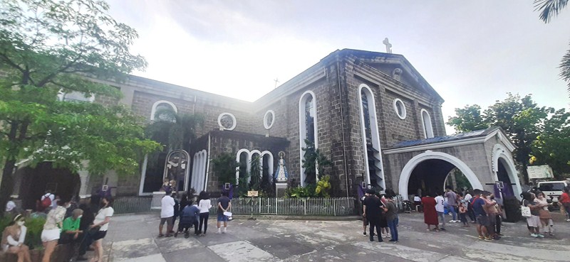
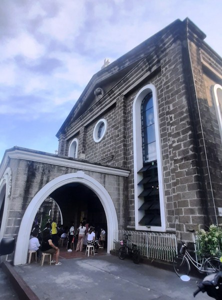
When we entered the churchyard from the main road, we only saw the side entrance near the altar. To see the beautiful façade, we had to first enter the church then go out the front door.
Side altar
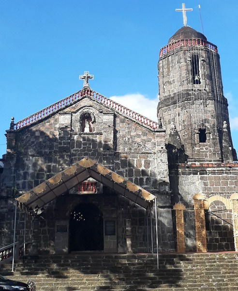
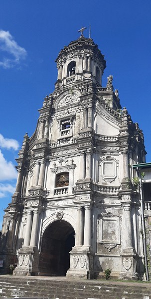
It’s simple, two-level Early Renaissance façade, with superpositioned paired columns, has semicircular arch statued niches, a square window at the choir loft and a circular window at the tympanum of the triangular pediment. The attached four-storey bell tower, on the church’s right, has semicircular arched windows.
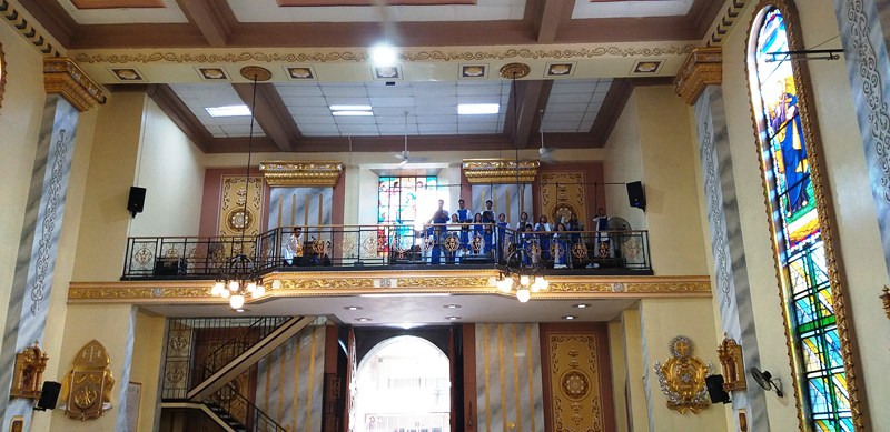
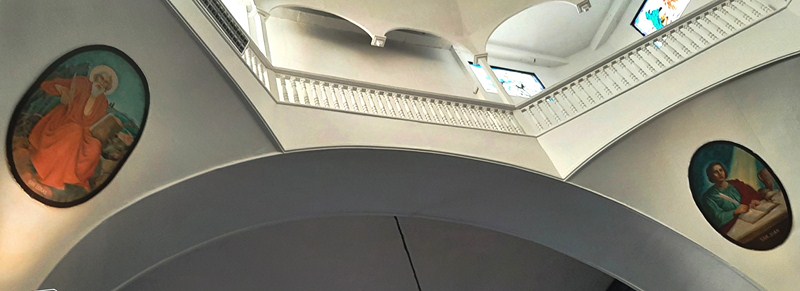
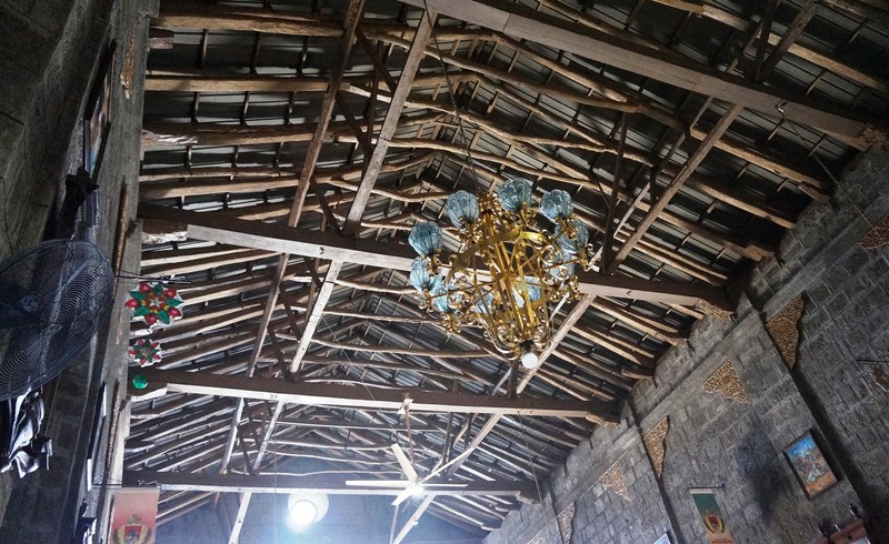
Choir loft
Church of Our Lady of Light: Andres Bonifacio Ave. (near Cainta Junction), Brgy. San Andres, Cainta 1900, Rizal. View Map>>> Tel: (02) 8655-0840. Feast of Our Lady of Light: December 1.
How to Get There: Cainta is located 29.1 kms. from Manila and kms. (a drive) from Antipolo City.