Taytay Falls (Majayjay, Laguna)

Rain, rain go away. Come again another day.”  So moaned this bored and grounded travel writer who was itching to get out of town again.  It was supposed to be the advent of the dreaded El Niño phenomenon again and, usually, mornings always promise to be a bright, sunny day.  However, expectations always turn to gloom as dark clouds always appear in the horizon by afternoon, bursting into rain hours later.  What the heck! I will go get out, rain or shine (shine I hope).

 Lala, the author, Myrna, Ning and Menchie

I did find people with the same mind set from Jesu-Mariae School (JMS), my son Jandy’s school.  Joining me were Mr. Robert Castañeda, Ms. Elvira “Lala” Mañanita, Ms. Myrna Samson, Ms. Leonila “Ning” Boncayao and Ms. Menchie Fortunado.  We decided to do some overnight camping at Taytay Falls in Brgy. Taytay, Majayjay in Laguna.  We all left JMS, after lunch (1:30 PM) on 12 October, a Saturday.  The trip to Majayjay was to take all of 120 kms.. Aside from my passengers, my Mitsubishi Adventure was laden with tents, backpacks, sleeping bags and provisions.  The afternoon skies were again overcast. We traveled via the South Luzon Expressway (SLEX) all the way to Calamba City, then on to the resort town of Los Baños, Bay (the old Laguna capital), Calauan, Victoria, Pila and Sta. Cruz (the provincial capital), turning right at the junction on to a road leading to Nagcarlan, Liliw and finally Majayjay.  There were glimmers of hope as the sun shone most of the way.

Settling in our tents

The last leg was particularly winding but altogether  scenic; passing beautiful mountain scenery (1,470-m. high Mt. Cristobal and 2,177-m. high Mt. Banahaw), lanzones trees laden with ripe and read-to-harvest fruit, and clear, swift flowing rivers with bathing children and washing mothers.  It was truly a scene for a Fernando Amorsolo genre painting. We arrived at Majayjay’s poblacion by 5 PM with hopes dashed as it began to rain. We were truly in for a “wet” reception. We first paid a visit to the home of Mr. Florencio “Flory” Rosales, secretary of town councilor Rey Cube (referred to us by Mr. Manuel “Noli” Canlas, board member of JMS).  Mr. Rosales was more than kind enough to personally guide us towards the staging area for the trek to Taytay Falls, waiving the entrance fee of PhP20 per person.  He also assigned guides to assist us.  From hereon we were on our own.

It was already getting dark when we arrived at the staging area.  Normally the hike to the falls takes just 10mins..  However, this was a different story as we would be trekking in the pitch-black darkness of a rainy, eerie and moonless night.  Luckily, we had flashlights and our guides.  The narrow, two-foot wide concrete path was sandwiched between a mountain spring-fed canal running alongside the mountain on the left and deep, treacherous ravines on the right. G.I. pipe railings kept us on the safe side.  We arrived at the campsite after what seemed an eternity.
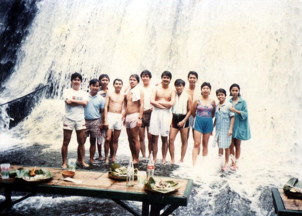
Taytay Falls

Our first face-to-face encounter with the falls would have to wait for tomorrow due to darkness but the sound of its onrushing waters would be a constant reminder of its presence.  For the time being, we had other concerns to think about. Beautiful places such as these are not well-kept secrets and the place was teeming with weekend campers from the town and Manila.  We were quite a sorry sight, drenched from head to foot by the rain, muddied, hungry and with no proper place to pitch a tent.  While our kusineras Myrna and Ning hastily prepared our dinner of fried liempo (it would have been barbecued if not for someone forgetting the grille – me), corned beef and steamed rice over my portable stove, Robert and I groped in dark for a less than suitable place (our selected site was rocky) to pitch 3 of our tents.  Once settled in, we attacked, with gusto, our prepared dinner and hit the sack early for a well-deserved but not so fitful sleep.

View of campsite from atop the falls

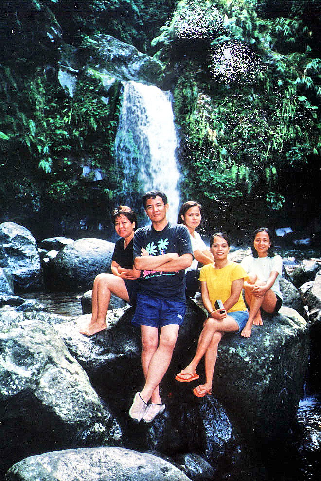
I woke up very early in the morning with somewhat revived spirits and a sore back (“Pwedeng pang sungka ang likod ko”).  The others soon followed, all in a similar state of mind and body.  As the early morning sun crept in, the beauty of the place slowly emerged.   No rain.  Our campsite was located beside a moderately flowing river whose icy-cold, crystal-clear waters came from the beautiful 30-ft. high waterfall located about 100 m.  away.  Everyone was excited to sample its inviting waters.  But first, my early morning coffee fix and breakfast!  As soon as it was prepared by our ever dependable kusineras, we all transferred all our stuff: tents, backpacks and prepared breakfast, to a more suitable site right beside the falls. Who cares about breakfast in bed when you can’t have it beside a beautiful waterfall!   That done, we soon settled down to a filling repast similar to what we had last night.

Our excitement to have our first dip at the falls soon turned to cowardice as we dipped our toes in the icy-cold waters of the natural pool.  Brrrr!  What the heck!  I bravely dove in and endured the shivering and the sound of my teeth clattering as my body slowly, but surely, adjusted to the temperature. After much goading, the others (Myrna, Ning, Menchit and Lala in that order of bravery) soon followed my lead.   Robert and I also did some exploring of our own by clambering up a well-defined but muddy trail to the top of the falls. It was even more beautiful here (and less crowded).  From here, we had a bird’s eye view of the campsite (our companions look like ants below), creek and the surrounding verdant rainforest.  I could stay here forever.   Back at the campsite and terra firma, we soon had our fill of the falls and its verdant surroundings, packed our tents, backpacks and other gear and soon made our way back to the staging area and our car.

The Waterfalls of Mt. Romelo (Siniloan, Laguna)

Mt. Famy in Laguna, the nearest and most accessible mountain trekking destination from Manila.  The mountain, in itself, is no “tall” order being only about 1,100 ft. (335 m.) high.  The charm of the place, aside from its accessibility, lies in its 7 beautiful waterfalls (Ambon-Ambon Falls, Batya-Batya Falls, Buruwisan Falls, Lanzones Falls, Matandang Buruwisan Falls, Sampaloc Falls and Sapang Labo Falls).  It was this charm that made me decide to visit the place.  I brought with me Jandy and Jesu-Mariae School teachers Mr. Roy Trillo and Mr. Arnel Daliva.  We left Manila by 6:30 AM traveling via the C-5 highway to Pasig City, Antipolo City, and the Rizal towns of Cainta, Taytay, Teresa, Morong, Baras, Tanay and Pililla, before crossing the Laguna boundary, to Mabitac and Famy.

Buruwisan Falls

The views along the winding and well-maintained asphalt highway at Mabitac were truly spectacular as we feasted our eyes on the surprisingly forested mountains of the majestic Sierra Madres and the calm, azure waters of Laguna de Bay.  The route here, and in Antipolo City, is full of sharp, Kennon-like zigzag bends.    Asking around at the Caltex station in Famy town, we were beginning to wonder why no one seems to know or even heard about this mountain named after their town.  One even gave us wrong directions to a mountain in Pakil.  The answer is simply because it isn’t there in the first place.  We tried the next town of Siniloan.

Jandy rafting at the falls

Later conversations with Siniloan residents Geronimo and Marilyn Pontipedra revealed that our mountain destination was, due to an erroneous land survey, placed within the territorial jurisdiction of Famy town. Hence, the name Mt. Famy.  In reality, the mountain belongs to Brgy. Macatad in Siniloan.  Here, they call it Mt. Romelo.  Two of the mountain’s 7 waterfalls are another story.  Buruwisan Falls and Ambon-Ambon Falls, according to some travel brochures that I’ve read, are supposedly under the jurisdiction of neighboring Sta. Maria and Pangil towns respectively.  Brgy. Macatad’s residents claim otherwise.   We arrived at the jump-off point by 9 AM and parked our car, for a fee, at a house along the highway.  All four of us registered our names at the store of Ms. Pontipedra and gave a small donation.  Laden with our gear we, at first, refused offers for guides and porters.  This was foolish economy on our part as there were many forks along the trails.  We finally engaged the services of 13-year old Macatad resident Joel Diaz as our guide.   Later, he also became my porter as the heavy weight of my backpack began to tell on my unfit, then 43-year old body.  Who ever said age doesn’t matter?

Camping by the falls

Our destination, Buruwisan Falls, is accessible by two mountain trails: Puting Bato and Pulang Lupa (the shorter route).  I neglected to ask which route we took. The initial part of the trail was through rocky streams and muddy river beds.  We soon entered a light forest and it was uphill and downhill all the way through 2 hills, passing occasional spear grass (cogon) trails.  The most difficult part was clambering up a steep 45-degree grassy incline to the top of the first hill.  Here, two stores offer a welcome relief of cool soft drinks and fresh buko (all for an understandably “steep” price of course) to the victorious climber.  This scene is also repeated on the second hill.   Both hills offer spectacular mountain views and weak Smart and Globe signals.  Beyond the hill, my mobile phone become useless baggage.

It is never lonely along the sometimes muddy trail as it was the peak of the trekking season.  Groups of hikers occasionally passed us by (and vice-versa).  One even rode on a horse (hired for PhP150 one way).  These horses also carry gear and supplies.  Soon after passing the second hill, our spirits were buoyed by the sound of rushing water as we neared our destination.  After three hours of strenuous trekking, we arrived at the campsite in time for lunch.  We pitched our tents below the falls’ rocky overhang (a good shelter from the sun and rain, but quite risky during an earthquake).  I particularly situated my tent‘s opening to face the falls. There were already 6 tents pitched before our arrival.

Lanzones Falls

The 50-ft. high, postcard-perfect Buruwisan Fall is featured in many travel books for the rappelling thrills it offers.   According to Joel, other visitors here even engage in the very dangerous, extreme sport of diving from the top of the cliff down to the falls’ deep pool.  Luckily, no one has, as yet, died from it.  On my part, I just engaged in the safer sport of just swimming in its bracingly cold waters while Jandy paddled along on a floating log.   Our indispensable Joel who continually served us throughout our stay, later guided me to Lanzones Falls, downstream to the right from Buruwisan Falls.  Although half the height of Buruwisan, it was just as spectacular and its shallow pool had surprisingly clearer waters than its predecessor.

Matandang Buruwisan Falls

The waters of the two waterfalls meet to form the majestic but rarely visited Matandang Buruwisan Falls (Binaytuan Falls to others).  Said to be 200 ft. high, its splendor is rarely seen by visitors as its base can be reached only after a very difficult hike.   Joel was one of the lucky ones to have visited it.  I could only view it from the falls’ top.  After an early supper, we retired to our tents for a much needed rest after a hectic day.  Sleep, however, was almost an impossibility as the ground beneath our tents was rocky.  The rubber mat I brought along only provided some relief.  I was also quite unused to roaring sound of the waterfall beside us.

Batya-Batya Falls

We awoke early amidst a slight drizzle, had a hearty breakfast, dismantled our tents and packed our backpacks.  Leaving our gear behind at the store of Joel’s grandmother, we then proceeded, with Joel leading the way, upstream to Batya-Batya Falls.  Getting there was easier said than done as we had to hop among large boulders and twice wade through 5-ft. deep waters, carrying our belongings above our heads.  After a 30 min. hike, we finally reached the falls.  Equally beautiful as the others we visited, it was unique in its own way as its crystal-clear waters fell in tiers.  There were small, deep basins (hence the name, batya which means “basin”) at every drop.  We had the irresistible urge to climb it and all four of us did so.  Joel stayed behind with our stuff.  Climbing it was quite difficult but well worth the effort.  Up the falls was another stream leading to Sampaloc Falls.  It entailed a long hike though.  Four out of seven waterfalls visited already make a good batting average, so we decide to forego a trek to this fifth fall.   With great difficulty, we retraced our steps back down the falls. 

We were back to the store by 10 AM. Here, we changed into dry clothes and started our hike back to my car.   We made it back in a “record” time of 2 hrs., stopping only for rest at the two hilltop rest areas.  After a short talk with Ms. Pontipedra and a late merienda of halo-halo, we left by 1 PM after paying the PhP100 parking fee.  We arrived in Manila by 4 PM, stopping only for a late lunch in Antipolo City.


Church of St. Bartolomew (Nagcarlan, Laguna)

From the Nagacarlan Underground Cemetery, we proceeded to the Nagcarlan town proper. A notable feature of this town is its old and narrow 3-storey Spanish-era houses surmounted by small watchtowers.  In those days, ostentatious displays of wealth were frowned upon so that the lot sizes were made quite small.  To get around this restriction, the wealthy residents built up rather than outward.  Hence, the tall structures. 
      
Church of St. Bartolomew
 
Opposite the market is the town’s tiered-wall St. Bartholomew Church.  It was first built of light materials in 1583 by  Fr. Tomas de Miranda.  The second church, of brick and stone, was built in 1752 by Fr.  Cristobal Torres but was badly damaged by fire in 1781.  It was repaired by Fr. Atanacio de Argobajo soon after and continued by Fr. Fernando de la Puebla who also built the four-storey bell tower. Fr. Vicente Velloc restored it in 1845 in “Laguna Baroque” style and added a choir loft.   
       
The church’s facade has a semicircular arched main entrance flanked and topped by semicircular arched windows.  The super-positioned orders consists of coupled columns on the first level and single columns (reaching only halfway on the walls) on the second.  Its pediment has a Baroque-inspired slightly curved raking cornice. The unusual bell tower is topped by Muslim-inspired crenelations.  Built on alternating layers of stone and brick, its blue and white tiles impart a Moorish tone to an interior which features fine woodcarving in its 3 tableaus of antique santos, stained glass windows depicting Jesus Christ and the saints and a unique depiction of Purgatory in mural.

Underground Cemetery (Nagcarlan, Laguna)

Underground Cemetery

Jandy and I left San Pablo City early in the afternoon of Easter Sunday.  It was just a short 14-km. drive from the city to Nagcarlan, passing by the tuba and lambanog-producing town of Rizal (formerly a barrio of Nagcarlan called Pauli).  Along the way, you can’t help but notice bamboo scaffolding linking coconut trees used by tuba gatherers.  Nagcarlan is Laguna’s vegetable garden and is the  biggest supplier of sweet lanzones (harvested  September to November) to Manila.  

Legend has it that the town’s name was a corruption of the name of Ana Kalang, a rich and generous benefactress much love by the townspeople.  Her name was eventually corrupted by speech to the more mellifluous Nanang Clara and Nang Clara before it became Nagcarlan.  In time, the town bore that name.   

Our first stop, before reaching the poblacion, was the Underground Cemetery, the first and only one of its kind in the country.  We parked our car at the service station opposite it. From this vantage point, I couldn’t help but admire its restored scrollwork-decorated octagonal red brick walls and  elaborate wrought iron gates.  Upon entering, we were ushered into an  enclosed circular garden surrounded by 240 above-ground crypts similar to Manila’s Paco Cemetery.  At the opposite end of the red tiled walkway is a dome-like chapel atop a hillock.  Quite spooky.

Entrance to Underground Cemetery

The first thing we saw upon entering the chapel is the Sto. Entierro, the glass bier of the dead Christ, at this time enshrouded.  The planked ceiling was water-damaged and in dire need of repair.  We were welcomed by the caretaker who narrated the history of the place.

An exclusive burial ground for Spanish friars, the cemetery was built in 1845 by Franciscan Fr. Vicente Velloc (or “Belloc” as spelled by some artifacts or documents). The crypt was a secret meeting place of Katipuneros in the 1890s and the historic Pact of Biak-na-Bato was first planned here by Pedro Paterno and Gen. Severino Taino in 1897.

In 1898, Emilio Jacinto, the “Brains of the Katipunan,” was captured here after being wounded in an encounter in Mahabang-Tanaw in Majayjay.  The Underground Cemetery was made into a National Shrine on August 1, 1973 by virtue of Presidential Decree No. 260 and again by Exec. Order No. 1505 on June 11, 1978. 

Still in use until 1981, the chapel was built in a strange arabesque style and has blue and  white tiles.  We went down the  stairs leading down to the underground crypt which contain tombs and burial plaques. I was, however, not allowed to take pictures or videos.   According to the caretaker, Fr. Velloc  also  built an  underground passage leading to 5 underground chapels where he was said to have held solitary masses.  Very spooky indeed.  It is also said to have continued all the way to Mt. Banahaw. The passage was then sealed off and its location now unknown.  Our visit ended, we signed the customary guest book and left.

Nagcarlan Underground Cemetery: open Tuesdays to Sundays. Admission is free.  Donations are needed and welcomed.

The Lakes of San Pablo City (Laguna)

San Pablo is also known as the “City of the Seven Lakes” and number one on my list of places too see is these lakes.   Within the city limits are 7 (actually 8 including a very small one) crater lakes of extinct volcanoes, all with scenic charm and worth seeing.  Total aggregate area is 210 hectares.  Leaving our car at the cathedral grounds, Jandy and I walked towards the City Hall where, as told to us by residents, the 105-hectare Sampaloc Lake could be found. It is the largest, nearest and most accessible of all the lakes.  The other lakes have an aggregate area of 34 hectares.

Sampaloc Lake

We viewed the circular Sampaloc Lake from the massive stone balustrade off the street above the lake.  It is also best viewed from the stone benches and picnic tables of the small Dona Leonila Park located adjacent to the City Hall and accessed by an 89-step concrete stairway (built 1912 to 1916).

According to legend, there once lived a well-to-do but childless couple with a large orchard of tamarind (sampaloc) trees which bore the sweetest fruits in all the land.  Proud and selfish, they fenced in the orchard and placed a big watchdog to guard it.  God was not pleased with the selfish couple.

He sent a fairy disguised as an old and hungry woman beggar to beg for some of their fruit.  They refused to give her any and instead let the watchdog loose to bite the woman.  Before turning away from the inhospitable spot, the old beggar touched the tree with her wrinkled, skinny hands and told the couple “You shall be punished for your selfishness.”

After she left, a terrible storm broke out with heavy rain falling throughout the night.  The following morning, a vast expanse of water covered what used to be the couple’s orchard.  Through the transparent waters, the dark mass of the tamarind trees still rooted to the sunken ground, could be seen.  From that day onwards, it was called Sampaloc Lake.

The lake is 1 km. across and 27 m. deep and has a fairly large river flowing through it.  A 4-km. cemented peripheral road (Dagatan Blvd.) encircles the lake which also serves as a walking path.  Around the lake are floating fishpens and cages (bangus and tilapia), water hyacinths (a special variety used for sandal weaving) and several lakeside restaurants (serving Filipino and Chinese cuisine) standing on piles along the shore.  The massive silhouette of Mt. San Cristobal forms a beautiful background on the east.

Lake Calibato

After exploring Sampaloc Lake, we retraced our way back to the cathedral and our car.  Driving south along Narcarlan Road, we parked within the entrance of Villa Reyes in Brgy. Sto. Angel (within is Kalibato Lake Resort).  From there, we made a 500-m. walk along a dirt track to the edge of Calibato Lake. It also has fishpens and has a fine view of Mt. San Cristobal and Mt. Banahaw.

According to legend, hundreds of year ago the place was once a beautiful valley with many kinds of verdant trees beneath which are numerous stone-covered paths called Cali-Cali.  It was inhabited by simple, peaceful and hardworking people who gathered firewood, picked fruits and hunted wild animals in the nearby mountains using the Cali-Cali.

The time came when no more wild animals were left.  Diwata, the goddess of the mountain, was deeply concerned.  She disguised herself as an old woman, going from place to place and observing how the people lived.  To her dismay, she found out that the people were living luxuriously beyond their means.

To punish them she sent a big storm into the valley, creating a fearsome flood that poured from the mountain and submerging everything in its path – trees, people, houses and the Cali-Cali.  Diwata followed this up with a strong earthquake.  The next day, people from the other side of the mountain saw a lake where the valley used to be. They named the lake Calibato after Cali-Cali and bato, the stones that covered the path.

With our limited time, we were not able to visit the other lakes (Malabunot Lake, Mohicap Lake, Palakpakin Lake,Pandin Lake and Yambo Lake) as we had to return to Manila.  Visiting the lakes involve varying amounts of hiking and some tourists may need the local guides to get there.  Just the same they are all worth visiting.

San Pablo Cathedral (San Pablo City, Laguna)

Jandy and I were on our way back to Manila from Sariaya (Quezon) when we got caught up in a horrendous traffic jam in San Pablo City.  Quite tired and hungry, we decided to leave the traffic, stay overnight in the city and leave for Manila the next day.  We went around the city looking for a place to stay before deciding on the City Inn Hotel.  Here, we got an airconditioned room with bath and TV.  After watching the Kirk Douglas classic Spartacus, a Holy week staple, in the comfort of our room, we retired to sleep.

The next day, Easter Sunday, we decided to explore, in detail, what this rapidly developing Southern Tagalog city had to offer.

San Pablo Cathedral

Upon departing our inn, we first decided to make a belated visita iglesia to the city’s San Pablo Cathedral for prayers.  The church was first built with light materials by Fr. Mateo Mendoza in 1586 and the second, made of brick and stone, was built in 1629 by Fr.  Hernando Cabrera.  The present building was built in 1714 by Fr. Francisco Eloriaga on a foundation laid down by Fr. Juan Labao in 1680.

Its Neo-Classical facade has superimposed coupled Doric columns and windows crowned with triangular and segmented pediments on the second level.  Two balustrades, mounted on rectangular piers, flank the unique pediment embellished by a centrally located decorative round window.  On its left is a 4-storey bell tower with semicircular arched windows and topped by a pointed roof.

City Inn Hotel: 126 C. Colago Ave., San Pablo City, Laguna.

AERA Memorial Museum (Villa Escudero Plantation & Resort, San Pablo, Laguna)

Part of day tour package of Villa Escudero Plantation & Resort included admission to the resort’s AERA Memorial Museum which houses the priceless collections of Arsenio and Rosario (nee Adap) Escudero.  Begun on June 29, 1923, it is run by the AERA (acronym of the founders’ names) Memorial Foundation.  It is housed in an exact replica of the beautiful San Francisco Church of Intramuros.  The original church was destroyed by heavy American artillery bombardment on February 3, 1945 during the liberation of Manila and the site is now occupied by Mapua Institute of Technology. 

The pink-colored  building took 10 years to build on a massive 7-ft. thick concrete foundation and has a high 200-sq. ft. ceiling with trompe l’ oeil paintings by Benny Cabezada.  Attached to the ceiling are ten chandeliers copied from an Arte Espanol original.  Its display arrangement was said to have taken 3 years to complete.  Ninety percent of the display is family-owned while the rest were donated or acquired by the foundation.

AERA Memorial Museum

The museum’s collection of religious art is its main attraction.   A wooden bas-relief of the Nuestra Senora de Augustia, donated by my late uncle and National Artist, Arch. Leandro V. Locsin, is located by the massive  ornate door made in 1768.  By the way, cameras and videocams are not allowed.   A kamagongSto. Entierro (glass bier of the Dead Christ, circa 1856) carriage fashioned by noted sculptor, Isabelo Tampingco, was formerly from the Sta. Cruz Church of Manila.  It is adorned with 24 batikuling (a local aromatic softwood) cherubs and was donated by Dona Maria Luisa Quiogue (of the funeral parlor chain).

Other displays include an ivory-headed statue of Virgen Dolorosa from a church in Marinduque, a Pieta by Ireneo Cristobal, rows of ivory-headed santos, a granite Chinese fu dog guarding the staircase, an ornate wrought iron pulpit (raised platform used by a preacher) on the right side of the nave, silver sanctuary lamps, statues of Christ with the Cross on his Second Fall, a statue of Christ embracing a molave Cross, silver main altar acquired from Quiapo parish in the 1960s and a massive retablo (altar backdrop) from Agno (Pangasinan).
       
Its non-religious collection includes a couple of 1,400-year old and 1.5-ft. high Chinese Tsu-Chao jars, 12th and 13th century celadon pottery, tear vials of early Roman aristocrats, gilded carrozas (Spanish carriages), life-size dioramas of ethnic tribes in authentic costumes, ethnic artifacts and clothing, antique furniture, paintings, a numismatic display of obsolete coins and money, U.S. astronaut suits, a Philippine and African beetle collection and an extensive freshwater, terrestrial and marine shell collection (including the rare “Golden Cowrie”). 
       
Next to it are a dioramas of stuffed rare and some already extinct Philippine fauna. The only foreign stuffed animal is a big leopard shot during the 1923 Manila Carnival for attacking and killing a dancer.  It was later bought by the Escuderos and mounted.   A properly identified 22,000-piece butterfly collection is at the ground floor gallery.  A walk through our country’s political history is revealed in the display of inaugural suits and gowns of all the past twelve Philippine presidents and their First Ladies, from Emilio Aguinaldo to Corazon Aquino.  There are also costumes of former beauty queens.  Outside are World War II weapons and relics including tanks and cannons.
       
For me, the most unusual (and grotesque) item in the collection is an amazingly preserved, fist-size shrunken head from the Upper Amazon River Indians of Ecuador.  A trophy of war and bravery, it was acquired from a Swedish collector.  Another unusual item is a pen-and-ink portrait of Christ which was donated by an American couple in 1970 and surrounded by cherubs.  I took a closer look with a magnifying glass and it revealed an actual text of the New Testament, from the first word to the last.  

Villa Escudero Plantation & Resort: San Pablo City, Laguna.  Manila booking office: 1059 Estrada St., Malate, Manila.  Tel: (632) 521-0830, 523-0392 and 523-2944. Website: www.villaescudero.com

Villa Escudero Plantation & Resort (San Pablo City, Quezon)

It was time for our annual R.R. Payumo & Partners office outing and management decided on a  day tour of Villa Escudero Plantation & Resort, an exotic 450-hectare Class “AA” resort opened in 1981.  A favorite destination among local and foreign tourists, it is situated within a vast 800-hectare (2,000-acre), self-contained working coconut plantation that encompasses San Pablo City (where most of its land belongs) in Laguna and the towns of Dolores and Tiaong in Quezon.  A total of 18 office staff joined (Annie Guevara, Vangie Vargas, Nelson Valdez, Toots Gomez, Eric Tinio, Mario de Padua, Ading Aquino, Mario Nabor, among others).

Arrival at the resort

Our trip, via a chartered bus, took all of 2.5 hrs. via the South Expressway and the highway to Lucena City.  About 10 kms. (6.2 miles) south of San Pablo City, we entered the Laguna-Quezon (Tiaong) border arch and, a few hundred past the arch, on the left, is the entrance to the resort. Upon arrival, we were welcomed at the reception hall with a warm greeting and cool native sago or fruit drinks.

Our carabao cart ride

After our welcome, we were uniquely toured around the park-like setting of the resort via a large, festively-decorated and carabao-pulled cart (aptly named Macho).  Along the way, local female folk singers serenaded us with Filipino songs to the accompaniment of a male guitarist.  All are appropriately dressed in native costumes: the women in baro’t saya or kimona and the men in camisa de chino and colorful trousers. Truly a laid-back and unique countryside experience in a serene pastoral atmosphere.

Labasin Hydroelectric Dam

Later, we had a delicious native-style buffet lunch beside the man-made  Labasin Waterfalls, actually the spillway of the Labasin hydroelectric dam. We all sat at rows of shaded wood and bamboo dining tables with 8 inches of running spring waters swirling around the calves of our bare feet, a truly singular and memorable experience as we dined al fresco with the falls as a backdrop.  The Labasin dam also created a long, narrow and deep artificial lake or reservoir from the waters of the Lagnas River.  Filled with dalag (mudfish) and tilapia, fishing is offered here but we opted to avail  of the relaxing bamboo raft ride at this lake which was included in the day tour.

Frolicking at Labasin Falls

Villa Escudero Plantation & Resort: San Pablo City, Laguna.  Manila booking office: 1059 Estrada St., Malate, Manila.  Tel: (632) 521-0830, 523-0392 and 523-2944.  Website: www.villaescudero.com.

Houseboating at Lake Caliraya (Cavinti, Laguna)

For the 4 days of Holy Week, Dad booked us on an unusual vacation – traveling on a houseboat in Lake Caliraya Reservoir in Laguna.  There were 6 of us joining – Dad, Mom, sisters Salve and Tellie, and me plus our maid Irene Nebreja.  We also had a pilot and crew to bring us wherever we want to go on the lake. Our white-colored houseboat, with light blue trimmings, had spartan sleeping quarters, a dinette, kitchenette and a sun deck.

Our houseboat

 Our boat, part of a fleet of houseboats, was, according to our pilot, used by the cast and crew of the 1979, Francis Ford Cuppola Vietnam-era war epic film Apocalypse Now when they were filming some scenes in Laguna (notably the river scenes at the Bumbungan River and Pagsanjan Falls).  Mr. Cuppola and stars Marlon Brando or Martin Sheen may have slept in it. Who knows?

Cruising the lake

The massive, man-made Lake Caliraya is a mountain lake situated at foothills of the Sierra Madre Range at an elevation of 300 m. (800 ft.), between Lumban and Cavinti (a large portion is located here) .  It was built in 1943 and supplies, together with Lake Lumot, runoff water to the Kalayaan Hydroelectric Plant complex located north of the town.  Its original outlet was the Pagsanjan River, just above the falls, but now the smaller, artificial Lake Lumot feeds the main lake through a pipeline.  Both lakes cover 1,834 hectares of land and 76.9 hectares of water resources.

On dry land

My brother Frankie with pregnant wife Cherry,  Cherry’s Silahis International Hotel officemate Anna Purino and Cherry’s sister-in-law May Martin (the wife of Cherry’s elder brother Tony) also dropped by while we were docked and went swimming.  Swimming here is not like that done in a beach or even a river as the lake’s shoreline of viscous red slippery clay steeply drops just a few feet from the shore. Again, according to our pilot, a kid drowned when he slipped on the mud and fell into the water.  For safety’s sake, we all donned life vests in the water.  Others just sunbathed at the boat’s roof.

Windsurfingwaterskiingand shallow draft boating are popular here.  Fishing especially for large-mouth (black) basscarp, bangus(milkfish), tilapia and dalag (mudfish) is a favorite activity in the lake.   Dad’s friend, Gen. Victor Natividad, was also there for the waterskiing, bringing along waterskiing equipment as well as a speedboat.  Frankie, May and I  took turns trying to waterski.  I was unsuccessful though as I kept falling when the speedboat started pulling me.

Resorts and picnic grounds line the shore of the lake and, on Easter Sunday, we docked at Nayong Kalikasan Resort where we heard mass at its clubhouse prior to our return to Manila.