
I recently got an invitation from Ms. Melissa Dizon, a professor, former Exec. Director of North Philippines Visitors Bureau (NPVB) and a Lakbay Norte colleague, to join her in a dance-movement therapy session to be conducted by Ms. Riza Regis (an author, she also conducts crystal healing sessions) at the Symbios Holistic and Wellness Sanctuary, an extension of the BioVitale Holistic Center.
.JPG) |
| Dance-movement therapy session with Ms. Riza Regis |
The center, a brainchild of owner Dr. Sonny Viloria (a proponent of complementary medicine which blends scientific Western practices with Eastern mysticism), is located in San Mateo, Rizal. Aside from dance-movement therapy, the center also offers laughter yoga (by Paulo Trinidad); Reiki healing (by Mr. Arnel Belenzo); meditation, sound therapy and shiva-shi movement (by Ms. Yet) and lectures on natural medicine by Dr. Viloria himself.
.JPG) |
| Mandala Farm Estates |
I met up with Melissa, with her daughter Bianca and her friend Mr. Jon Ryan ” J.R.” Ng (a photographer and magazine writer), very early in the morning at the Jollibee outlet at the Welcome Rotunda in Quezon City. With J.R. at the wheel of his car, we motored all the way to Mandala Farm Estates where we asked the security guards at the subdivision gate for directions to the center.
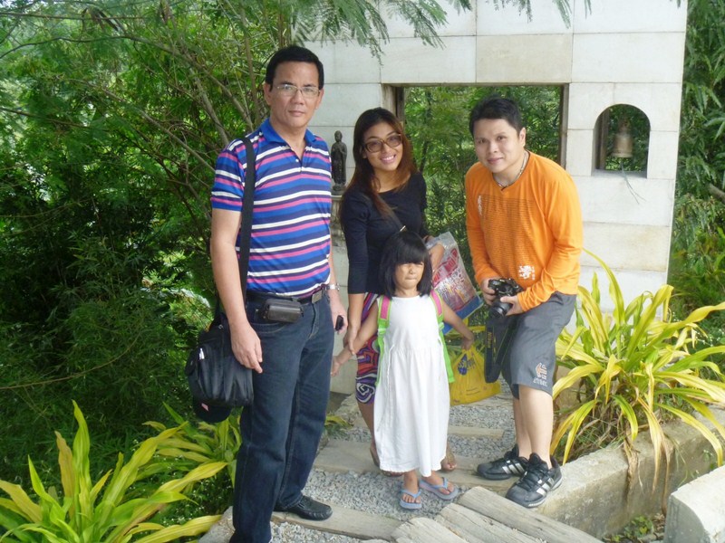
The gateway to the center
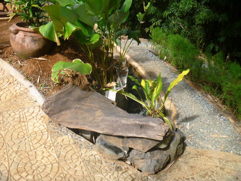
After some confusion with the given directions, we finally made it to the center’s parking area where we were met by Mr. Ronnie Cruz Bernardo, the center’s de facto media consultant. From the parking, we entered a marble gateway with wooden swing doors, flanked by a Buddha statue and a door bell, and went down, via a pathway (which varies from a combination of gravel, stones and railway sleepers, to stamped concrete) with a number of horseshoe bends, to the center’s native-style, open-air pavilion.
.JPG) |
| A pond and foliage-lined horseshoe bend |
Another horseshoe bend along the gravel and stamped concrete trail
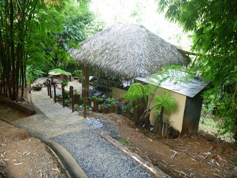
The pavilion had a floor of polished wooden planks and bamboo slats and wooden columns that supported wooden rafters and a roof of nipa and bamboo. It is furnished with eclectic furniture from Pampanga, Thailand and Burma, a large area rug plus lots of Eastern statuary of deities (Kuan Yin, Buddha, etc.), all tastefully arranged by Mr. Chris Munar. One side of the pavilion has a breathtaking view of the mountains of Rizal.
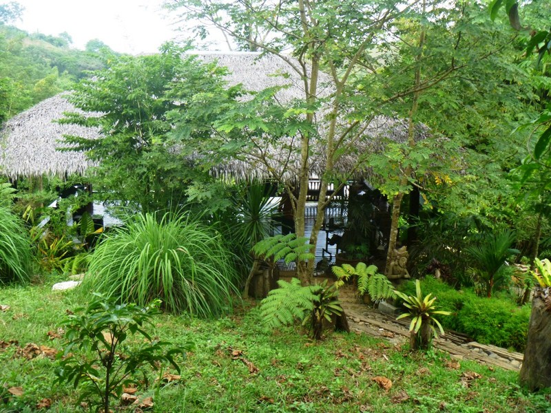
Native-style pavilion
.JPG) |
| The view of mountains from the pavilion |
At the pavilion, we were welcomed with a merienda of suman which we washed down with oxygenated water or a refreshing and healthy tea made with lemon grass (tanglad) and camote tops (talbos) infused with mint and sweetened with muscovado sugar.
 |
| Lemon grass and camote tops tea |
After merienda, Ronnie toured us around the 6,000-sq. m. sanctuary. Near the pavilion are Balinese-style, tastefully designed and furnished cottages (made with concrete as well as local wood, nipa, bamboo and sawali) with capiz windows that can accommodate 6 guests while below the pavilion is a social area (where one can set up tents) with a koi pond and mini fountain. Beside it is the food tent and the sun therapy (essential for natural healing) area with its pair of cushioned lounge chairs.
 |
| Sun therapy area |
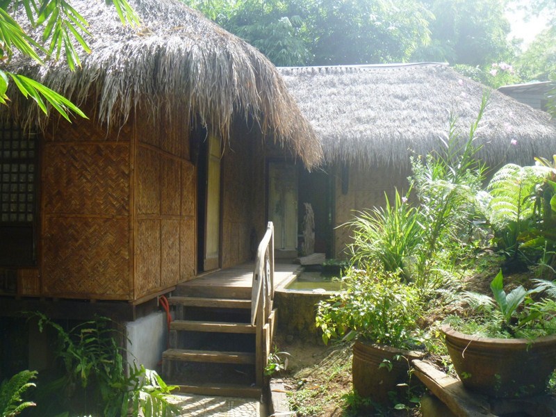
Balinese-style cottage
Part of the nature trail is lighted, come cool evening, by eco-friendly, solar-powered lamps and the natural light of fireflies (alitaptap). Just about every nook and cranny of the center is filled with the healing sound of natural water. Running within the property is a crystal-clear brook which feeds a man-made, stone-lined lagoon (an ideal swimming area) below with cool spring water. On one side of the lagoon is an Eastern-themed bas relief while overlooking the lagoon is a wooden meditation platform.
.JPG) |
| The man-made lagoon |
.JPG) |
| The meditation platform overlooking the lagoon |
A pond, with a covered bamboo and nipa platform (where one can do fishing), is filled with organic tilapia, floating duck weed and Azola (mosquito fern), a natural weed that is very rich in protein, vitamins and minerals. Smaller ponds can also be found along the trail. The piece de resistance is a small waterfall whose natural beauty inspired Dr. Viloria to buy the property.
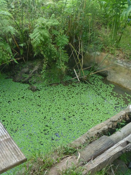
Tilapia pond
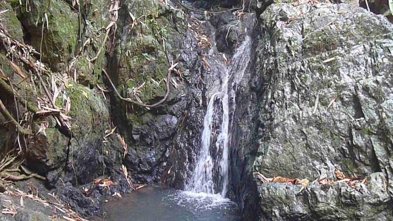
The center’s resident waterfall
 |
| A duyan and benches beneath a bamboo grove |
.JPG) |
| The hilltop meditation platform |
Up a hill, accessed by a wooden stair, is a meditation platform, a mini version of the pavilion, where one can do yoga, meditate, relax or just take a mid-afternoon siesta while enjoying the great nature view. Intersperse within a shady bamboo and giant fern grove are a pair of wooden benches and a native hammock (duyan).
.JPG) |
| A small pond |
Come lunch, we were all served, inside a food tent, tawilis, pinakbet, kalabasa in coconut milk, pako (vegetable fern) salad and clam soup, all complement with organic rice cooked in pandan leaves. This self-sufficient center promotes the locavore lifestyle – eating food that is locally produced.
Food preparation cottage
Meals served here are prepared, by chef Jen (a London-trained therapist and food connoisseur) at her food preparation cottage, from mostly homegrown, organic ingredients; from papayas, guavas, bananas, camote (sweet potatoes), taro, wild spinach, medicinal herbs and spices as well as tilapia and free-range (stress-free with no hormones and antibiotics) native chicken and ducks. From these, they are able to prepare their very own signature dishes such as laing, chicken adobo, banana heart salad, chicken sinampalukan (sour soup with chicken and tamarind leaves) and tilapia in coconut milk and petsay.
.jpg) |
| Our locavore lunch |
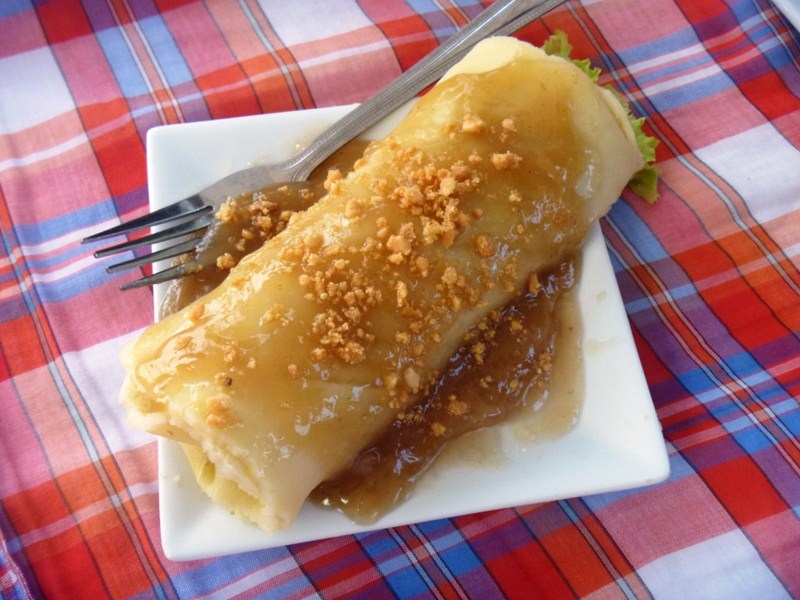
Our merienda cena of lumpiang ubod
Prior to leaving the center, we were all treated to a merienda cena, again at the food tent, of fresh lumpiang ubod, a Negros Occidental (especially in my mom’s hometown Silay City) favorite (and mine). This spring roll is filled with sautéed ubod (heart of palm), shrimps, tahure (bean cake) and bits of pork. Its sauce, topped with roasted garlic bits, created a unique flavor. Melissa and I liked it so much, we shared a second piece.
In the near future, the center plans to include regular hilot (the ancient Filipino art of massage) and dagdagay (a soothing and cleansing routine using native sticks for tired feet, from Ifugao and Mountain Province) service for its regular patrons.
Symbios Holistic and Wellness Sanctuary: Mandala Farm Estate, Timberland Heights, San Mateo, Rizal.
BioVitale Holistic Center: G/F, CRB Bldg., EDSA, Cubao, Quezon City. Tel: (632) 448-7625 to 26. Mobile number: (0921) 260-8459.

.JPG)
.JPG)
.JPG)
.JPG)

.JPG)
.JPG)


.JPG)


.JPG)

.JPG)
.JPG)
.JPG)
.JPG)

.JPG)

.JPG)
.JPG)
.JPG)
.JPG)
.JPG)
.JPG)
.JPG)
.JPG)
.JPG)
.JPG)
.JPG)
.JPG)
.JPG)