The Halsema Mountain Highway

After breakfast at the Albergo Hotel in Baguio City, Jandy and I packed just enough clothes for our 2-night stay in Sagada (Mountain Province) and left the rest at the Front Office.  From the hotel, we took a taxi to G.L. Liner terminal at the Dangwa Compound along Magsaysay Ave., fronting the Baguio Market.  We just missed the previous Sagada-bound bus by minutes so we paid the fare for the next bus, scheduled at 10:30 AM.  We spent the next hour at the Baguio Cathedral, climbing the steep stairs along Session Rd. to get there.  Here, we had snacks at the coffee shop within the compound before returning to the terminal.

The now paved Halsema Highway

A few after our return to the terminal, our designated bus arrived and we boarded the bus, sitting up front, to the right of the driver.  Soon, sacks, farm produce as well as luggage and bags were also being loaded around our area, making alighting a problem later for us.  We left the terminal just before 11 AM but, just before the interchange leading to La Trinidad Rd., traffic slowed us down due to road rehabilitation.  After 30 mins., we left the hustle and bustle of Baguio City and La Trinidad and were now on our way on our long-haul, 6.5-hr. drive to Sagada via the Halsema Highway, the highest highway system in the country.

Landslides and road slips are still a common occurence

Formerly called the “Mountain Trail,” this spectacular 146-km. (95 kms. of which are in Benguet) highway traverses Benguet from south to north.  Named after Eusebius Julius Halsema (American civil engineer and mayor of Baguio City, 1920 to 1936), it links La Trinidad and Baguio City with Bontoc, Sagada (151 kms.) and Banaue (196 kms.), cutting through mountain peaks, gorges and steep cliffs.   This highway was originally a foot trail used by mountain folk between Bontoc and the foot of Mt. Data.  U.S. Army engineers improved and widened it.  They also built a new winding road through precipitous slopes and traversing high ridges between Acops and Abatan,  The road reached Natubleng in 1928 and more than half its length (to Bontoc) was completed in 1931. All told, the highway took more than 15 years to build and was finally completed in 1936.

Fog can reduce visibility of the driver

Tracing a circuitous path, this road crosses the massive Cordillera Central mountain range, crossing deep ravines and skirting dangerous slopes. Jandy and I have passed this way before (in 1998), more than half the road then being unpaved, bumpy, rough and dusty. Today, about 95% of the highway is”paved.”  Still, landslides are a constant hazard here and big stones and debris tumble from peaks, especially during the rainy and typhoon season.  Occasional fog can also ruin a driver’s visibility. However, then and now, we stilled passed through some of the most spectacular mountain vistas found anywhere – magnificent, stonewalled rice and vegetable terraces; swift-flowing rivers spanned by hanging bridges; roadside waterfalls; pine-clad mountains; picturesque villages; etc..

Vegetable terraces
Along Km. 40, approaching Mt. Toyangan, we had good views of the 33-hectare Naguey Rice Terraces, along the banks of the Naburgo River (which joins the Amburayan River below Kibungan) in Brgy. Naguey in Atok. These stonewalled terraces are planted with both rice and vegetables.  The Amburayan River runs for about 30 kms. from Brgys. Pasdong to Naguey. Near Atok’s municipal hall, our bus made a highway stopover for a late lunch at Morning Star Restaurant and Fastfood.
 
Highest Point Marker in Atok

About 3 hrs. past Baguio City, we passed (but did not stop at) the Highest Point Marker (Philippine Pali), along Km. 53 (Km. 303), Brgy. Cattubo near Bayangan in Atok.  Here, the road crosses 2,450-m. high Mt. Paoay.  The highest point of all Philippine highways (7,400 ft. or 2,225 m. above sea level), its viewpoint has good views of Mt. Pulag, Mt. Timbac, Kabayan, Atok and the deep Agno Valley to the south (cloudy during the rainy season).

A beautiful, terraced mountainside

Along Km. 63 are the vast Natubleng Vegetable Terraces of Brgy. Natubleng in  Buguias.  Here, neat rows and upright trellises are planted with temperate-zone climate greens such as Baguio beans, cabbage, carrots and other vegetables and root crops.  We also passed the urbanized townships of Sayangan (Atok) at Km. 54 and Abatan (Buguias) at Km. 90.

The township of Abatan in Buguias
After the copper mining town of Mankayan, we entered Mountain Province at the town of Bauko, site of the 2,310 m. high Mt. Data and the Philippine Tourism Authority-managed Mt. Data Hotel, then on to Sabangan, the town before Sagada.  We exited the Halsema Highway when we turned left at the Dantay Junction where the still partly unpaved,10 km. road to Sagada starts.

Baguio City: Our Gateway to Sagada

Albergo Hotel

It was Jandy’s trimestral break at Asia Pacific College and we didn’t want this week-long opportunity to go by without going on vacation.  I decided to return to Sagada (Mountain Province), a place we last visited nearly 13 years ago.  Just like the previous, we were to go there via Baguio City, staying overnight at the E. Ganzon Inc.-owned Albergo Hotel.

Jandy and I departed Manila on the 1:15 PM Victory Liner de luxe (PhP715 each) airconditioned bus.  The 6.5-hr. trip was non-stop, the need for toilet breaks negated by a toilet on board, plus free wi-fi and some snacks. Part of the time was spent on siestas.  We arrived at the Victory Liner Terminal by 8 PM and, before anything else, had dinner at Maxim’s Teahouse within the terminal.

Room 811

From the terminal, we took a taxi to get to Albergo Hotel.  Once there, we stayed at Room 811 (with its view of SM Baguio).

Check out “Hotel and Inn Review: Albergo Hotel

Hotel Lobby

Albergo Hotel is also a stone’s throw away from Baguio City’s most popular tourist attractions such as Wright Park, Teachers Camp and Mansion House. 

Albergo Hotel: 1 Villamor Drive, Lualhati 2600 Baguio City, Benguet.  Tel: (074) 424-2620  and (074) 424-7176.Manila booking office – Tel:  (02) 552-0331.  Fax: (02) 552-0083. E-mail: egi.albergo@yahoo.com and albergohotel_baguio@yahoo.com.  Website: www.egialbergo.webs.com.

.

Church of Our Lady of the Immaculate Conception (Sta. Cruz, Laguna)

Church of the Immaculate Conception

The Church of Our Lady of the Immaculate Conception, first built by  Franciscan parish priest Fr. Antonio de la Llave in 1608 and enlarged in 1672 by Fr. Miguel Perciva with the addition of 2 wings (giving the church the form of a cross).  It was improved in 1850 by Fr. Juan Antonio Marzo who built the principal nave and convent and remodeled the 5 altars.  The church was destroyed during the July 18, 1880 earthquake and was reconstructed by Fr. Antonio Martin de Vidales in 1881 (assisted by Filipino Fr. Gregorio Ercilla, his coadjutor).

Church of the Immaculate Conception – Interior

On January 26, 1945, during the liberation in World War II, the church was partly destroyed by fire,  leaving only the walls and stairs of the convent.  The present church, a reconstruction in 1948 (through the initiative of Fr. Mariano O. Limjuco), now has an Early Renaissance facade with a pair of large pilasters supporting a plain pediment.  Inside is a bas-relief of the Stations of the Cross, a main altar with a stained glass rendition of the Blessed Mother and the apostle John watching over the crucified Jesus Christ and stained glass depictions of the Joyful and Glorious Mysteries.  On its left is its heavy, massive 3-storey bell tower topped by dome.

Church of Our Lady of the Immaculate Conception: Pedro Guevarra Ave., Brgy. Poblacion, Santa Cruz 4009, Laguna.  Tel: (049) 537-0211.

Sta. Cruz: Laguna’s Provincial Capitol

Laguna Provincial Capitol

It was already late in the afternoon when Jandy and I arrived at Sta. Cruz town, Laguna’s provincial capital and one of the province’s 2 main route centers (the other is San Pablo City). The health, education, transportation, commerce and social services center for the entire province, Sta. Cruz also serves as the business and commercial hub particularly for the predominantly rural northeastern towns of Cavinti, Famy, Luisiana, Mabitac, Majayjay, Nagcarlan, Pakil and Pangil.

Sta. Cruz Municipal Hall

Formerly a part of Lumban, it became a separate municipality in 1602 and was made into the provincial capital in 1858, replacing Pagsanjan.  This town is made famous for its delicious kesong puti (salty white cottage cheese).  This native delicacy, made from carabao’s milk, is cooked in large vats to which salt and vinegar is added till it curdles.  The cheese is then fermented, strained and molded and then individually wrapped in banana leaves.

Church of the Immaculate Conception

Upon arrival at the town, I parked the Revo across the blue and white municipal hall at the town plaza.  The town’s layout seems to be broader than most Laguna lakeside settlements. Sta. Cruz, however, has no natural tourist attractions, only man-made.   Near the plaza is the Church of Our Lady of the Immaculate Conception.

Check out  Church of Our Lady of the Immaculate Conception

Old Provincial Capitol Building

After merienda at a MacDonald’s outlet nearby, we proceeded to visit the Provincial Capitol Building along P. Guevarra St..  Also within the compound is the old provincial capitol.  Our visit to Sta. Cruz capped our Laguna joy ride and we proceeded on our 87-km. drive back to Manila.

Mayor’s Office: Municipal Hall, Poblacion, Sta. Cruz,  Laguna.   Tel: (049) 808-1008


The Ancestral Houses of Pila (Laguna)

Pila Municipal Hall

Past the town of Victoria, we soon reached the Pila town proper (87 kms. from Manila) and its plaza lined with shady, giant talisay trees.  Surrounding it are quaint early 20th century, American-era ancestral houses and, finding them interesting, decided to make a long stopover here to explore the town further.  I parked my Toyota Revo at the Municipal Hall, a heritage building built in 1931 and faithfully restored by Mayor Edgardo Ramos.

Town Plaza

Pila is cited as one of the few intact examples of Spanish colonial town planning where the center of the town was the plaza complex surrounded by the church, tribunal, school and large ancestral houses of the town’s leading citizens.  On May 17, 2000, as a consequence of these efforts, Pila was declared as a National Historic Landmark (a status also enjoyed by Vigan City in Ilocos Sur, Silay City in Negros Occidental and Taal in Batangas) by the National Historical Institute (NHI) .

Pila’s ancestral homes

Unlike nearby Sta. Cruz and Pagsanjan towns which were reduced to rubble by American bombing, Pila survived the ravages of World War II because American bombers failed to spot it.  Because of this great piece of luck, Pila still boasts of 36 19th century and turn-of-the-century structures, 28 of them ancestral homes.  Mostly located in Brgy. Sta. Clara, many of these ancestral homes, a good number of which belong to the Agra, Alava, Dimaculangan, Relova and Rivera families, have withstood the test of time and are still well-preserved, with fresh coats of paint with pastel and cream colors.  These home owners take great pride in town’s old world charm and their rich and varied heritage.  Once parked, Jandy and I strolled along the town’s plaza and its quiet streets, enjoying up close or from afar, the experience of seeing these stately structures that reflect a rich and varied architectural history.

Jose Agra Ancestral House

This lakeshore town, founded by Franciscan missionaries in 1580, has been given the moniker Lupang Pinagpala (“The Blessed Land”) and there are a number of reasons for this. In 1610, in recognition of the noble Pileños refined manners and genteel customs, this town steeped in history and culture was conferred the special status of La Noble Villa de Pila (“The Noble Town of Pila”), one of only five towns in the country accorded this honor by Spain (the others being Cebu, Vigan in Ilocos Sur, Libon in Albay and Oton in Iloilo). The town also survived the ravages of World War II because American bombers, on a bombing run to flush out Japanese soldiers, failed to spot it.  Nearby Sta. Cruz and Pagsanjan towns were not so lucky, both being reduced to rubble.

Relova Ancestral House

In December 1993, the Pila Historical Society Foundation was established to preserve and maintain these remnants of a gentler way of life.  The foundation raised funds and, with the cooperation of the late Mayor Querubin Relova and the Sangguniang Bayan, undertook the huge task of demolishing and relocating new structures that detracted from the beauty, purpose and historical relevance of the original town plan.  Pila is cited as one of the few intact examples of Spanish colonial town planning where the center of the town was the plaza complex surrounded by the church, tribunal, school and large ancestral houses of the town’s leading citizens.

Rudolfo Relova Ancestral House

Many houses built during the Commonwealth Period reflect a shift in architectural styles, evolving from the massive bahay na bato (stone house) to the charming American chalet-style houses with touches of Spanish design elements, decorative Art Deco or Art Nouveau treatments.  Using more Philippine hardwoods and cement, all provide comfort, a respite from the tropical heat and a general feeling of airiness with their high ceilings; tall and wide capiz or paned-glass windows that allow the breeze to come in and woodcarvings on the ventanillas that allow for good cross ventilation. The living and dining rooms, on the second floor, are accessed by stairs that figure prominently in the facade.  The ground floors of many houses facing the plaza, formerly used as storage areas, now house cafeterias and shops.

Pila Historical Society Foundation: tel: (049) 559-0382 (Ms. Cora Relova).

Diocesan Shrine of St. Anthony of Padua (Pila, Laguna)

After our museum visit, we next dropped by the town’s present Early Renaissance-style Diocesan Shrine of St. Anthony of Padua, the first Antonine church in the country.  Located beside the Liceo de Pila (founded in 1947), it was built in 1849 by Frs. Antonio Argobejo and Domingo de Valencia but, during the July 18, 1880 earthquake, was badly damaged and its bell tower toppled.  It was then repaired by Fr. Damaso Bolaños and finished by Fr. Francisco de Santa Olalia.

Diocesan Shrine of St. Anthony of Padua

Its bell tower was rebuilt by Fr. Lope Toledo.  The convent, completed in 1849, was also seriously damaged during the 1880 earthquake.  On July 9, 2002, it was proclaimed as a diocesan shrine by Bishop Francisco O. San Diego of the Diocese of San Pablo. Two relics of St. Anthony of Padua are enshrined behind the tabernacle.  During healing masses, devotees flock to the shrine for a chance to touch the miraculous relics.

The church interior
The church’s Early Renaissance facade, divided into 3 segments by superimposed Doric columns, has a semicircular arched main entrance.  On the second level is a statued niche flanked by pedimented windows.  The pediment, with its balustraded raking cornice, has a statued niche framed by an arched order.  On its left is the 3-storey bell tower with pointed roof.
Diocesan Shrine of St. Anthony of Padua: San Antonio St., Brgy. Sta. Clara, Pila, Laguna.  Feast of St. Anthony of Padua: June 13

Pila Museum (Laguna)

A short leisurely walk from the town plaza brought us to the Pila Museum, the former Spanish-era escuela pia (school).  This refurbished building, probably the oldest structure in the town, now houses priceless pre-Hispanic Northern Sung (960-1127 AD), Southern Sung (1127-1280 AD) and Yuan Dynasty (1280-1368 AD) Chinese porcelain (plates, jars, jugs, etc.) and tradeware transferred to this heritage building in 1994 by the Pila Historical Society Foundation.

Pila Museum

These were recovered, from May to October 1967, from the Esso Standard Philippines-Manuel Elizalde excavations of an ancient crematorium (the oldest in the country) and habitation sites among the coconut plantations in Brgy. Pinagbayanan and Bagong Pook.  The project was led by Ms. Julita G. Fernandez and Ms. Amelia O. Rogel, graduate students of anthropology from the University of the Philippines.  They were supervised by Dr. Robert Fox and Mr. Avelino Legaspi of the Anthropology Division of the National Museum.

Some 250 to 300 pieces of the finds were donated to the town by Mr. and Mrs. Manuel Elizalde. These include celadon dishes with fish motif; celadon censers; qingbai blue and white jarlets; small, lead-glazed water droppers and teapots; qingbai double gourd vessels; large, gray-glazed ewers; figurines of carabao with riders in plain and spotted qingbai; brown wares of all shapes and sizes; iron and glass bracelets; and colored beads and earrings that appear to be gold or copper.

Home of "The Other Rizal" (Los Banos, Laguna)

The Paciano Rizal Shrine

My next stop in my Laguna (Calamba City to Sta. Cruz) joy ride with my son Jandy was the charming resort town of Los Banos.  The town is famous for its hot medicinal sulfur springs that flow from the foot of Mt. Makiling and its present name is derived from the Spanish word for “The Baths.” These thermal springs were discovered in 1590 by Franciscan martyr St. Peter Baptist (San Pedro Bautista).   Today, most of the sulfur springs are piped into the pools and baths of the many hot spring resorts that line the National Highway.  This is the Los Banos that most people know and not many people know this town’s association with “the other Rizal.”

The old Los Banos Municipal Hall

To find out, I parked my Toyota Revo at the old municipal hall (a new one is being built along the National Highway).  Beside the town’s fire station is the inconspicuous retirement home of Paciano Mercado Rizal, Jose Rizal‘s elder (and only) brother who was also a revolutionary general (he led the defense of Laguna) and Emilio Aguinaldo‘s first Minister of Finance.  Though not as popular as the Jose Rizal Shrine in Calamba, this shrine, jutting out to Laguna de Bay, was built atop a hot spring in 1927 by Andres Luna de San Pedro (son of master painter Juan Luna) when Paciano’s original nipa hut was destroyed in a typhoon in 1926.

The back of the house

Rizal lived here, as a gentleman-farmer, with 2 helpers (with occasional visits from his grandsons, from daughter Emiliana, Franz and Edmundo), until his death from tuberculosis on April 30, 1930.  First buried in Manila North Cemetery, his remains were later transferred here, with full military honors, in 1985.  A historical marker was installed here on April 13, 1983 and the house was declared as a National Historical Shrine by the National Historical Institute on July 31, 1992.

Laguna de Bay

This modest American-style, one-bedroom bungalow was turned into a Japanese garrison during World War II, resulting in the loss of much of Paciano’s personal effects. Still around are some photos of his grandchildren, binoculars he used during the revolution, a pair of his shoes and a Quiroga bed.  Rizal’s spinster sisters Josefa and Trinidad are also buried in the sprawling garden which has a bronze statue of Paciano Rizal, on a pedestal, in his general’s uniform.  The shrine has a view of Talim Island. At the back of the house is the Paciano Rizal Park.

Church of the Immaculate Conception (Los Banos, Laguna)

Church of the Immaculate Conception

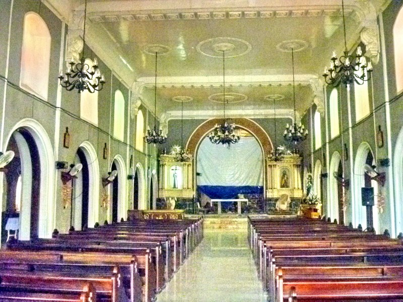
From the municipal hall, we next drove a short way to the town’s Church of the Immaculate Conception.  First built as a chapel from 1613, it was later destroyed by fire in 1727 and rebuilt in stone on its present site by Fr. Domingo Mateo OFM in 1790.

The church’s interior

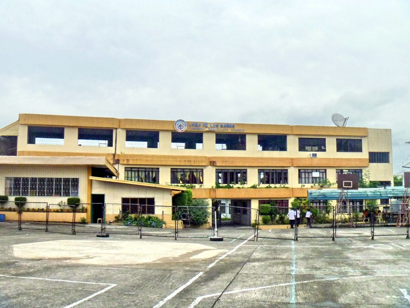
The belfry, sacristy and tile roofing were supervised by Fr. Manuel Amat in 1852.  The convent and bell tower were destroyed during the 1863 earthquake but repairs were made during the administration of Frs. Manuel Rodriguez and Gilberto Marin in 1880. During World War II, it was headquarters and garrison for the Japanese forces. Across the church is the Liceo de Los Banos.

Liceo de Los Banos

Church of the Immaculate Conception: Brgy. Timugan, Los Banos, Laguna. Feast o the Immaculate Conception: December 8.

The Country’s Tallest Rizal Monument (Calamba City, Laguna)

The new Rizal Monument

Unusually August 27 to 30, a long vacation, came and go without me and my son Jandy getting out of town due to Typhoon Mina (international name: Nanmadol). Thus, when the sun shone a bit the next day (still no classes for Jandy), we decided to hop into my Toyota Revo and go on a joy ride around Laguna, from Calamba City to Sta. Cruz, photographing historical sites and old churches along the way.Traveling via the South Luzon Expressway (SLEX), I took the Calamba Exit and made our first stopover at Calamba City, the birthplace of National Hero Jose Rizal, by noon.

The Calamba City Hall

Across the modern, 4-storey City Hall (inaugurated on August 16, 2005) along Bacnotan Road, on a 6.7-hectare government property, is the 6.7 m. (22-ft., representing the 22 languages Rizal spoke) high bronze statue of Rizal, said to be the tallest statue of the National Hero anywhere in the world.  The previous one was a 16-ft. high bronze statue, built by naturalized Jordanian philanthropist Mahmoud Asfour, in Bayombong, Nueva Vizcaya,

It stands on a tiled concrete pedestal mounted on a platform surrounded on all 4 sides by 15-step (representing 150 years) flights of stairs.  Calamba City is also home to the smallest statue of Rizal, a bronze statue of Rizal as a child in the Rizal Shrine,  done by Duddley Diaz and unveiled on June 19, 1998.  The Rizal Shrine is a 10-min. drive from the monument.

Posing beside the plaque

The monument was unveiled, by Pres.  Benigno Aquino III, during the 150th birth anniversary of Rizal  last June 19, 2011.  If measured from its concrete base, the whole monument stands 4 storeys high. The statue, started in December 2010, was designed and executed by 35 year old sculptor Jose Dionas “Jonas” Roces of Marikina City with about a dozen assistants.  Roces also did medium-sized sculpture of Pres. Aquino’s parents, martyred opposition leader Benigno “Ninoy” Aquino Jr. and the late Pres. Corazon Aquino.

NOTE: This Rizal statue was the tallest one from 2011 until 2014 when the 7.93 m. (26 ft.) high bronze Rizal Monument, sculpted by Toym Imao (son of National Artist for Sculpture Abdulmari Asia Imao), was unveiled in Santa Cruz, Laguna for the 2014 Palarong Pambansa  hosted by the province. Depicting Rizal wearing a fencing uniform and holding an epee, it is the only one of its kind in the world.

Rizal Monument: Calamba’s Real Village, Brgy. Real, Calamba City, Laguna.