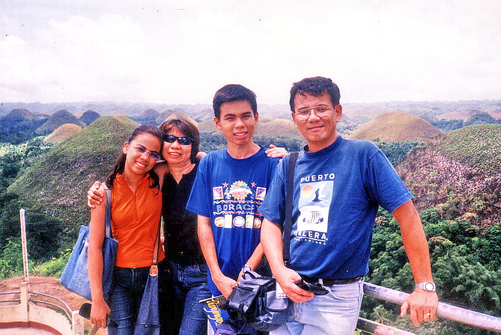
Consocep Resort (Tigaon, Camarines Sur)

After an early morning breakfast at the hotel, Alex, Rick, Jess and I, together with Boyet and Susan, all left on our van for a familiarization tour of Naga City’s favorite getaway from the hustle and bustle of the city: Consoscep Mountain Resort at the foot of Mt. Isarog in Tigaon.  Accompanying us as guides were Ms. Melba Niebres and Ms. Shiela Clara of the Camarines Sur Tourism Office in Pili. The trip, via the Jose Fuentabella Highway, was to take all of an hour.   Past the towns of Pili and Ocampo, we turned left at the intersection leading to the resort.  The 8-km. uphill drive was scenic all the way as we passed abaca plantations and verdant forests.  Turning off our airconditioning, we instead savored the cool caress of its Baguio-like mountain air.  Along the way, we also passed the Parks and Wildlife Office.  Nabontolan Springs are located within its grounds.

Consocep Resort
A welcome arch signaled our entry into Consocep Resort.  This resort, developed in 1989 during the term of Gov. Luis Villafuerte, is located at the 1,800-ft. level of Mt. Isarog.  This extinct, isolated volcano’s vast 101.12-sq. km. (10,112-hectare) base covers Naga City and the towns of Calabanga, Goa, Pili, Tigaon and Tinambac.  The mountain is said to be the home of the legendary Bicolano goddess Aligata and Negritos also live within its dipterocarp forest.  Upon arrival, we parked our van at the park’s spacious lot.
 
Mt. Isarog
From hereon, it would be all footwork.  The appeal of this mountain resort is its fascinating waterfalls.  The resort has 3 major waterfalls: Bulalacao Falls, Kawa-Kawa Falls and Tumaguiti Falls.  There are also 2 smaller ones.  Getting to these falls proved to be easy as we leisurely hiked along cemented, pebbled-washout or cobbled-stoned pathways and stairs (there are said to be 1,394 steps along the trail).
 
Entrance to the resort
The first waterfall we reached, Tumaguiti Falls, was the park’s highest.   Its name was derived from its rain shower-like gush of water.  We weren’t prepared for a wet reception at this fall as we didn’t bring bathing attire or extra clothes.  Boyet didn’t seem to care as he took, with gusto, his first “natural” shower, clothes and all.  We could only watch in envy.
      
Tumaguiti Falls
We soon continued on our way to our next destination: Kawa-Kawa Falls.  Its name was derived from the native word kawameaning “big cauldron.”  Although a David compared to the Goliath-like Tumaguiti Falls, it is still the best known and most popular because of its natural “slide” into a man-made swimming hole so structured as to blend naturally with its surroundings.  Again, Boyet took a natural bath in its refreshing waters while we consoled ourselves by just breathing the cool mountain air and admiring the tall trees and giant ferns.  We also interviewed 47-year old Domingo Saulon, one of the park’s four rangers.
     
Kawa-Kawa Falls
After about 30 mins., we continued on our way to our final destination: Bulalacao Falls, so named because of its rushing cascade. After passing a dressing area and an impressive treehouse, we soon heard the rushing waters of the waterfalls.  But first, we proceeded to its viewing deck.  Quite tired and famished, we partook of the packed Bigg’s Diner packed lunch we brought along: fried chicken and laing (taro leaves with shrimps in coconut cream) cooked in true Bicolano fashion; hot and spicy.   After this hearty lunch, our group proceeded down the steps, to the falls.
      
Bulalacao Falls
What a falls it was!  This third major waterfall truly lived up to its name, as its onrushing waters fell down, in graduated steps, to a deep, inviting pool surrounded by lush foliage.  The temptation to dive in was irresistible and since I had already missed out on two beautiful falls, it would truly be a sin to miss out on this third and last opportunity.  Clad only in my jogging pants, I waded its icy-cold waters for my own “natural” bath.  Boyet, Alex and our guides; Melba and Sheila, soon followed suit.   Susan, Jess and Rick still opted to remain as spectators, watching us as we lolled about the pool.
     
A treehouse at the resort
After 30 mins. of sheer ecstasy, we reluctantly left the falls, drenched as a newborn chick, to make our way back to the park entrance.  The return trip was all slightly uphill and our group was split in two as the others lagged behind.   Reaching the parking lot ahead of them, I took the opportunity, while waiting for the others, to dry myself under the sun.  Soon everyone was accounted for and we all boarded our van for the return trip down the mountain.

Back to Naga (Camarines Sur)

The first time I’ve been to Naga City was way back in 1980 when I attended a Rotaract convention there.  I wasn’t much of a tourist then as I was now.  Opportunity beckoned again when I was invited by the Department of Tourism to cover its May 25 to 28 Kaogma Festival.  I was to join a media group consisting of Mr. Rick Alberto of What’s On/Expat, Mr. Jess Escaros of Philippine News Agency and Mr. Alex de los Santos of Pilipino Reporter.   Also accompanying us were Mr. Boyet Escueta and Ms. Susan Codotco, media coordinator and in-house writer, respectively, of the DOT’s Office of Tourism Information.  We left the DOT by 11 AM on an airconditioned tourist van.

Quezon National Park

All of us were in for a long haul as the trip to Naga City took all of 9 hours, passing 6 towns and 1 city in Laguna, 11 towns and 1 city in Quezon, the whole length of Camarines Norte and 5 towns of Camarines Sur before reaching our destination.  Places of interest along the way include the scenic seacoast highway along Atimonan, Plaridel and Gumaca and the Quezon National Park with its winding zigzag road (locally called bitukang manok).

The Miss Camarines Sur beauty contest

We arrived at the city by 8:30 PM and checked in at the Villa Caceres Hotel.   After a hearty supper, it was off to work as we covered the Ms. Camarines Sur beauty pageant held at the Government Center in Pili.  Special guest there was former Miss International Melanie Marquez.  After a courtesy call on Gov. Luis Villafuerte, we called it a day and returned to our hotel for a fitful sleep.

Villa Caceres Hotel: Magsaysay Ave., Naga City, Camarines Sur. Tel: (054) 473-6530 to 33 and 811-6083 to 89. Fax: (054) 473-9327.   E-mail: info@villacacereshotel.com. Website www.villacacereshotel.com.

Matabungkay’s Balsa Festival (Lian, Batangas)

Parade of Decorated Balsas

I, together with other members of the print and broadcast media, were again invited (my first was a media familiarization tour last March 23 and 24) to cover the First Balsa Festival in Matabungakay, Lian.  Matabungkay’s very shallow beach is lined with about 150 of these rented balsas, all ingeniously fitted with shaded picnic tables and grills for visitors who want to go dining al fresco, swimming, snorkeling, sunbathing and, at the day’s end, watching the magnificent sunset. These hardy balsas and their navigators have, in effect, become the durable and unique symbol of Matabungkay and a very important contributor to Lian’s tourism livelihood economy.

Sunset at Matabungkay

We were guests of the 4.2-hectare, DOT-accredited “Class AA” Matabungkay Beach Resort and Hotel (MBRH).  Just recently, the resort was named as the “Most Outstanding Beach Resort of 2002” during the 17th Annual Parangal ng Bayan Awards and the 2002 National Consumer Excellence Awards.  As festival hosts, MBRH was in the thick of preparations with the visibly-tired Ms. Charley Leviste-Antonio (Vice-President for Operations), Ms. Marissa Romero-Balangue (Marketing and Sales Director), Mr. Rico M. Violeta (General Manager) and Ms. Blessie Zarzuela (Gen. Manager of Adea Advertising) ably providing the push.

Sen. Loren Legarda

We arrived at Matabungkay in time for the festival’s highlights: the Balsa Race and the Parade of Decorated Balsas.  The weather was perfect with the sun shining brightly on a cloudless, blue sky.  The race and parade was held along the beachfront of Kandahar Resort.  Invited guests of honor included Sen. Loren Legarda-Leviste and former Batangas Gov. Antonio Leviste.   The Balsa Race was a test of the boatmen’s strength, endurance and dexterity with the bamboo pole as they navigated their sometimes unwieldy balsas to the end of a one hundred meter long course along the shoreline.  The winners took home cash prizes of PhP10,000, PhP7,000 and PhP5,000 for first, second and third place respectively.

Matabungkay’s hardy balsas

The Parade of Decorated Balsas was truly a spectacle in itself.  It also had a message: recycling and use of indigenous materials.  This theme was evident among the eleven entries who vied for even bigger cash prizes of PhP20,000, PhP15,000 and PhP10,000 for first, second and third respectively.  Aside from bamboo, the indigenous material from which all balsas are made, the entries also made free use of the town’s famous caballero flowers, the fiery-red blooms of the flame tree.   Recyclable materials of choice were old newspapers (as banderitas) and plastic, colored water-filled, 1.5-liter soft drink bottles strung together.  The star of the parade (although not the winner) and the photographer’s delight was a balsa featuring a gay, blue-painted shokoy (local name for a “merman”).

A crowd favorite

After the show, it was back to MBRH for a sumptuous, a la carte lunch at its Caballero Café.  Later, we were all booked in some of the resort’s 57 airconditioned superior and executive guest rooms with cable TV, private bath and spacious veranda.   In the afternoon, the mood of the Balsa Festival turned Filipiniana as MBRH also played host to two exciting games, both qualifying as the Filipinos’ version of “Grease.”  The first was a palo sebo, where contestants had to clamber up a greased up bamboo pole in a no-holds-barred race to grab the pennant on top.  Equally greasy was the habulan ng biik, where contestants raced against each other in a bid to be the first to catch a greased up piglet.  Poor pig.   

A senior citizen dance

Later in the afternoon, students from the town’s different secondary and tertiary schools as well as senior citizens showcased their talents in dance and other production numbers at MBRH’s basketball court.  Quite a colorful sight was the dance troupe which performed a komedya (also called a moro-moro), an age-old dramatization of the battle between Christians and Moors.  It won the top prize. Another sure-fire scene stealer was the town’s old ladies in white and multi-colored balintawak attire who showed a lot of spunk in rendering a native dance.  One even regaled the appreciative crowd with her whole-hearted rendition of the timeless song “Tayo na sa Antipolo.”  Bravo!  Come nighttime, the festival was capped by band performances where the townspeople slowly but surely danced the night away, to the beat of old and new disco tunes, up to the wee hours of the morning.  What a way to end a day (and a festival).

The Waterfalls of Mt. Romelo (Siniloan, Laguna)

Mt. Famy in Laguna, the nearest and most accessible mountain trekking destination from Manila.  The mountain, in itself, is no “tall” order being only about 1,100 ft. (335 m.) high.  The charm of the place, aside from its accessibility, lies in its 7 beautiful waterfalls (Ambon-Ambon Falls, Batya-Batya Falls, Buruwisan Falls, Lanzones Falls, Matandang Buruwisan Falls, Sampaloc Falls and Sapang Labo Falls).  It was this charm that made me decide to visit the place.  I brought with me Jandy and Jesu-Mariae School teachers Mr. Roy Trillo and Mr. Arnel Daliva.  We left Manila by 6:30 AM traveling via the C-5 highway to Pasig City, Antipolo City, and the Rizal towns of Cainta, Taytay, Teresa, Morong, Baras, Tanay and Pililla, before crossing the Laguna boundary, to Mabitac and Famy.

Buruwisan Falls

The views along the winding and well-maintained asphalt highway at Mabitac were truly spectacular as we feasted our eyes on the surprisingly forested mountains of the majestic Sierra Madres and the calm, azure waters of Laguna de Bay.  The route here, and in Antipolo City, is full of sharp, Kennon-like zigzag bends.    Asking around at the Caltex station in Famy town, we were beginning to wonder why no one seems to know or even heard about this mountain named after their town.  One even gave us wrong directions to a mountain in Pakil.  The answer is simply because it isn’t there in the first place.  We tried the next town of Siniloan.

Jandy rafting at the falls

Later conversations with Siniloan residents Geronimo and Marilyn Pontipedra revealed that our mountain destination was, due to an erroneous land survey, placed within the territorial jurisdiction of Famy town. Hence, the name Mt. Famy.  In reality, the mountain belongs to Brgy. Macatad in Siniloan.  Here, they call it Mt. Romelo.  Two of the mountain’s 7 waterfalls are another story.  Buruwisan Falls and Ambon-Ambon Falls, according to some travel brochures that I’ve read, are supposedly under the jurisdiction of neighboring Sta. Maria and Pangil towns respectively.  Brgy. Macatad’s residents claim otherwise.   We arrived at the jump-off point by 9 AM and parked our car, for a fee, at a house along the highway.  All four of us registered our names at the store of Ms. Pontipedra and gave a small donation.  Laden with our gear we, at first, refused offers for guides and porters.  This was foolish economy on our part as there were many forks along the trails.  We finally engaged the services of 13-year old Macatad resident Joel Diaz as our guide.   Later, he also became my porter as the heavy weight of my backpack began to tell on my unfit, then 43-year old body.  Who ever said age doesn’t matter?

Camping by the falls

Our destination, Buruwisan Falls, is accessible by two mountain trails: Puting Bato and Pulang Lupa (the shorter route).  I neglected to ask which route we took. The initial part of the trail was through rocky streams and muddy river beds.  We soon entered a light forest and it was uphill and downhill all the way through 2 hills, passing occasional spear grass (cogon) trails.  The most difficult part was clambering up a steep 45-degree grassy incline to the top of the first hill.  Here, two stores offer a welcome relief of cool soft drinks and fresh buko (all for an understandably “steep” price of course) to the victorious climber.  This scene is also repeated on the second hill.   Both hills offer spectacular mountain views and weak Smart and Globe signals.  Beyond the hill, my mobile phone become useless baggage.

It is never lonely along the sometimes muddy trail as it was the peak of the trekking season.  Groups of hikers occasionally passed us by (and vice-versa).  One even rode on a horse (hired for PhP150 one way).  These horses also carry gear and supplies.  Soon after passing the second hill, our spirits were buoyed by the sound of rushing water as we neared our destination.  After three hours of strenuous trekking, we arrived at the campsite in time for lunch.  We pitched our tents below the falls’ rocky overhang (a good shelter from the sun and rain, but quite risky during an earthquake).  I particularly situated my tent‘s opening to face the falls. There were already 6 tents pitched before our arrival.

Lanzones Falls

The 50-ft. high, postcard-perfect Buruwisan Fall is featured in many travel books for the rappelling thrills it offers.   According to Joel, other visitors here even engage in the very dangerous, extreme sport of diving from the top of the cliff down to the falls’ deep pool.  Luckily, no one has, as yet, died from it.  On my part, I just engaged in the safer sport of just swimming in its bracingly cold waters while Jandy paddled along on a floating log.   Our indispensable Joel who continually served us throughout our stay, later guided me to Lanzones Falls, downstream to the right from Buruwisan Falls.  Although half the height of Buruwisan, it was just as spectacular and its shallow pool had surprisingly clearer waters than its predecessor.

Matandang Buruwisan Falls

The waters of the two waterfalls meet to form the majestic but rarely visited Matandang Buruwisan Falls (Binaytuan Falls to others).  Said to be 200 ft. high, its splendor is rarely seen by visitors as its base can be reached only after a very difficult hike.   Joel was one of the lucky ones to have visited it.  I could only view it from the falls’ top.  After an early supper, we retired to our tents for a much needed rest after a hectic day.  Sleep, however, was almost an impossibility as the ground beneath our tents was rocky.  The rubber mat I brought along only provided some relief.  I was also quite unused to roaring sound of the waterfall beside us.

Batya-Batya Falls

We awoke early amidst a slight drizzle, had a hearty breakfast, dismantled our tents and packed our backpacks.  Leaving our gear behind at the store of Joel’s grandmother, we then proceeded, with Joel leading the way, upstream to Batya-Batya Falls.  Getting there was easier said than done as we had to hop among large boulders and twice wade through 5-ft. deep waters, carrying our belongings above our heads.  After a 30 min. hike, we finally reached the falls.  Equally beautiful as the others we visited, it was unique in its own way as its crystal-clear waters fell in tiers.  There were small, deep basins (hence the name, batya which means “basin”) at every drop.  We had the irresistible urge to climb it and all four of us did so.  Joel stayed behind with our stuff.  Climbing it was quite difficult but well worth the effort.  Up the falls was another stream leading to Sampaloc Falls.  It entailed a long hike though.  Four out of seven waterfalls visited already make a good batting average, so we decide to forego a trek to this fifth fall.   With great difficulty, we retraced our steps back down the falls. 

We were back to the store by 10 AM. Here, we changed into dry clothes and started our hike back to my car.   We made it back in a “record” time of 2 hrs., stopping only for rest at the two hilltop rest areas.  After a short talk with Ms. Pontipedra and a late merienda of halo-halo, we left by 1 PM after paying the PhP100 parking fee.  We arrived in Manila by 4 PM, stopping only for a late lunch in Antipolo City.


Taal Volcano: Hike to the Crater Lake (Talisay, Batangas)

Mt. Binintiang Malaki

This Holy Week, I availed of a standing invitation from Ms. Lily Rodrigo-Canlas, president and C.E.O. of Jesu-Mariae School, my son’s school, to stay at the Jesu-Mariae Center in Tagaytay City.  This retreat/seminar center could comfortably accommodate 80 people in dorm-style facilities.  With this center as a jump-off point, I planned to revisit Taal Volcano via the Kayabok Trail on the other side of Volcano Island.  Joining me were my son Jandy and daughter Cheska who’s been egging me to include her in my escapades.  Joining us were 5 of Jandy’s teachers: Mr. Robert Castaneda, Ms. Veneriza “Vener” Trillo, Ms. Theresa “Thet” Quieta, Mr. Joel Fatlaunag and Mr. Erwin Vizcarra.  All, except Robert, are jittery first-timers at the volcano.     

Picnic Grove with Taal Volcano behind us

We left Manila on the morning of March 27 and arrived at the center in time for preparation of a delicious barbecue lunch.  After customary visits to the city’s Picnic Grove (where we went horseback riding) and People’s Park in the Sky (now in a sorry state of disrepair), we returned to the center for a delicious supper and retired early as we had to leave very early in the morning for the volcano trek. 

Cheska horseback riding with Thet

The next day, Holy Thursday, we all awoke by 5 AM, had breakfast, pack our provisions of bottled water, sandwiches and bananas (good trail food) and left the center by 6:30 AM.  From Tagaytay City, we went down to Talisay (Batangas) via the treacherous concrete zigzag road called Ligaya Drive, down to Brgy. Caloocan.  As soon as we arrived at the boat landing station, we were swamped by boatmen hoping for an early kill, this day being a holiday.   Soon, they were trying to pluck our feathers by charging us a cutthroat rate of PhP3,200 just for the trip (with 6 passengers only).  It was soon watered down and we settled at the still horrendous price of PhP2,400 to bring all 8 of us to our destination.

On our way, by boat, to Volcano Island

We left the station by 7 AM on board a big motorized banca.   The trip was smooth all the way as the waters were calm. As we went around the island, the 311-m. high (the island’s highest point) Mt. Binintiang Malaki (translated as “giant leg”), soon hove into view.   This northwest cone, seemingly featured on most Taal Volcano postcards like an island (actually connected to the real Volcano Island), emerged overnight during the 1707 eruption but is now dormant. A dismal sight during the voyage was the presence of numerous fishpens which our boat had to negotiate to get to the other side.

Nearing the homestretch

We landed on the island’s western shore at Brgy. Kayabok by 7:30 AM.  All throughout the trip, the boatman kept egging me to get a guide (at extra cost of course) but we have decided even before the trip to do without one as the Kayabok Trail was definitely well-trodden.  We also refused a lady islander’s rather steep offer to guide us for PhP500.  Anyway, we had all the time in the world even if it meant getting lost in a small island.   Our seemingly concerned boatmen seem to have other things in their minds.  I wonder why.

The Crater Lake seen from a distance

We began the trek on a happy note, following the well-trodden trail up a hill. The sun soon rose brightly on the sky and we began to feel the effects of the intense heat from the morning sun.   As we soon reached the top of the hill, the trail began to fork, leaving us in a dilemma.  All the while, we somehow had a feeling that we were being followed and, soon enough, our boatmen were hollering for us to come back.  We ignored them.  Later, we encountered our huffing and puffing boatmen along the trail.  We were told that we took the wrong turn and they, in all kindness, offered to guide us in the right direction.  Or were they?    It soon dawned upon me that these boatmen were concerned, not with the guide fee (which I consistently refused), but with the fact that they may lose their first big meal ticket (or buena mano) of the day among the winding trails.  We could just as easily have taken our boat ride back to Talisay from the other coastal villages.  With this in mind, they never left us out of their sights after that.

Finally, at the Crater Lake

Vegetation on the island is sparse, consisting mostly of short grass, tall, nettled spear grass (cogon) and thorny brambles.  The treeless trail we trekked was all loose volcanic ash and the ground underfoot was also hot as volcanic rock retains heat both from the sun and the hot magma trapped deep within its bowels.  This, coupled with the sweltering heat of the sun, soon made our tongues hang out.  Our party was soon divided into two as our neophyte mountaineers Vener and Thet began to lag behind.  Cheska, however, proved to be tough and resilient as she kept up with the guys. 

The island within the Crater Lake

We took solace under the small shade of occasional thorny aroma trees (most of the large trees have been blown away by previous eruptions) where we quenched our parched throats and munched bananas as we waited for the stragglers to arrive.  Along the trail we passed by one of Taal’s 47 craters.  This seemingly dormant crater had a flat, cogon-covered bottom.  We also encountered makeshift refreshment stalls selling canned softdrinks (PhP30) and bottled water (PhP20).  After a tiring uphill hike, the shimmering blue-green waters of the crater lake made its appearance like a mirage on the horizon.  It was all downhill after that and, soon enough, we reached the crater lake’s rim.  It was 9 AM and the hike took all of one and a half hours.    It could have been longer.  Our socks and shoes were soon off as we couldn’t wait to dip our tired feet in those inviting waters.  However, the lake’s waters deepen just a few feet from the shore. About 30 m.  offshore is the small, crescent-shaped island.  The lake’s waters are actually dilute sulfuric acid with salts and other minerals such as sodium, boron, magnesium and aluminum added in.   Acidity in the water, measured in pH (the lower the pH, the higher the acidity), is a “whopping” 2.7 (neutral pH is 7.0) with about 3% sulfur.   Sulfurous waters have medicinal qualities and it did wonders for my mosquito-bitten legs.  Our boatmen also took home 1.5-liter bottles filled with this salty and bitter water.  Also as a result of the sulfur deposits, the stones at the lakeshore are coated yellow.

L-R, Vener, the author, Jandy, Thet, Robert, Erwin and Joel

After lolling about the waters, taking our lunch of sandwiches and photo shoots for posterity, we left the lake and retraced our way back to our boat and left the island by 11:30 AM.  Any notions of being in Tagaytay for an early lunch were dashed when our boat engine conked out (obviously out of gas) just a kilometer off the shore of Brgy. Caloocan.   We had to wait for half a hour for a relief boat to ignominiously tow us back to shore.  After paying our boatmen (they had the gall to ask for a “tip”), it was back to our car for the uphill drive back to Tagaytay and a well-deserved lunch.  Back at the Jesu-Mariae Center, we collapsed, dead-tired, on our beds. 

The Balsas of Matabungkay (Lian, Batangas)

Matabungkay Beach Resort & Hotel

I was invited to join a media familiarization tour of Matabungkay Beach Resort & Hotel in Lian, Batangas on March 23-24, the weekend preceding Holy Week.  Our assembly area was the Department of Tourism (DOT) Bldg. near Rizal Park.  I left my car at my wife’s office at Gil Puyat Ave, took a fully-packed LRT train, overshot my designated stop which was U.N. Ave. and dropped off instead at Central Station where I decided to just walk, for the exercise, back to the DOT.   I arrived at the DOT cafeteria, huffing and puffing and drenched as a newborn kitten, just in time for breakfast.

Check out “Resort Review: Matabungkay Beach Resort & Hotel

Joining me at the breakfast table were some of the Who’s Who in travel journalism: Mr. Randy V. Urlanda of Panorama, Mr. Frank A. Evaristo of Manila Bulletin, TODAY veteran photographer Mr. Manny Goloyugo, Ms. Arlene Dabu-Foz of Manila Bulletin, Mr. Romark Mayuga of Manila Times, Ms. Claudeth E. Molon of TODAY, Ms. Lala Rimando of Newsbreak Magazine, Ms. Ruby Gonzalez of Travel Weekly East, Ms. Maggie De Pano of Business World Online, Mr. Michael David C. Tan of What’s On & Expat and Mr. Melvin S. Magtaus and Mr. Dennis Lapan of Lifestyle Asia.

Also present, as host, were Ms. Leona  DG. Nepomuceno and Ms. Camille Cua of the DOT.  Also joining us were Ms. Blessie Zarzuela of Adea Marketing, the TV crews from ABS-CBN (3) and RPN 9 (3) and 2 other DOT personnel.

We left the DOT at exactly 8:30 AM for the 3-hr. airconditioned coaster trip to Matabungay.  I sat at the lone bucket seat up front with its wide legroom suitable for my 5’-10” frame.   I had to buckle up though.  The long 105-km. trip via the Sta. Rosa Expressway was pleasantly uneventful until we reached the junction leading to Lian.  Here the coaster was bodily stopped by resident “commissioners” out to make a killing this early.   This scene was repeated  5 more times as we approached the town and our hotel, the last one a roadblock set up by the barangay soliciting donations for their fiesta.  What a damper!

Media participants by the Nestea swimming pool
A fleet of balsas

After arrival and check in at the resort, we had lunch and, after a short rest, we were all invited by Marissa to take a ride on one of the resort’s floating bamboo rafts (locally called balsa) where a merienda of pancit bihon and canned soft drinks awaited us.   Ideal in Matabungkay’s very shallow beach, the shore is lined with lots of these balsas.   They are navigated by long bamboo poles sometimes up to the edge of the drop-off and, once a suitable spot is chosen, anchored in place.  All rafts have shaded picnic tables and grills.  From the balsa, visitors could go swimming, snorkeling and, at the day’s end, sunset watching.

Even after the sun has set, a number of these lighted balsas are used to await fishermen and their much-awaited bountiful catch.   These balsas, in effect, have become a very important contributor to Lian’s tourism and livelihood economy.   As a tribute to this hardy and durable symbol of Matabungkay, Lian has decided to hold its first Balsa Festival this coming May 17-18.

The 2-day festival, proudly hosted by Matabungkay Beach Hotel & Resort, promises to be activity-packed.  Highlights are a Balsa Race and the Parade of Decorated Balsas.  Different sectors of Lian and the nearby towns will be invited to participate, 80 for the Balsa Race and 60-70 for the Parade of Decorated Balsas.  Students from the town’s different secondary and tertiary schools will also showcase their talents in dance and other production numbers.   The festival will be capped, on the evening of May 18, by band performances and a beach party.

Preparing for my trial dive

After the raft excursion, Marissa invited us to try our hand at scuba diving at the resort’s swimming pool.  I, plus  Blessie and Lala, took a crack at it.  The others begged off.   Mr. Jim Waite, the in-house dive instructor, gave us a brief overview on the  basics of diving and its equipment.  The much-awaited actual lesson followed and we were soon fitted with masks, snorkel, buoyancy compensator, tanks, weight belts and fins.   This being my second dive (my first was a trial dive in Club Paradise in Palawan), I was soon diving about at the pool’s floor like a fish within its element.

After a much-needed shower, a torchlit dinner was served along the beach.  Additional lighting was provided by a bonfire.   We were also joined by TV crews of ABS CBN and RPN 9 TV.  Immediately after that, we were again invited to a round of nighttime entertainment at Gotcha Club.  The girls monopolized the videoke while us guys contented ourselves with rounds and rounds of billiards and table tennis.  Still others just watched the girls sing to their heart’s content until the wee hours of the morning.

Press conference by the beach

The next day, after a sumptuous buffet breakfast at Caballero Café, we buckled down to serious business with a mini-conference held at the beach area.   Invited to the conference were Ms. Charlie Leviste-Antonio (the resort’s Vice-President for Operations), Mr. Jim Waite, Ms. Balangue, Mr. Violeta and the town’s Chief of Police.  Here we voiced our concerns (the “commissioner” episode, environmental issues, Holy Week security, etc.) and asked questions concerning the resort’s history, facilities and plans, the upcoming Balsa Festival, scuba diving opportunities and Fortune Island (a sister resort).

Posing with our hosts

Immediately after the mini-conference some of us opted, it being Palm Sunday, for a mass (complete with the appropriate palms) held at the resort’s pavilion.  After a late lunch at Café Caballero, we packed up our stuff, had a photo session at the resort entrance and said goodbye to our gracious hosts, Ms. Leviste-Antonio, Ms. Balangue and Mr. Violeta.  We left the resort by 2:30 PM  and arrived in Manila by 6:30 PM, after a side trip to Calatagan and numerous stopovers at Tagaytay City for fruits, espasol, buko pie and mazapan sweets.

Matabungkay Beach Resort and Hotel: Brgy. Matabungkay, Lian, Batangas.  Manila office: Unit H, Garden Floor, LPL Towers, 112 Legaspi St., Legaspi Village, Makati City.  Tel: (632) 819-3080, (632) 752-5252 and (632) 751-6685.  Fax: (632) 817-1176.  E-mail: mrb@matabungkay.net or inquiry@matabungkay.net.  Website: www.matabungkay.net.

The National Gallery of Art (Manila)

The next day, I continued on my rounds of the National Museum, this time proceeding to the next door National Gallery of Art, housed in the Old Legislative (Congress) Building.  This historic edifice, a magnificent Neo-Classic-inspired structure with stylized Corinthian columns, is a work of art in itself.

It was designed in the Federal style of architecture as a museum/library in 1921 by American architect and Manila and Baguio City planner Daniel H. Burnham and Filipino architect (and later 1973 National Artist) Juan Nakpil.  It functioned as a museum/library until 1935 when it was made the legislative seat of the Philippine Commonwealth.

This grand, earthquake-proof edifice, was, however, reduced to rubble during the Liberation of Manila.  After the war, the building was rehabilitated with Ralph Doane and Antonio Toledo as architects in charge for its construction and extensive renovation.  A fourth floor was added.

After the declaration of martial law on September 21, 1972, Congress was abolished and the building was closed.  After years of neglect, the building was restored to its former glory as the Executive House, Office of the Vice-President, Philippine Senate and finally as the permanent home of the National Gallery of Art.  It was formally inaugurated as such on October 18, 2001, during the National Museum’s centennial.

The museum’s ground and fourth floors houses offices, laboratories and storage.  The second floor houses art exhibits while the third floor has a seminar hall and two major halls, also airconditioned, for science exhibits.   Today, the National Gallery of Art has amassed a collection of 1,204 visual art pieces, most of which are paintings housed in three major halls and three smaller halls at the second floor, all airconditioned.  A session hall, for formal lectures and concerts, has just been refurbished.

The National Gallery of Art
The star attraction of the National Gallery of Art is the Juan Luan Hall facing the front entrance lobby of the second floor.  It houses the Juan Luna Collection, a September 19, 1990 bequest of the now defunct Far East Bank and Trust Company.  Inside are 162 oil paintings (on canvas, panelboard and wood panels) and charcoal sketches of foremost Filipino master painter Juan Luna y Novicio (October 23, 1857-December 7, 1899) as well as Andres Luna de San Pedro (1887-1952).   

The remarkable Juan Luna studied and perfected his craft by living in the art capitals of the world: Rome (Italy), Paris (France) and Madrid (Spain).  In Spain, he was commissioned by the Spanish Senate and King Alfonso XII to paint El Batalla de Lepanto (The Battle of Lepanto) which now hangs at the halls of the Spanish Senate.

Another work, La Muerte de Cleopatra (Death of Cleopatra), won the silver medal at the 1881 Exposicion General de Bellas Artes in Madrid, Spain. His last major work, Peuple et Rois (People and Kings), completed in 1889, was acclaimed as the best entry in the 1904 St. Louis Exposition.  Unfortunately, it was destroyed by fire during World War II.  But these were not his greatest obra maestras.

Juan Luna’s Spoliarium
Populating a whole wall in the gallery is Luna’s famous and awesome (425 cm. x 775 cm.) mural masterpiece Spoliarium which won the first gold medal (grande prix) awarded by the elitist Salon des Beaux Arts during the 1884 Exposicion General de Bellas Artes in Madrid, Spain.  Luna, upon the instigation of Francisco de Paula Redoreda, painted this colossal multi-figure mural depicting a scene of dead gladiators being mourned by relatives. 

Rendered in frenzied fin de siecle brushstrokes, it was identified by Jose Rizal as an allusion to the exploitation of the country by Spain.  This art achievement underscored the ability of Filipinos to compete with Europeans at their backcourt and it was also a subtle affirmation of the Filipino’s capability to run affairs back home.

The Art Donations to the National Museum Hall displays notable donated art pieces by rising stars Emilio Aguilar-Cruz, Lex Cachapero, Elizabeth Chan, Papo de Asis, Jaime de Guzman, Gene de Loyola, Josie de Ocampo, Zozimo Dimaano, Miguel Galvez, Elmer Gernale, Ang Kiukok, Gregorio Lim, Hernando R. Ocampo, Joaquin Palencia, Al Perez, Jonathan Pulido, Carlos P. Valino and Roy Veneracion.

A retablo at the Religious Art Hall

The Religious Art Hall houses Spanish-era statues of saints, paintings and retablosRetablos are intricately carved and decorated altar pieces which are often gilded, polychromed and embellished with rosettes, scrolls, Solomonic columns and cherubs. On display are a huge retablo from Leyte (late 18th century) and another smaller one from Dimiao (Bohol).

The oldest painting in the collection is the unsigned, circa 1800 oil on wood painting Coronation of the Virgin.  Another hall houses the still ongoing Centennial Celebration of Wood & Form by Jerusalino “Jerry” Araos which was opened last October 24, 2001.

The Colonial Art Hall houses oil paintings on canvas and wood as well as pencils sketches of genre scenes, typical landscapes known as pasajes, still life as well as portraits done by prominent Spanish and American-era Filipino painters.

The most noteworthy is Juan Luna contemporary Felix Resurreccion Hidalgo (1855-1913) who won the second prize for Virgenes Cristianas Espuestas al Populacho in the same Madrid competition won by Juan Luna’s Spoliarium .   His teacher (as well as Juan Luna’s), Lorenzo Guerrero (November 4, 1835 to April 8, 1904), is a painter of religious and native landscapes. Gaston O’Farrell (1879 to 1942), on the other hand, was a student of Juan Luna.

Fabian de la Rosa (May 5, 1868 to December 14, 1937) is famous for his painting Planting Rice which won in the 1904 St. Louis Exposition.   Rafael Enriquez (July 1, 1850 to May 5, 1937) was the first director of the U.P. College of Fine Arts.  Prominently displayed at the center of the gallery is a terra-cotta bust of Gov. Ricardo Carnicero done by National hero Dr. Jose Rizal in 1892.

The Colonial Art Hall

The Old and Contemporary Figurative Art Hall houses works done by seven of the country’s National Artists as well as other noted artists.  These National Artists are painters Fernando Amorsolo (1892 to 1972), Victorio Edades (1895 to 1985), Carlos V. “Botong” Francisco (1913 to 1969), Cesar Legaspi (1917 to 1994) and Vicente S. Manansala (1910 to 1981), and sculptors Napoleon V. Abueva and Guillermo Tolentino.  They consist of oil paintings done on canvas or wood, pastel on paper and charcoal on paper as well as sculptures.

The Zoology Division, born in 1901, is one of the oldest pillars of the National Museum.  Their exhibits are both interesting and captivating, providing a true-to-life showcase of our rich and diverse Philippine fauna.

The country is home to 172 terrestrial mammals, 351 reptiles and amphibians, 573 birds and 1400 butterflies.  Of the 1,236 species known to occur in the country, 512 are endemic.  As the Department of Tourism Building hasn’t been officially turned over to the National Museum, the zoological displays are still confined at the National Gallery of Art.

The Philippine Terrestial Fauna at the third floor was opened last October 30, 2001 with the theme “Ride the Green Wave.”  It features a walk-in diorama of preserved and mounted endangered specimens in their simulated habitats.   They include the Mindoro dwarf water buffalo or tamaraw, scaly anteater or tangiling, Palawan bearcat or binturong, Philippine brown deer or usa, mouse deer or pilanduk and Gray’s monitor lizard or butaan.

Birds include the critically endangered Philippine eagle or haribon (our national bird), rufous hornbill or kalaw, black-naped oriole or tulihao/kilyawan, grey-headed fish eagle and the pink-bellied imperial pigeon.  Mounted in glass cases on the walls are various insects like butterflies, moths, beetles, grasshoppers, locust, bugs, ants, wasps, bees, crickets and cicadas.

Also on display are a glass enclosure of a termite colony plus another of anthropods of a more pesky nature but still of medical importance: dog louse (garapata), sucking lice (lisa), human lice (kuto), bedbug (surot) and the mosquito (lamok).

The Bones from Prehistoric Times to the Present

The Bones from Prehistoric Times to the Present Exhibit, an exhibit with a lot of stories to tell, is also located on the third floor.  It was opened last October 10, 2001.  On display are skeletons of man, mammals, frogs, birds, fishes, snakes, dolphins and sharks (entered through a bite-size portal surrounded by huge shark teeth).

There are also fossilized specimens of a stegodon (Stegodon sp.) tusk found at the Espinosa tusk site in Solana (Cagayan), an Elephas sp. molar, a Rhinoceros philippensis mandible with teeth and a giant tortoise (Gechelone sp.) limb bones and claw. There are also bone awls and ivory seals from the Ambangan site (Butuan City, Agusan del Norte) and Stone Age tools and knives.

Also noteworthy, as a shining example of the Filipino’s oftentimes wildly fertile imagination, are the remains of a basking shark found near the shores of Burias Island (Masbate).  It was mistakenly identified as those of a Loch Ness-type monster or dinosaur, and presented as such in sensational Jurassic stories featured by the Philippine Star (February 24, 1997) and the Pilipino Star Ngayon (March 1, 1997).

The exhibit’s star attraction, however, is a huge, complete and centrally displayed skeleton of a sperm whale (Physeter catodon).  A “must see” for medical detectives and forensic scientists, this whale skeleton has a tale to tell.

It is not a whodunit tale but rather a “who didn’t do it” story of extreme pain as this specific specimen suffered from osteoarthritis as shown by an extra bone along the margin of the articular surface of vertebra no. 24 and 25.  It also had a fractured rib.  However, this was not the smoking gun that killed the whale because signs of healing are seen on several broken ribs.

National Gallery of Art: National Gallery of Art Bldg., cor. Taft and P. Burgos Ave., Manila.  Tel: (632) 527-0278 and 527-1215.   Fax: (632) 527-0306. Open 10 AM-4:30 PM.  Admission is free.  Website: www.nationalmuseum.gov.ph.

Museum of the Filipino People (Manila)

After a 20-year hiatus, I returned to my old training ground (the National Museum was my college thesis) to see for myself how the rehabilitated National Museum was faring and to write an article about it.    I sought the assistance of Ms. Francis Caberoy (Assistant Chief of the Museum Education Division) and Ms. Phoebe Espinas (Information Officer 3), before I was given the necessary passes and permits to photograph.

Museum of the Filipino People

Housed in the former Finance Building, this museum was the second building pledged to the National Museum.  As a cultural center, it takes the lead in the study and preservation of the nation’s rich artistic, historical and cultural heritage in the reconstruction and rebuilding of our nation’s past.

The impressive, Neo-Classic-influenced, 5-storey Finance Building was built in 1940 on the same Federal architectural style concept of American architect and Manila and Baguio City planner Daniel H. Burnham.  Its construction was implemented by Arch. Antonio Toledo of the Bureau of Public Works.  He was responsible for the construction of Manila government structures under the American colonial regime.

Trapezoidal in plan, its planning called for a vast extensive system of parks and walkways with views of Manila Bay.  The building was barely finished when World War II broke out on December 7, 1941.  During the Liberation of Manila, the building, because of its strategic location, became a Japanese stronghold that was intensely bombarded by the Americans.  Its recapture on March 3, 1945 actually marked the end of the Battle of Manila. After the war, the building was rebuilt by the company of A.M. Oreta.  Half a century later, during the centennial celebration of Philippine independence, the building was refurbished and inaugurated to house the Museum of the Filipino People.

The building has approximately 7,000 sq. m. of display area and it houses anthropology, archaeology and history collections.  At the ground level are the Gallery of the “Best of Philippine Art,” four seminar rooms (Cabinet Ladies Foundation, Nestle Philippines, SGV & Co. and the SSS) and the Pamana Museum Shop, a souvenir shop.  At the open court is an actual Ifugao House (Fhaley Ad Henenga) from Mayoyao presented by Petron Corporation.

The “Treasures of the San Diego are  are displayed at the 4 seminar rooms at the ground floor (Cabinet Ladies Foundation, Nestle Philippines, SGV & Co. and the SSS) and at Asianbank Corp./A. Soriano Corp./Phinma Group Gallery at the second floor.    The San Diego’s 5,000 artifacts on display represent a time capsule of the known world at that time.  Its recovery confirmed the Philippines’ reputation as a rich ground for underwater archaeology.  And why not?  Records show that 59 galleons alone sank in Philippine waters.  Of this total, only three – the Nuestra Senora de la Vida, the San Jose and now, the San Diego, have so far been retrieved.

The Treasures of the San Diego

Navigational instruments recovered from the San Diego are a major scientific find as they represent a much delayed, but altogether appropriate, reply to Chinese inventions such as the compass, an 11th century Chinese innovation.

One of the most important treasures recovered from the San Diego is an old astrolabe, one of only 67 that have been preserved and, more uniquely, 1 of 5 oldest as well as 1 of 6 or 7 known examples dating before 1600.  As one authority exclaimed, “the entire cost of the whole expedition was worth that one piece of nautical antiquity.”

Called the oldest scientific instrument in the world, the astrolabe is used to determine latitude accurately by measuring the angle a heavenly body (sun or stars) makes with the horizon. It is derived from the planispheric astrolabe invented by Greek mathematicians in ancient Alexandria (Egypt).

The San Diego astrolabe

The astrolabe appeared in Europe in the late fifteenth century, first used in Portugal and adapted by nearly all Western mariners.  The San Diego astrolabe weighed 2,434 gms. had a diameter of 182.5 mm. and was 17 mm. thick at the top and 18 mm. at the bottom.

The absence of a date and signature on makes it impossible to determine the astrolabe’s geographic origin or date of manufacture.  The instrument, however, bears a remarkable resemblance to the Valencia astrolabe at England’s Greenwich Maritime Museum (which almost certainly came from the Spanish Armada).  The only difference is that its spokes have footers and no handles.  Its similarities lead us to believe that they were made in the same workshop.

Another important discovery was an astronomical ring, the only known example of this type, in terms of both mechanism and shape.  Its exact function has not been determined; although it is known that the position of the Philippines on the map was calculated using a similar instrument.

A compass was also recovered with its glass intact and the original liquid still present inside the glass casing.  Other navigational instruments recovered include sounding weights and a ruler which were more suitable for reading charts and navigating in coastal waters than for open ocean voyages.

Model of the San Diego

According to the ships inventory list, the San Diego brought 14 cannon from the fortress of Manila.  They were outstanding examples of bronze casting techniques and gave an excellent overview of artillery at the end of the 16th century.  Of the 14, 7 are dolphin-types (with handles shaped like dolphins), 2 are foot-types, 1 lion-type, 1 box-type and 2 are unidentified.  Their maximum lengths range from 208 to 359 cms., their mouth diameters range from 14.5 to 27.5 cms. and their bore diameters range from 7 to 18 cms.. They were fabricated in the Philippines, Flanders (Netherlands) and Portugal.

The cannons from Portugal were more advanced and were called breech loaders.  Eleven of the cannon are displayed at the museum’s ground floor and the rest at the second floor. There were 8 grades of caliber which required different types of ammunition.  There were 197 cannonballs recovered.  The iron cannonballs were for the smaller cannons and the stone for the bigger ones.  The cannonballs range from 6.5 to 14 cms. in diameter and weighed between one and 7 kgs..

Aside from the cannons, little remains of ship’s offensive weaponry:  arquebuses, muskets and swords.  Arquebus spring shots (lead, brass or iron wire) range from 0.4 to 3.5 cms. in diameter.  Also found were a gunpowder shovel and cases for musket shot made of lead that were attached together by brass coil.  A glimpse of the soldier’s outfit came from 3 morions (military helmets of copper alloy), pieces of armor (shoulder and neck armor, breastplate), sword handles, belts and shoe buckles.  Also a ball mold to press musket and arquebus balls was found.

The possibility of high ranking Japanese samurai (possibly mercenaries) on board the ship can be seen from a pair of recovered Japanese bushi swords, 2 dozen sword decorative elements, a writing set with a rare aubergine (fruit of the eggplant)-shaped porcelain water dropper and two stones for mixing ink.

Cannons of the San Diego

It must be remembered that the San Diego was a galleon (trading ship) before she was pressed into service as a battleship by Antonio de Morga.  As preparations were being rushed to meet the Dutch, there had been no time to unload the bulky porcelain cargo in the main hold and these all went down with the ship.  To the Western world, Chinese porcelain seems to be the most accurate reflection of China and it was an important part of trade in Manila.

The San Diego carried a cargo of assorted ceramic objects that survived in a much better condition than the metal objects. A majority of the recovered ceramic ware was intact and many pieces were restorable.  They include a precious cargo of more than 500 fine, exceptionally strong, blue and white China porcelain. They date from the Wan Li Period (1573 to 1619) of the Ming Dynasty (1368 to 1644) and come in the form of plates, dishes, bottles and kendis (pitchers).  This special class of pottery is made from kaolin from Jiangxi, near the city of Jingdezhen in China.  Their white background is decorated principally with cobalt oxide and applied with a brush under a glaze.

It is believed that the San Diego also carried over 750 Chinese, Thai, Burmese and Spanish or Mexican stoneware jars to store food, water and cargo as well as serve as ballast.  They date from the sixteenth century and many have applied handles where a rope could be strung to secure and protect them from breaking.  Animal bones from preserved meats as well as coconut shells and seed (prunes and chestnuts) remains have been found inside the jars.

There are also over 70 Philippine-made amphora-like earthenware jars influenced by European stylistic forms and types. They were originally used to transport olives and oil, but they also have been used to hold wine, preserved fruit or the tar used to caulk the ship.  Their capacity varied from 4 to 15 liters (4.2 to 15.9 quarts) and they weighed between 3 and 9 kgs. (6.6 to 19.8 lbs.).

Many recovered artifacts provide fascinating insights of life on board a galleon.  Recovered were a piece of rope made of Manila hemp; a wooden pulley; writing implements (3 inkstands, 2 powder cans with powder used to dry the ink, a metal pen, etc.); a silver candle snuffer; a bronze candlestick; ivory and wood chessmen; locks; keys; a well-preserved wood pole with a hammock tied to it; a hammer; a glass plate with wooden frame (probably from the captain’s cabin); barber’s kit (2 razors, various weights, remains of a beam balance); and a block of hardened resin that was noted, in historical accounts, to have been used in caulking and for making fire in stoves. Also recovered were two coral-encrusted iron anchors.

A meager haul of 8 gold artifacts was also recovered.  They provide a rare look at ornaments of 16th century Philippines and, ultimately, an insight into the Spanish and Filipinos of that time.  One of the artifacts is an Asian coin while the rest are articles of personal adornment or functional objects crafted in gold: a neck ring of gold wire with scrolled clasp; a 78-inch long, multiple loop-in-loop necklace woven with fine gold wire; a dress ornament; a book clasp with pin for girdle prayer book; a ring with granulation; an oval document seal cap of Morga (which “seals” the positive identification of the wreck); and a rosary with ivory beads and crucifix and chain of gold wire.  None were stamped or hallmarked.

The rosary, girdle prayer book and the ring may have been made for women.  Were there women on board the San Diego? Initial studies on human bones recovered from the site indicate that some of them may have been females.  Or were they good luck keepsakes given by shore-bound lovers?  God only knows.

A total of 428 sixteenth century silver coins, as well as six small and one big cluster of cemented coins, were recovered.  Most are of uneven roundness and flatness and its markings and designs are unclear.  Struck the year before its sinking (either in Mexico or Potosi), the majority are 1, 2, 4 and 8 reales of American origin, an indication of the lively trade between New Spain (Mexico) and the Philippines.

The “Best of Philippine Art” Gallery houses selected art pieces from the National Museum Collection.  They include 3 Juan Lunas, 3 Hidalgos, works of 6 National Artists (Napoleon Abueva, Fernando Amorsolo, Victorio Edades, Carlos V. “Botong” Francisco, Cesar Legaspi and Vicente Manansala), a bronze (Mother’s Revenge) and terra cotta (El Ermitanio) sculpture by Jose Rizal, other sculptures in glass (Ramon Orlina), adobe (Abueva), bronze (Abdulmari Imao, Solomon Saprid) and wood (Abueva, Jose Alcantara, Graciano Nepomuceno) plus paintings by other noted masters.

Best of Philippine Art

Before the coming of the Spaniards, merchant vessels were already sailing through Southeast Asia, charting new routes for trade and commerce and venturing into the unknown.  The Exhibit on “Five Centuries of Maritime Trade,” at the museum’s second level, reaffirms this active interchange that existed among peoples of the region.  On display are artifacts recovered from sunken Chinese merchant junks at five wreck sites.     The blue and white Ming Dynasty chinaware from the San Isidro Wreck Site were recovered at 50-m. deep waters off the coast of Zambales.

The Lena Shoal artifacts, numbering 5,000 pieces, date from the 15th to early 16th century and were excavated in 1997 at the north of Palawan.  They include elephant tusks, small bronze cannons and greenware (celadon), 2,183 of which were recovered whole, 213 slightly damaged and 1,501 heavily damaged.

The pre-colonial Pandanan artifacts, recovered in 1993 off Pandanan Island in Southern Palawan, date from the Long Ye Period (1403-24) as seen from a Chinese copper coin recovered.  They consist of 4,722 pieces (80% of which were intact) recovered after 947 dives totaling 1,044 hours.

The Investigator Shoal artifacts, dating from the 12th-13th century, were found under three to four-meter deep waters in a coral environment.   It had a cargo of greenware and quingbai in the form of cups, saucers, bowls and plates.  The junk was probably used for the illicit trade of smuggling as 54 kgs. of bronze bracelets were hidden in a large jar under a layer of tea.

The Breaker Reef artifacts, mostly copper items, date from the late 11th to early 12th century (1004-1100) and were found off the western shore, halfway along an island on a reef known as “Breaker” in Northwest Palawan.

The museum’s main attraction is the “Story of the Filipino People,” a permanent, 1,600-sq. m. exhibit located at the third floor.  It provides a thematic “story-telling display” of the museum’s anthropology and archaeology collections.  Anthropology deals with the study of the structure and evolution of humans as animals while archaeology deals with the study of human history and prehistory through excavation of sites and analysis of physical remains. The triumphant partnership between Filipino and foreign researchers has reaped dividends for Philippine archaeology.

On March 28, 1962, American Dr. Robert B. Fox (National Museum Anthropology Division Head) and Manuel Ma. Santiago (also of the National Museum), discovered the fossilized Pleistocene skullcap of the “Tabon Man” (actually a woman’s) in Tabon Caves in Quezon (Palawan).  It was carbon-dated to be between 22,000 to 24,000 years, the oldest known habitation site and trace of man in Southeast Asia.

The archaeological excavations in two of the three limestone caves of Bato Caves in Brgy. Bato in 1959, also by Dr. Robert Fox, have unearthed Late Neolithic artifacts dated to 100 B.C. such as stone tools, blades, bowls, drinking cups, burial jars, strung shell beads and nautilus shell spoons.

Another extensive archaeological project was the discovery in Calatagan (Batangas) of over 500 pre-Hispanic (late 14th-early 16th century) Tagalog grave sites yielding coins, glass beads, metal ornaments (including some with gold leaf covering), bracelets, native pottery (including some with syllabic inscriptions), statuary and weapons.  The discovery of 1,135 pieces of Chinese Ming Dynasty, Annamese and Siamese porcelain and stoneware indicated pre-Hispanic trade with neighboring Asian nations

The Manunggul Jar

The splendid Manunggul Jar, a late Neolithic secondary burial jar (dated 890 to 710 B.C.), was found in Palawan’s Manunggul Cave.  This painted, incised jar has impressed decoration on its lid, on top of which is a unusually compelling finial of 2 small round-eyed human figures representing souls paddling to the afterworld on a death boat.  The branched-curl designs at the upper portion of the jar had been dabbed with hematic. The jar was found along with other highly developed earthenware burial jars and relics including bone fossils of at least 3 other individuals, pebble flake tools from the Late Pleistocene and early post-Pleistocene Period, deer bones, Sung and Yuan Dynasty porcelain and stoneware, spoons and other utensils.

The Bolinao skull of gold was recovered from the excavation of a 13th and 14th-century burial cave at the mouth of the Balingasay River in Brgy. Balingasay, 6 kms. south of Bolinao in Pangasinan.  It indicated a rich and flourishing early culture as seen from remarkable fish-scale patterned gold embedded in skull teeth, earrings, necklaces, gold bracelets as well as Tang, Sung and Ming dynasty porcelain. However, most of the valuable pieces have been spirited away by antique collectors and treasure hunters for their private collections.

Maitum Anthropomorphic Pottery

The Maitum Anthropomorphic potteries found in Ayub Caves in Brgy. Pinol in Maitum (Saranggani) are large earthenware jars sculpted to represent humans.  Dated to approximately 5 BC to 370 AD, they are characteristic of the Metal Age.

Maitum Anthropomorphic Pottery

The Banton relics were found at the Hanging Cemetery, a cliffside burial cave located a short distance from Banton town (Romblon).  It contained 17 small hollowed hardwood log coffins dating from the 14th-15th centuries which indicate that early inhabitants practiced secondary burial.  Also found were skulls, two burial jars and pieces of Chinese and Siamese tradeware.

Another milestone in Philippine prehistory and archaeology was the discovery in 1976, by pot hunters in search of Chinese ceramics, of nine balanghai boats at Brgy. Ambangan in Butuan City, Agusan del Norte.   When news of its discovery reached the National Museum, 8 of its water-logged timber boats were excavated.  One of these boats has been preserved and reconstructed for public display at the museum.

These large sea-going wooden plank-built and edge-pegged outrigger boats are 15 m. long and 3 m. wide across the beam.  Carbon-14 dating indicates it belongs to the 4th and 13th to 14th century AD. The oldest was dated to 320 AD by Tokyo’s Gakushuin University.  Two others were dated to 990 and 1250 AD. These predate the relics of Viking ships in European museums and they represent the oldest fleet of boats excavated in one place.

Balanghai boat

Other star archaeological exhibits of the museum are the limestone urns of Kulaman Plateau (Cotabato), the gold mask and nose shield of Oton (Iloilo), Duyong Cave excavation (Palawan), the Laguna copperplate inscription, musical instruments, fishing, farming and kitchen implements, Ifugao bul-ols, Maranao Art and sample writings of the Hanuno Mangayan and Pala’wan tribes.

These veritable goldmine of interesting pre-history discoveries are displayed at the “Kaban ng Lahi Archaeological Treasures” at the Don Vicente Madrigal Gallery, “Origins” at the Cabinet Ladies Foundation Gallery and “The Filipinos Today” at the Meralco Lopez Group of Companies Gallery, all at the 3rd floor.

The “Silk and Brass: Highlights of the Datu Matsura Collection,” at the 4th level, showcases the creativity of the Maguindanao and Maranao textile silk weavers and brass artisans.  On display are various malong cloth and a pedal frame loom known as irwan.  Brass items include bells, a sword (kris), pitcher (kendi) and a ladle (sakdo).

A brass frog, used as a container for tobacco or money, signified the high position, power and authority held by Datu Michael Matsura, a direct descendant of Sultan Kudarat, in Maguindanao society. Prominently displayed at the corner, opposite the exit, is a lavish platform-type bed with a canopy found in a torrogan, the sultan’s residence.

The “Cloth Traditions,” at the  4th level Metrobank Foundation Textile Gallery, displays different types of clothing materials made from calado and sombrado needlework techniques, bark beating (to produce bark cloth) and reserved dying tradition.  The latter is called Bedbed or Budbud and refers to the process known elsewhere by the Indonesian terms ikatplangi or tritik.   At the entrance is a glass case with the remains of a Banton cloth death shroud, a warp-dyed ikat cloth found enshrouding the remains of a person in a wooden coffin in a 400-year old grave site in Banton Island (Romblon).

At the end of the gallery are a display of clothes worn by Bukidnons, B’laans and Ubos of Mindanao as well as abaca clothes, all from the early 20th century collections of John M. Garvan, O.V. Wood, Dean Conant Worcester, Robert B. Fox and Harold C. Conklin.  Some were exhibited at the 1904 St. Louis Exhibition and subsequently returned to the National Museum.

The “Mga Hinabing Panaginip” Exhibit, also at the 4th level, features the long and tedious t’nalak weaving of the T’boli weavers.  T’nalak, made of the whitest abaca and dyed red and blackest brown, are used in rituals and are considered works of art.  Its patterns, bestowed on the weaver by Fu Daku, the spirit of the abaca, are handed from mother to daughter.

A Calesa Tour of Intramuros (Manila)

After Jandy and I finished touring Fort Santiago and its Rizal Shrine, a calesawas waiting outside for us.  During our absence, my daughter Cheska, always the adventurer, took a fancy for a ride in that horse-pulled contraction and was able to convince Grace to hire one (for PhP200).

It surprised me that the 4 of us were able to fit in a carriage with a backseat made to seat just 2 passengers comfortably.  Jandy and later Cheska took turns on the driver’s seat.  Our driver, Boy Javier, rode shotgun.  Grace and I, plus one of our kids, just managed to squeeze (or should I say contort) ourselves at the back.  We all took it good-naturedly and proceeded in high spirits on our nostalgic 1-hour tour which took us from the fort to Manila Cathedral, Plazuela de Sta. Isabel, San Agustin Church, around the walls and gates of Intramuros and back.  Boy, quite familiar with Intramuros’ history, acted as our tourist guide.

During the Spanish era, Intramuros was breached by eight main gates or puertas: Aduana (Pasig River), Almacenes, Isabel II (Pasig River), Sta. Lucia (Manila Bay), Sto. Domingo, Parian (landward), Postigo del Palacio (Manila Bay) and Real (landward).  The last three were main gates of the original 16th century fortifications. When the Americans took over the 67-hectare walled city, two of the eight gates, Aduana and Almacenes, were torn town to make way for wharves, warehouses and vehicular access. 


The Postigo del Palacio, along Calle Postigo (from the Spanish word meaning “door latch”), was built in 1783 and was the private gate of both the archbishop and the governor-general, who would use it whenever they wanted to enter or leave the city incognito.  Our National Hero Jose Rizal was led to his December 30, 1896 execution through this gate from his cell in Fort Santiago.


The Puerto Real (Royal Gate), built in 1663, was the gate reserved for the governor for his stately entrance or exit.  It was originally located at Calle Real del Palacio (now Gen. Luna St.), at the right side of Baluarte de San Diego facing Bagumbayan.  It was destroyed during the British invasion of 1762.  Later, it was transferred from to its present site along Muralla St. and was made narrower and lower.  Civil and religious parades that used to pass the old gate were later rerouted to Puerto del Parian.  Two spiral staircases lead to the ramparts.  Its interior holds a collection of church silver.  Musical performances take place in the Puerto Real Gardens.

Puerta del Parian, the official gate of the governor after the British invasion, links the city with the bustling Chinese ghetto (Parian de Arroceros, one of Intramuros’ earliest concentrations of Chinese merchants) outside the walls. 


Puerto de Isabel II, at Magallanes Drive, diagonally across the Bureau of Immigration, was built as a storage arsenal and was the last gate built by the Spaniards in Intramuros.  Opened in 1861 to ease the traffic between Intramuros and Binondo, flanking it are vaulted chambers which served as soldiers’ barracks and arsenals for storing munitions.  A bronze statue of Queen Isabel, which once stood in front of Malate Church, was unveiled in 1860 at Plaza Arroceros (now Liwasang Bonifacio) but was moved next to the restored gate for the 1975 state visit of Prince (and later King) Juan Carlos de Bourbon of Spain.  Today, its vaulted chambers house a series of seven restaurants and cafes: Aposento, Café Provencal, Capone Bistro, E-hive, Pancake House, Starbucks Café and Tamayo Café.  The open area outside are reserved for chairs and tables.
Puerto de Santa Lucia, built in the 18th century, has two side chambers.  One chamber has steps leading to a dungeon-like cell that served as a septic tank.  The gate led directly to Malecon Drive, a popular promenade ground, through an excavated and restored cobblestone bridge.

  
Intramuros had a total of 10 bulwarks or baluartes : six of which were in Intramuros proper (Dilao, San Andres, San Diego, San Gabriel, Sta. Lucia and Sto. Domingo) and the rest in Fort Santiago.  Three ravelins or revellins (Bagumbayan, Parian and Recoletos), four mini-bulwarks or baluartillos (San Eugenio, San Francisco, San Juan and San Jose) as well as two redoubts or  reductos (San Francisco and San Pedro), were added to strengthen weak areas and serve as outer defenses


Baluarte de San Gabriel, once Intramuros’ most important defense to the north, faced the settlements of San Gabriel and Parian, both heavily populated by Chinese merchants, traders and transients.  After the British invasion of 1762, its bulwarks were renovated by Spanish Engineer Miguel Antonio Gomez to strengthen its defense.


Baluarte de San Andres, formerly known as Baluarte de San Nicolas y Carranza, still has its original lookout tower (logarita), bombproof powder magazine (built in 1733, it contains military artifacts on display), stable house, drainage and foundation.  A reconstructed guardhouse overlooks the powder magazine.    Today, there are 3 commercial establishments within it: Mas y Mas Music Lounge (opened July 28, 2000) at the far end, Creole Café inside the powder magazine and Ciudad Fernandina (opened December 1999) at the site of the former stable house.

Baluarte de Dilao was also called at different times as San Lorenzo, San Francisco de Dila, San Fernando de Dilao or simply Dilao (after the Japanese suburb it faced across the moat).  Part of the original fortification of Intramuros in 1592, it was constructed to reinforce the intermediate space of the walls between Parian and Real called frente de tierra.  Reduced to rubble during World War II, its reconstruction in 1984 was based on the original 1773 plans of Engr. Dionisio O’Kelly.


Baluarte de San Diego was known as the Fundicion or foundry.  The noted blacksmith, Panday Pira (who built the six lantakas or bronze cannons of Sulayman’s bamboo-palisaded fort), forged cannons for the Spanish at the site.   It was the only bulwark facing the sea (although part of it has now been reclaimed and is now the Port Area) and was built and designed by Jesuit Fr. Antonio Sedeno from 1586 to 1587 as a circular fort called Nuestra Senora de Guia, the first stone fort of Manila.  It was renovated in 1593 to join the walls of the city.  The old fort was of poor quality and it soon fell into disrepair.  In 1979, high walls of three concentric circles were discovered and excavated, part of the original fort’s round tower.  In 1644, construction of the present baluartewas started and was completed between 1653 and 1663.  This subterranean arsenal storage also served as dungeons for the Spanish military’s prisoners.   Shaped like an ace of spades it was formerly covered with a big mound of earth. Its walls were breached by the British cannon fire in 1762.  After the British occupation, its walls were restored and strengthened.  It was again damaged during the 1863 earthquake and destroyed in 1945 during the liberation of Manila.  It was again restored from 1979-92 after the archaeological excavation of the old fort.
       
Both are now major attractions in Intramuros.  It being so, we all made a stopover here.  Preparations for a wedding were then in progress, with the ceremonies to be held at the left of the entry and the reception at the right.  The old fort was accessible via a spiral stone stairway.  From the bulwark, we had a bird’s eye view of the city as well as the 18-hole Club Intramuros golf course.  The old fort is close after 6 P.M. to discourage lovers’ trysts.  


Ravellin de Recoletoswas so named because of its proximity to the Agustinian Recollect Church.  It served as defense to fill the gap between Baluarte de San Andres and Baluarte de Dilao.  The original entrance was sealed off and a new one opened in 1941 to make way for new Victoria St..  It is now converted into the Aurora Gardens (named after the late wife of Commonwealth Pres. Manuel L. Quezon).

       
Revellin de Real de Bagumbayan, also built in 1663, was used as prison cells during the American period and was later converted into the Manila Aquarium just before World War II.  During the Japanese Occupation, it was used as barracks and was damaged during the liberation of Manila in 1945.  It was restored in 1969 and additional works were done in 1982. The Manila Aquarium was maintained until its closure in 1983.  It was reopened in 1990 with the name Acuario de Manila.  It has an impressive collection of Philippine fishes on display.  The moat that separated it from the gate is now a garden of tropical greens and coconut palms.  It serves as a venue for performing art presentations.   
     
Revellin del Parian, the defensive bastion or outwork of Puerto Parian, was named after the Parian de Arroceros across which lived the Chinese living outside across the moat. It was built in 1603 soon after the Chinese uprising (October 3, 1603, St. Francis Day) and its cannons were hereafter aimed at them. The ravelin was used as a defense line between the curtain walls of Baluarte de San Andresand the Parian Gate.  Its vaulted chambers were built in 1739 to house soldiers and military supplies.  The entire defense works were completed in 1782 and it was restored, after World War II damage, from 1967-82.       Archaeological excavations of the site yielded 17th century artifacts and Japanese Occupation mass graveyards.  Some of the gruesome World War II findings include finger bones clutching an unexploded grenade or clinging to a rusty bayonet.
       
Baluartillo de San Jose, known as “No. 1 Victoria Street”, served as Gen. Douglas MacArthur’s headquarters in 1941.  A tunnel-like passage built in with a drainage canal emptying out into the moat, its primary use was to transport ammunition to Reducto de San Pedro.

       
Reducto de San Pedrois an independent pentagonal structure built outside the walls.  A powder magazine during Spanish times, it had its own stockpile of cannon balls deposited in recessed ledges at the entrance.  A ramp on one side of the structure leading to the parapet made their transport easier.  Gun emplacements looked out.  During the pre-World War II period, it was an office of the USAFFE.        

During our tour, Grace and I could not help but notice the proliferation of fine-dining restaurants and cafes inside portions of the ancient walls, vaulted chambers and some fortifications, notably at Baluarte de San Andres and Puerta de Isabel II, all built in the name of “adaptive re-use,” a concept wherein the past is adapted to keep it as a living part of its newer environs.  Here, the argument between conservationists (notably the Heritage Conservation Society, an NGO) and the Intramuros Administration.  The first is  concerned by this commercial invasion of Intramuros’ past while the latter concerned with the task of preserving it by any and all means.      In these days of national budget deficits and cuts and the Asian financial crisis, economic imperatives have necessarily come into the picture.  A great deal of funding is needed in the restoration and preservation (and later, the operation) of historic sites such as Intramuros.  That is a given.   On one side of the coin, the IA is hoping that revenues earned from these restaurant and café endeavors would help in the economic revitalization of Intramuros by creating new jobs, promoting heritage tourism, increasing the area’s property value and, in the long run, attracting new investments.  In short, they are hoping that this economic base will eventually support Intramuros’ preservation.  “Revitalized” historical districts usually cited include Clarke Quay in Singapore, Covent Garden in London and the Cartagena de Indias Fortifications in Colombia.     On the other side of the coin, conservationists and moralists are concerned that these new constructions will violate the IA charter by debasing the structural integrity of the historic walls.  The IA charter states that “all walls, fortifications and gates are special zones subject to specific rules and regulations regarding allowable and prohibited uses, specific building requirements and architectural standards”.   They also contend that these restaurants and cafes endanger Intramuros’ unique historical atmosphere as well as damage the morals of students studying in the nearby schools and universities.     As architects, Grace and I are doubly concerned with how these new commercial developments may compromise Intramuros’ structural, as well as, aesthetic integrity.  Just the same, we are also pragmatists who believe, especially in these days of economic uncertainty, that these are viable ways of making restoration and preservation pay for itself.     However, it is our hope that, with proper monitoring of building regulations and violations, a compromise might be struck between the two sides.  

Revisiting Fort Santiago (Manila)

After our lunch at Toho Restaurant in Chinatown, Grace, Jandy, Cheska, Dad, Mom and I drove to Intramuros and parked the car at Fort Santiagojust across the Manila Cathedral.  Being a weekend, there was a steady stream of visitors, including foreigners, all strolling leisurely. With Jandy, I planned to revisit the fort, our last visit being  way back March 1, 1993 when Jandy was just 6 years old.   

Upon entry, we were ushered into the well-kept Plaza Moriones, a public promenade that was fenced off by the Spanish military in 1864.   It now has beautiful landscaping, a flagpole and a fountain. To the right is the Almacenes Reales (Royal Warehouses) where goods brought in by the galleons were stored.  We passed by the Administrative Office, a refreshment kiosk and the picnic area (at its back is the archaeological excavation of the Artilleria de Maestranza, the foundry which cast cannons and ammunition during Spanish times) before reaching the moat and, across it, the fort’s main gate. 
       
The original gate was built in 1714, destroyed during the American liberation and was restored in 1983.  Its stone carvings were done by Zacarias Salonga.  Above the gate is a wooden equestrian relief carving of St. James (Santiago Matamoro, after whom the fort was named) slaying the Moors done by Wilfredo Layug (a distant relative?). Guarding its flanks are Baluarte de San Miguel (Manila Bay side) on the left and the Medio Baluarte de San Francisco (Pasig River side) on the right.
      
Immediately upon entry is Plaza Armas, the fort’s main square and probable site of the palisaded fort of Rajah Sulayman.  On its left are the ruins of the Spanish Barracks and the Rizal Shrine and on its right is the renowned Dulaang Rajah Sulayman, an outdoor theater built on the site of the old barracks.  It has a 3-dimensional stage built amidst the fort’s adobe walls.  Next to the theater is the Postigo de la Nuestra Senora del Soledad (Postern of Our Lady of Solitude) used as a passage to the Pasig River.
    
Fronting Plaza Armas, on the right, is the Casa del Castellano, site of the fort commander’s residence and now occupied by a terraced garden.  Below it is a dungeon/cellar where food supplies were kept.  On the left, is the Baluarte de Sta. Barbara, strategically located to overlook both the Pasig River and Manila Bay.  Started as a wooden platform in 1593, storage vaults and the bombproof powder magazine where added in 1599.

       
Almost destroyed in the fighting of 1945, Sta. Barbara has since been landscaped and now contains a memorial park known as the Shrine of Freedom. Its Memorial Cross marks the common grave of 600 World War II victims found there.   On its Pasig River side are the Falsabragas de Sta. Barbara and Media Naranja, 2 false walls which protected the main bulwark when heavily bombarded from the river.
On our way out we noticed the brass shoeprints (many of them now missing) installed during the 1998 centennial to trace the path of National Hero Jose Rizal when he walked from his cell to Bagumbayan for his execution (7:03 A.M., December 30).  After exiting the fort’s gate, it was back to Plaza Moriones and some more time travel.  Past the Wall of Martyrs, the American Barracks Ruins and the picnic grounds is the Baluartillo de San Francisco Javier. Built by Gov.-Gen. Sabiniano Manrique de Lara, it protected the old postern gate when the first Governor’s Palace was located inside the fort until 1654. It kept military supplies.  Its Reducto de San Francisco Javier, added in 1773, now houses the Shrine of Nuestra Senora de Guadalupe.
       
Restored in 1985, the Baluartillo’s 10 chambers now house the Intramuros Visitors Center (IVC).  It consists of an information center, a photo gallery exhibiting the Walled City’s past and present, an audio-visual chamber (where “The Sanctuary of the Filipino Spirit”, an 18-min. video-documentary on Intramuros, is shown), a restaurant/coffee shop and souvenir shops.