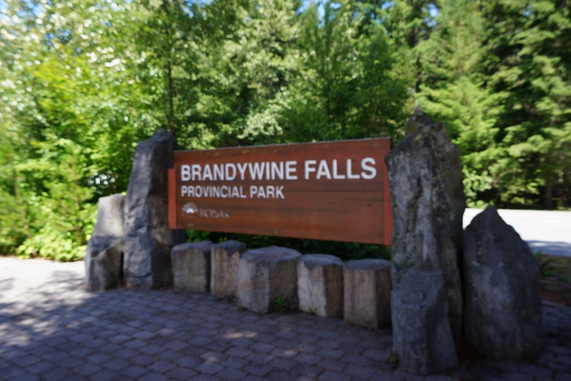
Brandywine Falls Provincial Park
From the Sea-to-Sky Gondola, a 43-km. (30 min.) drive brought Grace, Jandy, Danny and I to Brandywine Falls Provincial Park which is located adjacent to BC Highway 99, between Garibaldi and Whistler. Managed and operated by Sea to Sky Park Services Ltd. Sea for BC Parks, Brandywine Falls Provincial Park, located 11 kms. (7 mi.) south of Whistler, off BC Highway 99, and 47 kms. (30 mi.) north of Squamish, is the perfect detour for anyone travelling between the two towns.
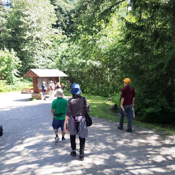
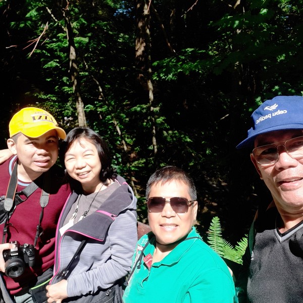
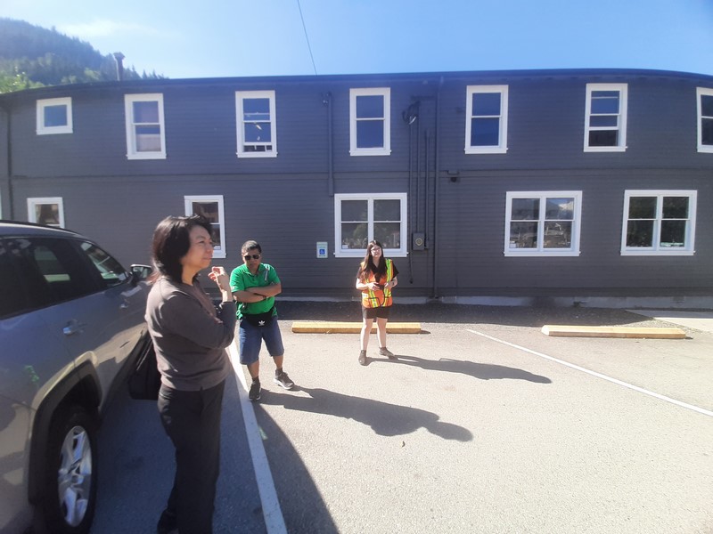
Danny, Grace and Jandy
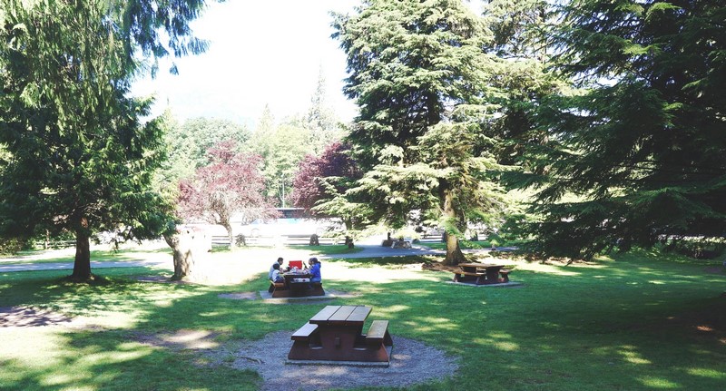
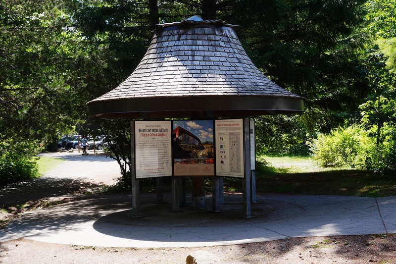
A day use only park, it doesn’t have a lot of facilities, just a few outhouses and picnic tables. The huge, de luxe parking can accommodate large recreational vehicles, though not overnight. There’s also a Squamish First Nation Info Legend Display Kiosk.
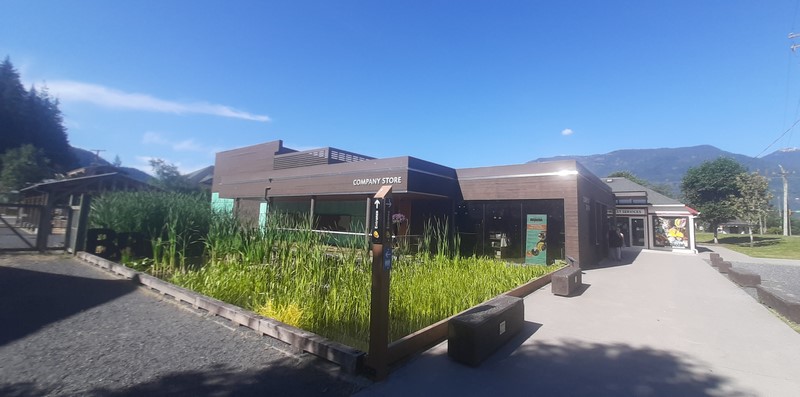
Check out “Sea-to-Sky Gondola”
There are two versions on the origin of the name Brandywine. In the first version, Jack Nelson and Bob Mollison, two surveyors for the Howe Sound and Northern Railway, made a wager over the height of the falls, with the closest guess winning a bottle of brandy (wine). Measuring the height with a chain, Mollison won the bottle of brandy and Nelson then named the falls Brandywine. The second version comes from around the 1890s when Charles Chandler and George Mitchell passed out there after drinking too much Brandywine in their tea.
Squamish First Nation Info Legend Display Kiosk
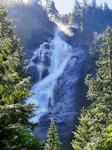
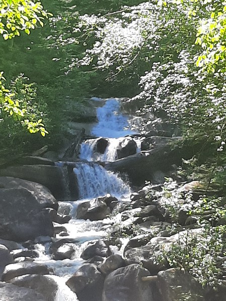
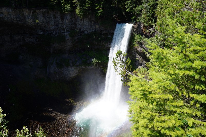
The spectacular, 66-m. (218-ft.) high falls, located on Brandywine Creek, has its origin in the Powder Mountain Icefield to the west. It was formed by the lip of a lava flow flanking the west bank of the Cheakamus River.
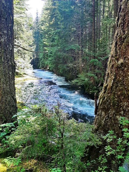
Cheakamus Creek
The vertical walls surrounding Brandywine Falls are comprise of the Cheakamus Valley basalts, at least four basaltic lava flows of Late Pleistocene Age that are part of the Garibaldi Volcanic Belt, a northwest-southeast chain of volcanoes and related lavas that form the northern end of the Cascade Volcanic Arc.
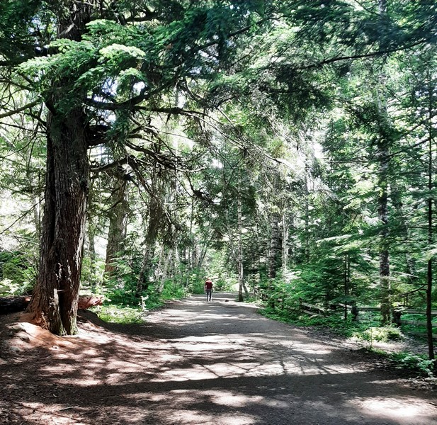
The smooth, easy and flat trail
The lava, flowing over deposits of glacial till, silt, and gravel, then cooled, creating a hard, weather-resistant top cap over loose unconsolidated and easily weathered material, the perfect conditions for the creation of a waterfall.
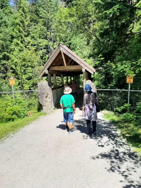
Approaching the covered wooden bridge
Around 10,000 years later, ice from the Fraser Glaciation receded from Cheakamus Valley, releasing melt water and creating Brandywine Creek. Working its way downstream, the creek started to erode the looser material and undercut the hard basalt top layer, creating the falls.
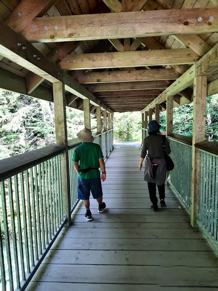
The covered wooden bridge
Around the early 1900s, Brandywine Falls used to have a train station and many log cabins (some still seen, in a dilapidated state, by the side of the trail) adjacent to the falls. As part of the BC Highway 99 improvements for the Whistler/Vancouver Winter Olympics, the area was subject to many day use improvements which replaced overnight camping with parking and picnic tables.
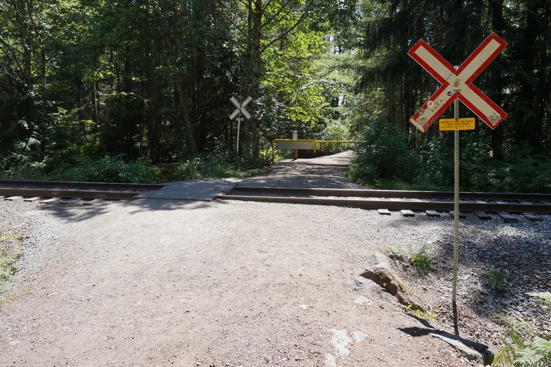
The BC Rail Track Crossing
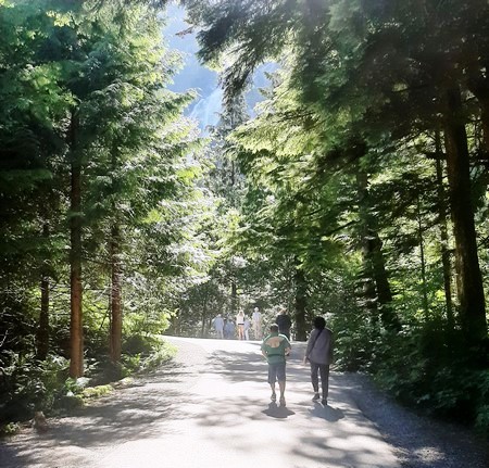
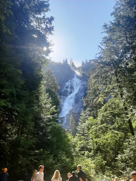
Brandywine Falls is best seen from a large and elaborate observation platform at the top, directly opposite the falls, reached by a quick and easy, 1-km. (15-min.) hike over smooth, flat and easy terrain. From the parking lot (just off the Sea-to-Sky Highway), a short walking trail, beneath some towering fir trees, passes close to Cheakamus Creek.
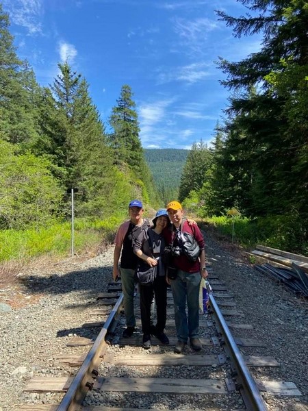
The author, Grace and Jandy at the BC Rail Track Crossing
At the trailhead, we crossed a covered, wooden bridge over the creek. On the other side of the bridge, a marker (Falls Lookout 300 m) pointed us to the trail to the right. The route to the left would take you along the Lava Lake Trail which extends 2.7 kms., through the forest, to a series of two small lakes at the northern boundary of the park.
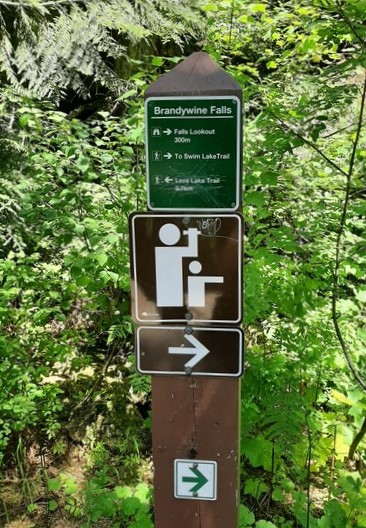
The marker pointing us at the right direction towards the falls
Following the wide, well-groomed trail for a few hundred meters, we came upon the BC Rail tracks. Just before the track, a split, off to the left, leads towards Swan Lake (not a great spot to swim as there is no beach).
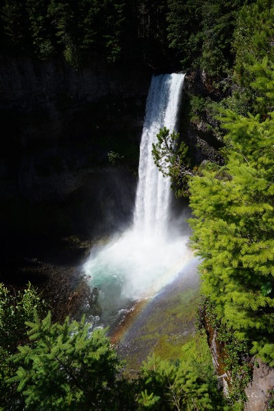
Brandywine Falls
We crossed over to the other side of the track, first making sure that the coast is clear. Keeping to the right, after 10 mins. and a few hundred meters, we were brought to a clearing beside the viewpoint.
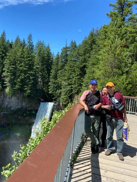
The author, Grace and Jandy at the observation platform
The viewpoint also presents some marvelous views of the surrounding mountains and Daisy Lake, just downstream of the falls, which spreads out below as the monolithic Black Tusk probes the skyline. Depending on the time of year, the dammed lake may be, more or less, at “full pool.”
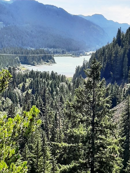
Daisy Lake
Spray from the escarpment that creates the falls, coats the sides of the gorge into which it plummets, with ice in winter and nourishes lush growth in warmer months. During our visit, we were lucky to see a rainbow over the waterfall.
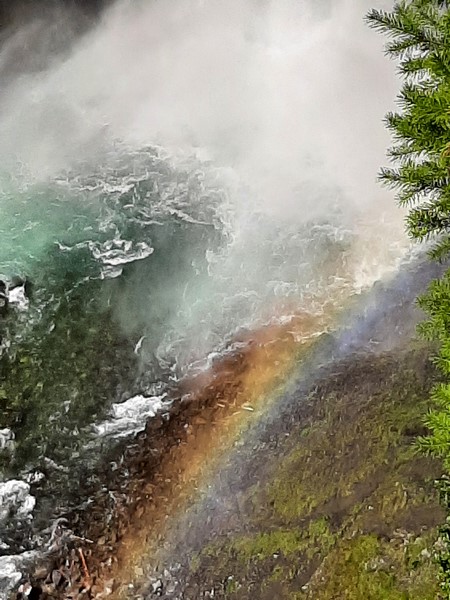
The rainbow over the falls
Brandywine Falls Provincial Park: Whistler, British Columbia. Coordinates: 50°02′07″N 123°07′07″W. There are no parking fees or entrance charges.