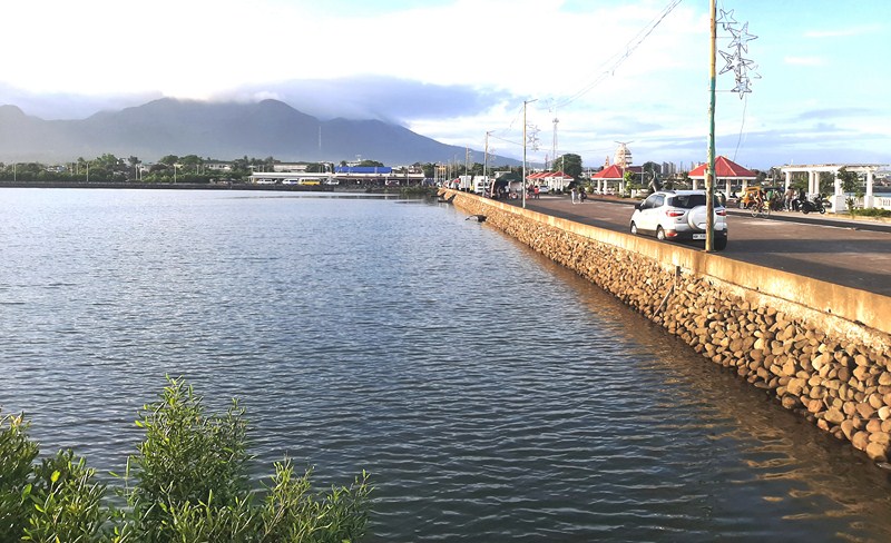
Century Gardens (Burnaby, British Columbia, Canada)

Century Gardens

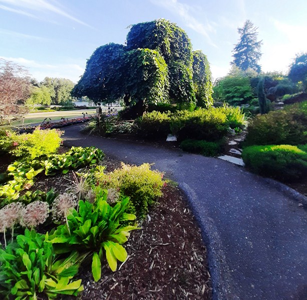
Century Gardens, within the northern border of Deer Lake Park, near the neighborhoods of Buckingham Heights and Middlegate, was a originally a Mixed Style Victorian garden made for the mock Tudor-style Fairacres Mansion (now Burnaby Art Gallery).

Check out “Burnaby Art Gallery,” “Fairacres Mansion” and “Deer Lake Park”
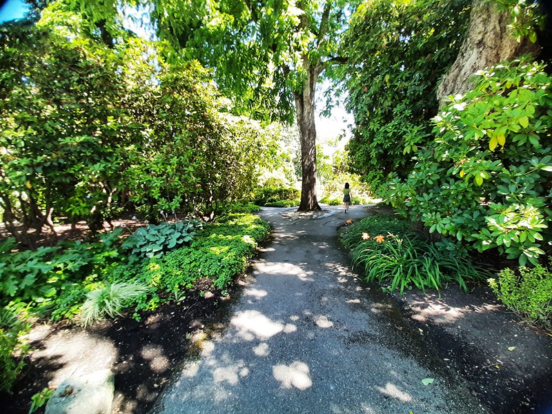
 

The single best place in the city to admire and celebrate Burnaby’s official flower (adopted as the official emblem in August 1966), this circular garden, with a path system, has over 2,000 rhododendrons that burst into bloom in spring (March to July).
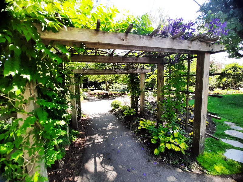
One of two developed rhododendron gardens (the other are plantings on Burnaby Mountain along Centennial Way) dedicated on June 18, 1967, in celebration of the 100th anniversary of the Canadian Confederation, it features the developments of some of the Pacific Northwest’s accomplished rhododendron growers.
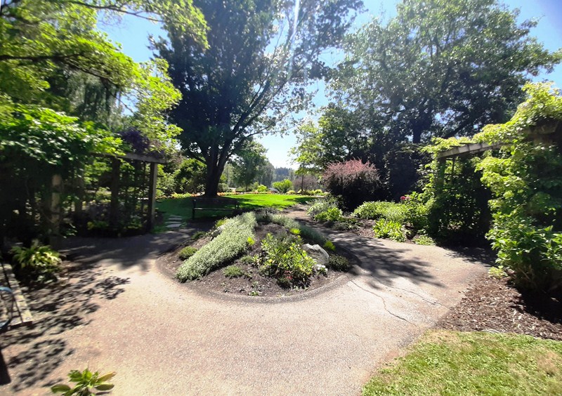
A garden within displays each of the winning plants, as well as samples of all the competition entries, of the May 1992 Burnaby Rhododendron Festival  (the festival was first held in 1989).  The winner was John Lofthouse (his plant developments are extremely well known) and honorable mention went to Gene Round (an accomplished grower).
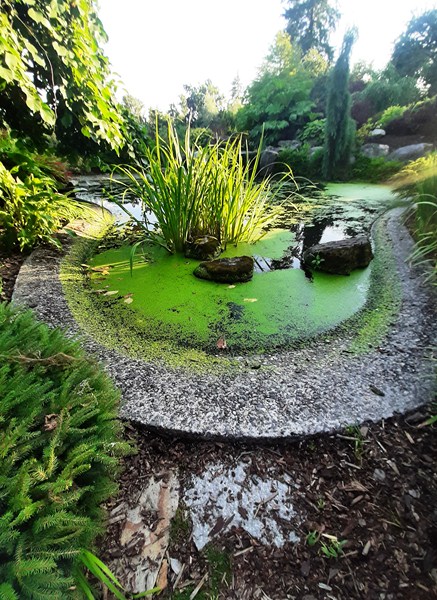
Water feature

The winning entry was the R. Burnaby Centennial, a “Leona” x “Etta Burrows” cross.  The compact truss consists of 14 to 16, five-lobed flowers which are raspberry red in color centered with a lighter red stamen, style and black anthers.  Foliage is pointed, medium in size and shiny, dark green in color.
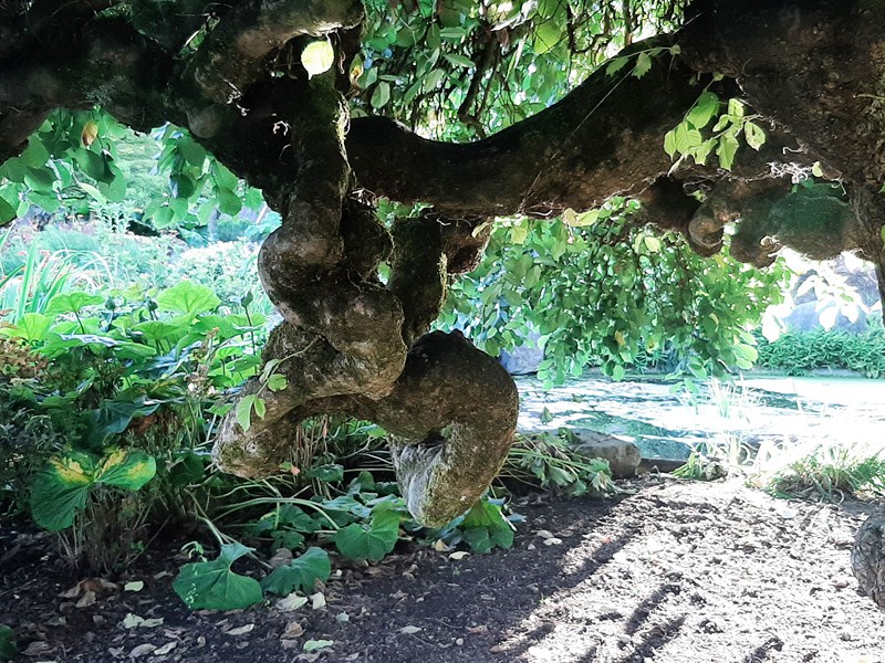
Camperdown Elm (Ulmus glabra camperdownii)

A new entrance to the garden features Hak Chu/Pak Chu, supersized concrete replicas of white Pak Chu and black Hak Chu, public art created by Vancouver born and raised Nathan Lee in 2000.  It is based on fan-tan (translated as “repeated spreading out”), a game, long played in China, based on pure luck and randomness.
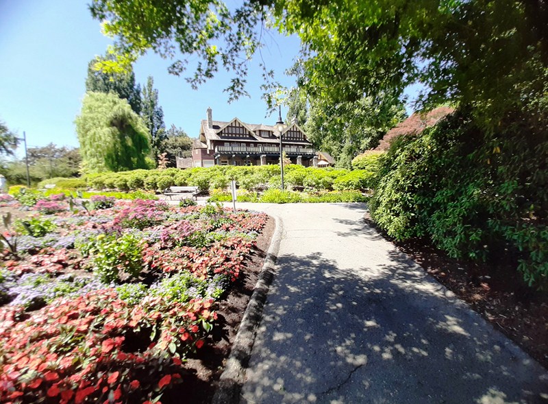
Fairacres Mansion (now Burnaby Art Gallery) in the background

It involves using hak-chu and pak-chu as counters (where white pieces are worth one-fifth the value of the black pieces).  In the 1990s, a single white pak chu was discovered under the Fairacres Cottage, indicating an early Chinese community on this site.
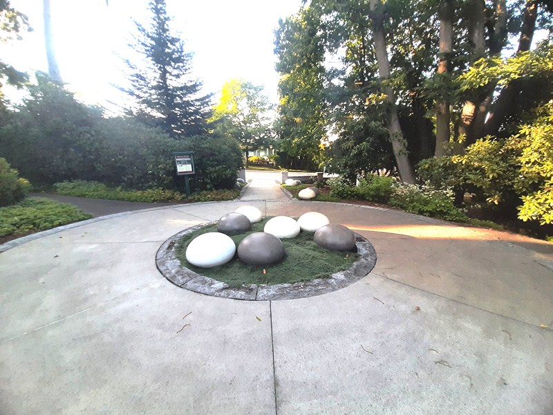
Hak Chu/Pak Chu (Nathan Lee, 2000)

Century Gardens is also lined with numerous varieties of colorful flowers, including an extensive rose garden.  This flower paradise can be viewed from the wooden boardwalk that encircles Deer Lake Park. The annual Burnably Rhododendron Festival includes guided rhododendron and perennial walks in Century Gardens.
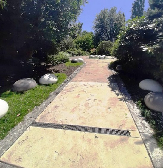
Century Gardens: 6344 Deer Lake Ave., Burnaby V5G 213, British Columbia, Canada.

How to Get There: Bus 144 Metrotown runs from the Burnaby Lake SkyTrain Station to the gardens.  By car, take Sprott St. Exit, drive straight through Canada Way, past Burnaby City Hall and Central High School, turn left into Deer Lake Ave.  The Fairacres Mansion is at the top of the hill on your right.  Beside it is the garden.
Deer Lake Park (Burnaby, British Columbia, Canada)

Deer Lake Park

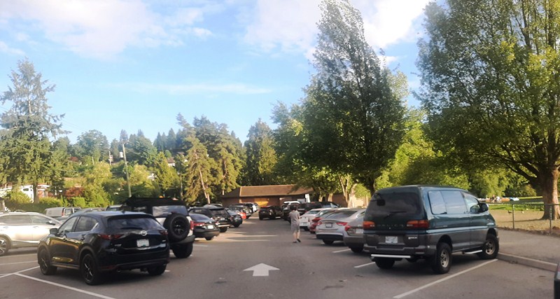
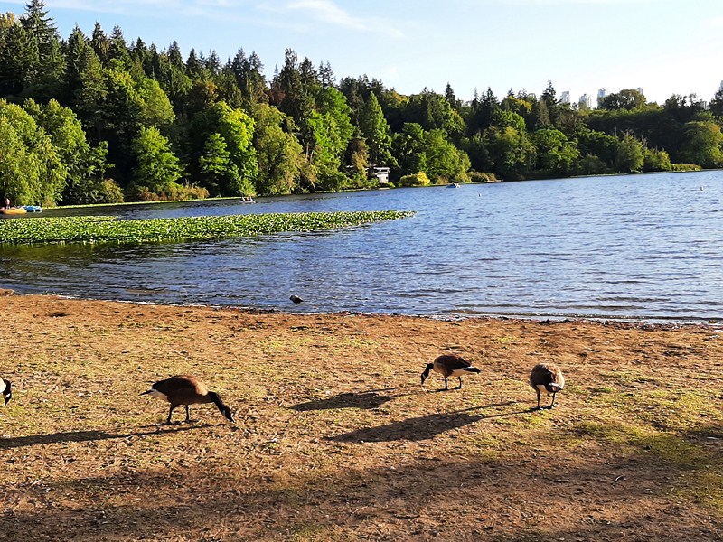
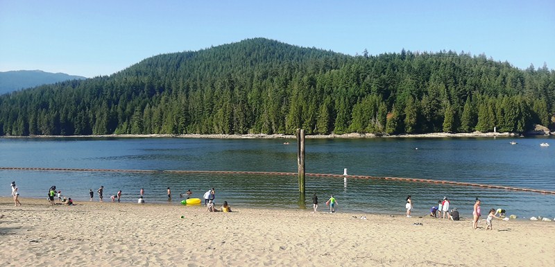
On the late afternoon of our 12th day in Vancouver, my daughter Cheska brought my wife Grace, my son Jandy, grandson Kyle and I to tranquil,  207-hectare Deer Lake Park, a 5.5-km. (12-min.) drive away, where we were to have a picnic dinner with  some U.S. friends.  From Sperling Ave., we parked at a lot closer to Deer Lake beach area.  Right across were two tables with benches where we had our picnic. An accessible washroom is located on the east side of the lake, near the parking area.

Parking lot along Sperling Ave.

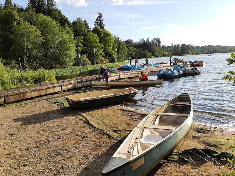
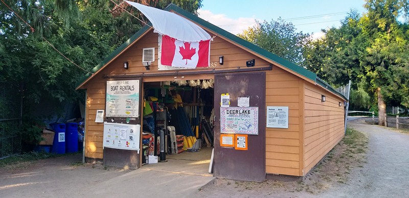
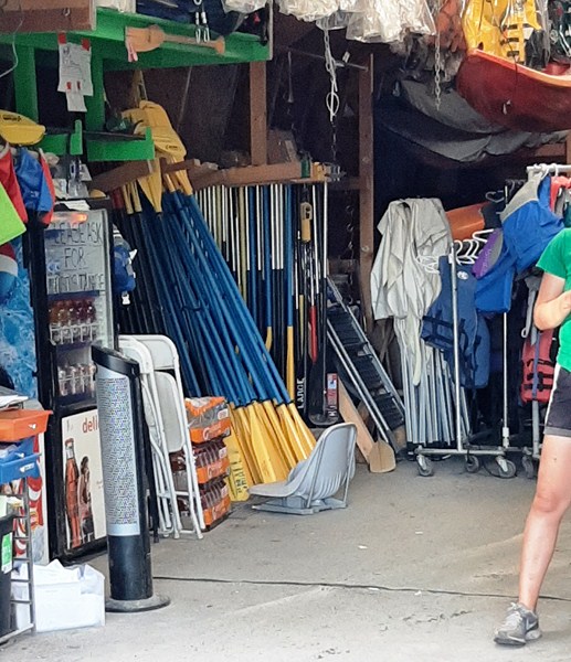
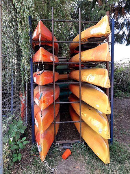
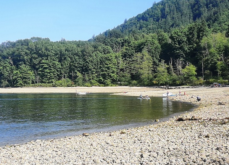
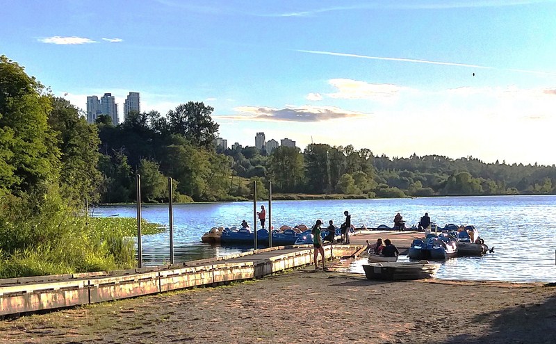
Nearby, on the east end of Deer Lake, is a sandy public beach for play, along with swings for children. Plus, there’s a dock where you can launch small boats, like kayaks and canoes during the spring through the fall season. Those arriving with a kayak or canoe on their car top carrier, can launch it from the dock. From the dock, (on the western edge of the park), at 5435 Sperling Ave., there’s also Deer Lake Rental, a rental service for non-motorized watercraft such as rowboats and pedal boats as well as canoes and kayaks.
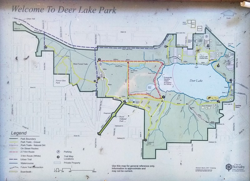
Deer Lake Park Map

Europeans who came here, not having seen caribou before, called the caribou “deer,” Caribou, in great numbers, could be seen crossing the lake from north to south, hence the name Deer Lake (the park’s namesake).

Boat Launch Dock

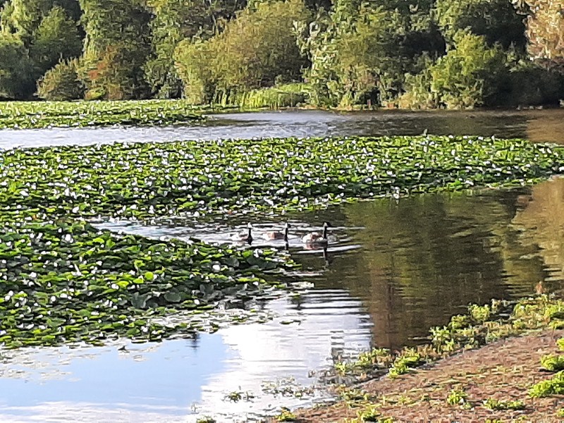
Situated in the central heart of the city, Deer Lake, along with Burnaby Lake, is home to resident populations of wildlife like many species of ducks, song birds (flitting through the meadows), otters and, just maybe, beavers (hard at work building dams in the marshy areas to the west of the lake) which one might glimpse them as one walks or runs along the trails that circle the lake’s 2.4-km. perimeter.

Deer Lake Rentals

You can also climb the wildlife viewing tower, near the southwest corner of the lake, to watch for endangered Western painted turtles sunning themselves on logs or basking on rocks in the ponds.

Deer Lake Rentals

Year-round resident birds in the park include red-tail hawks (circling the sky for prey below), black capped chickadee, spotted towhee, majestic great blue herons (fishing in the shallows), Anna’s hummingbird, Bewick’s Wren and Stellar’s Jay.  Summer breeding birds include Northern Harrier, March Wren, Cedar Waxwing, Swainson’s Thrush, Common Yellowthroat and American Goldfinch.  Winter & Migratory birds at Deer Lake Park include Dark Eyes Junco, Ruby Crowned Kinglet, Hermit Thrush, Yellow-rumped Warbler and Mountain Bluebird.

Kayaks for rent

The temperate rainforest, the vegetation natural to the area, is dominated by trees considered particularly tall for the Lower Mainland, with conifers such as Western hemlock (Tsuga heterophylla), Douglas fir (Pseudotsuga menziesii), and Western Red Cedar (Thuja plicata). Deer Lake and the surrounding park is a highly altered habitat and while cutthroat trout, rainbow trout, stickleback, sculpin and crayfish were likely native to Deer Lake, most of the aquatic animals are introduced species and invasive species include bullfrog, ictalurid catfish and carp.

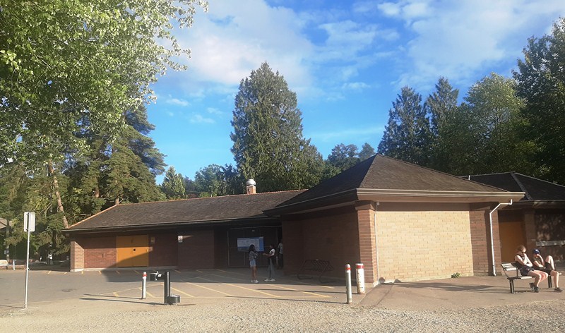
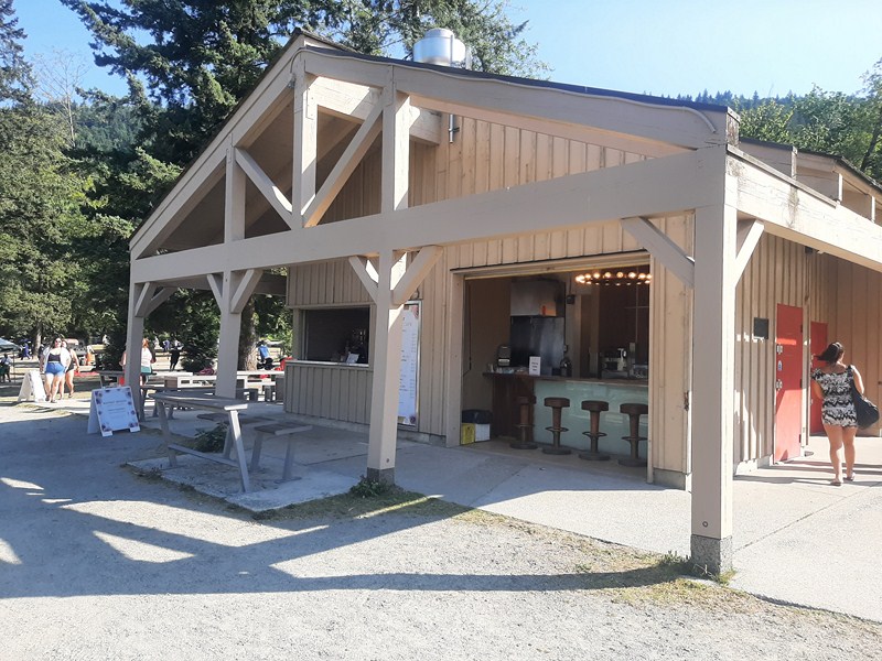
Deer Lake Beach House

Beaver Creek, flowing under the wooden boardwalk, is used by fish for feeding and as a refuge from predators such as larger fish, mink, otters, herons, and kingfishers. Young Coho salmon use this stream as they grow before their journey to the ocean. Most of the wetlands along Beaver Creek are wet meadows and open water pond area, and a remnant bog area on the Western lakeshore. Trees that can tolerate these wet conditions are Sitka Spruce, Birch, Willow hardhack, Sweet gale, Black twinberry, Dwarf dogwood, Labrador tea, Salmonberry, Sedges and Bulrushes.

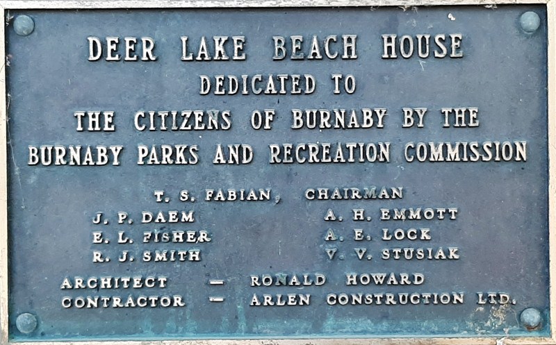
Deer Lake Beach House plaque

To the north of Deer Lake, you’ll find Burnaby’s cultural centre for art and culture – Burnaby Art Gallery (located Fairacres Mansion at 6344 Deer Lake Ave.),  Shadbolt Centre for the Arts (just a short ways further down the road at 6450 Deer Lake Ave.), Burnaby Village Museum (an excellent outdoor museum at the northeast corner of the park at 6501 Deer Lake Ave.) and more. It’s a hub of activity during the busy summer season, hosting concerts and festivals on the Festival Lawn.  The park is also home to Burnaby Village and Hart House (a historic building and present-day restaurant at 6664 Deer Lake Ave.).

Check out  “Fairacres Mansion,” “Burnaby Art Gallery,” “Burnaby Village Museum” and “Shadbolt Centre for the Arts“

Located in Central Burnaby, not far from Burnaby City Hall and halfway between Burnaby Lake and Metrotown, it is one of Metro Vancouver’s largest and most popular city parks, with walking trails and wide open spaces, and is a very popular area for birding and running (you’ll likely encounter other people while exploring).

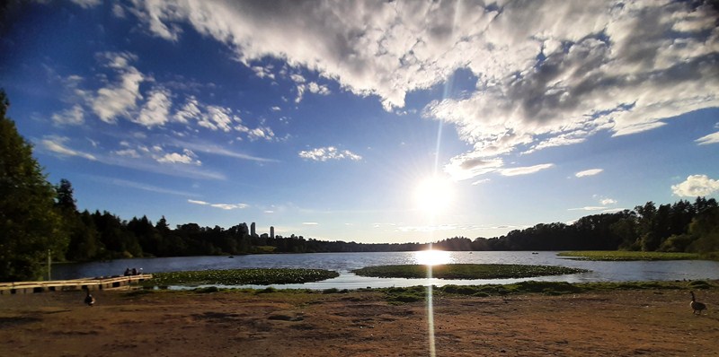
Even if the skyscrapers of Metrotown rise above the lake, Deer Lake Park still provides a unique nature escape in the middle of Burnaby. It’s a great place for hiking, boating, spotting wildlife, and learning about history and culture.  Just below the Burnaby Art Gallery, the Deer Lake Park Festival Lawn is an ideal spot for a picnic on the grass or at the picnic tables near the wide paved path leading to Deer Lake.

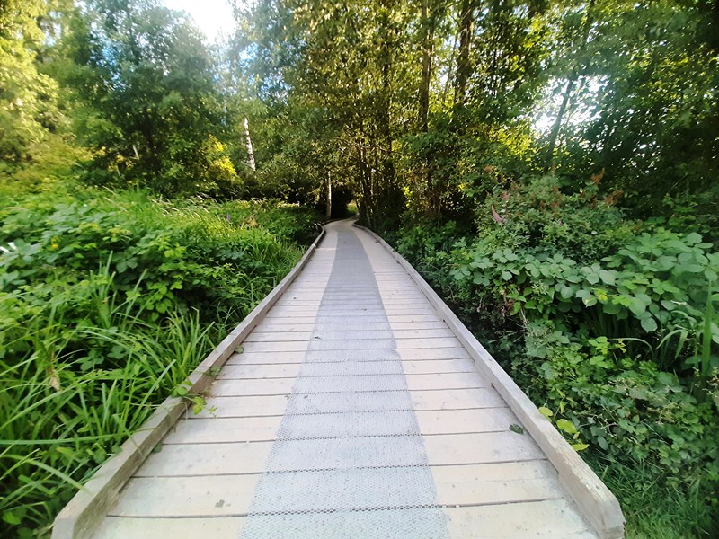
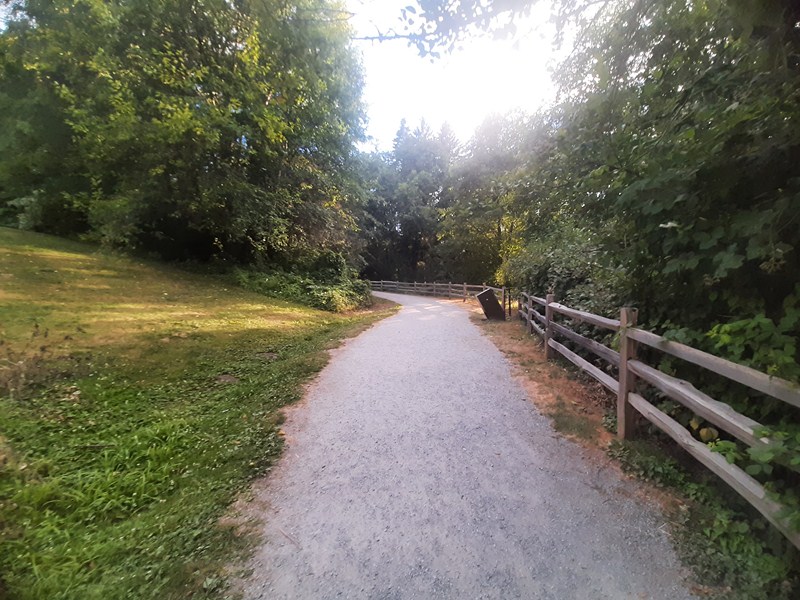
The lake itself, in the middle of the park, has a lovely, mostly finely crushed gravel and hard packed dirt (in some parts it’s a wooden boardwalk) main walking trail along the water’s edge and through the forest (this map shows all the trails and their surfaces). Some of the paths may be too steep for some users and tree roots crossing the trail also pose a tripping hazard.  Dogs are welcome, but must be on a leash.

The park offers a variety of many connecting trails (open year-round and beautiful to visit anytime and routes (more of an outdoor urban walk than a hike) that surround the lake:

  • Deer Lake Loop Route
  • Hart House Mini Route
  • Oakland Flats
  • Royal Oak Meadow Route

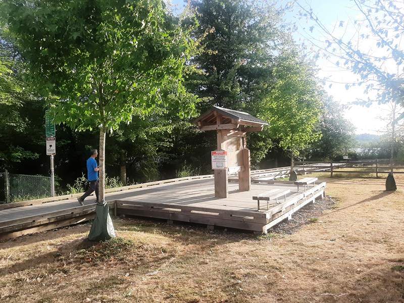
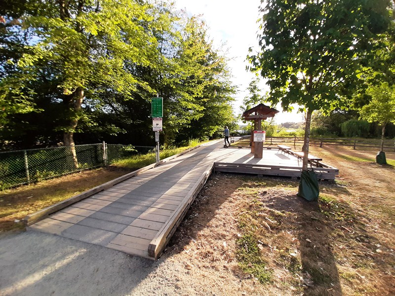
Wooden Boardwalk

You can do a small loop which runs around the edge of the lake for most of the way and takes about 35 mins., depending on how fast you walk.  You can go past the end of the lake though and continue on the larger loop (which takes about 45 mins.) which then makes its way back to the lake and the last part of the smaller loop. Doing both loops, considered an easy route, in a figure eight (where you walk along the middle section twice on your way round), is about 4.5 to 5 kms. long and takes 55 mins to an hour or so, from start to finish. Bikes are not permitted on wooden boardwalks.

Dirt and crushed gravel trail

A number of annual events take place at Deer Lake Park.  They include the following:

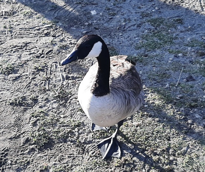
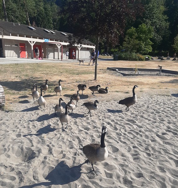
Canada goose

The park was a nice place for families with small kids, folks looking for a nice nature trip, or a good loop outside (if you are short on time). To enjoy the gardens in bloom, visit Deer Lake Park in spring. To enjoy many different flowers (including rhododendron, Burnaby’s official flower), visit Century Garden, next to the Burnaby Art Gallery, or the city-owned Eagles Estate Heritage Garden, on the southeastern shore of the lake, which dates back to 1929 and includes Japanese maples, rhododendrons, and magnolias.

Check out “Century Gardens“

Sunset over Deer Lake

Deer Lake Park: 5435 Sperling Ave., Burnaby, British Columbia V5E 2L8.  Tel: (604) 294-7450.

How to Get There: From Vancouver, take Highway 1 east. Use exit 33 to Kensington Avenue. Turn left on Canada Way. then right on Sperling. There are several options for parking. Continue on Sperling for another block to a large parking area. Or turn right onto Deer Lake Avenue. This road runs through the east side of the park and leads to parking areas on the southeast shore of Deer Lake next to the Burnaby Village Museum, the Shadbolt Centre for the Arts, and the Burnaby Art Gallery.  This map shows the parking areas noted below. The Shadbolt Centre for the Arts, Burnaby Art Gallery and Burnaby Village Museum parking lots are accessible from Deer Lake Ave. There is a parking lot on the west side of the park off Royal Oak Ave.  Parking isn’t permitted in the residential areas around Deer Lake Park.  Parking lots close at 10 PM every night.  Get directions or visit TransLink Trip Planner.

Deer Lake Rentals: Website: www.deerlakeboatrentals.com. Tel:  604-839-3949.

  • Kayak Charges: 1-person kayak ($16.07 plus taxes per hour, maximum total weight should be 350 lbs. or 160 kgs.), 2-person kayak ($19.64 plus taxes per hour, maximum total weight should be 450 lbs. or 205 kgs.)
  • Rowboat & Canoe Charges: 2-person rowboat ($19.64 plus taxes per hour, maximum total weight should be 400 lbs. or 180 kgs.), 2-3-person canoe ($19.64 plus taxes per hour, maximum total weight should be 500 lbs. or 230 kgs.), 4-person canoe ($31.25 plus taxes per hour, maximum total weight should be 850 lbs. or 390 kgs.)
  • Pedal Boat Charges: 2-person pedal boat ($19.64 plus taxes per hour, maximum total weight should be 600 lbs. or 270 kgs.), 4-person pedal boat $31.25 plus taxes per hour, maximum total weight should be 850 lbs. or 390 kgs.)

Dry bag rental is $1 per hour.  Last rental is 1 hour before sunset. The last 1.2 hr rental is 1/2 hour before sunset.

Barnet Marine Park (Burnaby, British Columbia, Canada)

Barnet Marine Park

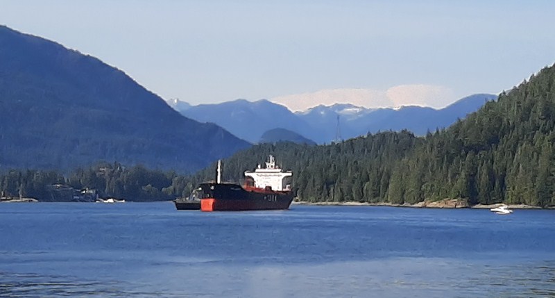
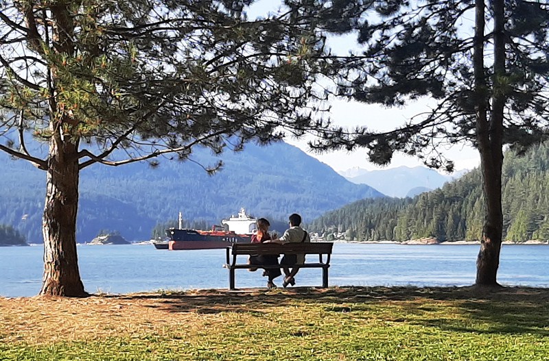
On our fourth day in Vancouver, we drove 6.6 kms. to Barnet Marine Park, a small but beautiful and popular waterfront park, where we were to enjoy an afternoon outdoor picnic with family while sitting back taking and watching the action on the south shore of the spectacular, tanker-dotted Burrard Inlet (here’s a map of the picnic area).

A tanker at Burrard Inlet

As it was a sunny weekend, the main parking lot was already filled so we parked at the overflow parking above the highway right next to the Air Mountain Bike Park.

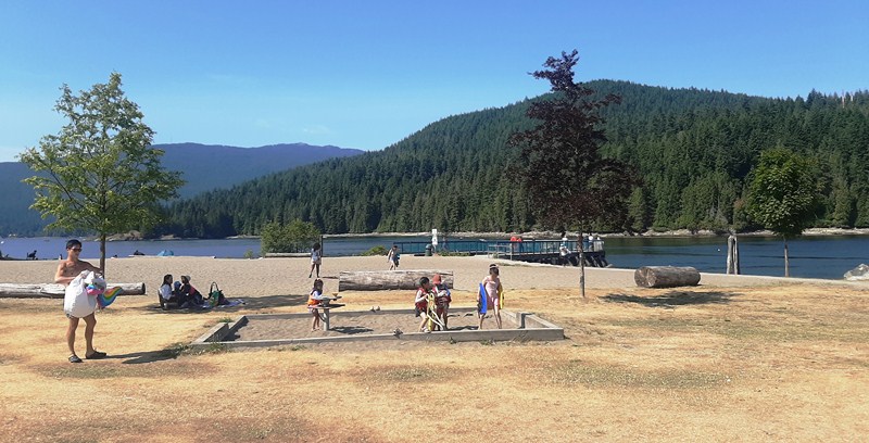
Located right along the north end base of Burnaby Mountain and across Burrard Inlet from Cates Park and Vancouver’s North Shore, on an important harvesting, gathering and processing site for the Coast Salish peoples, as well as the site of a century-old logging mill camp, this spectacular foreshore park, Burnaby’s only official saltwater beach, is perfect for a stroll and has ocean and mountain views. Although small in size, the park feels large as it is long and narrow, stretching for about 1.5 kms. along the waterfront.


Barnet was formerly a thriving logging community of the North Pacific Lumber Company (later the Barnet Lumber Company), one of the largest sawmills in the British Empire.  Established in 1889 (at the site of a new C.P.R. station), David MacLaren (the owner) named it “Barnet” after his wife’s family.

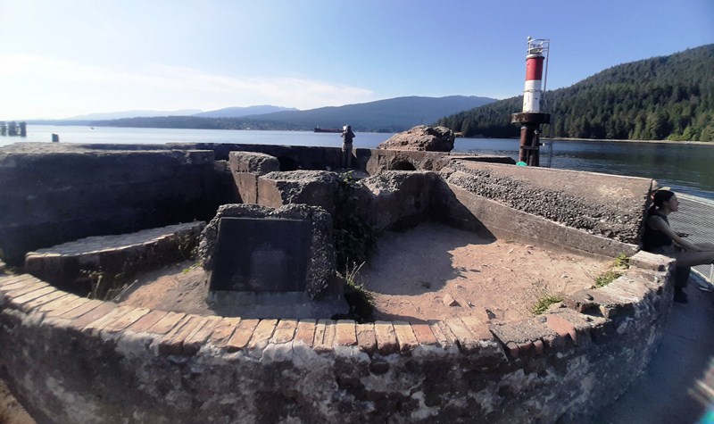
Foundation of Mill Wood Scrap Burner

Due to the Great Depression, the mill closed in 1931 and reopened in 1939 as the Kapoor Sawmills.  Destroyed by fire in 1946, plans to rebuild the mill to its former scale never materialized.  The community started to fade when the small replacement mill was finally dismantled in 1958.

Mill Wood Scrap Burner

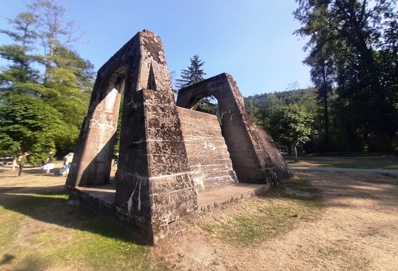
Here, you can still see traces of the once prosperous mill such as the mill’s scrap burner as well as the concrete and brick foundations nearby.

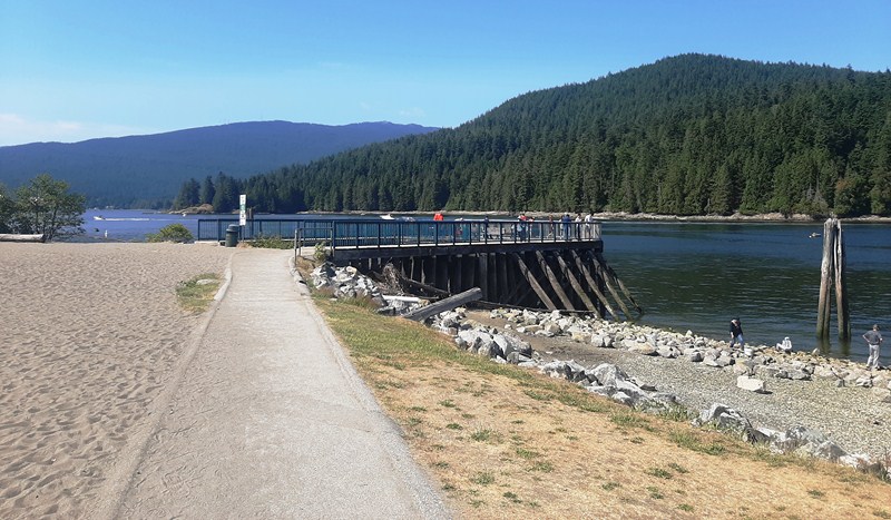
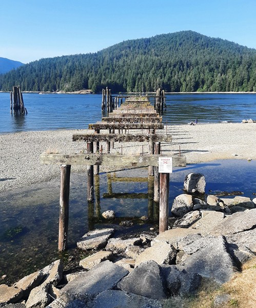
Remains of Old Wharf

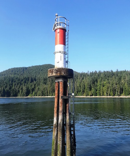
On the water are the remains of the old wharf (where processed timber bound for American and Asian ports was loaded), its pylons now nesting sites for birds.

Aside from the picnic (some in the shade) site, it has a designated dog off-leash area  allowing our dog Luffy to get some exercise. We had to keep your dog leashed everywhere else in the park (you also have to pick up after your dog and drop our waste bag in the designated bins). For sanitary reasons, they aren’t allowed on the beach. The sandier beach areas of the off-leash dog area are at the far west end of the park.

Sandy Beach

Rocky Beach

Along the shore are both rocky and nice sandy (at the far western end) beaches. The most popular beach is at the far eastern end as it’s closer to the parking lots and has both grassy and sandy areas.  Wildlife to be found here includes seals, crabs, geese and herons.

Geese

To enjoy a relaxing meal or a quick bite, there’s Park Cafe. Propane barbeques and charcoal and open-flame barbeques are also allowed at this park (you have to use the on-site ash pits to safely dispose of hot ashes).

Park Cafe

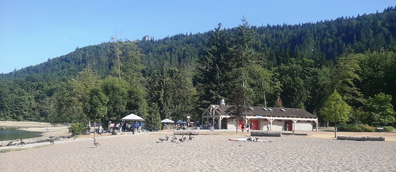
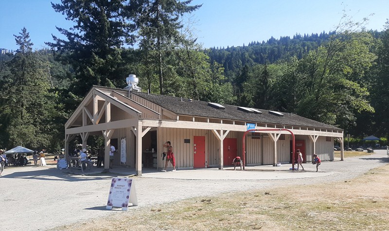
Accessible washrooms and changing rooms are located in the concession building, open year-round.  There are also outdoor showers for swimmers.

Concesson Building

Barnet Marine Park is an excellent spot to enjoy fishing from shore (just make sure you have a license). To explore the sheltered waters of Indian Arm or the Burrard Inlet, you can launch canoes, kayaks and sailing craft on the rocky or sandy beach.

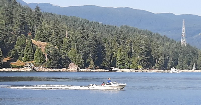
Motorboat at Burrard Inlet

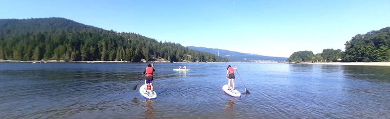
On the rocky beach, Cheska, Bryan and Kyle went paddleboarding but they had to carry everything down to the beach.

Bryan (with Kyle) and Cheska paddleboarding off the rocky beach

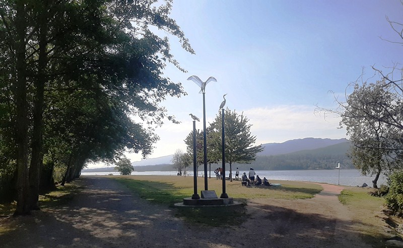
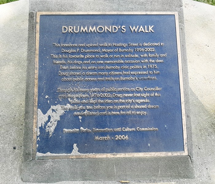
Trails here are either paved or crushed limestone, with benches available throughout. I traversed the length of Drummond’s Walk, a peaceful foreshore and upland walk named after former Mayor Douglas P. Drummond (1996-2002) in April 2006.

Start of Drummond’s Walk

Plaque

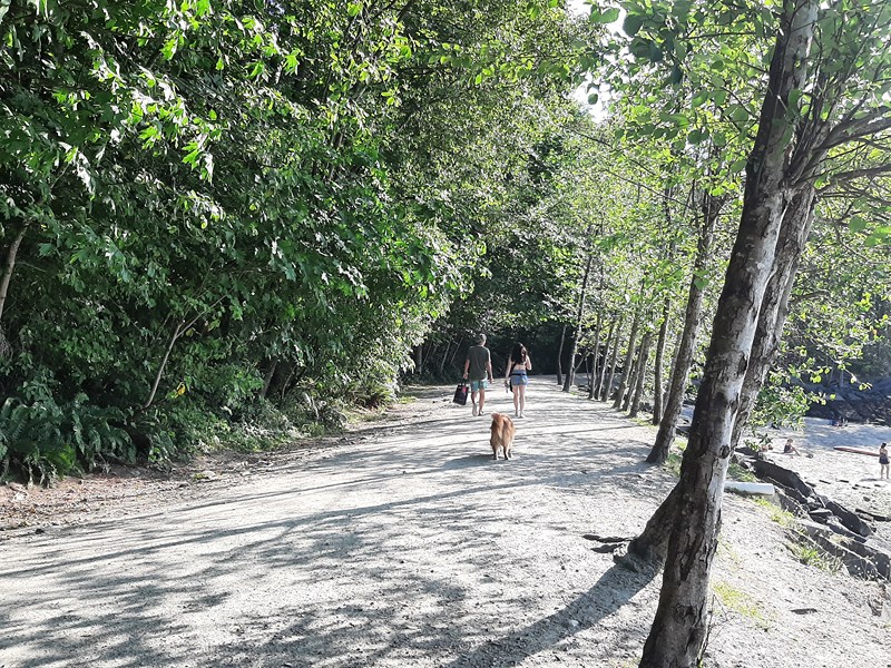
It was his favorite place to exercise. This flat and easy trail, suitable for all ages and fitness levels, runs 1,5 kms. from one end of the park to the other.

Drummond’s Walk

Along the path, I encountered grassy lawns and a large and impressive off-leash dog zone that includes multiple waterfront beaches. Here’s a map showing all the paths in the park.

Watching tankers go by at Drummond’s Walk

Barnet Marine Park: 8181 Barnet Rd, Burnaby, BC V5A 3G8, British Columbia. General inquiries: 604-294-7450. E-mail: parksrecandculture@burnaby.ca. Website: www.burnaby.ca/explore-outdoors/parks/barnet-marine-park. Open from 7 am and closes at dusk between April and October. During May to September, the closing time changes with the increase in daylight hours. Park Café is open Friday to Sunday on ‘good weather’ days in the summer, 11:30 AM -6:30 PM.  If the weather looks wet and cold, call 604-297-4888 to confirm if the café is open. Since January 1, 2022, smoking has been banned in all City parks and multi-use paths.
Parking: the main parking lot (download map) is located on the south side of the rail line. The north (beach) side of the rail line is pedestrian only. Don’t park on the rail line. There are 6 accessible parking stalls located east of the park entrance, closest to the beach. Additional accessible parking stalls and surface parking are available to the east and west of park entrance on a first come, first served basis.

Additional parking is available farther to the west of the park entrance and on the other side of Barnet Rd where the Mountain Air Bike Skills Course (an incredible bike skills park located just across the Barnet Highway, it features an outdoor wood pump track for beginners to advanced mountain bikers that’s free to the public) is located. Accessible parking stalls at beach levelare available Monday to Friday, 9 AM-7 PM until September 1, 2023 (excluding statutory holidays). To check availability and obtain access, call park staff at 604-319-7083. Due to safety and operational concerns when the park is very busy, all beach-level parking (including accessible parking) are not available on weekends and statutory holidays.

How to Get There: The park is about 10 kms. (a 30-min. drive) from downtown Vancouver, and a 10-min. drive from Port Moody. Travel east on Hastings Street. Keep left on Inlet Dr/Barnet Rd and turn left onto the park at Takeda Drive. Get directions.
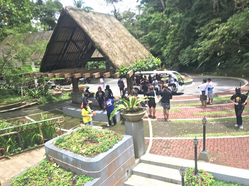
Subic Pink Sand Beach (Matnog, Sorsogon)

Subic Pink Sand Beach

Part of Sorsogon Countryside Tour

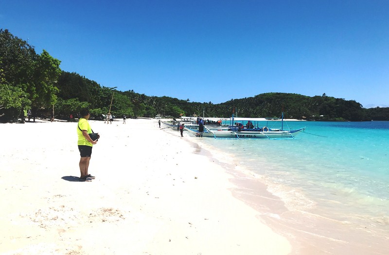
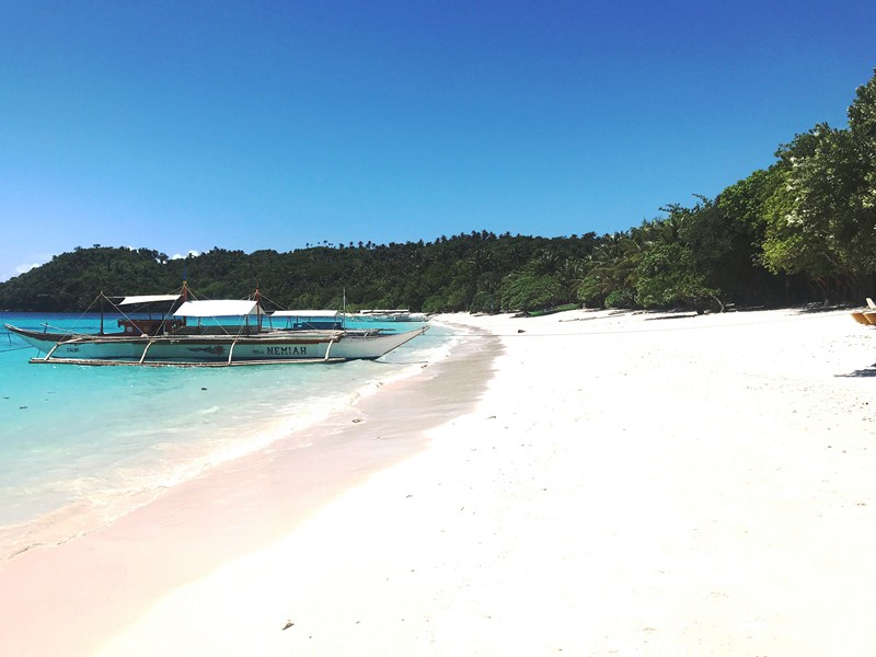
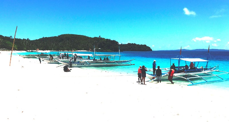
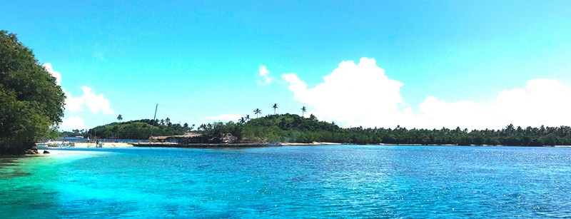
After our enjoyable tour of Juag Lagoon Fish Sanctuary on Juag Island, we again boarded or boat for the short 20-min. ride to Calintaan Island. On this island is pristine Subic Beach (locally called “La Playa Rosa”), one of two places in Sorsogon (the other is Tikling Island) with sand that has a pinkish hue. This is due to a combination of creamy white sand with crushed organ pipe coral (Tubipora musica).

Check out “Juag Lagoon Fish Santuary“

Calintaan Island

There are actually two adjacent Subic beaches – the quieter and less developed Subic Liit (Little Subic) and a longer stretch called Subic Laki or Subic Dako (Big Subic), both separated by a short stretch of land.

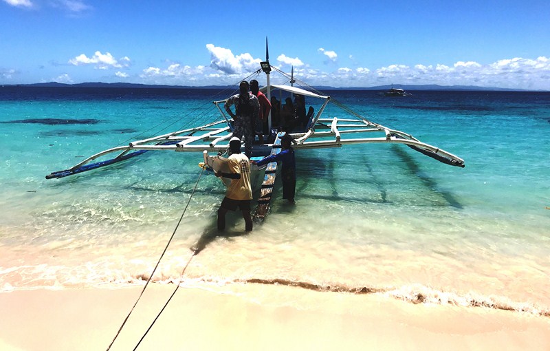
Landfall at Subic Dako Beach

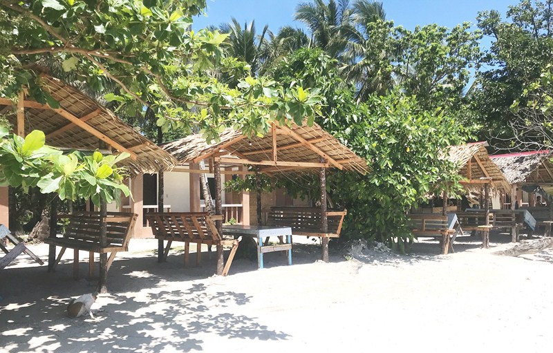
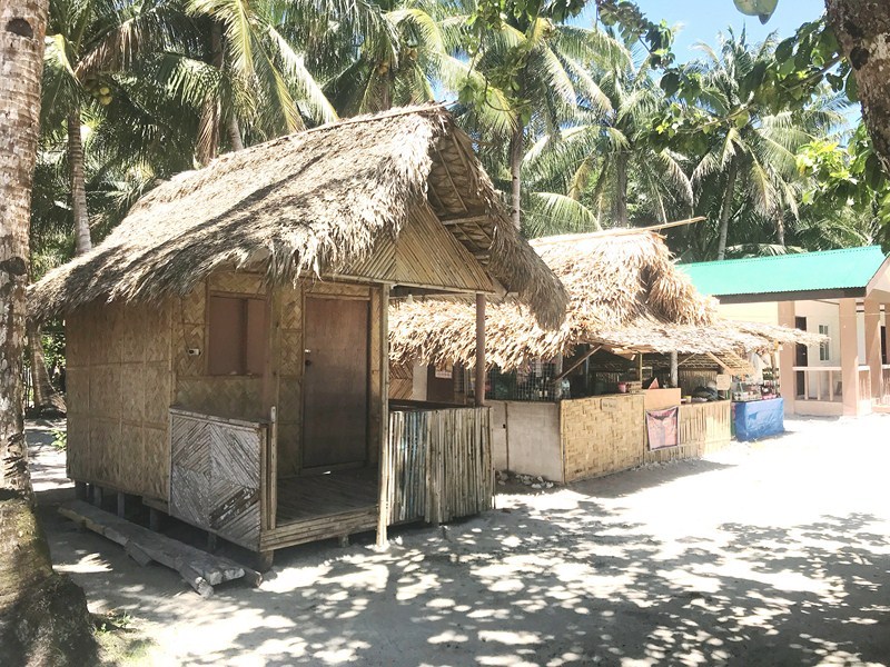
We landed at the latter, the more popular of the two due to the presence of basic amenities that allow visitors to rent native-style nipa huts with anahaw roofing for day use (Php400), pitch tents and cook their own food.There are also sari-sari stores and grilling stations.   Potable water is also available. 

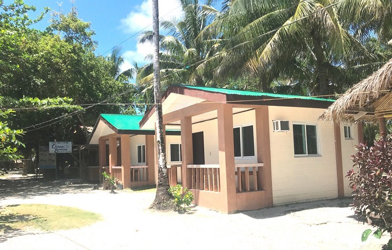
There are also two or three resorts (the best is Holy Trinity Beach Resort which has airconditioned rooms and a swimming pool) for overnight stays, .   Calintaan Island  has electricity thanks to a wired connection with Matnog town in the mainland.

We stayed at this so-called “Boracay of Matnog” for about 45 mins., swimming its calm and crystal-clear waters or just taking pictures as we enjoyed its beauty. You can also snorkel here (bring your own snorkeling gear).

Picnic huts

Too bad we didn’t have time to explore the hidden lagoon at the back of the beach and the old lighthouse (parola).  Despite recent developments on this beach, it still retains its pristine charm and it is my hope that it would remain that way in the future.  Truly, it was a picture-perfect example of a tropical island paradise.

Rustic accommodations

More modern, airconditioned accommodations

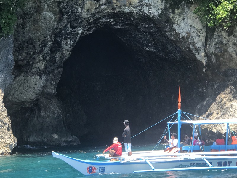
Back at our boats, we proceeded to Murong Burongan Island where we were to have lunch.  About 10 mins. into our trip, we passed by Calintaan Cave, a small cave opening into a one-of-a-kind cove, amidst cliffs at the southeastern end of the island, with green vegetation and a flat, grassy terrain with coconut trees.  A great site for snorkeling, under ideal conditions you can enter the cave.

Check out “Murong Burongan Island Resort”

Calintaan Cave

Subic Beach, Calintaan Island, Brgy. Calintaan, Matnog 4708, Sorsogon.

How to Get There: Matnog is located 575.9 kms. (a 13.25–hr. drive) from Manila and 61.2 kms. (a 1–hr. drive) from Sorsogon City, both via the Pan-Philippine Highway/AH26..

Sorsogon Provincial Tourism Culture and Arts Office: Ground Floor, Capitol Building, 4700 Sorsogon City. Mobile number: (0968) 624-6279. E-mail: tourism@sorsogon.gov.ph.  Facebook: www.facebook.com/sorsogonprovincialtourismoffice

Matnog Tourism, Culture and Arts Office: Brgy. Camcaman, Matnog 4708, Sorsogon. Mobile number: (097) 231-8168. Facebook: www.facebook.com/Matnog Tourism.  Fees: Environmental Fee: Php20/pax and Php16 (senior citizens). Registration Fee: Php320 (foreigners), Php70 (locals) and Php40 (senior citizens).

Ur Place Travel & Tours: OLV Pangpang, Sorsogon City, Sorsogon.  Mobile number (Viber): (0927) 950-3927 (Ms. Annie Gueb).  Facebook: www.facebook.com/urplacetravel.

Juag Lagoon Fish Sanctuary (Matnog, Sorsogon)

Juag Lagoon Fish Sanctuary

Part of Sorsogon Countryside Tour

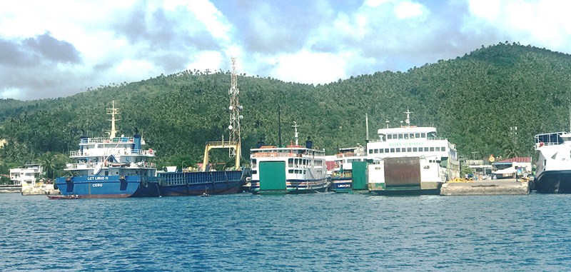
After breakfast and checking out at Residencia del Hamor Casiguran, we again boarded our coaster for 56.4-km. (1-hr.) drive to Matnog Port, the jump off point to the southern Philippines and vice-versa. From here, we were to explore the three of the town’s outlying islands – Juag Island  Calintaan Island and Murong Burongan Island.

Check out “Hotel and Inn Review: Residencia del Hamor Casiguran”

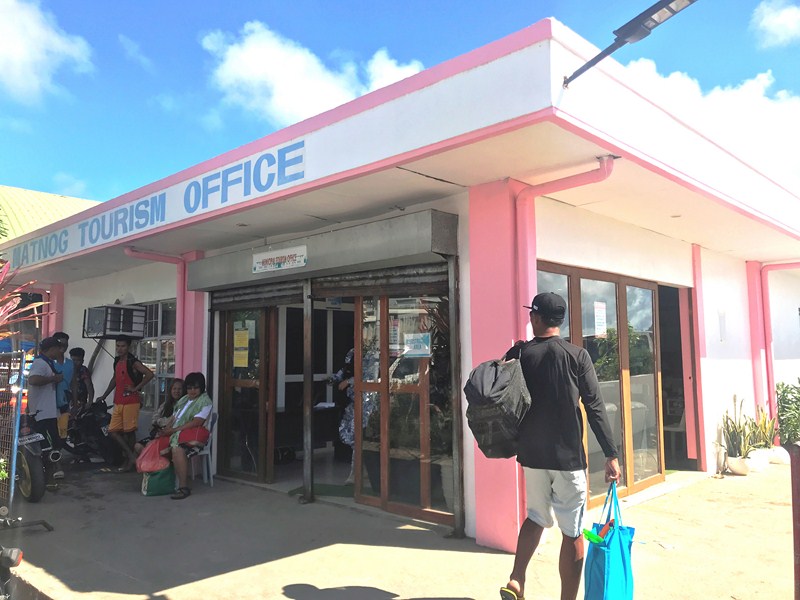
Matnog Tourism Office

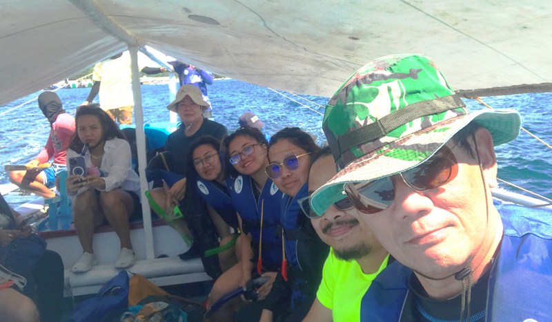
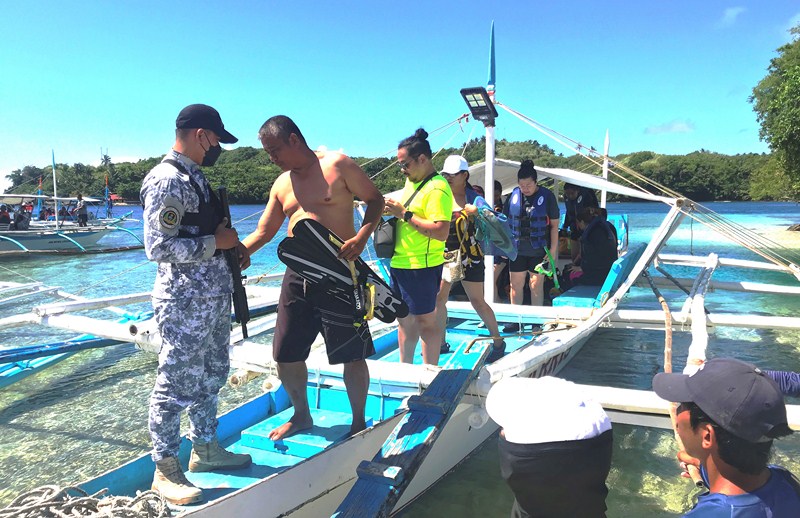
Upon arrival at Matnog Tourism Office, we had to first register ourselves.  Then, we attended a 5-min. briefing (on proper waste disposal and the importance of keeping the beach clean) before boarding our respective motorized outrigger boats at Matnog Port. There were seven of us plus two boatmen and a security escort. Our first destination was to be Juag Island where the Juag Lagoon Fish Sanctuary is located. The boat trip from the port to the island took about 20 mins. and, as we neared the island, we were greeted by a stunning scenery of white sand beaches, mangrove tress and coconut trees.

Matnog Port

Privately owned and maintained (by the Geneblazo family headed by Mr. Alex Geneblazo, Juag Island has an area of 572 sq. m. and is home to 40 fish species.  It was started in 2000 with a few pairs of bangus (milkfish) fed with seaweed.

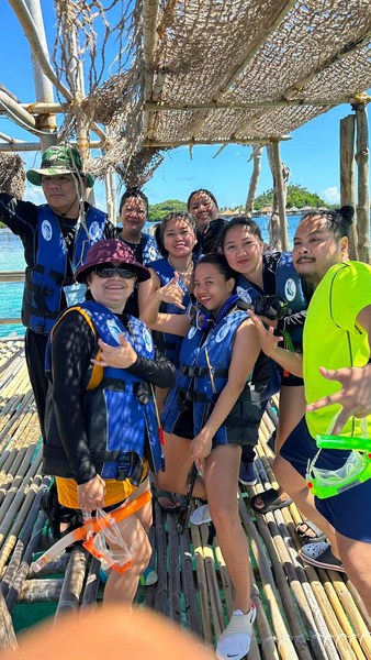
The author (right) with is companions

Despite being privately owned, the family decided to open it up to the public to educate and entertain, thereby contributing towards the conservation of aquatic species and marine environment by protecting several aquatic animals and plants in a sanctuary.

Making landfall at Juag Island

Residing on the shore of the sanctuary, he and his family are and have made great efforts in providing the marine creatures with a healthy habitat and environment to grow and multiply. The Geneblazo family does not charge an entrance fee to the property but donations for the maintenance of the sanctuary are very welcome.

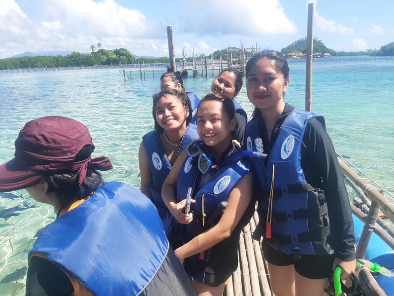
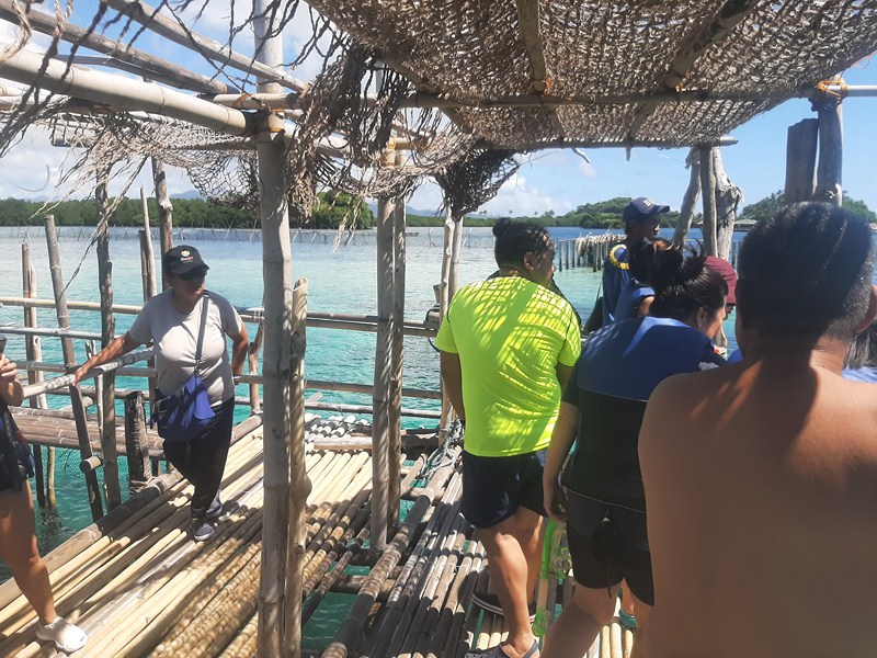
The ladies at the first platform

The sanctuary, nothing like a fish farm, aims to make people aware of as well as to protect and conserve aquatic life, helping tourists understand the importance of marine biodiversity.  It prides itself with a wide variety of beautiful marine animals and aquatic species.

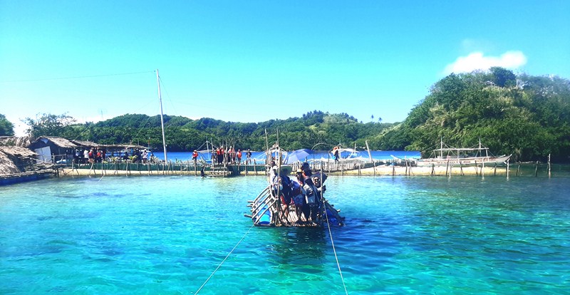
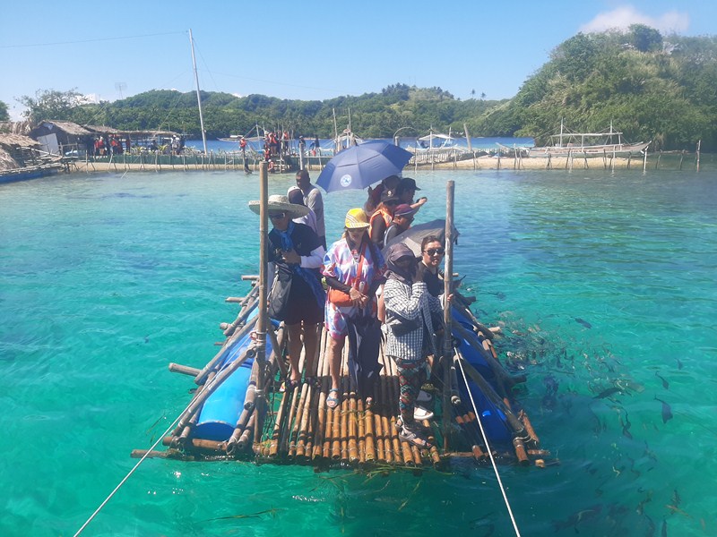
Transferring to the second platform via bamboo raft

To protect the variety of species enclosures of bamboo are built inside which the species move freely in herds. Each enclosure holds different aquatic creatures that are raised by Sir Alex and his family, along with their caretakers. Touring the sanctuary made us experience the significance of protecting the beautiful marine life.

The author (left) with the others at the second platform

The first bamboo platform is used for briefing the visitors on what not to do while exploring the sanctuary. Here, we got to view underwater coral fishes, reefs and other aquatic weeds and plants.

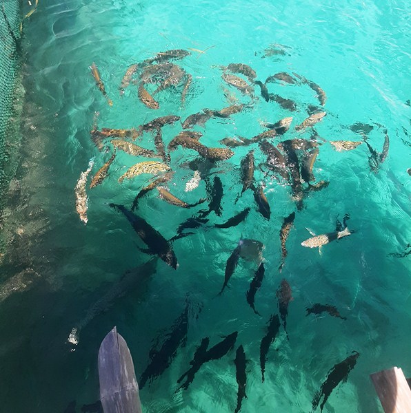
View of the fish from above ……

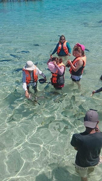
No diving is allowed since it might distract the fishes but visitors are allowed to swim with the fishes as long as the influx of travelers is controlled. They allow tourists to go there by batch.  Here, we got to feed the fish with fish pellets, small fish and bread.

When it was our group’s turn, we hopped on this bamboo raft and, guided by ropes, crossed the sanctuary leading, from the owners’ hut, into a second bamboo platform  on stilts in the middle.

Fish feeding time

This platform contained the real giants of Juag – namely large baraka/lapu-lapu (brown marble grouper), mameng (Napoleon wrasse) and mamsa/talakitok (trevally or big-eyed jack) as well as bangus (milkfish), dugso (long nose emperor), saploran/maya-maya (emperor red snapper), loro/kalolong (parrotfish), pasingko/maynila (Goldman sweetlips), bayang (long-fin batfish), angelfish, labahita (surgeonfish), alatan (harlequin sweetlips) and maramara/samaral (orange-spotted spinefoot).

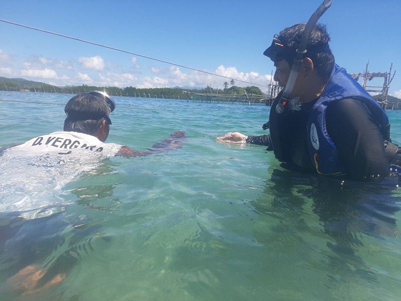
The author all geared up for snorkeling

Donning our snorkels, we were allowed to swim with the fishes in the shallow, crystal-clear waters.  However, they have a strict no-sunblock policy to avoid poisoning the fishes.

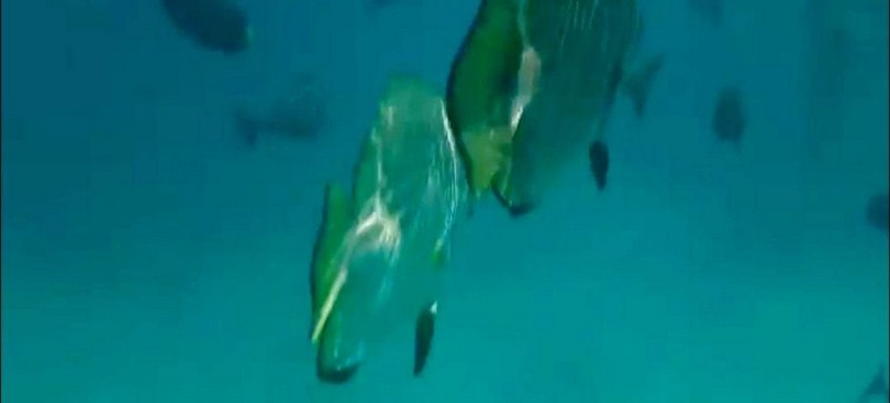
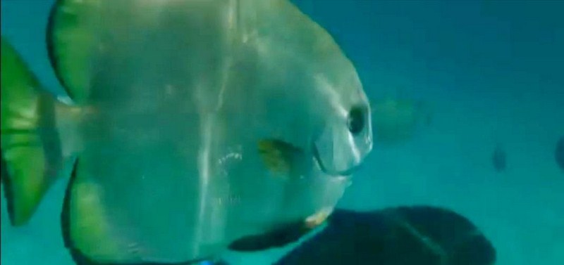
The view from below…..

A batfish

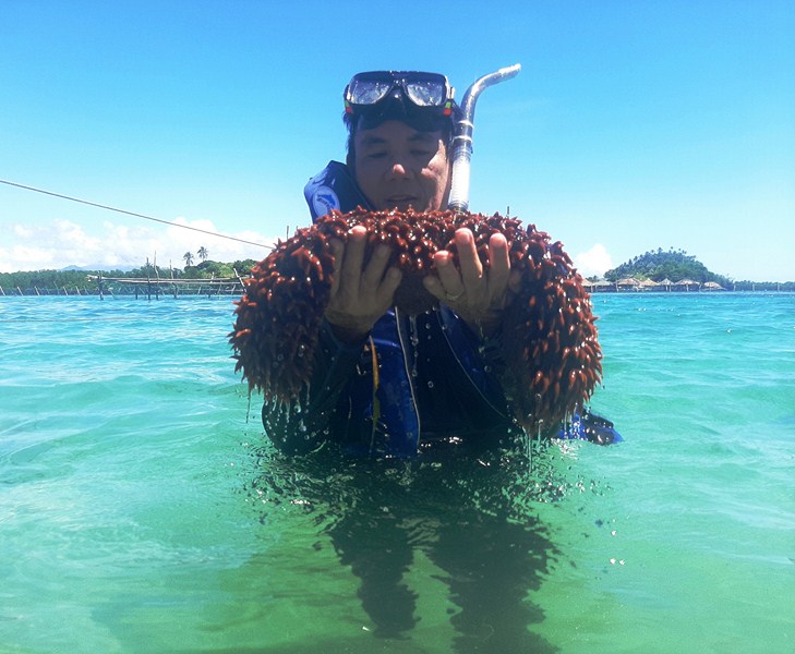
I also posed for the camera carrying a huge balat (pineapple sea cucumber, Thelenota ananas), There are also pawikan (sea turtles), starfishes, banagan/banahawon (tiger lobsters) and taklobo (giant clams).

The author holding a huge  balat (pineapple sea cucumber)

Juag Lagoon Fish Sanctuary: Matnog, Sorsogon.  Mobile numbers: (0907) 957-7748 and (0918) 304-5437. Fish pellets can be bought (php35/kg.) from a sari-sari store near the feeding area.  Facebook page: http://juaglagoon.wix.com/sanctuary
https://www.facebook.com/JuagLagoonMarineSanctuary

How to Get There: Matnog is located 575.9 kms. (a 13.25–hr. drive) from Manila and 61.2 kms. (a 1–hr. drive) from Sorsogon City, both via the Pan-Philippine Highway/AH26..Manila to

Matnog by Bus:
There are several bus liners going straight to Matnog including Philtranco, Penafrancia, Raymund and Amihan. The trip takes 12-15 hours depending on the traffic.

Manila to Legazpi City by Air:
Cebu Pacific Air and Philippine Airlines fly daily to Legazpi City from Manila. Legazpi City is about an hour travel by plane from the capital.

Legazpi City to Matnog:
To get to Matnog from Legazpi City, ride a tricycle going to the bus terminal located near Gaisano Mall. Ride the bus bound for Sorsogon. From Sorsogon, ride the jeepney heading to Matnog and ask to be dropped off near the port. From Matnog Pier, it is a 20-min. motorized boat ride to Juag. 

Sorsogon Provincial Tourism Culture and Arts Office: Ground Floor, Capitol Building, 4700 Sorsogon City. Mobile number: (0968) 624-6279. E-mail: tourism@sorsogon.gov.ph.  Facebook: www.facebook.com/sorsogonprovincialtourismoffice. 

Matnog Tourism, Culture andArts Office: Brgy. Camcaman, Matnog 4708, Sorsogon. Mobile number: (097) 231-8168. Facebook: www.facebook.com/Matnog Tourism.  Fees: Environmental Fee: Php20/pax and Php16 (senior citizens). Registration Fee: Php320 (foreigners), Php70 (locals) and Php40 (senior citizens). 

Ur Place Travel & Tours: OLV Pangpang, Sorsogon City, Sorsogon.  Mobile number (Viber): (0927) 950-3927 (Ms. Annie Gueb).  Facebook: www.facebook.com/urplacetravel.

Mateo Hot and Cold Spring Resort (Irosin, Sorsogon)

Mateo Hot and Cold Spring Resort

Part of Sorsogon Countryside Tour

After our trek at Zoe’s Resort Adventure Park in Bulusan town, we were then driven 14.4 kms. (a 26-min. drive), via the Pan Philippine Highway/AH26 plus a rough road, to the rebranded Mateo Hot and Cold Spring Resort in the adjoining town of Irosin for some therapeutic swimming.

Check out “Zoe’s Resort & Eco-Adventure Park”

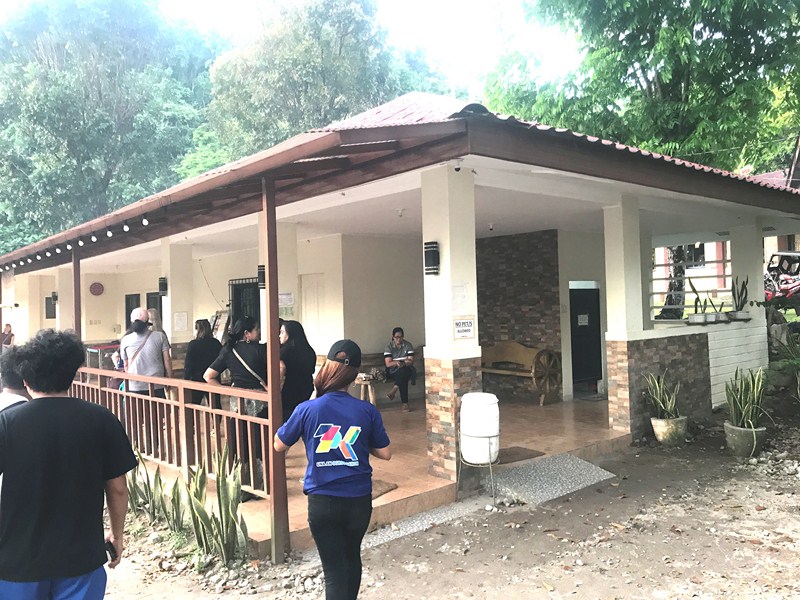
Entrance pavilion

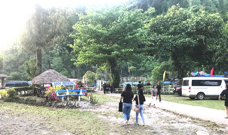
Formerly known  as San Benon Hot and Cold Springs (locals still call this place simply as San Benon), it is now owned and operated (starting April11, 2012) by ARAMARU Resort Corporation of Mr. Reyrold A. Mateo.  The resort was named the DDr. Eliseo Mateo, the original owner.

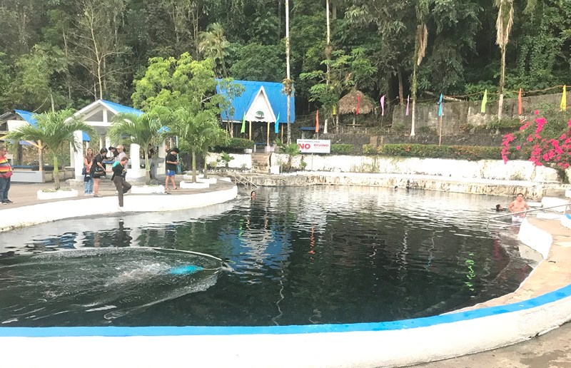
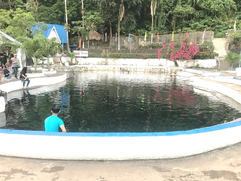
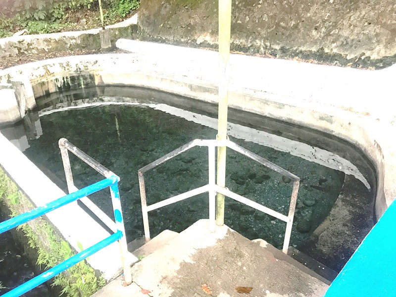
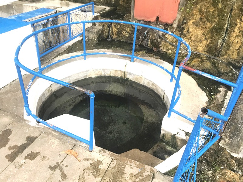
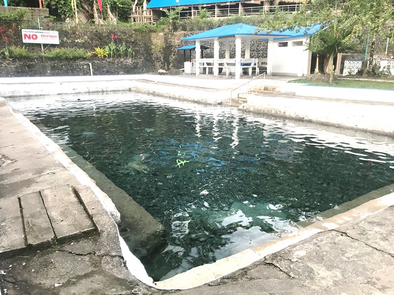
Located at the foot of 1,547 m. high Mt. Bulusan (one of the most active volcanoes in the world) in a forest 4 kms. northeast of the town, it has three man-made pools with a mixture of sulfuric, steaming (Hot Swimming Pool), lukewarm (Lukewarm Swimming Pool) and cool waters (Cold Pool).

Lukewarm Swimming Pool

This is a nice, well maintained place to balance and harmonize our body and mind, to unwind, relax, enjoy and find peace in a quiet and secluded place or just have a picnic with the family and friends during weekends and holidays.

Hot Swimming Pool

Hot jacuzzi

As I came from a trek to two waterfalls, I decided to soak myself in the natural hot spring. Soaking in its hot, crystal-clear waters have many health benefits.

Cold Pool

A good therapy, soaking in the heated pool is extremely beneficial to those who suffer from arthritis plus the buoyancy of the water relaxes the muscles (increasing their range in motion), supports and reduces stress on the joints (encouraging freer movement), and increases the heart rate (while lowering the blood pressure than raising it as does other forms of exercise) with less strain on the heart. A nice place to visit.

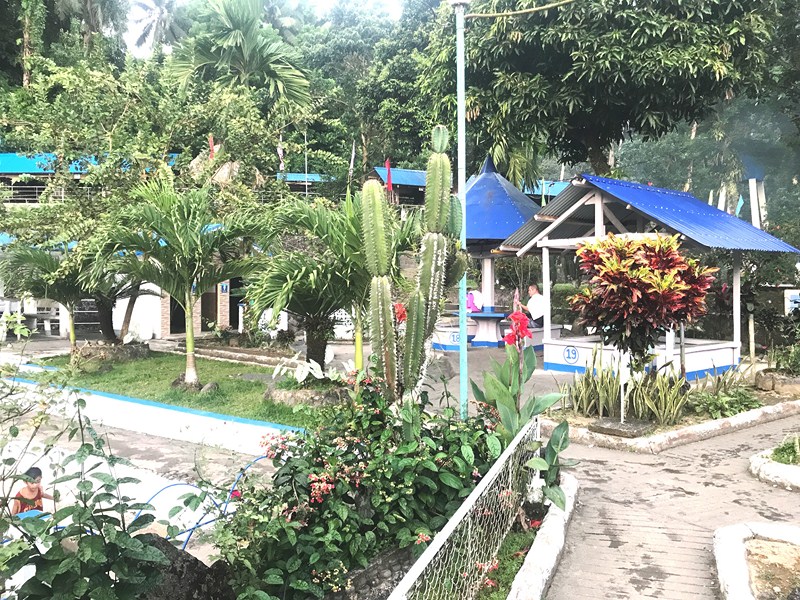
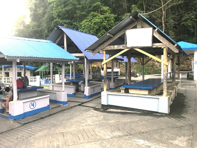
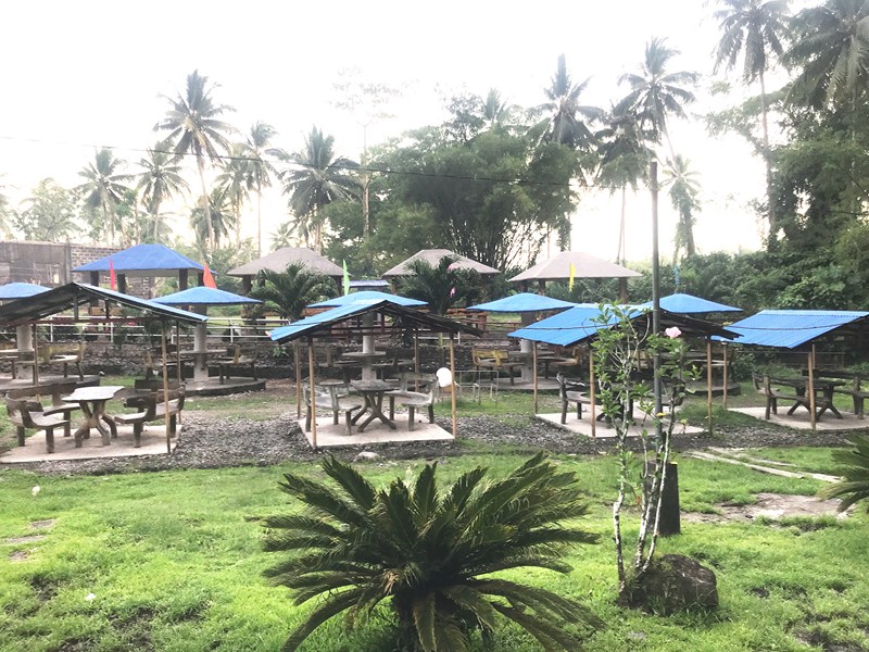
Picnic sheds

Picnic sheds

Mateo Hot and Cold Springs: Sitio San Benon, Brgy. Monbon, Irosin 4707, Sorsogon.  Open daily, 8AM -11 PM (weekdays), 8 AM-12 midnight (weekends).  Mobile number: (0948) 137-0098 (Ms. Jovy O. Fuellas) and (0909) 213-6152 (Ms. Jackie Lou F. Baeza). E-mail: aramaru2012@yahoo.com. Entrance fee: Php65 (day swim, 6 AM -5 PM), Php75 (night swim, 5 PM – 10 PM), Php25 (children below 4 ft.) and free (children 3 ft. and below).

You can also rent a cottage for Php 250 (small cottage, 20 pax), Php350 (big cottage, 30 pax), Php500 (Cottage #9 & #41, 35 pax), Php600 (Cottage #12, 30 pax), Php800 (Cottage #17 – #10, 40 pax),  Php700 (open cabana, 40 pax),  Php1,000 (cabana with fan #1, 45 pax),  Php1,100 (cabana with fan #2, 45 pax) and Php1,600 (Paulina, 60 pax).

Aircon room rates   for 2 pax: Php1,200 (overnight 12 hours, 6 PM – 6 AM) and  Php2,200 (overnight of 1 day, 2 PM – 12 noon).  Family room rates for 5 pax: : Php3,000 (overnight 12 hours, 6 PM – 6 AM) and  Php5,000 (overnight of 1 day, 2 PM – 12 noon). Aircon room rates for 4 pax: Php1,800 (overnight 12 hours, 6 PM – 6 AM) and  Php2,800 (overnight of 1 day, 2 PM – 12 noon).  Aircon room rates for 3 pax: Php1,500 (overnight 12 hours, 6 PM – 6 AM) and  Php2,500 (overnight of 1 day, 2 PM – 12 noon).

How to Get There: Irosin is located 556.4 kms. (a 12.5–hr. drive), via the Pan-Philippine Highway/AH26,  from Manila and 43.4 kms. (a 45–hr. drive), via the Pan-Philippine Highway/AH26,  from Sorsogon City.  From the Municipal Hall, the spring is a 10-15-min. drive.

Sorsogon Provincial Tourism Culture and Arts Office: Ground Floor, Capitol Building, 4700 Sorsogon City. Mobile number: (0968) 624-6279. E-mail: tourism@sorsogon.gov.ph.  Facebook: www.facebook.com/sorsogonprovincialtourismoffice.

Irosin Municipal Tourism Office: E-mail: tourism@irosin.gov.ph.  Website: www.tourism.irosin.gov.ph. Mobile number: (0977) 382-2298. Facebook: www.facebook.com/IrosinTourismOfficial

Ur Place Travel & Tours: OLV Pangpang, Sorsogon City, Sorsogon.  Mobile number (Viber): (0927) 950-3927 (Ms. Annie Gueb).  Facebook: www.facebook.com/urplacetravel.

Zoe’s Resort & Eco-Adventure Park (Bulusan, Sorsogon)

Zoe’s Resort & Eco-Adventure Park

Part of Sorsogon Countryside Tour

After lunch at Balay Buhay sa Uma Farm, we proceeded to the nearby Zoe’s Resort & Eco-Adventure Park driving across a long rough road before getting to the resort.  This eco-tourism site, a 10-min. drive from Lake Bulusan, offers outdoor activities for adventure-seekers and laid-back facilities for visiting families and children.

Check out “Balay Buhay sa Uma Bee Farm”

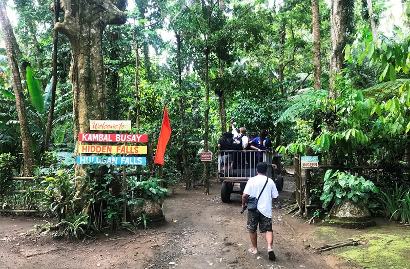
Here, we were to trek two (Kambal Busay and Hidden Falls) of their three waterfalls (the other is Hulugan Falls). A tour guide was assigned to us as we can get lost in the vast space inside Zoe’s Resort and the waterfalls are quite far from each other.

Getting to the jump-off point via tractor

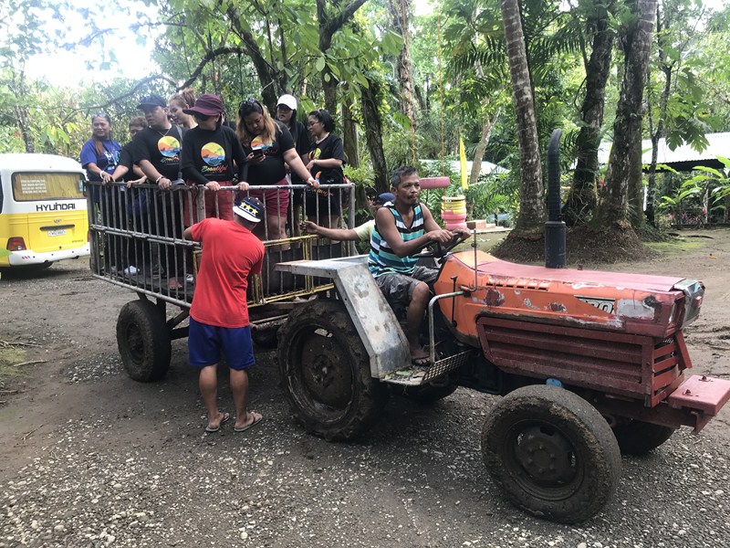
At the main entrance, we were given the option to get to the jump-off point for the trek to Kambal Busay via tractor.  Most of the ladies chose this option while the rest (including me) just walked for about 5 mins..

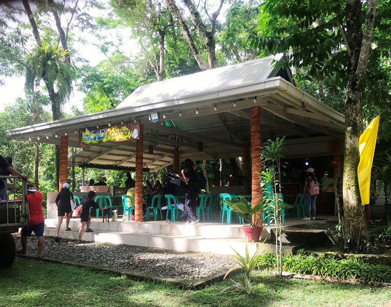
SCAD Kapehan

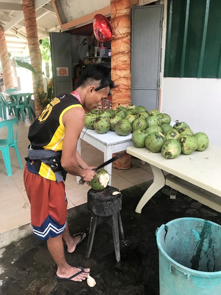
Fresh buko being prepared for us at SCAD Kapehan

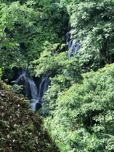
We soon reached Scad Kapehan, the resort’s al fresco cafeteria, where we were treated to fresh buko (coconut) juice. From the cafeteria, we could already hear the sound of and see, from up the stairs, Kambal Busay Falls.

View of Kambal Busay Falls from SCAD Kapehan

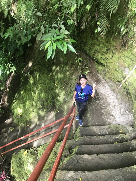
After this refreshing treat, I proceeded down the 119-step stairway (this would be Calvary on my return) that lead to Kambal Busay Falls.

My guide Ms. Rachel Romano at the 119-step stairway leading down to the falls

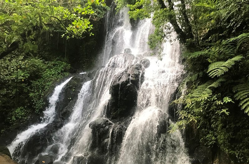
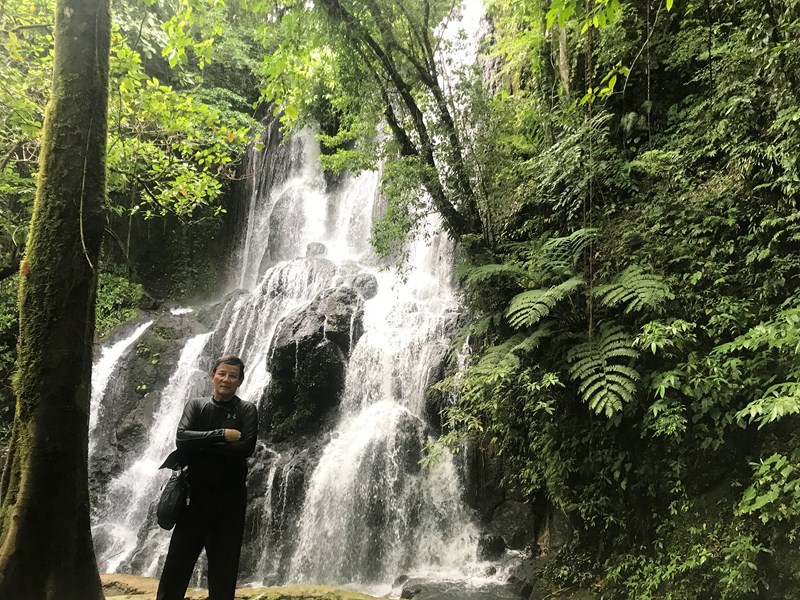
At the base of the stairway, I espied the beautiful, 30-ft. high Kambal Busay Falls in all its glory.  Its basin was quite safe to swim and some of us did so.  There was a rope that you can hold onto so you can stand directly under the falls.

Kambal Busay Falls.  The boulder in the middle cuts the falls into two, hence the name

The author at Kambal Busay Falls

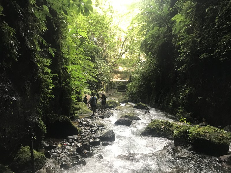
To get to Hidden Falls, I had to hike much further (about 10-15 mins.), traversing cascades of water and slippery rocks and boulders.

Downstream from Kambal Busay Falls

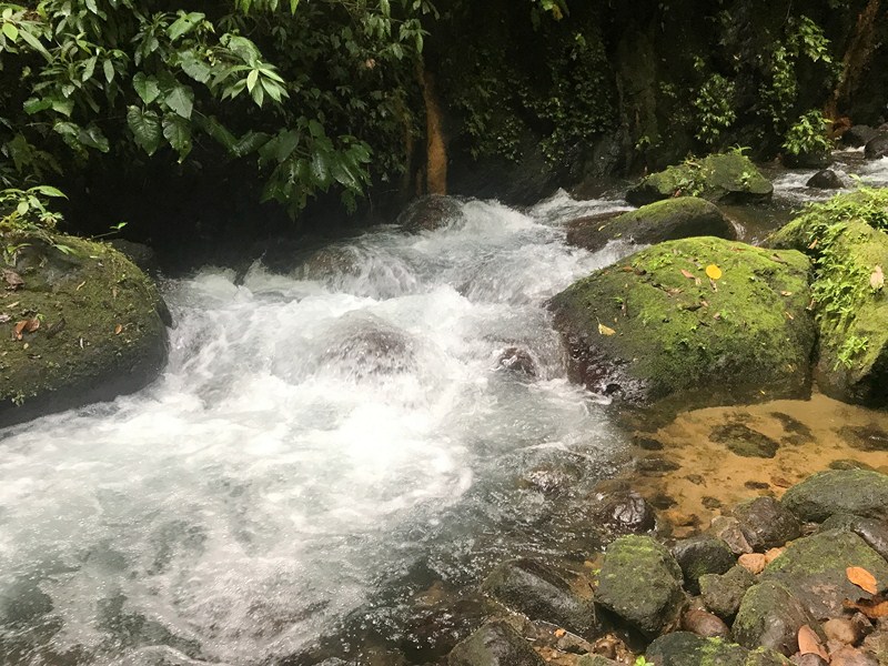
Cascades of water along the trail to Hidden Falls

Literally hidden inside a cave-like entrance, the fall’s current is strong and pools into what looks like a deep basin.

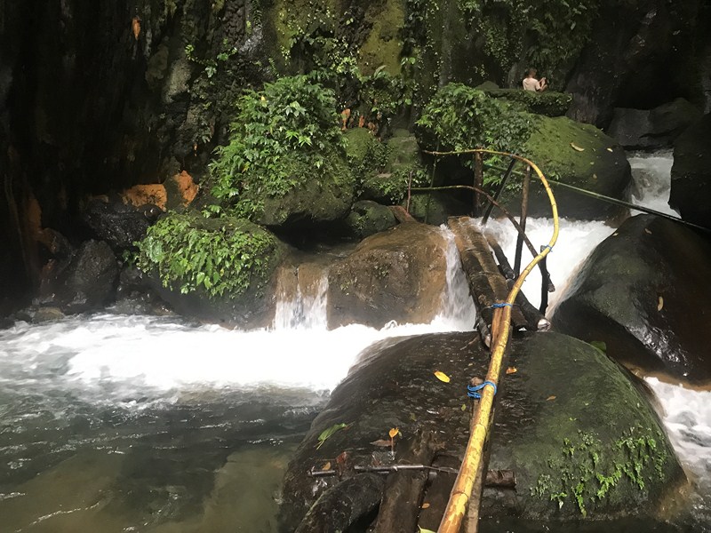
Improvised walkways and handrails such as these made trekking to Hidden Falls much easier

A short set of wooden stairs and walkways with bamboo handrails led up to a huge boulder where I can take a peek of the waterfall.

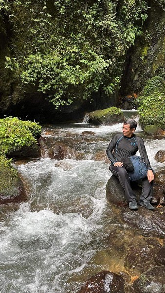
The author resting along the way (photo: Ms. Joan April Chang)

The 23-ft. high Hulugan Falls, the last one and the farthest, is 1 km. (a 30-45-min. hike) away from the main entrance. In Irosin (where the falls is located), it called Naglahaw Falls (from the word naglalahao meaning “to fall down”) and its entry point is coming from Danao Irosin lake, a 10-15 min. hike. It is fed by several rivers and tributaries from nearby localities and even water from the crevices of Bulusan Volcano.

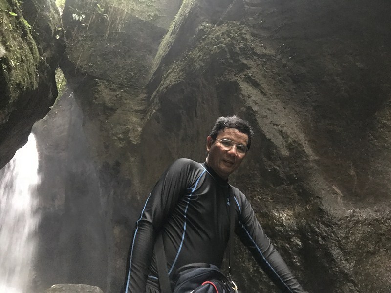
The author at Hidden Falls

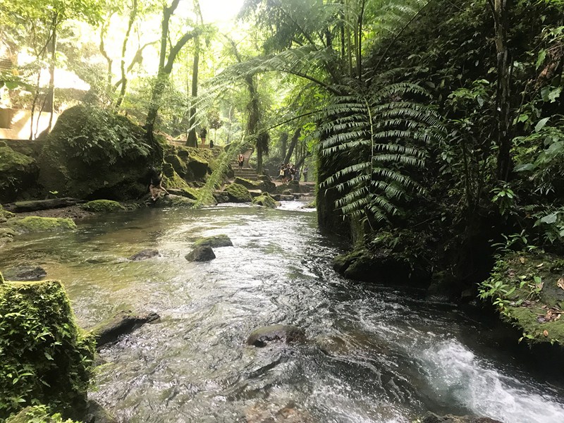
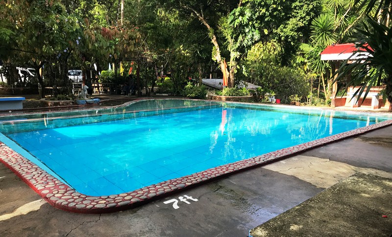
For those who want to stay longer in the resort, Zoe’s Resort has different varieties of cottages: umbrella (Php250), casa (Php500) and hall. The halls are two casas combined cost between Php1, 500 – Php2, 000.  The resort also has two swimming pools (the Cold Spring and the Bloody Pool).  The one for the adults has a depth of 7 ft. and one for the kids has a depth of 3 ft.

Idyllic scenes such as these make you want to linger longer

Aside from the tractor ride (Php50 per pax), you can also try ATV (Php150 per 15 mins.) to the 3 waterfalls and bamboo rafting in their manmade lake (Php20 per pax).

One of the resort’s two swimming pools

Zoe’s Resort & Eco-Adventure Park: Brgy. San Roque, Bulusan 4704, Sorsogon.  E-mail: zoesresort@gmail.com.  Mobile number: (0948) 620-7196 and (0919) 578- 4079. Open daily, 6 AM – 6 PM. Entrance fee: Php150/pax.  Tour guide fee: Php150 (for 2 pax) and Php350 (up to 10 pax).

How to Get There: Bulusan is located 557.3 kms. (a 13-hr. drive  via Pan Philippine Highway/AH26) from Manila and 44.5 kms. (a 55-min. drive) via the Junction Abuyog-Gubat-Ariman Rd., from Sorsogon City.

Sorsogon Provincial Tourism Culture and Arts Office: Ground Floor, Capitol Building, 4700 Sorsogon City. Mobile number: (0968) 624-6279. E-mail: tourism@sorsogon.gov.ph.  Facebook: www.facebook.com/sorsogonprovincialtourismoffice.

Bulusan Municipal Tourism Office: www.facebook.com/ExploreBulusan.

Ur Place Travel & Tours: OLV Pangpang, Sorsogon City, Sorsogon.  Mobile number (Viber): (0927) 950-3927 (Ms. Annie Gueb).  Facebook: www.facebook.com/urplacetravel.

Bulusan Lake Eco-Tourism Center (Sorsogon)

Bulusan Lake Eco-Tourism Center

Part of Sorsogon Countryside Tour

After our short stopover at Casiguran Settlement, we again boarded our coaster for the hour-long, 3.4 km. drive to Bulusan Lake in Bulusan town.  This would be my second visit to the lake, the first over ten years ago (June 26, 2012). Upon arrival, I was surprised by how much the park has improved since my first visit.

Check out “Casiguran Settlement” and “Eco-Friendly Kayaking at Lake Bulusan”

The new facilities include a 1,002.5-square meter, Php60 million Bulusan Lake Eco-Tourism Center to cater to tourists, with a road network and parking area.  Inaugurated, after a massive two-year restoration and rehabilitation, last March 5, 2022 by then Gov. Francis “Chiz” Escudero and Bulusan Mayor Michael Guysayko (with DOT Regional Director Herbie Aguas , DENR Bicol Director Francisco Milla, Jr. and other officials in attendance),  it is accredited by the Department of Tourism as a Tourism Recreation Center.

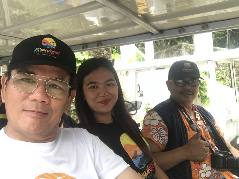
The author (left) on an E-jeep

The center has a registration booth, an alfresco coffee shop and a restaurant called Sagurong Restaurant, a spa massage spa, and a souvenir shop where one can buy pasalubong including local arts and crafts.

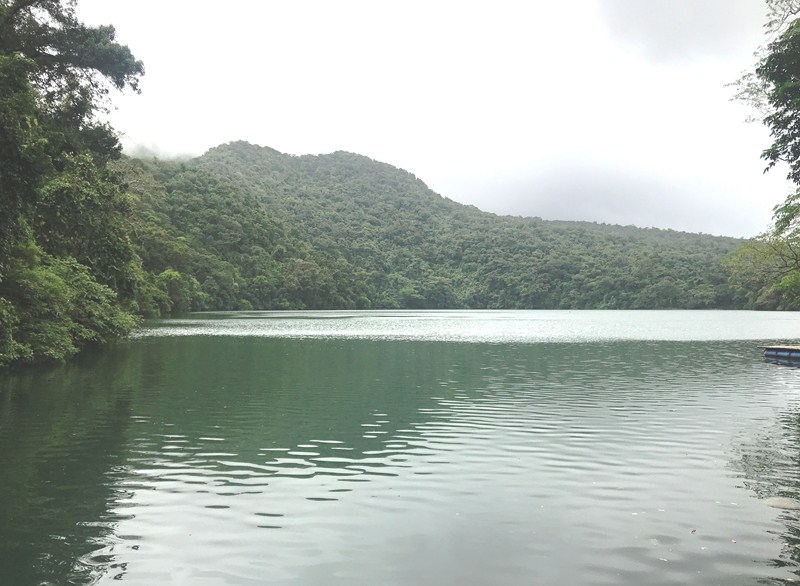
Lake Bulusan


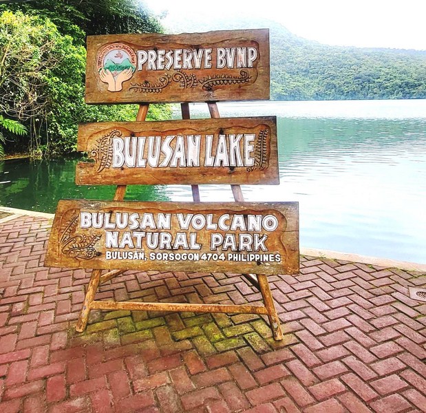
Our coaster as well as other private vehicles are not allowed to enter the park so, from the Ecotourism Center, we all boarded e-jeeps (there are three available) that took us to the entrance to Bulusan Volcano National Park (dubbed as the “Switzerland of the Orient”), a 3,672-hectare protected landscape located at an elevation of 635 m. on the southeast flank of Mount Bulusan, an active stratovolcano, where Bulusan Lake, a small. Round crater lake, is nestled within.

For those who prefer to walk, the lake is a 20-30-min. hike. The natural park is also home to the Bulusan Eco-Adventours, which was launched coinciding with the blessing and inauguration of the tourism center.

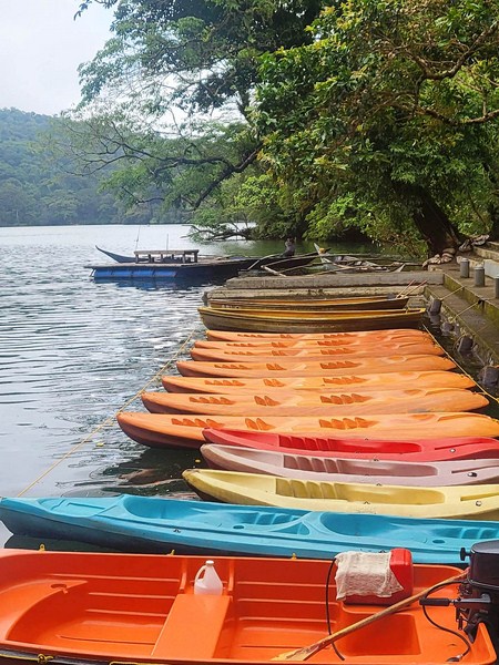
Single and tandem kayaks for rent

The lake remained as peaceful and beautiful as I remembered it to be.  Aside from Lake Bulusan, the park also covers Lakes(Aguingay (where water accumulates during the rainy season) and Blackbird (found at the mountain’s crater) and its rainforests are home to endemic flora and fauna.

The upper view deck

Flora include the Forestia philippensis, Pinanga insignis and the newly discovered Schefflina bulusanicum (an aquatic plant) and Pronephrium bulusanicum (a type of fern); jade vine (Stronglylodon macrobothrys); ground orchids (Phojus tankervillea); tall, centuries-old tindalo (Afzeliarrhomboidea) trees and mountain agoho (Casuarina rumphiana).

Food bar and dining hall

Fauna found here include the Luzon Hornbill, Philippine Fairy Bluebird, Philippine Warty Pig, South Luzon Cloud Rat Spotted Wood Kingfisher, Philippine Frogmouth, etc.).

Imelda and I all suited up and ready to go kayaking….. (photo: Mr. Marlon Atun)

Multipurpose facilities were built near Bulusan Lake. They include a food bar or dining area with comfort rooms and ramps, waiting shed, souvenir shop, ticket booth and queue sheds.  However, its main feature was an upper view deck overlooking the lake which offers an overview of the lake and its surrounding mountains.

On our way…. ((photo: Mr. Marlon Atun)

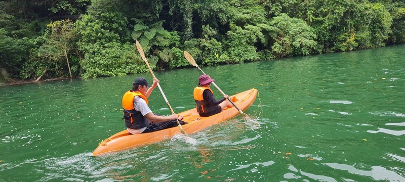
Bulusan Lake was still a sight to behold. This emerald-green, still lake spans 16 hectares and is 33 m. deep.  As in the past, the best way to appreciate the beauty of the lake is to take a boat ride on the emerald green water.

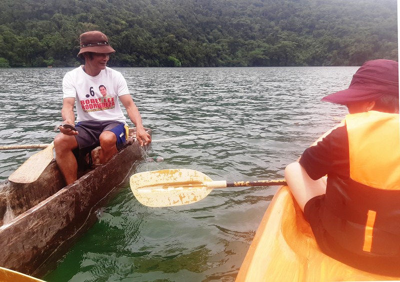
Meeting up with a local fisherman

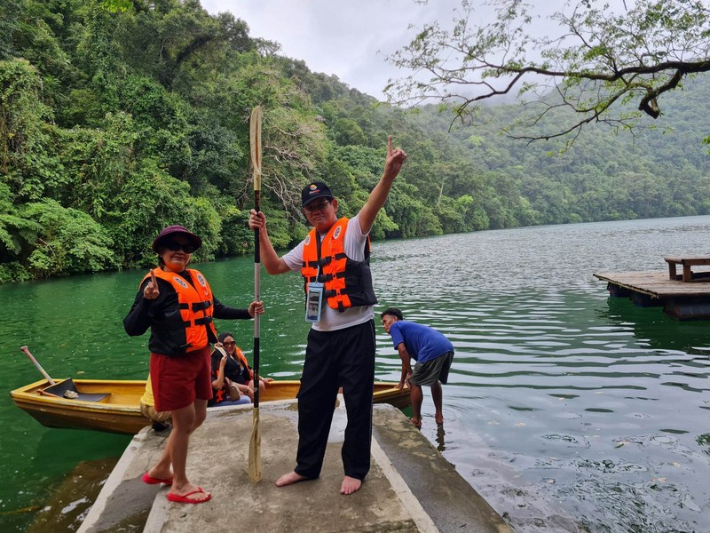
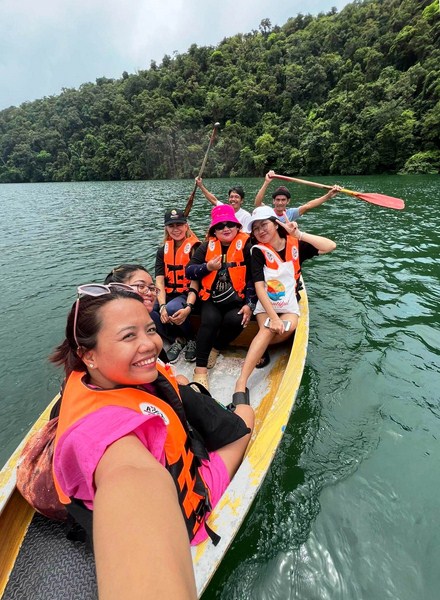
While the others enjoyed the surrounding from the park’s viewing deck, I geared up and rented kayak.  Five others rented a boat paddled by a guide.  Joining me at my two-seater kayak was fellow senior citizen Ms. Maria Imelda Favi. It was a tiring yet peaceful activity as we paddled our way around the lake, admiring the scenic and lush view of the surrounding rainforest.  In the middle of the lake, we met up with a local fishing for tilapia on his banca.  Check out our kayaking video here.

Paddle boating at the lake (photo: Ms. Joan April Chang)

Aside from boat riding, you can also try fishing and stand up paddleboarding.   You can also take a leisurely walk along the perimeter of the lake where the guides can help in pointing out interesting flora and fauna.

Bulusan Lake Ecotourism Center: Brgy. San Roque, Bulusan, Sorsogon.  Mobile number: (090) 505-0988. Facebook: www.facebook.com/bulusanlake  and www.facebook.com/ExploreBulusan.

Admission: Php50 (adults), Php25 (student or Bulusan resident with valid ID) and free (senior citizen and PWD with valid ID).  Environmental fee: Php10.  Shuttle service: Php35. Eco-guides fee: Php150/hr.  Massage: Php250. Paddling guide for kayak and stand up paddleboading: Php100. Trekking: Php10/pax.  Boating: Php00 for five pax, inclusive of two paddlers.

Parking fees: Php20 (motorcycles), Php30 (tricycle), Php50 (cars/SUV), Php60 (jeepney/coaster), Php70 (truck) and Php150 (bus)

How to Get There: Bulusan is located 557.3 kms. (a 13-hr. drive  via Pan Philippine Highway/AH26) from Manila and 44.5 kms. (a 55-min. drive) via the Junction Abuyog-Gubat-Ariman Rd., from Sorsogon City. From Sorsogon City, ride a jeep bound for Bulusan (1 hour). Then charter a tricycle to Bulusan Lake (about 15-20 minutes).

Sorsogon Provincial Tourism Culture and Arts Office: Ground Floor, Capitol Building, 4700 Sorsogon City. Mobile number: (0968) 624-6279. E-mail: tourism@sorsogon.gov.ph.  Facebook: www.facebook.com/sorsogonprovincialtourismoffice.

Bulusan Municipal Tourism Office: www.facebook.com/ExploreBulusan.

Ur Place Travel & Tours: OLV Pangpang, Sorsogon City, Sorsogon.  Mobile number (Viber): (0927) 950-3927 (Ms. Annie Gueb).  Facebook: www.facebook.com/urplacetravel.

Casiguran Settlement (Sorsogon)

Casiguran Settlement

Part of Sorsogon Countryside Tour

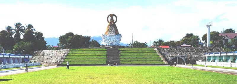
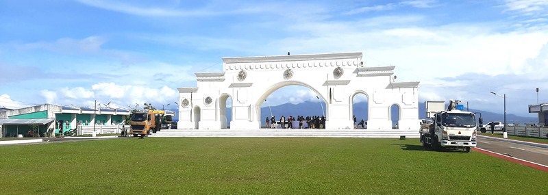
After breakfast and checking out at Villa Isabel Hotel in Sorsogon City, we again boarded our coaster for the short 22.5 km. (30 min.) drive to Casiguran town.  Accompanying us was Mr. Angel Ayala, the former Information and Tourism Officer of Casiguran.  Our destination was to be the Casiguran Settlement, a housing project of Gov. Jose Edwin “Boboy” B. Hamor when he was still mayor (2016-2022) of Casiguran.  The sight of a monumental, multi-arched portal along the road signaled our arrival at our destination.

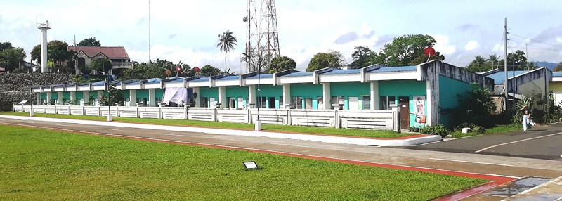
A row of brightly painted, pastel colored housing units

Sitting on 14 hectares of land reclaimed from the sea, this settlement houses 500 plus units for informal settlers whose income mainly relies on fishing and farming.  Built in 2017, the LGU awarded one 35 sq. m. (5 by 7 m.), one-storey unit per family, giving them a more decent and spacious home within this well-regulated community. All the families need to do is pay 10 pesos per day for five years after which their units will be fully awarded to them.  They are not allowed to sell or rent out their units.

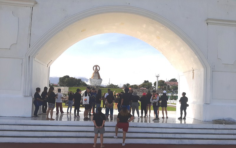
The monumental, multi-arched portal and Plaza Escudero

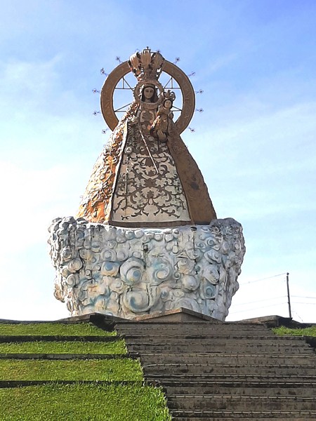
At the center of Casiguran Settlement is Plaza Escudero, a vast,, grassy open space for recreational activities such as biking, jogging and other exercise activities.  Here, we had a stunning view of the Sorsogon Range.  Opposite the monumental portal is the equally monumental Statue of Our Lady of the Most Holy Rosary, modeled after the image of Our Lady of La Naval de Manila, it serves as the community’s main attraction..  The statue sits atop a terraced mound and can be reached by a flight of steps.

Statue of Our Lady of the Most Holy Rosary

Flanking these monumental structures are the housing units painted in bright, eye-catching pastel colors.  The Church of Our Lady of the Holy Rosary is a few streets away from the Casiguran Settlement,

AUTHOR’S COMMENT:

With its monumental structures, vast open spaces and majestic and pleasant views of the mountains and the sea, the Casiguran Settlement has the potential to be a major tourist attraction and pilgrimage site of the town as well as the province.

Casiguran Settlement: Brgy. Central, Casiguran, Sorsogon.

How to Get There: Casiguran is located 537.9 kms. (a 12.5–hr. drive) from Manila and 23.2 kms. (a 30 min. drive) from Sorsogon City,  all via the Pan-Philippine Highway/AH26. 

Sorsogon Provincial Tourism Culture and Arts Office: Ground Floor, Capitol Building, 4700 Sorsogon City. Mobile number: (0968) 624-6279. E-mail: tourism@sorsogon.gov.ph.  Facebook: www.facebook.com/sorsogonprovincialtourismoffice.

Casiguran Tourism Office: www.facebook.com/LGU Casiguran Sorsogon. 

Ur Place Travel & Tours: OLV Pangpang, Sorsogon City, Sorsogon.  Mobile number (Viber): (0927) 950-3927 (Ms. Annie Gueb).  Facebook: www.facebook.com/urplacetravel

Rompeolas Bay Walk (Sorsogon City, Sorsogon)

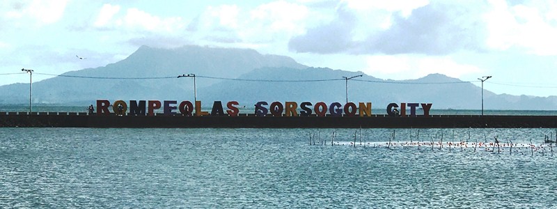
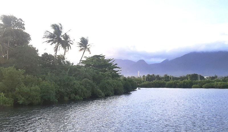
Rompeolas Bay Walk.  In the foreground is the standee while in the background is the partially cloud-shrouded Mt. Bulusan

Part of Sorsogon Countryside Tour

After our tour of the Sorsogon Cultural Center for the Arts, we were driven 4 kms. to Rompeolas Bay Walk.  Also known as the Sorsogon City Bay Walk, it is located along Sorsogon Bay.

Check out “Sorsogon Cultural Center for the Arts”

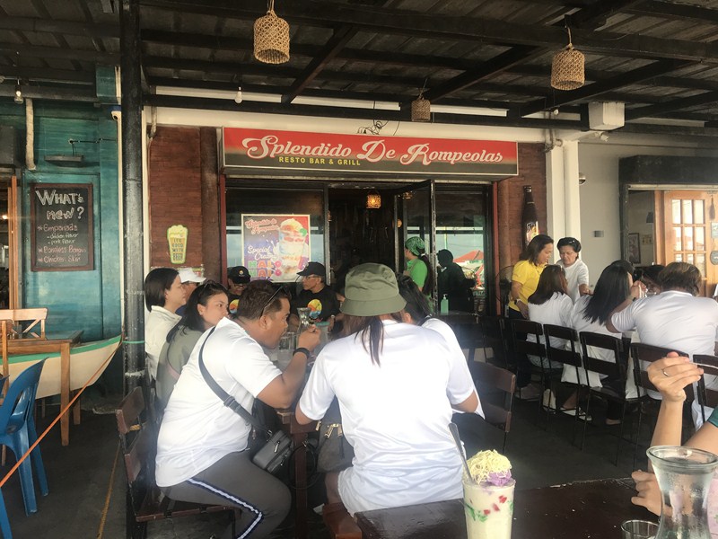
Splendido de Rompeolas

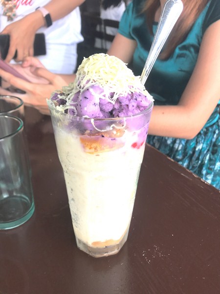
Our creamy halo-halo

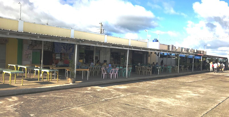
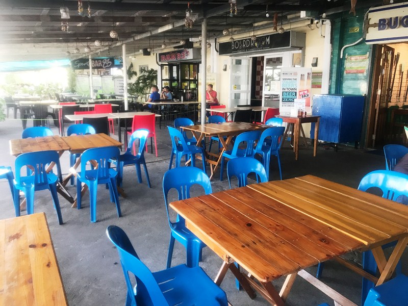
Here, we had a merienda of creamy halo-halo at Splendido de Rompeolas Restobar & Grill, one of a number of restaurants at the Rompeolas Food Court that serve breakfast, lunch, dinner and merenda meals. It is being developed by the provincial government as a tourist zone.

Rompeolas Food Court

Sports Bar 83, Boardroom Snacks & Games Cafe

Its name was derived from the Spanish word romper meaning “where the waves cavort.” At Rompeolas, Pinaculan Island, the “Rompeolas Sorsogon City” standee as well as picturesque views of Sorsogon Bay and, on a clear day, Mount Bulusan can be seen from afar.

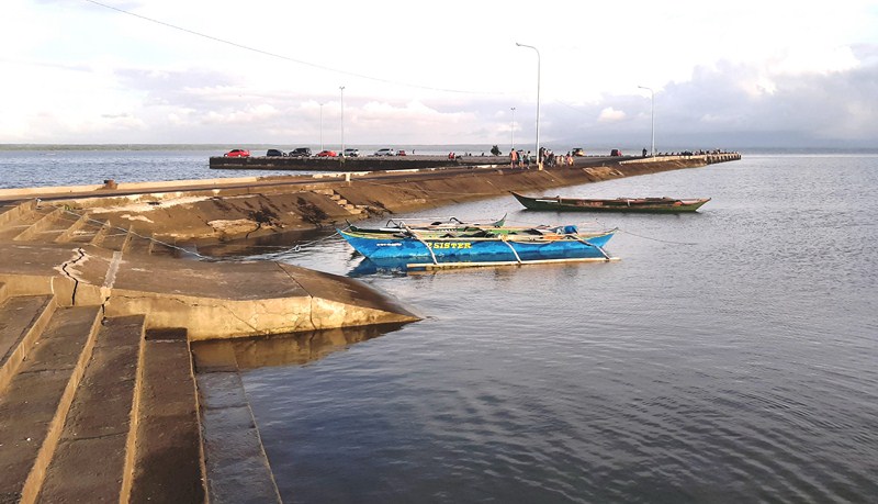
Sorsogon Pier

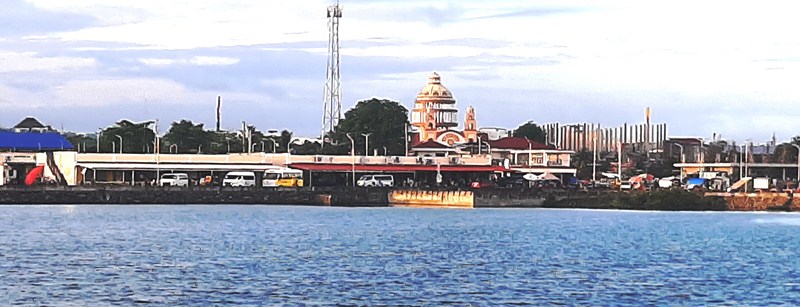
It also has a fairyland view of Sts. Peter and Paul Cathedral, with its colorful, dome and pointed steeples.

View of the dome and spires of the Sts. Peter & Paul Cathedral

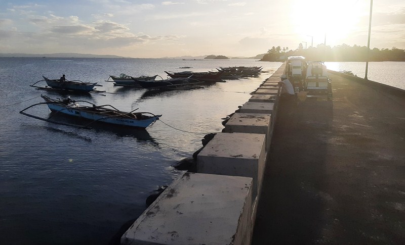
The site of the old Sorsogon Pier (which juts into Sorsogon Bay), this pleasant, arrowhead-shaped promenade, with fresh sea air (especially in the morning), gets really crowded with students out on date, kids out on a day of fun (there is a playground), and those who just can’t get enough of the glorious and spectacular, reddish-orange  Sorsogon sunset over Pinaculan Island. It is also crowded during sunrise, with people exercising or jogging to start their day.

View of the sunset over Pinaculan Island from the causeway

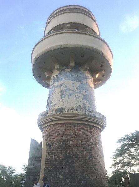
The adjacent quiet, 3-hectare, tadpole-shaped Pinaculan Island, site of a lighthouse, was once only connected to the mainland, at Brgy. Bitan-o-Dalipay, during low tide.

Pinaculan Island

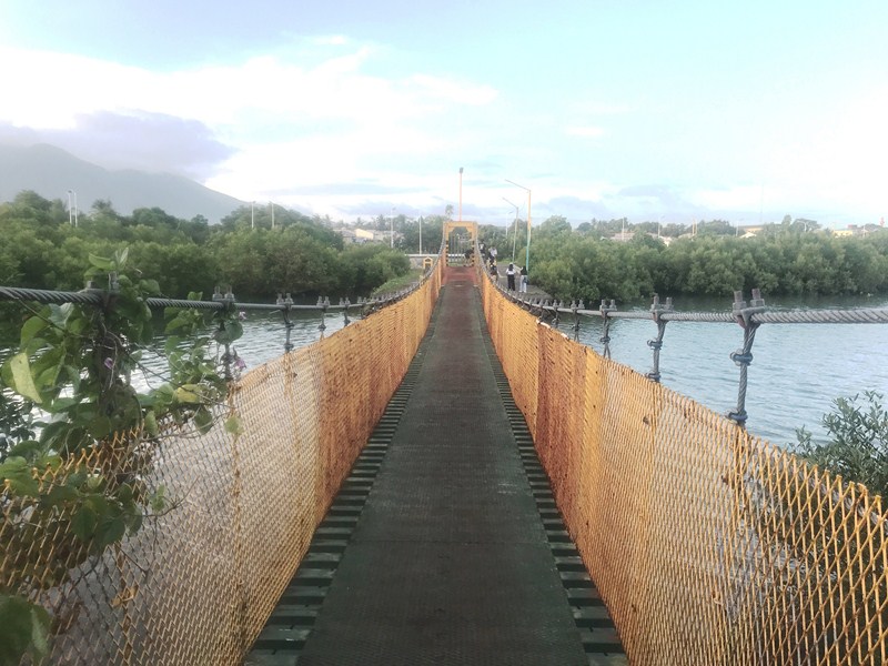
Today, it is now connected to the mainland via a causeway (built around 2012) and an aesthetically pleasing hanging bridge crossing over to Brgy. Bitan-o-Dalipay. 

The hanging bridge

On October 31, 2019, during Sorsogon’s Kasanggayahan Festival, a total of 7,127 Sorsogon residents, including Gov. Francis ‘Chiz’ Escudero and his wife actress Heart Evangelista, performed the Pantomina sa Tinampo (the Bicolano courtship dance mimicking the movement of doves in  courtship) from Fatima Church to Bulwagan and Rompeolas Baywalk. In doing so, Sorsogon now holds a Guinness World Record for the largest Philippine folk dance. Swapnil Dangarikar of India, official adjudicator from Guinness World Records, witnessed the historic performance.

Pinaculan Lighthouse

The 4-lane, 5.52-km. long Sorsogon City Coastal Rd., opened last August 30, 2020, connects Rompeolas Bay Walk with Brgy. Balogo.  It bypasses Sorsogon City’s main thoroughfare along Maharlika Highway. Providing a pleasant view of Sorsogon’s coastline, it also doubles as a protection against storm surges.


Rompeolas Bay Walk: Brgy. Talisay, Sorsogon City 4700, Sorsogon. Coordinates 12.96481,124.0041.

Splendido de Rompeolas Restobar & Grill: Pier Site, Rompeolas, Brgy. Talisay, Sorsogon City 4700, Sorsogon. Mobile number: (0912) 105-9950.

How to Get There: Sorsogon City is located 517.5 kms. (a 12–hr. drive) from Manila via the Pan-Philippine Highway/AH26. 

Sorsogon Provincial Tourism Culture and Arts Office: Ground Floor, Capitol Building, 4700 Sorsogon City. Mobile number: (0968) 624-6279. E-mail: tourism@sorsogon.gov.ph

Ur Place Travel & Tours: OLV Pangpang, Sorsogon City, Sorsogon.  Mobile number (Viber): (0927) 950-3927 (Ms. Annie Gueb).  Facebook: www.facebook.com/urplacetravel