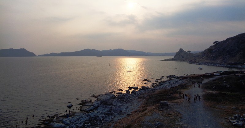
It was now Black Saturday in Mariveles, Bataan and, to avoid the rush of tourist returning to Manila the next day, Maricar, Norman, Jandy and I opted to leave The Oriental Bataan in the morning, right after breakfast. Normally, returnees take the Roman Superhighway (Bataan Provincial Expressway) to avoid the traffic gridlock in towns along the MacArthur Highway but we chose to travel via the latter to go on our own Lenten tradition of Bisita Iglesia (visit to 7 churches).
Check out “Hotel and Inn Review: The Oriental Bataan”
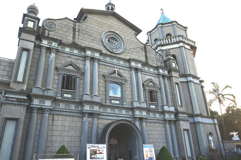
Jandy and Maricar at Church of St. Michael the Archangel in Orion
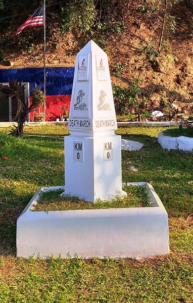
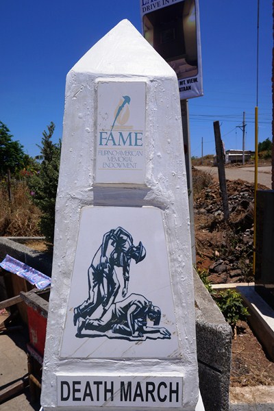
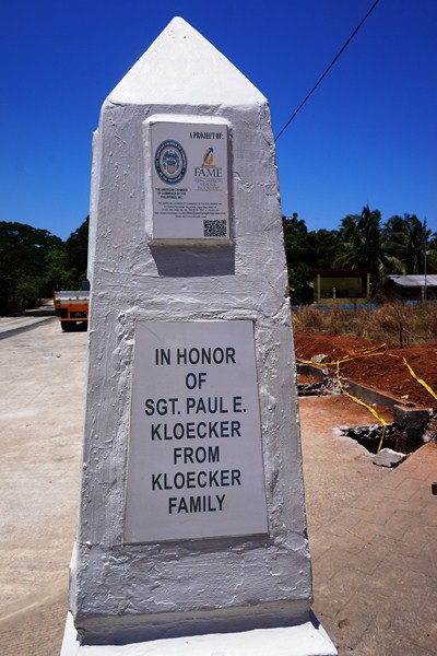
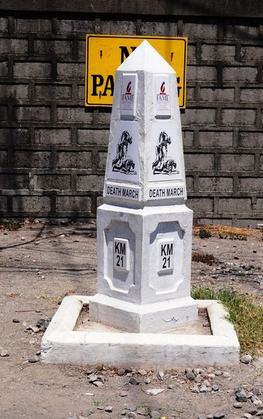
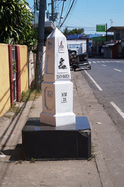
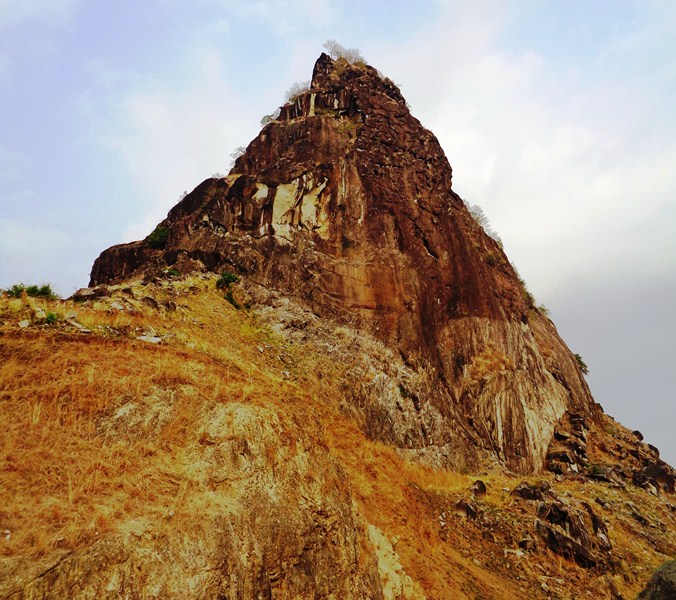
Aside from the old Spanish-era churches along the MacArthur Highway, you’ll also pass a lot of interesting Death March Markers as well as World War II monuments, museums and shrines.
Check out “Bataan’s Death March Markers” and “Museo ng Kagitingan”
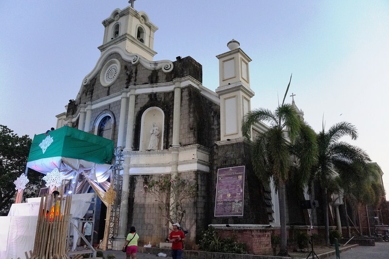
Church of Our Lady of the Pillar in Pilar
The churches we visited were:
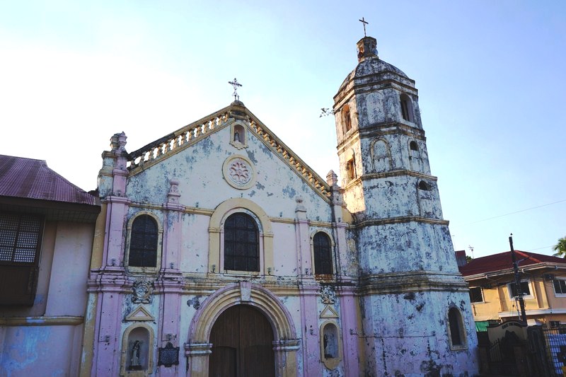
- Church of St. Michael the Archangel (Orion) – this 352 year old church, the third oldest in the province, was repaired by the Dominicans upon their return in 1832.
Check out “Church of St. Michael the Archangel“
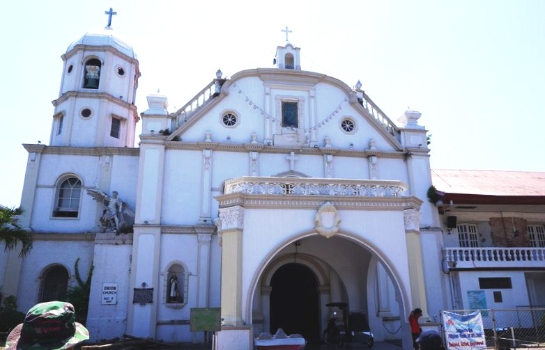
Church of St. Michael the Archangel
- Church of Our Lady of the Pillar (Pilar) – this 218 year old church, the seventh oldest in Bataan, was burned by revolutionaries on May 28, 1898. The image of Nuestra Senora del Pilar survived.
Check out “Church of Our Lady of the Pillar“
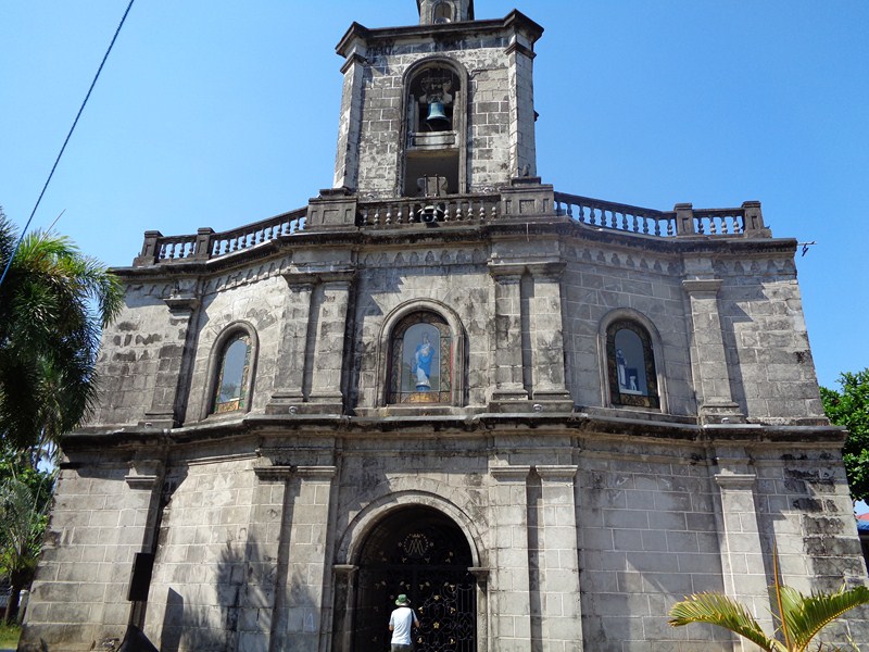
Church of Our Lady of the Pillar
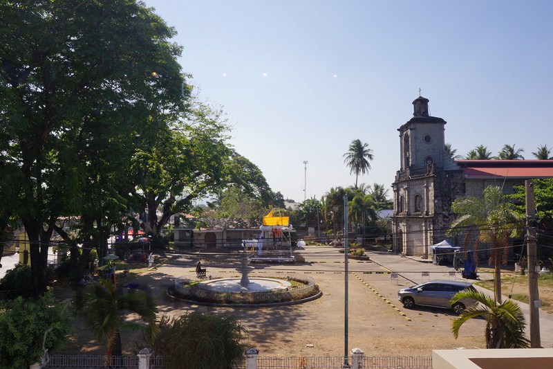
- Diocesan Shrine and Cathedral of St. Joseph (Balanga City) – this 305 year old church, the fifth oldest in Bataan was, during World War II, used by the Japanese 14th Army as an artillery emplacement to bombard Mt. Samat. On March 19, 2015, the cathedral was formally declared as a Diocesan Shrine.
Check out “Diocesan Shrine and Cathedral of St. Joseph“
Diocesan Shrine and Cathedral of St. Joseph
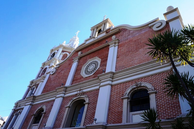
- Church of St. Dominic of Guzman (Abucay) – this 431 year old church, the oldest in Bataan, housed one of the earliest printing presses in the country and its court was the site of a fierce battle between the Dutch and PPampango natives on June 23, 1647.
Check out “Church of St. Dominic of Guzman“
Church of St. Dominic of Guzman
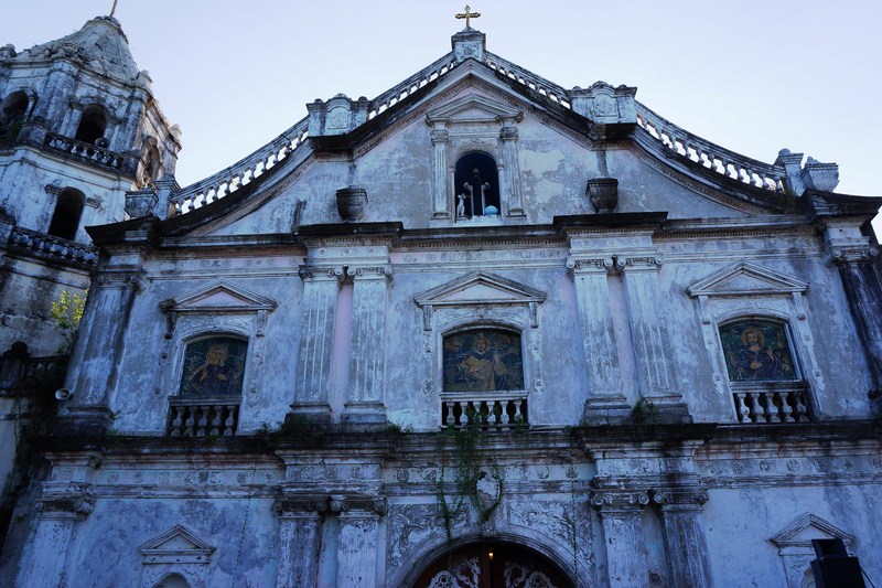
- Church of St. Catherine of Sienna (Samal) – this 423 year old church, the second oldest church in Bataan, was burned by Katipuneros in 1898 to drive out their enemies in the convent. The present church and convent were rebuilt from 1903 to 1905.
Check out “Church of St. Catherine of Sienna“
Church of St. Catherine of Sienna
- Church of Our Lady of the Most Holy Rosary (Orani) – this 309 year old church, the fourth oldest in Bataan, is one of the best in the province. Repaired by Dominican friars in 792, it was badly damaged during the September 16, 1852 earthquake.
Check out “Church of Our Lady of the Most Holy Rosary“
Church of Our Lady of the Most Holy Rosary
- Church of St. Peter, Martyr of Verona (Hermosa) – this 263 year old church, the sixth oldest in Bataan, was built in stone by Dominican friars, destroyed by fire several times but was renovated in 1869.
Check out “Church of St. Peter, Martyr of Varona”
Church of St. Peter, Martyr of Varona
Bataan Provincial Tourism Office: Roman Superhighway, Balanga City, Bataan. Tel: (047) 237-4785