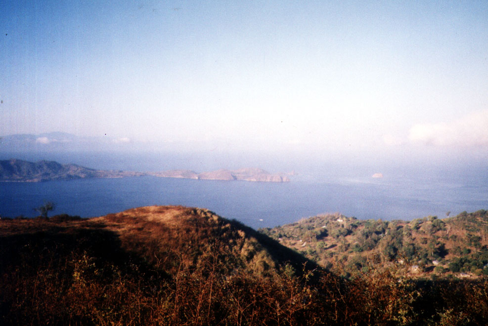
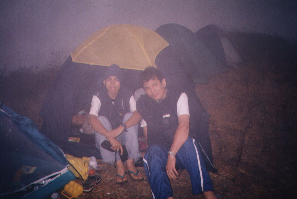
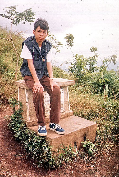
Matabungkay’s Balsa Festival (Lian, Batangas)

Parade of Decorated Balsas

I, together with other members of the print and broadcast media, were again invited (my first was a media familiarization tour last March 23 and 24) to cover the First Balsa Festival in Matabungakay, Lian.  Matabungkay’s very shallow beach is lined with about 150 of these rented balsas, all ingeniously fitted with shaded picnic tables and grills for visitors who want to go dining al fresco, swimming, snorkeling, sunbathing and, at the day’s end, watching the magnificent sunset. These hardy balsas and their navigators have, in effect, become the durable and unique symbol of Matabungkay and a very important contributor to Lian’s tourism livelihood economy.

Sunset at Matabungkay

We were guests of the 4.2-hectare, DOT-accredited “Class AA” Matabungkay Beach Resort and Hotel (MBRH).  Just recently, the resort was named as the “Most Outstanding Beach Resort of 2002” during the 17th Annual Parangal ng Bayan Awards and the 2002 National Consumer Excellence Awards.  As festival hosts, MBRH was in the thick of preparations with the visibly-tired Ms. Charley Leviste-Antonio (Vice-President for Operations), Ms. Marissa Romero-Balangue (Marketing and Sales Director), Mr. Rico M. Violeta (General Manager) and Ms. Blessie Zarzuela (Gen. Manager of Adea Advertising) ably providing the push.

Sen. Loren Legarda

We arrived at Matabungkay in time for the festival’s highlights: the Balsa Race and the Parade of Decorated Balsas.  The weather was perfect with the sun shining brightly on a cloudless, blue sky.  The race and parade was held along the beachfront of Kandahar Resort.  Invited guests of honor included Sen. Loren Legarda-Leviste and former Batangas Gov. Antonio Leviste.   The Balsa Race was a test of the boatmen’s strength, endurance and dexterity with the bamboo pole as they navigated their sometimes unwieldy balsas to the end of a one hundred meter long course along the shoreline.  The winners took home cash prizes of PhP10,000, PhP7,000 and PhP5,000 for first, second and third place respectively.

Matabungkay’s hardy balsas

The Parade of Decorated Balsas was truly a spectacle in itself.  It also had a message: recycling and use of indigenous materials.  This theme was evident among the eleven entries who vied for even bigger cash prizes of PhP20,000, PhP15,000 and PhP10,000 for first, second and third respectively.  Aside from bamboo, the indigenous material from which all balsas are made, the entries also made free use of the town’s famous caballero flowers, the fiery-red blooms of the flame tree.   Recyclable materials of choice were old newspapers (as banderitas) and plastic, colored water-filled, 1.5-liter soft drink bottles strung together.  The star of the parade (although not the winner) and the photographer’s delight was a balsa featuring a gay, blue-painted shokoy (local name for a “merman”).

A crowd favorite

After the show, it was back to MBRH for a sumptuous, a la carte lunch at its Caballero Café.  Later, we were all booked in some of the resort’s 57 airconditioned superior and executive guest rooms with cable TV, private bath and spacious veranda.   In the afternoon, the mood of the Balsa Festival turned Filipiniana as MBRH also played host to two exciting games, both qualifying as the Filipinos’ version of “Grease.”  The first was a palo sebo, where contestants had to clamber up a greased up bamboo pole in a no-holds-barred race to grab the pennant on top.  Equally greasy was the habulan ng biik, where contestants raced against each other in a bid to be the first to catch a greased up piglet.  Poor pig.   

A senior citizen dance

Later in the afternoon, students from the town’s different secondary and tertiary schools as well as senior citizens showcased their talents in dance and other production numbers at MBRH’s basketball court.  Quite a colorful sight was the dance troupe which performed a komedya (also called a moro-moro), an age-old dramatization of the battle between Christians and Moors.  It won the top prize. Another sure-fire scene stealer was the town’s old ladies in white and multi-colored balintawak attire who showed a lot of spunk in rendering a native dance.  One even regaled the appreciative crowd with her whole-hearted rendition of the timeless song “Tayo na sa Antipolo.”  Bravo!  Come nighttime, the festival was capped by band performances where the townspeople slowly but surely danced the night away, to the beat of old and new disco tunes, up to the wee hours of the morning.  What a way to end a day (and a festival).

Taal Volcano: Hike to the Crater Lake (Talisay, Batangas)

Mt. Binintiang Malaki

This Holy Week, I availed of a standing invitation from Ms. Lily Rodrigo-Canlas, president and C.E.O. of Jesu-Mariae School, my son’s school, to stay at the Jesu-Mariae Center in Tagaytay City.  This retreat/seminar center could comfortably accommodate 80 people in dorm-style facilities.  With this center as a jump-off point, I planned to revisit Taal Volcano via the Kayabok Trail on the other side of Volcano Island.  Joining me were my son Jandy and daughter Cheska who’s been egging me to include her in my escapades.  Joining us were 5 of Jandy’s teachers: Mr. Robert Castaneda, Ms. Veneriza “Vener” Trillo, Ms. Theresa “Thet” Quieta, Mr. Joel Fatlaunag and Mr. Erwin Vizcarra.  All, except Robert, are jittery first-timers at the volcano.     

Picnic Grove with Taal Volcano behind us

We left Manila on the morning of March 27 and arrived at the center in time for preparation of a delicious barbecue lunch.  After customary visits to the city’s Picnic Grove (where we went horseback riding) and People’s Park in the Sky (now in a sorry state of disrepair), we returned to the center for a delicious supper and retired early as we had to leave very early in the morning for the volcano trek. 

Cheska horseback riding with Thet

The next day, Holy Thursday, we all awoke by 5 AM, had breakfast, pack our provisions of bottled water, sandwiches and bananas (good trail food) and left the center by 6:30 AM.  From Tagaytay City, we went down to Talisay (Batangas) via the treacherous concrete zigzag road called Ligaya Drive, down to Brgy. Caloocan.  As soon as we arrived at the boat landing station, we were swamped by boatmen hoping for an early kill, this day being a holiday.   Soon, they were trying to pluck our feathers by charging us a cutthroat rate of PhP3,200 just for the trip (with 6 passengers only).  It was soon watered down and we settled at the still horrendous price of PhP2,400 to bring all 8 of us to our destination.

On our way, by boat, to Volcano Island

We left the station by 7 AM on board a big motorized banca.   The trip was smooth all the way as the waters were calm. As we went around the island, the 311-m. high (the island’s highest point) Mt. Binintiang Malaki (translated as “giant leg”), soon hove into view.   This northwest cone, seemingly featured on most Taal Volcano postcards like an island (actually connected to the real Volcano Island), emerged overnight during the 1707 eruption but is now dormant. A dismal sight during the voyage was the presence of numerous fishpens which our boat had to negotiate to get to the other side.

Nearing the homestretch

We landed on the island’s western shore at Brgy. Kayabok by 7:30 AM.  All throughout the trip, the boatman kept egging me to get a guide (at extra cost of course) but we have decided even before the trip to do without one as the Kayabok Trail was definitely well-trodden.  We also refused a lady islander’s rather steep offer to guide us for PhP500.  Anyway, we had all the time in the world even if it meant getting lost in a small island.   Our seemingly concerned boatmen seem to have other things in their minds.  I wonder why.

The Crater Lake seen from a distance

We began the trek on a happy note, following the well-trodden trail up a hill. The sun soon rose brightly on the sky and we began to feel the effects of the intense heat from the morning sun.   As we soon reached the top of the hill, the trail began to fork, leaving us in a dilemma.  All the while, we somehow had a feeling that we were being followed and, soon enough, our boatmen were hollering for us to come back.  We ignored them.  Later, we encountered our huffing and puffing boatmen along the trail.  We were told that we took the wrong turn and they, in all kindness, offered to guide us in the right direction.  Or were they?    It soon dawned upon me that these boatmen were concerned, not with the guide fee (which I consistently refused), but with the fact that they may lose their first big meal ticket (or buena mano) of the day among the winding trails.  We could just as easily have taken our boat ride back to Talisay from the other coastal villages.  With this in mind, they never left us out of their sights after that.

Finally, at the Crater Lake

Vegetation on the island is sparse, consisting mostly of short grass, tall, nettled spear grass (cogon) and thorny brambles.  The treeless trail we trekked was all loose volcanic ash and the ground underfoot was also hot as volcanic rock retains heat both from the sun and the hot magma trapped deep within its bowels.  This, coupled with the sweltering heat of the sun, soon made our tongues hang out.  Our party was soon divided into two as our neophyte mountaineers Vener and Thet began to lag behind.  Cheska, however, proved to be tough and resilient as she kept up with the guys. 

The island within the Crater Lake

We took solace under the small shade of occasional thorny aroma trees (most of the large trees have been blown away by previous eruptions) where we quenched our parched throats and munched bananas as we waited for the stragglers to arrive.  Along the trail we passed by one of Taal’s 47 craters.  This seemingly dormant crater had a flat, cogon-covered bottom.  We also encountered makeshift refreshment stalls selling canned softdrinks (PhP30) and bottled water (PhP20).  After a tiring uphill hike, the shimmering blue-green waters of the crater lake made its appearance like a mirage on the horizon.  It was all downhill after that and, soon enough, we reached the crater lake’s rim.  It was 9 AM and the hike took all of one and a half hours.    It could have been longer.  Our socks and shoes were soon off as we couldn’t wait to dip our tired feet in those inviting waters.  However, the lake’s waters deepen just a few feet from the shore. About 30 m.  offshore is the small, crescent-shaped island.  The lake’s waters are actually dilute sulfuric acid with salts and other minerals such as sodium, boron, magnesium and aluminum added in.   Acidity in the water, measured in pH (the lower the pH, the higher the acidity), is a “whopping” 2.7 (neutral pH is 7.0) with about 3% sulfur.   Sulfurous waters have medicinal qualities and it did wonders for my mosquito-bitten legs.  Our boatmen also took home 1.5-liter bottles filled with this salty and bitter water.  Also as a result of the sulfur deposits, the stones at the lakeshore are coated yellow.

L-R, Vener, the author, Jandy, Thet, Robert, Erwin and Joel

After lolling about the waters, taking our lunch of sandwiches and photo shoots for posterity, we left the lake and retraced our way back to our boat and left the island by 11:30 AM.  Any notions of being in Tagaytay for an early lunch were dashed when our boat engine conked out (obviously out of gas) just a kilometer off the shore of Brgy. Caloocan.   We had to wait for half a hour for a relief boat to ignominiously tow us back to shore.  After paying our boatmen (they had the gall to ask for a “tip”), it was back to our car for the uphill drive back to Tagaytay and a well-deserved lunch.  Back at the Jesu-Mariae Center, we collapsed, dead-tired, on our beds. 

The Balsas of Matabungkay (Lian, Batangas)

Matabungkay Beach Resort & Hotel

I was invited to join a media familiarization tour of Matabungkay Beach Resort & Hotel in Lian, Batangas on March 23-24, the weekend preceding Holy Week.  Our assembly area was the Department of Tourism (DOT) Bldg. near Rizal Park.  I left my car at my wife’s office at Gil Puyat Ave, took a fully-packed LRT train, overshot my designated stop which was U.N. Ave. and dropped off instead at Central Station where I decided to just walk, for the exercise, back to the DOT.   I arrived at the DOT cafeteria, huffing and puffing and drenched as a newborn kitten, just in time for breakfast.

Check out “Resort Review: Matabungkay Beach Resort & Hotel

Joining me at the breakfast table were some of the Who’s Who in travel journalism: Mr. Randy V. Urlanda of Panorama, Mr. Frank A. Evaristo of Manila Bulletin, TODAY veteran photographer Mr. Manny Goloyugo, Ms. Arlene Dabu-Foz of Manila Bulletin, Mr. Romark Mayuga of Manila Times, Ms. Claudeth E. Molon of TODAY, Ms. Lala Rimando of Newsbreak Magazine, Ms. Ruby Gonzalez of Travel Weekly East, Ms. Maggie De Pano of Business World Online, Mr. Michael David C. Tan of What’s On & Expat and Mr. Melvin S. Magtaus and Mr. Dennis Lapan of Lifestyle Asia.

Also present, as host, were Ms. Leona  DG. Nepomuceno and Ms. Camille Cua of the DOT.  Also joining us were Ms. Blessie Zarzuela of Adea Marketing, the TV crews from ABS-CBN (3) and RPN 9 (3) and 2 other DOT personnel.

We left the DOT at exactly 8:30 AM for the 3-hr. airconditioned coaster trip to Matabungay.  I sat at the lone bucket seat up front with its wide legroom suitable for my 5’-10” frame.   I had to buckle up though.  The long 105-km. trip via the Sta. Rosa Expressway was pleasantly uneventful until we reached the junction leading to Lian.  Here the coaster was bodily stopped by resident “commissioners” out to make a killing this early.   This scene was repeated  5 more times as we approached the town and our hotel, the last one a roadblock set up by the barangay soliciting donations for their fiesta.  What a damper!

Media participants by the Nestea swimming pool
A fleet of balsas

After arrival and check in at the resort, we had lunch and, after a short rest, we were all invited by Marissa to take a ride on one of the resort’s floating bamboo rafts (locally called balsa) where a merienda of pancit bihon and canned soft drinks awaited us.   Ideal in Matabungkay’s very shallow beach, the shore is lined with lots of these balsas.   They are navigated by long bamboo poles sometimes up to the edge of the drop-off and, once a suitable spot is chosen, anchored in place.  All rafts have shaded picnic tables and grills.  From the balsa, visitors could go swimming, snorkeling and, at the day’s end, sunset watching.

Even after the sun has set, a number of these lighted balsas are used to await fishermen and their much-awaited bountiful catch.   These balsas, in effect, have become a very important contributor to Lian’s tourism and livelihood economy.   As a tribute to this hardy and durable symbol of Matabungkay, Lian has decided to hold its first Balsa Festival this coming May 17-18.

The 2-day festival, proudly hosted by Matabungkay Beach Hotel & Resort, promises to be activity-packed.  Highlights are a Balsa Race and the Parade of Decorated Balsas.  Different sectors of Lian and the nearby towns will be invited to participate, 80 for the Balsa Race and 60-70 for the Parade of Decorated Balsas.  Students from the town’s different secondary and tertiary schools will also showcase their talents in dance and other production numbers.   The festival will be capped, on the evening of May 18, by band performances and a beach party.

Preparing for my trial dive

After the raft excursion, Marissa invited us to try our hand at scuba diving at the resort’s swimming pool.  I, plus  Blessie and Lala, took a crack at it.  The others begged off.   Mr. Jim Waite, the in-house dive instructor, gave us a brief overview on the  basics of diving and its equipment.  The much-awaited actual lesson followed and we were soon fitted with masks, snorkel, buoyancy compensator, tanks, weight belts and fins.   This being my second dive (my first was a trial dive in Club Paradise in Palawan), I was soon diving about at the pool’s floor like a fish within its element.

After a much-needed shower, a torchlit dinner was served along the beach.  Additional lighting was provided by a bonfire.   We were also joined by TV crews of ABS CBN and RPN 9 TV.  Immediately after that, we were again invited to a round of nighttime entertainment at Gotcha Club.  The girls monopolized the videoke while us guys contented ourselves with rounds and rounds of billiards and table tennis.  Still others just watched the girls sing to their heart’s content until the wee hours of the morning.

Press conference by the beach

The next day, after a sumptuous buffet breakfast at Caballero Café, we buckled down to serious business with a mini-conference held at the beach area.   Invited to the conference were Ms. Charlie Leviste-Antonio (the resort’s Vice-President for Operations), Mr. Jim Waite, Ms. Balangue, Mr. Violeta and the town’s Chief of Police.  Here we voiced our concerns (the “commissioner” episode, environmental issues, Holy Week security, etc.) and asked questions concerning the resort’s history, facilities and plans, the upcoming Balsa Festival, scuba diving opportunities and Fortune Island (a sister resort).

Posing with our hosts

Immediately after the mini-conference some of us opted, it being Palm Sunday, for a mass (complete with the appropriate palms) held at the resort’s pavilion.  After a late lunch at Café Caballero, we packed up our stuff, had a photo session at the resort entrance and said goodbye to our gracious hosts, Ms. Leviste-Antonio, Ms. Balangue and Mr. Violeta.  We left the resort by 2:30 PM  and arrived in Manila by 6:30 PM, after a side trip to Calatagan and numerous stopovers at Tagaytay City for fruits, espasol, buko pie and mazapan sweets.

Matabungkay Beach Resort and Hotel: Brgy. Matabungkay, Lian, Batangas.  Manila office: Unit H, Garden Floor, LPL Towers, 112 Legaspi St., Legaspi Village, Makati City.  Tel: (632) 819-3080, (632) 752-5252 and (632) 751-6685.  Fax: (632) 817-1176.  E-mail: mrb@matabungkay.net or inquiry@matabungkay.net.  Website: www.matabungkay.net.

Finally …. The Summit of Mt. Makulot

Marge, Jandy and I at the summit

The others woke up by 8 AM and we all had breakfast at Mang Ed’s place.  We soon prepared to climb the mountain’s peak.  Jandy and I were joined by Rainy and Marge.  Lulu, still under the weather, decided to remain and Vi stayed with her.  We left by 9 AM, bringing along our cameras and mineral water bottles and entered the trail blazed along the tall and sharp cogon grass. It was getting hot as we arrived after 30 mins. at the edge of the light forest.  We had a last look at the campsite on the mountain’s shoulder, its tents but pinpricks to our eyes.  The forest cover was a welcome relief from the sweltering heat of the sun but the trail was extremely muddy as this forest is frequently cloud shrouded.  We literally had to crawl our way up, clinging to tree trunks and hanging vines for support.  Rest stops were frequent and we soon exhausted our water.  After what seemed another eternity, we soon reached the clearing at the peak, tired but exhilarated. 

View at the summit

Eureka! We made it!.  Jandy and I finally conquered our first mountain, the highest in Batangas for that matter.  I sent text messages on my mobile phone to Grace and Cheska and got a congratulatory call in return.  After the all-important photo session for posterity’s sake, we made our way back down the mountain, crawling in reverse this time, arriving at the campsite in time for lunch at Mang Ed’s store.   After lunch, we decided to leave early and make our way down the mountain. After dismantling our tents and packing our stuff in our backpacks, we thanked Mang Ed and hired Eduardo, Jr., Mang Ed’s son, to carry some of the ladies’ backpacks.  I, for once, decided to carry my own pack. The descent was faster, with fewer rest stops, but harder on the joints and toes.   We arrived at the Mountaineer’s Stop-over Store after an hour’s hike, drained a huge bottle of Sprite and changed into dry clothes.  We were soon on our way back to Manila, taking the more scenic Lemery/Tagaytay City route.  We had stopovers for a photo session at the Disneyland-like Fantasy World residential resort in Lemery and a short visit to my almost finished residence project at Southridge.  We were back in Manila by nightfall.  I had a dead toenail when I took off my shoes at home.

Return to Mt. Makulot (Cuenca, Batangas)

The summit of Mt. Makulot

Four months have passed since my climb to Mt. Makulot and here I am making plans to climb again, this time to camp at the shoulder and make for the peak.  Aside from Jandy, also traveling with us are Ms.  Glorain “Rainy Canillas” and Ms. Marge Yu, former SPED (Special Education) teachers of Jandy; and Warner Bros. executive Ms. Lourdes “Lulu” Seguinza and Ms. Rosevie Sevilla, both friends of Rainy and me.  All, except Rainy (who made it up the campsite a few years back), were first timers up the mountain.         

A World War II Japanese tunnel

Laden with backpacks, tents, sleeping bags and provisions for an overnight camping stay, we left Manila at 6 AM, Friday, February 25, 2000 (Edsa Revolution anniversary and a non-working holiday), passing through the South Luzon Expressway (SLEX) up to the Calamba Exit, then entering Batangas to Sto. Tomas, Tanauan, Malvar and Lipa City before turning right to Cuenca, arriving there at 9 AM.  At the barangay hall of Brgy.  7, we all registered and paid the required PhP5 fee .  Here, I secured the services of 3 porters to carry the bulk of our equipment.  We parked our car at the Mountaineer’s Stopover Store and began our climb from here.

Another tunnel

My first climb to the campsite was a breeze compared to the climb we were doing now.  During my first visit the skies were overcast, the weather was cool and the ground along the trail, slightly wet due to rain the day before, was nevertheless compact, making it easier to climb.  Today, the sun was shining intensely bright and the weather was humid. There wasn’t a gust of wind.  We were in boisterous spirits when we initially started out over the gentle, moderate grade gravel trail, chatting and laughing as we went along.  As the porters were carrying our equipment, we only carried our bottles of water.  Pretty soon, the chatting died down as our tongues were beginning to hang out due to thirst and heat stroke.  Even as our load was beginning to lightened (we were drinking our water at an alarming rate), we frequently had to stop to recover our breath and replenish our system with water.

The mountain spring

After about 30 minutes, the trail became steeper as we entered the light forest.  As the ground was very dry, we frequently slipped and literally had to crawl our way up.  There were many refreshment stations along the way selling fresh buko juice (good for rehydration), a welcome relief.  Things changed as the forest gave way to an even narrower, dusty and more slippery path through tall, sharp cogon grass, virtually unprotected from the intense heat of the sun.  And worse, there were no more refreshment stations along the way. The pace was beginning to tell on us especially Lulu who was a little bit under the weather.   She practically lost her voice and had to be assisted.  Our once compact group was now splintered as the others were beginning to lag behind and we had to wait for them.  Other hikers, all seemingly fit and able, occasionally passed as by.  We all arrived at the campsite after about 2 hrs.; hungry, thirsty, drenched with perspiration and bedraggled.  Again, it seemed like an eternity getting there.

Being a long 3-day holiday, there were many campers and tents were sprouting like mushrooms all around us. By the end of the day, there would be 250 names registered in the barangay hall logbook.  Mang Ed, together with his wife, was there to welcome us.  Both were minding their store and doing brisk business, selling canned goods, snacks, soft drinks in cans, bottled water and buko juice from which we quenched our thirst.  Their son, Ramon, showed us a suitable place to pitch our tents. The spot we chose, at the edge of the clearing, had a good worm’s eye view of the now cloud-free (it was cloud-shrouded during my first visit) main summit.  Further off, we also had an impressive view of Taal Lake, Lipa Point, Volcano Island, the nearby towns and beyond it, Laguna de Bay and the sea. We pitched our 3 tents beside each other.  It took me some time to figure out how to set up our tent, a 6.5-ft. by 4.75-ft.Bobcat dome tent with ultra-light aluminized coating.  After about 30 mins., our tents were set up and we settled down to a late lunch, dining on provisions that we brought along: packed rice, pork and beans and sausages.  Being very hot and tired indeed, we decided to postpone our final trek to the main summit for the next day.

On top of the Rockies

Instead, we decided to visit the Japanese World War II caves (there are 5 on the mountain) and the bukal (spring) located about 100 m. down the campsite.  The trail was also well-marked and we passed (but did not explore) 3 caves, a group of campers and a cluster of tents along the way to the spring.  The spring, the mountain’s only water supply, was actually a constantly dripping aquifer by the side of a cliff.  The only way to get to it was by clambering down the huge, exposed roots of a tree beside it.  I was the only who attempted this and the others just contented themselves with the view and the sound of the spring.  Upon reaching the spring, I rewarded myself with a refill of my water bottle.  On the way back we had a photo session by a huge dangling aerial root of a huge tree.

Sunset at Mt. Makulot

After about an hour, we returned to the campsite as we didn’t want to miss the beautiful sunset.  We proceeded along a small trail through the cogon grass to the Philippine Air Force marker. Beyond it was the knife’s edge leading to the 700-m. rocky drop-off of the “Rockies”.  Its peak was beginning to fill with people waiting for the sunset.  Rainy, Marge and I decided to join them.  The way up wasn’t easy as we had to negotiate the narrow, but well-marked, knife’s edge and then clamber up the cliff.  Sometimes, we had to stop to give way for others going down.  After about 10 mins. we reached the top.  The 360 degree view here was even more spectacular.  This is as close to God and Heaven as I have ever been and I was not the only one who felt that way.  Nearby was a religious group of young people singing their high praises to the Lord above.  After admiring the spectacular sunset, I descended the way I came in.  

Campsite at the shoulder

It was getting dark and we made arrangements with Mang Ed for a hot supper.  It was also getting very icy cold and windy and we arrived at Mang Ed’s store wrapped up in our warm sweaters, jackets and caps.  The night was very cold and windy.  We soon had our fill of the hot supper prepared for us and prepared to retire to bed literally with the night sky and stars as our blanket.  Too bad we can’t start a bonfire (it is prohibited) to keep warm. Dead tired, we decided to retire early to our sleeping bags.  However, sleep for me was an impossibility since the spot I chose to build my tent was quite lumpy and uncomfortable.  I envied Jandy who was sleeping soundly. While still dark, I mustered the courage to get out of my tent, wrapped as warmly as possible, to have hot coffee and a chat with Mang Ed.

Halfway Up Mt. Makulot (Cuenca, Batangas)

Mt. Makulot

Jandy and I checked out of Casa Punzalan in Taal early in the morning and proceed to Cuenca, passing by the towns of Sta. Teresita and Alitagtag.   We planned to climb the 1,145 m. high Mt. Makulot, the highest mountain in Batangas.  The weather was perfect.  Mt. Makulot (also called Macolod), located at the northeast boundary with Laguna, is said to have been named after the kinky-haired people who lived on the mountain.  The mountain dominates the southeastern shore of Taal Lake and has a rounded, densely-forested  main summit and an extended shoulder on the west flank which ends abruptly in a 700-m. rocky drop-off.  The mountain  is thought to be the highest part of the caldera rim that was not blown away in Taal’s ancient eruptions.  Others say the mountain is part of another extinct volcano.  It was the last Japanese stronghold in the province during World War II, and 5 Japanese-built tunnels still exist in the area.  To preserve the mountain for future generations, the mountain was adopted by the Philippine Air Force, under then commanding Gen. William Hotchkiss, on February 21, 1998.

The Philippine Air Force Marker

Upon entering Cuenca town, we stopped at the town hall where we were advised, as a safety measure, to register (PhP5 per person)  at the Barangay 7 hall.  After registration, we were given a quick lecture lecture on how to get to the campsite.   I parked our Nissan Sentra at the Mountaineer’s Stop-over Store.  At the last minute, I decided not to bring my camping equipment and to just go on a day hike up to the mountain’s shoulder.  I wanted to go home early.  We donned jackets, changed into rubber shoes and packed 5 bottles of mineral water, my camera, extra shirts, my cell phone and a first aid kit.

The Rockies

The initial trail is a fairly gentle, moderate grade section through a gravel path.  After passing some residential houses, including an expensive-looking one, and entering a forest, we reached a fork along the trail.  Remembering the lecture, we took the left trail (the one descending), and went past a dried rivulet and another fork. We asked around and were told to take the right trail.  We were also told that the left trail leads to a staircase down a cliff to the lake shore.  Surely for the more adventurous.  The trail became steeper (and more lung-busting) as we entered the forest.   We needed both hands to hold on to roots and branches of trees.  Rest stops became more frequent.  All the while, hikers, as well as local residents, were passing me by.  I was shamed by the sight of a woman carrying a heavy load of long bamboo stems.  As we went along, I befriended a man laden with two backpacks and an icebox full of soft drinks, all slung on a pick.  Named Eduardo Puso, he was a Barangay 7 tanod on his way to bring supplies for his store on top of the mountain.  His two sons, Eduardo Jr. and Ramon, also carrying provisions, passed me by a while earlier.

The knife’s edge leading to the Rockies

The last quarter of the hike was through an even narrower path through tall cogon grass which swayed in rhythmic, wave-like motions when the wind blew. At around 11:30 AM, we reached the campsite at the mountain’s shoulder.  Mang Ed and his sons were already tending to their store, which is beside another store tended by a woman.  Even on this mountain, the spirit of healthy competition lives on.   The campsite, Makulot’s main attraction, is actually a small clearing on the cogon-covered shoulder.  We explored a small trail through the cogon grass leading to a clearing with a marker installed by the PAF. 

The fog-covered peak

Here, we were presented with an impressive view, the best I’ve seen so far, of Taal Lake, Lipa Point, Volcano Island, the surrounding towns and beyond it, Laguna de Bay and the sea. Over a knife’s edge is the 700-m. drop-off (500 m. of which are almost vertical).  Locals call it the “Rockies” after its American namesake.   We returned to Mang Ed’s store and I interviewed him about the mountain.  He said that Makulot has 14 Stations of the Cross frequented by townsfolk during Holy Week.  Trekkers and campers come here even in adverse weather conditions and peak days are Fridays to Sundays when up to 200 campers converge.  

View of Volcano Island

Mang Ed opens his store only during those peak days.  Set up with money borrowed from a “five-six” loan shark, the store offers cigarettes, bread, candies, soft drinks in cans, real buko juice and, only on request, cooked food.  When provisions run low, he quickly sends his sons down the mountain for supplies.  Prices are high, but understandably so considering the labor involved. Mang Ed, being an elected barangay tanod, sees to it that the campsite remains clean. He frowns on campers who leave their rubbish behind.  Just the same, he and his sons gather the trash and carefully burn it.  They also assist in bringing down badly injured campers on a stretcher and advises climbers not to go beyond the Rockies. In 1994, a woman fell to her death (some say it was a suicide).  In 1997, another man fell but survived.  He was evacuated by helicopter.

Eduardo Jr. guided me 100 m. down the mountain to a bukal (spring) where potable water can be had.  As can seen from discarded shampoo sachets, campers frequently bathe here. Also in the area are four bat-and-bird-inhabited tunnels built by the Japanese close to one another during the war. Birds panicked and flew away as we entered one guano-filled tunnel.  It is said that campers caught by storms seek refuge here.  The fifth and longest tunnel is located a distance away.  A Japanese expedition had tried to enter it but retreated. And it remains unexplored to this day.

Upon our return, Mang Ed invited me to a late lunch, and we feasted, kamayan-style, on tuyo, fried egg and rice, washed down by mountain spring water.  We left the campsite at around 2:30 PM.  The descent was faster and less tiring, but slippery and harder on the joints.  Along the way we passed and conversed with two groups of backpackers on the way up.  Peak season has just began.  We reached the Mountaineer’s store at around 4 PM, snacked on crackers and soft drinks, changed our clothes and left for Manila, passing by Lipa City and the towns of Malvar, Tanauan, Sto. Tomas and Calamba City before entering the South Luzon Expressway.  We were home by 8:30 PM. 

Casa Punzalan and the Taal Heritage Foundation (Taal, Batangas)

We decided, due to the late hour, to spend the night in Taal.  Driving back to the municipal hall, we stopped at nearby Casa Punzalan, Taal’s first pensionnne. The ancestral home of the prominent Punzalan family, it was leased by Mr. Jesus Samala Punzalan, Jr. and Capt. Nieto Punzalan, at no cost, to the Taal Heritage Foundation.  We were welcomed by Ms. Betty Lualhati, a U.S. balikbayan and one of the foundation’s members.

Jandy at Casa Punzalan

The foundation was, together with the Department of Tourism and in close coordination with the municipal government, in the forefront of Taal’s recent failed campaign to be included in the World Heritage List of the UNESCO (United Nations Educational, Scientific and Cultural Organization).  They also organized the Taal Heritage Tour (or Taal Walking Tour), an educational, enriching and entertaining guided tour that allows the visitor to experience the lifestyle of the town; its culture, arts, crafts and the warm hospitality of the people.

It just so happened that we were the only boarders at Casa Punzalan for the night, and I not only got the feel of Taal’s 19th century lifestyle, but also a tingling feeling one gets when one stays alone in a old, haunted house.  The inn has 7 rooms, all named after owners (Graciano and Juliana) and their children; 5 of them fan-cooled (PhP600) and 2 airconditioned (PhP1,00-1,200), all accessed by a grand staircase.  It also has common baths (mens and ladies), a living room (sala), a coffee shop and a gift shop.  We opted to stay at the corner and well ventilated Graciano Room with its excellent view of the basilica and park from its capiz windows.  After a well-deserved bath at the modern-looking common bathroom, we retired to an uneventful sleep.

Graciano Room

We were awaken at 6 A.M., stirred by the sound of crowing roosters, packed our bags and were off, after an early breakfast at Lemery, to Cuenca and its stately 1,145-m.  high guardian, Mt. Makulot.

Casa Punzalan: cor. C. Ilagan and P. Gomez St., Brgy. Poblacion 7, Taal, Batangas.  Tel: (043) 408-0084.

Taal Heritage Foundation: Casa Punzalan, Taal, Batangas. Tel: (043) 421-3034, 421-1053 & 421-1071.  Fax: (043)  408-0577.

Felipe Agoncillo Mansion and Monument (Taal, Batangas)

Later, accompanied by the HME Embroidery Store caretaker, Jandy and I crossed the street to the 2-storey Felipe Agoncillo Mansion and Monument, birthplace of Felipe Agoncillo, the husband of Marcela  who was appointed by Pres. Emilio Aguinaldo as ambassador to the U.S. to campaign for recognition of Philippine independence.  He is considered as the first Philippine diplomat.  In the well-manicured front garden is a prominent brass statue of Felipe.

Felipe Agoncillo Mansion and Monument

Known as the White House, this mansion is also known as the Don Gregorio R. Agoncillo (nephew of Felipe) Museum and is now a National Historical Landmark.  As we were accompanied by the store caretaker, we were allowed passage.  On the second floor are Edwardian and Spanish-inspired antique, 1800s to early 1900s furniture and choice period items plus busts of the Agoncillo ancestors.

Agoncillo Mansion dining room
Felipe Agoncillo Mansion and Monument: J.P. Rizal St., Brgy. Poblacion 13, Taal, Batangas

HME Embroidery Store (Taal, Batangas)

From the Leon Apacible Museum and Library, Jandy and I proceeded to the HME Embroidery Store, one of the town’s pioneers in the now dying art of fine needlework of hand-embroidered, semitransparent pina (made from pineapple fibers) cloth which is usually done by women in their homes and sundried around the market.    

HME Embroidery Store

The store is located within the Art Deco-style ancestral house (also called the “Pink House”) of Ramon and Jovita Estacio, built in 1918 with narra and molave shipped all the way from Mindoro.  We were shown around the second floor by Mrs. Ofelia Estacio, the wife of Honesto Estacio, the current owners, where we appreciated its antique furniture. I bought barong cloth for PhP600 at the ground floor store.

HME Embroidery Store: J.P. Rizal St., Brgy. Poblacion 13, Taal, Batangas

Leon C. Apacible Museum and Library (Taal, Batangas)

Returning to our car, I drove further up the street, across Taal National High School, to the Leon C. Apacible Museum and Library, ancestral house of Leon and Matilde Apacible.  Leon Apacible, son of Don Vicente Apacible and Catalina Castillo, was Gen. Emilio Aguinaldo‘s finance officer and was a delegate to the Revolutionary Malolos Congress of 1898.  This extremely well-preserved bahay na bato home to 4 generations of Apacibles, was remodeled twice, in 1870 and from 1938-40.  It was recognized as a National Historical Landmark and was donated to the government on December 6, 1976 by former town mayor (1975-80) Mrs. Corazon Apacible Caniza, daughter of Leon Apacible, Jr. and Consolacion Noble.  It is now managed by the National Historical Institute with Mrs. Annie Marie Moreno as curator. 

Leon Apacible Museum and Library
Upon entering the house’s foyer, the first thing you would notice is a karitela (horse carriage) restored by the NHI on August 1992.  We were toured by Mr. Oprenilo Canoza.  Below the stairs are displays of old documents, faded photos, a chart showing the family’s genealogy and a 400-year old gallinera said to have been used as a coop for the master’s (and his friend’s) fighting cocks. Upstairs we were shown the house’s extremely well-preserved American Art-Deco interiors with details carved and inlaid into the floor and door trims.  Display cases exhibit the hand-painted fans of Dona Matilde, lace veils, the fans of Corazon when she was five years old, embroidered camisa blouses, and the children’s clothes she wore.

On display at the dining room are blue and white Ming Dynasty Chinese pottery, gilded Florentine wine decanters and a gilt-edged and hand-painted Venetian dinner service. The kitchen, which is still being used by the adjoining house of Mrs. Caniza, is closed to the public.  The family collection of fine antique furniture includes an 18th century hand-carved mahogany divan.  Inside the 2 bedrooms are 19th century vanity tables adorned with 4 oval mirrors inlaid with a hundred tiny circular mirrors; a beautiful carved wooden cabinet with two big mirrors; an early 19th century mahogany cabinet with 3 big mirrored doors;  an 18th century writing desk; a massive escritorio displaying Dr. Galicano Apacible’s 19th century medical equipment and 4-poster beds.   A piano, made in 1870 by M.F. Rachals of Hamburg, Germany, still works.  On the ceiling above the stairs is an 18th century chandelier.   There are also a 16th century statue of the Virgin of the Holy Rosary and 17th century ivory santos.

On the enresuelo (ground floor) are old documents showing Don Leon’s involvement in the revolutionary movement; a 1880 laminated photo of 16-year old Jose Rizal, Don Leon and younger brother Don Galicano as members of Intramuros’ Artist Club; pictures of Don Leon and his family and paintings of the Don Leon’s ancestors.   Underneath the azotea (court garden) is the aljibe (cistern) where rainwater is stored. Also on display are an old cannon, a stone water purifier, horse and cow brands, rice and corn grinders and other artifacts.  

Leon Apacible Museum and Library: M.M. Agoncillo St., Brgy. Poblacion 4, Taal, Batangas.  Open daily, 8 AM-5 PM. Admission is free.