
I accepted an invitation from my friend Rosevie “Vi” Sevilla to join her and her friends Ms. Dynah Pizarro and Ms. Cecil Divinagracia on a camping hike to the 501-m. high Mt. Panay (locally called Gulugud Baboy) in Anilao in Mabini, Batangas. Gulugud Baboy is the highest point on the rocky headland of the Calumpang Peninsula. I brought along my son Jandy plus my tent and other camping equipment. To joining us later, in a separate vehicle, were Edwin A. Guisihan, Jersey Miranda, Joseph de la Rosa and Carlo Peña. The morning trip from Manila was via the South Luzon Expressway (SLEX) to the Calamba Exit, then on to the Batangas towns of Sto. Tomas, Malvar, Cuenca, Alitagtag, Sta. Teresita and Bauan as well as the cities of Lipa and Tanauan. It took all of 3 hrs., traffic and all, including stopovers and asking for directions.
 |
| Gulugud Baboy |
We arrived at the port just in time for a carinderia-style lunch. That done, we proceeded down to a road on the left located about 200 m. before the marketplace and jeepney terminal. From here, we drove 8 kms. along a sometimes paved, but often rough and dusty road, from Brgy. San Jose to San Teodoro. The route is lined with about 40 dive resorts, many of them quite basic and most situated along the coast of Balayan Bay. Some do not have access by road and could only be reached by banca from Anilao. The Calumpang Peninsula is a rocky headland all throughout, the end result of which is a lack of suitable beach spots.We finally arrived at Arthur’s Place, said to be the jump-off point to Gulugud Baboy.
 |
| Our campsite |
It so happens that Arthur’s Place, according to its manager Ms. Lita Abrigonda, is just the nearest resort to the access road going up the mountain. It would be a long hard climb going up and we couldn’t secure porters around willing to take our heavy backpacks up. So I decided to take my Mitsubishi Adventure, with all my passengers and gear, all the way up as I could possibly go. The mostly rough and dusty zigzag access road was very steep, narrow and quite treacherous, with ravines along the way. Already very difficult to traverse even during that late afternoon sun, I wouldn’t imagine anyone trying it at night. I was to be proven wrong later on. Our “breathtaking” drive was somehow alleviated by the equally breathtaking scenery along the way.
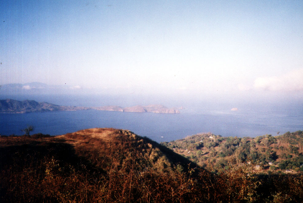 |
| A fantastic view of Maricaban Island |
We soon reached a basketball court with a sari-sari store beside it. Going beyond it was made impossible by an impassable stretch so we decide to just park our car at the court. From hereon, it would be all footwork. However, I haven’t given up hope of getting porters and we asked around at the store for one. There were no male porters around but the “porter” we secured (at PhP200 for a one-way trip) proved to be more dependable than three male porters; a horse. Thus unburdened, we proceeded, together with our heavily-laden horse and guide, past the village, along a moderately graded dirt path. It was initially quite a breeze but it all ended upon reaching an opening beside the road. From hereon it was all uphill along a grassy and treeless trail. The scenery began to unwind into a series of plateaus resembling sloping golf courses. I wonder if this spine-like contour is where the mountain got its name. Gulugud baboy is translated as “pig’s spine.” Store caretaker Lina Castillo gives a different version, that of a baboy ginto (golden pig) seen to roam the place.
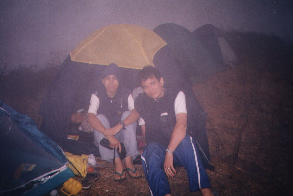 |
| A foggy, very cold and windy evening |
After about an hour’s hike, we finally reached the peak of Gulugud Baboy. And what a peak it was! From this vantage point high up, we had a spectacular 360 degree view of the ocean, Anilao, Batangas Pier, the narrow 11-km. long, densely forested Maricaban Island, the hat-shaped Sombrero Island, the 1,145-m. high Mt. Makulot and even Mindoro, Mt. Lobo and Mt. Manabo. Within reach is the similarly grassy and treeless Pinagbanderahan where the Americans were said to have raised their flag (bandera) after the Japanese surrender in World War II.
 |
| The gang’s all here |
last seen the blog of the previous hiking made with my tropa…
Edwin Guisihan
Thanks for your patronage. Much appreciated