
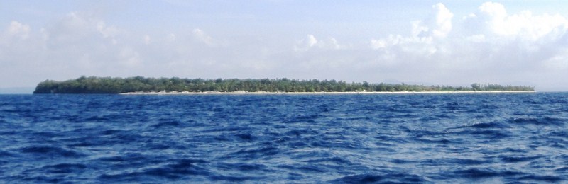
Pamilacan Island
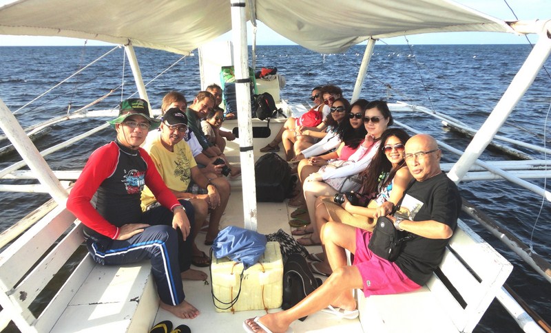
It was now Day 2 of our 3-day media familiarization tour of Bohol. After a very early breakfast at Panglao Bluewater Resort, we were slated to do some dolphin watching off Pamilacan Island, followed by lunch at Balicasag Island. The tide was still low and our large motorized outrigger boat was anchored some distance off. To get on board her, we took turns riding a tandem kayak until all were on board. The sun was already up in the sky when we got underway.
On our way
The island’s name was derived from the word meaning “nesting place of manta rays.” However, it has also been interpreted to to have been derived from the word pamilac, a harpoon (large hooked implement) used to capture manta rays, dolphins, whale sharks and Bryde’s whales. Under the jurisdiction of the municipality of Baclayon, it is situated 14 kms. (8.7 mi) south of the Bohol mainland.
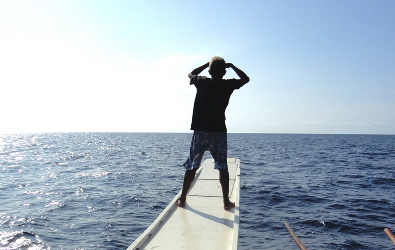
Our spotter scanning the horizon for dolphins or whales
The waters around the island are home to at least 11 species of dolphins and whales, including the playful Spinner Dolphins, Bryde’s whales and the gigantic Sperm Whale. Blue Whales are sometimes seen in the early months of the year. The whale watching season begins in March until the onset of the rainy season in June or July.
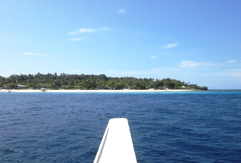
Soon to make landfall
The 15 to 20 m. long boat we rode on was possibly a former canter, a boat formerly used for whale hunting. These have been refitted with seats and roofing for a comfortable ride for 7 to 10 passengers who want to go whale or dolphin watching. A skilled, elderly spotter, who is also an excellent guide, soon took his place at our boat’s bow, scanning the horizon for any whales or dolphins. Resident dolphins and small whales can be found all year round but sightings are dependent on weather and sea conditions. Just like my first try in 2003, we were unlucky to find any of them.
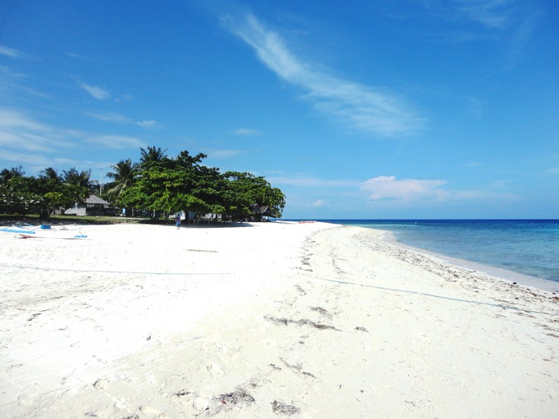
Footprints along the island’s immaculately white sand beach
We made landfall at the island’s beautiful white sand beach located on its northwest side. Upon landing, we were welcomed by members of the island’s small and closely knit fishing community which has around 200 families living in 3 sitios – one facing Baclayon, another amid an island and a third on the southern coast. Their main livelihoods now concentrate on dolphin and whale watching tours and subsistence fishing. In the past, it also included whale, dolphin and manta ray hunting. However, with the strict enforcement of marine life preservation laws in the country, this practice was stopped. Their houses, though, are still adorned with jaws and bones of these marine mammals.
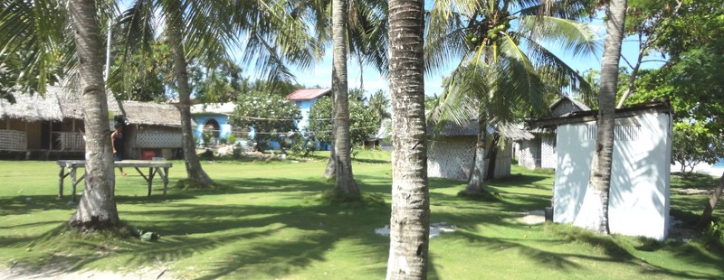
The island’s barangay
When we arrived, a table (with red tablecloth) and chairs were set up under a shady palm tree, beside some picnic sheds. A merienda of sliced camote (sweet potatoes), either steamed, caramelized or fried, plus rice cakes and corn coffee were prepared for us. The latter looked and tasted like your good old caffeinated coffee but is said to be healthier.
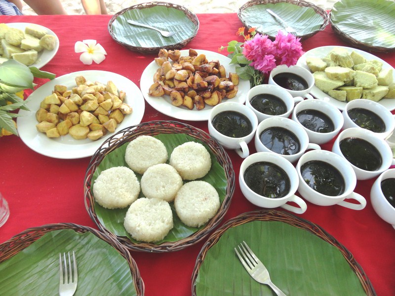
A merienda of camote, rice cake and corn coffee
After this filling repast, I together with Czarina, Euden, Joy, Kathleen and Lara went on a snorkeling tour on 3 small boats, each with a local boatman who paddled for us. Czarina joined me on one boat. The island’s wide flat reef, now a marine sanctuary, offers good snorkelling and diving (it has some great dive sites such as Dakit-Dakit).
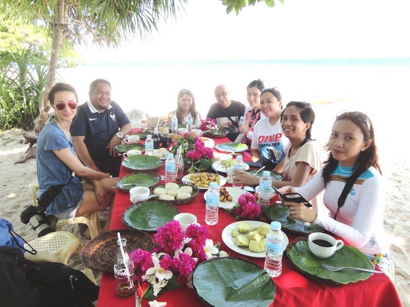
Dining al fresco along the beach
After some great snorkeling over coral gardens, we returned to shore early as Czarina wasn’t feeling good. Back on dry land, I explored the nearby Spanish-era fort which, in the past, served as a watch station for pirates, intruders and other enemies. Triangular in shape and probably constructed in the 19th century, it was made with rubble while cut coral blocks lined its portal and windows. The three corners of the structure were supported by round buttresses.
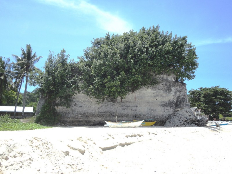
The triangular, Spanish-era fort
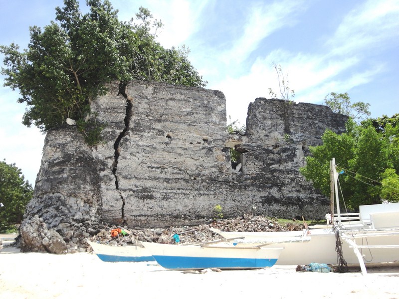
Another view of the fort
Inside are embedded trusses and a triangular pillar in the middle, indication that the fort may have had a second floor, probably made of wood. A large hardwood cross, with an 18oos date carved on it, once stood near the fort but is now housed in a nearby modern chapel. The fort was said to have formed a network with the towns of Baclayon, Loay and Tagbilaran.
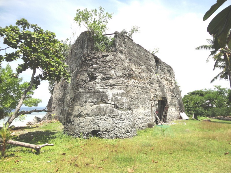
View of the fort from another angle
The ladies were already back from their snorkeling trip when I returned. Soon enough, we were back on board our boat for the second half of our island hopping expedition – Balicasag Island. The waters were already choppy when we left and our boat had to travel slowly as the waves kept pounding the boat. Soon a number of us (including me), especially the already ill Czarina, were already feeling seasick and, since our destination was still a long way off and it was already way past noontime, it was decided to just return to our resort. Anyway, I have been to Balicasag Island 11 years ago, going around it on foot and snorkeling its coral gardens. However, I felt sorry for those who haven’t been there. Oh well, you can’t win them all.
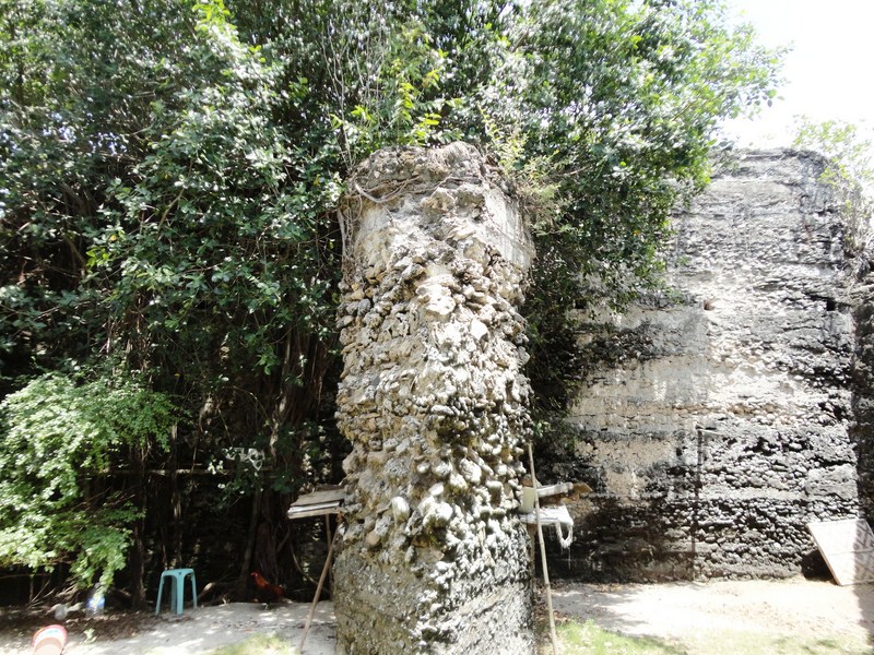
The triangular pillar in the middle of the fort
How to Get There: Pamilacan Island is located about 20 kms. southeast of Tagbilaran City, 23 kms. east of Balicasag Island and 11 kms. (a 45-min. pumpboat ride) offshore from the town. Pumpboats can be hired at Baclayon port.
Hi Benj! Nice post.. I too want to check out Bohol someday soon. For you I see the adventure continues… regards to you and the wife! Les
You certainly should. Such a beautiful province shouldn’t go unnoticed. Too bad some of their iconic Spanish-era churches are gone foreever.