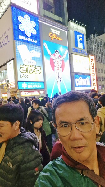
They say that any visit to Osaka is never complete without a photo-op with the Glico Running Man Sign, one of the most well-known and recognized landmarks in Osaka, in the background. This iconic, huge, brightly lit neon/LED billboard, located in Osaka’s Dotonbori district, has glowed over the Dotombori Canal in Osaka‘s premier shopping and entertainment district for more than 90 years now.
Check out “Dotonbori District”
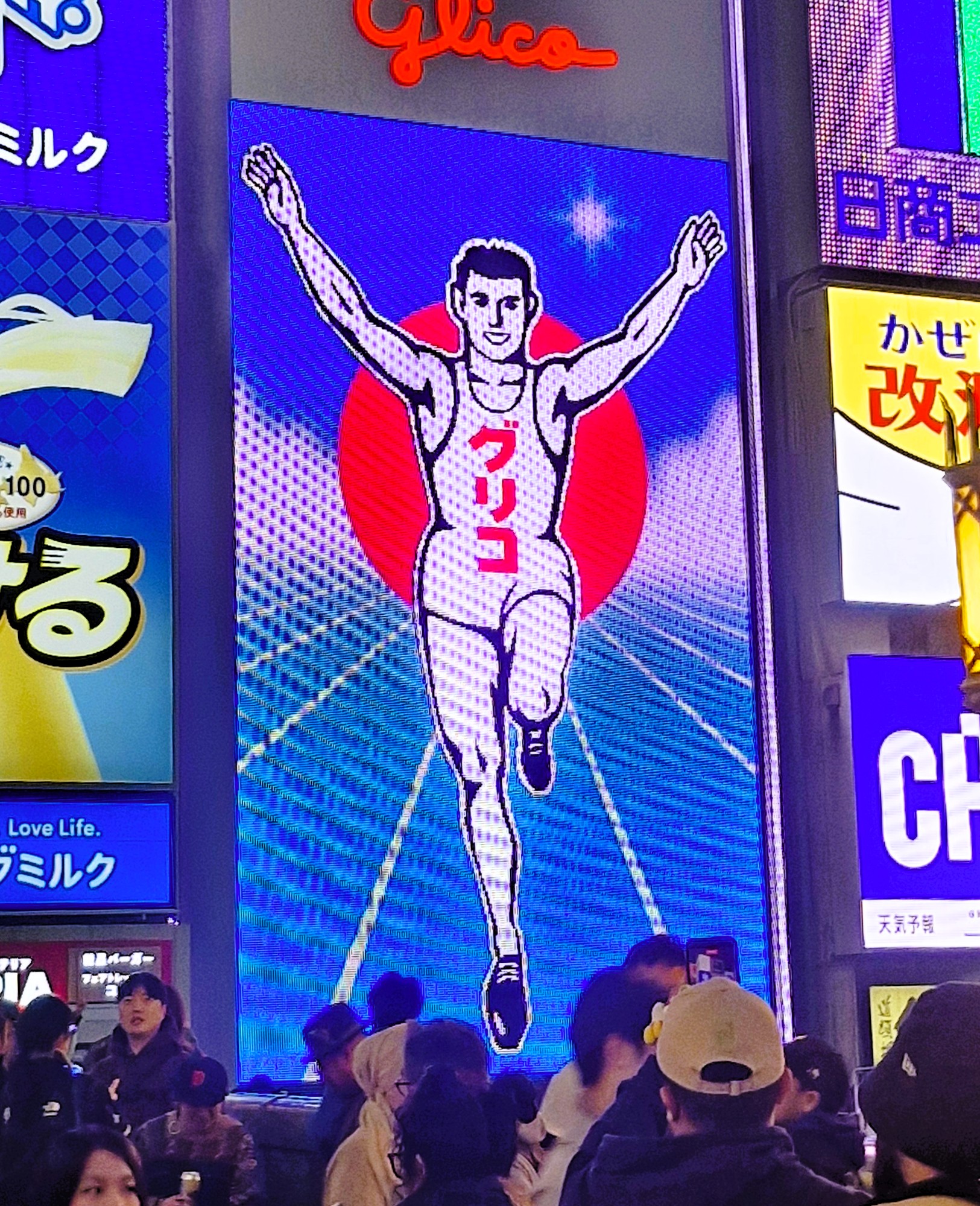
It shows a runner, against a blue track with Osaka landmarks, reportedly inspired, in part, by the winning form of Fortunato Catalon, an early 20th century Filipino champion sprinter, from Tolosa, Leyte, known in the 1910s and 1920s, as “Asia’s Fastest Man,” in the 100-yard and 220-yard dashes during the 1917 Far Eastern Games held in Tokyo, as well as Japanese marathoner Shizu Kanaguri. It was first installed in 1935 by Ezaki Glico (manufacturer of one of Asia’s most famous confectioneries) company founder Ri-ichi Ezaki, to represent his energy-boosting caramel Glico candy that, according to lore (the Japanese love a backstory), could give you “enough energy to run 300 meters.” This energy product was created in 1922 by adding glycogen from oysters to the snack and, to this day, this running man has been used as the company’s mascot and logo.
Ezaki Glico’s most popular product is Pocky, confectionery-coated pretzel sticks, which comes in a number of tasty flavors, very popular in Japan and abroad (it is known as Mikado in some parts of the world). Glico’s other confectionery products include Pretz, Caplico, Bisco and Karujaga. Glico also makes ice-cream products and a few processed foods and curry roux blocks. Glico has a museum, at their Osaka headquarters, featuring all sorts of nostalgic packaging and a collection of the free toys that are given away with each box. Currently on display, part of a special exhibition, is a selection of diorama’s of Dotombori and the Running Man billboard.
The sign, which now serves as a symbol of perseverance, energy, health, victory and the spirit of Osaka, has had several overhauls. Since 1972, the huge neon has shown the Running Man on a running track. In 1998, some of Osaka‘s best-known landmarks, such as Osaka Castle and the Tsutenkaku Tower, were added to the background. The previous five versions were all neon. The 2014 LED version follows a similar theme, with the landmarks taking a more dynamic role.
Also, through the years, it has been occasionally altered to support the mighty Hanshin Tigers, Osaka’s baseball team (when Japan hosted the Soccer World Cup), and to celebrate various sporting triumphs or celebratory images, such as in 2020, to celebrate Takuma Sato and his second Indy 500 victory (the sign changed every 15 minutes to an image of Sato performing the “Glico Man Pose”). The current 6th generation sign, installed in October 2014, is the first to use the new high-resolution LED technology which allows even more special events celebrated via the huge billboard. It is 20 m. high, 10.38 m. wide and is illuminated from sunset until 12 midnight.
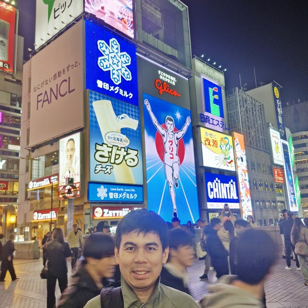
A popular meeting place and spot to take photos, here visitors, both local and foreign, often mimic the runner’s pose (arms raised, one leg up). For the best experience, visit during the week or earlier in the day, though the sign is truly spectacular at night when the bridge is jam packed, especially at weekends, with people entering the Dotombori entertainment area. A central point for shopping and food in Dotonbori, the area around the sign is crowded, with other bright, large signs.
Just east of the Glico Man billboard is Ebisubashi, originally constructed to provide access to the nearby Ebisu Shrine. The bridge, more practically, provides a link between the Shinsaibashi-suji and Ebisubashi-suji shopping districts. The bridge is also the location of a legendary curse, on Osaka’s baseball team, the Hanshin Tigers, which was considered broken in 2023.
Ebisubashi also makes for a convenient gathering point, due to the familiarity of the Glico Man, hence its nicknames, nanpa-bashi (mostly used by foreigners) and hikkake-bashi (“the pulling bridge”), mostly used by native Japanese.
Glico Running Man Sign: 1 Chrome-10-4Dotonbori Sistrict, Chuo Ward, 542-0071 Osaka. Tel: +81 120-917-111.
How to Get There: The sign is located at the South bank of the Dotonbori Canal, near Ebisubashi Bridge.