Singapore Zoo – Night Safari (Singapore)

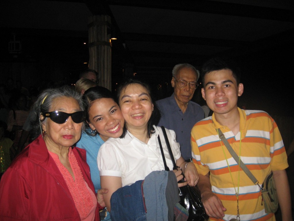
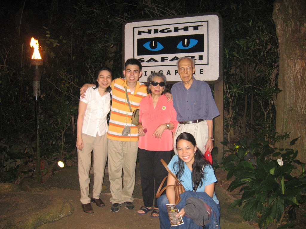
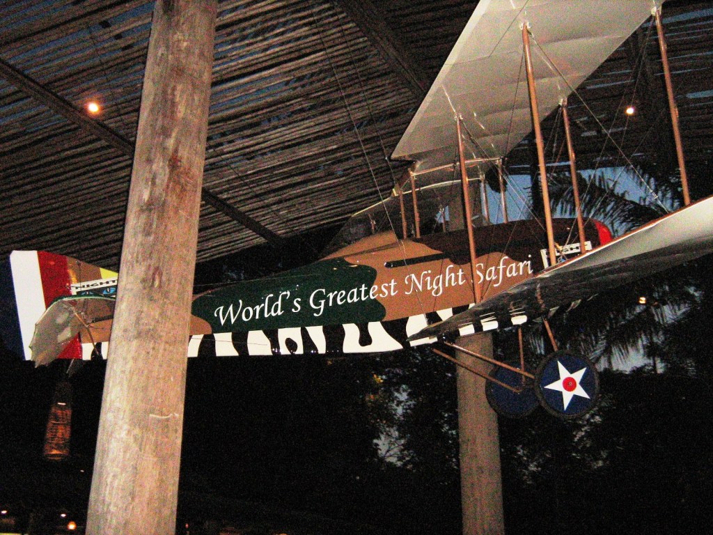
After our hotel check in, we rested a bit before all leaving, via 2 taxis (a 30-min. drive), for the world-famous Night Safari, the world’s first nocturnal zoo. The Night Safari opens at 7 PM, only after the zoo itself has closed for the day (6 PM) and, because it takes place at night,  everything was dark and the habitats are only illuminated, if at all, by soft, indirect lighting that resembles moonlight.  The paths between sites are very dark.

Night Safari

Built at a cost of S$63 million, the 40-hectare Night Safari, adjacent to the Singapore Zoo and Upper Seletar Reservoir and managed by Wildlife Reserves Singapore, was officially opened on May 26, 1994. It currently houses a total of 1,040 animals of 120 species (29% of which are threatened).

We availed of the 45-min. night tram ride which took us past areas only accessible by tram, passing lots of wild South American and Asian animals roaming free in naturalistic enclosures that simulate the animals’ native habitat. On the first part of the trip, those seated on the right side of the tram had  the best views (opposite on the second leg).

Tram Ride

Carrying anything too bright is prohibited, and pointing lights at the animals is not allowed. I wasn’t able to get pictures of the animals because it was very dark, and all flash photography is prohibited so as not to freak out the animals. We were dropped off at a “jungle station” where some explored, on foot, the walking trails to get a closer look at some of the animals.  Later, we were picked up again for the second half.

"Creatures of the Night" Animal Show

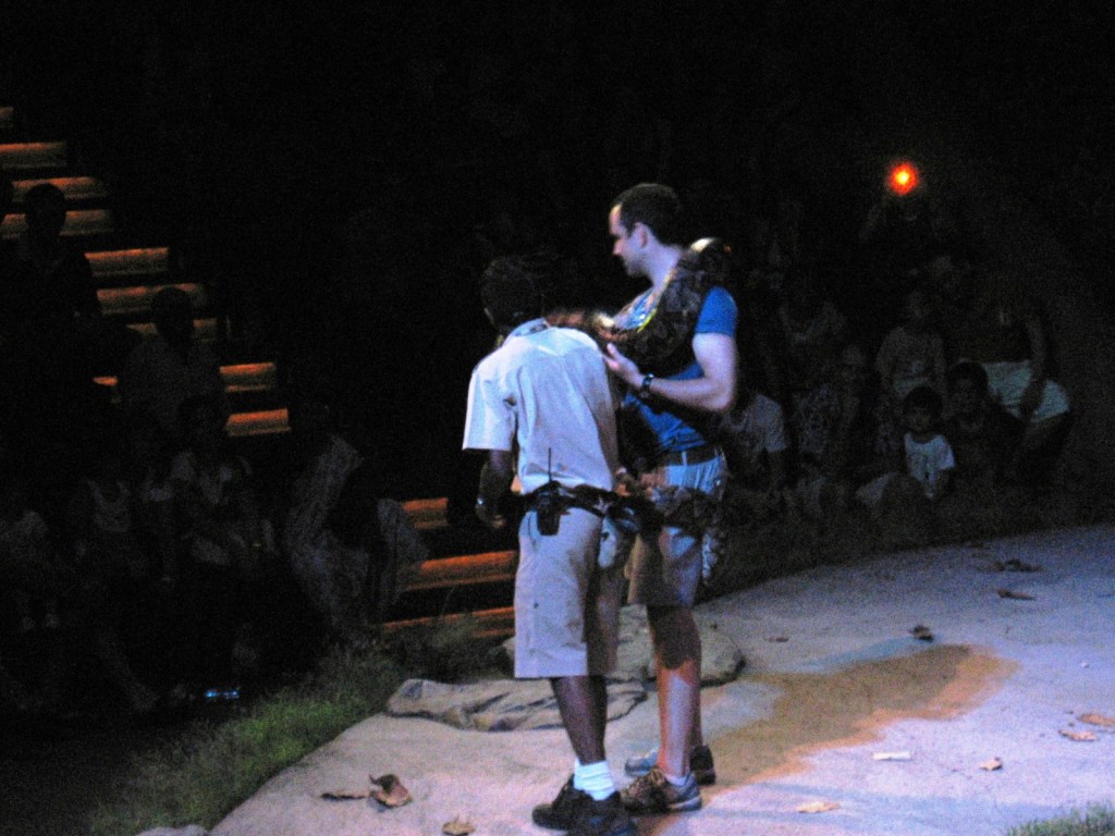
Later, we attended the “Creatures of the Night” animal show where we saw the animals in action.  At one point, a night barn owl, on cue, swooped over the audience at hair top level.

Back at the main entrance, we checked out the food and beverage outlets there for our dinner. Choices include very tasty satays, noodles, fish and even burgers offered by Ulu Ulu Safari Restaurant, Bongo Burgers and Ben & Jerry’s Scoop Shop.  We decided on Bongo Burgers.

Singapore Zoo: 80 Mandai Lake Rd., Singapore 729826.  Tel: 6269 3411.  Website: www.zoo.com.sg. Open daily, 6 PM-12 midnight. Admission: S$22.00 (adults) and S$11.00 (children 3 to 12 years old).

Dicasalarin Cove (San Luis, Aurora)

After lunch, the Sen. Angara invited us to explore the compound and climb the hill.  We were particularly impressed by and enjoyed exploring the compound’s Ifugao Village, a mini-complex of quaint Ifugao-inspired cottages.  

View of Dicasalarin Cove from Lighthouse Hill

Then, with some guides, we decided to explored the cove itself, its stunning beauty as rough as the continually crashing waves of the Pacific Ocean.  Its beauty remains so as there are no resorts and visitor facilities along the beach.  Instead, scattered along this cove are unique rock formations, each with a unique charm of its own.

Unique rock formations at Dicasalarin Cove
Exploring the cove

On the right side of a peninsula we discovered a sea-sculpted cave and did some swimming inside.  This short cave, seemingly accessible only during low tide, is well-lighted as it is open on both sides of the mountain.

Exploring the sea-sculpted cave

Nearby is Birhen Island, a rock formation sculpted by natural erosion to resemble the figure of the Blessed Virgin praying amidst the pounding waves. On our way back, we then climbed a steep imposing hill, the site of the senator’s future lighthouse.

The route up Lighthouse Hill
The gang’s all here

Steps, with ropes tied to wood posts as railings, were cut along the hill to provide access.  The 15-20 min. climb was exhausting but the rewards were great when we reached top as we had a panoramic and breathtaking, 360 degree view of the cove, the Sierra Madre Mountains, sheer cliffs and the pounding waves of the Pacific Ocean.  The way way down was easier but harder on the heels.  Back on the beach, we gave our tired bodies a break with a brief but welcome frolic at the sea.

Relaxing along the beach after a tiring trek

Returning to the resthouse, we met up with Ms. Alexandra “Alex” Angara, the London-educated daughter of the senator, and her boyfriend Joseph “Joe” Cole and her pet dog Huckleberry.  Alex invited us to stay the night and we were really tempted to accept the offer.

With Alex Angara (third from left)

However, we only planned our visit as a day trip and didn’t bring enough clothes.  Besides, we had to leave very early in the morning for our long-haul return trip to Manila.    Thus, it was with some difficulty that we declined the invitation.

The beauty that is Dicasalarin Cove

After washing up, Alex graciously accompanied us to the beach where our speedboat was waiting to bring us back to Cemento.   Truly, our visit to Dicasalarin Cove was the piece de resistance to our 4-day visit to the beautiful province of Aurora.

How to Get There: As the cove is privately-owned, you have to secure a gate pass (PhP300/pax) at Bahia de Baler Garden Resort before heading for the cove.  The cove is open for guests at the resort.  By land, you can get there in 30 mins. by car via a steep (too steep for a tricycle) and narrow  road with scenic views of the cove.  By sea, you can charter a motorized boat at Sabang.  The trip takes 45 mins.

Exploring Baler’s Environs (Aurora)

Dimadilangat Island

After surfing lessons at Sabang Beach, we packed up our tent and belongings, loaded it at the Toyota Revo and decided to spend the rest of the afternoon doing some sightseeing.  First on our itinerary was the Ermita Park in Brgy. Zabal, the highest point in the town.  According to the locals, many of the town’s inhabitants sought refuge here when a tidal wave struck and completely engulfed Baler on December 1735.  Today, it has a huge white cross (which is lighted at night), picnic huts, a chapel and a mini-zoo.  To get to the cross, we had to climb over a hundred steps but the effort was well worth it as it has, from its concrete view deck, an excellent view of the town, the Sierra Madre Mountains, Cemento and Sabang Beaches, Lukso-Lukso rock formation and the offshore islands of Dimadilangat and Aniao. 

The cross at Ermita Hill

Having seen the the latter islands from Ermita Hill, we next drove down the hill to visit Dimadimalangat Island.  Located off the reef shore, it serves as a point identifying the southernmost tip of Baler Bay.  This rock formation is approachable during low tide and, during the calm months of April to June, the place becomes a haven for wall divers.   It is also a good dive and snorkeling site.

Aniao Islands

We next drove further south to the Aniao Islands, just off the coast of Brgy. Zabali.  These two small but imposing, shrub-covered islands are a habitat for kingfishers, gulls and even hawks and its peaks are a challenge for rock climbers.   Towering waves adamantly pound the island’s base. The islands are a 20-min. boat ride from Sabang.

Diguisit Falls

I wanted to continue on to the Radar/Weather Station at Cape Encanto and, beyond, to Dicasalarin Cove in neighboring San Luis town but boulders were blocking the already bad road so I decided to turn the Revo around and return to the town.  On our way back to the town proper, we also made a stopover at roadside Diguisit Falls (a.k.a. Natulo Falls).  Located 10 kms. from the town proper, it was said to be the first potable water source  for the people of Baler, made so through the efforts of Dona Aurora Quezon.  

Camping and Surfing at Sabang Beach (Baler, Aurora)

Cheska on her surfboard

Baler Tourism Coordinator Riza del Rosario sadly informed us that there wasn’t any accommodation available whatsoever for us, at least for this day.  I wasn’t surprised as it was the holidays and Baler was packed with tourists.  Anticipating this, I brought along my new Coleman 5-pax tent which I received last Christmas.  It measures 3 m. by 3 m. and has a 1.83 m. head clearance, convenient if you need to stand up while dressing.  From the town proper, I first drove to the Hanging Bridge at Brgy. Zabali where my 4 companions gamely crossed to the other side.  Motion sickness, caused by the swaying bridge, made me stop midway during my crossing and forced me to turn back.  After this adrenalin-filled crossing, we returned to the Revo and drove on to the gray sand Sabang Beach in Brgy. Sabang.  Most of the accommodations in Baler are located along this beach but, since all were fully booked, I just rented a picnic hut and pitched my tent on the grassy ground beside it.     

The gray sand Sabang Beach

Long before the movie Baler, the town was known as one of the country’s top 5 surfing areas. The waters of the Pacific formed strong, sharp break waves that provide an exhilarating high among experienced surfers. The best waves come in from October to March when the northeast monsoon blows down from China but surfing waves are present all year round, even during our visit.  Glassy right and left waves occur in the early mornings. They are not usually big, except during typhoons.   Thus, Sabang Beach is a good site for beginners and novice surfers.  Jandy and Cheska, as well as Lulu, all beginners, opted to take some surfing lessons (PhP350/pax for 1 hr.) while Vi, an avid photographer, just took pictures.  I stayed behind to watch the tent and our belongings. 

Fish catch being hauled in
Sabang Beach has three surfing sites: Cobra Reef, Charlie’s Point and Secret Spot.  Charlie’s Point, located north of Sabang Beach, within walking distance from the town proper, was where the surfing scene of Francis Ford Cuppola‘s 1979 Apocalypse Now was filmed.  It is known for its medium-quality, right and left breakwaves on sand and gravel bottom. The waves are best from December to January. Secret Spot is located at the mouth of the Cemento River. Further north of Sabang Beach is the newly discovered surfing spot called Lindy’s Point, a 15-min. hike from Bay’s Inn.

On the Road to Baler

Canili-Diayo Dam (Alfonso Castaneda)

Baler, the provincial capital and center for trade and industry of Aurora province, recently hit it big when its namesake movie Baler won Best Picture and a host of other awards in last year’s Metro Manila Filmfest, its plot based on the 337-day (June 27, 1898-June 2, 1899) siege of its Spanish garrison by Filipino rebels.  When it finally surrendered (the last to do so in the country), Gen. Emilio Aguinaldo, in admiration, declared, on June 30 (now Philippine-Spanish Friendship Day), that the remaining 33 Spanish soldiers were not be imprisoned but honored as friends.  Me and my family watched it and, being actually filmed on location, I was also impressed by its rugged scenery and decided to visit it, doing so on Holy Week.  Joining me were my two kids, Jandy and Cheska, plus lady friends Ms. Lourdes “Lulu” Siguenza and Ms. Rosevie “Vi” Sevilla, an avid photographer.

As we left Manila late afternoon of April 8, Wednesday.  Traffic was relatively light considering it was the eve of the Holy Week break but, once out at the North Luzon Expressway (NLEX), I took the wrong exit and was, instead, on our way to Zambales before I realized my mistake and backtracked, losing valuable time (not to mention the gasoline) in the process.  Dinner was at a Chowking outlet at a rest station along NLEX.  Late evening caught us in San Leonardo, Nueva Ecija, and tired from all these misadventures, decided to call it a night, pulling into a roadside drive-in motel.  I was speechless when Cheska inquired as to the strange furniture as well as the bathroom with the see-through glass in our room.

Camp Pangatian

Come morning, we continued on our way and made a short stopover, along the Cabanatuan-Palayan Rd., at Camp Pangatian, 8 kms. from Cabanatuan City.

Check out “Pangatian War Memorial

Provincial Capitol (Palayan City)

There are 2 routes to Baler – the Baler-Bongabon (Nueva Ecija) Road and the longer Pantabangan-Canili Road. As the former was impassable during the rainy season, we opted for the latter.  Just the same, at least 20 kms. of the trip was along gravel roads at Alfonso Castaneda (Nueva Vizcaya), the last town before entering Aurora province.  Here, we made photo op stopovers at Pantabangan Lake (a man-made lake resulting from the construction of the Pantabangan Dam) and its tributary, the Canili-Diayo Dam and Reservoir, probably the most picturesque irrigation dam in the country.

Check out “Canili-Diayo Dam and Reservoir


Millennium Tree

We entered Aurora province at Maria Aurora town (the province’s biggest).  Here, we made another stopover at  Balete Park and its star attraction – the Millennium Tree, a  massive, 49-m. high, 10-15 m. wide balete tree.

Check out “Millennium Tree

Camsur Watersports Complex (Pili, Camarines Sur)

I was invited to cover the 2nd Bagasbas Summer Surf Festival (April 4-5) to be held in Daet, Camarines Norte, and I was to get there via an Air Philippines flight to Pili Airport in Camarines Sur.   At the NAIA terminal,  there was a long queue for this as well as other flights to Pili as the surf festival also coincided with  April 2-5 Terry Larrazabal Bike Festival to be held in Camsur.  Many participants brought along their packed bikes.  I was lucky to get on board my flight.  Flights were overbooked and other members of the media who were joining me had to move their flight for next day and would have to land in Legaspi City (Albay) instead of Pili. 

Camsur Watersports Complex
The flight to Pili took just 45 mins. and I arrived at the airport by 8 AM.  It seems no one was at the airport to pick me up as they must have thought that my flight was cancelled.  Luckily for me, I met up with Ms. Marife Nolasco-Maralit, the Camarines Sur Provincial Officer who I met previously at the 2002 Kaogma Festival of Naga City.  She contacted the Mr. Melvic Brinas, the driver who was supposed to pick me up.  Melvic was already on his way back to Daet when he received the call and he promptly turned back.  As I still had time to kill before his arrival, Mariefe offered to tour me around the nearby Camsur Watersports Complex (CWC).
 
The clubhouse restaurant
This unique, 6-hectare watersports park, opened in May 2006 (during the term of Gov. Luis Raymond Villafuerte, president of the Philippine Waterski and Wakeboard Federation), is the top tourist attraction in the Bicol Region.  It offers a 6-point cable ski system designed for wakeboarding, wakeskating, kneeboarding and waterskiing.  These are done in 2 large man-made lakes.  It is open even at night as the park is equipped with spotlights.  CWC also has a clubhouse restaurant by the lagoon, a swimming pool, sand bars, spa, pro-shops and a grandstand for guests.
One of the man-made lakes
On October 2006, the 1st Cable Wakeboarding Nationals were held here and, on July 2008, the complex hosted the 2008 World Wakeboarding Competition.  Accommodations in and near this provincial government-run complex include first-class hotel rooms, Tiki huts, airconditioned individual cabanas and refurbished container vans just meters apart from each other.
 
Camsur Watersports Complex: Provincial Capitol Complex, Brgy. Cadlan, Pili, Camarines Sur.  Tel: (054) 477-3344, 475-0689 and 477-3349.  Fax: (054) 477-3347.  Website: www.camsurwatersportscomplex.com.


A Historical Tour of Clark (Pampanga)

After watching the early morning flight of Clark’s famous hot air balloons, Jandy and I returned to our Toyota Revo and made our way out of Clark as we still wanted to explore nearby Angeles City.  Along the way we made brief stopovers at some of Clark’s historical sights.  Our first stopover was at the old parade grounds.

Fort Stotsenberg Gate Posts

The Fort Stotsenberg Gate Posts once stood at the Dau Gate, the first gateway to Fort Stotsenberg , from the early 1900s until the Japanese Occupation in 1942 when they were removed and buried as landfill.  Unearthed intact in 1965,  these posts were moved to the American Legion Post (near the Personnel Office and not far from the Clark Gym) and finally relocated to the south side of the entrance of the parade grounds in 1984.

Clark Museum

Near the old parade grounds, on the original site of the 217-bed base hospital (dating to September 1903) and the Base Commander’s office, is the Clark Museum, also called the Kapampangan Museum.


Check out “Clark Museum

Death March Marker

At the entrance of the Clark Veterans Cemetery, along the main entrance road, just past the main gate, is the Death March Marker.  This memorial marker was erected by the Manila BPO Elks lodge in honor of fellow Elks, American and Filipino POWs, who passed this spot during the infamous Bataan Death March in 1942.

Clark Veterans Cemetery

Just inside the Main Gate, along the Mitchell Highway, is the 20.365-acre, 12,000 plot Calrk Veterans Cemetery, formed between 1947 and 1950 to house 7,559 military and civilian remains.  There are headstones/markers and remains from at least 4 other U.S. military cemeteries (Fort Stotsenberg 1 and 2, Fort McKinley and Sangley Point Naval Cemetery).  These include 2,030 fallen American soldiers, including at least 638 Philippine Scouts (PS) from the pre-World War II era.  Some, but not all, were veterans of the Spanish-American war and the Philippine-American War.

Graves of the unknown dead

Others are graves of U.S. veterans from the U.S. Army, U.S. Navy, U.S. Marine Corps, U.S. Coast Guard and U.S. Air Force who died after World War II (all World War II dead were moved to the American Cemetery in Manila) and during the Korean and Vietnam War.  The largest category interred is civilian, mostly U.S. and Filipino, all of whom worked for the U.S. government, and their dependents.  In addition, nationals from France, Spain, Canada, Japan, China, Vietnam and India are also buried there.  A little over 1,600 remains are still unidentified.  The cemetery is also the only place in the former U.S. 13th Air Force base where the U.S. flag flutters alongside the Philippine flag.

Salakot Arch

Finally, at the main gate entrance to the Clark Freeport Zone, at Bayanihan Park, is the Salakot Arch, a cavernous welcome landmark fashioned after a farmer’s hat built in 1979.  It stands as a sign of Philippine-American friendship over the years and was originally built to symbolize the historical March 14, 1947 signing of the RP-US Military Bases Agreement.  Beyond the arch is Angeles City.

The City of "Angels" (Angeles City, Pampanga)

Angeles City

After the culmination of Clark’s Hot Air Balloon Festival, Jandy and I drove on to Angeles City for a walking tour of the City of Angels.  Many know Angeles City only as a rest and recreation area frequently visited by the U.S. servicemen from nearby Clark Air Base.  Even with the base’s closure, Angeles is still home to a large colony of expatriates as many Americans chose to permanently settle in city, particularly in the Balibago District.  They were just about everywhere I looked in the city.  However,  not many people know that, on March 17, 1899, Angeles was briefly made the capital of the First Philippine Republic by Gen. Emilio Aguinaldo.  In fact, the first and only anniversary of the Declaration of Philippine Independence (June 12, 1899) was celebrated here.  Upon its capture by the Americans on November 5, it was made the headquarters of Maj.-Gen. Arthur MacArthur (father of Douglas).  Angeles, once just a jungle clearing and a northernmost barrio of San Fernando called Kuliat (after an indigenous vine that grew abundantly in the area), soon grew rapidly around the former Clark Air Base and was made into a chartered city on June 22, 1963 by virtue of Republic Act No. 3700.

Holy Rosary Cathedral

Many relics of the city’s Spanish and American era past still exist, all within the Sto. Rosario Historic District and all within walking distance from each other. My walking tour started at the Holy Rosary Cathedral (where I parked my car), along Sto. Entierro corner Sto. Rosario St.

Check out Cathedral of the Holy Rosary

The Holy Family Bldg., the former convent, was used by the U.S. Army from August 1899 to December 1900 as a military hospital and by the Japanese Army as a troop barracks, officers’ quarters and arsenal in early 1942.

Angeles Physical Therapy Rehabilitation Center

Adjacent to the cathedral is the 2-storey Museo Ning Angeles, the former City Hall built in 1922.    This museum, opened on December 8, 1999, now showcases Kapampangan lifestyle and culture.

Check out Museo Ning Angeles

The Angeles Physical Therapy Rehabilitation Center, now a center for polio and stroke patients, was first built in 1899 as the deposito for religious statues and carriages used in religious processions.   From 1899 to 1901, it was utilized by the U.S. Army as a jail  for recalcitrant U.S. troops and, from 1946 to 1947, as headquarters of U.S. Army 11th Film Exchange.  From February 6, 1967 to 1986, it was  the City Post Office.

Bale Matua

The oldest building in the city is Bale Matua, also known as the Founder’s House.  It was built in 1824 by Don Angel Pantaleon de Miranda, the former gobernadorcillo of San Fernando, and his wife Doña Rosalia de Jesus.  Together, they founded Angeles in 1796.  On December 8, 1829, the barrio was separated from San Fernando and was renamed Angeles in honor of Don Angel and the town’s patron saints, the Holy Guardian Angels (Los Santos Angeles de los Custodios).  To build Bale Matua, Angel used materials salvaged from their older house built around 1811. The house was later inherited by their only daughter, Doña Juana de Miranda de Henson.  It has high stone walls and an ornate gate and was declared as a Historical Site by the National Historical Institute.

Nepomuceno Ancestral House

The Nepomuceno Ancestral House, along Sto. Rosario St., was the home of Don Ciriaco de Miranda, the first gobernadorcillo of Angeles. Built in 1840, it was inherited in 1868 by Don Ciriaco’s niece, Doña Agustina Henson de Nepomuceno.  A restored grain storehouse (kamalig), along Sto. Rosario St., between these two old houses, was also built in 1840 by Don Ciriaco. In 1980, it was restored by Armando L. Nepomuceno and is now home to Armando’s Pizza and the Camalig Restaurant.   Bale Herencia, at the corner of Lakandula and Sto. Rosario Sts., was built in 1860 by carpenters from Vigan (Ilocos Sur). Said to have been built for the mistress of a parish priest, the current owners now use it as a banquet hall.

Bale Herencia

Hike to Tappiya Falls (Banaue, Ifugao)

Tappiya Falls

Come morning it was decision time for the group.  There were two options left for us before leaving Batad in the afternoon.  For the still adventurous, me included, there was the 30-min. (according to the locals) hike to Tappiya Falls, something I haven’t done during my first visit (which was just a day tour way back April 1998).  The other was an easier hike down to Batad Village proper to photograph village life.  I chose the former but half opted for the latter. Joining me to the falls were AACC members Jun, Steve and Rosevie plus Pearl, Phoebe, Ivy, Arvic and our local guide Mang Vicente.

Batad Village

After a hearty but very early breakfast, we all left Simon Inn by 7 AM, taking the same route to the Central Viewpoint.  Beyond the rice terraces, it was a slow, lung busting and steep (with slopes reaching 45 degrees) hike.  A meandering river soon came into view, indicating how near we were to our destination. Across this river and upstream along the far bank was the beautiful and impressive, 25-m. high waterfall with its enormous swimming natural pool.  We were in luck as running across the falls was a rainbow, making for another beautiful and rare photo op. While the others went bathing, Jun, Vi, Steve and yours truly started clicking.

Apo Ben

After 30 mins.of this bather’s and photographer’s heaven, it was time to go as we had another long hard climb ahead.  A rest stop at the Central Viewpoint provided an opportunity to pose (for a fee) with Apo Ben, an Igorot dressed up in full tribal attire (complete with g-string, native spear and feathered headdress).  We arrived at Simon Inn by 11 AM in time for a well-deserved lunch we had no more time for a power nap as we had to pack our stuff and leave. Bebet and Bryan had left by then to allow themselves longer rest stops.  We left the inn with our porters by 1 PM.  The hard part was the hike, now uphill, to the Saddle but from here it was downhill all the way to our pick up point, arriving by 4:30 PM.  The debris from the landslide had been cleared by then.

Dinner at Hillside Inn

Our AUV brought us to Banaue town proper in time for an early pansit dinner at Hillside Inn.  We left Banaue by 6 PM on board a similar airconditioned GV Florida bus and arrived in Manila by 4:30 AM the next day. Again, this rewarding experience helped me gain a healthier respect for the hardworking Ifugao’s ingenuity, the wonders of God’s creation and, in spite of the long hikes, an additional 3 pounds (thanks to the pizza and nutritious highland rice!)

The Trail to Batad Rice Terraces (Banaue, Ifugao)

The Batad Rice Terraces

This stupendous amphitheater of stone and earth terraces was sculpted out of twin coalescing spurs of a steep, wooded mountain from riverbed to summit. Considered as the “Eighth Wonder of the World” by many, belo it is the relatively unspoiled Batad Village.

These masterpieces of agricultural engineering are said to be the highest of its kind in the world and the largest single agricultural project in the history of mankind.  The terraces are estimated to be more than 100-sq. miles in area, reaching heights of 1,500 m. and its length, if put end to end, would extend 48,280.40 kms., encircling half the globe or extending 10 times the length of the Great Wall of China.

Our hired AUV was soon on our way, along the often dusty but now muddy Mayoyao Rd.,  to the Km. 12 Junction (called the “Saddle”), take-off point for the  hike to Batad Rice Terraces.  However, we only made it halfway as a fresh landslide, brought about by heavy rain the night before, blocked our way, adding another 6 kms. to our already arduous 4-km. hike.  Luckily, there were local porters to carry our backpacks (at PhP200/pack, 2 packs per porter, placed front and back).  Still, this wasn’t going to be a walk in the park as our group had to hurdle, aside from the landslides, tired and aching muscles, sore feet, rough mountain trails (sometimes narrowed to footpaths where only one person at a time could pass) and deep, treacherous ravines. Even in the cold, refreshing mountain air, most were sweating profusely due to the hot sun.

At Km. 12 Junction

Would-be backpackers soon gave up their backpacks to the porters, one had a bout of gout (nice rhyme), another, a diabetic, collapsed from insulin shock and another was on the watch list (having had a quadruple bypass).  Just the same, the photo opportunities were great, with lots of rice terraces, forest-cladded mountains and rivers to shoot, plus there were about six rest stations offering relief and refreshments (as well as souvenir items) to hikers.  From the Saddle, it was an easy downhill hike most of the way.