Bataan’s Vietnamese Connection

It being Good Friday, we fittingly made plans for a self-imposed, late afternoon Calvary-like hike, up Mt. Agalis, to the remote Pintong Alipi Falls.  Bienvenido “Kit” Nazareno, Vener’s 55-year old uncle, volunteered to drive and accompany us there.  The 30-min. jeepney trip to the jump-off point included passing by the 380-hectare, Subic Bay Metropolitan Authority (SBMA)-managed Bataan Technology Park in Brgy. Sabang. Now being developed as the “Silicon Valley of the Philippines,” this place used to have a humanitarian beginning, it being the former site of the Refugee Processing Center (PRPC), a refugee processing camp for Vietnamese “boat people.”  

A Vietnamese relic at Bataan Technology Park

It was said that the PRPC was among the most comfortable refugee camps in the world.  No barbwire fences and no border soldiers to accost the refugees coming in and out of the camp.  Set up in 1979 under the United States Repatriation Program, it served as a temporary home and transit center for the relocation of Indo-Chinese refugees (Vietnamese, Khmers and Laotians) victimized by the American war in Southeast Asia.  Here, they were trained in English, American history and vocational skills.  The center housed 18,000 refugees at one time and more than 100,000 have passed through here.

Remains of the first Vietnamese refugee boat

Today, the PRPC is no more as it was closed in 1994.  All we saw during transit was a shrine and the rotting remains of the first refugee boat to arrive there.  Vietnamese cuisine, however, has left an imprint in the town.  Near the town hall is a store serving hu-thieu, a soup concoction consisting of sotanghon noodles, sliced hard-boiled eggs, spices and bean sprouts.  We sample this before we departed Morong for Manila.  We, however, missed out on the bun-mi, another Vietnamese-inspired favorite which consists of grilled bun stuffed with pipino, tomatoes, onions and sliced meat with spices, mustard and mayonnaise added.

Holy Week in Morong (Bataan)

Napot Point

After our Dambana ng Kagitingan pilgrimage, it was back to my car again for the final drive to Morong. Along the final 23-km. stretch from Bagac to Morong, we passed the controversial Bataan Nuclear Power Plant, situated 18 m. above sea level at Napot Point.  Morong was the chosen site for this “white elephant,” which was supposed to be the first nuclear power plant in the country.

Begun in 1977, it was constructed by Westinghouse (allegedly under a “conspiracy of corruption”) and was expected to generate 620 MW of electricity when completed.  After much delays (construction was stopped in June 1979 due to the Three Mile Island incident in the U.S.), it was finally completed in 1985 at a cost of US$1.95 billion (its initial budget was US$1.1 billion).  However, cause-oriented groups staged a number of “No Nukes” rallies.

They protested its potential to life and property, and its being built on a major earthquake fault line.  The Chernobyl nuclear plant accident in the former Soviet Union in 1986 was the final nail in its coffin as Pres. Corazon Aquino ordered it mothballed that same year.  To this day, it has not been decided what to do with this overpriced but unsafe complex and the sophisticated equipment already installed there.  In the meantime, the country is left with the problem and an incurred US$2.2 billion debt.

Sunset at Morong

We finally reached Morong late in the afternoon and stayed at Vener’s house, located near the town’s Spanish-era church and a few hundred meters from the beach.  A soothing and well-deserved cool afternoon dip at the beach, augmented by a beautiful fiery sunset, relaxed our tired bodies. Early morning of the next day, Good Friday, provided an opportunity to observe, up close, the countrywide Holy Week ritual of self-flagellation.  I first encountered this shocking and bloody ritual when I was still living in Malibay (Pasay City).  Here in Morong it is called pagbubulyos.   This is performed mostly by men, both young and old, who wish to fulfill a panata (vow) of public atonement for one’s sins.  This panata is done for a minimum of 10 successive years and is reflected in the bulyos, a whip consisting of bamboo strips tied to sturdy cord.   Each strip represents one year of atonement, its number being reduced every succeeding year until he completes his panata.  Each strip should be secured properly.  If one is detached during his rounds, another strip (and another year) is added to his bulyos.

Before the actual flagellation, the flagellant’s back is prepared by beating with stick and paddles until swollen and numb.  Numerous small cuts on the back are then made with razors, with vinegar or salt sometimes applied to the cuts.   Only then is the raw back whipped continuously by the bulyos.  The flagellants, most with heads covered, walk barefoot along the town’s streets, stopping by the church to pray, then continuing on until they reach the sea where a healing noontime dip awaits them.

Taal Volcano: Hike to the Crater Lake (Talisay, Batangas)

Mt. Binintiang Malaki

This Holy Week, I availed of a standing invitation from Ms. Lily Rodrigo-Canlas, president and C.E.O. of Jesu-Mariae School, my son’s school, to stay at the Jesu-Mariae Center in Tagaytay City.  This retreat/seminar center could comfortably accommodate 80 people in dorm-style facilities.  With this center as a jump-off point, I planned to revisit Taal Volcano via the Kayabok Trail on the other side of Volcano Island.  Joining me were my son Jandy and daughter Cheska who’s been egging me to include her in my escapades.  Joining us were 5 of Jandy’s teachers: Mr. Robert Castaneda, Ms. Veneriza “Vener” Trillo, Ms. Theresa “Thet” Quieta, Mr. Joel Fatlaunag and Mr. Erwin Vizcarra.  All, except Robert, are jittery first-timers at the volcano.     

Picnic Grove with Taal Volcano behind us

We left Manila on the morning of March 27 and arrived at the center in time for preparation of a delicious barbecue lunch.  After customary visits to the city’s Picnic Grove (where we went horseback riding) and People’s Park in the Sky (now in a sorry state of disrepair), we returned to the center for a delicious supper and retired early as we had to leave very early in the morning for the volcano trek. 

Cheska horseback riding with Thet

The next day, Holy Thursday, we all awoke by 5 AM, had breakfast, pack our provisions of bottled water, sandwiches and bananas (good trail food) and left the center by 6:30 AM.  From Tagaytay City, we went down to Talisay (Batangas) via the treacherous concrete zigzag road called Ligaya Drive, down to Brgy. Caloocan.  As soon as we arrived at the boat landing station, we were swamped by boatmen hoping for an early kill, this day being a holiday.   Soon, they were trying to pluck our feathers by charging us a cutthroat rate of PhP3,200 just for the trip (with 6 passengers only).  It was soon watered down and we settled at the still horrendous price of PhP2,400 to bring all 8 of us to our destination.

On our way, by boat, to Volcano Island

We left the station by 7 AM on board a big motorized banca.   The trip was smooth all the way as the waters were calm. As we went around the island, the 311-m. high (the island’s highest point) Mt. Binintiang Malaki (translated as “giant leg”), soon hove into view.   This northwest cone, seemingly featured on most Taal Volcano postcards like an island (actually connected to the real Volcano Island), emerged overnight during the 1707 eruption but is now dormant. A dismal sight during the voyage was the presence of numerous fishpens which our boat had to negotiate to get to the other side.

Nearing the homestretch

We landed on the island’s western shore at Brgy. Kayabok by 7:30 AM.  All throughout the trip, the boatman kept egging me to get a guide (at extra cost of course) but we have decided even before the trip to do without one as the Kayabok Trail was definitely well-trodden.  We also refused a lady islander’s rather steep offer to guide us for PhP500.  Anyway, we had all the time in the world even if it meant getting lost in a small island.   Our seemingly concerned boatmen seem to have other things in their minds.  I wonder why.

The Crater Lake seen from a distance

We began the trek on a happy note, following the well-trodden trail up a hill. The sun soon rose brightly on the sky and we began to feel the effects of the intense heat from the morning sun.   As we soon reached the top of the hill, the trail began to fork, leaving us in a dilemma.  All the while, we somehow had a feeling that we were being followed and, soon enough, our boatmen were hollering for us to come back.  We ignored them.  Later, we encountered our huffing and puffing boatmen along the trail.  We were told that we took the wrong turn and they, in all kindness, offered to guide us in the right direction.  Or were they?    It soon dawned upon me that these boatmen were concerned, not with the guide fee (which I consistently refused), but with the fact that they may lose their first big meal ticket (or buena mano) of the day among the winding trails.  We could just as easily have taken our boat ride back to Talisay from the other coastal villages.  With this in mind, they never left us out of their sights after that.

Finally, at the Crater Lake

Vegetation on the island is sparse, consisting mostly of short grass, tall, nettled spear grass (cogon) and thorny brambles.  The treeless trail we trekked was all loose volcanic ash and the ground underfoot was also hot as volcanic rock retains heat both from the sun and the hot magma trapped deep within its bowels.  This, coupled with the sweltering heat of the sun, soon made our tongues hang out.  Our party was soon divided into two as our neophyte mountaineers Vener and Thet began to lag behind.  Cheska, however, proved to be tough and resilient as she kept up with the guys. 

The island within the Crater Lake

We took solace under the small shade of occasional thorny aroma trees (most of the large trees have been blown away by previous eruptions) where we quenched our parched throats and munched bananas as we waited for the stragglers to arrive.  Along the trail we passed by one of Taal’s 47 craters.  This seemingly dormant crater had a flat, cogon-covered bottom.  We also encountered makeshift refreshment stalls selling canned softdrinks (PhP30) and bottled water (PhP20).  After a tiring uphill hike, the shimmering blue-green waters of the crater lake made its appearance like a mirage on the horizon.  It was all downhill after that and, soon enough, we reached the crater lake’s rim.  It was 9 AM and the hike took all of one and a half hours.    It could have been longer.  Our socks and shoes were soon off as we couldn’t wait to dip our tired feet in those inviting waters.  However, the lake’s waters deepen just a few feet from the shore. About 30 m.  offshore is the small, crescent-shaped island.  The lake’s waters are actually dilute sulfuric acid with salts and other minerals such as sodium, boron, magnesium and aluminum added in.   Acidity in the water, measured in pH (the lower the pH, the higher the acidity), is a “whopping” 2.7 (neutral pH is 7.0) with about 3% sulfur.   Sulfurous waters have medicinal qualities and it did wonders for my mosquito-bitten legs.  Our boatmen also took home 1.5-liter bottles filled with this salty and bitter water.  Also as a result of the sulfur deposits, the stones at the lakeshore are coated yellow.

L-R, Vener, the author, Jandy, Thet, Robert, Erwin and Joel

After lolling about the waters, taking our lunch of sandwiches and photo shoots for posterity, we left the lake and retraced our way back to our boat and left the island by 11:30 AM.  Any notions of being in Tagaytay for an early lunch were dashed when our boat engine conked out (obviously out of gas) just a kilometer off the shore of Brgy. Caloocan.   We had to wait for half a hour for a relief boat to ignominiously tow us back to shore.  After paying our boatmen (they had the gall to ask for a “tip”), it was back to our car for the uphill drive back to Tagaytay and a well-deserved lunch.  Back at the Jesu-Mariae Center, we collapsed, dead-tired, on our beds. 

Sunken Cemetery (Catarman, Camiguin)

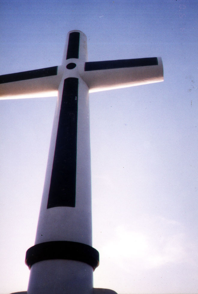
From Cotta Bato, we made a short drive to the Sunken Cemetery, site of the community cemetery which sank during the 1871 eruption.  After paying a PhP2 entrance fee, we proceeded down the hill to secluded, brown-sand Sabang Beach.  About 200 m. offshore is the huge concrete white cross which was built from 1997 to 1999 to replace another installed further offshore in 1982.  

Cross at Sunken Cemetery

Sunken Cemetery (6)

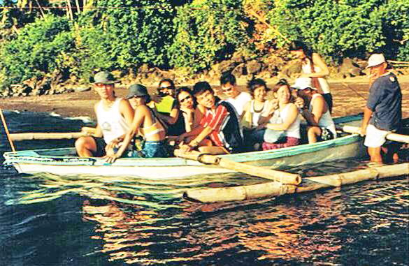
Connecting the cross with the shore is a nylon rope from which is tethered a boat for crossing.  We paid PhP10 each for the two-way trip.   According to the boatman, years ago, gravestones were still visible during low tide.  Now they can no longer be seen.  Every year, on May 1, a fluvial procession is held there.  The islanders row out to offer flowers and floating candles to the dead.

View from Sunken Cemetery

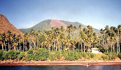
From our vantage poin at its terracet, we had a panoramic view of Mts. Vulcan Daan and Tres Marias. Scattered along Mt. Vulcan Daan’s northwestern slope is a winding trail with life-size, white-washed cement figures of the 14 Stations of the Cross depicting the passion death and resurrection of Jesus Christ.

Sunken Cemetery (12)

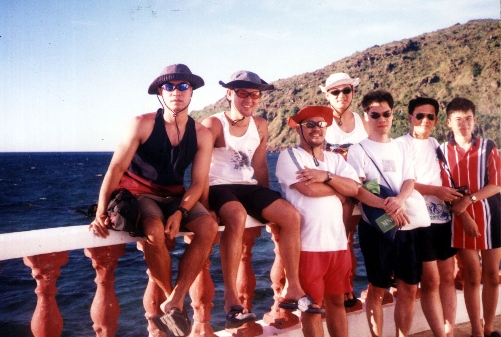
The last station is a sepulcher carved out of volcanic rock.  During Holy Week, a Panaad is held for religious retreat and penitence.  It features a 2-day, 64-km. trek around the island, from Brgy. Benoni to the Stations of the Cross.  The sun was just setting when we returned to shore and a well-deserved rest back at the resort.  

Sunken Cemetery (9)

Sunken Cemetery (4)

Sunken Cemetery: Brgy. Bonbon, Catarman, Camiguin

Taguines Lagoon (Mahinog, Camiguin)

We all left Katibawan Falls by 11 AM and proceeded on a 40-min. drive to Taguines Lagoon, near Benoni Port, for lunch.  This beautiful artificial lake has mantles of limpid water surrounded by craggy cliffs, huge boulders and gently rolling hills.  Truly, a relaxing break from a tiring tour around the island.

Taguines Lagoon

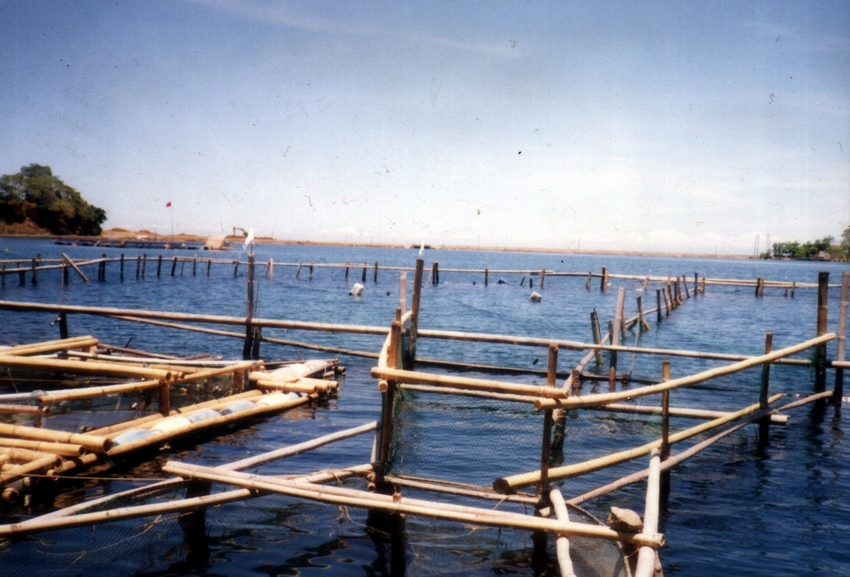
We stopped at J.A. Fishpen, a restaurant on stilts overlooking the lagoon.  Around it are fishpens where bangus (milkfish), mamsa (jack), lunab (surgeonfish), katambak (spadefish), danggit (seganid), maming (parrotfish), kitong and alimango (crabs) are bred.  Quite hungry, we feasted, kamayan-style, on fresh-caught and cooked alimango. kitong and bangus, plus fried chicken, pancit canton and halaan soup and washed it all down with buko and green mango shakes.

Image-03

J.A. Fishpen: Brgy. Benoni, Mahinog, Camiguin.  Tel:  (088) 387-4008.

Camiguin or Bust

The island province of Camiguin

I was still deciding on where to go with my son Jandy this Holy Week when my 2 companions from a previous climb up Mt. Makulot – Ms. Lourdes “Lulu” Siguenza, a Warner Bros. advertising executive, and free-lance artist Ms. Rosevie Sevilla – invited me to join them, with some other companions, on a week-long trip to the Northern Mindanao island province of Camiguin, an invitation I simply can’t refuse.  This would be my second trip to Mindanao, the first being in Zamboanga City way back in 1976.  I promptly secured plane tickets for me and Jandy.  

On board the ferry MV Royal Princess

We left Manila on April 8, Palm Sunday, on the 5:15 AM Cebu Pacific flight.  Joining us was Mr. Henry Chua, a Pizza Hut advertising executive and Lulu’s boyfriend.  Upon arrival at Cagayan de Oro City’s Lumbia Airport (Misamis Oriental), we waited an hour for our 8 other companions arriving on the incoming Philippine Airlines (PAL) flight.  On that flight were advertising executives Mr. Carl Allen and Begonia “Goni” Gonzalez of McCann Ericksson, Mr. Jake San Diego of Ace Saatchi, Ms. Tey Abonador of Harrison Communications, Ms. Rose Pantoja and Mr. Nubbin Beldia of Aviacom, Ms. Karen Rosel of Publicis-AMA and Mr. Randy Ypon, a balikbayan from Canada.  Carl and Randy brought along their own diving equipment minus the oxygen tanks which they intend to rent on the island.

Shuttling by jeepney

From the airport, we were picked up by a hired (for PhP2,000) Nissan Urvan to take our party on a 83-km. (1-hr.) trip to the Misamis Oriental ferry port town of Balingoan, the gateway to Camiguin.  Upon arrival, we all boarded the 11 AM ferry MV Royal Princess. Fare was PhP20 per pax  for the 45-min. crossing to Brgy. Benoni in Mahinog.   The boat was filled to the brim with passengers out on holiday, many crowding on the unshaded deck.  The trip was smooth all the way until we reached sight of Benoni. Or so we thought …. We heard a loud crash and were tossed about as the ship hit the pier head-on just when we were docking.  As if it were not enough, the crash was followed by a scraping sound as the ship sideswiped the dock ala Titanic.  What an exciting way to start a vacation!   

Tongonan Hot Spring National Park (Ormoc City, Leyte)

From Lake Danao, we again boarded our AUV and proceeded to Tongonan Hot Spring National Park.  Located at an elevation of 2,000 ft. amid densely forested hills, this 272-hectare park is at the west end of the Leyte Mountain Trail, 18 kms. (a 45-min. drive) northeast of Ormoc City.  It also has a cool climate, lush tropical vegetation and underbrush, a warm medicinal pool, a cavernous hillside geyser that spouts boiling water and steam hourly and formations exuding sulfuric vapors.  It is also home to wild pig, monkeys, deer and birds.  Its 112.5 MW Tongonan Geothermal Power Plant is the first geothermal power plant to operate in the Philippines. It supplies the region’s less than 100 MW consumption as well as that of the Luzon and Visayas grid.  A little farther off is the 5-hectare Lake Kasudsuran, located in a virgin forest at Brgy. Ga-as and Mt. Hanagdan, 1,000 ft. above sea level.

Tongonan Hot Spring National Park

After the Tongonan tour, we returned to Ormoc City for lunch, switched to Roy’s car and next paid a visit to the house of our host, Mr. Sabin Larrazabal.  We were greeted by his widowed daughter-in-law, Daya and his son Dr. Mario “Butch” Larrazabal who served us coffee and snacks.  Mr. Larrazabal arrived after a few minutes.  Already in his 70s, his still very active lifestyle belies his actual age.  Roy introduced us, but due to Mr. Larrazabal’s hectic schedule, could only talk to us for a short while.  After saying farewell, we proceeded back to the resort to check out our luggage.

Back at the city proper

Before we were brought to the bus terminal, Roy showed us around the city.  We also visited the Philippine-Japan Peace Memorial on Carlota Hills (a marker overlooking Ormoc Bay put up by the relatives of Japanese war veterans from the Nagoya and Gifu Prefectures) and the nearby cross-shaped common burial vault of the unknown victims of the Ormoc tragedy.

Near the port, we visited the marker showing plaques of the city’s achievements, the remnants of the old Spanish-era Fuente de la Reina bridge and the 7,000-person capacity Ormoc City Superdome (where the PBA provincial games are played). Ending our city tour, Roy dropped us off at the city’s bus terminal where we took a PhP100 per person Hi-Ace van for the 2-hr. trip back to Tacloban City.

Underground Cemetery (Nagcarlan, Laguna)

Underground Cemetery

Jandy and I left San Pablo City early in the afternoon of Easter Sunday.  It was just a short 14-km. drive from the city to Nagcarlan, passing by the tuba and lambanog-producing town of Rizal (formerly a barrio of Nagcarlan called Pauli).  Along the way, you can’t help but notice bamboo scaffolding linking coconut trees used by tuba gatherers.  Nagcarlan is Laguna’s vegetable garden and is the  biggest supplier of sweet lanzones (harvested  September to November) to Manila.  

Legend has it that the town’s name was a corruption of the name of Ana Kalang, a rich and generous benefactress much love by the townspeople.  Her name was eventually corrupted by speech to the more mellifluous Nanang Clara and Nang Clara before it became Nagcarlan.  In time, the town bore that name.   

Our first stop, before reaching the poblacion, was the Underground Cemetery, the first and only one of its kind in the country.  We parked our car at the service station opposite it. From this vantage point, I couldn’t help but admire its restored scrollwork-decorated octagonal red brick walls and  elaborate wrought iron gates.  Upon entering, we were ushered into an  enclosed circular garden surrounded by 240 above-ground crypts similar to Manila’s Paco Cemetery.  At the opposite end of the red tiled walkway is a dome-like chapel atop a hillock.  Quite spooky.

Entrance to Underground Cemetery

The first thing we saw upon entering the chapel is the Sto. Entierro, the glass bier of the dead Christ, at this time enshrouded.  The planked ceiling was water-damaged and in dire need of repair.  We were welcomed by the caretaker who narrated the history of the place.

An exclusive burial ground for Spanish friars, the cemetery was built in 1845 by Franciscan Fr. Vicente Velloc (or “Belloc” as spelled by some artifacts or documents). The crypt was a secret meeting place of Katipuneros in the 1890s and the historic Pact of Biak-na-Bato was first planned here by Pedro Paterno and Gen. Severino Taino in 1897.

In 1898, Emilio Jacinto, the “Brains of the Katipunan,” was captured here after being wounded in an encounter in Mahabang-Tanaw in Majayjay.  The Underground Cemetery was made into a National Shrine on August 1, 1973 by virtue of Presidential Decree No. 260 and again by Exec. Order No. 1505 on June 11, 1978. 

Still in use until 1981, the chapel was built in a strange arabesque style and has blue and  white tiles.  We went down the  stairs leading down to the underground crypt which contain tombs and burial plaques. I was, however, not allowed to take pictures or videos.   According to the caretaker, Fr. Velloc  also  built an  underground passage leading to 5 underground chapels where he was said to have held solitary masses.  Very spooky indeed.  It is also said to have continued all the way to Mt. Banahaw. The passage was then sealed off and its location now unknown.  Our visit ended, we signed the customary guest book and left.

Nagcarlan Underground Cemetery: open Tuesdays to Sundays. Admission is free.  Donations are needed and welcomed.

A Day Tour of Batad Rice Terraces (Banaue, Ifugao)

Batad Rice Terraces

A stay in Banaue is never complete without visiting the Batad Rice Terraces.  Seeing it is a “must” but getting there is no picnic as I was soon to find out.  The next day, April 12, Easter Sunday, after an early morning breakfast at the inn, Jandy and I were joined by Asia, Min-Min and Tom as we proceeded to the Trade Center.  Here, we hired a jeepney for PhP1,500 and waited awhile for other hikers to join us, our intention being to split the bill even further.  There were no takers.  We decided for the 5 of us to go at it alone.  The Batad Rice Terraces are located 16 kms. from the town and 12 kms. of the distance can be traversed, over the dusty Mayoyao national road, by our jeepney. Luckily for us, there were no sudden occurrences of landslides triggered by too much heat, it being the peak of the El Nino season. We safely made it all the way to the junction at Km. 12.

From hereon it would be hiking for the rest of the 4-km. distance. Jandy and I had on our indispensable media jackets (with its many pockets) and I brought along bottled water and my Canon point and shoot camera and videocam. The 2 to 3-hr. uphill/downhill and winding hike is demanding, but rewarding for hardy and seasoned hikers in good physical condition.  I didn’t exactly fit in that category as I wasn’t in good shape.  Jandy, a specimen of good health, kept egging me on – as I was huffing, puffing and sweating profusedly (even in the cold mountain air) – so I could keep up with the group, being the frequent tailender.   Luckily, for me, there were about 6 waiting sheds offering refreshments (as well as souvenir items) to hikers.  The rugged mountain trail sometimes narrowed to footpaths where only one person at a time could pass.  Below us were treacherous ravines.  Fog sometimes blanketed these trails.

After a few hours we emerged at the Batad “Saddle” in Bohr-Bohr, a landmark station in Cordilleras used to gauge the distance stretching to Batad. After another arduous hike, we finally reached our destination – the Simon Inn Viewpoint and its breathtaking side vistas of the Batad Rice Terraces.    This stupendous amphitheater of stone and earth terraces, sculpted out of twin coalescing spurs of a steep, wooded mountain from riverbed to summit, are considered as the “Eighth Wonder of the World” and, unlike the more famous Pyramids of Egypt built by slave labor, were  built in the true bayanihan spirit (system of helping each other without fees).  However, the rice terraces weren’t as green as I would have wanted them to be, again it being the height of the El Nino phenomenon.

Below the viewpoint and adjacent to the rice terraces is Cambulo Village, a typical, unspoilt Ifugao village with two lodges and pale Hershey Kisses-like roofs in the midst of terraces.  My 3 companions decided to visit this rustic cobblestoned village where the ancient craft of bark cloth weaving thrives. Going down seemed easy but I dreaded the uphill return trip so I opted to stay behind and admire the view instead.  Too bad I didn’t bring any extra clothes with me.  It would have been nice to have stayed overnight.  Maybe next time.  My 3 companions returned after 2 hrs..  After a 3-hr.  stay (including lunch at the inn), we retrace our way back, under a more comfortable late-afternoon sun, to the Km. 12 junction where our jeepney waited for us.  Unlike our previous trip, our jeepney was now filled to capacity with foreign and local hitchhikers all thankful for the free ride back to town.  They then left us to settle our bill with our driver.   The nerve!!!  Jandy and I then proceeded to the Autobus ticket office at the town center to reserve bus seats as there was only one trip back to Manila. Asia, Min-Min and Tom planned to spend an extra day in Banaue.  Afterwards, we returned to People’s Lodge for a well-deserved dinner and rest.

The next day (Monday), after a very early breakfast at the inn, we proceeded to the Trade Center where we boarded our Autobus bus for the 347-km. (10-hr.) long-haul trip back to Manila via the Dalton Pass in Nueva Vizcaya.  Although the bus was branded as “aircon,” it would have been better for us to open the bus windows as the airconditioning wasn’t working.  It was hot all the way.  However, as soon as we reached the lowlands, my mobile phone became useful again.  Thank God.

Arrival in Banaue (Ifugao)

The 47-km. jeepney ride from Bontoc to Banaue, Ifugao province’s main tourism destination, was to take all of 2.5 hrs., the seemingly short distance made while climbing steep mountains via the dusty, narrow and bumpy Halsema Highway.  The discomfort was somehow alleviated by great views of some rice terraces that we passed.  By 4 PM, we arrived at the parking area for buses and jeepneys at the town’s Trade Center.   Banaue is the province’s transportation hub, being traversed by the one major highway leading south to Nueva Vizcaya and Manila and by a less-developed road going to Bontoc (Mountain Province), and from there, to Baguio City (Benguet).

Banaue town

This touristy area is the center of activity in the town and it has handicraft shops selling different kinds of traditional fabric like the woven bark cloth and dyed ikat cloth, wooden objets d’art  such as bowls, trays, oversized spoons and forks, antiques, entirely alien statues of American Indian chiefs and smiling, pot-bellied Chinese gods, and the traditional bul-ols (statues of rice gods).  Curio souvenirs include handwoven wall hangings, crocheted bedroom slippers and pfu-ong (traditional jewelry) representing good luck in hunting or prosperity of children.    At one end of it is the Municipal Hall and Post Office Sub-station.