Calauit Island Game Reserve and Wildlife Sanctuary (Busuanga, Palawan)

Calauit Island

After my trial dive,  we booked ourselves on an optional half-day tour of Calauit Island Game Reserve and Wildlife Sanctuary, located just off Busuanga Island’s northwestern coast and opened to tourists since 1985.  Cost, including permit and boat ride,  was to set us back US$30 per person.  We left right after lunch at the resort.

An eland

This 3,700-hectare, DENR-administered Strict Nature Reserve was, in response to an appeal made by the International Union of Conservation of Nature (IUCN), was established as a repository for 108 African animals endangered by the 1977 drought and Kenya’s civil war on August 1976 by virtue of Presidential Proclamation No. 1578 issued by the late Pres. Ferdinand Marcos.  Its original 250 island families were relocated, 40 kms. away, to Halsey Island and compensated with land titles.  Since 1994, it was managed by the Office of Palawan Council for Sustainable Development, a  government body dealing with environmental issues in Palawan.

On our way to Calauit

We, together with other resort guests, left the resort by 1 PM on the resort’s motorized outrigger boat.  The trip took about 45 mins.  Upon arrival, we first logged in at the sanctuary’s office.  Then, accompanied by a guide, we ushered to the back of the sanctuary’s only “safari” vehicle, a converted 6 x 6 truck which resembled a huge open cage.  From our slow-moving and somewhat dilapidated truck, we got up close and personal with these herbivores as some fed near the road we were traveling while zebras grazed under shading trees.  Bushbucks (Tragelaphus sylvaticus), Grévy’s zebra (Equus grevyi), Common Eland (Taurotragus oryx), Topi (Damaliscus lunatus jimela), Impala (Aepyceros melampus), Thomson’s gazelle (Eudorcas thomsonii),  Reticulated Giraffe (Giraffa camelopardalis reticulata) and Waterbuck (Kobus ellipsiprymnus) can be seen, in pairs or in groups, as they feed or gracefully gallop at the sign of our presence.

A short necked giraffe

Graceful giraffes, with their somewhat shorter necks (maybe because trees here are shorter), were unmindful of our presence as they continued  feasting on the branches of their favorite acacia trees.  Our vehicle halted when these tall “jaywalkers” crossed the road.  Others stayed put for a short while as if purposely posing for our cameras.   Too bad we weren’t able to bond or interact with the giraffes by feeding them (it is discouraged), truly a highlight of any trip to the sanctuary.  Such an experience would probably  come second to swimming beside a whale shark or butanding off Donsol (Sorsogon).

Zebras in the wild

From the original 108 African animals brought here in 1977, 3 or 4 generations of offspring have increased the animal population to 570  heads comprising 8 species, all herbivorous.  At the time of our visit, there were now 43 giraffes, 155 impalas, two Thompson gazelles, 122 water bucks, 78 zebras, 50 elands, 14 topis and 16 bushbucks. Together with indigenous animals, they range freely around the island in an environment that loosely approximates their original environment.

The Palawan bearcat

The guided tour includes stops at pens holding many of Palawan’s indigenous species.  The sanctuary has saved from extinction, by  successfully breeding in captivity, the foot-high The Philippine mouse-deer (Tragulus nigricans) or pilanduk, the smallest hoofed animal found in Asia; the largely nocturnal and endangered Calamian Deer (Hyelaphus calamianensis)  and the Philippine reshwater crocodile (Crocodylus mindorensis) which now lives along the mangrove swamps.  Also bred in captivity are the Palawan bearcat or Binturong (Arctictis binturong), Palawan bearded pig (Sus ahoenobarbus), tarsier or mago (Tarsius philippensis), scaly anteater or balintong (Manis javanica), leopard cat or maral (Felis bengalensis), Philippine porcupine (Hystrix pumila) or landak/duryan  and monitor lizard (Varanus salvator).  I had a very close encounter with a forever hungry binturong.  Too close, in fact, that he snarled when I tried to feed him a banana.

An encounter with a snarling bearcat

There are also over 120 species of birds, endemic and transient and, as a boon to birdwatching enthusiasts, the personnel here are quite capable of identifying these birds.  There are also protected rearing and egg-laying areas for giant sea turtles or pawikan (Chelonia mydas). The project also includes a 7-km. marine sanctuary which protects the highly endangered 16-20 dugongs or sea cows (Dugong dugon) that feed along the offshore sea grass beds, and  7 species of clams including what is believed to be the largest live giant clam shell (Tridacna gigas) in the world which weighs as much as 300 kgs..  As fishing is prohibited, commercial fishes, crabs and lobsters now breed here in undisturbed .  The coral reefs around the island have shown a 75% recovery rate.

Tour of Calapan (Mindoro Oriental)

From Calapan port, we all boarded tricycles which brought us to Ronnie’s 2-storey house which is located by the sea. Upon arrival, we were welcomed by Ronnie’s elder sister Jing and their other relatives.  

At dining room with Ronnie (left) and Jing (center)
The porch overlooking the sea

Probably the only concrete house in the area, it had a spacious porch facing the sea (ideal for fishing and catching the sea breeze) and an airy roof deck where we had a panoramic view of the town, the sea and offshore islands.

View of Calapan Point
View of the town from the roof deck
View of offshore islands

After lunch, we all made a walking tour of the town proper.  At the town plaza, in front of the municipal hall, is a monument to a Mangyan youth.  There are also statues to our national heroes Jose Rizal and Andres Bonifacio as well local son Macario Adriatico, the first representative of Mindoro.

The town plaza

The Cathedral of the Holy Infant (Sto. Nino) is the seat of the Calapan Vicariate since October 3, 1951.  The original church, founded by Recollect Fr. Diego de la Madre in 1670, had two watchtowers.  It was torn down in 1959 to give way to the new cathedral. 

The Cathedral of the Holy Infant
After our sightseeing tour of the town center, we proceeded to the gray sand Aganhaw Beach which is located 4 kms. from the town proper.

Aganhaw Beach

After our sightseeing tour, we all proceeded to the house of Ronnie’s aunt where we had supper before returning home for a much needed rest.

My First Visit to Mindoro Oriental

During the All Saints Day break, 8 year old Jandy and I joined Jandy’s TLC (The Learning Center) teachers Erwin Cifra, Glorain “Rainy” Canillas and Felipe Ronnie Martinez plus Rainy’s friends Lourdes “Lulu” Siguenza and Liezl Lumbao, on a tour of Mindoro Oriental, a first for both of us.  We plan to stay in Ronnie’s family home in Calapan, the capital of the province.  

L-R Erwin, Jandy, Rainy, Lulu & Liezl

From Manila, we all took the very early morning (4:30 AM) airconditioned  BLTB (Batangas Laguna Tayabas Bus) bus bound for Batangas City.  The land trip took just 2.5 hrs. and we arrived at Batangas International Port in time to buy tickets and catch the next RORO (Roll On Roll Off) ship to Calapan.

On our way

Aside from passengers, these ancient, ocean-going ships also carry wheeled cargo such as cars, trucks, trailers and buses that are driven on and off the ship on their own wheels.  They are so named for their built-in ramps and doors that allow cargo be “rolled on” and “rolled off” the vessel when in port.

One of the islands we passed

The boat trip, via the Verde Island Passage (one of the busiest sea lanes in the country) took a slow 2.5 hours.  Still, it was scenic all the way as our passed a bevy of islands.  Just out of Batangas Port, we were awed by the rugged cliffs and white sand beaches of the 8-km. long, thickly vegetated Verde Island.  Then, as we approached Calapan Bay, we passed the much   smaller but equally beautiful Baco Chico Island, Pulong Gitna and Pulong Munti.  We arrived at Calapan port by 9:30 AM.

Sentosa Island – Underwater World (Singapore)

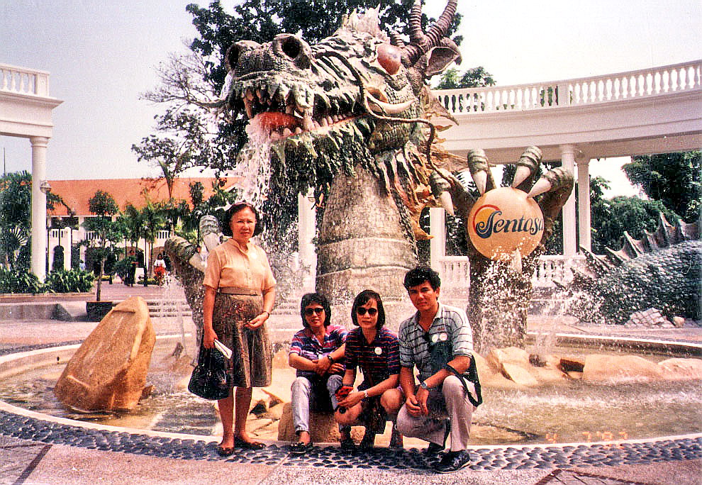
After our Pioneers of Singapore/Surrender Chambers Museum tour, we proceeded to Underwater World, Asia’s largest tropical oceanarium located on the western part of Sentosa.  Opened in 1991, this underground living museum has more than 2,500 marine and freshwater animals of 250 species from different regions of the world. Here, we befriended American couple William (Bill) and Ellen Smith.

Underwater World – Touch Pool

Upon entering, we encountered the “Touch Pool” where I got to feel starfishes, sea cucumbers, turtles and more. Further on is the Tidal Pool where we saw samples of multi-colored, living coral.

American Couple William (Bill) and Ellen Smith at the Perspex Tunnel

Next, we moved along a submerged, glass-windowed Perspex tunnel via an 83 m. long travelator, practically nose-to-nose with an array of marine life including a coral reef, stingrays, moray eel, turtles, sharks and other fishes and other fishes.

Underwater World – Schooling Fish Display

Enroute to Sentosa Island (Singapore)

After our city tour and lunch, we again availed of another RMG Tours Pte. Ltd. tour, this time to the resort island of Sentosa (S$22 each). We were transported to the Mt. Faber Station where we boarded a 6-pax gondola of the Singapore Cable Car System (actually a bi-cable, detachable-grip gondola lift system), traversing 2 supporting towers and the World Trade Center & Ferry Terminal, to Sentosa.

Mount Faber Cable Car Station

Opened on February 15, 1974, it was the first aerial ropeway system in the world to span a harbor. Traveling the 1,650 m. distance at a speed of 4 m. per second, it took us about 12 mins. to get from Mount Faber to Sentosa, including the short interval at the World Trade Center.

World Trade Center and Ferry Terminal

Opened on February 15, 1974, it was the first aerial ropeway system in the world to span a harbor. Traveling 1,650 m. distance at a speed of 4 m. per second, it took us about 12 mins. to get from Mount Faber to Sentosa, including the short interval at the World Trade Center.

The Mount Faber Station has now been renamed as Jewel Box Station while the World Trade Center was renamed as the HarbourFront Centre in 2000 and its cable car station as the HarbourFront Station.

Sentosa

City Tour – Mt. Faber (Singapore)

View of City From Mount Faber

From Chinatown, we moved out of the city to the 105 m. (344 ft.) Mt. Faber (actually just a hill), the highest point in the southern part of Singapore and a frequent tourist destination.  Located near the Bukit Merah planning area in the Central Region, it overlooks the Telok Blangah area, and the western parts of the Central Area.

Formerly known as Telok Blangah Hill, it was renamed after Capt. Charles Edward Faber of the Madras Engineers.  The hill’s slope includes a tower that is part of the Singapore cable car system.  Here, we had a panoramic view of Singapore Harbor, the Central Business District and, over the  horizon, the islands of the Riau Archipelago of Indonesia.

City Tour – Merlion (Singapore)

After breakfast at the hotel, we left on our city tour ( RMG Tours Pte. Ltd., S$21 each).  A surprise was our first destination – the bustling Serangoon Central Wet Market along Serangoon Rd. (Little India’s main thoroughfare), well stocked with the freshest vegetables, meat, fish, spices, etc.  and surprisingly fly-free.

Merlion Park

From Serangoon Rd. we made a short photo-op stopover at Merlion Park which houses the 8.6 m. high, 70-ton statue of the merlion, a mythical creature with the body of a fish and the head of a lion. The statue, made from November 1971 to August 1972 by the late Singapore sculptor Lim Nag Seng, was installed on September 15, 1972 at the mouth of the Singapore River, with the Anderson Bridge as its background.

In 1997, the completion of the Esplanade Bridge blocked the views of the Merlion from the Marina Bay waterfront.By then, its original location was also no longer the entrance of Singapore River. In 2002, the statue and its cub were relocated, from April 23-25, 2002, 120 m., to the current Merlion Park, fronting Marina Bay, where it stands on a newly reclaimed promontory in front of the Fullerton Hotel.

Indonesia: Batam Island

Mom and I finally arrived at Finger Pier, at the end of Prince Edward Rd., and I got us fast ferry tickets (S$28 round trip).  Ferries for Sekupang Pier, the main entry point in the 715 sq. km. Batam Island, leave every half hour.

Later in the year, the regional ferry operation at Finger Pier was relocated to the S$50 million International Passenger Terminal (IPT) at the Harbourfront Cruise Centre (formerly World Trade Center).

On Board the Fast Ferry Sea Flyte of Dino Shipping Pte. Ltd

We left on board Dino Shipping Pte. Ltd.’s streamlined and airconditioned  Sea Flyte, leaving the pier by 3:40 PM.  The trip took a little over 30 mins. and was uneventful. Along the way, we weaved through Singapore’s southern islands, most of which are small and uninhabited. We docked at Batam Island’s Sekupang Pier by 4:15PM.

Sekupang Pier, Batam Island

After securing our arrival clearance at the Batam Customs & Immigration Area, I hired the services of a local taxi driver to tour us around the island.  Batam Island, a duty-free island, is about two-thirds the size of Singapore and is an economic development zone of Indonesia with emphasis on tourist development. Nagoya City, formerly known as Lubuk Baja which means “Pirates Waterhole,” has shops that offer local handicrafts and Asian food delicacies.

Nagoya City

Beginning in the 1970s, the island underwent a major transformation, from a largely forested area, into a major harbor and industrial zone. During our tour, land was being cleared for new roads and many factories, many operated by Singaporean companies, were being built. Evidently, with its lower labor costs and special government incentives, the island’s economy benefits from being close to Singapore.

However, we weren’t shown any old government buildings, mosques, churches or temples as there didn’t seem to be any.  After our tour, our taxi driver brought us back to Sekupang Pier where we again boarded our fast ferry back to Finger Pier, arriving there by 10 PM. Upon arrival, we had a late dinner at a Burger King outlet before returning to our hotel.

Johor Bahru (Malaysia)

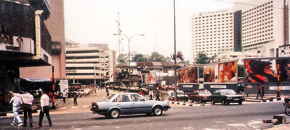
Upon reaching the Malaysian side, I cleared my entry to Johor Bahru at the Malaysia Customs and Immigration Office. Once past, I found myself along Jalan Tun Abdul Razak.  Here, a fenced historical marker with a plaque tells the story of the town.

Johor Bahru Historical Marker

Johor Bahru has a rich history that dates as early as the 16th century but its urbanization began in 1855. Sultan Abu Bakar (1862-1895), the 21st Sultan of Johor, transformed Johor Bahru from a fishing village into a thriving city.

Johor Bahru

Jalan Tun Abdul Razak and the adjoining  Jalan Trus has a number of shophouses, mostly built in the 1920’s,with great heritage value. Here, traders from Arab, India and China used to come to trade spices and tobacco. Also along Jalan Tun Abdul Razak is the Johor Bahru Railway Station.

On October 10, 2010, the spanking new JB Sentral railway station, along Jalan Tun Abdul Razak and Jalan Jim Quee, was opened. The old train station, located just 200 m. south of JB Sentral, has been decommissioned, its platform 2 and its tracks dismantled.  Only one track and platform remain.  There are plans for it to be preserved for a future Mini Railway Museum for the Southern Region.

Johor Bahru Railway Station

The relatively old Plaza Kotaraya shopping center, along Jalan Trus, is only 5 minutes walk from the Malaysia Customs and Immigration Office.  Across the street is the Arulmigu Sri Raja Mariamman Devasthanam Hindu Temple.  Built in 1922, it is one of the town’s oldest Hindu temples and has an impressive gopuram (entrance tower).

The Arulmigu Sri Raja Mariamman Devasthanam Hindu Temple was rebuilt and was officially reopened in 1996. In 2009, the temple was embellished with an impressive mosaic of 300,000 pieces of red, blue, yellow, green, purple and white glass (completed in October 2009) and, on May 12, 2010, the temple was listed in the Malaysian Book of Records as the first and only glass temple in the nation.

Arulmigu Sri Raja Mariamman Devasthanam Hindu Temple and Plaza Kotaraya Shopping Center

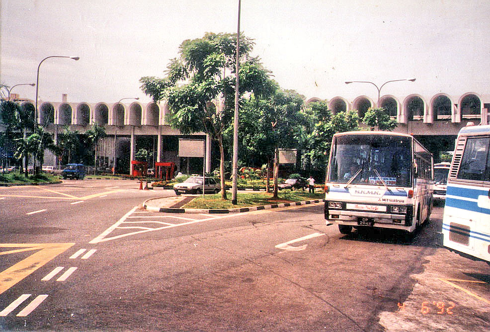
After this relatively short walking tour of Johor Bahru, I retraced my steps back to the Malaysia Customs and Immigration Office to clear my departure and, this time, took a bus back to the Queen Street Bus Terminal in Singapore.

Arulmigu Sri Raja Mariamman Devasthanam Hindu Temple: 22 Lorong 1, Jalan Tebrau, Johor Bahru, Malaysia.

The Causeway (Singapore)

Singapore Customs and Immigration Office

Upon arrival at the Queen St. Bus Terminal, I took the SBS (Singapore Bus Service) Transit’s service 170.  These public buses provide one of the cheapest and most reliable form of transport directly into the heart of Johor Bahru, across the causeway over the Straits of Johor, from Singapore. The Johor-Singapore Causeway, completed in 1923 after 4 years of construction, was partially destroyed in 1942 during World War II, to prevent the Japanese army from invading Singapore. However, it was rebuilt once the Japanese had captured the island.

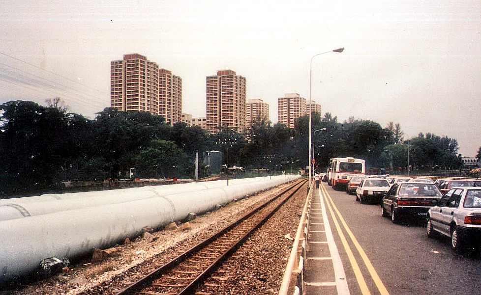
Huge Water Pipes, Railway Track as well as Roads Line the Johor-Singapore Causeway

Very popular but terminally congested, the causeway is crossed by buses, trains, taxis and cars and is normally jam-packed on Friday evenings (towards Malaysia) and Sunday evenings (towards Singapore).  However, it was the Qing Ning holiday (similar to our All Saints Day) and the bus queue was very long going to Johor. Seeing the traffic, I decided to alight from the bus and just walked towards the Singapore Customs & Immigration Office at Woodlands for the necessary departure clearance.

A second crossing, between Johor Bahru and western Singapore, was open on January 2, 1998. Known as the Tuas Second Link, it is much faster and less congested than the Causeway and  is used by some of the luxury bus services to Kuala Lumpur.

Traffic Along the Johor-Singapore Causeway

I also decided to just walk the whole 1 km. length of the Causeway to the Malaysian side.  It seems I was the only one doing so. Along the way, I noticed, aside from the huge traffic jam, the huge water pipes as well as the railway track between the two sides of the Causeway. I was dripping with sweat by the time I reached the other side.

In December 2008, immediately after the opening of the new Johor Bahru CIQ complex, crossing the Causeway, on foot, from Singapore to Johor Bahru was officially forbidden by the Singapore authorities. Once you have cleared Singapore immigration at the Woodlands Checkpoint, you have to take any of the public or private buses waiting at the bus bays downstairs to cross the Causeway. There is always a Singapore police officer stationed at the staircase entrance to the Causeway to prevent anyone from crossing the Causeway on foot.

Malaysia Customs and Immigration Office