Good Friday in Sagada (Mountain Province)

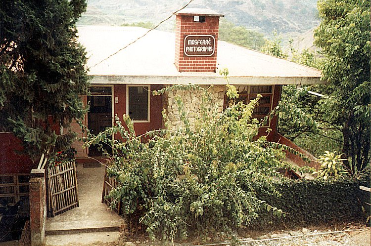
Good Friday, our last whole day in Sagada, was partly spent in prayer.  Together with my Danum Lake companions who were also staying in my inn, we made our way past the school gate and up some steps to the cemetery where Eduardo Masferre, the famous photographer (June 24, 1995), and William Henry Scott (1993), are buried.  It has a view of the northern valley.  Further up is Calvary, the highest point in the town cemetery which is marked with a huge cross.  Here, we visited and prayed at its 14 Stations of the Cross.
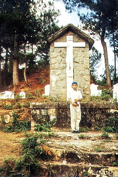
Sagada Cemetery

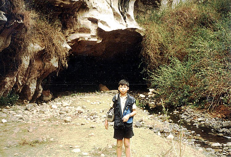
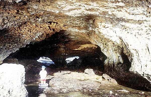
From the cemetery, a steep path took us to Echo Valley.  Halfway down, we viewed hanging coffins on large, gray limestone cliffs at the opposite side and some small burial caves.  There are still a few sangadil (“death chairs”) next to the hanging coffins, placed there for the spirits to rest on.

Hanging coffins

When a Sagadan nears old age, he is given the choice of cave burial or “hanging coffins.”  The deceased is cladded in special burial attire woven by a widow in the village.  This ensures that the spirit (anito) community would recognize them and admit them to the spirit world.

They are bound to a sangadil (death chair) and placed on the house porch for the duration of the long makibaya-o (wake period).  During the makibaya-o, pigs are sacrificed, dirges are sung and eulogies given during the all-night vigils.

The empty coffin is first taken to the burial site (cave or rock ledges).  The funeral procession follows later, preceded by torchbearers who make sure that no animals crosses its path.  When bad omens are encountered, the previously selected burial site could be changed at the last moment in the belief that the new arrival is not welcomed by the present occupants.

The deceased’s body is borne by young lads who vie with one another for the honor of carrying it the furthest distance.  In doing so, it is believed that he would gain much strength and wisdom from the deceased.  Today, these traditional rites are still being practiced, although on a smaller or revised scale, and still requested by some old people.

However, most are now buried on family land or at the Christian cemetery. The makibaya-o, whether traditional, Christian or in combination, is still significant in adult deaths.

The next day, Saturday, after breakfast at the inn, Jandy and I left Sagada on the 10 AM jeepney bound for Bontoc.

Hiking along Bontoc Road (Sagada, Mountain Province)

We spent the whole afternoon hiking along Bontoc Road. On both sides of the road is the 34-hectare Mission Compound.  It includes St. Theodore’s Hospital (established in 1926), the Rectory, the recently restored Doctor’s Residence, the Girl’s Dormitory (established in 1912) and residence  of American historian William Henry Scott. Across St. Theodore’s Hospital  is the DOT accredited and Episcopalian parish-operated St. Joseph’s Resthouse. Further out along Bontoc Road, on the left, is Sagada Weaving & Souvenir Shop.  Established  in 1978, it produces quality products hand-woven on backstrap looms and supervised by Mrs. Andrea Bondad and daughter Rhoda.  Finished products sold at reasonable prices include backpacks, shoulder bags, tapis (Igorot skirts), wallets and blankets.

Masferre Photographs

Further out along Bontoc Road, at the Bagaan Road Junction, is the Masferre Gallery.  Here, Mrs. Nena Masferre, wife of the late photographer Eduardo Masferre, welcomed us.  In the 1930s, 40s and 50s, through his pioneering skill and sensitivity as a photographer, Eduardo took photographs of the vanishing life and culture in the villages of Mountain Province. Mrs. Masferre showed us the black and white photographs taken by her husband and a few maps and artifacts.

Eduardo, a Spanish mestizo, was born on April 18, 1909, the second of eight children.  He was the son of Jaime P. Masferre, a retired Spanish soldier from Cataluna, who settled in Sagada at the turn of the century, became a coffee farmer, married an Kankanai woman (Mercedes Cunyap Langkew), joined the Episcopal Church and became a minister.  From 1914 to 1921, Eduardo first lived with his family in Spain where he began his education.  After completing his schooling in the Philippines, he became a missionary teacher like his father and then a missionary administrator.  In addition, he took up farming.

In the 1920s, he learned photography from U.S. missionaries.  Returning to photography in 1934, his artistic focus were the mountain people of the Cordilleras with whom he shares part of his heritage.  After World War II, he opened a photographic studio in Bontoc.  In 1951, he married Nena Ogues, a nurse from Kapangan.  The union produced six children.

His grainy, high contrast monochrome photos are displayed here and around the world.  His first exhibit was held in Manila in 1982.  After a second Manila exhibit the following year, his work traveled to Copenhagen (1984) and Tokyo (1986).  In 1988, his third Manila exhibit was mounted.  A book of his work, “E. Masferre: People of the Philippine Cordillera” was also produced.  Mobil Philippines funded the work, provided 1,500 copies to Philippine schools, museums and libraries, and funded the touring exhibit of his works to the cities of Baguio, Cebu, Cagayan de Oro, Davao and Bacolod.

In 1989, Masferre exhibited his works at Les Recontres International de la Photographie in Arles (France), the only Filipino to be accorded such an honor.  In 1990, again with Mobil support, the Smithsonian Institute of Washington D.C. purchased 120 of his impressive original photos and exhibited them for six months at the main rotunda of the American National Museum of Natural History.  They are now carefully archived in the same museum.  He died on June 24, 1995 at the age of 86.

Jandy with Ms. Nena Masferre

Plodding on, we reached a bend opposite the Rocky Valley Inn.  Here, a path lead down to the small Matangkib Burial Cave. However, it was closed due to the recent death of a hapless Irish tourist who slipped and broke his head.  Coffins here are carefully stacked. At  the lower end of the path, to the left of Matangkib burial cave, is the unmistakable mouth of the Latang Underground River.  We didn’t bring along a good flashlight and weren’t prepared for a 15-min./500-m. spelunking hike through  cold, knee-deep waters and a scramble over rocks.  It was late in the day and we made our way back to the inn.

Latang Underground River

The night was chilly and foggy.  Tourists from Manila were beginning to arrive, all looking for places to stay and most without any success.  Even St. Theodore’s hospital beds were rented out (barring any emergencies) for PhP45 per head.  Others camped out on the Mission grounds while others just slept in their vehicles.  Poor fellows.  Sagada has a reputation as a meeting place for travelers and I also made a number of friends during my stay.  Many were guests staying at the inn while the others I met were straying in the town’s  different coffee shops.

Arrival in Sagada (Mountain Province)

Sagada

We arrived at Sagada by 4 PM. Upon our arrival at the bus terminal near the municipal hall, Jandy and I checked in at one of the 5 double rooms with common bath at the second floor of nearby Ganduyan Inn, managed by Hanzel and Marina Biag. The inn was strategically located as it was just across the bus terminal and the municipal hall.  Rate was a very cheap PhP75 per person per day. The inn also had a restaurant.  According to Marina, her husband, as well as a significant portion of Sagada’s population, are descendants of Biag, a folk hero of the Igorots  and the most important figure in Sagada’s history.  Biag introduced new rites, prayers and customs.

Ganduyan Inn

As it was late in the afternoon, we decided to just visit the nearby Episcopal Church of St. Mary the Virgin.  Along the winding, pine needle-paved cement lane, to the  right of the basketball court, is this massive, gray stone Anglican church,  originally built under the direction of Reverend John Staunton and consecrated on December 8, 1921.  It was  badly damaged (especially the belfry) by U.S. bombing raids during World War II and later repaired.  The oldest church in the Cordilleras outside of Baguio City, its foreign architectural design is fused with indigenous motifs.  Further down is the 30-hectare St. Mary’s High School.  Founded in 1912, it was destroyed in World War II, rebuilt in 1950, destroyed by fire in 1975 and reopened in 1983.

Episcopal Church of St. Mary the Virgin

After this short tour we returned to the inn for supper at its coffee shop.   Food in Sagada is really cheap and the servings humongous.  Noteworthy is its tasty native red rice (kintuman), mountain tea and its aromatic and strong Arabian coffee, locally-grown, grounded and roasted.

Sagada Municipal Hall

The Road to Sagada (Mountain Province)

From Baguio City, we left for Sagada around 9:30 AM, Tuesday, April 7, on board an ordinary Lizardo Transit bus from the Dangwa Tranco terminal, off  Magsaysay Ave..  Once outside Baguio City, my mobile phone became useless.   The 151-km. trip from Baguio City to Sagada passes through the spectacular 146-km. Halsema (named  after Engr. Eusebius Julius Halsema, American civil engineer and mayor of Baguio City, 1920-36) Mountain Highway. It was originally a foot trail used by mountain folk and was improved and widened by the Americans. The highest highway system in the country, it was formerly called the “Mountain Trail” and it links La Trinidad and Baguio City with Bontoc.  It took more than 15 years to build and was finished in 1936.

View of dried up rice terraces

The trip took all of 7 hrs. (including stops for lunch and snacks) as we cut through mountain peaks, gorges and  steep cliffs, cross deep ravines and skirted dangerous slopes.  It could have been shorter but more than half of the drive was over rough, dusty and unpaved roads.  Jandy had a case of biyahilo (travel dizziness) and threw up.  Some sections were so narrow that only one vehicle could pass at a time. A narrow section over one treacherous gorge was simply breathtaking (but I was afraid to look out the window).   It was the peak of the El Nino phenomena and a number of the terraces were dry.  Smoke from some small forest fires could also be seen in the distance. Still the drive was scenic all the way as we passed through some of the most spectacular mountain vistas found anywhere. We also passed the highest point of all Philippine highways  – at Km. 50 near Bayangan,  2,225 m. above sea level.  Here, where the road crosses 2,450-m. high Mt. Paoay, we had good views  of Mt. Pulog, Kabayan, Atok and the Agno Valley.  Too bad we didn’t  stop.   

Tops Lookout (Cebu City, Cebu)

After breakfast at the Zodiac Restaurant at the hotel, Grace, Jandy, Cheska and I joined Grace’s fellow EGI employees who were going, via van, to the popular Tops Lookout (better known as “Tops”), a must-visit viewpoint situated 2,000 ft. (610 m.) atop Busay Hill. On our long drive up the hill’s steep, winding road, we passed by Cebu Plaza Hotel where Grace and I stayed over a decade ago for our honeymoon. 

Tops Lookout

About 4 kms. past the hotel, we finally reached Tops and paid the required parking fee and admission fee for each of us.  This modernist, fortress-like and well-maintained viewpoint has kiosks where we could buy snacks and drinks; toilet facilities and benches where we could sit and have a breathtaking, panoramic view of Cebu City, Mactan and Olango Islands and Bohol in the  background.

Our breathtaking view

It was very windy and a bit chilly while we were there.  Other ideal times for a visit are during sunrise or sunset up to the wee hours of evening when you can see the city basking in lights.

Tops Lookout: Brgy. Malubog, Busay, Cebu City, Cebu. Admission: PhP100/pax

San Juanico Bridge (Tacloban City, Leyte)

After breakfast at the Filamor Residence, Grace, Jandy, Cheska and I, together with Manny, Paula, Mark, Nenette, Daddy, Mommy and Cheska’s new friend Kookie Bal left for our tour of Tacloban City.  We secured the services of a guide and a van at the Department of Tourism Region 8 office.  Our first destination was to be the San Juanico Bridge, the longest bridge in the country as well as Southeast Asia.   At the foot of the San Juanico Bridge is the 15-hectare, Japanese-funded multi-million peso National Maritime Polytechnic, a  merchant marine training school and the most modern graduate institution for seamen in Asia.  

Posing along the San Juanico Bridge
 
We finally made our way midway up the bridge and made a short stopover.  Here, we had a panoramic view of the San Juanico Strait, located between the islands of Leyte and Samar.  It is considered the narrowest but most navigable strait in the world.   The strait has a number of beautiful islets.     The San Juanico Bridge, which crosses this strait, is also called the Marcos Bridge.  Inaugurated on July 2, 1973 and located 10 kms. from Tacloban City, it is a major link in the 3,000-km. Pan-Philippine Highway.  
 
San Juanico Strait
 
This impressive S-shaped bridge, said to be the most beautifully designed bridge in the country, is 2,162.4 m. (7,092 ft.) long, 10.62 m. wide with 43 spans and towers 41 m. above the sea at its highest point.    The S-shaped structure on the Samar side had to be adopted to make use of the importance of the existing islet, the Cabalauan islet that lies in the middle of the strait.  This islet serves as resting point and provides added support to the massive structure soaring over the swift currents of the strait.

Daliran Cave and Roca Encantada (Buenavista, Guimaras)

Daliran Cave and Spring

Our next stopover (3:30 PM) was at the Villa Fe Summer Resort, in Brgy. Old Poblacion, Buenavista, a 5-min. hike from the wharf.  Frank and his family, together with a local guide, decided to go spelunking and explore the resort’s  Daliran Cave, the most accessible cave in Guimaras, and its cold fresh water spring and stalactites.  The rest, including me and my family, just waited outside.  Inside, they got down and dirty with guano (bat droppings) as they communed with its denizens of the dark.   Yuck!

Posing outside Roca Encantada

Our final sightseeing stop (5 PM) was Roca Encantada (Enchanted Rock), the summer vacation home of the Lopez family, one of the oldest grand clans of Iloilo and Guimaras. Emily Relucio Lopez was Guimaras’ first governor. We were allowed entry by the caretaker.

The grand balcony of Roca Encantada

The mansion, accessed by a long flight of stairs, was built in 1910 by Presentacion Hofilena-Lopez on a promontory on one of 7 picturesque rock islets of the Siete Pecados (Seven Sins) Islands, in Brgy. Getulio. From its grand, spacious and airy balcony, we got a panoramic view of the beachfront, the Iloilo Strait and the 6 remaining islands. A lighthouse is situated on the largest islet.

Presenting the Siete Pecados

The Trappist Abbey (Jordan, Guimaras)

Trappist Monastery chapel

After lunch at the resort, we all availed of an afternoon sightseeing tour by jeepney.  Our first stop (2 PM) was the Trappist Abbey.  It was founded in 1972 and is the first and only one of its kind in the country and in the Orient.  The Trappist (or Cisterians of the Most Strict Observance) monks, who called Guimaras the “Island of a Happy Man,” follow the rules of St. Benedict and all adhere to a vow of silence. They take care of the Aeta community through the Contemplative Outreach Program, grow Philippine lemon (kalamansi) and pioneer fruit processing in the province.   

The Gift Shop

We dropped by the monastery’s Gift Shop where religious items (crucifixes, prayer books, rosaries, etc.) and excellent processed food products such  as jam, chutney, prunes, wines, marmalade, candies, ginger tea, cookies, piyaya and jelly (all made from mango, cashew, kamias, duhat, kalamansi and guava) are sold.  Grace bought a small crucifix.  We also bought some snacks and soft drinks.  Grace, Jandy, Cheska and I also visited its small but quaint chapel.  At the side of the walkway leading to the chapel are an array of 3 small bells.

An array of small bells

Trappist Abbey: Brgy.  San Miguel, Jordan, Guimaras. Fax: (033) 581-3468.

Exploring Guimaras on Foot

After lunch at the resort’s clubhouse, Jandy and I made a 20-min. hike, along well-marked concrete and dirt trails, past fishponds and Villa Igang, to sea-sculpted Igang Cave in Igang Bay.  From a small opening, we waded its cool, crystal-clear and waist-deep waters, and emerged inside a large chamber with a rock platform with a great view of some islets and the western sky, where the sun sets.  Taking a photo of the magnificent sunset and these islets, silhouetted by the cave’s opening, would have been a great shot.  Too bad, I couldn’t wait for it.     

Villa Igang
Jandy at Igang Cave
The late afternoon of the next day, Good Friday, Jandy and I hiked to Sacred Heart Hill (with its huge statue of Jesus Christ) as well as tried the alternative route to Igang Bay via a 30-min. crossing, over the murky waters of a mangrove forest, of a long and winding bamboo bridge where we observed, up close, these huge trees that are so essential for protecting marine life.   

Sacred Heart Hill

Also that day, the town was presenting the Ang Pagtaltal (meaning “to remove”), the Visayan version of the Oberammergau (South Bavaria, Germany) passion play whose final act is the scene where  Jesus is taken off the cross and laid on his Mother’s lap.  Too bad we didn’t watch it.

Calauit Island Game Reserve and Wildlife Sanctuary (Busuanga, Palawan)

Calauit Island

After my trial dive,  we booked ourselves on an optional half-day tour of Calauit Island Game Reserve and Wildlife Sanctuary, located just off Busuanga Island’s northwestern coast and opened to tourists since 1985.  Cost, including permit and boat ride,  was to set us back US$30 per person.  We left right after lunch at the resort.

An eland

This 3,700-hectare, DENR-administered Strict Nature Reserve was, in response to an appeal made by the International Union of Conservation of Nature (IUCN), was established as a repository for 108 African animals endangered by the 1977 drought and Kenya’s civil war on August 1976 by virtue of Presidential Proclamation No. 1578 issued by the late Pres. Ferdinand Marcos.  Its original 250 island families were relocated, 40 kms. away, to Halsey Island and compensated with land titles.  Since 1994, it was managed by the Office of Palawan Council for Sustainable Development, a  government body dealing with environmental issues in Palawan.

On our way to Calauit

We, together with other resort guests, left the resort by 1 PM on the resort’s motorized outrigger boat.  The trip took about 45 mins.  Upon arrival, we first logged in at the sanctuary’s office.  Then, accompanied by a guide, we ushered to the back of the sanctuary’s only “safari” vehicle, a converted 6 x 6 truck which resembled a huge open cage.  From our slow-moving and somewhat dilapidated truck, we got up close and personal with these herbivores as some fed near the road we were traveling while zebras grazed under shading trees.  Bushbucks (Tragelaphus sylvaticus), Grévy’s zebra (Equus grevyi), Common Eland (Taurotragus oryx), Topi (Damaliscus lunatus jimela), Impala (Aepyceros melampus), Thomson’s gazelle (Eudorcas thomsonii),  Reticulated Giraffe (Giraffa camelopardalis reticulata) and Waterbuck (Kobus ellipsiprymnus) can be seen, in pairs or in groups, as they feed or gracefully gallop at the sign of our presence.

A short necked giraffe

Graceful giraffes, with their somewhat shorter necks (maybe because trees here are shorter), were unmindful of our presence as they continued  feasting on the branches of their favorite acacia trees.  Our vehicle halted when these tall “jaywalkers” crossed the road.  Others stayed put for a short while as if purposely posing for our cameras.   Too bad we weren’t able to bond or interact with the giraffes by feeding them (it is discouraged), truly a highlight of any trip to the sanctuary.  Such an experience would probably  come second to swimming beside a whale shark or butanding off Donsol (Sorsogon).

Zebras in the wild

From the original 108 African animals brought here in 1977, 3 or 4 generations of offspring have increased the animal population to 570  heads comprising 8 species, all herbivorous.  At the time of our visit, there were now 43 giraffes, 155 impalas, two Thompson gazelles, 122 water bucks, 78 zebras, 50 elands, 14 topis and 16 bushbucks. Together with indigenous animals, they range freely around the island in an environment that loosely approximates their original environment.

The Palawan bearcat

The guided tour includes stops at pens holding many of Palawan’s indigenous species.  The sanctuary has saved from extinction, by  successfully breeding in captivity, the foot-high The Philippine mouse-deer (Tragulus nigricans) or pilanduk, the smallest hoofed animal found in Asia; the largely nocturnal and endangered Calamian Deer (Hyelaphus calamianensis)  and the Philippine reshwater crocodile (Crocodylus mindorensis) which now lives along the mangrove swamps.  Also bred in captivity are the Palawan bearcat or Binturong (Arctictis binturong), Palawan bearded pig (Sus ahoenobarbus), tarsier or mago (Tarsius philippensis), scaly anteater or balintong (Manis javanica), leopard cat or maral (Felis bengalensis), Philippine porcupine (Hystrix pumila) or landak/duryan  and monitor lizard (Varanus salvator).  I had a very close encounter with a forever hungry binturong.  Too close, in fact, that he snarled when I tried to feed him a banana.

An encounter with a snarling bearcat

There are also over 120 species of birds, endemic and transient and, as a boon to birdwatching enthusiasts, the personnel here are quite capable of identifying these birds.  There are also protected rearing and egg-laying areas for giant sea turtles or pawikan (Chelonia mydas). The project also includes a 7-km. marine sanctuary which protects the highly endangered 16-20 dugongs or sea cows (Dugong dugon) that feed along the offshore sea grass beds, and  7 species of clams including what is believed to be the largest live giant clam shell (Tridacna gigas) in the world which weighs as much as 300 kgs..  As fishing is prohibited, commercial fishes, crabs and lobsters now breed here in undisturbed .  The coral reefs around the island have shown a 75% recovery rate.