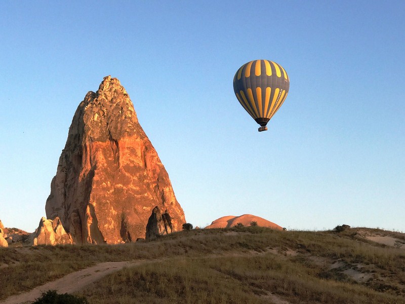
Hot-air balloon beside a stone spire
The thrilling Hot-Air Balloon Ride of Cappadocia, one of the best ways to discover and explore this rugged, historical region in east-Central Anatolia in the Asian part of Turkey, is a must-do if you are in the area. Here, we were to see scenic Cappadocia like you’ve never seen it before, through this once-in-a-lifetime, 1.5 hour-long flight on board a colorful hot air balloon. To do this, we had to stay at least a night in Cappadocia (the balloon ride starts very early in the morning, before sunrise), staying at the Solem Cave Suites (in the province of Nevsehir), on top of a hill, with its stunning views of cave houses. From Istanbul, it was a one hour and 20 min. flight, via Turkish Airlines, to Kayseri Erkilet Airport, our gateway to Cappadocia.
Check out “Hotel and Inn Review: Solem Cave Suites” and “Kayseri Erkilet Airport”
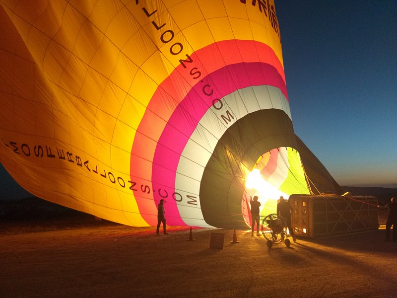
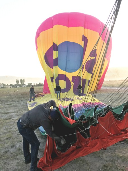
Inflating the hot air balloon……
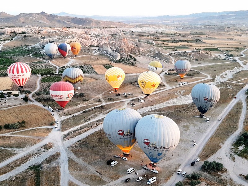
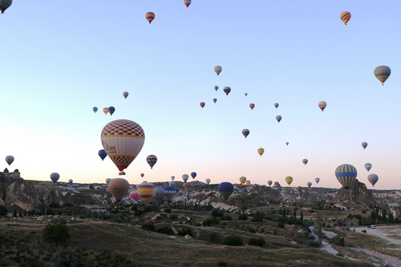
This has been planted firmly at the top of my bucket list ever since I saw photos of the magical Cappadocian landscape topped with a sky filled with colorful hot air balloons. The most popular location in the world for hot air ballooning, last year, over half of the world’s balloon trips took place in the Cappadocia region, with almost half a million people taking to the skies.
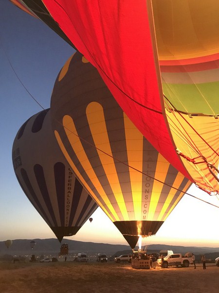
Hot air balloons now ready to take flight…..
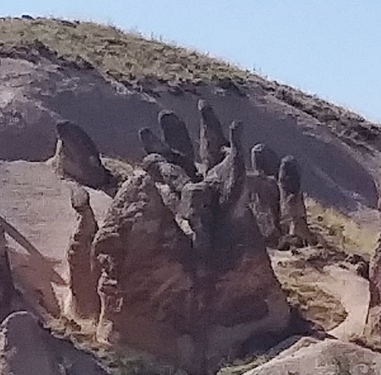
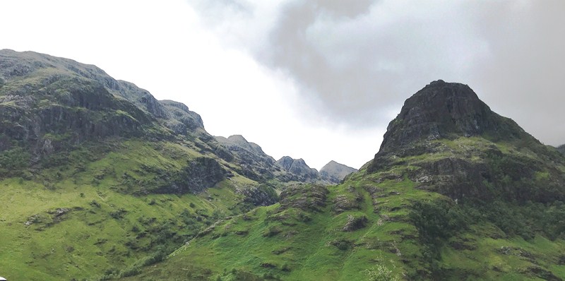
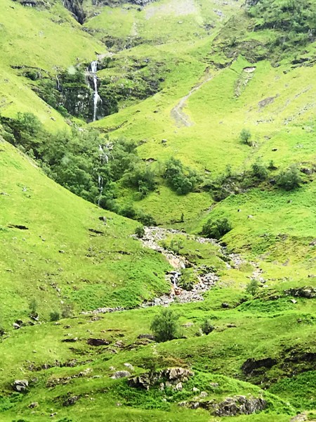
Cappadocia has an amazing and spectacular landscape of cave-like dwellings, the animal rock formations of Devrent Valley, fairy chimneys, towns such as Mustafapasa, and the rock-hewn, domed churches dating back to the Byzantine post-Iconoclastic Period, as far back as 4th century, all sculpted by erosion over thousands of years. Today, what is left are these amazing troglodyte villages, underground cities that once contained human habitat and beautiful valleys that go for as far as the eye can see.
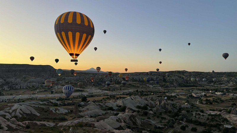
Balloons about to take off
Cappadocia is also one of the few places in the world you can soar in a balloon almost all year round, with trips running during boiling hot summers and snowy winters (when the whole area is covered in a thick layer of snow), with the landscape looking incredible in both. For our hot-air balloon flight, we chose Atmosfer Balloon. Based in Avanos town and under Dorak Holding, it has been around since 2010 and is Cappadocia’s fourth biggest hot air balloon company.
Balloons now taking to the air….
In the flight zone of Cappadocia, Atmosfer Balloons holds 10 slot rights (7 slots in the first flight period and 3 slots in the second). It currently has a fleet of 18 hot-air balloons (max. flying capacity: 203 passengers) and actively employs 12 commercial pilots , 13 assistant pilots and 50 ground staff.
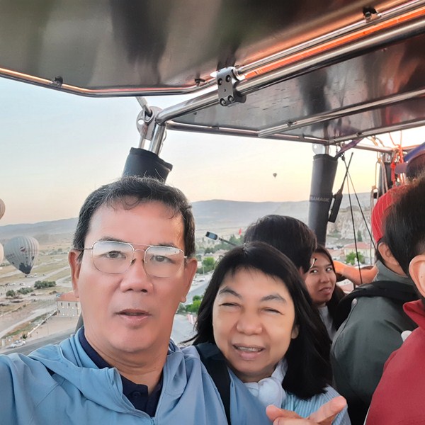
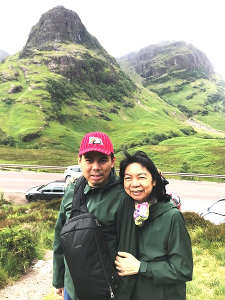
The author and Grace
Early in the morning (3:30 AM), a driver from Atmosfer Balloons picked us up from our hotel, along with other guests from the hotel and the nearby Dere Suites Cappadocia Hotel, and transferred us, via a Mercedes Benz van, to the balloon site.
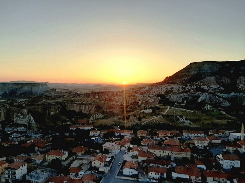
Sunrise over Cappadocia
(photo: Sean Sta. Maria)
During our trip, we stopped by the roadside and were given a light breakfast of pastries and packed drinks while waiting for the decision, by the Directorate General of Civil Aviation (DGCA), on whether it would be safe to fly. When the green flag was given, we set off to the balloon take-off zone, chosen by our pilot, that is appropriate for the latest local weather and wind direction. Since the balloons move in the direction of the wind, they are different from each other every day.
Soaring over the moon-like landscape
At the take-off zone, we watched the stages of balloon preparation and inflation. Our unique Parliament blue and yellow-colored hot air balloon, produced by Spanish Ultra Magic company, one of the leading hot air balloon manufacturers in the world, consisted of a burner system, a basket and an envelope.
Ripstop nylon is the most common material for the envelope, but polyester and other fabrics are also used. The fabric around the lower opening (called the mouth) of the balloon are usually made from a fire resistant material like Nomex, similar to the suits that firefighters wear.
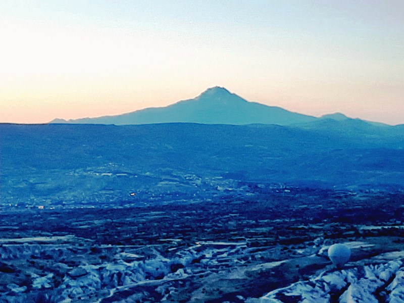
The 3,864 m. high Mount Erciyes, an inactive volcano, is the highest mountain and most voluminous volcano of Central Anatolia
To board the balloon, they lay the woven wicker basket (wicker is used because it is lightweight, flexible and easily repaired). on the side, with deflated balloons lying on their sides, and you crawl in. It was quite a sight to see, up close, the busy balloon staff setting them up, checking them for safety and starting to inflate the balloon (it takes 15 mins.).
Our balloon pilot
Balloons operate through the basic principles of gravity and heat transfer. As the air inside the balloon is heated, it rises and, as the air inside the balloon cools, it descends. To make the balloon fly, an inflator fan fills it with air which is then heated by propane in stainless steel fuel tanks. hot air balloons carry 60 to 110 gallons (120 to 200kg) of propane and use roughly 75% of the fuel during a single flight.
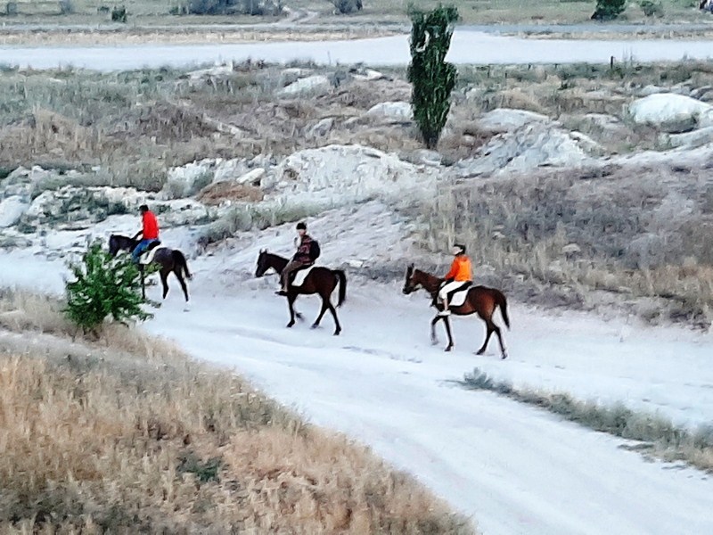
Horseback riders
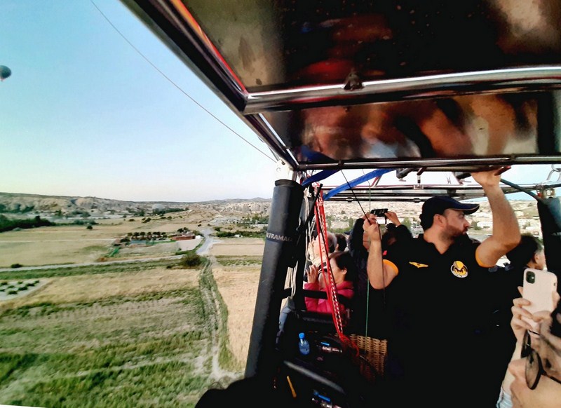
Soon after, it was time to hop into the now upright basket which is split into 5 sections – 4 squares on each side, which each fit 4 people, and a long section, in the center, for our Atmosfer Balloons pilot Yassir and his assistant. Upon boarding our balloon, general information on flight safety and flight is given by Yassir and our flight over Cappadocia began. During flight, the balloons range from 5 m. to 800 m. in altitude. Winds determined our balloon’s direction and Yassir steered our balloon, to a limited extent, by adjusting the balloon’s altitude to make use of different wind speeds and directions.
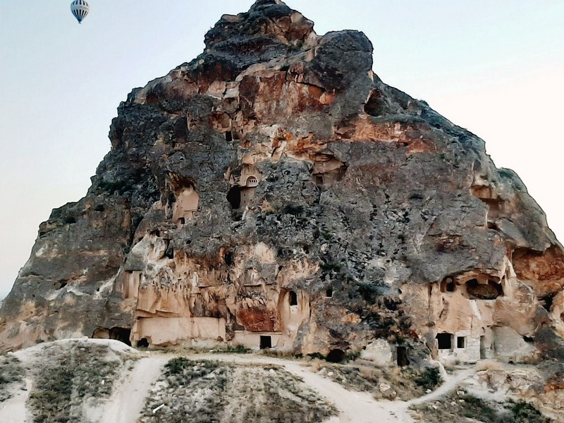
Cave houses
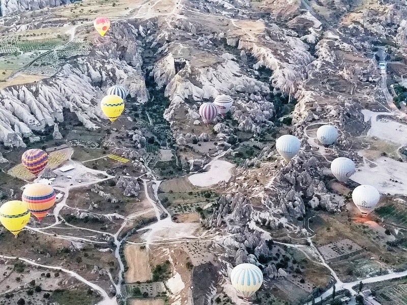
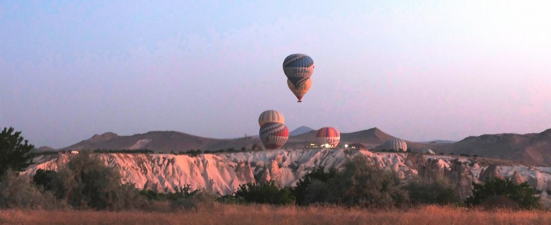
We drifted peacefully, before sunrise, for an extraordinary, amazing and unbelievably breathtaking, 360-degree views of Cappadocia, seeing all its landmarks from above. During our flight, the day was like a fiesta, with the sky filled with around 100 balloons with different colors and designs. We didn’t have to worry though (actually, the view of the other balloons in the sky made it a completely magical experience) as Cappadocia happens to be one of the most highly regulated places, with an excellent safety record.
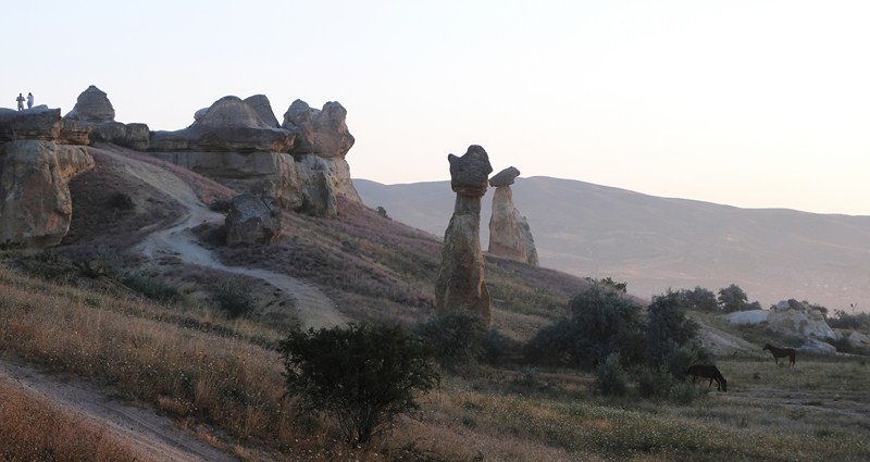
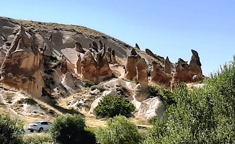
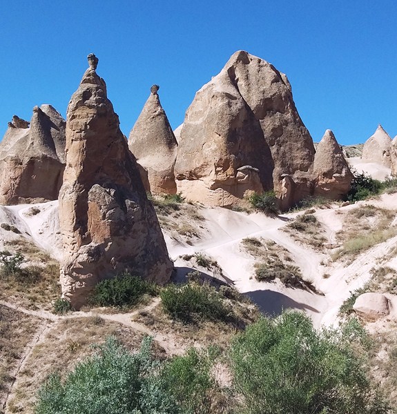
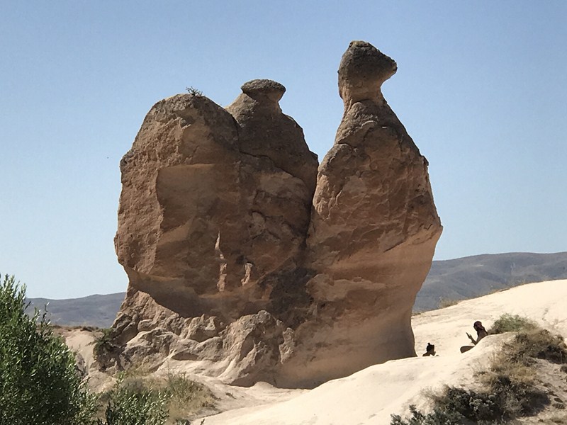
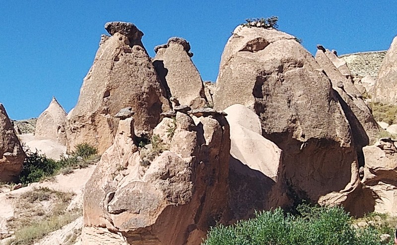
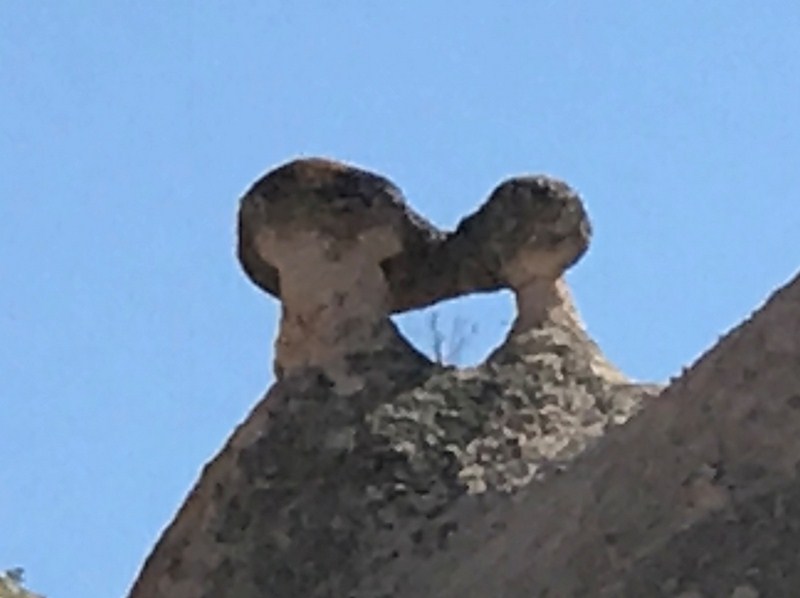
The fairy chimneys of Cappadocia
Our pilot Yassir was very experienced, navigating the incredibly uneven landscape, flying safely so close to other balloons, in an aircraft which only has the ability to go up and down. To fly here, he must train for around 5 times as long as in other parts of the world. While piloting our balloon, he also explained all the sceneries that we saw during the flight.
Our hot air balloon being repacked …..
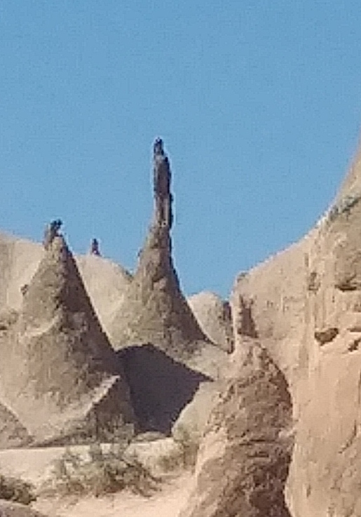
The views, over the next hour or so, were breathtaking and the landscape constantly changing color, as the minutes ticked by, as we drifted through the different areas. We passed the famous Fairy Chimneys (natural yet surreal-looking spires, up to 40 m. tall, that were carved out of soft volcanic rock by the elements over millions of years), Monk’s Valley (Pasabag Valley), the beautiful Devrent Valley (renowned for its surreal and otherworldly landscape which has earned the valley the nickname “Lunar Landscape” or “Moonscape”), pigeon houses, plenty of cave houses and vineyards.
Check out “Fairy Chimneys of Monk’s Valley “ and “Devrent Valley”
From the amazing maximum altitude of about 800 m., the panoramic views of surreal, moon-like landscape of the region was completely mind-blowing while, from the lowest points, we could almost pick fruit from the trees. The motion back to the ground was effortless and we landed precisely near the balloon’s trailer. It took about 15 mins. to deflate the balloon and pack the balloon after flight.
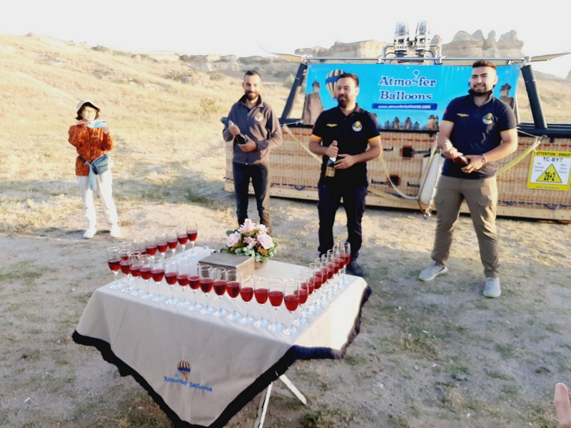
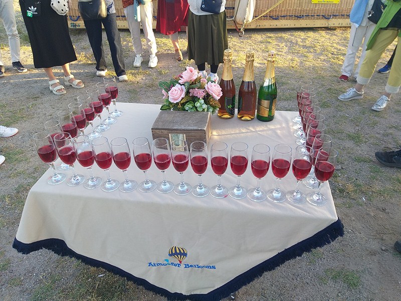
The champagne toasting ceremony
Once back on dry land, we were rewarded with a champagne toasting ceremony (they are also trained in such things as champagne service and flower arrangements) and a personalized flight certificate. Overall, it was a very impressive, professional and truly great, unparalleled and unforgettable experience.
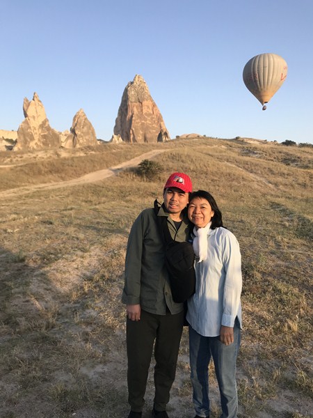
Jandy and Grace back on dry land
Atmosfer Balloons: Cumhuriyet, Göreme Yolu No:1, 50500 Avanos/Nevşehir, Turkey. Tel: +90 384 219 26 43. E-mail: fly@atmosferballoons.com. Website: www.atmosferballoons.com.