Istanbul and the Bosphorus Strait
After a 12 hour, 35 min. long flight from NAIA international Airport (NAIA) Terminal 3, our Turkish Airline (Flight Number TK265) arrived at Istanbul International Airport by 12:30 PM, Sunday, June 16.
Check out “Istanbul International Airport”
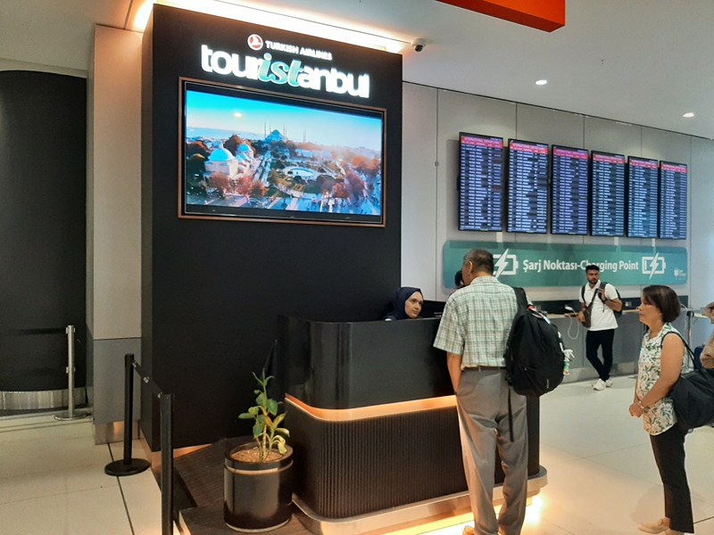
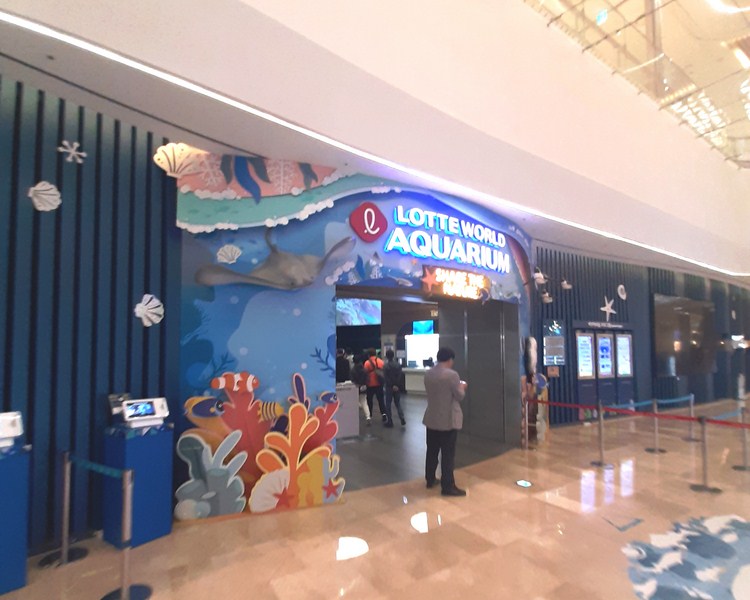
The Touristanbul counter at the Istanbul International Airport
Before visiting Turkey, we obtained an e-visa ($30 per pax) at the www.evisa.gov.tr/ website (check your country’s requirements to see if it is necessary to obtain a visa to enter Turkey). If you are eligible for an e-visa, you may obtain it from the Turkish Airlines Sales / Ticket Desks before or on the day of your departure.
Boarding our Touristanbul bus at the airport
Our connecting international flight to Edinburgh Airport, Scotland was still 18 hours and 45 minutes later so we took advantage of our complimentary Touristanbul service to discover Istanbul, the city that never sleeps, during our layover time. According to the time frame best suited to your flight arrival and departure schedule, we selected the 6:30 PM-11 PM tour, one of the eight carefully arranged and planned tours offered by Touristanbul for those with a layover between six and 24 hours.
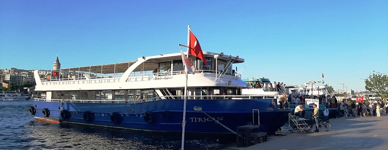
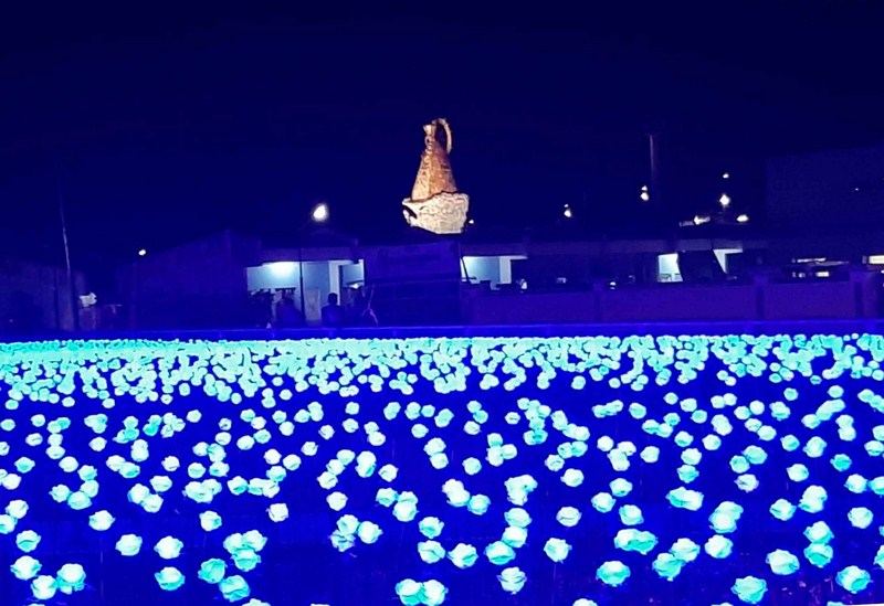
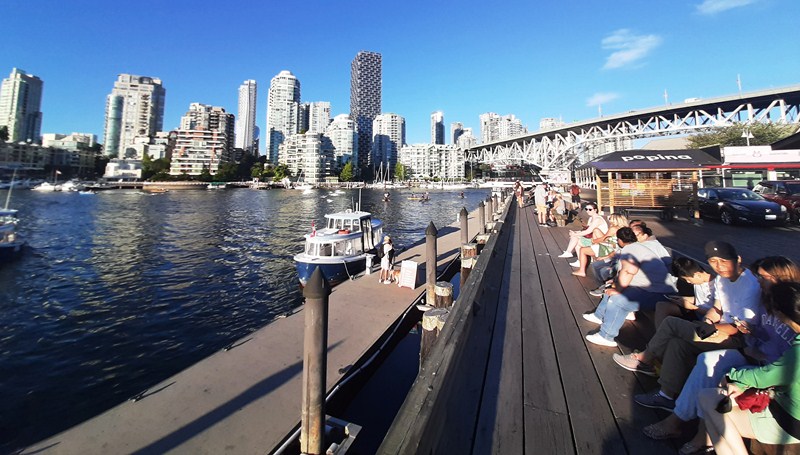
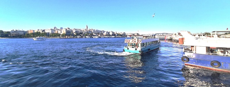
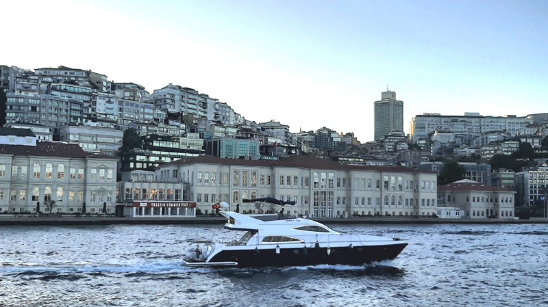
BUDO Eminonu Pier
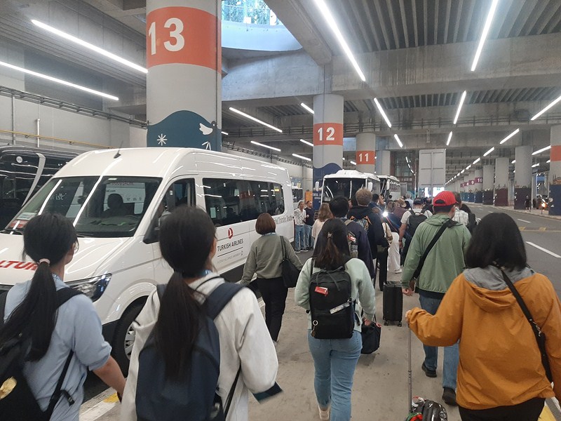
With such an abundance of historical sightseeing spots in Istanbul and too little time to squeeze them all into your short holiday, an unforgettable cruise, between two continents (Asia and Europe) along the 32-km. long Bosphorus Strait (not a river) is probably the most overlooked Istanbul tourist attraction. After our Turkish Airlines connecting international flight landed at İstanbul Airport, we proceeded all the way through into international arrivals (past baggage claim), turned right and walk to the end of the hall to TourIstanbul, opposite of the arrival hall of the Turkish Airlines and opposite the passport control at the Transfer Desk.

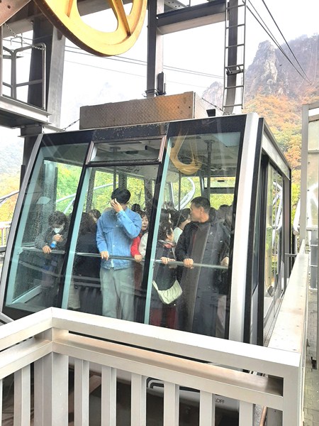
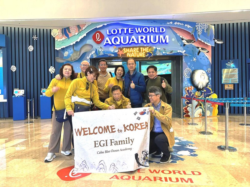
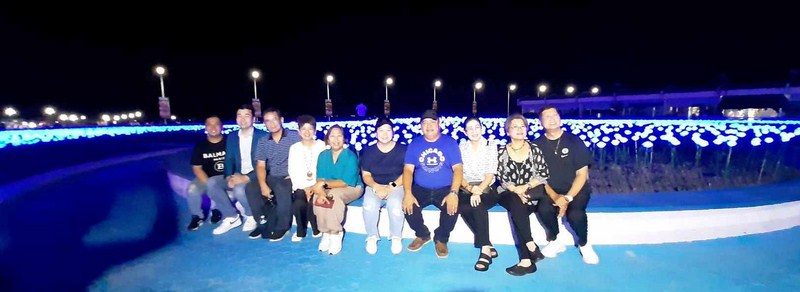
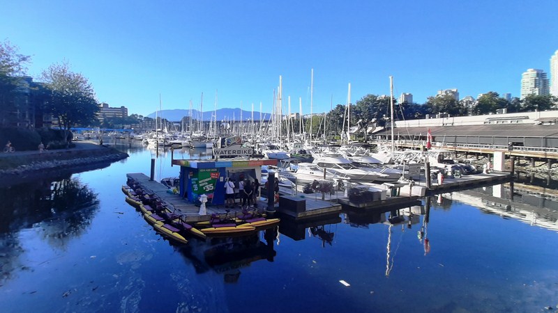
Boarding the Naral Istanbul
Upon arrival, we all signed up for the free Touristanbul tour at the Hotel Desk in the International Arrivals Terminal of İstanbul Airport (you can also sign up at the Touristanbul Desk Office in the Transfer desk area), using our ticket number issued by Turkish Airlines ticket number starting 235, and got a ticket for the queue. Istanbul Airport only provides one-hour free wi-fi to fliers that are in the Departure Area.
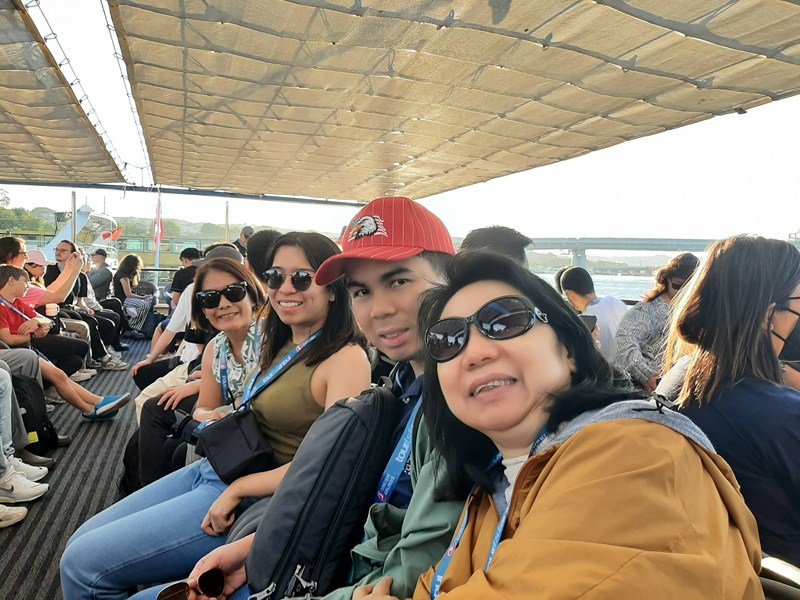
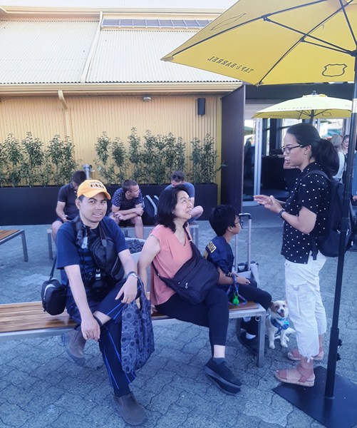
Paula, Selena, Jandy and Grace on board the Naral Istanbul
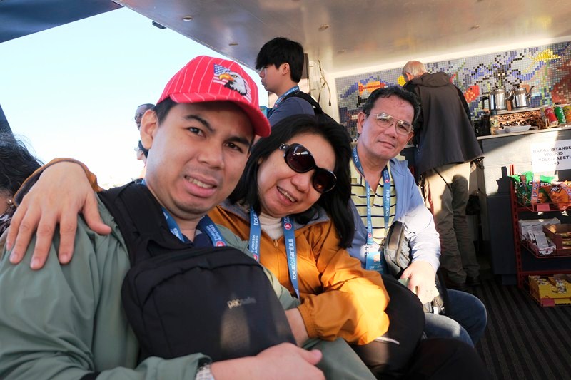
The author (right) with Jandy and Grace (photo: Selena Sta. Maria)
Touristanbul is available for Turkish Airlines’ flights, including code share flights. There is no hotel offered. If a guest is unable to make their flight, in cases that are their responsibility, they will ensure that the passenger reaches their destination smoothly via the next flight.
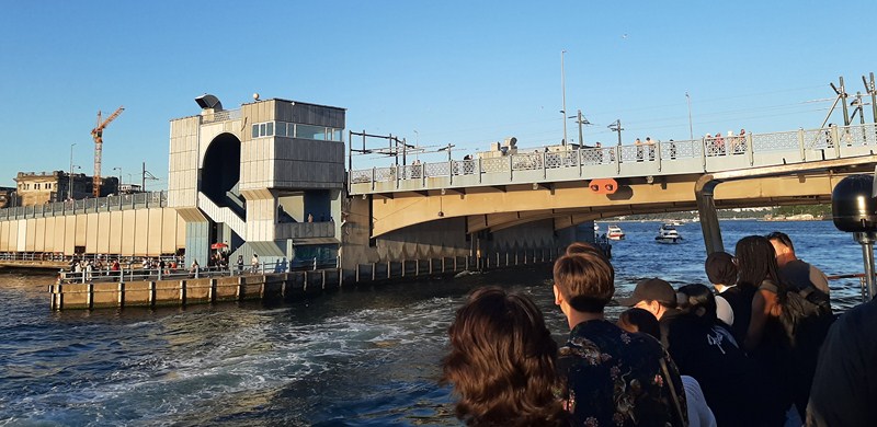
Galata Bridge, the fifth on the same site, was built in 1994. The bridge was named after Galata (the former name for Karaköy) on the northern shore of the Golden Horn. This bascule bridge is 490 m. (1,610 ft.) long with a main span of 80 m. (260 ft.). The deck of the bridge is 42 m. (138 ft.) wide and has two vehicular lanes and one walkway in each direction. Tram tracks running down the middle of it allow the T1 tram to run from Bağcılar, in the western suburbs to Kabataş, a few blocks away from Dolmabahçe Palace.
After signing up and booking our tour, we were picked up by a friendly and well-informed guide named Eray and boarded an airconditioned tourist bus with about 40 other guests. Before joining the tour, we stored our heavy luggage at the luggage office next to the hotel desk ($18 per piece) and just brought our hand-carried bags with us which were stored in the boot of the bus. The 42.2-km. bus ride, from the airport to the boat landing near the Golden Horn Metro Bridge, took us around 45 mins.
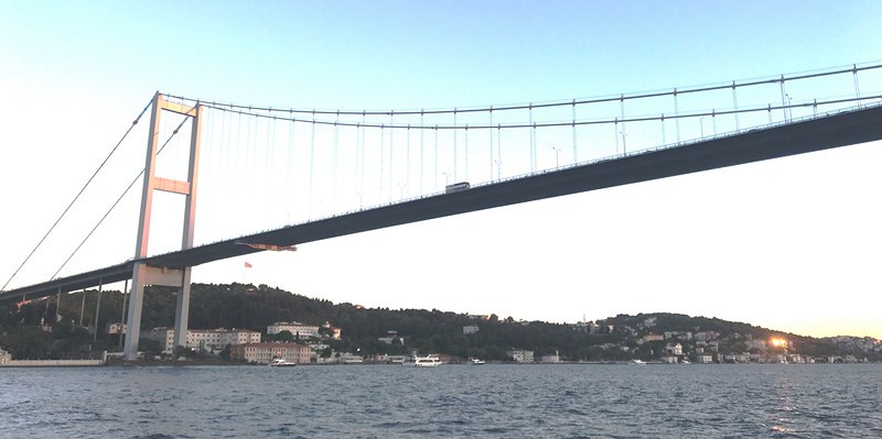
Bosphorus Bridge, the oldest and southernmost of the three suspension bridges spanning the Bosphorus strait, is a gravity-anchored suspension bridge with steel towers and inclined hangers. The aerodynamic deck hangs on steel cables. The bridge is 1,560 m. (5,118 ft.) long, with a deck width of 33.40 m. (110 ft.). The distance between the towers (main span) is 1,074 m. (3,524 ft.) and the total height of the towers is 165 m. (541 ft.). The clearance of the bridge, from sea level, is 64 m. (210 ft.).
The tour covers a lot of territory. During this unforgettable, two-hour tour experience on board the 24 m. long and 7 m. wide pleasure craft Naral Istanbul, cruising at an average speed of 7.2 knots, having a fabulous view of the legendary Bosphorus Strait and saw some of Istanbul’s most notable and iconic historical sites, structures and monuments. Its rolling hills are covered with a mix of ancient and modern architecture, all of them overlooking the water.
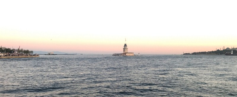
The Maiden’s Tower between Europe and Asia
The Maiden’s Tower (Kiz Kulesi), built in 1725 0n a small islet at the southern entrance of the Bosphorus Strait, between the European and Asian sides, is one of the landmarks and most storied structures of Istanbul.
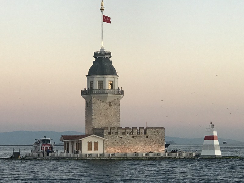
Maiden’s Tower, a small islet at the southern entrance of the Bosphorus strait, 200 m. (220 yds.) from the coast of Üsküdar, has a café and restaurant with views of the former Roman, Byzantine and Ottoman capital at Sarayburnu. Private boats ply back and forth between the tower and the shore throughout the day. The tower appeared on the reverse of the Turkish 10 lira banknote from 1966 to 1981.
Formerly an observation terrace, a tax collection area for merchants, a hospital and a lighthouse, it now houses a café and restaurant. Recently, it was featured in the 1999 James Bond film The World is Not Enough. From 1966 t0 1981, the tower also appeared on the reverse side of the Turkish 10 lira banknote.
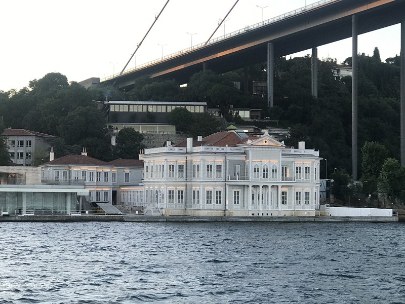
Hatice Sultan Mansion, a historical yalı (waterside mansion) located at Bosporus, in the Ortaköy neighborhood, was named after its original owner Hatice Sultan. It is used today as a water sports club’s building.

Naime Sultan Yalisi was given to Sultan Abdul Hamid II’s favorite daughter Naime upon her marriage to Mehmed Kemaleddin Bey in 1898.
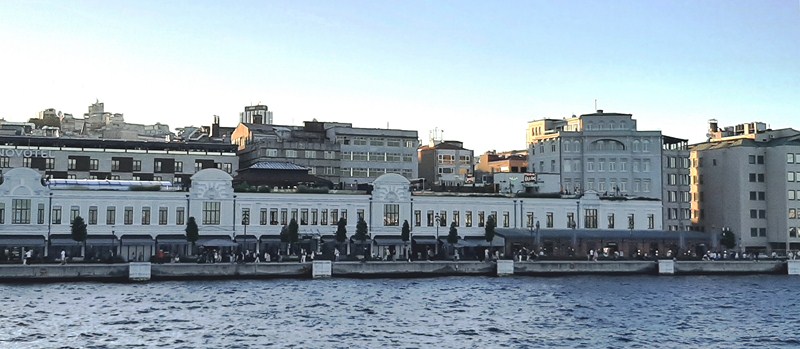
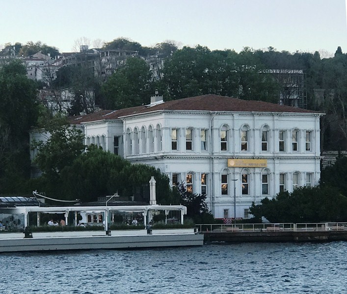
The Bosphorus Strait is home to many beautiful and historical mansions (yalilar). Many designed by members of the Balyan family (Armenian architects for the Ottoman court for five generations), they are considered an important cultural heritage of Istanbul. Of the original 600 mansions, about 360 are still standing, with 150 preserved in their original form, each reflecting a particular era and architectural style.
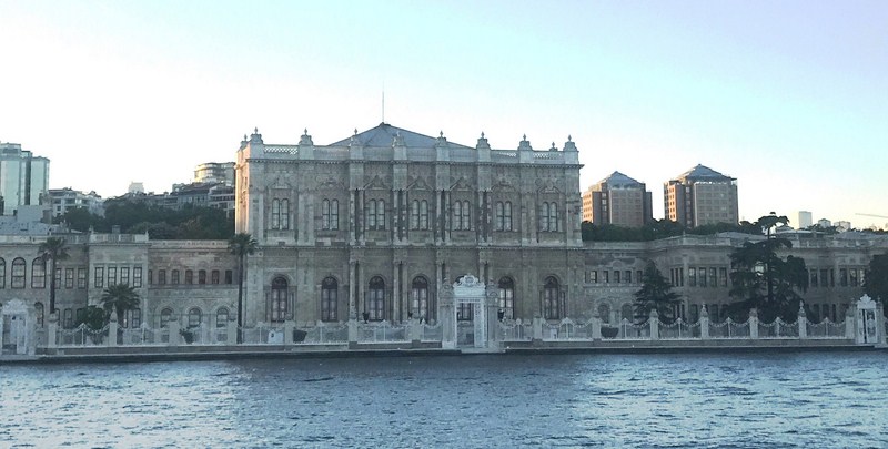
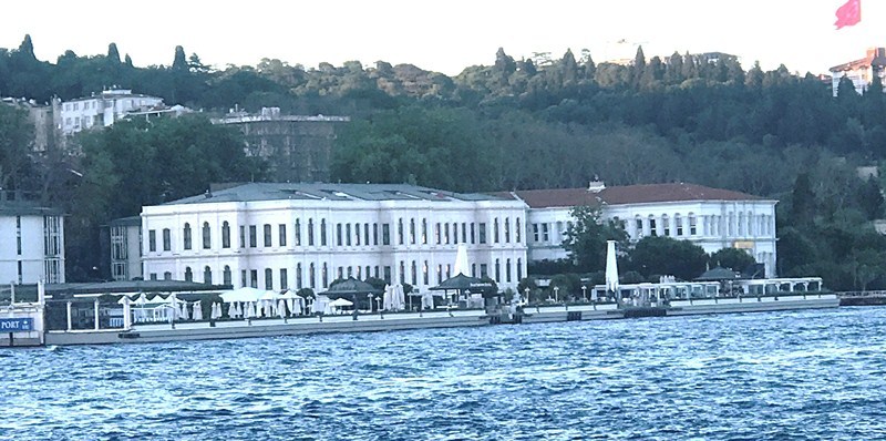
Dolmabahce Palace was home to six Sultans from 1856, when it was first inhabited, up until the abolition of the Caliphate in 1924: The last royal to live here was Caliph Abdülmecid Efendi. A law that went into effect on March 3, 1924, transferred the ownership of the palace to the national heritage of the new Turkish Republic.
Gracing the edges of the Bosphorus Strait, on the European side, is the beautiful and elegant Dolmabahce Palace, the main administrative center of the Ottoman Empire (from 1856 to 1887 and from 1909 to 1922), was built from 1843 and 1856 and was home to the Sultan up to the end of the Ottoman Empire.
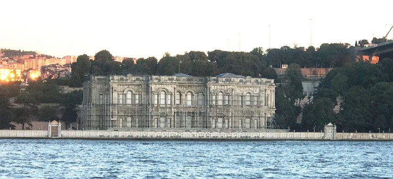
Beylerbeyi Palace, an imperial Ottoman summer residence built between 1861 and 1865, is now situated immediately north of the first Bosphorus Bridge. It was the last place where Sultan Abdulhamid II was under house arrest before his death in 1918.
The Beylerbeyi Palace, at the Asian side, is an imperial Ottoman summer residence built between 1861 and 1865. Designed in the Second Empire style by Sarkis Balyan, it is now a museum.
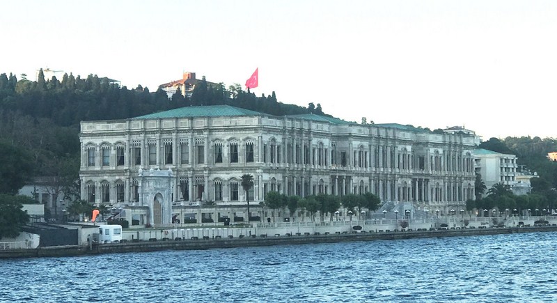
Ciragan Palace, built by Sultan Abdulaziz to replace the old Çırağan Palace which was at the same location, was designed by the Armenian palace architect Nigoğayos Balyan and constructed by his sons Sarkis and Hagop Balyan between 1863 and 1867. It is now a five-star hotel in the Kempinski Hotels chain.
Four Seasons Istanbul Hotel, formerly the Atik Pasha Palace, is a renovated 19th century Ottoman palace that sits on the European bank of the Bosphorus Strait. Now a hotel with 170 guestrooms and suites, it has magnificent views of the hills of Asia.
Former 19th century Ottoman palaces, on the European side of the Bosphorus, that have been renovated and converted into hotels include the five-star, 317-room Ciragan Palace Kempink and the Four Seasons Hotel Istanbul. On the other hand, the Shangri-la Bosporus is a restored 1930s tobacco warehouse with a Neo-Classical façade.
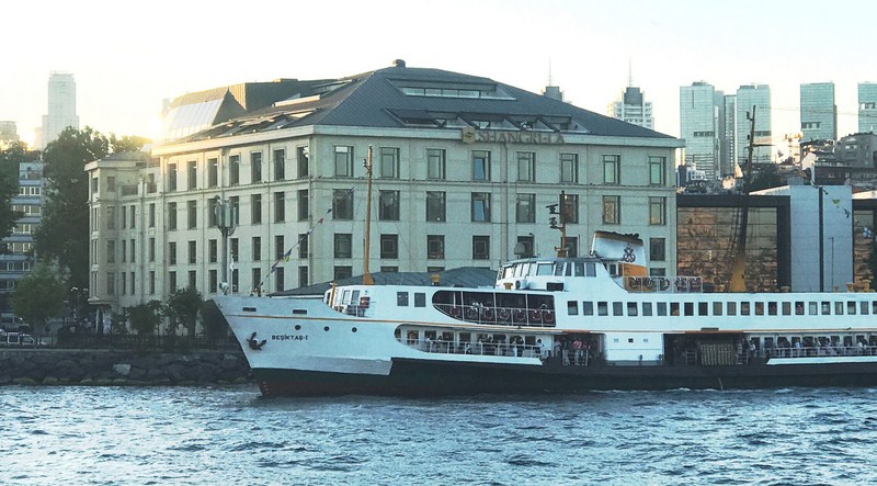
Shangri-la Istanbul Hotel, located between Dolmabahce Palace and Naval Museum on the European coast of the Bosphorus, emulates a modern art museum, showcasing more than 1,000 European and Asian pieces.
The city continues its long history as the center of architecture as diverse and rich as its past, with new buildings also being built upon the ancient landscape. The 400,000 sq. m. Galataport Istanbul, a world-class, innovative underground cruise ship port stretching 1.2 kms. along the coastline, is a mixed-use development housing around 250 shops and restaurants, a Peninsula hotel and other cultural and entertainment facilities.
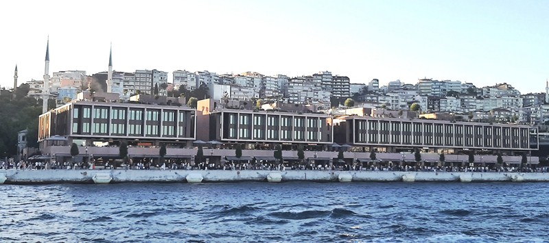
Galataport has space for three large cruise ships to dock side by side behind specially designed screens that rise to ensure that no one can leave the ships without passing through the Customs and Immigration facilities but that are retracted when no ships are in port. Customs and Immigration facilities are located underground, with most of the overground space taken up by shops, restaurants and offices.
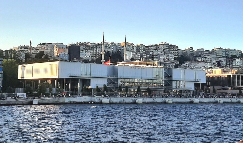
Istanbul Museum of Modern Art, inaugurated on December 11, 2004, it is Turkey’s first modern and contemporary art gallery. Focusing on Turkish artists, it is a private venture under the umbrella of the nonprofit Istanbul Foundation for Culture and Arts.
It also incorporates the Istanbul Modern Art Museum (designed by Italian architect Renzo Piano along the waterfront zone of Karaköy, it was opened last May 2023), the İstanbul State Art and Sculpture Museum of the Mimar Sinan Fine Arts University and the restored Paket Postanesi (Parcel Post Office), now a symbol of Galataport.
Mimar Sinan Fine Arts University, established on January 1, 1882 under the leadership of Osman Hamdi Bey, as the College of Fine Arts, the Ottoman Empire’s first educational institution for fine arts and architecture.
Parcel Post Office (Paket Postanesi), built from 1905 to 1911, was designed by engineer S. Saboureaux. It is one of the oldest structures of the port area and one of the finest in the city with its characteristic slate dome and roof, unique spaces and facades. The restored Post Office, now featuring 73 boutique stores facing the interior and exterior courtyards, has a 180-m. long coastline overlooking the historical peninsula.
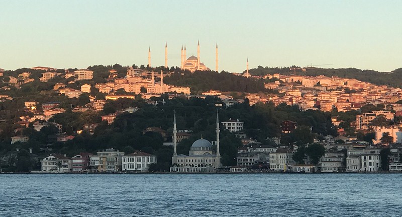
Atop Little Camlica Hill in Uskudar is the futuristic, 369 m. high (221 m. of which is a 49-storey reinforced concrete structure with 18 m. below ground) Camlica TV and Radio Tower, the highest structure in Istanbul.
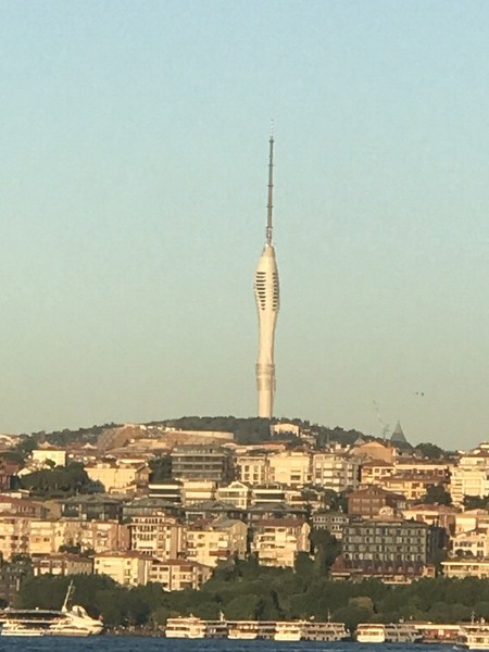
The Camlica Radio and TV Tower has panoramic elevators rising from the ground floor to the top floor. Located on both sides of the main building, these elevators symbolize the Bosphorus, which both separates and integrates the Asian and European continents.
Completed in 2020, this telecommunications tower has observation decks and restaurants. Designed by Melike Altinisik Architects (MMA) firm, the building was inspired by the tulip flower, a symbol of the Turks during the Ottoman period
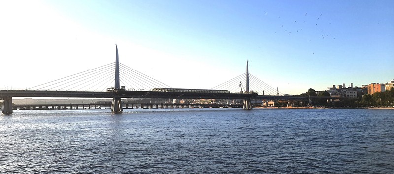
The 936 m. long, €146.7 million Golden Horn Metro Bridge, a cable-stayed bridge carrying the M2 line of the Istanbul Metro, is the fourth bridge across the Golden Horn. Entering service on February 15, 2014, its eventual design pays homage to the city’s maritime heritage with support towers shaped to look like horns and hull-shaped supports for the platforms..
The cruise also passed by some of the iconic bridges spanning the Bosphorus River. The 490 meter long and 80 meter wide Galata Bridge, the fifth on the site, is a bascule bridge completed in December 1994. At the underside of the bridge are a string of restaurants. The 1,560 meter long and 33.4 meter wide Bosphorus Bridge (officially known as the 15 July Martyrs Bridge), the oldest and southernmost of the three suspension bridges spanning the strait, was completed in 1973. Underneath it is the Ortakoy Mosque.
The Golden Horn Metro Bridge, a cable-stayed bridge carrying the M2 line of the Istanbul Metro across the Golden Horn, connects Karaköy and Küçükpazarı on the European side of Istanbul. The bridge enables a direct connection between Hacıosman metro station in the Sarıyer district (at the northern end of the M2 line), and the Yenikapı transport hub in the Fatih district (at the southern end of the M2 line.).
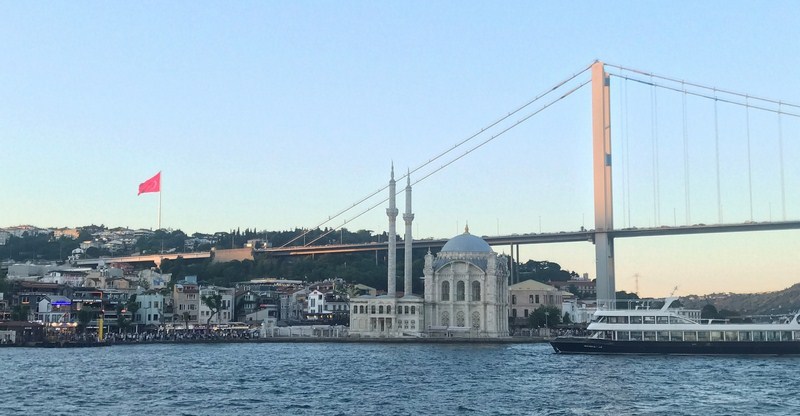
Ortakoy Mosque with the Bosphorus Bridge behind it. The mosque was designed in a mixed or eclectic style incorporating contemporary European Revivalist trends such as Neoclassical, along with some details and overall design elements drawn from the earlier Ottoman Baroque style.
Completed around 1854 or 1856, it was designed by the father-and–son team of Garabet and Nikogos Bayan (who also designed the aforementioned nearby Dolmabahce Palace). It is distinguished from other mosques of the period by its particularly ornate stone-carved decoration.
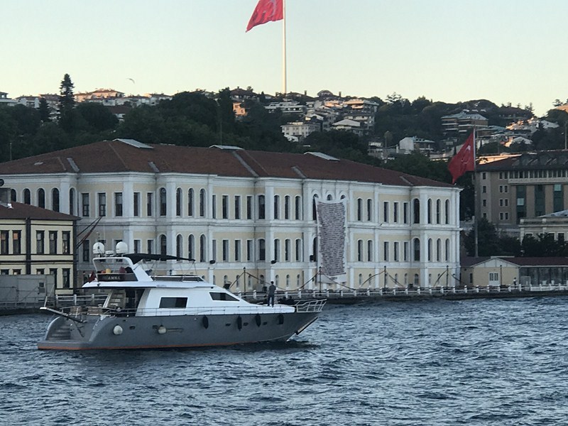
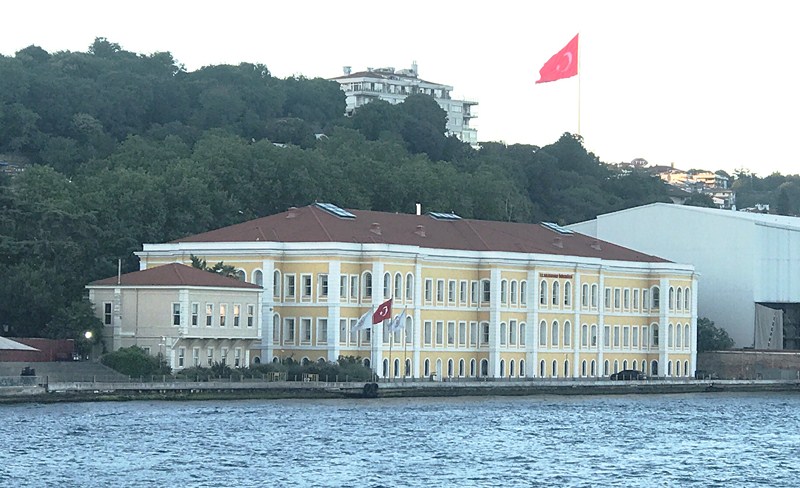
Besktas Anatolian High School, located on the European side of Istanbul, is one of the best schools in Turkey. Built for Abdulaziz in 1871, the building was an addition to the Çırağan Palace and later used as a harem room.
Another of the best known sights of Istanbul is the Suleymaniye Mosque, a masterpiece of Ottoman architecture and the largest Ottoman-era mosque in the city. From its location on the Third Hill, it commands an extensive view of the city around the Golden Horn.
The iconic Blue Mosque and its six minarets. Included in the UNESCO World Heritage Site list in 1985 under the name of “Historic Areas of Istanbul,” it was constructed between 1609 and 1617 during the rule of Ahmed I and remains a functioning mosque today.
The iconic Blue Mosque, another popular monument of Ottoman architecture built between 1609 and 1617, is the second mosque in the world, after Mecca, with six minarets.
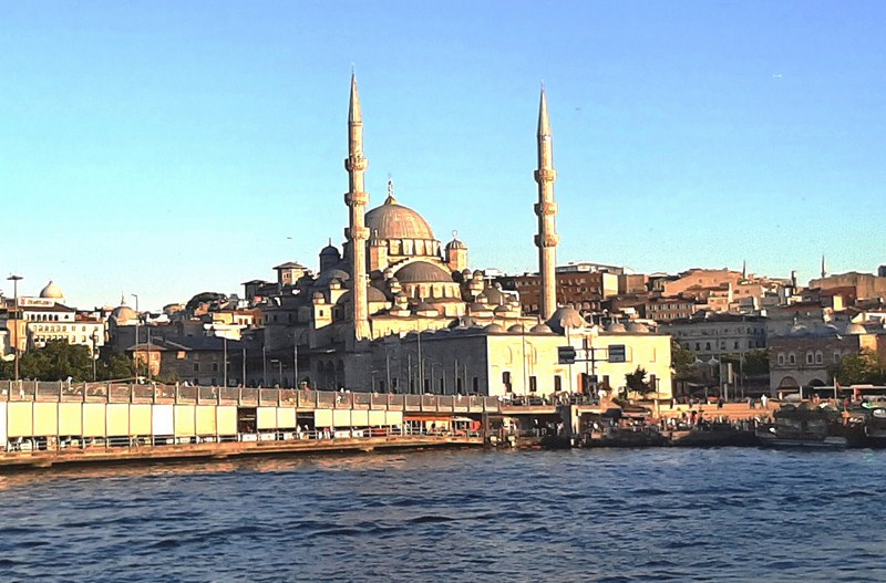
Suleymaniye Mosque, commissioned by Suleiman the Magnificent (r. 1520–1566), was designed by the imperial architect Mimar Sinan. One of the best-known sights of Istanbul, from its location on the Third Hill, it commands an extensive view of the city around the Golden Horn. Considered a masterpiece of Ottoman architecture, it is one of Mimar Sinan’s greatest works and is the largest Ottoman-era mosque in the city.
Many schools, colleges and universities are also located along the banks of the Bosphorus Strait. They include the Kabatas Boys’ High School (one of the oldest and most prominent high schools in Turkey), Galatasaray University (widely regarded as one of the most prestigious and notable universities in Turkey), Besiktas Anatolian High School (one of the best schools in Turkey), and Kuleli Military High School (the oldest military high school in Turkey).
Kabatas Boys’ High School. one of the oldest and most prominent high schools in Turkey, was established in 1908 by the Ottoman sultan Abdulhamid II.
T.C. Galatasaray University, built in 1871, during the reign of Sultan Abdülaziz, was designed by Ottoman Armenian architect Sarkis Balyan. The building was used as a dormitory for the female students of the Galatasaray High School until 1992, when it was inaugurated as the Galatasaray University.
Normally, guests also experience a taste of the city by sampling a traditional and authentic Turkish and Ottoman cuisine at an elegant restaurant (depending on the time you choose, you can have breakfast, lunch or dinner but, in our case, we had dinner) but this wasn’t available so, instead, we had our dinner of a Turkish crepe (washed down with soda) on board our coach. After finishing our dinner, we were driven back to Istanbul International Airport.
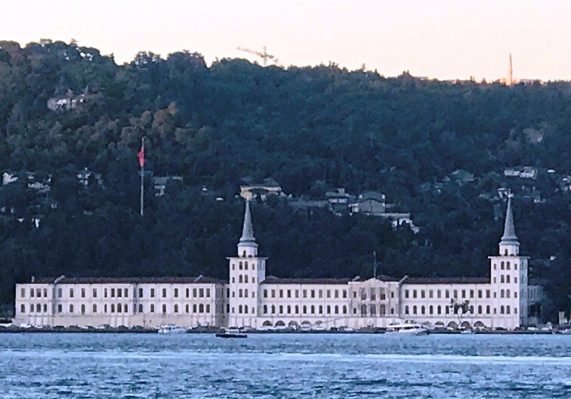
Kuleli Military High School, the oldest military high school in Turkey, is located in Çengelköy, on the Asian shore of the Bosphorus strait. It was founded on September 21, 1845, by Ottoman Sultan Abdülmecid I.
NEWS FLASH:
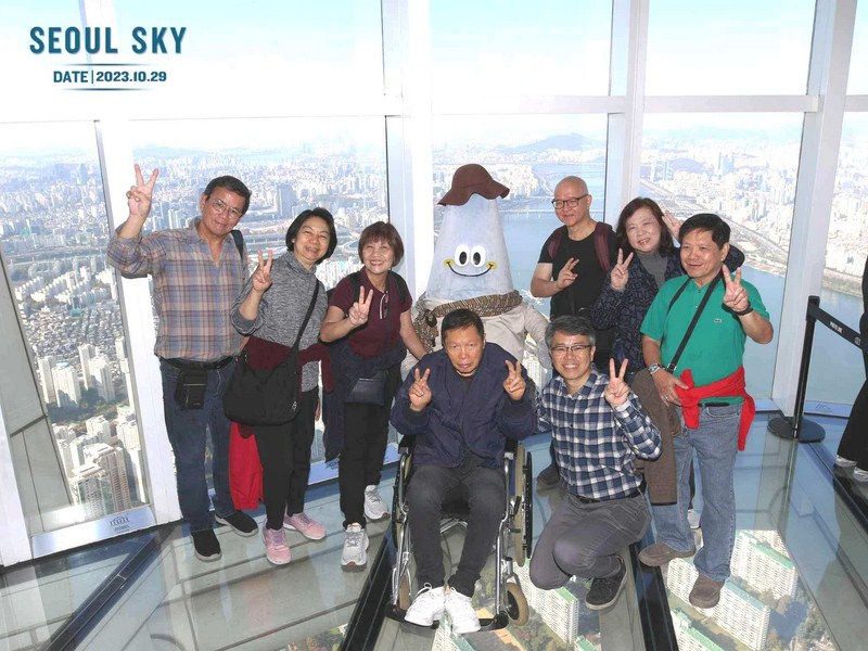
There’s a new but somewhat different player in the travel and tour industry – Toujours Travel and Tours. Aside from providing clients the usual the usual travel requirements offered by other tour agencies, it also wants to make travel available to all and that includes travelers with special requirements – the sick and those facing physical challenges or having restricted mobility but still want to travel. Its founder, Ms. Abigail Mae Fuentes Selma personally knows this all too well having undergone open-heart surgery, which made traveling more challenging. Check it out here,
Touristanbul: E-mail: touristanbul@thy.com. Website: www.touristanbul.com