Chao Phraya River Cruise (Thailand)

After our Wat Phra Mongkhon Bophit tour in Ayutthaya Historical Park, we all returned to our coach and were all brought to Potangtai Pier near Bangsai (the royal folk arts and handicrafts center) for the start of our 2.5 hr. Chao Phraya River cruise from Ayutthaya back to Bangkok on board the modern and luxurious cruiser Grand Pearl.  From Ayutthaya, we would be passing through Pathumthani and Nonthaburi provinces before arriving in Bangkok.

The Grand Pearl

On board, we were in for a late but delicious buffet lunch of mostly spicy Thai and international cuisine served within the luxurious confines of the cruise boat.  All 4 of us sat in a comfortable, u-shaped booth beside a large viewing window.

Dining, Buffet-Style, on Thai Cuisine

Throughout our lunch, we watched the scenery along the banks Chao Phraya River banks within the refreshing airconditioned cabin lounge.  By 3:30 PM, midway through our cruise,  a refreshing beverage of tea or coffee and cookies were also served to the guests.

The Airconditioned Cabin Lounge

After our filling lunch, some guests proceeded to lounge at the wooden sun deck  at the front of the cruiser while the majority, including us, opted to remain in airconditioned comfort at the cabin lounge.

The Sun Deck of the Grand Pearl

Sometimes, I would also go up the sun deck, amidst the fresh cool tropical air and warm, afternoon sun, to get an amazingly clearer view of the life of the inhabitants that dwell along the river and the unforgettable scenery of children as they greet the visitors going by.

Houses Mounted on Stilts

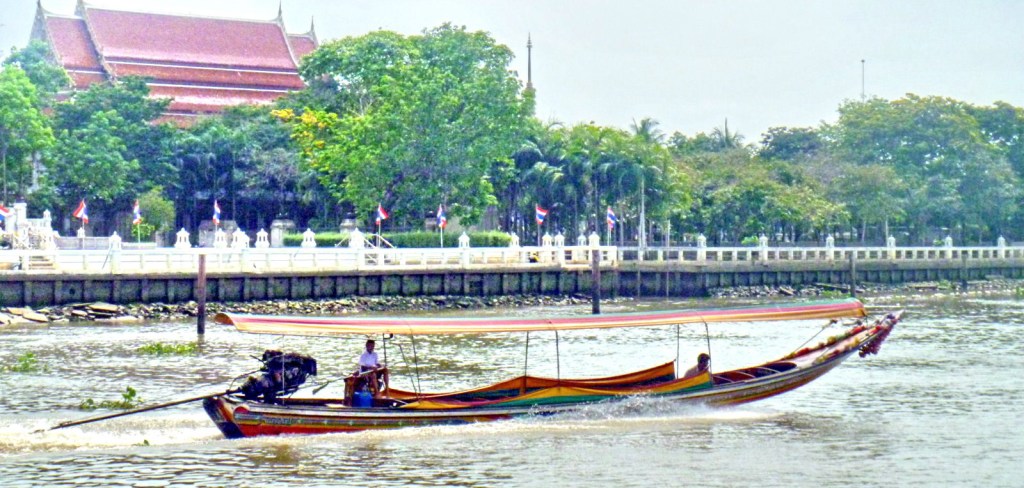
We would watch various kinds of river craft, from barges, smaller wooden pleasure cruise boats to traditional, long-tail boats, their engines invariably mounted on an inboard, turret-like pole which can rotate through 180 degrees, allowing steering by thrust vectoring.

Long-Tail Boats

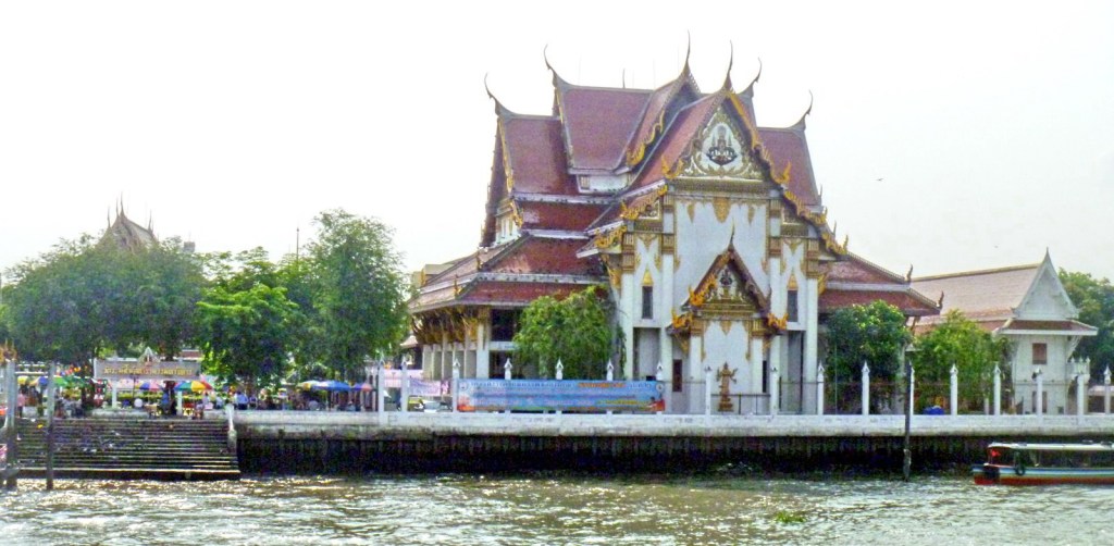
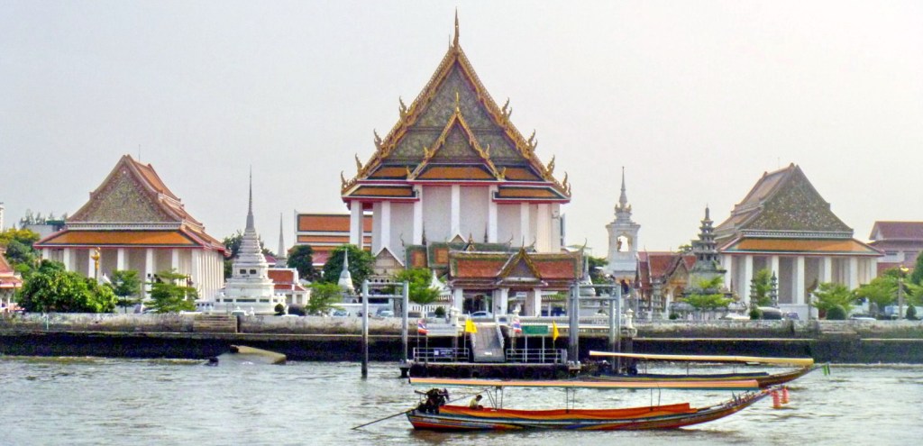
The architectural scenery also varies; from simple houses on stilts to modern villas, to modern medium-rise (Mandarin Oriental Hotel) and high-rise (The Peninsula Bangkok) hotels, from traditional Thai temples (the graceful Wat Arun,  Wat Kanlayanamit, Wat Rakang Khosittaram, Wat Pathum Khongkha) to old Roman Catholic churches (Church of the Holy Cross) and from magnificent palaces (Grand Palace, Bang Khunprom Palace, etc.) to engineering marvels (King Rama VIII Bridge).

Royal Barge Museum

The Royal Barge Museum, on the banks of the Bangkok Noi Canal , is a huge boathouse that displays 8 finely-crafted Thai royal barges (including 4 for the king). The majestic Suphannahongsa (“golden swan,” the personal barge of the King, carved out of a single teak tree trunk, was completed in 1911.

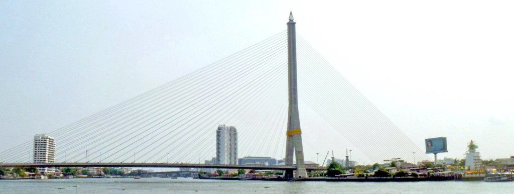
King Rama VIII Bridge

The asymmetrical, cable-stayed, 2.45 km. long (including approach spans) Rama VII Bridge, opened on September 20, 2002, has a single, inverted Y-shaped tower, a sleek superstructure and gold-colored suspension cables arranged on single and double planes.

Bang Khun Phrom Palace (Bank of Thailand Museum)

The Baroque cum Art Nouveau Bang Khun Phrom Palace, the former residence (until 1932) of HRH Prince Paribatra Sukhumbhand, the 33rd son of King Chulalongkorn (Rama V), now houses the Bank of Thailand (BOT) Museum. The museum has 14 rooms many of which display the history of Thai currency and the Bank of Thailand.

Wat Arun

Wat Arun, recognizable by its central, 66.8 m. high prang (Khmer-style tower) topped with a 7-pronged trident, was started in 1809.  It is called the “Temple of the Dawn” because the first light of morning reflects off the surface of the temple with a pearly iridescence.  By the side of the river are 6 Chinese-style pavilions made of green granite and containing landing bridges.

Wat Rakang Kosittaram

Wat Rakang Kosittaram (Temple of the Bells), built during the Ayutthaya period, was later reconstructed and upgraded as a Royal Temple by King Taksin. The main features of the temple is the bell tower whose bells gave the name temple the name “Rakang” (Thai for “bell”).

Wat Kalayanamit

The massive, mid-nineteenth century  Wat Kalayanamit is well known for its 15.45 m. high and 11.75 m. wide Phra Buddha Trai Rattana Nayok (Luang Po To), called Sum Po Hud Kong in Chinese, which is Bangkok’s biggest Buddha image.

Sunanthalai Building (Royal Seminary)

The elegant, century-old Neo-Classical Sunanthalai Building, within the compound of Rajini School (the first girl’s school operated by Thais, founded by Queen Saowapa), was built  by King Rama V in memory of Queen Sunantha Kumariratana who drowned in the Chao Phraya River  on May 31, 1880.  It was restored after a fire in 2005.

Church of the Holy Cross

Nestled among old houses on the river banks and newer buildings inland, recognizable by its reddish dome, is the Church of the Holy Cross (Santa Cruz Church), one of Bangkok’s many old Catholic churches.  First built in wood in 1770 during the reign of King Taksin (1867–1782), it was rebuilt in 1835.  The present church, built in 1916, was designed by Italian architects Annibale Rigotti and Mario Tamagno.

River City Shopping Complex

Other sights along the river include  Thammasart University (Tha Prachan Center), Pom Pra Athit, and the Holy Rosary Church (the oldest Catholic Church in Thailand, also known as Wat Kalawar).  Our cruise ended when we docked at the River City Shopping Complex Pier, Si Phraya in Bangkok by 5 PM.  Altogether, it was a worthwhile experience.

Grand Pearl Cruises: 19/394 Chaovalitr Village, Rimklong Bangkor Rd., Chomthong, Bangkok, Thailand.  Tel: 084-1361199 and 081-9005429.

The Famous Salt Beds of Dasol (Pangasinan)

The famous salt beds of Dasol

After our lunch and ocular visit of Dasoland, we again boarded our van to finally make our way back to Manila.  Its been a very busy and educational three days in Pangasinan. However, we haven’t traveled far when we espied the famous salt beds of Dasol.  We therefore stopped along the highway to take pictures of these fascinating man-made creations.  The  province’s name was derived from the word panag-asinan (“place where salt is made”) and Dasol is one of only four Pangasinan towns (the others are Anda, Bani and Bolinao) that produce salt.

Baskets of raw salt

These salt beds, glistening whitely in the late afternoon sun, have sluices that are opened to allow about 3 inches of sea water from  the incoming ocean tides of Dasol Bay to pour into and be trapped in a checkerboard of shallow ponds lined with grayish-brown clay and paved with shards of clay pots, similar to inland rice paddies.  The impounded water is allowed to naturally evaporate in the sun for a few hours, after which thin crusts of salt crystals would form on the surface and sink to the bottom of the pond.  The resulting encrusted salt is then raked, gathered into small neat piles, scooped into baskets and then transferred to a bigger pile in a hut.  The raw salt is then brought to the cooking sheds to be washed, boiled and condensed into pure rock salt. During the rainy season, the salt beds are converted into fish ponds.

Balingasay River (Bolinao, Pangasinan)

The clean, multi-awarded Balingasay River


On the way back to the Tourist Center from Enchanted Cave in Bolinao, we made a short stopover at a bridge to photograph the 7-km. long, pristine and now fishpen-free Balingasay River (Brgy. Balingasay),  twice winner of the Gawad Pangulo sa Kapaligiran Award for inland bodies of water in the Ilocos Region and a recipient of the highly prestigious Wetlands Conservation Award in 1994. Set aside as a protected seascape, this river, noted for its scenic beauty and biodiversity, has 15 hectares of century-old and new growth mangroves areas, 30 hectares of of attap palms (used for nipa hut roofing), wild ferns and balete trees hanging into the water.  These protect the river from erosion and pollution.  Different species of wild birds (locally called kiaw and pagaw) also make their home atop the trees and wild ducks, lizards, monkeys and wild boar also make their home in the forest.

Some boats parked at the river mouth

The Balingasay River is fed by Quibuar Spring, Bolinao Falls and several other springs and creeks. Fresh water meets the sea water of the South China Sea toward the middle of the river,  a perfect environment for unique fish (malaga, lapu-lapu, etc.) and shellfish (crabs, shrimps and oysters) species to flourish.  Boats from the bridge can be rented (PhP500) to explore the river which connects 5 villages to the town proper, located 5.5 kms. from the mouth of the river. Aside from regular outrigger boats, some boats that ferry villagers are made, through Filipino ingenuity, from discarded wings of World War II airplanes secured from the former U.S. Naval Base in Subic.  The wings are fitted with bamboo and wood as “balancers” and then wooden seats are installed for 12 people.

Bolinao Marine Laboratory (Pangasinan)

Bolinao Marine Laboratory

After our brief rest stopover at El Pescador Beach Resort, we proceeded to the Bolinao Marine Laboratory (BML), the official marine station, started in 1983, of the Marine Science Institute (MSI), University of the Philippines.The BML, located 2 kms. from Bolinao town proper, has a main laboratory building (with research lab and classrooms), administration building, staff houses, dormitories and a land-based hatchery.  A venue for research work, BML also aims to be a focal point for extension activities involving the municipality and the various communities inhabiting the coast; serve as an educational exhibit center for research activities on marine science; to offer direct service to the local community in the form of environmental education programs and; to assist in the formulation of coastal management plans for the municipality.

Giant clams

At BML, we observed the laboratory’s propagation of the endangered giant clam (Family Tridacnidae),  sea urchins and certain species of sea cucumbers through grow out culture and sea ranching.  The sea cucumber Holothuria scabra, one of the most expensive if not the most expensive in the market, are, once bred, are then planted in research pens in Santiago Island.  Sea urchins (scientific name: Tripneustes gratilla), locally called uni, have been overharvested by fishermen in the 1980s and 90s for the Japanese market. These too are bred, fed with processed sea weeds (sargassum) in a hatchery and re-seeded.  BML also does habitat restoration (e.g., coral transplantation) and sets up marine protected areas for coral and sea grass conservation. 

Bolinao Marine Laboratory: U.P. Marine Science Institute (MSI), Brgy. Luciente 1, Bolinao, Pangasinan.  Tel: (075) 541-8022 ext. 102. E-mail: chin445@yahoo.com.

Paoay Lake National Park (Ilocos Norte)

Cattle and boats for hire line the lake shore

After our brief sojourn in Batac City, we next proceeded to the Malacanang Ti Amianan (Malacanang of the North) in Paoay.  Along the way, we made a brief stopover at the view deck of Paoay Lake National Park.  This 470-hectare, horseshoe-shaped lake, the largest in the province, was declared as a National Park on June 21, 1969 by virtue of Republic Act No. 5631.  Once known as Naguyudan, it is known to the locals as Dakkel a Danum and is a popular picnic site. The lake is artificially seeded with various species of colorful fish and is 10 m. deep, yet the surface is below sea level.  Its fresh water comes from a subterranean source.

Lakbay Norte 2 at Lake Paoay National Park

According to a charming but Sodom and Gomorrah-like legend, it is said that a once-prosperous town, San Juan de Sahagun, once stood where the lake is now.  The materialism of the town and the indolence of its people incurred God’s wrath, so he sent an earthquake and flood waters that swallowed up the town and formed the lake.   Town elders will tell you that the original townsfolk, in gaudy fiesta finery, can still be seen as colorful, transformed fishes swimming around with earrings and bracelets.  Geological studies indicate that the lake was formed by a massive earthquake that caused the ground to sink and be filled with water from underground springs.  

A barge used to cross the lake

The lake is ideal for bird watching   Common residents here include the endemic Philippine Duck (Anas luzonica), the White-Collared Kingfisher (Halcyon chloris), the White-Throated Kingfisher (Halcyon smymensis), the Brahminy Kite, cattle egret and little egret. Migratory birds that linger for a while here include the Tufted Duck (Aythya fuligula), the Grey Heron (Ardea cinerea), great egret and the osprey. Cottages (PhP50) can be rented at the viewing deck.

Paoay Lake is located north of Paoay town, 3 kms. off the main highway and 3 kms. from the sea.

The Surreal World of Kapurpurawan Rock Formation (Burgos, Ilocos Norte)

Kapurpurawan Rock Formation: The Sphinx-like “Head”

After our biscocho and salt making observation tour in Pasuquin, our Lakbay Norte 2 media group then boarded our bus and proceeded to the fellow Ilocos Norte town of Burgos.   From the National Rd. our bus turned towards a gravel road and traversed it for about 3 kms. until we reached a makeshift picnic hut, our jump-off point for the amazing, unique and Sphinx-like Kapurpurawan  Rock Formation, one of the best places to visit in the town, aside from the iconic Cape Bojeador Lighthouse, the country’s tallest.

Bonsai-like plants amid pools of limpid sea water

From the hut, it was a 30-min. walk, along concrete steps, dirt track and then, through a tidal pool.  At the tidal pool, sea water-filled coral rock pools, of varying sizes, and bonsai-like vegetation can be seen sporadically.  The rock formation was formed from sandstone naturally carved by weathering from wind, sand and water to create different surreal shapes such as the iconic “Head,” “Cradle” and the “Resting Dragon.” The word kapurpurawan was derived from the Ilocano root word puraw meaning “white” and these formations are said to be much whiter during the summer months of April and May.

This rock formation, possibly the “Resting Dragon,” looks
like a slithering cobra  about to pounce

Our short Kapurpurawan Rock Formation hike made us hungry and, as it was lunchtime, we proceeded to the nearby, picturesque town of Paoay for lunch at Cafe Herencia.

Check out “Restaurant Review: Cafe Herencia

Herencia Cafe: MacArthur St., Brgy. 14, Sangladan, Paoay, Ilocos Norte.  Tel: (077) 614-0214

On the Road to Adams (Ilocos Norte)

It was still raining and windy in the early morning when we left Kapuluan Vista Resort in Pagudpud, via coaster, for the nearby town of Adams, located at the foot of the Gran Cordillera Central Mountain Range. This fairly young (it became independent from Bangui on May 16, 1983 by virtue of Republic Act No. 337), 159.31 sq. km. town has a sparse 2007 population of 1,522 uniquely spread out in only one barangay with 8 sitios.   Our coaster backtracked towards the Cagayan boundary, again traversing the 1.3-km. long Patapat Viaduct  until we reached a junction at Brgy. Panzian. Incidentally, Patapat’s rocky shore is now littered with the unsightly, rusting hulk of the marooned Korean-owned MV Nam Yang 8 oil tanker which listed at the height of Typhoon Juan in January 2010, causing an oil spill.
The marooned MV Nam Yang 8

Our coaster finally stopped at the junction in Brgy. Panzian.  This was the end of the road for our coaster and, from hereon, we were to tackle the last, rugged 13-km. uphill drive to the town via a dump truck (the only suitable transportation for our group as the only other way was via single-seat motorcycles).  

Our transportation to Adams

Most, except those who sat beside the driver and on a cooler box, good-naturedly endured the hour-long trip standing up and clinging to the sides of the truck.  The going was really rough as the road was really bumpy and we had to watch out for overhanging tree branches.  

A sparkling stream
Rice fields

The hardships and rigors of the ride was somewhat offset by the rugged and pastoral beauty of the countryside which included sparkling streams and rivers; verdant rice fields; lush lowland and montane rainforests, colorful flowers and a number of narrow hanging bridges that traverse the streams and rivers.

One of the town’s hanging bridges

Enchanting Claveria (Cagayan)

Claveria Cove

We left Buguey around 1:30 PM and our bus was to travel another 2 hours to get to Claveria, the last Cagayan town prior to entering Ilocos Norte.  It was now raining intermittently when we traversed the beach boulevard facing the town’s clean, 4 km. long brown sand Claveria Cove.  It was very windy when we alighted the bus for some photo ops and the waves along the beach were very turbulent.  On our left, we could sees the hazy outlines of the rock formations Punta Lakay-Lakay (“old man”), Punta Baket-Baket (“Old woman) and Punta Ubing-Ubing (“child”).  The onset of rain necessitated our return to the bus.

Lakay-Lakay Blue Lagoon

Back on our bus, we proceeded to Taggat to visit Lakay-Lakay Blue Lagoon. This lagoon is also located in a cove, albeit a smaller one.  As the bad weather prevented fishermen from going out to sea, the shore of this fishing village was filled with similarly-colored (blue and white with yellow stripes) fishing boats parked prow-to-bow and outrigger-to-outrigger. Minus the boats and in sunny weather, the panorama before us would have been a photographer’s dream.  Picture a lagoon enclosed by towering cliffs on both sides (the cliff on the right is topped by a cross) and jagged, rocky islands, all lashed and sculpted by the turbulent, churning waves of the sea.   Only in my dreams can I imagine such a scenery. In calmer weather and low tide, I could have swam to those rocky islets. Rain again woke me up from my day dream and we all had to run back to our bus.

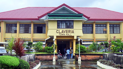
Claveria town hall

Back in our bus, we next proceeded to the Claveria municipal hall where the amiable Mayor Celia Layus and other town officials welcomed us.  A merienda of buko juice, still in its shell, palitaw ( a sweet, flat and glutinous rice cake topped with brown sugar) and ginataan was prepared for us.  During the presscon, Mayor Layus narrated her plans to put up a zip line facility in the lagoon.  Personally, I would prefer that they leave the lagoon as it is and set up the zip line somewhere else in the town.

Buguey: The "Crab Capital of the North" (Cagayan)

El Presidente Beach Resort

After breakfast at Eastern Hawaii Casino and Resort, we next headed west, to Ilocos Norte, with stopovers at Buguey and Claveria. We arrived at Buguey by 10 AM and were dropped off at the El Presidente Beach Resort where we were welcomed by town officials led by Mayor Licerio Antiporda III and his wife. The skies were overcast and it was very windy.  Before entering the conference hall, we were given a welcome drink of fresh buko juice, still in its shell, plus crab sandwiches.  While waiting for the start of the press conference, some sampled the Lamba Sparkle Berry Delight, a cocktail consisting of a 1/3 cup each of the following: native Buguey lambanog (nipa palm wine), sparkle and red berry juice, plus half a teaspoon of sugar; then garnished with lime and cherry and, finally, all the ingredients are shaken, strained and poured into a cocktail glass.

Lamba Sparkle Berry Delight

In his speech at the presscon, Mayor Antiporda enumerated his efforts to further boost the town’s tourism potential as well as to fortify its claim to being the “Crab Capital of the North.”  He also informed us that the local government-run El Presidente Beach Resort will soon be undergoing a total makeover, thanks to a PhP32 million loan from Land Bank, and will be turned into a U-shaped, bungalow-type hotel with 15 guestrooms and two dorms and will be renamed as the Buguey Crab Hotel.

Crab claws anyone….?

Afterwards, we were all invited to partake of the feast prepared for us: steamed shrimps; brackish water crabs, both steamed and cooked in the half shell; breaded prawns; seaweed, oysters, fresh fruits (mangoes, bananas) and bocayo (coconut candy). Some, foregoing the use of spoons, forks and knives, decided to dine kamayan style. While we were doing so, we were regaled with a bevy of native dances performed by schoolchildren and young adults.

Driftwood by the beach

After dining, some of us slipped out the conference hall to burn the excess calories gained as well as to check out the windswept black sand beach, observe people harvesting shells or children playing and to admire the high, turbulent waves breaking on the shore, a consequence of the converging waters of the South China Sea, the Pacific Ocean and the Cagayan River.  Prior to our leaving for Claveria, everyone in the media group was gifted with a bottle of Buguey lambanog to take home (I was given two).

KL Tower (Kuala Lumpur, Malaysia)

After our visit to Petronas Towers, we next walked some distance to the KL Tower, locally called Menara Kuala Lumpur, until we reached the verdant and green Bukit Nanas Forest, the only gazetted forest reserve in the country.  Before anything else, we opted first to have lunch at Bangkok Expresso, which serves Asian, Indochinese as well as Thai cuisine.  We tried the pandan chicken among other dishes. Here, as in many areas in the city, we met up with Filipinos employed in the restaurant. Once done, we walked up to the gate at the base of 94 m. high Bukit Nanas (Pineapple Hill), where the tower stands.  Here, we availed of the free shuttle service, up the hill, to the tower entrance at the upper ground level.

KL Tower

At this level are 9 shops, a fastfood restaurant, a 222-pax, open-air amphitheater, souvenir shops and a mini-theater that shows a documentary, every 15 mins., of the construction of the tower. After paying the entrance fee, we proceeded to the fast speed elevator that brought us up the 335-m. high observation deck.

KL Tower Observation Deck

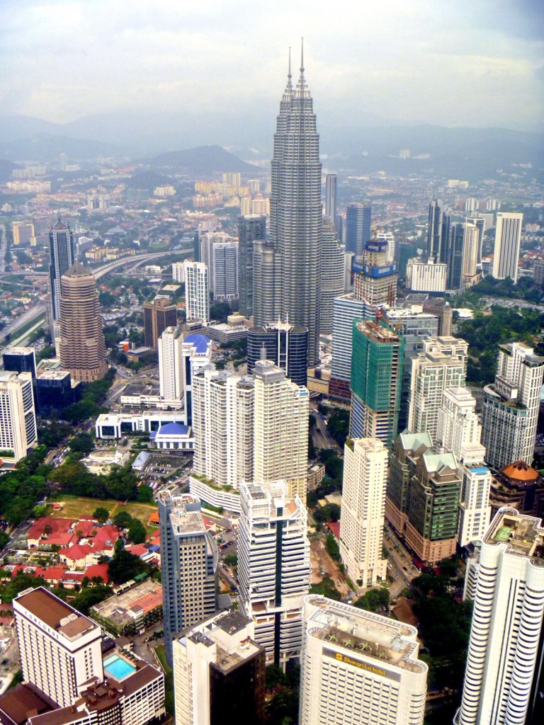
At its observation deck, we finally manage to get a panoramic, 360° bird’s eye view of the city, better than at its sister landmark as it is actually taller (at 515 m. above sea level) than the Petronas Towers, being built on a hill.  At the deck, we were given hand-held devices with Sony headsets that guided us through each of the windows and explain each of the attractions.  Around the deck are some souvenir shops and some Nikon 30×80 II coin-operated binoculars.

Getting a Better View via a Nikon 30×80 II Coin-operated Binocular

The KL Tower, locally called Menara Kuala Lumpur, was designed to withstand wind pressures of up to 90 mph.  It was built, with 45,000 cu. m. of concrete, over a period of 4 years and was completed on May 1996. Used for communication purposes, its antenna reaches 421 m. (1,381 ft.), currently making it the tallest in Southeast Asia, the second tallest freestanding tower in the world and also ranking it fourth amongst the tallest telecommunications towers in the world (after 553 m. high CN Tower in Canada, the 537 m. high Ostankino Tower in Russia and the 468 m. high Shanghai Tower in China). Here, we clearly saw the Genting Highlands, the Klang Valley and other buildings of Kuala Lumpur, including the Petronas Towers.

A Spectacular View of the City (including Petronas Towers)

The tower’s Islamic tiles, classic Islamic floral and abstract motifs and soothing color combinations reflects the country’s Islamic heritage. Designed with vertical ribs on its external surface, the tower weighs 100,000 tons and was built on freestanding land with no piles.

Bangkok Expresso: The Weld Shopping Center, 76 Jalan Raja Chulan, Kuala Lumpur, Malaysia.

Menara Kuala Lumpur: Jalan Puncak, Off Jalan P. Ramlee, 50250 Kuala Lumpur, Malaysia. Tel: 603-2020 5444. Fax: 603-2034 2609.  Email: menara@menarakl.com.my. Website: www.menarakl.com.my. Open daily, 9 AM–10 PM.