After our short stopover at the venerated Bodbe Monastery, we continued on our GNTA-sponsored tour, proceeding on a short 2-km. drive to the town center of Sighnaghi. We arrived at the town by 11:30 AM and alighted at a park with a monument to Georgian philosopher, journalist, historian and native son Solomon Dodashvili (May 17, 1805 – August 20, 1836).
Postcard-pretty Sighnaghi (photo: Ms. Riva Galveztan)
Other famous sons of the town include composer Vano Sarajishvili, political figure Sandro Mirianashvili and world-renowned primitivist painter Niko Pirosmani. We were to have lunch at Pheasant’s Tears but, as we still had some time to spare, our Georgian guide Sopho Makashvili took us on a walking tour around the town.
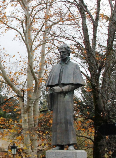
Monument to native son Solomon Dogashvili (photo: Ms. Riva Galveztan)
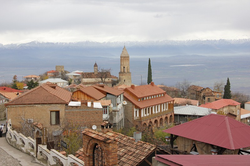
Sighnaghi, located in Georgia’s easternmost region of Kakheti, is the administrative center of the Sighnaghi district and one of the country’s smallest (2.978 km²) towns (2002 population: 2,146). One of Georgia’s leading trading centers in the 19th century, Sighnaghi’s economy is dominated by the production of wine, leather, gobelin tapestry, woodcarving, metal craft, ceramics, traditional carpets and traditional food.
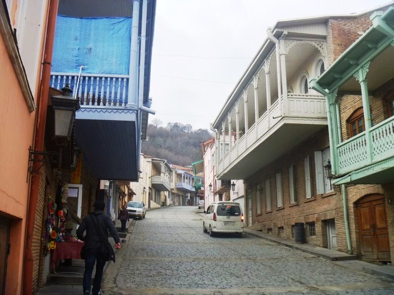
Uniquely designed terrace architecture of the town
The town and its environs, also known for their landscapes and historical monuments, has recently undergone a fundamental reconstruction and has become an important part of the Georgian tourism industry (it is now known as the “City of Love”). The town is also the jump-off point for exploring the lush vineyards of Kakheti, the cradle of wine (Georgia boasts of 500 varieties of grapes, more than anywhere else in the world).
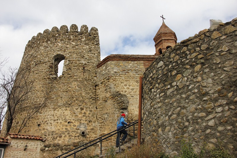
Exploring part of Sighnaghi’s defensive wall and towers (photo: Ms. Riva Galveztan)
The town was developed in the early 18th century by the king Erekle II (Heraclius II) as a refuge for the population against Lezgin and Persian attack, hence the name sighnaghi which comes from the Azeri word signak meaning “shelter.” In 1762, he sponsored the construction of the town and erected a fortress to defend the area from marauding attacks by Dagestan tribesmen. The 4.5 m. high, 1.5 m. wide and 4.5 km. long city wall, one of the biggest in Georgia, has 23 towers, each named after local villages the town is surrounded by, and 6 entrances.
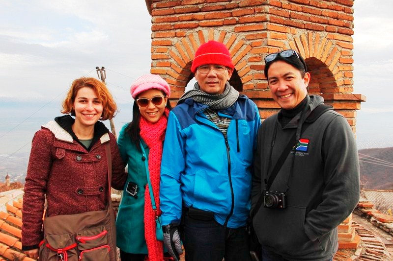
Our guide Sopho Makashvili, Riva Galvezltan, the author and Consul Buddy Cunanan (photo: Ms. Riva Galveztan)
Sopho showed us, from afar, the section of the city’s defensive wall that has been restored for tourism and we climbed one of the towers for a panoramic view of the town. Walking along the town’s narrow cobblestone streets, I was also enthralled by the uniquely designed terrace architecture of the 2 to 3-storey tiled-roof houses of Sighnaghi, the majority of which still date back from 17th, 18th and 19th century. Built with fine Georgian brick, they were built to accommodate a variety of stores and workshops, above which are wooden, lacy balconies and bow-backed windows. The town also has a beautiful fountain.
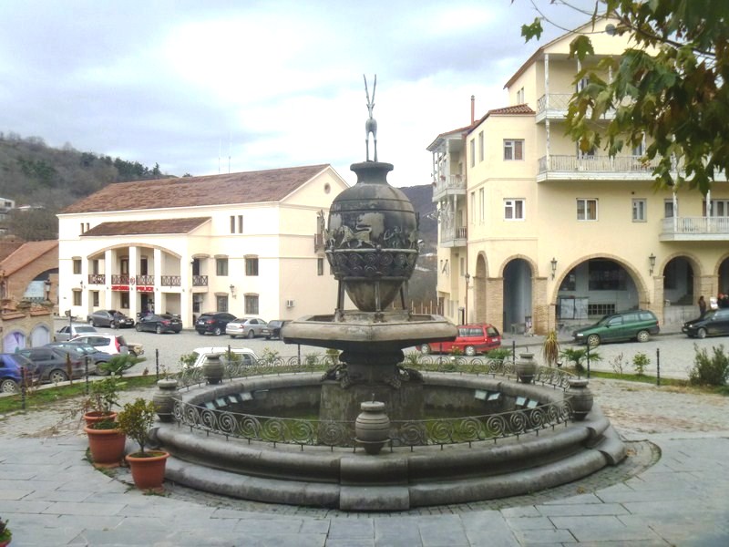
A beautiful fountain
Consul Buddy Cunanan and I also observed a number of Georgian men playing nardi (backgammon). Popular in Georgia, men, women, children and the elderly all know how to play it, and just about every family owns a backgammon set. They say that life in Georgia is like a game of backgammon – people tend to approach life like a game of chance.
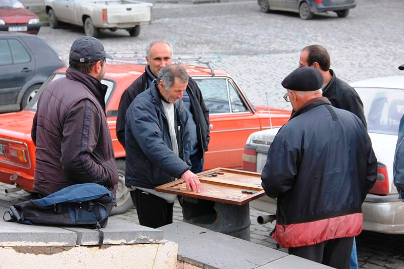
Georgian men playing nardi (backgammon) in the open (photo: Ms. Riva Galveztan)
We also visited the town’s market, near the town hall, where fresh fruits and vegetables, locally made Georgian red (saperavi) and white wine and the clear and strong chacha (Georgian pomace brandy); natural honey; churchkhela (the traditional type of Georgian candy from the Caucasus region also referred to as the Georgian “Snickers”) and cheeses. Buddy and I each tried out a glass of Georgian wine.
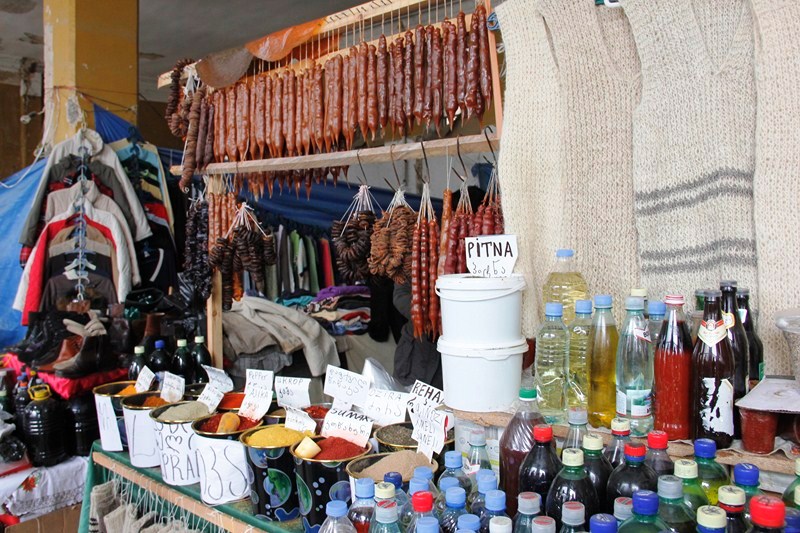
An array of products sold at the market (photo: Ms. Riva Galveztan)
There are also Georgian spice and spice mixes such as khmeli suneli (a powdered herb/spice mixture), adjika (a spicy paste or sauce seasoned with hot chili peppers) and pilpili (pepper) plus a picturesque array of knitted goods (Georgian socks with traditional patterns, local wool, hats, scarves, slippers, baby booties, etc.) for sale at cheap prices.
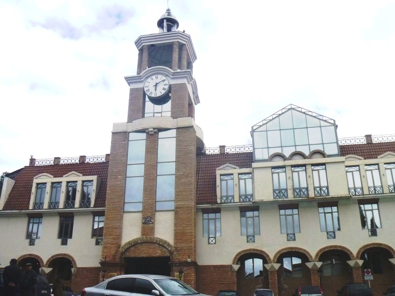
The town hall with its distinctive clock tower
Georgia National Tourism Administration: 4, Sanapiro St, 0105, Tbilisi, Georgia. Tel: +995 32 43 69 99. E-mail: info@gnta.ge. Website: www.georgia.travel; www.gnta.ge.
Qatar Airways has daily flights from Diosdado Macapagal International Airport (Clark, Pampanga) to Tbilisi (Republic of Georgia) with stopovers at Hamad International Airport (Doha, Qatar, 15 hrs.) and Heydar Aliyev International Airport (Baku, Azerbaijan, 1 hr.). Website: www.qatarairways.com.