Shannon Falls Provincial Park (Squamish, British Columbia, Canada)

Shannon Falls

From Britannia Beach, Grace, Jandy, Danny and I next drove the short 7.2-km. distance, along the Sea-to-Sky Highway on Howe Sound, to 87-hectare (210-acre) Shannon Falls Provincial Park, established on August 29, 1984 and located 58 kms. (36 mi.) from Vancouver and 2 kms. (1.2 mi.) south of Squamish.

Check out “Britannia Beach

Picnic Area

One of the town’s most recognizable features and visible along the Sea-to-Sky Highway (making it a popular day-use park), facilities in this park are operated by Sea to Sky Park Services Ltd. The small concession and information center, located next to the flush toilet building on the trail to the waterfalls, is managed by the park operator and offers food snacks, park and outdoor recreation information and souvenirs.

Concession and Information Center

The main point of interest in this park, which also protects the surrounding area on the north-east shore of the Howe Sound, is the 335 m. (1,099 ft.) high, iconic, scenic and towering Shannon Falls, composed of a series of cliffs.

The start of the hike …..

The third highest waterfall in British Columbia, it is ranked behind the 481 m. high Della Falls (Strathcona Provincial Park, Vancouver Island) and the 396 m. Hunlen Falls (Tweedsmuir Provincial Park near Bella Coola).

Shannon Creek

The falls was named after William Shannon who first settled the property in 1889 and made bricks in the area. The tumbling waters of the falls originate from Mount Habrich and Mount Sky Pilot. Shannon Falls rarely freezes but, when it does, it’s the subject of intense ice climbing interest. The falls and adjoining woods are commonly used in television and film production.

It is just a short hike to the spectacular viewpoint just below the falls.  From the parking lot, we walked towards the park area where the picnic tables and the building with washrooms were located. From there, we veered left and began walking uphill as our path turned into a gravel trail.  At the first junction, we went straight and continued, along the gravel path, as we entered the forest and continued walking next to scenic Shannon Creek.

Shannon Falls seen from the viewpoint

The route, going up a short hill, then reaches a paved path.  We went right and, as we continued walking, soon heard the sound of the roaring falls until the waterfall came into view.  This first viewpoint was an excellent place to take photos and selfies. Further up the trail is the Sea to Summit Trail, a second viewpoint, with Shannon Falls viewed at a slightly different angle.

L-R: Jandy, Grace, Danny and the author at the viewpoint

Shannon Falls Provincial Park: Squamish, British ColumbiaCanada. Tel: 604 986-9371.  E-mail: info@seatoskyparks.com.  Website: www.seatoskyparks.com.  Coordinates: 49°40′10″N 123°09′21″W

The Sad Tale of Lolong (National Museum of Natural History, Manila)

One of the prominent osteological specimens and main attractions on display at the National Museum of Natural History, hanging from the ceiling of Ayala Hall, is the skeleton of Lolong, the Philippine’s largest saltwater crocodile  (in captivity) ever recorded and officially certified by the Guinness Book of World Records on June 2012.

Check out “National Museum of Natural History

The taxidermied Lolong at Galley I (Philippine Biodiversity) of the National Museum of Natural Historyin Manila

This Indo-Pacific saltwater crocodile (Crocodylus porosus) weighed (via a truck weigh-bridge) 1,075 kgs. (2,365 lbs.), was estimated, subjectively, to be 50 to 60 years old and the crocodile was measured, sedated (via pancuronium bromide and diazepam), from the tip of the snout to the end of its tail, at 6.17 m. (20 ft., 3 in.), by Australian crocodile expert and zoologist Dr. Adam Britton, for Natural History New Zealand and National Geographic, in his enclosure on November 9, 2011.  Lolong broke the record of previous record-holder Cassius, the 5.48 m. (18 ft.) long male saltwater crocodile weighing around 998 kgs. (2,200 lbs.), kept captivity, since 1984, in the crocodile park of MarineLand Melanesia on Green Island, off the shore of Cairns in Queensland, Australia

This crocodile was suspected of eating a fisherman who went missing on June 2011 in the town of Bunawan in the province of Agusan del Sur, and also of consuming a 12 year old Rowena Romano paddling her way to school in Lake Mihaba.  Her head was discovered on March 7, 2009. He was also the primary suspect in the disappearance of water buffaloes in the known area. However, after his capture, Lolong was subjected to a purgative session, pumped with clean, fresh water until all the contents of his belly were upchucked.  Upon examination of the contents of his stomach, no remnants of human remains nor of the missing water buffaloes were found.

The author beside Lolong

He was captured on September 3, 2011 with the joint cooperation of the local government unit, residents and crocodile hunters of Palawan led by the 49 year old Ernesto “Lolong” Goloran Canete (the Philippines’ version of “Crocodile Dundee”), one of the veteran crocodile hunters from the Palawan Wildlife Rescue and Conservation Center (PWRCC).  The crocodile was hunted over a period of three weeks and it took around 100 people to bring him onto land. During the capture in a Bunawan creek in Barangay Nueva Era, he became, at several points, aggressive and broke restraining steel ropes (baited with carabao meat) four times before eventually being properly secured by a fifth, thicker cabled noose.

However, after weeks of stalking the crocodile, the hunt took its toll on Cañete’s health and, several days before the crocodile was captured, he died of a heart attack in August 28, 2011 (Cañete’s assistant led the successful capture).  In his memory, the crocodile was named after him. After his capture, Lolong, now in a small, hastily and cheaply prepared enclosed artificial pond with a concrete bottom, became the centerpiece in the Bunawan Ecopark and Wildlife Reservation Center, an ecotourism park in Barangay Consuelo, located 8 kms. from the town, for species found in the marshlands.

However, around 8:05 PM on February 10, 2013, just one and a half years after his capture, Lolong flipped over on its side and died inside his miserable compound. The necropsy (skinning of the carcass and other post-mortem procedures) revealed he had died of chronic interstitial pneumonia and cardiac arrest, which was aggravated by a fungal infection and stress brought about by his captivity. Large crocodiles often need to spend a large amount of time in water to alleviate the stress their weight puts on their body and the pool would frequently be drained to allow visitors a better look at him, helping to damage his internal organs which, potentially lead to his death.

Lolong’s carcass was first buried in the eco-park and then later exhumed and temporarily kept in freezers at Davao Crocodile Park.  On July 2013, a memorandum of agreement was signed between the new National Museum of Natural History and Bunawan town authorities for the museum to inherit and enshrine Lolong in its then-planned new museum. With Lolong’s death, the title of the world’s biggest crocodile in captivity reverted back to the aforementioned Cassius.  Likewise, the country’s largest crocodile in captivity reverted back to the 18 ft. long Pangil in the aforementioned Davao Crocodile Park.

To preserve his remains, taxidermy was performed at Philippine National Museum of Natural History.  Taking nearly 5 years to process both his skeleton and skin, zoologists, museum researchers and technicians worked to preserve its bones, assemble them and plan the best way to display the fragile specimen.  Exhibition fabricators, installation specialists and conservators also devised a steel frame to make sure the skeleton is securely held together and, in the process, will not be damaged.  Lolong’s skeleton was displayed as if it were swimming underwater and ready to attack its prey. Today the skeleton is displayed, hanging, at the museum’s Ayala Reception Hall.

Check out “The Sad Tale of Lolong” and “Ayala Reception Hall

The suspended skeleton of Lolong at Ayala Hall of the National Museum of Natural History in Manila

It took 12 people to lift the crocodile to its new home at the said museum.  The preserved skin is displayed at Gallery I (Philippine Biodiversity) at the fifth floor of the museum.  As the head and snout did not survive the post-mortem preservation stages, they are synthetic and difficult to recreate.  In the taxidermal stages, Lolong might have shrunk as much as 15%, so it shorter by as much as 3 ft.  Accordingly, the girth is also smaller.

Check out “Gallery I (Philippine Biodiversity)

National Museum of Natural HistoryAgrifina Circle in Rizal Park, T.M. Kalaw Street, corner General Luna Street, Manila. Open Tuesdays – Sundays,   9 AM to 12 noon (cut off time is 11 AM) and 1 to 4 PM (cut off time is 3 PM). Tel: 82981100 local 3000 and 85277889.  E-mail:  cmvod@nationalmuseum.ph or inquiry@nationalmuseumph.gov.ph. Visitors shall be limited to 100 per museum per session. Visitors are required to pre-book online at https://reservation.nationalmuseum.gov at least a day before the visit. Confirmation of booking will be sent through email. Group reservations are limited to five (5) persons only.  Walk-in visitors will NOT be accommodated.  Coordinates: 14°34′59.9″N 120°58′55.9″E.

The Great Ocean Road Adventure Tour: The Gibson Steps (Australia)

View from The Gibson Steps

Loch Ard Gorge was supposed to be the last item in our Great Ocean Adventure Tour itinerary but our Bunyip Tour guide/driver Jake Smithers said that, as we still had time, we were in for another treat to explore – The Gibson Steps.  From Loch Ard Gorge, it was just a short 5.1-km. (8-min.) drive to the Gibson Steps, another area of cliffs.

The Gibson Steps

For travelers heading west along the Great Ocean Road, the cliffs are actually the first sightseeing stop-off in Port Campbell National Park, a 1-km. (2-min.) drive from The Twelve Apostles. Set along the glorious stretch of Great Ocean Road, the Gibson Steps refers to the staircase, leading down the 70-m. high vertical cliffs, to the lush stretch of beach below.

The boardwalk leading to The Gibson Steps

Like most of the Great Ocean Road’s attractions, the Gibson Steps has a fascinating history dating back hundreds of years as it was originally thought that the steps were cut out by the Kirrae Whurrong people, a local tribe who called the area home.

However, it was only in 1869 that the steps got their full use and their name as local settler and pioneer Hugh Gibson, who built nearby Glenample Homestead, as well as fishermen and other seafaring workers, regularly used the 86 steep steps, carved into the face of the cliff, to access the beach and the water below.

The beach below

Gibson is most famous for his role in the Loch Ard shipwreck as Tom Pearce and Eva Carmichael, the two shipwreck survivors, regained their strength at his homestead.

Check out “The Great Ocean Road Adventure Tour: Loch Ard Gorge

From the viewing platform at the top of the steps, we marveled at the natural scenery on offer – Gog and Magog, the nicknames given to the two jutting giant limestone rock stacks rising up out of the Indian Ocean (or Southern Ocean according to Australian geographers). Spectacular natural wonders like the Twelve Apostles (however, they are not considered part of the Twelve Apostles), they were also sculpted by weather conditions.

Check out “The Great Ocean Road Adventure Tour: The Twelve Apostles

Gog (or Magog?)

The beach at the bottom of the Gibson Steps is popular for recreational fishing (Australian salmon, sweep, trevally, gummy shark, etc.) at an exclusion zone east of the steps towards Princetown (Clifton Beach).  However, despite the popularity of fishing, swimming here is highly unadvised, as the ferocious reefs and rip holes make for incredibly choppy waves.

The disappointing sign…..

Jandy and I wanted to make my way down to the beach via the steps to view the stacks in a different perspective but, halfway down, the path was barred as the area has been subjected to widespread storm and flood damage and will remain temporarily closed until required safety works are completed.

Our visit to The Gibson Steps marked the end of our Great Ocean Road Adventure Tour and  we were in for a long nearly 3-hour (226.9-km.) drive, via Princes Highway/A1 and M1, back to Melbourne. An hour (74.5 kms.) out of Gibson Steps, we made a short stopover, for dinner, at the Noodle Canteen in Colac before continuing on our way back to Melbourne. 

Noodle Canteen (Colac)

The Gibson Steps: Port Campbell National Park, Victoria, Australia. Tel: 1300 137 255. E-mail: pcvic@corangamite.vic.gov.au.

For those bringing their cars, park at the 12 Apostles and walk to Gibson Steps via a 1.1-km. gravel path section of the Great Ocean Walk which departs from the back of the kiosk at the 12 Apostles and safely underpasses the Great Ocean Road near the Gibson Steps viewing platform and beach access.  Coordinates:  38°40′06″S 143°06′43″E.

Noodle Canteen: 243 Murray St., Colac, Victoria 3250, Australia.  Tel: +61 3 5231 2807.

The Great Ocean Road Adventure Tour: Loch Ard Gorge (Australia)

Loch Ard Gorge

From The Twelve Apostles Visitor’s Facility, it was just a short 4.1-km. (5-min.) drive northwest, again via the Great Ocean Road/B100, to Loch Ard Gorge, one of the best-loved stop-off points along the road and the site of the most famous shipwrecks on the aptly named Shipwreck Coast.

Check out “The Great Ocean Road Adventure Tour: The Twelve Apostles

Jandy (in green jacket) making his way down the gorge via the stairway

Here are some interesting trivia regarding the gorge:

The Tom and Eva Pillars

Part of Port Campbell National Park, the gorge was named after the 3-masted clipper ship Loch Ard, one of over (since 1797) 800 known shipwrecks in Victoria, of which only 240 of them have been discovered.

On March 2, 1878, the clipper ship Loch Ard, on its fifth and final voyage, left England for Melbourne. Captained by the 29-year old newlywed George Gibb, it had a 36-member crew and 18 passengers. On June 1, 1878, approaching the end of a tumultuous three-month journey, it got lost in a pea soup type of fog, collided with a rock reef and ran aground on nearby Muttonbird Island. Of the fifty-four passengers and crew, only two survived – 15 year old Tom Pearce (a ship’s apprentice) and 17 year old Eva Carmichael (an Irishwoman emigrating with her family).

The bruised and dazed Tom, who jumped off the ship, clung to an upturned lifeboat and was washed ashore.  After hearing cries for help, he swam back into the ocean for an hour to rescue Eva, who was clinging on a chicken coop and ship’s spar, from the water. Tom dragged the barely conscious Eva into a cave and then proceeded to climb out of the gorge to raise the alarm to local pastoralists. Two stockmen from the Glenample Station, three miles away, rushed to their help and immediately set into plan a rescue attempt. However, only four bodies were retrieved and buried. Eva’s parents, three sisters and two brothers drowned that night.

The world wanted a satisfying ending and thousands of people sent letters and telegrams calling for Tom and Eva to be married. However, they hailed from different social classes (Eva’s father was a doctor) and they went their separate ways. After three months in Australia, Eva sailed to Ireland where she went on to marry an aristocrat Captain Thomas Achilles Townshend. Tom, hailed as a hero (he received £1000 for heroism and the first gold medal struck by the Victorian Humane Society), returned to England and lived until age 49 and was buried in Southampton. Eva died in 1934 at the age of 73. 

The author at Loch Ard Gorge

To soak up the incredible rugged scenery, a flight of stairs allow us and other visitors’ access to the picturesque gorge. We descended down to an undeveloped, orange-colored beach surrounded by jagged cliff tops.  A sharp sea breeze was blowing inland. The beach was fronted by a smooth, pearlescent bay and an inlet of clear, blue water flanked by two yellow-washed unconnected rock pillars, with tufts of vibrant greenery, of the nearby Island Archway.

The author, Kyle and Grace

A clear example of the process of erosion in action, the pillars once formed a natural bridge over the gorge but collapsed in June 2009.  They are officially named Tom and Eva after the two teenage survivors of the Loch Ard shipwreck.

Tom Pearce’s Cave

The loch also has two small caves which served as shelter for Tom and Eva and are aptly named Miss Carmichael Cave and Tom Pearce’s Cave. After getting to shore, Tom and Eva spent most of June 1st sleeping in the same cave but Victorian sensibilities demanded that they could not spend this time together unsupervised. Thus that cave became Miss Carmichael’s Cave, while the big cave to the east became Tom Pearce’s Cave.

The weathered cliff face

Unusual for this section of coast, Loch Ard Gorge has a relatively calm interior. Its low energy beach has a moderate sloping dune that, in most tide and ocean conditions, makes the beach accessible with caution.

A pathway also allowed access to the eastern side of the gorge. There are also numerous plaques (detailing geological features), a small museum (detailing the site’s history as well as housing some artifacts salvaged from the wreck), a rest area and a cemetery housing many of the people that died.

Loch Ard Gorge: Great Ocean Road, Port Campbell National ParkVictoria 3269, Australia.

The Great Ocean Road Adventure Tour: The Twelve Apostles (Australia)

The iconic 12 Apostles

From the Cape Otway Lighthouse, it was a longer 1 hour 15 min. (77.2- km.) drive, again via the Great Ocean Road/B100, to the Twelve Apostles along Victoria’s coastline, the highlight of our day-long tour and the jewel in the crown of the Great Ocean Road.

Koala on the ground. Though poorly adapted to walking on the ground, when disturbed, they can break into a bounding gallop, moving at speeds of up to 30 kms. per hour.

Along the way, we made a short stopover to observe adorable, spoon-nosed koalas, in the wild, on the ground or perched between the forks of eucalyptus trees.

12 Apostles Visitor’s Center

Interior of Visitor’s Center

The 12 Apostles are a collection of magnificent limestone stacks off the shore of Port Campbell National Park and their proximity to one another has made the site a popular tourist attraction. The road going there was breathtaking in its rugged splendor, with its dramatic, rugged cliffs carved from the sea and its panoramic views across the rich and azure waters.

Check out “The Great Ocean Road Adventure Tour: Cape Otway Lighthouse

Until the 1960s, the stacks were originally known as the Pinnacles and then, later, nicknamed the Sow and Pigs (or Sow and Piglets), with Muttonbird Island being the sow, and the smaller limestone rock stacks being the pigs or piglets.

The boardwalk leading to the viewing platform

For marketing purposes, they were then coined as the Apostles, which slowly turned into the 12 Apostles (although you could only see eight at the time of the name). In fact, there are thirty different limestone masses stretched along the coast.  However, the only visible ones from the viewing areas are the eight apostles left.

Grace, Cheska and Kyle at the viewing platform

Upon our arrival at the Twelve Apostles Visitor’s Center (has toilets, coffee shop and souvenirs), we walked, along a wooden boardwalk, towards the viewing platform where we were awestruck in wonder at their size, splendor, myth, mystery and beauty.

However, only seven of the original eight stacks, spread out along 17 kms. of the Shipwreck Coast, have remained standing tall and proud along the shore, after a 50-m. tall (160 ft.) stack collapsed in July 2005.

The additional stacks located to the west

Though the view of the Twelve Apostles, from the promontory, never included twelve stacks, additional stacks, not considered part of the Apostles group, are located to the west within the national park.

Beginning 10–20 million years ago, the iconic as the incredible  Twelve Apostles were formed by constant erosion (up to two centimeters a year) by harsh and extreme weather conditions from the blasting winds, powerful surf and the salt of the tempestuous and stormy Southern Ocean which gradually eroded the soft limestone, carving out cavernous caves in the cliffs.

These caves then become arches that eventually collapse, leaving rock stacks or columns up to 50 m. (160 ft.) high which were left isolated from the shore and susceptible to further erosion from waves.

In the future, due to wave action also eroding the majestic, 70 m. high cliffs, the existing headlands are also expected to become brand-new apostles emerging from the coast in the near future.

The reason for the irregular shape of the erosion is due to the stacks being made up of layers of varying soil types.  The main layer is limestone but the other layers are a mixture of clay and mudstone. Because of the lower density of the mudstone and clay layers, they tend to be more narrow and much more easily eroded by the weather than the slightly denser limestone.

A glorious photo opportunity of the Apostles, in all their splendor, is during sunrise and sunset when the 12 Apostles change color, from dark and foreboding in shadow to brilliant sandy yellow under a full sun.  As the sun rises on her mast, the golden colors, with flecks of rose and red, spill across the rocks.

As the sun starts to fall, the sky explodes with burnt oranges and lavender hues, and the same colors drip across the rocks, adorning the apostles with rainbow colors before they look into foreboding shadows.

12 Apostles: Great Ocean Rd. and Booringa Rd., Princetown, Victoria 3269, Australia. Tel: +61 1300 137 255.

How to Get There: The 12 Apostles are located 275 kms. west of Melbourne, approximately a 4 to 4.5-hour scenic drive, along the Great Ocean Road, from Melbourne via Geelong. You can return to Melbourne on the 3.5-hour inland route along the Princes Highway.

Beitou Thermal Valley (Taipei, Taiwan)

The steaming, jade-colored waters of Beitou Thermal Valley

It was raining heavily when we departed Yangming Park for the short 6.6-km. (15 min.) drive to Beitou Thermal Valley, a valley located on the foothill of Yangmingshan National Park.

Hotels, resorts and inns on a hillside within the valley

It is one of the sources of acidic sulfur hot spring in the area and, historically, was considered as one of the eight attractions and one the “12 great sights of Taiwan” during the Period of Japanese Occupation.

Stalls selling street food and souvenir items

Xinbeitou Village occupies a lush valley that is home to 1200 species of plants, 110 species of birds and 160 varieties of butterflies.

Check out “Yangmingshan National Park

Guide Map

The park is a good place to relax or go for a stroll. The rain stopped when we arrived at the resort area.

Souvenir Shop/Cafe

Walking along a boardwalk, past a souvenir shop (with a café inside selling hot and cold drinks), we could already feel the temperature rise (having the highest temperatures of any in the Datunshan volcano group, the highest temperature of the springs here ranges from 80-100℃).

We also noticed an eerie sulfuric steam rising from the surface of the bubbling, green-tinted pond which blankets the Thermal Valley year-round. Playing around in the breeze, the steam gave the valley a surreal sulfuric atmosphere and a frightening quality, which has given rise to nicknames such as “Ghost Lake” and “Hell Valley.”

In the past, visitors were once allowed to soak their feet at certain points as well as boil eggs in the hot springs.  Both practices have since been prohibited, not only to protect the water quality but also to keep tourists from falling in and boiling themselves.

A small waterfall

Located beside Beitou Hot Spring Park, the spring water here is high in the radioactive element Radium which, in the past, underwent a corrosive reaction with andesite  rocks on the river bed about 150 meters downstream, creating layers of rare, cream and white diamond-shaped crystals called hokutolite (named after Hokuto, the Japanese name for Beitou), also known as Anglesobarite or Beitou rocks, the only mineral in the world to be named after a region of Taiwan. They can only naturally be found in only two places: Beitou and Tamagawa (Akita Prefecture, Japan).

A glass-encased hokutolite rock sample

To ensure the protection of these natural rarities, the “Beitou Rock Conservation Area” has been established in recent years. Thus, visitors to the Thermal Valley not only get to experience “hell,” but also gain insight into some rare radioactive rocks. Its mineral water also contains PlasterAluniteJarositeRealgar and  Sulfur and its pH value is between 1.4~1.6.   As sodium carbonate tend to be highly acidic and corrosive, the springs have also been called the “Green sulfur springs” and “Sulfur heads.”

The author at Beitou Thermal Valley

Today, the main source of the “white sulfur” hot spring water used in Beitou hot spring establishments is the Liuhuanggu and Longfenggu thermal valleys located further uphill in Yangmingshan National Park.

Beauty Age Hotel

Beitou Thermal Valley: Beitou DistrictTaipeiTaiwan.  Open Tuesdays to Sundays, 9 AM – 5 PM.

How to Get There: The only metro-accessible hot spring in Taiwan, a two-station line connects Xinbeitou, Taipei City’s only hot spring village, to Beitou station on the Danshui line. From Taipei’s Main Station, go north on the Red Line, to Beitou. Once there, change to the Pink Line by going downstairs and back up again on the other side of the platform and take it one stop to Xinbeitou (New Beitou).


Sugba Lagoon (Del Carmen, Surigao del Norte)

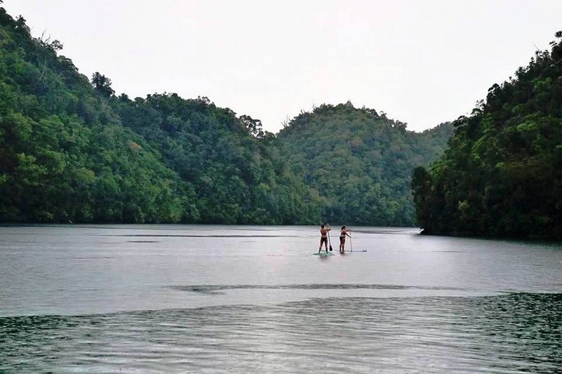
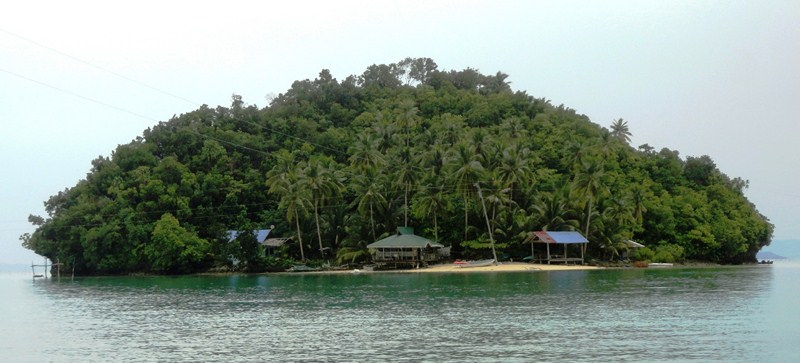
Sugba Lagoon (photo: Ms. Louise Santianen)

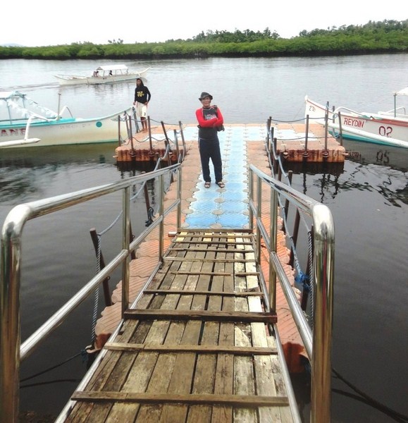
After a lunch at Krokodeilos and tour of the nearby Mangrove Protection and Information Center (MPIC), we all went down a gangplank to Del Carmen’s modular plastic floating dock and boarded two motorized outrigger boats for our boat tour to Sugba Lagoon (also known as Caub Lagoon).

Check out “Mangrove Protection and Information Center

Del Carmen’s floating dock

The 30 to 45-min. boat ride to the lagoon from the port was half the fun as we were to traverse wonderful and breathtaking scenery.

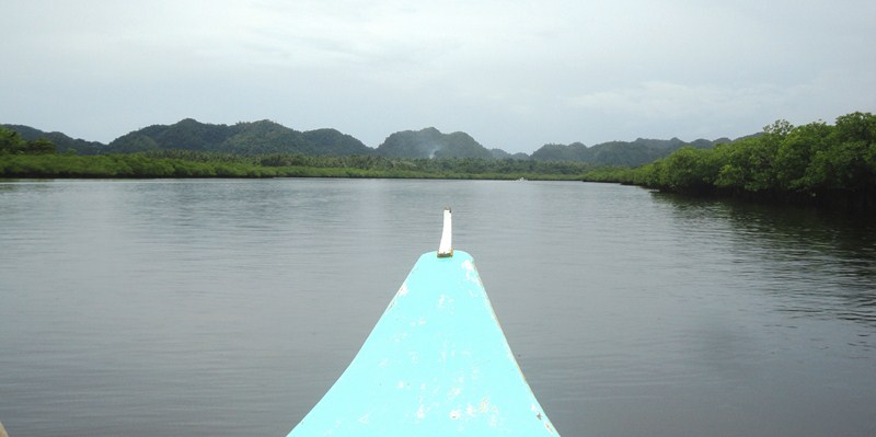
Entering the town’s massive mangrove area with its backdrop of green hills

Initially, we entered Del Carmen’s massive mangrove area with a backdrop of small green hills, passing fishermen on their boats, to some offshore islands.

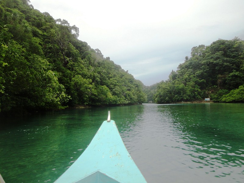
Our boat wining its way through a narrow passage

Then, we went through a narrow passage that opened up into a large bay.  Here, we espied some small, thickly vegetated islands with sandy pocket beaches and small villages with houses on stilts.

Small island with a pocket beach and houses on stilts

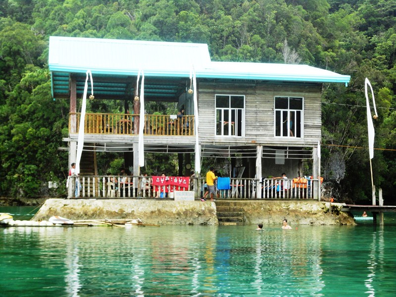
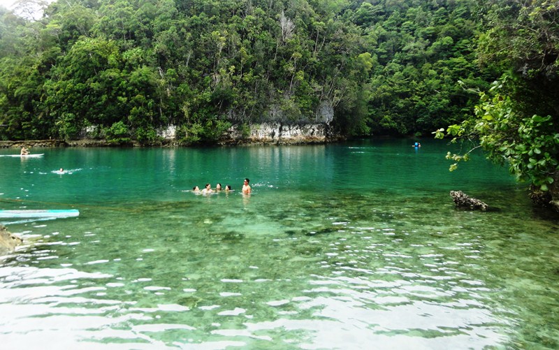
Soon after, we reached the small, secluded Sugba Lagoon and its two-storey pavilion built by the local government unit to cater to visitors. At the pavilion, you can rent a table (PhP50). The lagoon, with an estimated area of 87 hectares, visually captivated us with its overwhelming natural beauty.

The two-storey pavilion for visitors

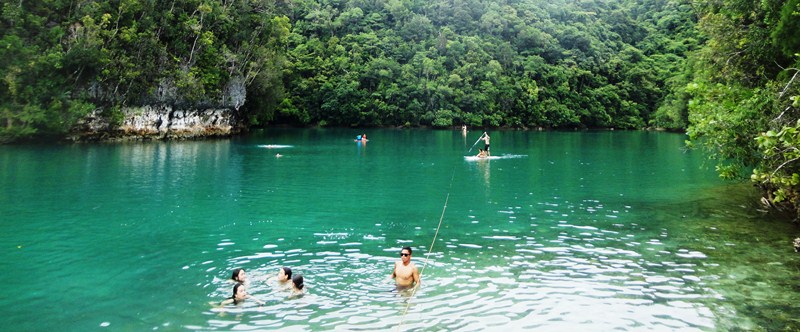
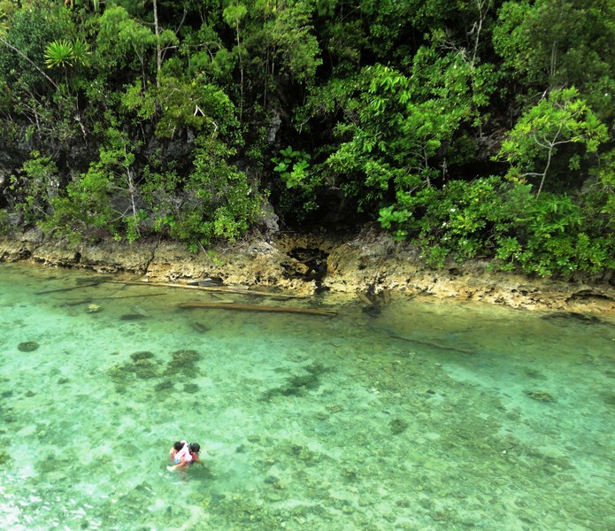
The clear green-blue, brackish waters, inhabited by different variety of fish, are surrounded by large rocky limestone hills that are home to a rich diversity of flora and fauna, different species of birds as well as endangered species of hardwood trees.

The lagoon is said to have gotten its name from the Visayan word sugba meaning “to grill,” in reference to the smoke seemingly coming off the lagoon when it is covered with fog. With its nice and clear waters, it was perfect for swimming.

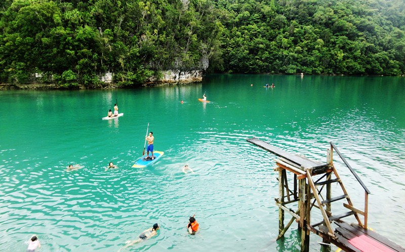
Diving area

The water is quite deep but you can rent (PhP50) life vests if you don’t swim. There are some jellyfish here but, apparently the small ones are harmless, but the big transparent jellyfish with long tentacles do sting.

The shallow part of the lagoon

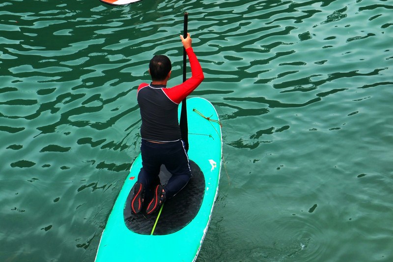
Here, TJ and I tried stand up paddle boarding (rent: PhP600/ay or PhP200/hour).  The rest of our media group just stayed within the pavilion. You can also do snorkeling, kayaking or jump off from a 2 m. long wooden diving board of moderate height.

You can also rent rafts at the lagoon. You can get some decent lunch to take out at the Krokodeilos restaurant. So you won’t be abruptly short on time, it is best to go there in the morning or noon as the place has a curfew in the afternoon unless you’re booked for an overnight stay.

The author taking his first baby steps in stand up paddle boarding (photo: Ms. Louise Santianen)

Sugba Lagoon: Brgy. Caub, Del Carmen 8418, Surigao del Norte. Admission fee: PhP250/group. At Del Carmen port, a boat ride costs PhP1,600 for 6 persons (additional PhP200/pax if there are more than 6 people in your group). If you have a guide with you, he gets in for free. You will also need to pay for a boarding pass of PhP50/boat.

Siargao Tourism Office: Paseo De Cabuntog, Brgy. Catangnan, Gen. Luna, Siargao Island. Mobile number: (0921) 718-2268 (Ms. Donna Grace T. Estrella – Siargao Tourism Coordinator).

How to Get There: Skyjet Airlines has daily, 100-min. direct flights from Manila (NAIA Terminal 4) to Siargao (Sayak Airport). ETD Manila at 6 AM (M8-421), ETA Siargao at 7:40 AM. Return flights: ET Siargao at 8:10 AM (M8-422), ETD Manila at 9:50 AM.

Skyjet Airlines: Manila Domestic Airport, Parking A, Terminal 4, NAIA Complex, Brgy. 191, Pasay City, Metro Manila. Tel: (02) 863-1333 and (02) 823-3366. E-mail: sales@skyjetair.com. Website: www.skyjetair.com.

Magpupungko Tidal Flats & Lagoon (Pilar, Surigao del Norte)

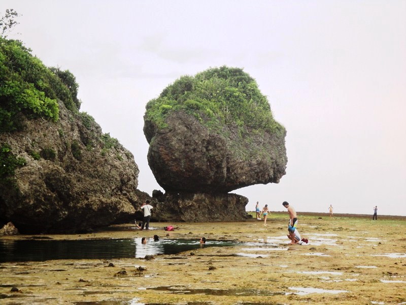
Magpupungko Rock

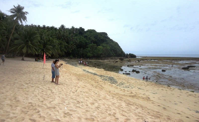
After our short visit at Port Pilar,we again boarded our respective vans for the short drive to Magpupungko Beach, a favorite destination of tourists.  This small 300 m. long stretch of cream colored sand beach has cottages and shower rooms and, as it faces east towards the edge of the Pacific Ocean, it also has a great view of the sunrise. However, this is not your usual beach.

Magpupungko Beach

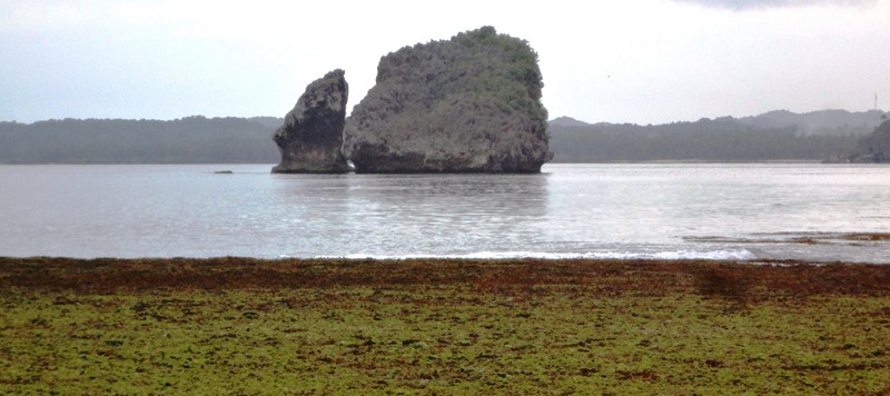
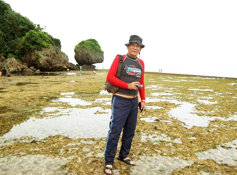
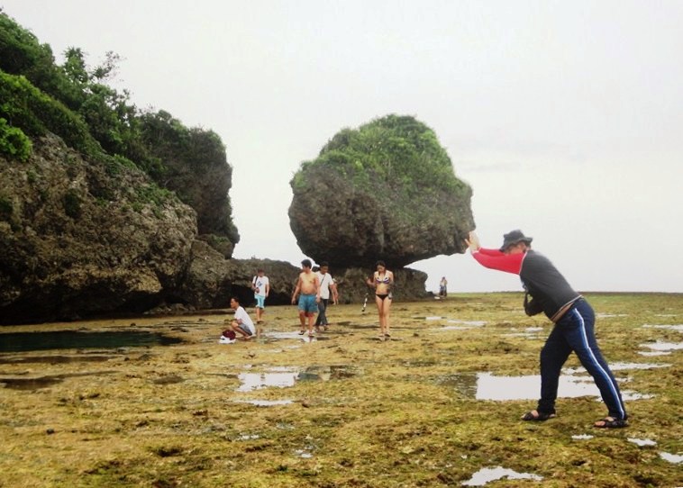
It was low tide when we arrived, so we were able to walk, in ankle-deep waters and exposed rocks, to its northernmost end which is decorated by amazing rock formations, the largest of which is the iconic Magpupungko Rock that sits on top a flat rock.

The place was so named because of this rock’s squatting position. The word pungko is Visayan for “to squat,” “to bend” or “to sit”so, after adding some prefixes, the name became Magpupungko.


An offshore rock formation

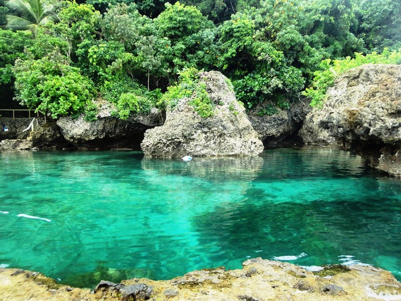
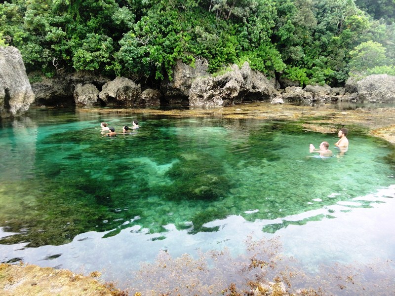
The area also hosts one of the Philippines’ stunning tide pools, natural pools along the shore that seem like infinity pools, created by enclosed underwater crevices where sea water gets trapped during low tide.

The author with Magpupungko Rock in the background (photo: Donald Tapan)

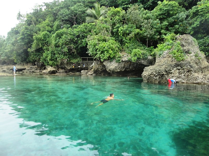
Swimmers in these natural, placid green pools are protected by the strong, crashing waves coming from the Pacific Ocean by wide underwater boulders that serve as a wall. Both rock formations and tidal pools were created by nature itself.

The refreshing pools were too good not to be enjoyed so I dove into one natural, jacuzzi-like pool with clear and gleaming turquoise sea water flowing into it. The other members of my group just opted to take pictures of the rock formations and the strong waves crashing against the rocks.

The water seemed shallow because I could see various rocks jutting out from it but, at the farther end of the rock pool, some parts were actually deep, even in low tide.

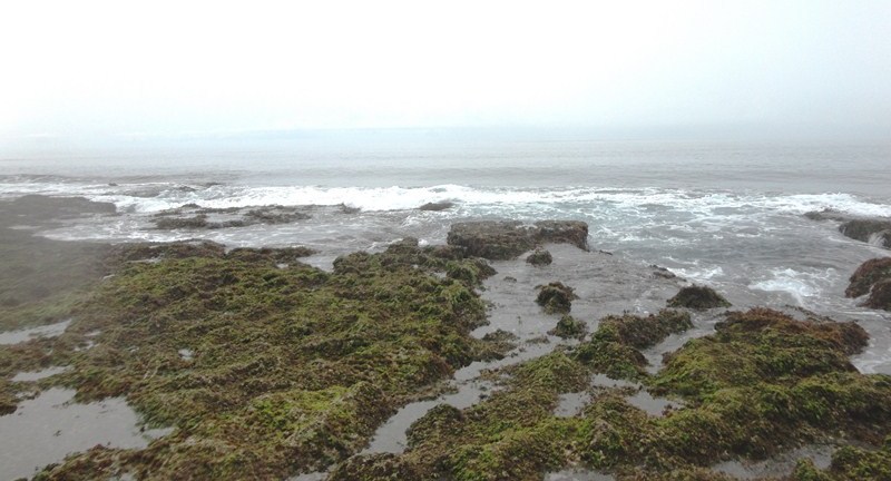
The waves of the Pacific crashing against the boundary of the reef

These alluring, crystal clear tidal pools, hardly discernible during high tide.are indeed unique and a sight to behold. The color of the water is comparable to that of Tangke Lagoon at Isla Gigantes in Iloilo.

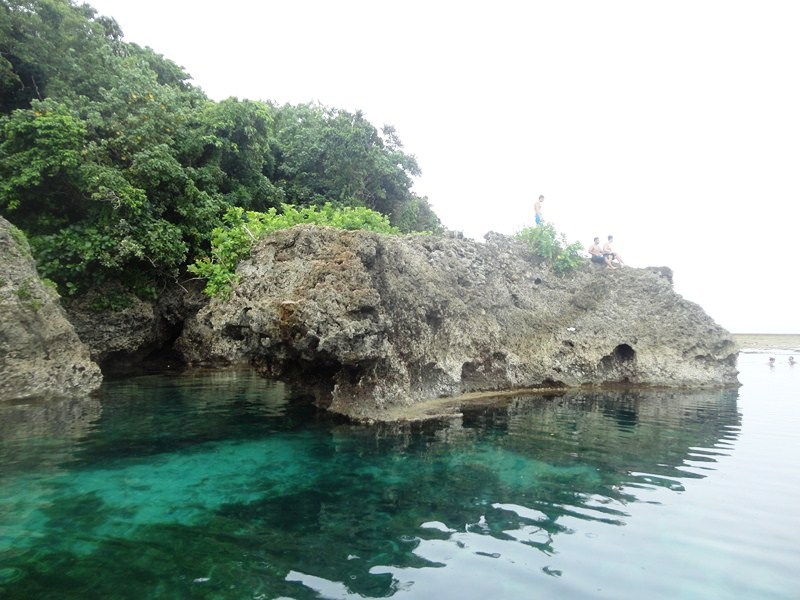
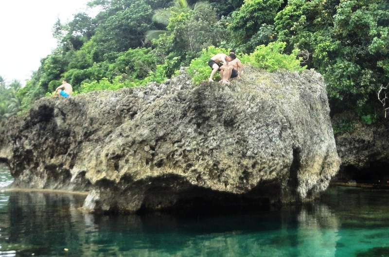
However, most tourists and locals go here for cliff diving, an extreme activity done from one of the islets. Many sections of the pools are deep enough and, thus, safe to dive from.

The edge of the tidal flat is also just a few strokes away and, as long as you can swim, there’s very little chance of drowning. They climb the rocks beside the pool (which is not easy to do as they’re sharp and kind of a long walk), and then jump off to the deep end of the water.

Tourist getting ready to dive atop a large rock formation

These tidal pools are also perfect for snorkelers, with stout elephant ear corals, providing shelter for many marine organisms that inhabit the pool, growing at the sides of rock outcroppings.

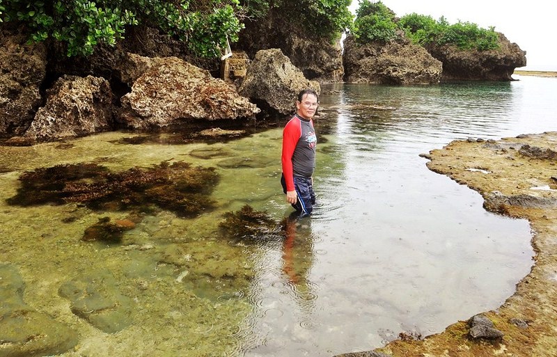
The author trying out one of the tidal pools (photo: Donald Tapan)

Beyond the Magpupungko rock formation are shallow, sandy tidal pools which are habitats of reef snakes and sea kraits. Though sea snakes are often shy and reluctant to bite, it is not recommended that you swim here.

The author trying to push Magpupungko Rock out of the way

Magpupungko Tidal Flats & Lagoon: Brgy. Consolacion, Pilar, Surigao del Norte. Beach entrance fee: PhP50/pax. Coordinates: 9.87551N 126.11995E. Besides a toilet, there are no facilities in Magpupungko, so bring food and other essentials if you wish to stay long.

Siargao Tourism Office: Paseo De Cabuntog, Brgy. Catangnan, Gen. Luna, Siargao Island. Mobile number: (0921) 718-2268 (Ms. Donna Grace T. Estrella – Siargao Tourism Coordinator)

How to Get There: Skyjet Airlines has daily, 100-min. direct flights from Manila (NAIA Terminal 4) to Siargao (Sayak Airport). ETD Manila at 6 AM (M8-421), ETA Siargao at 7:40 AM. Return flights: ET Siargao at 8:10 AM (M8-422), ETD Manila at 9:50 AM.

Skyjet Airlines: Manila Domestic Airport, Parking A, Terminal 4, NAIA Complex, Brgy. 191, Pasay City, Metro Manila. Tel: (02) 863-1333 and (02) 823-3366. E-mail: sales@skyjetair.com. Website: www.skyjetair.com.

Small Lagoon (El Nido, Palawan)

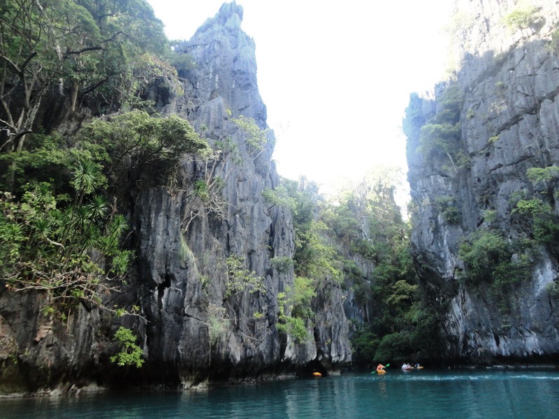
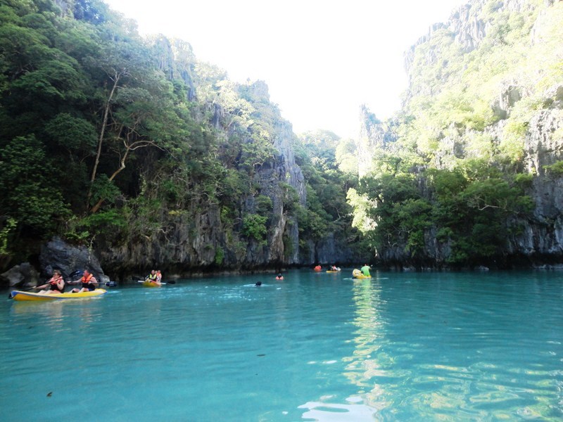
The Small Lagoon

The Small Lagoon

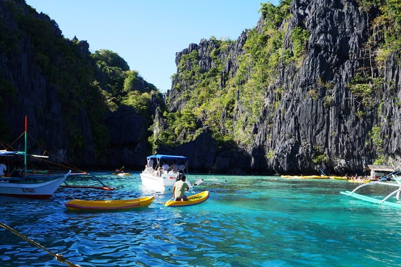
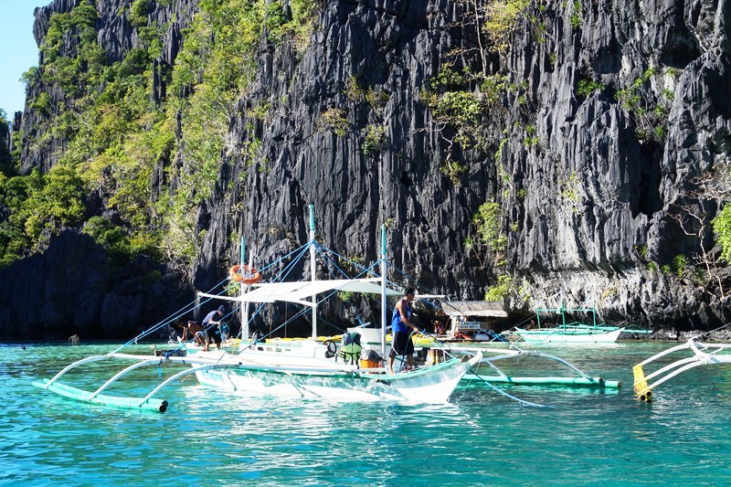
From Secret Lagoon, we again boarded our motorized outrigger boat for the continuation of our Island Tour A, this time to the Small Lagoon.  Along the way, we passed by, but didn’t stop, at the entrance of the Big Lagoon. On arrival, our outrigger boat parked , alongside other boats, just outside the entrance of the Small Lagoon as it could not access the interior as its entrance is narrow and its waters are shallow.

The entrance of the Small Lagoon

The entrance of the Small Lagoon

Boats parked at the entrance

Boats parked at the entrance

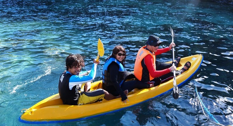
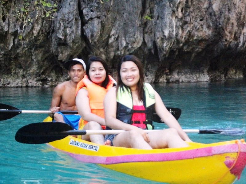
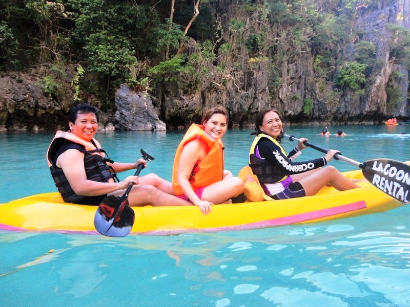
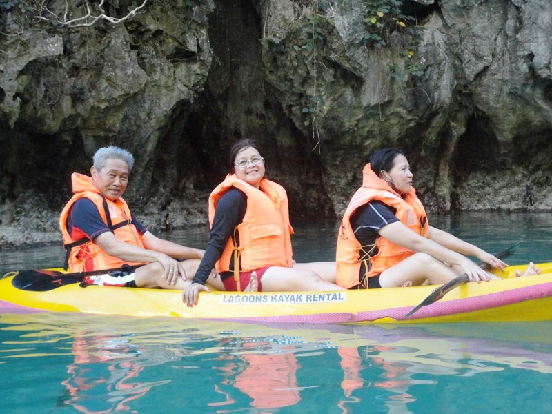
To view the wonders of the lagoon, we would have to either swim the 150-300 odd meters into the lagoon from our boat, if you’re a good swimmer, or kayak. Those who opt to swim usually get really tired going to the end of the lagoon, since the waters are deep inside.  We all chose the latter.

Jandy, Melissa and Osang get on their way ......

Jandy, Melissa and Osang get on their way ……

Our boatman, Luchie and I follow suit ......

Our boatman, Luchie and I follow suit ……

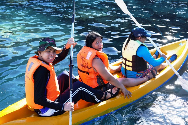
Kayaks here are rented for PhP300. Though made for two people, a third person was allowed to seat between the two sitting compartments.  Jandy joined Melissa and Osang in one kayak while I was joined by Luchie and another boatman.  Tess, Venus, Sandy, Pam, Melai, York, Lydia and Weng also rented kayaks.

Melai and Pam with their boatman

Melai and Pam with their boatman

Sandy, Venus and Tess

Sandy, Venus and Tess

York, Lydia

York, Lydia

Donning our orange-colored life jackets, we made our way to the narrow archway between the rock face.  Once through, we were ushered into eerily quiet and serene waters of a beautiful, turquoise lagoon enclosed by towering limestone cliffs. The giant limestone walls towering over us bounced around our echoes of wows.

The massive limestone cliffs enclosing the lagoon

The massive limestone cliffs enclosing the lagoon

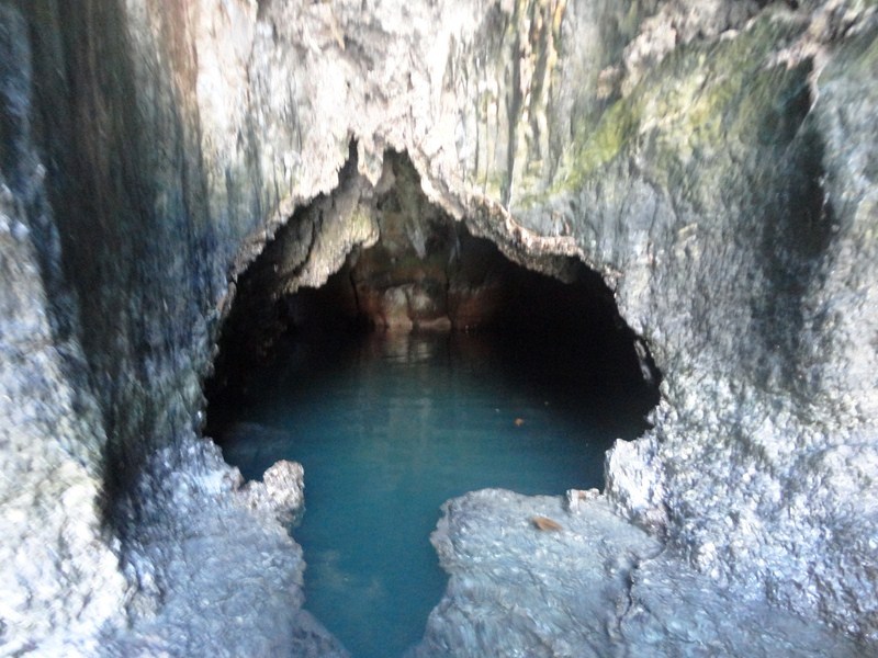
The small cave at one end of the lagoon

The small cave at one end of the lagoon

We were always on the lookout as we kayaked as there were also a number of swimmers inside the lagoon. This place is also great for snorkeling and there were also some snorkelers checking out the underwater creatures beneath.

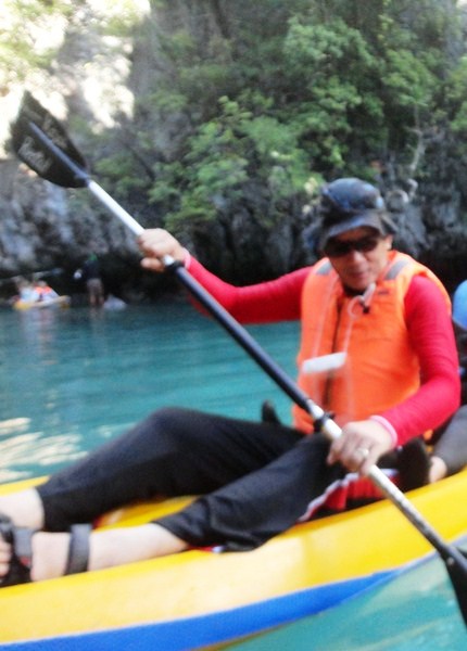
The author paddling away

The author paddling away

There was a rocky area where people could climb up and dive off or use it as a stage where they can do their selfies. We also checked out a small cave and pool at the end of the lagoon.

The Resort Bayview Hotel El Nido: Sitio Marimegmeg, Brgy. Corong-Corong, El Nido, 5313, Palawan.  Tel: + 66(0) 76 281 406. Fax: + 66(0) 76 384 369. Mobile numbers: (0915) 250-7368 (Globe) and (0920) 975-8690. E-mail: theresortelnido@gmail.com. Website: www.elnidobayview.com.

The Colorful, Sound of Music Town of Mondsee (Austria)

Mondsee

After our short photoop stopover at the Salzburg Lake District, we again boarded our tour bus for the final destination of the Original Sound of Music Tour – the scenic and lovely, Baroque Upper Austrian  lakeside town of Mondsee in the Vöcklabruck district.

Check out “The Original Sound of Music Tour

Peter briefing tour participants upon arrival at Mondsee

Located at the northern banks of Mondsee Lake (one of Austria’s last privately owned lakes), it is named for the lake’s crescent-moon shape. One of the biggest (and the warmest) of the Salzkammergut 76 lakes, Mondsee lake is 11 kms. (6.75 miles) long and 2 kms. (1.25 miles) at its widest.

Cheska at the town square

At the town, our Panorama Tours guide Peter allotted us time to avail of lunch as well as explore the lemon-and-white, twin-spired Minor Basilica of St. Michael the Archangel, the cloister collegiate church of the historic medieval Mondsee Abbey (founded in 748).

The author (left) with the Minor Basilica of St. Michael the Archangel in the background

The interior of the church hosted the wedding of Maria (played by Julie Andrews) and Captain von Trapp (played by Christopher Plummer) in the famous 1965 Austrian-set musical film The Sound of Music.

Grace and Kyle at a fountain beside the church

It has made the town the go-to wedding destination of the region, with 400 weddings taking place throughout the year.

Check out “Minor Basilica of St. Michael the Archangel

Colorful townhouses

Apart from its connection with the movie, charming Mondsee is a riot of gaily painted townhouses, mostly restaurants and stores selling handcrafted wares, bordering its main square and along its streets.

The Rathaus (town hall)

Right outside the church is the city tram stop where trams bring visitors to the lakeside promenade which is lined with several highly rated and elegant restaurants and cafés serving traditional Austrian fare (such as local apple strudel and freshly baked rye bread from a traditional mill) as well as modern cuisine.

Drachenwand (Dragon Wall) MountainA stunning backdrop is formed by the craggy rock face of the impressive Drachenwand (Dragonwall) at the southern shore of the lake.

Schlossbräu Mondsee,

Mondsee is also home to a series of Neolithic pile-dwelling (or stilt house) settlements discovered in 1864 in the lake.  Dating back 5,000 years, they are that are part of the Prehistoric Pile dwellings around the Alps UNESCO World Heritage Site.

Kyle and Jandy

In the warmer months, Mondsee offers stunning scenery and, in December, charming Weihnachts (Christmas) festivities.

Mondsee Tourist Information Office

The town is a 28-km. (21 min.), drive, via the A1, from Salzburg and thanks to its proximity to the city, Mondsee is frequented by visitors every weekend.

Mondsee Town Square

Mondsee Tourist Information Office: Dr.Franz-Müller-Straße 3, 5310 Mondsee, Austria. Tel: +43 6232 2270. Website: salzkammergut.at.