Save the Manila Metropolitan Theater!!!

Just a day after my birthday, I joined my media friend Mr. Fernando “Rannie” Bernardo and Ms. Melissa Grace Dizon (La Consolacion College School of International Hospitality Management professor) in a group being assembled  by Mr. Lawrence “Rence” Chan (who hosts the Royal Postal Heritage Tour), of the Filipinas Stamp Collectors’ Club, that was to be part of a special documentary tour with the GMA 7 I-Witness team.  The documentary was to feature the sorry plight of the now-abandoned and unused Metropolitan Theater (fondly called “The Met”), for me a precious and stunning icon of the Filipinized Art Deco genre that needs to be preserved for other generations to see and appreciate.

The Manila Metropolitan Theater

Aside from Rence, Ronnie, Melissa  and I, our group also consisted of Ms. Ma. Fatima T. Flores (a B.S. Architecture student from FEU), Mr. Efren C. Taburnal, Jr.; Ms. Gemma Suguitan-San Jose (of the Southern Luzon Association of Museums); Ms. Maria Ronna Beltran (a blogger); Mr. Dong Despojo (Prima Camera Club); Mr. Noel Aguilera Acedillo (Prima Camera Club); Ms. Bettina Arriola (an art teacher) and Ms. Marian L. Barro (a U.P. Manila student).

Our documentary group

However, due to some miscommunication between GMA 7 and Rence, the scheduled tour did not push through.  Even worst, we were not allowed entry by the security guards.  Just the same, so as not to make this an exercise in futility, Rence proceeded to give us a moving documentary on the history of the Met. The theater, along the Pasig River and in front of the equally classic Manila Post Office, was designed, in  the Art Deco style (then a rage in the U.S.A.), by National Artist (for Architecture) Arch. Juan M. Arellano.
Inaugurated on December 10, 1931, it seats 1,670 (846 in the orchestra section, 116 in loge and 708 in balcony) and was the biggest in the Far East at that time. During its heyday as the “Grande Dame” of theaters, the Met played host to vaudeville acts, zarzuelas, operas, pageants, Filipino and Spanish plays, and performances by well-known artists such as violinist Maestro Jascha Hefertz and composer/conductor Dr. Herbert Zipper (who conducted the Manila Symphony Orchestra).

Severely damaged (losing some of its roofing and some walls destroyed) during the liberation of Manila in 1945, the theater was rebuilt, fell into decay in the 1960s (where it became an ice cream parlor, boxing arena, garage, motel and gay club) and was meticulously restored to its former glory by Arch. Otillo Arellano (Juan Arellano’s nephew) and former First Lady Imelda R. Marcos and rededicated on December 17, 1978.

However, it again fell into decay. Worst, a nondescript, 24-hour Park n’ Ride bus terminal and parking structure, with its accompanying itinerant vendors and equally unsightly food stalls, was built behind the theater by then Manila Mayor Lito Atienza, compromising the theater’s once-privileged landscape.

Stained glass panels above main entrance
Detail of bas-relief curlicues

In 1996, it was closed due to a long-running financial dispute between the city government and the Government Service Insurance System (GSIS) over its ownership and management. On June 3, 2010, after extensive renovations (the main roof and 2 minor ones were repaired), it was again reopened by Pres. Gloria Macapagal-Arroyo and Manila Mayor Alfredo S. Lim but again slowly deteriorated due to disuse, typhoons (Angela) and water infiltration.  Water and electricity has been cut off.  The main entrance is now home to the homeless vagabonds and its arcades are filled with garbage and stinks to the high heavens with urine.

Tiara-like pediment with minarets
The theater’s still exuberant and symmetrical exterior, with its tiara-like pediment with stylized minarets, has rectangular stained glass panels (by Kraut Art Glass of Germany), bas-reliefs with curlicues or mask-like chimeras; whimsical rope designs; friezes; colorful ceramic tiles; capiz shell main entrance lamps; intricate grille work at the doors and windows; and is also enhanced by sensuous, exotically-draped female statues, said to be Siamese dancers, done by Italian sculptor Francesco Riccardo Monti (who lived in Manila from 1930 until his death in 1958). It used to house the Museum of Philippine Costumes and Dolls, a GSIS district office, an LBC branch and a travel agency.
 
Female statues done by Monti
Detail of column with capiz lamps
Theater arcade
Another statue by Monti
NHI plaque

Such a beautiful Art-Deco masterpiece deserves a much better fate and should not follow the demise of other gems such as the Manila Jai Alai Building and Meralco Building.

Manila Metropolitan Theater: Padre Burgos Ave., Liwasang Bonifacio (near LRT Central Terminal), Manila

Quezon Bridge (Manila)

Quezon Bridge

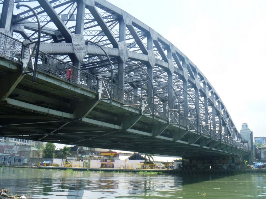
The 447 m (1,467 ft) long 22.50 m and (74 ft) wide Quezon Bridge, a combined arch and prestressed concrete girder bridge, connects the Manila districts of Quiapo (it is also commonly known as “Quiapo Bridge” since it connects the Quiapo area to the heart of Manila proper) and Ermita across the Pasig River in the Philippines.

Structural members underneath the bridge

The bridge, which replaced the Puente Colgante, the first bridge built over the Pasig River and first steel suspension bridge in Southeast Asia, was constructed in 1939 under the supervision of the engineering firm Pedro Siochi and Company. Immediately behind the bridge is the Manila Post Office Building.

The murky Pasig River underneath the bridge

Named in honor of Manuel Luis Quezon, president of the Philippines at the time of its construction, Quezon Bridge was designed as an Art Deco style arch bridge and was inspired from the design of Sydney Harbour Bridge. Rebuilt in 1946, after World War II, its last major structural repair was done in 1996.

NOTES:

On April 10, 2014, the bridge was affected by a fire that razed a community of shanties underneath the bridge.

After months of construction work, the bridge was strengthened, without entirely closing Quezon Bridge to traffic, by replacing damaged structural components, performing sand blasting, installing carbon fiber and applying epoxy on the deck slab.

Arroceros Forest Park: Manila’s “Last Lung”

I was slated to join a group being assembled  by Mr. Lawrence “Rence” Chan (who hosts the Royal Postal Heritage Tour) as part of a special documentary tour with the GMA 7 I-Witness team tasked to feature the sorry plight of the now-abandoned and unused Metropolitan Theater.  However, as I arrived very early, I decided to explore the nearby Arroceros Forest Park.

Arroceros Forest Park

Arroceros Forest Park

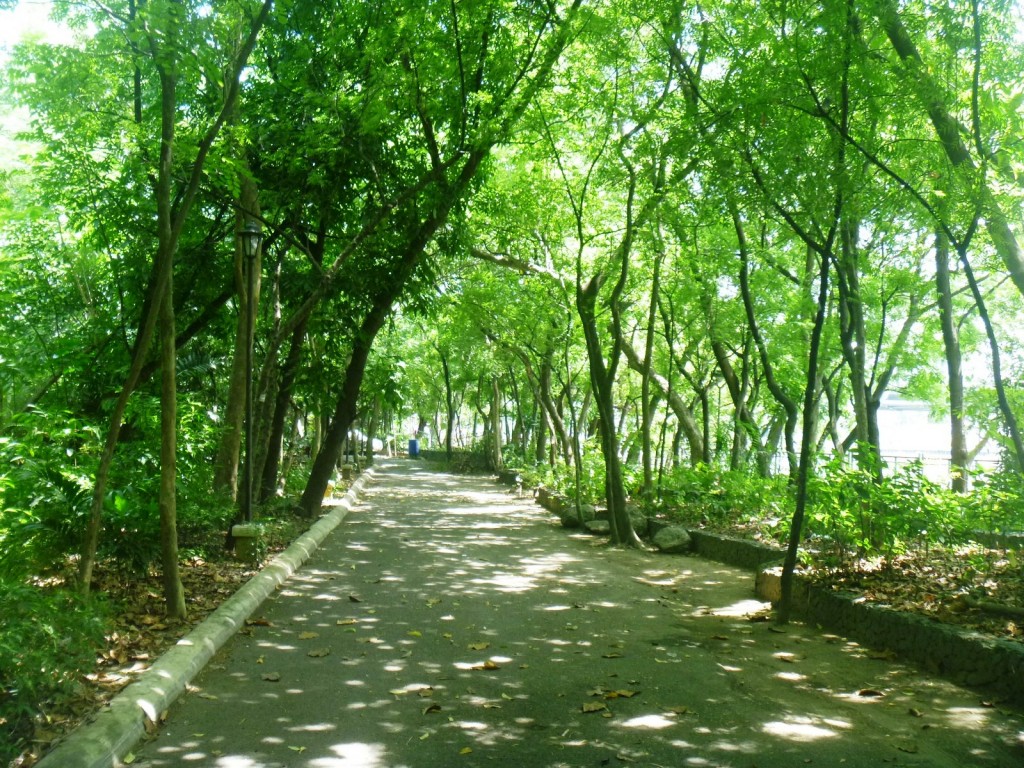
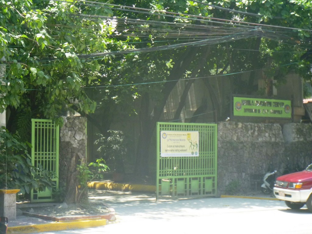
Located in the  middle of Manila, on the western bank of the Pasig River, beside the LRT Central Terminal Station and right beside the point where one end of the Quezon Bridge (formerly Puente Colgante) is situated, this small but valuable pocket of green is the only secondary forest left in the entirety of this noisy and polluted metropolis.

Quezon Bridge over the Pasig River

Quezon Bridge over the Pasig River

Upon entering its gate, I was literally transported to a different world as this 2.1428-hectare mini forest park was intended, by former Mayor Alfredo Lim, as a refuge of Manileños from the chaos and pollution of this rapidly urbanizing city.  In 1992, the city government purchased this abandoned riverside lot, for PhP60 million, from the Land Bank of the Philippines.

The park entrance

The park entrance

The park has a rich history, though, it being the site of a 16th and 17th century trading post where Filipino rice dealers in Pasig River engaged in barter with visiting Malay and Chinese traders.  The name arroceros was derived from the Spanish words meaning “rice dealer.”  Later, it became the site of the historic Fabrica de Tabacos. during the 19th century and, site of a military barrack (Estado Mayor) during the American era.

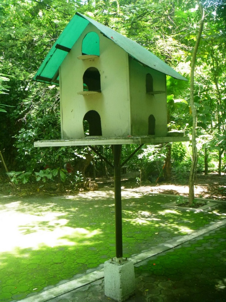
A man-made home for the birds

A man-made home for the birds

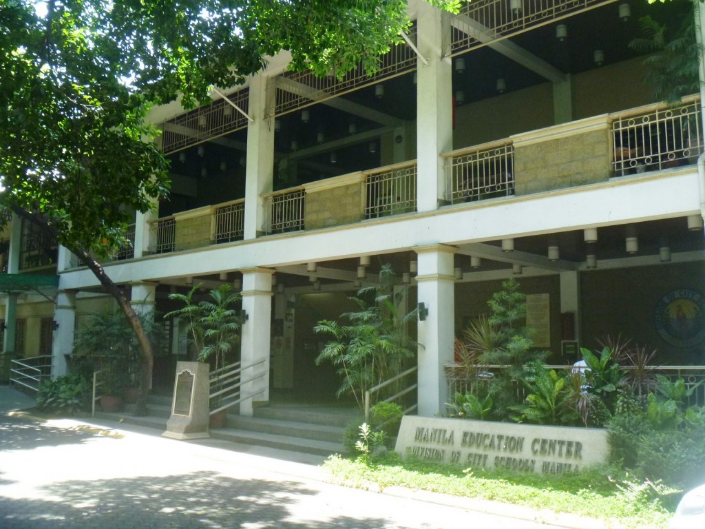
Though almost a half of its original area (and 70% of the trees) has been irretrievably lost to the concrete structure of the Manila Education Center of the Division of City Schools (another ill-conceived project, built in 2002, of former city mayor Lito Atienza), it still plays host to a diverse array of 8,000 ornamental plants (pink frangipani, palm fronds, etc.) as well as 10 kinds of city-dwelling avian wildlife (sparrows, bulbuls, etc.). Currently, the park is being maintained by Winners’ Foundation Inc. with the help of the Catholic Women’s Club.

The ill-conceived Manila Education Center

The ill-conceived Manila Education Center

To enhance the park’s visual appeal, some minimal landscaping was done, mostly in the form of walking paths, thus enabling visitors to walk within the park. The 61 varieties of trees in the park (labeled accordingly), which insulate the visitor from the noise, heat and pollution, include talisay trees (Terminalia catappa), acacia trees (Acacia confusa), narra trees (Pterocarpus indicus), mango trees, ficus rubber trees (Ficus elastica), mahogany trees (Swietenia mahogani) and Indian neem trees (Azadiratsa indica). Despite its diminished size, this accessible and calm oasis, the “last lung of Manila,” was still worth a visit.

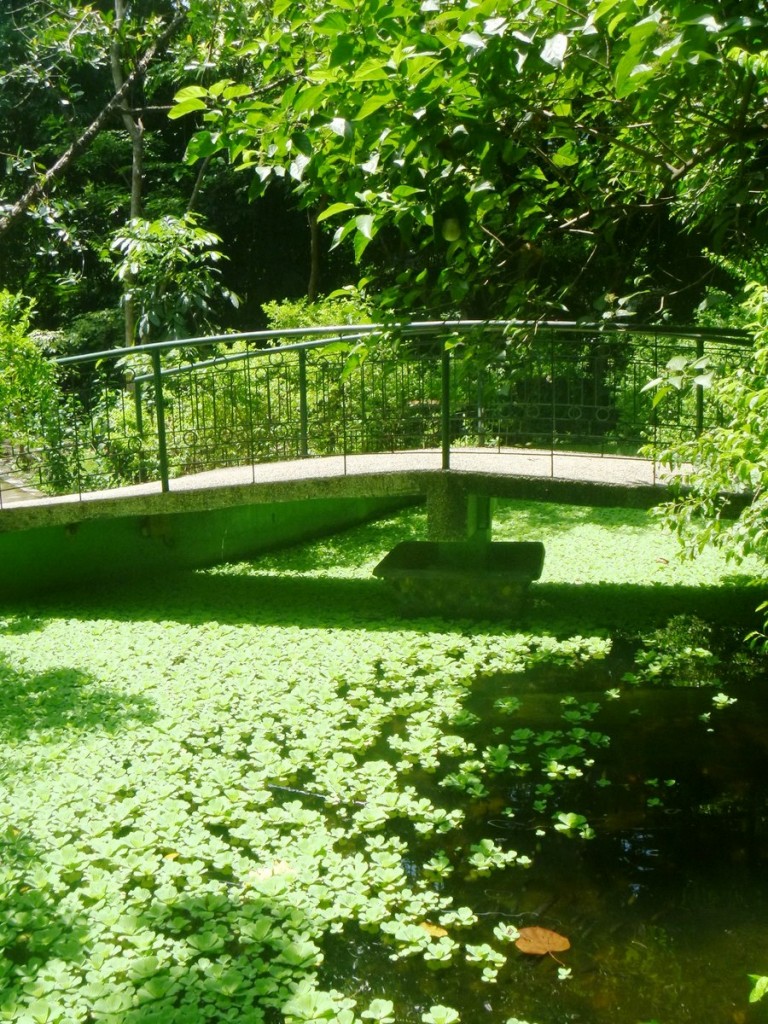
Bridge over a pond

Bridge over a pond

Valenzuela City Museum ((Metro Manila)

The first half of this museum tour features the Pre-Colonial Period (when a group of settlers lived within the city’s modern boundaries which was then surrounded by bodies of water, hence the name Pulo, meaning “island,”later to be called Polo), the Spanish Period (when Spanish authorities founded the town of Polo in 1623, then constructed a church from 1627-1632), the Philippine Revolution (where  Dr. Pio played a key part by publishing Kalayaan, the Katipunan’s newspaper, with the help of residents), the Philippine-American War (where Polo became the headquarters of Gen. Antonio Luna and where the March 26, 1899 Battle of Malinta took place, resulting in the death of U.S. Col. Harry ClayEgbert), the American Period (when Dr. Pio became Polo’s president municipal and the MacArthur Highway was constructed in 1928, allowing enterprising Americans to buy swathes of land, including the over 3,000 hectare Malinta Estate in 1904, which were turned into sites for subdivisions and factories such as the Balintawak Beer Brewery, which opened in 1938, eventually becoming San Miguel Brewery after the war) and World War II (when residents, including incumbent presidente municipal Feliciano Ponciano, formed a guerilla group, under Lt.-Col. Edwin Ramsey, to combat the Japanese invaders).

The Pre-Colonial Period
The Philippine-American War
The Spanish Period

Midway through the exhibit are life-size statues of 3 homegrown heroes of the Philippine Revolution and Philippine-American War: Delfin Vellila (who fought the Spanish during the March 30, 1897 battle at Pasong Balite and died fighting the Americans in Guiguinto, Bulacan, in 1899), Dr. Pio Valenzuela (with his walking stick on his right hand and doctor’s bag on his left) and Gen. Tiburcio de Leon (known for his role in the Battle of Tullahan River which enabled the forces of Gen. Emilio Aguinaldo to flee to Northern Luzon).

Life-size statues of Vellila, Valenzuela and De Leon

Interesting text and photo panels include an 1865 description of Polo by Fr. Felix de Huertagobernadorcillos(“little governors”) of Polo during the Spanish Period; a list of 55 World War II heroes (Barrion’s Division); and a list of 22 revolutionaries from Polo.  There’s also  beautiful, backlighted stained glass panels depicting San Diego Alcala (the city’s patron saint) and San Roque, flanked by texts of the hymn to the former and prayer to the latter.

San Diego and San Roque in stained glass

Another interesting panel is dedicated to the city as home to 2 movie companies (Premiere Productions and Larry Santiago Productions) and location site of movies (Asiong SalongaMinsa’y May Isang GamugamuDarnaMga Mata ni AngelitaLo Waist Gang, etc.); the local delicacy putong Polo (Polo rice cakes), with an actual gilingan bato (stone mill) on display; as well as to Stone Age (Pre-Neolithic Period), flaked tektites (rocks believed to have fallen from the sky) and obsidians (natural volcanic glass formed by the rapid cooling of magma) unearthed in 1933 at the barrios of Pugad Baboy (now Brgy. Gen. T. de Leon) and Maysan by Prof. H. Otley Beyer.

Tektites and obsidians
Putong Polo and a stone mill
Valenzuela in Movies

The second half of our museum tour, which began as soon as we entered the replica of Arkong Bato (built in 1910, it marked the boundary of Rizal, where Malabon formerly belonged, and Bulacan, where Polo formerly belonged), brought us to the city’s present, as an industrial hub. A prominent section, called “Made in Valenzuela,” features products made by factories based in the city – roasted peanuts (Grower’s), processed food (CDO), beauty and skin-care products (Splash), beer (San Miguel Beer), mattresses (Uratex), steel pipes (Mayer), water tanks (Bestank) and water pumps.

“Made in Valenzuela” Exhibit

The final part of the museum shows facilities and services (health care, education, etc.) offered by the current city government, photos of past and present mayors and congressmen of the city, and awards garnered by the city and modern-day Valenzuelanos (Marc Logan, Rowell Santiago, Fe Evangelista Padrinao, Irene S. De Castro, Isidro Arenas, Fernando S. Lumacad, etc.) deemed as role models for the current generation.

Photos of past and present mayors and congressmen
Modern Day Valenzuelanos

Valenzuela City Museum: G/F, City Hall, MacArthur Highway, Valenzuela City, Metro Manila.  Open from Mondays to Fridays, 8 AM-5 PM. Admission: free.

The Andres Bonifacio Monument (Caloocan City)

A few days ago, I again got an invitation from Valenzuela City historian and museum curator Mr. Jonathan C. Balsamo, this time to attend the opening of the Valenzuela City Museum, the city’s second (after Museo Valenzuela). To get there, I took the LRT (Light Rail Transit) from the Gil Puyat Station (near which I parked my car), along Taft Ave., all the way to its terminus at at the Andres Bonifacio Monument.  At its end is the beginning of the MacArthur Highway (or Manila North Rd.), where I was to take a Malanday or Malinta-bound jeepney to Valenzuela City Hall.  West of the monument is Samson Rd..  As I still had time on my hands, I decided to view the monument up close.
 
The Andres Bonifacio Monument
Popularly called Monumento, the monument, dedicated to the lifework of Katipunan founder (July 7, 1892) Andres Bonifacio (the “Great Plebeian”), is also the terminal point of bus and jeepney routes.  The move to build it came from former Katipuneros, particularly Bonifacio friend Guillermo Masangkay.  On February 23, 1918, the Philippine Legislature passed Act No. 2760, approving the erection of a national monument in memory of Bonifacio. Eight years later, on August 29, 1930, a jury, headed by Arch. Andres Luna de San Pedro (the son of Spoliarium painter Juan Luna) and composed of sculptor Vicente Francisco and Arch. Tomas B. Mapua, was created and convened to select the best design for the monument.
 
Andres Bonifacio
The design chosen was from sculptor (and later National Artist for the Visual Arts in 1973) Guillermo E. Tolentino. On November 30, 1929,  its cornerstone was laid by First Lady Doña Aurora A. Quezon and was started in 1931 with the help of sculptor Anastacio T. Caedo.  It was inaugurated on November 30, 1933.  On August 17, 2002, it was declared as a National Monument, by the National Historical Institute, and a National Cultural Treasure, by the National Museum, on November 30, 2009. 
The ravages of Spanish colonial rule
The execution of Frs. Gomez, Burgos and Zamora
The monument, Caloocan City’s most famous landmark, is said to face Tondo (Manila), Bonfacio’s birthplace.  This sculptural masterpiece has 23 bronze figures surrounding a four-sided, 40-ft. high marble pylon that rises from a 4-sided marble base and is topped by the winged figure of victory.   At its base is a platform-like structure with figures symbolizing the causes of the Philippine Revolution.
 
NHI plaque
The pylon has 5 parts, each representing the 5 aspects of the Katipunan. The monument stands on a base in the shape of an octagon whose 8 sides symbolize the first 8 key provinces (Batangas, Bulacan, Cavite, Laguna, Manila, Nueva Ecija, Pampanga and Tarlac) placed under martial law for revolting against Spain and the 8 rays in the Philippine flag. The 3 steps leading up to the monument represent the 3 centuries (333 years to be exact) of Spanish rule.
 
Winged Victory
Bonifacio Monument: intersection of EDSA (Epifanio de los Santos Ave.), MacArthur Highway, Samson Rd. and Rizal Ave. Ext. (Avenida), Caloocan City, Metro Manila

A Walking Tour of Escolta (Manila)

I have been dying to do a walking tour of Escolta , Manila’s historic version of High Street. During the Spanish era, this short (less than a kilometer long) stretch was linedwith rows of camarines (1-storey Chinese shops). On his way to his office in Intramuros from Malacanang, the Spanish governor-general would usually pass here with his escolta (official escorts), hence the derivation of its name (from the Spanish word escortar meaning “to escort”).  Later, these camarines along Calle Escolta were replaced by bahay-na-bato  (stone houses) adorned with Neo-Classical elements such as Greek columns and caryatids and, towards the end of the Spanish regime, by European establishments, the only ones permitted to do business along the cobblestones (imported from Hong Kong) of this narrow, historic thoroughfare.

Escolta – A shadow of its former self

From the early 1900’s to the 1960s, Escolta was the country’s premier shopping mecca, with high-end stores such as La Estrella del Norte and Puerta del Sol, which marked the east and west entrances of Escolta.  It is also home to H.E. Heacocks and Oceanic (for fine household items);  Berg’s (for fashionable clothes);  Hamilton Brown and Walk-Over Shoe Store (for quality leather shoes); 2 high-class cinema theaters (Capitol and Lyric) which brought the glitz and glamour of Hollywood to Manila; restaurants (Henry’s Donuts, Max’s Fried Chicken, Dencia’s Pansit Malabon, Savory Restaurant, etc.); and Botica Boie (for mixed potent medicines).  Founded in 1830, the latter also served the best ice cream sodas, brewed coffee and clubhouse sandwiches in its glass-in mezzanine overlooking the street.  With the emergence of commercial and business districts of Makati City and Quezon City, the prestige of Escolta gradually faded.

The First United and Regina Buildings

Needing to buy some lighting fixtures along nearby Soler St., I decided to include a visit to Escolta  in my itinerary.  From Gil Puyat Ave., I took the LRT and dropped off at Carriedo Station.  The first notable piece of architecture I encountered was the Neo-Classical-style Don Roman R. Santos Building, fronting Plaza Lacson (formerly Plaza Goiti).  When the Japanese bombed the city during World War II, only 3 of its 5 floors were finished.  Luckily, it survived and the building was finished in 1957.  The building once housed the headquarters of Monte de Piedad and Prudential Bank and, later, a shopping mall (South Super Mart).  When the mall closed, Bank of the Philippine Islands (BPI) took over the building. Its entrance has Ionic columns with a triangular pediment, within which is a big clock flanked by bas-relief sculptures.

Don Roman R. Santos Building

Both ends of Escolta open into impressive open spaces  (Plaza Sta. Cruz and Plaza Moraga).  Though no longer the premier shopping district it used to be, strolling along Escolta is still a rewarding experience as one could still find traces of its glorious past.  Upon crossing the little Visita Bridge spanning Estero de la Reina, at the Sta. Cruz entrance of Escolta, I was attracted by 2 impressive, eye-catching (though marred by entangled electrical cables) buildings facing each other – the fancy, Art Deco-style First United Building and the elegant Beaux Arts-style Regina Building.

First United Building

The pink and white First United Building, formerly the Perez-Samanillo Building, is one of the few surviving examples of the Art Deco architectural style in Manila. Built in 1928 by Andres Luna de San Pedro (Juan Luna’s son), it’s awesome façade has a large amount of architectural and decorative elements.  Its central bay rises towards a crowning block rendered with a bas-relief of the Creation. Once described as Manila’s foremost business address, it prides itself with providing maximized space, abundant lighting and ventilation to its tenants.

Check out “First United Building

Regina Building

The graceful, white Neo-Classical-style Regina Building, built in 1934, its design (with traces of Renaissance Revival) also attributed to Andres Luna de San Pedro, was originally designed as a 3-storey commercial building. A fourth floor was added by Arch. Fernando H. Ocampo (founder of the UST College of Architecture and designer of the UST Central Seminary and the 8th Manila Cathedral) when the de Leon family bought the building from the Roxases. The staff of the late Sen. Vicente Madrigal (grandfather of Sen. Jamby Madrigal) rented a suite in this building.  Also on the same floor, across the hall, was the office of Madrigal Shipping, then the world’s largest tramp steamship company.

Burke Building

Further out was the Burke Building, with its simple balance lines.  Built in 1919, it was named after the cardiologist William J. Burke who introduced and installed the first electrocardiograph in the country.  Also a philanthropist, he donated the land for the street (Calle David, renamed W. Burke St. in 1990).  The first Otis elevator in the Philippines was installed in this building.

Natividad Building

The charming, Beaux Arts-style Natividad Building, one of the most beautiful landmarks in the area, is one of the oldest buildings along Escolta.  It was burned during the 1945 Battle of Manila (leaving only its exterior shell) and was later restored.  In the 1950s, this building housed the office of the Insurance Commission.  Its alluring, ivory and white-colored facade, evocative of a French café in a Parisian neighborhood, has four levels alternately decorated with arched and square windows with cornices with tooth-like dentils underneath it.

Calvo Building

The stunning, Beaux Arts-style Calvo Building, built in 1938, was also designed by Arch. Fernando Ocampo.   This 4-storey building, with its  richly-decorated facade, once housed the Philippine Bank of Commerce, the popular MV Villar Records Store and the original radio station of Robert “Uncle Bob” Stewart’s Channel 7. On its roof deck was Luisa, a popular soda fountain. Today, Mercury Drug and Tropical Hut flank the entrance to the building, with Wah Yuen Hot Pot and Seafood Restaurant in its Calle Soda side. Its mezzanine  is home to the little-known Escolta Museum.

Check out “Escolta Museum” and “Calvo Building

Across the street from the Calvo Building is the decaying and dilapidated shell of the majestic, Mesopotanian-inspired Art Deco-style Capitol Theater. Built in the 1935, this theater, designed by National Artist Arch. Juan Nakpil, had a seating capacity of 800 and an unusual double balcony.  Its lobby once mounted a beautiful wall mural by the late Filipino modernist and National Artist Victorio C. Edades. Now abandoned, it ceased operations in the late 1980s.

Capitol Theater

On the face of its western tower were bas-reliefs, evocative of Art Deco lines and curves, showing Filipinas (one holding a mask and another holding a lyre) in traje de mestiza frame and set in a tropical landscape, attributed to the Italian atelier of Francesco Ricardo Monti. The bigger, 1600-pax Lyric Theater, another Art Deco masterpiece designed by Modernist Arch. Pablo S. Antonio, was demolished in the early 1980s.

Burke Building: 321 W. Burke St., cor, Escolta St., Binondo, Manila

Calvo Building: 266 Escolta St. cor. Calle Soda, Binondo, Manila.  Tel: (632) 241-4762.

First United Building: 413 Escolta cor. David St., Binondo, Manila.

Natividad Building: Escolta cor. Tomas Pinpin St., Binondo Manila

Regina Building: W. Burke St., cor, Escolta St., Binondo, Manila

Roman S. Santos Building: Escolta cor. Yuchengco St., Binondo, Manila

A Walk Through Manila’s Chinatown

After canvassing for lighting fixtures along Soler Street, I decided to explore Manila Chinatown via  the Arch of Goodwill Arch, a  Chinese archway (paifangwhich marks the east end of Ongpin Street, named after Don Ramon Ongpin, a Chinese businessman who supported the Katipunan movement in 1896. The Arch of Goodwill, one of several which acts as a spatial marker to welcome visitors into a different cultural sphere, commemorates the friendship between the Filipino people and Chinese immigrants.

The Arch of Goodwill

The Arch of Goodwill

Manila’s 66-hectare Chinatown, located just across the Pasig River, opposite  the walled city of Intramuros, was originally for  Chinese Catholic converts only. In 1790, non-Christian Chinese were allowed to move into Chinatown. Our first Filipino saint, San Lorenzo Ruiz, was born in Binondo.

Ongpin Street

The terribly congested but colorful Ongpin Street, home to many gold and silver jewelry stores, herb-scented Chinese medicine shops, spacious restaurants, little teahouses and well-stocked groceries, is flanked at each end by the Minor Basilica of San Lorenzo Ruiz (Binondo Church) in the west and the Baroque-style National Shrine of the Perpetual Adoration of the Blessed Sacrament (Sta. Cruz Church) in the east.

A Chinese drugstore

A Chinese drugstore

Manila’s Chinatown, the oldest in the world (established in 1594), is known to the Filipinos as Binondo (derived from the Tagalog word binundok meaning “mountainous”), to the Filipino-Chinese community as Chi Lai (市内), a Hokkien term for “inner city,” and by tourists simply as Chinatown, a common reference to an area where there are a lots of Chinese and Chinese businesses. Most of the people in this district are of Hokkien ancestry as most of their ancestors are from Fujian province. My ancestor, Sing Lok, also from Fujian, arrived in the country in 1750. He later changed his surname to Locsin and adopted the Christian name of Agustin.

An Eng Bee Tin Chinese Deli branch

An Eng Bee Tin Chinese Deli branch

Chinese heritage and traditional Chinese institutions are very evident in Manila’s Chinatown and, once I passed the Arch of Goodwill, I began to find icons, institutions and features typical of most Chinatowns. Unlike in other parts of the city, the horse-drawn calesa is still alive and well here.Unlike the Chinatowns I have visited in other Southeast Asian cities, this one in Manila is really very busy on Sundays.

A sidewalk fruit stall

A sidewalk fruit stall

The street signs in Chinatown, some decorated with dragons, are also often bilingual and sometimes trilingual. with Filipino, English and Traditional Chinese script.  Even signages are bilingual, as businesses here cater to the cultural and religious needs of the Filipino-Chinese population. Restaurants offer a wide range of Chinese food while other shops offer the latest CDs VCDs from China, Hong Kong and Taiwan, religious goods and festive fruits that are in season.

A Chinese gift shop

A Chinese gift shop

A long time (since 1912) fixture in Chinatown is Eng Bee Tin Chinese Deli, reputed to be the home of the best-tasting hopia (a popular Filipino bean filled pastry) in country.  It has a number of stores in Chinatown, selling 22 variants of hopia, including ube, nangka, buco pandan (my favorite) and cheese variations.  Some bakeshops even carry their hopia products. They also sell other traditional Chinese delicacies such as tikoy, glutinous balls and ube pao.

The calesa is alive and well here

The calesa is alive and well here

Chinatown is known for the having the best volunteer fire-fighting unit in the city, the residents’ response to the frequent fires that strike their community. Their fire engines, often sponsored by individuals or organizations, are highly visible all over the district. Eng Bee Tin has also set up Txtfire, the largest volunteer firefighting organization in the Philippines (with more than 4,500 affiliate firefighters nationwide), and have donated 10 ube (violet)-colored fire trucks, one of which I saw parked beside Binondo Church.

An ube-colored fire truck donated by Eng Bee Tin

An ube-colored fire truck donated by Eng Bee Tin

A street-side temple with an altar was also built along Tomas Pinpin Street. Here, people come to light at least 3 joss or incense sticks (hui), make offerings or donations, recite a prayer to the venerated image of Sto. Cristo de Longos (a miraculous crucifix found by a deaf and mute Chinese in an old well in Longos), make a prayer request, then take two crescent-shaped jiaobei blocks (or moon blocks) and throw it to answer a yes (identical faces) or no ((opposing figures) question.  Truly an intriguing fusion of Roman Catholicism and Buddhism.

A roadside shrine dedicated to Sto. Cristo de Longos

A roadside shrine dedicated to Sto. Cristo de Longos

As I strolled and enjoy the proverbial sights, sounds and smell of Chinatown, I knew that I have reached the district’s boundaries as I saw another Chinese archway at Ongpin North Bridge.

Ongin North Bridge Arch

Ongin North Bridge Arch

Carriedo Fountain (Manila)

Carriedo Fountain

The National Shrine of the Perpetual Adoration of the Blessed Sacrament, more popularly known as Sta. Cruz Church, is surrounded by three open spaces which, in the 1900s, came to be known as downtown Manila – Plaza Sta. Cruz in front, Plaza Goiti at the rear, and a wide street on the right leading to Calle Escolta. The centerpiece of the 1-hectare Plaza Sta. Cruz is the 19th century the Spanish-era Carriedo Fountain (Fuente Carriedo).

Check out “National Shrine of the Perpetual Adoration of the Blessed Sacrament

Built in May 1882 (at a cost of 745,590 pesos) as part of the Carriedo water works system, it was inaugurated by Governor-General Fernando Primo de Rivera on July 24, 1882. The fountain was built in honor of Don Francisco Carriedo y Peredo (November 7, 1690 – September 1743), 18th-century Capitán General of Manila, who conceived of and eventually funded Manila’s pipe water system.

The centerpiece of the fountain

A Basque from Santander, Spain and general of the Santa Familia galleon, Carriedo raised funds for the construction of the water system of Manila and donated 10,000 pesos drawn from his fortune from the Manila- Acapulco trade. However, he did not live to see his resolve of creating a water system in Manila take fruit.

The lower pedestal and vasque

The fountain was moved three times before its current location at Plaza Santa Cruz, right in front of the Santa Cruz Church. Since Don Francisco resided in Santa Mesa, the fountain was first located at the Rotonda de Sampaloc, the intersection between LegardaLacson and Magsaysay streets which today forms the  Nagtahan Interchange that separates Sampaloc from Santa Mesa.

The upper pedestal and vasque

In 1976, due to traffic concerns, the roundabout was cleared and the fountain was then transferred to the Balara Filters Park, in front of the Metropolitan Waterworks and Sewerage System (MWSS) Building right after MWSS moved from their office in Arroceros, Manila, in the latter part of the 1970s.

Seated female figure holding a harp

In the 1990s, then-Manila Mayor Alfredo Lim convinced MWSS administrator Mr. Luis E. V. Sison to bring back the Carriedo Fountain to Manila. A replica of the original fountain, using plaster as the primary material, was built by National Artist Napoleon Abueva.

Cherub sitting on an urn

Two bas reliefs of cherubs, sitting on a shell-like basin, holding tridents. The water spout is between them

During our visit, the fountain wasn’t operating and the stagnant water in the basin was littered with floating garbage and green with algae.

AUTHOR’S NOTES:

This Classical-style fountain features a large circular basin to hold the water at the center of which is a pedestal with statues of four cherubs holding urns. The pedestal is also decorated by bas reliefs of 4 pairs of cherubs, seated on shell-like basins, holding tridents.

The words “A Carriedo” (the letter “A” is a mystery) and “Manila” (below it) are also engraved around this pedestal.

The pedestal supports a large vasque, above which is another smaller pedestal supporting a smaller vasque. Around the smaller pedestal are four bas reliefs of bearded heads (probably depicting Neptune, the Roman god of freshwater and the sea).

Above these heads are four seated female figures, one is holding a trident and the other a harp. This set up is reminiscent of the Statue of Queen Anne at St. Paul’s Churchyard in London (England) which has the seated female figures representing England with a trident; Ireland with a harp; France with a truncheon and a crown; and North America holding a bow and arrow with a quiver at her back, her right foot resting on a severed head.

Above the smaller vasque is an urn-like finial. Water spouts from the top of this finial,   at water spouts between the two trident-wielding cherubs; the urns of the cherubs; the side of the bigger vasque and the inner perimeter of the circular basin.

The words “A Carriedo” and “Manila” engraved on the pedestal

Carriedo Fountain: Plaza Santa Cruz, Manila

Calvo Building (Escolta, Manila)

Calvo Building

The historic Calvo Building, an outstanding example of Beaux Arts architecture, is one of the remaining buildings from the earlier part of the 20th century along Escolta Street. It was designed by architect and civil engineer Fernando H. Ocampo, Sr. (of Arguille & Ocampo Architects) and inaugurated on August 14, 1938 on the land owned by the couple Angel Calvo and real estate businesswoman Emiliana Mortera Calvo.

Plaque installed by National Historical Commission of the Philippines in 2018

On November 1944, during World War II, it was temporarily used by Japanese Imperial Forces and was destroyed during the 1945 Battle of Manila and restored in 1946. On August 14, 2018, a historical marker (entitled Gusaling Calvo) was installed by the National Historical Commission of the Philippines.

Cartouche above the arched window

This 4-storey building was one of the most prestigious business addresses of its time.  Its tenants were:

  • Philippine Bank of Commerce (ground floor)
  • Lissar Commercial (ground floor)
  • Aquino-Lichauco Law Offices (second floor)
  • Offices of Araneta & Co. (third floor)
  • MV Villar Records Store – then Manila’s biggest vinyl record bar
  • Sabater Optical
  • Mareco Broadcasting – owner of 105 Crossover FM
  • Mabuhay Records – a recording company that produced albums for kundiman legends Ruben Tagalog, Sylvia dela Torre and Pilita Corrales
  • Sorriente-Santos Department Store – the first store that introduced the “buy-one-take-one” selling strategy.
  • Luisa & Son (roof deck) – a pre-war soda fountain popular with Manila’s high society.

The truncated corner

On March 1, 1950, the GMA Kapuso Network was also born at a makeshift studio at the fourth floor of the building (before moving to its present location in Diliman, Quezon City) when former American war correspondent for United Press Robert “Uncle Bob” Stewart (who eventually fell in love with a Filipina and the country as a whole) transmitted the first signal of  Republic Broadcasting System, now radio station DZBB-AM. Stewart would later expand his media enterprise into television, and Radio Broadcasting System would later be renamed GMA.

Today, Uno Seafood Wharf Palace, Mercury Drug and Tropical Hut flank the entrance to the building, with Wah Yuen Hot Pot and Seafood Restaurant in its Calle Soda side.

Old pre-World War II photo of Calvo Building without its fourth floor

Its mezzanine is home to the little-known Escolta Museum which contains memorabilia from the past.  During the post-war years, a fourth floor was added to the three-storey edifice.

Check out “Escolta Museum”

The ground floor lobby

Its front being a flagstop for the tranvia (electric tram line), it is the only building along Escolta that is pushed back. It house one of the few classic-style and rare, manually operated Otis elevators.

The richly-decorated and stunning facade at the second level has arched windows (except at the truncated corner) flanked by Ionic pilasters, above which is a cornice embellished by garlands and gracefully broken, in alternating sections, by cartouches supported by corbels above the window’s arch.

Photo of Don Angel Calvo

Calvo Building: 266 Escolta cor. Soda Sts., BinondoManila. Coordinates: 14.597141°N 120.978221°E.

How to Get There: The building is accessible from the LRT1-Carriedo station. The Pasig Ferry also has an Escolta stop.

A Tour of Valenzuela City

After the video documentary presentation on the life of Dr. Pio Valenzuela, I requested museum curator Mr. Jonathan C. Balsamo for a tour of the city’s historical sites using their open pickup.  Sandy, Mark, Ronnie and Violeta  joined us.  Jandy and Violeta stayed inside the pickup’s airconditioned cabin while Mark, Sandy, Jonathan, Ronnie and I rode on the open cargo area as we traversed the city’s very narrow streets exposed to the hot, late morning sun.

Arkong Bato

Our first stopover was at Arkong Bato (Spanish for “stone arch”), along the only road that links MacArthur Highway with the North Luzon Expressway (NLEX).  This arch was built in 1910 along the old national road passing through the old town of Polo before the construction of MacArthur Highway.  It formerly marked the boundary of Rizal (where Malabon formerly belonged) and Bulacan (where Polo formerly belonged).  Today, it marks the boundary between Brgy. Santulan (Malabon City) and Brgy. Arkong Bato (Valenzuela City).

San Gabriel House
The former Valenzuela City Emergency Hospital

We next proceeded to the old town proper and made a stopover at Liwasang Rizal, the old town plaza with its own simplified replica of the Rizal Monument (its base somewhat shorter because the plaza’s grounds were elevated through the years).  Surrounding it are the old town hall (now home to the former Valenzuela City Emergency Hospital), the San Diego De Alcala Church and the old but still wonderfully preserved, 2-storey San Gabriel house (now home to Aida Carinderia).  The latter has capiz sliding windows, intricate woodwork and double roofs typical of houses built during the Spanish and American eras.  This house should be added to the list of the city’s tourist attractions.

Church of San Diego Alcala Ruins

Beside the church are the ruins of the oldest church in Valenzuela, built by Fr. Juan Taranco and Don Juan Monsod and later expanded and completed by Fr. Jose Valencia, aided by Capt. Juan Tibay, in 1632.  In 1852, the church was fully repaired and remodelled by Fr. Vicente but was razed to the ground during World War II.  Only the octagonal bell tower and the arched main entrance have been preserved.

Gabaldon-style building of Pio Valenzuela Elementary School

From the church, we also walked to the nearby American-era, Gabaldon (named after Assemblyman Isauro Gabaldon of Nueva Ecija, author of Act No. 1801, better known as the Gabaldon Act)-style schoolhouse of Pio Valenzuela Elementary School, one of a number of heritage schoolhouses, built in the Philippines between 1907 and 1946, that follow standard plans designed by American Arch. William Parsons.

Church of San Roque

Back to our pickup, we next proceeded to the San Roque Church which dates to 1763.  The church facade has a semicircular arched main entrance flanked by statue niches and twin bell towers with pyramidal roofs.  The wall above the triangular pediment as well as the wings on the sides of the church are probably modern additions.  Our last destination in our city tour was the 2-storey Pio Valenzuela House.  The original house was, together with its antique furniture, razed during World War II.

Dr. Pio Valezuela House

The marker in front of the house erroneously identifies it as the birthplace of Dr. Pio.  He was actually born in Brgy. Tagalag, its actual location already unknown even to his relatives.  This house was where Dr. Pio lived and died.  Only a caretaker lives here.  The grounds of the house were partly flooded, a result of it being situated on one of the lowest parts of the city.  Valenzuela City is located on swampy land crisscrossed by rivers.

Historical Marker

Arkong Bato: Brgy. Arkong Bato
San Roque Church: Brgy. Mabolo
Pio Valenzuela House: Velilla St., Brgy. Pariancillo Villa