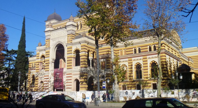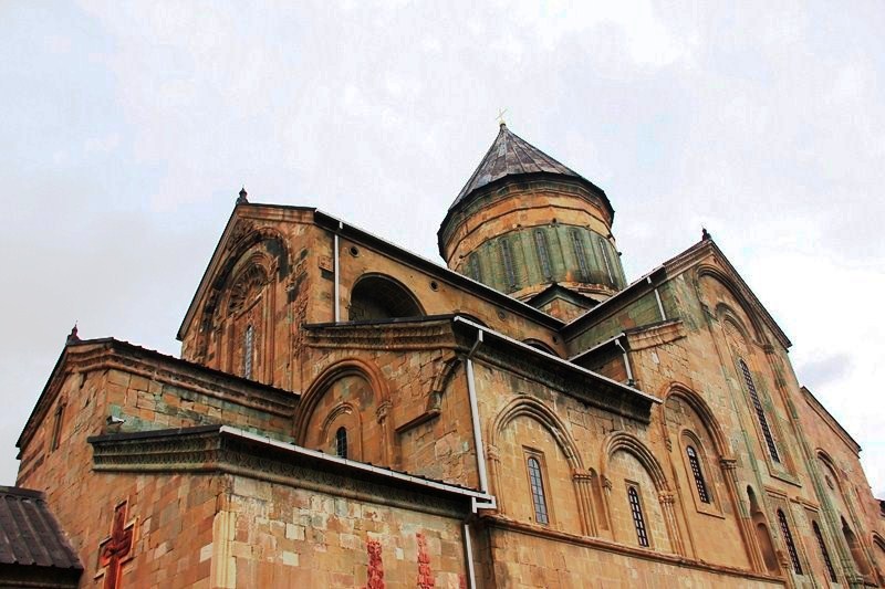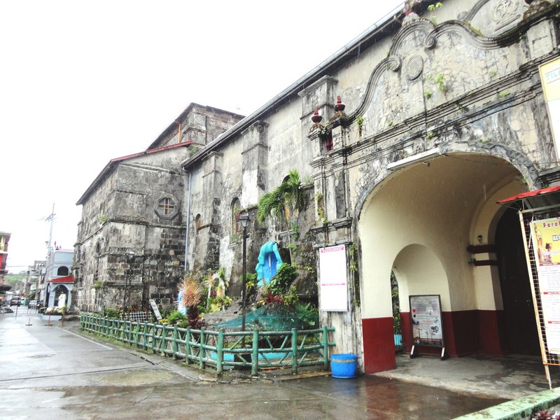
Jade Emperor Pagoda
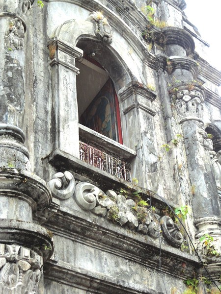
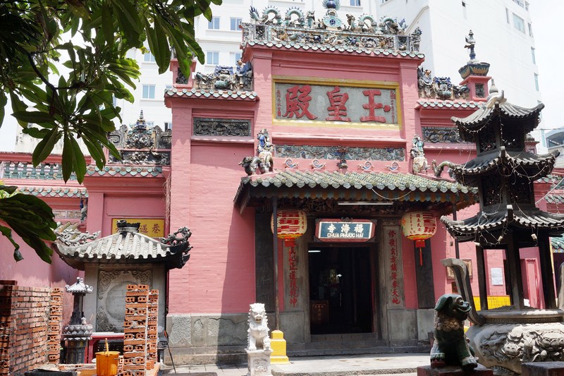
From the War Remnants Museum, we again boarded our van for the Jade Emperor Pagoda, one of the more colorful temples in HCMC, hidden in a small street, between high buildings. The facade of the Jade Emperor Pagoda is made with brick painted in pink and had exquisite and elaborate woodcarvings on tablets decorated with gilded Chinese characters. Its very striking and unique YinYang-shaped roofs are also works of art, with characteristic sharp peaks and sprinkled with numerous sculptures of dragons (the symbol of the divine) and completed with structures of red wood bound with elaborate, green-colored ceramic tiles.
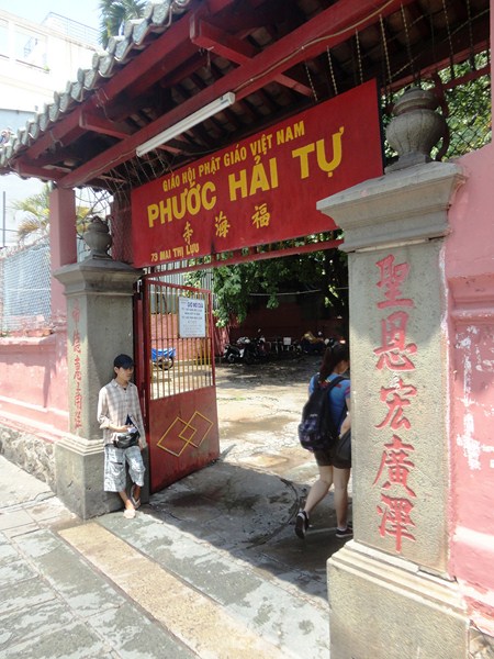
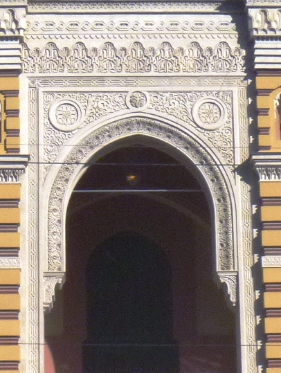
The pagoda gate
Built from 1892 to 1909 by the Cantonese (Quang Dong) Congregation from Guanzhou, this spectacularly atmospheric pagoda (Vietnamese: Chùa Ngọc Hoàng; official name: Ngọc Hoàng Điện) is dedicated to various Taoist and Buddhist gods, especially to the supreme Taoist god Ngoc Hoang (the Jade Emperor or King of Heaven), the emperor monitoring entry through the gates of heaven by deciding who will enter and who will be refused. Originally known as Pagoda Ngoc Hoang, this pagoda was renamed in 1984 as Pagoda Phuoc Hai Tu (“Luck Sea Temple”), a new Chinese name which it still retains to this day.
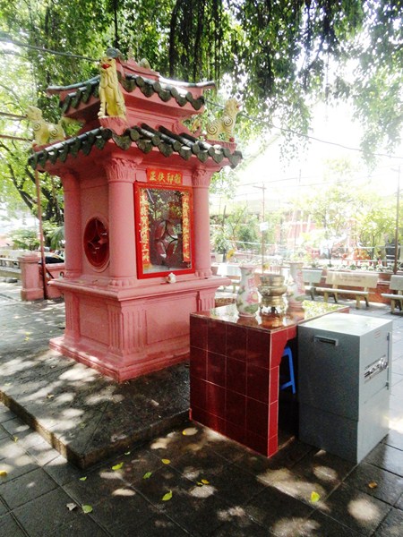
A small shrine with a steel safe
We entered the temple via Phuoc Hai Tu, the only door to the temple, passing under a red porch into a courtyard where we were greeted by a huge banyan tree, after which we passed a small shrine with a steel safe (a reminder that, though admission is free, donations are accepted). Within the courtyard are benches for sitting.
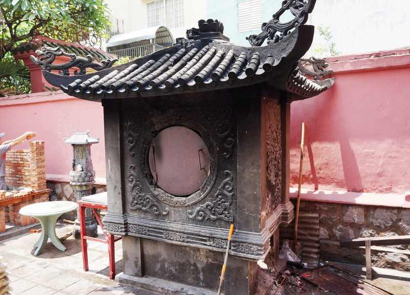
The incinerator
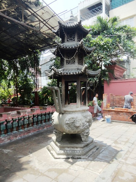
To the left of the entrance to the Jade Emperor pagoda is the so-called incinerator, a chimney-shaped structure where believers burn offerings of paper. According to religious beliefs, smoke from the burning paper reaches the ancestors and deceased in heaven.
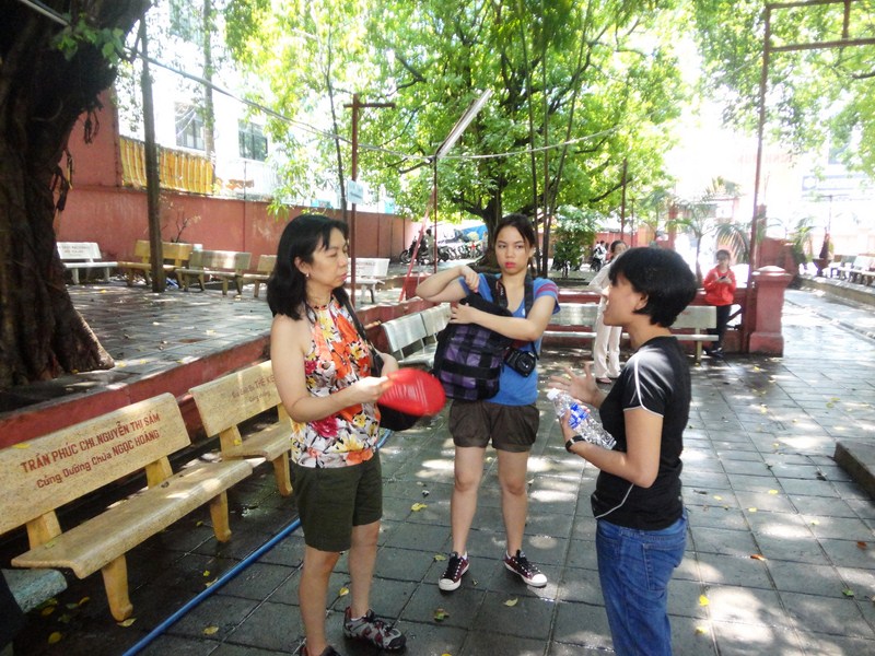
Grace, Cheska and our guide at the pagoda courtyard
To the right of the entrance is the shelter for hundreds of turtles (the temple is also called the “Pagoda of Turtles” or “Tortoise Pagoda”). Turtles, in Asian culture, represent longevity. In Vietnam, they are also considered as a symbol of fortune and good luck.
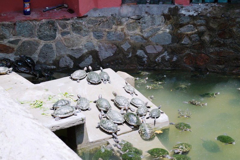
Turtle pond
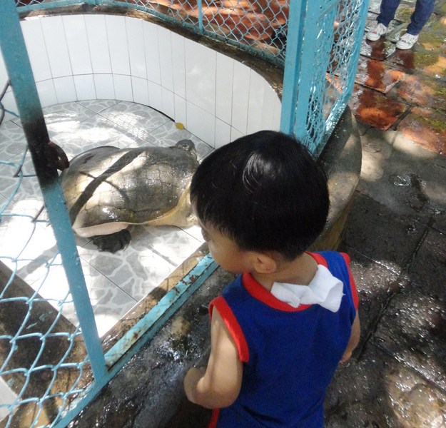
Kyle’s close encounter with a land turtle
In decorating the pagoda, the Cantonese community was inspired by many Buddhist legends and myths. The pagoda is filled with towering and really impressive statues, made with wood and reinforced papier mâché, of phantasmal divinities and grotesque heroes which represent characters from both the Buddhist and Taoist traditions.
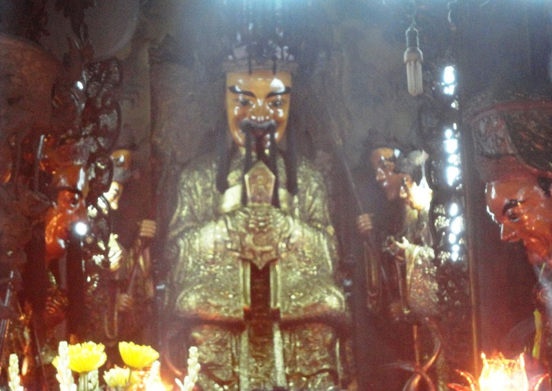
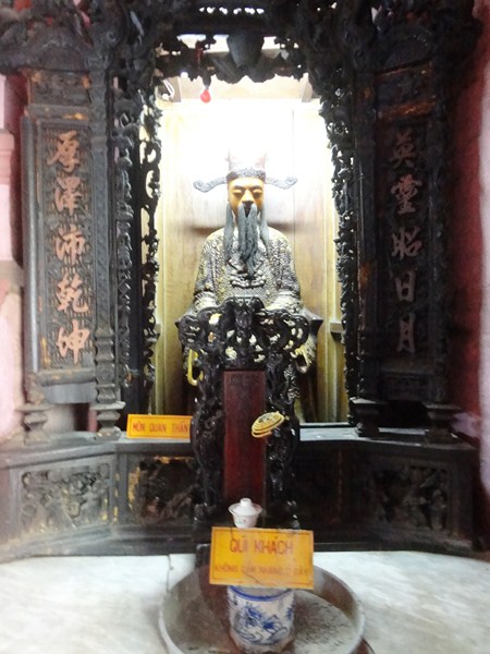
The Jade Emperor
Undoubtedly, the best of the Jade Emperor Pagoda is in the main building. Beside impressive carved wooden doors with human and divine figures, to the right, is Mon Quan, the God of the Gate while opposite him is Tho Than (Tho Dia), the God of the Land.
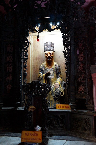
Mon Quan, the God of the Gate
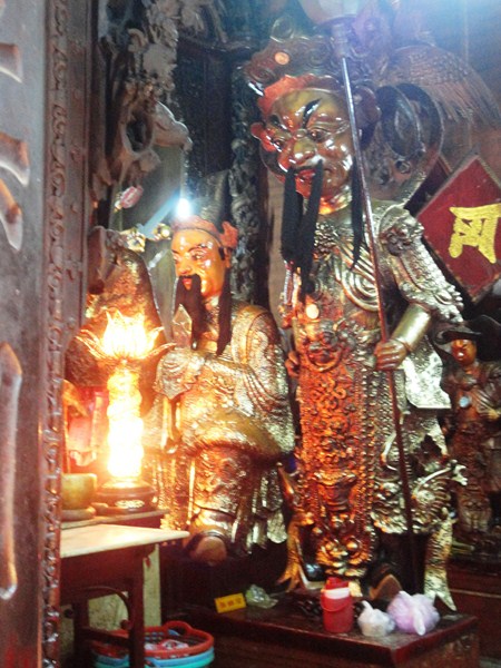
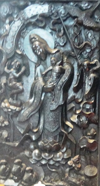
Against the wall are two 4 m. high, especially fierce and menacing figures of demons flanking the main sanctuary, both guardians of the gate. On the right (as you face the altar) is the statue the general who defeated the Green Dragon (depicted underfoot), while on the left is the general who defeated the White Tiger (which is also being stepped on).
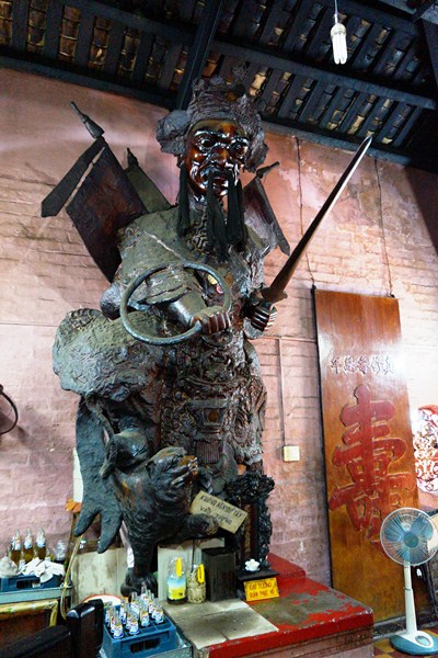
The general who defeated the Green Dragon
Straight on is an altar on which are Phat Mau Chuan De, who gave birth to the five Buddhas of the cardinal directions; Dia Tang Vueng Bo Tat (Ksitigartha), the King of Hell; the Di Lac Buddha (Maitreya), the Buddha of the Future; Quan The Am Bo Tat; and a portrait of the Thich Ca Buddha. Behind the altar, is the Duoc Su Buddha, or Nhu Lai Buddha.
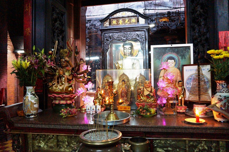
The altar of Phat Mau Chuan De
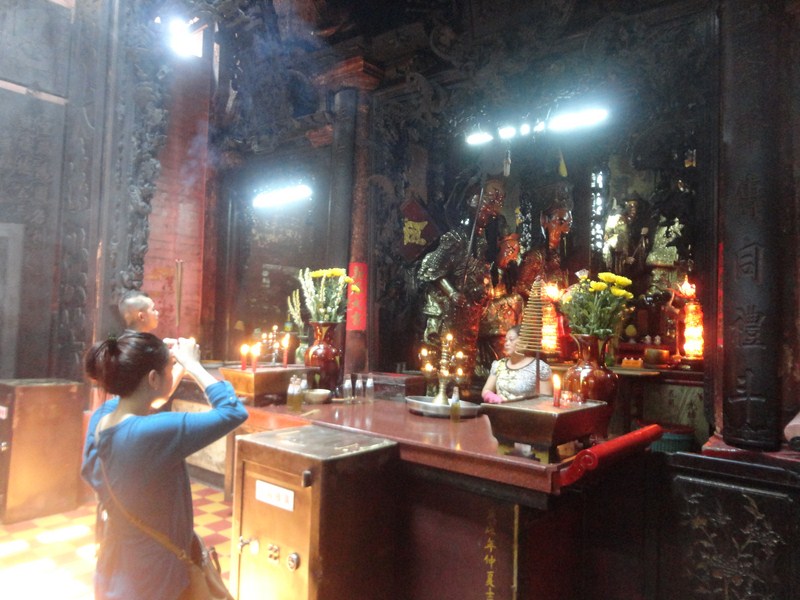
The air inside is thick with the pungent smell of incense smoke from burning joss sticks. Presiding over the main sanctuary is the Jade Emperor Ngoc Hoang (easily recognizable by its large mustache typical of Cantonese culture), draped in luxurious robes, flanked by his guardians, the Four “Big Diamonds” (Tu Dai Kim Cuon). They are so named because they are said to be as hard as diamonds.
Four Big Diamonds (Tu Dai Kim Cuong)
In front of the Jade Emperor, on the left, is Bac Dau, the Taoist God of the Northern Polar Star and Longevity, flanked by his two guardians; and, on the right, is Nam Tao, the Taoist God of the Southern Polar Star and Happiness, also flanked by two guardians. To the right of the Jade Emperor is 18-armed Phat Mau Chuan De.
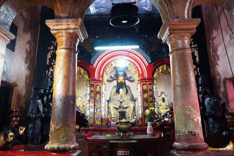
On the wall to her right is Dai Minh Vuong Quang,reincarnated as Sakyamuni. Below are the Tien Nhan (the ‘God Persons’). To the left of the Jade Emperor sits Ong Bac De, one of his reincarnations. On the wall, to the left of Ong Bac De, is Thien Loi, the God of Lightning, who slays evil people. Below him are the military commanders of Ong Bac De and Thien Loi’s guardians. At the top of the two carved pillars that separate the three alcoves are the Goddess of the Moon and God of the Sun.
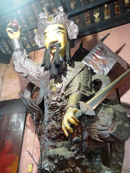
Guardian demon of the Hall of the Ten Hells
We then went out a door, on the left-hand side of the Jade Emperor’s chamber, to another room. To the right is a semi-enclosed area presided over by Thanh Hoang, the Chief of Hell, while to the left is his life-sized effigy of red horse. Closest to Thanh Hoang are Am Quan, the God of Yin, and Duong Quan, the God of Yang. The other four figures, the Thuong Thien Phat Ac, are gods who dispense punishments for evil acts and rewards for good deeds.
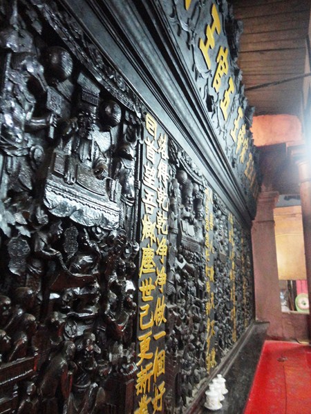
Hall of the Ten Hells
Thanh Hoang faces in the direction of the Hall of the Ten Hells, usually filled with the smoke of incense sticks as well as multitude of candles, fruit offerings and lucky money. Ten interesting and magnificently carved wooden panels, lining the walls on the sides of the room, represent the 1,000 torments or storms awaiting evil people in each of the Ten Regions of Hell. Each panel is topped with a representation of a King of Hell perusing a book that details the very evil acts perpetuated by the dead. This depiction of the horrors awaiting the ungodly is the equivalent of “Judgment Day” in Chinese mythology.
Quan Am Thi Kinh on a lotus blossom holding her “son.”
On the wall opposite Thanh Hoang is a wood panel depicting Quan Am Thi Kinh on a lotus blossom holding her “son.” To her left is her protector Long Nu while to her right is her guardian spirit Thien Tai. To the right of the panel of Quan Am Thi Kinh is a panel depicting Dia Tang Vuong Bo Tat, the King of Hell.
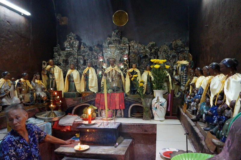
Kim Hoa Thanh Mau
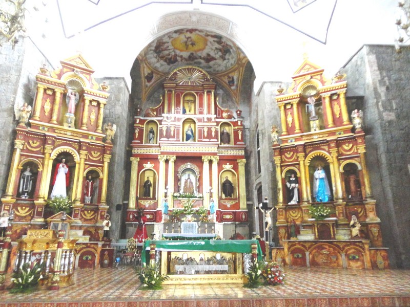
Facing the Chief of Hell, on the other side of the wall, is a fascinating little room with ceramic figures of 12 women wearing colorful clothes, overrun with many babies and sitting in two rows of six. They are presided over by Kim Hoa Thanh Mau, the Chief of All Women and the protector of all mothers and children. Each figurine exemplifies a particular human characteristic, either good or bad (as in the case of the woman drinking alcohol from a jug), and also represents a year in the 12-year Chinese astrological calendar. Childless Vietnamese couples often visit this small chapel to pray to be granted a child. Off to the right of the main chamber, stairs lead to a second floor sanctuary and balcony.
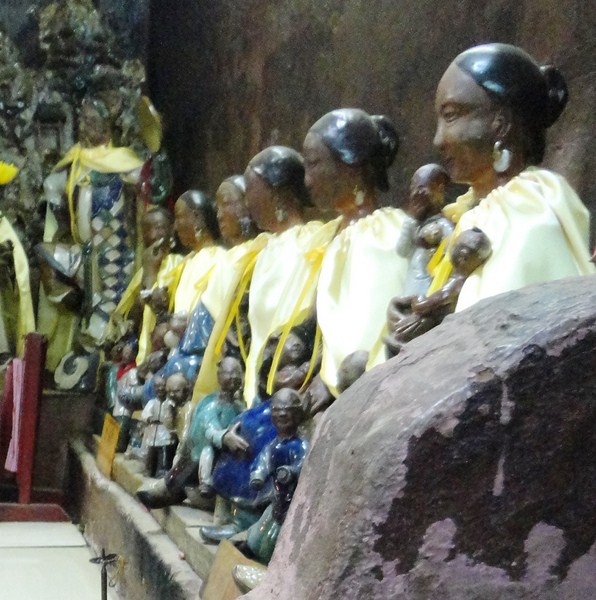
Figurines of 6 women in a row with babies
The rather interesting Jade Emperor Pagoda, a lovely and quiet place of worship, is a gentle and exotic little spot full of character. I liked looking at all these rather nasty and mean statues (they may scare very young children!) but also liked seeing the young and old local worshippers who came to pray, make offerings and burn incense. Set within a calm leafy courtyard with a rare spiritual glow, this island of tranquility in the sea of frenetic activity that is HCMC is definitely worth a look.
A pagoda worshiper
Jade Emperor Pagoda: 73 Mai Thi Luu Street, District 1, Ho Chi Minh City, Vietnam. Tel: +84 8 3820 3102. It is open daily, 6 AM – 6 PM.
How to Get There: City buses 36 And 54 stop in the vicinity of the pagoda. Bus 36 leaves from the Ben Thanh bus station (just opposite Ben Thanh Market) and stops along Tran Quang Khai Street while bus 54 departs from the Mien Dong bus station and stops closest to the pagoda along Vo Thi Sau Street.