
Just two months before the lockdown on March 16, 2020, Taal Volcano awoke from 43 years of quiet and began to spew gases, ash, and lava into the air on January 12, 2020. On the evening of that day, I was having dinner with some US-based friends at the Manila Hotel when its ash fall reached Manila. The next morning, our balcony at home was almost black with ash.
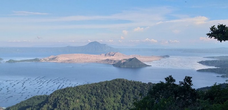
Volcano Island one and a half years after its latest eruption
The ash also reached Metro Manila and the provinces of Batangas, Cavite, Laguna, Rizal and Bulacan. Of the cities and municipalities within the 14 and 17 km. danger zones, Laurel and Agoncillo in Batangas, was very much affected as ashfall covered the buildings and other built structures. Lemery, Tanauan, and Talisay in Batangas were also covered with ash and, similarly, buildings in Amadeo, Silang, and Tagaytay City in Cavite were affected by ashfall. Ashfall was also remotely-detected to cover buildings in Sta. Rosa and Calamba in Laguna. On the ground, ashfall was reported in other parts of CALABARZON, Metro Manila, and Central Luzon.
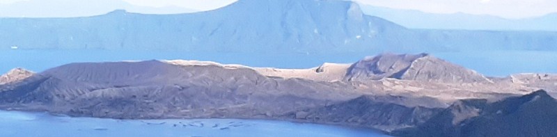
The now desert-like part of Volcano Island. The high point on the right used to be the location of the viewpoint overlooking the crater lake
Now, one and half years later, in the midst of the COVID 19 pandemic, our whole family decided to go to Tagaytay City, the grand viewpoint for viewing Taal Volcano, for an early supper in celebration of my son-in-law Bryan’s birthday. We chose to have it at Dahon at Mesa which is located along Tagaytay Ridge.
Check out “Restaurant Review: Dahon at Mesa“
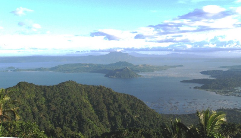
The still pristine Taal Volcano and Lake 13 years before its latest eruption
The view of Volcano Island, from the restaurant, that welcome us was way different from what we used to see prior to the eruption as the island’s lush fields, forests and other vegetation have all been killed or stripped of leaves, turning much of the island into a ghostly gray. It seems that the eruption, in the days and weeks that followed, have dropped a layer of unusually wet, heavy ash on the surrounding landscape of Volcano Island.
Thick blankets of volcanic ash can have big consequences for plants, animals and people. The ash-damaged landscape still looks more like the Moon than the tropics. Aside from a few green promontories on the north side of the island, ash has altered much of the landscape, burying several villages along the coasts.
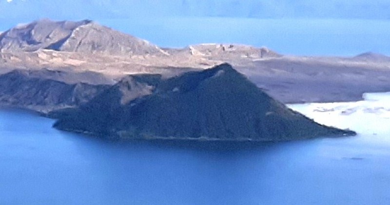
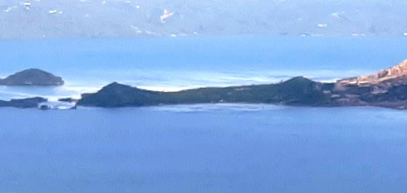
Mt. Binintiang Malaki, on the north of the island, is one of two areas around Volcano Island with still some vegetation
The damage extended beyond plant life as dozens of people perished during the eruption. When tens of thousands of people were evacuated from the island, large numbers of livestock and pets were also left behind to perish or die from starvation. Ash even affected the fish (mainly tilapia and milkfish) being raised in thousands of aquaculture pens in Taal Lake as about 30 percent of the fish cages in Taal Lake were destroyed during the eruption due to changes in acidity and temperature.
The Pira-piraso area on the north of Volcano Island which still retains some vegetation
However, despite the widespread effects, plants will eventually recover or re-colonize the island and the layer of new ash will help keep the soil fertile. Water has returned to Taal’s main crater lake (which I last saw from its viewpoint in 2008 and actually dipped in in 2002), which mostly evaporated or drained during the eruption.
Check out “A Morning Trek to Taal Volcano” and “Taal Volcano: Hike to the Crater Lake“
Taal Lake and Volcano: Talisay, Batangas