
Rannoch Moor
Part of Scottish Highlands Tour
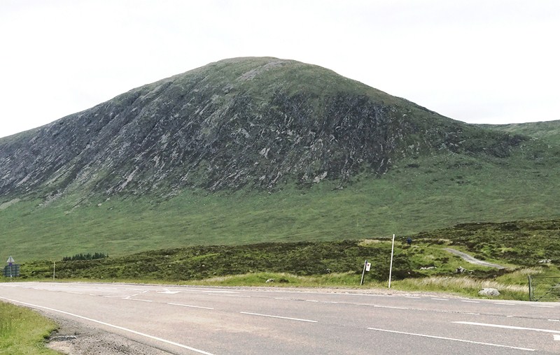
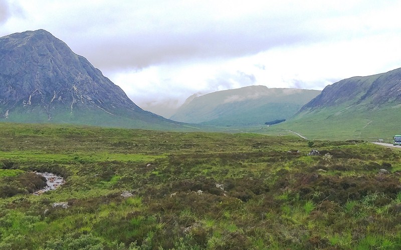
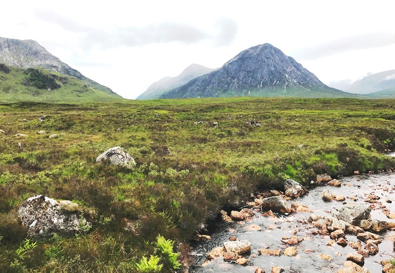
From Loch Tulla Viewpoint, a further 6.76-km. drive brought us to roadside car park by the Loch Ba, off to our right, that lead up a small mound. From here, we had a 360° view across the exposed moorland of the 130 sq. km. (50 sq. mi.) Rannoch Moor (also known as the Great Moor of Rannoch) and the inlets of Loch Ba grasping like fingers at the land. Here, we could also see the 1,021.4 m. (3,351 ft.) high Buachaille Etive Mor, Scotland’s most photographed mountain known for its iconic pyramidal shape.
Check out “Loch Tulla Viewpoint“
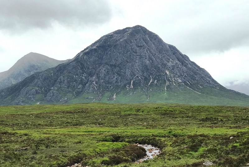
Buachaille Etive Mor
At an average altitude of 300 m., Rannoch Moor is a a vast, boggy landscape that sits on an elevated grand plateau in the Highlands of Scotland in the Bridge of Orchy near Glen Coe. It is located to the west of Loch Rannoch in Scotland, where it extends from and into westerly Perth and Kinross, northerly Lochaber (in Highland), and the area of Highland Scotland toward its south-west, northern Argyll and Bute.
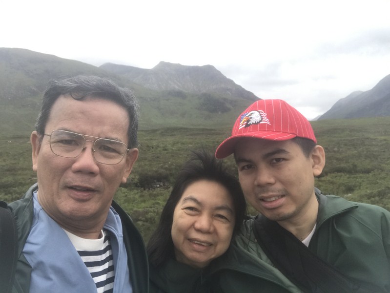
The author (left) with Grace and Jandy
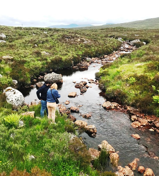
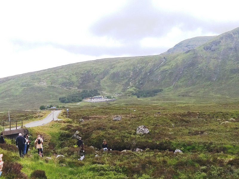
Here, at every angle, we virtually see water, whether it is a loch (lake), a lochan (small lake), stream or bog. Its desolate rugged landscape of peat swamps, flowing streams and untouched land, gave me an unsettling sense of “nothingness.” This wild territory, known for its insects, plants and wildlife, is also a Site of Special Scientific Interest (SSSI) and a Special Area of Conservation and is often referred to as “the last place of wilderness in Britain.” Much of the western part of the moor lies within the Ben Nevis and Glen Coe National Scenic Area, one of 40 such areas in Scotland.
Whilst some patches might look dry, a short walk, without proper boots, soon proved to us how wet and waterlogged the land is as the Rannoch Moor is actually 82% water or bog, making it the largest area of blanket bog in Britain. Beneath the watery surface of Rannoch Moor lies granite, a hard rock that is impermeable, which means water cannot easily soak through it but collects in pools on top.
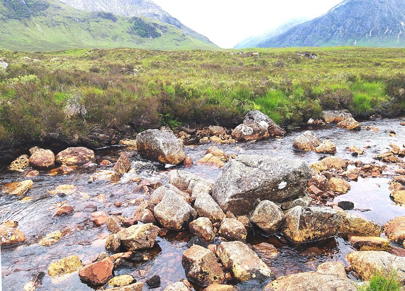
During the end of an Ice Age, approximately 12,000 years ago (when much of western Scotland was covered by a large ice cap), the center of the massive ice cap was over Rannoch Moor and, in some places, the ice was more than 400 m. thick. Although ice sheets look vast and immovable, ice does flow inside them very slowly and, over the years, the movement of the ice scraped out holes in the tough granite. Pieces of the rock and sand scoured away by the ice then became frozen within the ice cap.
When the climate improved and the ice melted, the fragments of rock and sand were scattered across the granite. This left a landscape with lots of hummocks where the rocks had been deposited, and lots of holes where the granite had been gouged out. The holes filled with water creating lochs and lochans in the bedrock.
Notable for its wildlife, it was frequently visited by Horace Donisthorpe who collected many unusual species of ants on the moor and surrounding hilly ground. Today it is still one of the few remaining habitats for Formica exsecta, (the “narrow-headed ant”), although recent surveys have failed to produce any sign of Formica pratensis, which Donisthorpe recorded in the area in the early part of the 20th century.
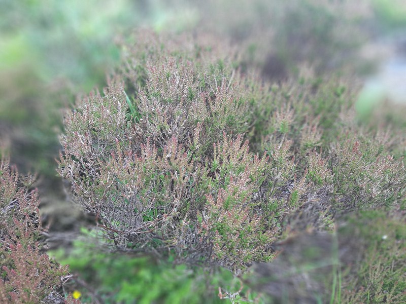
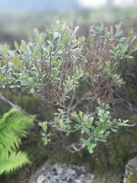
Though only a few plants could grow on top of this watery plateau, it is particularly famous as being the sole British location for the Rannoch-rush, named after the moor. The cold and wet conditions meant there was always plenty of water around, with the constant dampness preventing plant and animal matter from decaying fully and, over thousands of years, this created peat, a thick, dark material rather like soil, that spread across the area, forming an unusual waterworld that is known as a blanket bog.
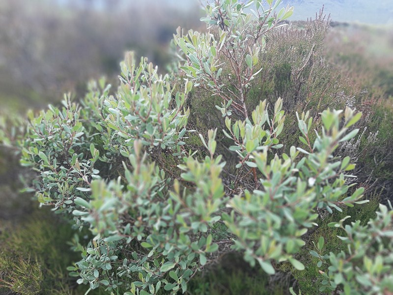
Dwarf birch (Betula nana)
Not many have tried to inhabit these lands as the boggy territory makes this unlivable. However, this is close to the site of the Massacre of Glencoe between Clan MacDonald and Clan Campbell on February 13,1692 when, as narrated by our driver and tour guide Michael Mitchell, an estimated 30 members and associates of Clan MacDonald of Glencoe were killed by Scottish government forces, allegedly for failing to pledge allegiance to the new monarchs, William III and Mary II.
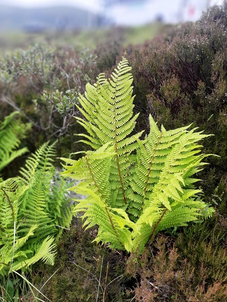
Marsh fern (Thelypteris palustris)
In the 19th century, the West Highland Line railway, which gently crosses the moorland for 37 kms. (23 mi.), was started to provide a link from Glasgow to Fort William. It took several years as they had to build on soft peat and soil and float the tracks by bringing thousands of tons of earth and ashes over the land and laying a mattress of tree roots, branches and brushwood to stop the railway line from being absorbed by the bog. Today, the railway line still runs but has been extended to Mallaig. Corrour railway station, the UK’s highest, and one of its most remote being 16 kms. (10 mi.) from the nearest public road, is located on this section of the line at 408 m. (1,339 ft.).
Fans of the Highlander novel series will recognize Rannock Moor in in the fictional novel The Element of Fire where Duncan and Connor MacLeod track the antagonist Khordas to Rannoch Moor. There Duncan defeats Nerissa, Khordas’ female companion.
Many people may also recognize it as a filming location for a number of movies and TV series. This moorland was featured in the TV series Outlander and Kinloch Rannoch was the location for Craigh Na Dun. It also briefly appeared in the 2010 movie Harry Potter and the Deathly Hallows – Part 1 when the Death Eaters board and stop the Hogwarts Express train looking for Harry Potter and Neville then gets up and says “Hey losers, he isn’t here.” Corrour railway station was also used for the remote rural location scene in 1996’s Trainspotting.
Rannoch Moor Viewpoint: A82, Bridge of Orchy, Highland PA36 4AG. Coordinates: 56°39′15″N 4°35′37″W. Click here for a Google Pin for the viewpoint.
The Hairy Coo: Suites 6 & 7, Administrative Office Only, St. John’s Studios, 46A Constitution St., Leith, Edinburgh EH6 6RS, United Kingdom. Tel: +44 131 212 5026. E-mail: contact@thehairycoo.com. Website: www.thehairycoo.com.
How to Get There: Rannoch Moor viewpoint is located 165kms. (a 2.5-hour drive via A85) from Edinburgh, 116 kms. (a 1-hour 45-min. drive via A82) from Glasgow, and 105.6 kms. (a 90-min. drive via A82 and A84) from Stirling. The A82 road crosses western Rannoch Moor on its way to Glen Coe and Fort William.