Sto. Lucia Complex (Dolores, Quezon)

Lakbay Kalikasan, Southeast Asia’s first and premier outbound education outfitter, embarked on a series of outbound education demonstration tours for teachers from other schools willing to try out their outbound education programs and they invited me to cover one of these tours that promote appreciation of the living remnants of a pre-Hispanic tradition which is still being practiced today in Mt. Banahaw, that of worshiping nature (rivers, mountains, old trees and fields) in the belief that such natural objects were the habitats of spirits. Jesu-Mariae School, my son Jandy’s school, joined the tour and they were represented by Robert “Rob” V. Castañeda and Eleser “Ely” Borero.  

Hiking up Calvario

Our destination was Mt. Banahaw’s Brgy. Sta. Lucia Complex 1 in Dolores (Quezon), one of Banahaw’s 4 complexes – the others being Kinabuhayan (Resurrection), Durungawan (Window) and Ilalim (Crater), which lies at the foot of the 1,470-m. high Mt. Cristobal.  We left the EDSA Shrine (our assembly place) by 5:30 AM, April 9 (Bataan Day), on board one of two vans. Joining us were 16 other teachers from 6 Metro Manila schools (Augustinian Abbey School, Madre Pia, Miriam College, Olivarez College, St. Benedict and Santa Catalina High School).  Our Lakbay Kalikasan hosts were Mr. Ramon Jocson (Corps Director), Mr. Ronaldo Dalofin (Team Leader/Lecturer 2), Mr. Roger Quizol (Team Leader 2), Mr. Oscar Orbe (Team Leader 3) and Ms. Billy de la Cruz (Facilitator 3).   The trip to Dolores was to take all of 3 hours.

Upon arrival at Sta. Lucia, we visited the compound of the Suprema Iglesia del Ciudad Mystica del Dios, Inc.  (Supreme Church of the Mystic City of God), the largest of Banahaw’s 66 to 88 registered colorums, entering it via a huge 20-foot high stainless steel gate.   The word colorum is derived from the Latin Mass invocation in saecula saeculorum.  These esoteric folk Christian religious communities, varying in size from several thousand members to a few adherents, believed that Mt. Banahaw is the site of the Holy Land and that Christ walked in the area.  They also share an intense nationalism and reverence for National Hero Jose Rizal who is considered a demigod or the Tagalog Jesus Christ.  Many sects also believe in the ascendancy of the female (Ciudad Mystica included) and women, rather than men, perform the priestly functions. These religious sects around Dolores resent the kulto (cult) connotation insinuated by non-believers. 

Piedra Mental

Mt. Banahaw is full of sacred natural shrines locally called puwestos (places), all said to have been discovered by Katipunero Agripino Lontok, and one of our objectives was to undergo and relive the pre-Hispanic tradition of pamumuwesto (spiritual pilgrimage) by hiking, crossing rivers and entering caves, all sacred destinations with deep historical and symbolical meanings, communing with the spirits for paglilinaw (discernment) and paglilinis ng loob (inner cleansing) so that we may take the challenges ahead.  Along the way, lectures and meditations are intermittently given and, in all puwestos, candles are always lit.

My baptism

We descended, down a gorge, to Sta. Lucia Falls, fed by the cool Lagnas (or Kinabuhayan) River, and Piedra Mental, a stone altar where pilgrims pray for mental discernment as they go through the pamumuwesto. At the stream which courses down Banahaw (also called Ilog ng Jordan, alluding to John the Baptist’s baptism of Christ), we “cleansed” or “purified” (water is a universal archetype for cleansing) ourselves and drank the sulfuric waters of the falls 3 times (symbolic of the Triune God – the Father, the Son and the Holy Spirit) prior to our entering the sacred caves (kuweba), the pilgrim’s church.  After our ritual baptism, we we then climbed up the steep gorge. 

One of many caves in Sta. Lucia Complex

At the huge boulder of Kaban ni San Isidro, the gate to the entire complex of Sto. Kalbaryo, we lighted candles and said a short prayer for safety and guidance, while at the book-shaped boulder called Aklat ng Buhay (the Book of Life said to contain our names, date of birth and even date of death) at Prisintahan , we imaginatively “register” our names and those of our loved ones. A real hurdle was the 40-m. long Santong Husgado (Holy Judge), one of the caves at Ina ng Awa revered by the religious sects and given Biblical names.  Said to test the purity of those who enter, it is believed that when you get out of this cave, 7 years of your sins will be forgiven but, if you are not completely malinis (cleansed), you will be trapped inside. 

Santong Husgado

We had to hike, barefoot, from Ina ng Awa to the cave opening (with lit candles strategically placed along the cave), carrying just the clothes on our back.  The ladies,  with their small frames, decided to go in first.  I was the last to enter this “cave” which was more of a rabbit hole.  All the while, I was figuring out how to get my 5’-10,” 188-pound frame inside that hole. Ready and willing for this test of faith (pagsubok), I kept remembering the familiar Biblical proverb “I can do anything through Christ who strengthens me” (Philippians 4:13).  Crawling through it entailed a lot of body contorting as well as decision-making. “Should I enter head or feet first?”  “Should I do it on my stomach or on my back?” Finally, after what seemed like an eternity of struggle, I finally made it out to Ina ng Awa. Now I know how a worm feels.   I, together with the others, were all mud-splattered yet, surprisingly, our habit-cladded sister colleague from Madre Pia was still spotlessly clean.  Could it be divine intervention?  I wonder.   

Lakbay Kalikasan: G/F Balai Lakbay, 2 Alondras St., Mira-Nila Homes, Tandang Sora Ave., Quezon City, Metro Manila.  Tel: (632) 932-7818 to 19.  Mobile number: (0917) 500-4796. Website: www.lakbaykalikasan.com.

Anilao: Arthur’s Place Dive Resort (Mabini, Batangas)

A chilling, foggy morning greeted me when I woke up.  It was already sunrise but the sun was obscured by the clouds.  We soon had breakfast prepared, packed our gear and waited for our “porter” and guide to arrive.  In the meantime we posed, as mountain conquerors would do, behind our cameras.  Our guides soon arrived and similarly unburdened, we easily proceeded down the mountain and back to our starting point.  After refreshing drinks at the store, it was back to our car for the now downhill, but nevertheless still treacherous, drive down the zigzag road.   The guys hiked down to their car further down the road.

Arthur’s Place

We decided to all meet at Arthur’s Place to savor what Anilao has to offer underwater.  The beach here was a relatively shallow.  Offshore is a dive site aptly named Arthur’s Place, gradually sloping from five to 21 meters with plenty of reef fish, small coral heads, soft corals, feather stars, hydroids, anemones and sponges.  The resort, opened in 1984 (with two rooms) by the late Arthur Abrigonda was, together with Aqua Tropical Sports (opened in 1967) and Aquaventure Reef Club, the first to open resorts in the area.  It now has 12 rooms with bath (two of them airconditioned), a restaurant, dive shop, picnic tables, shower rooms and offers two boats for diving trips.

None of us went diving (although Cecil was a trained diver) but we indulged in the next best thing by going snorkeling.  Even near the shore, the fish and coral life along the reef was quite good.  I’ve tried diving once (in Club Paradise in Palawan) a long time ago.  Anilao is sure worth the second try with its coral slopes or steps of small drop-offs, shallow coral gardens among sandy patches, profuse small fish life and numerous crinoids and nudibranches.  Some marine sanctuaries have been set up.  Diving is good all year round but the best season is from November to May.

Arthur’s Place Dive Resort: Anilao, Mabini, Batangas. Mobile numbers (Ms. Estelita M. Abrigonda): (0919) 716-7973 and (0919) 312-3938.  E-mail: arthursplace_ph@yahoo.com.  Website: www.arthurs-place.com.

Anilao’s Gulugud Baboy (Mabini, Batangas)

I accepted an invitation from my friend Rosevie “Vi” Sevilla to join her and her friends Ms. Dynah Pizarro and Ms. Cecil Divinagracia on a camping hike to the 501-m. high Mt. Panay (locally called Gulugud Baboy) in Anilao in Mabini, Batangas.  Gulugud Baboy is the highest point on the rocky headland of the Calumpang Peninsula. I brought along my son Jandy plus my tent and other camping equipment.  To joining us later, in a separate vehicle, were Edwin A. Guisihan, Jersey Miranda, Joseph de la Rosa and Carlo Peña.  The morning trip from Manila was via the South Luzon Expressway (SLEX) to the Calamba Exit, then on to the Batangas towns of Sto. Tomas, Malvar, Cuenca, Alitagtag, Sta. Teresita and Bauan as well as the cities of Lipa and Tanauan.   It took all of 3  hrs., traffic and all, including stopovers and asking for directions.

Gulugud Baboy

We arrived at the port just in time for a carinderia-style lunch.  That done, we proceeded down to a road on the left located about 200 m. before the marketplace and jeepney terminal.  From here, we drove 8 kms. along a sometimes paved, but often rough and dusty road, from Brgy. San Jose to San Teodoro.  The route is lined with about 40 dive resorts, many of them quite basic and most situated along the coast of Balayan Bay.  Some do not have access by road and could only be reached by banca from Anilao.     The Calumpang Peninsula is a rocky headland all throughout, the end result of which is a lack of suitable beach spots.We finally arrived at Arthur’s Place, said to be the jump-off point to Gulugud Baboy.

Our campsite

It so happens that Arthur’s Place, according to its manager Ms. Lita Abrigonda, is just the nearest resort to the access road going up the mountain.   It would be a long hard climb going up and we couldn’t secure porters around willing to take our heavy backpacks up.  So I decided to take my Mitsubishi Adventure, with all my passengers and gear, all the way up as I could possibly go.   The mostly rough and dusty zigzag access road was very steep, narrow and quite treacherous, with ravines along the way.  Already very difficult to traverse even during that late afternoon sun, I wouldn’t imagine anyone trying it at night.  I was to be proven wrong later on.  Our “breathtaking” drive was somehow alleviated by the equally breathtaking scenery along the way.

A fantastic view of Maricaban Island

We soon reached a basketball court with a sari-sari store beside it.  Going beyond it was made impossible by an impassable stretch so we decide to just park our car at the court.  From hereon, it would be all footwork.  However, I haven’t given up hope of getting porters and we asked around at the store for one.  There were no male porters around but the “porter” we secured (at PhP200 for a one-way trip) proved to be more dependable than three male porters; a horse.   Thus unburdened, we proceeded, together with our heavily-laden horse and guide, past the village, along a moderately graded dirt path.  It was initially quite a breeze but it all ended upon reaching an opening beside the road.  From hereon it was all uphill along a grassy and treeless trail.   The scenery began to unwind into a series of plateaus resembling sloping golf courses.  I wonder if this spine-like contour is where the mountain got its name.  Gulugud baboy is translated as “pig’s spine.”  Store caretaker Lina Castillo gives a different version, that of a baboy ginto (golden pig) seen to roam the place.

A foggy, very cold and windy evening

After about an hour’s hike, we finally reached the peak of Gulugud Baboy.  And what a peak it was!  From this vantage point high up, we had a spectacular 360 degree view of the ocean, Anilao, Batangas Pier, the narrow 11-km. long, densely forested Maricaban Island, the hat-shaped Sombrero Island, the 1,145-m. high Mt. Makulot and even Mindoro, Mt. Lobo and Mt. Manabo.  Within reach is the similarly grassy and treeless Pinagbanderahan where the Americans were said to have raised their flag (bandera) after the Japanese surrender in World War II.

The gang’s all here
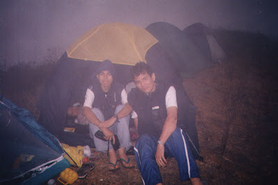
Within minutes, we unloaded our backpacks, paid our guide then went about the necessary business of setting up our tents on the grassy, treeless peak and cooking an early dinner. That done, we settled down to a hearty meal.  It was now late in the day and we were rewarded with a beautiful, fiery sunset.  Simply Heaven!  However, the bitter cold and fog soon began to set in.  We also began to wonder if our other companions could still make it up as they were still in Bauan having dinner.  It would seem recklessly foolhardy for them to try to negotiate that steep and narrow zigzag road at night.  But foolhardy they were as they still pushed on to Anilao and up the steep and treacherous road up to Gulugud Baboy.  We had to guide them by phone.  There were anxious moments when we lost touch of them due to signal dead spots.  Finally, after what seemed an eternity, the faint but welcome glow of flashlights carried by the guys came into foggy view.  We all greeted them with a sigh of relief and, after a narration of their misadventures, helped them set up their tents.  The rest of the night was spent chatting, singing, drinking and making merry.

Trek to Walang Langit Falls (Gloria, Mindoro Oriental)

Crossing the river with a carabao-driven cart

We were all awake by 6:30 AM and soon picked up by our trusty driver Mr. Saez for breakfast at Byahero.  Our guides soon arrived minus Karen who was replaced by Ms. Eleanor “Nhoy” Magsino.  Laden with packed lunch and bottled water provided by Robert, we left by 8 AM, traveling the 14-km. distance to Brgy. Mirayan in 30 mins.. The starting point is beside a swift flowing river.  From hereon, it would be all footwork (and some swimming) through different types of terrain: rivers, mud tracks, steep hills, creeks and boulders.

The short crossing over the fast-flowing river proved to be difficult, more so if it had rained the night before (no wonder we were not allowed to go during my first visit).  Luckily, a carabao-driven cart was also crossing.  Rodel, who would have had a hard time crossing with his polio-stricken right leg, hopped in.  Me and the others followed behind.  Our next hurdle would be just as difficult (and longer), slogging through the muck of a dirt road muddied by previous rains.  This road, built to provide easier access to the falls, had just being started and grading work was going on.   The carabao cart pushed on with its human load and so did we, merrily singing and chatting as we walked.  An opening alongside the road signaled the start of our hilltop trek (and the end of Rodel’s carabao cart ride).  It wasn’t so steep but the muddy trail, plus the intense heat of the sun which penetrated the light forest, made it very tiring especially for the limping but still game Rodel.

Once downhill, we were rewarded, at the foot, by the cool, clear and inviting waters of a smooth-flowing stream.  I lay down by the shallow waters, feeling its cool comfort flow through the length of my body.  I could have stayed that way the whole day but it was not to be as we were only halfway to our goal.  Our sole consolation was that the remaining part of the trek would be all along this meandering stream. The initial portion was along evergreen banks lined with coconut and banana trees, giant ferns and some nipa houses.  Occasionally, we would cut corners by making short, diagonal overland treks.

Soon, we were in for a change of scenery. As we went further down the river, it started to narrow dramatically and began to change to eerie jungle, with massive and very rugged rocky outcrops gradually towering, high and steeply, on both sides of the river.  We also passed some bizarre, weather-sculpted rock formations.  Huge trees, with interlaced, hanging roots and thick branches, hug the river’s edge.  Some, uprooted by typhoons, blocked our path.  Large boulders also jutted out the water.  I was also slowly being drenched by a drizzle from above.  No, it wasn’t raining. Rather, small waterfalls from underground streams in the cliff above were being blown by the wind to create a perpetual drizzle.   I was so engrossed by my surroundings that I failed to notice that, with my huge stride, I had left behind my guides and now was all by my lonesome.  It dawned upon me that I must have made a wrong turn.  I was lost.

May Langit Falls

But not for long.  Soon enough, Exan and Donna came to my rescue. Rather than turn back, I decided to push forward and see what was at its end.  The gorge was getting narrower, so much so that I could touch both sides of the gorge with my outstretched arms.  The river was also getting deeper, waist-high, in my case, and neck-high for the diminutive Donna. Our efforts were rewarded with vistas of two small but beautiful waterfalls: an unnamed one, at our right, and May Langit Falls at the end of the gorge.  Thus fulfilled, we retraced our way back to rejoin our companions.

The way to Walang Langit was via a fork on the river which I somehow missed.  The path through was no less difficult than my previous trek.  Luckily, a huge fallen tree trunk which once blocked the path had been sawn by the municipal government into six-inch sections similar to the tadtaran (chopping boards) of old.  After passing another waterfall, I was dumbstruck by what I finally saw at the gorge’s end, the 100-ft. high torrent of Walang Langit Falls, surrounded, in all its majesty, by equally tall, densely-vegetated cliffs flanking it.  Here, the sun only penetrates the gorge at noon. Simply awe-inspiring.  Only in my dreams can I imagine such a place.

Walang Langit Falls

Much anticipated was a dip in its icy-cold, waist-deep pool. Once acclimatized with the cold, we also indulged in a tingling back massage underneath the fall. Soon all these activities made us hungry and we finally recharged ourselves with a much-needed lunch.  Rodel and I soon finished our photo shoot with a prayer, hoping that our shots in the dim light would come out nice.  Rodel alone used up 3rolls of black and white film by the end of the day.  It was getting late and we had another long hike ahead of us.  Our gear was soon packed (including our garbage).  However, I wasn’t looking forward to this return hike as we were now going to do it in reverse, from heaven back to earth.   We were totally drained once we got back to the dirt road.  The return hike took twice as long and we made it back to our vehicle very late in the afternoon.

As we couldn’t make it to the last Supercat ferry trip back to Batangas City, we decided to stay another night in Gloria.  Sleep was again out of the question as Robert honored us with a small despedida (farewell) party, with our guides, at our cottage.   We left at 2:30 AM for Calapan City, making it to the first fast ferry (6 AM) back to Batangas City and on to Manila.  I was back on “earth” by 9 AM.   Goodbye heaven.

Taytay Falls (Majayjay, Laguna)

Rain, rain go away. Come again another day.”  So moaned this bored and grounded travel writer who was itching to get out of town again.  It was supposed to be the advent of the dreaded El Niño phenomenon again and, usually, mornings always promise to be a bright, sunny day.  However, expectations always turn to gloom as dark clouds always appear in the horizon by afternoon, bursting into rain hours later.  What the heck! I will go get out, rain or shine (shine I hope).

 Lala, the author, Myrna, Ning and Menchie

I did find people with the same mind set from Jesu-Mariae School (JMS), my son Jandy’s school.  Joining me were Mr. Robert Castañeda, Ms. Elvira “Lala” Mañanita, Ms. Myrna Samson, Ms. Leonila “Ning” Boncayao and Ms. Menchie Fortunado.  We decided to do some overnight camping at Taytay Falls in Brgy. Taytay, Majayjay in Laguna.  We all left JMS, after lunch (1:30 PM) on 12 October, a Saturday.  The trip to Majayjay was to take all of 120 kms.. Aside from my passengers, my Mitsubishi Adventure was laden with tents, backpacks, sleeping bags and provisions.  The afternoon skies were again overcast. We traveled via the South Luzon Expressway (SLEX) all the way to Calamba City, then on to the resort town of Los Baños, Bay (the old Laguna capital), Calauan, Victoria, Pila and Sta. Cruz (the provincial capital), turning right at the junction on to a road leading to Nagcarlan, Liliw and finally Majayjay.  There were glimmers of hope as the sun shone most of the way.

Settling in our tents

The last leg was particularly winding but altogether  scenic; passing beautiful mountain scenery (1,470-m. high Mt. Cristobal and 2,177-m. high Mt. Banahaw), lanzones trees laden with ripe and read-to-harvest fruit, and clear, swift flowing rivers with bathing children and washing mothers.  It was truly a scene for a Fernando Amorsolo genre painting. We arrived at Majayjay’s poblacion by 5 PM with hopes dashed as it began to rain. We were truly in for a “wet” reception. We first paid a visit to the home of Mr. Florencio “Flory” Rosales, secretary of town councilor Rey Cube (referred to us by Mr. Manuel “Noli” Canlas, board member of JMS).  Mr. Rosales was more than kind enough to personally guide us towards the staging area for the trek to Taytay Falls, waiving the entrance fee of PhP20 per person.  He also assigned guides to assist us.  From hereon we were on our own.

It was already getting dark when we arrived at the staging area.  Normally the hike to the falls takes just 10mins..  However, this was a different story as we would be trekking in the pitch-black darkness of a rainy, eerie and moonless night.  Luckily, we had flashlights and our guides.  The narrow, two-foot wide concrete path was sandwiched between a mountain spring-fed canal running alongside the mountain on the left and deep, treacherous ravines on the right. G.I. pipe railings kept us on the safe side.  We arrived at the campsite after what seemed an eternity.

Taytay Falls

Our first face-to-face encounter with the falls would have to wait for tomorrow due to darkness but the sound of its onrushing waters would be a constant reminder of its presence.  For the time being, we had other concerns to think about. Beautiful places such as these are not well-kept secrets and the place was teeming with weekend campers from the town and Manila.  We were quite a sorry sight, drenched from head to foot by the rain, muddied, hungry and with no proper place to pitch a tent.  While our kusineras Myrna and Ning hastily prepared our dinner of fried liempo (it would have been barbecued if not for someone forgetting the grille – me), corned beef and steamed rice over my portable stove, Robert and I groped in dark for a less than suitable place (our selected site was rocky) to pitch 3 of our tents.  Once settled in, we attacked, with gusto, our prepared dinner and hit the sack early for a well-deserved but not so fitful sleep.

View of campsite from atop the falls

I woke up very early in the morning with somewhat revived spirits and a sore back (“Pwedeng pang sungka ang likod ko”).  The others soon followed, all in a similar state of mind and body.  As the early morning sun crept in, the beauty of the place slowly emerged.   No rain.  Our campsite was located beside a moderately flowing river whose icy-cold, crystal-clear waters came from the beautiful 30-ft. high waterfall located about 100 m.  away.  Everyone was excited to sample its inviting waters.  But first, my early morning coffee fix and breakfast!  As soon as it was prepared by our ever dependable kusineras, we all transferred all our stuff: tents, backpacks and prepared breakfast, to a more suitable site right beside the falls. Who cares about breakfast in bed when you can’t have it beside a beautiful waterfall!   That done, we soon settled down to a filling repast similar to what we had last night.

Our excitement to have our first dip at the falls soon turned to cowardice as we dipped our toes in the icy-cold waters of the natural pool.  Brrrr!  What the heck!  I bravely dove in and endured the shivering and the sound of my teeth clattering as my body slowly, but surely, adjusted to the temperature. After much goading, the others (Myrna, Ning, Menchit and Lala in that order of bravery) soon followed my lead.   Robert and I also did some exploring of our own by clambering up a well-defined but muddy trail to the top of the falls. It was even more beautiful here (and less crowded).  From here, we had a bird’s eye view of the campsite (our companions look like ants below), creek and the surrounding verdant rainforest.  I could stay here forever.   Back at the campsite and terra firma, we soon had our fill of the falls and its verdant surroundings, packed our tents, backpacks and other gear and soon made our way back to the staging area and our car.

Deer Breeding Farm (Ocampo, Camarines Sur)

With still some daylight up ahead, we opted to visit another of Gov.  Luis Villafuerte’s priority projects: the Deer Breeding Farm in  Ocampo.  Located below Mt. Isarog’s slopes, this experimental breeding farm, started in 1996, has a 60-head herd made up of 5 species of Australian deer (blackbuck antelope, the fallow deer, the chital deer, red deer and elk).

Grazing deer with Mt. Isarog in the background

Here, we decided to go “deer hunting” with our cameras.  This proved quite difficult as the deer were wary of us newcomers, retreating as we approached them.  Luckily, it was feeding time and the deer seemingly ignored us as they went about their meal with gusto.  We also had our fill as we clicked away with our cameras.

The deer up close

Its not everyday that we see deer in the country but it certainly is possible in Camarines Sur.  Satisfied with this unique experience, we decided to call it a day, returned to our van for the return trip back to Naga City and our hotel, dropping off our guides along the way.  That night, I slept soundly, counting deer instead of sheep.

Deer Breeding Farm: Brgy. Sta. Cruz, Ocampo, Camarines Sur

Consocep Resort (Tigaon, Camarines Sur)

After an early morning breakfast at the hotel, Alex, Rick, Jess and I, together with Boyet and Susan, all left on our van for a familiarization tour of Naga City’s favorite getaway from the hustle and bustle of the city: Consoscep Mountain Resort at the foot of Mt. Isarog in Tigaon.  Accompanying us as guides were Ms. Melba Niebres and Ms. Shiela Clara of the Camarines Sur Tourism Office in Pili. The trip, via the Jose Fuentabella Highway, was to take all of an hour.   Past the towns of Pili and Ocampo, we turned left at the intersection leading to the resort.  The 8-km. uphill drive was scenic all the way as we passed abaca plantations and verdant forests.  Turning off our airconditioning, we instead savored the cool caress of its Baguio-like mountain air.  Along the way, we also passed the Parks and Wildlife Office.  Nabontolan Springs are located within its grounds.

Consocep Resort
A welcome arch signaled our entry into Consocep Resort.  This resort, developed in 1989 during the term of Gov. Luis Villafuerte, is located at the 1,800-ft. level of Mt. Isarog.  This extinct, isolated volcano’s vast 101.12-sq. km. (10,112-hectare) base covers Naga City and the towns of Calabanga, Goa, Pili, Tigaon and Tinambac.  The mountain is said to be the home of the legendary Bicolano goddess Aligata and Negritos also live within its dipterocarp forest.  Upon arrival, we parked our van at the park’s spacious lot.
 
Mt. Isarog
From hereon, it would be all footwork.  The appeal of this mountain resort is its fascinating waterfalls.  The resort has 3 major waterfalls: Bulalacao Falls, Kawa-Kawa Falls and Tumaguiti Falls.  There are also 2 smaller ones.  Getting to these falls proved to be easy as we leisurely hiked along cemented, pebbled-washout or cobbled-stoned pathways and stairs (there are said to be 1,394 steps along the trail).
 
Entrance to the resort
The first waterfall we reached, Tumaguiti Falls, was the park’s highest.   Its name was derived from its rain shower-like gush of water.  We weren’t prepared for a wet reception at this fall as we didn’t bring bathing attire or extra clothes.  Boyet didn’t seem to care as he took, with gusto, his first “natural” shower, clothes and all.  We could only watch in envy.
      
Tumaguiti Falls
We soon continued on our way to our next destination: Kawa-Kawa Falls.  Its name was derived from the native word kawameaning “big cauldron.”  Although a David compared to the Goliath-like Tumaguiti Falls, it is still the best known and most popular because of its natural “slide” into a man-made swimming hole so structured as to blend naturally with its surroundings.  Again, Boyet took a natural bath in its refreshing waters while we consoled ourselves by just breathing the cool mountain air and admiring the tall trees and giant ferns.  We also interviewed 47-year old Domingo Saulon, one of the park’s four rangers.
     
Kawa-Kawa Falls
After about 30 mins., we continued on our way to our final destination: Bulalacao Falls, so named because of its rushing cascade. After passing a dressing area and an impressive treehouse, we soon heard the rushing waters of the waterfalls.  But first, we proceeded to its viewing deck.  Quite tired and famished, we partook of the packed Bigg’s Diner packed lunch we brought along: fried chicken and laing (taro leaves with shrimps in coconut cream) cooked in true Bicolano fashion; hot and spicy.   After this hearty lunch, our group proceeded down the steps, to the falls.
      
Bulalacao Falls
What a falls it was!  This third major waterfall truly lived up to its name, as its onrushing waters fell down, in graduated steps, to a deep, inviting pool surrounded by lush foliage.  The temptation to dive in was irresistible and since I had already missed out on two beautiful falls, it would truly be a sin to miss out on this third and last opportunity.  Clad only in my jogging pants, I waded its icy-cold waters for my own “natural” bath.  Boyet, Alex and our guides; Melba and Sheila, soon followed suit.   Susan, Jess and Rick still opted to remain as spectators, watching us as we lolled about the pool.
     
A treehouse at the resort
After 30 mins. of sheer ecstasy, we reluctantly left the falls, drenched as a newborn chick, to make our way back to the park entrance.  The return trip was all slightly uphill and our group was split in two as the others lagged behind.   Reaching the parking lot ahead of them, I took the opportunity, while waiting for the others, to dry myself under the sun.  Soon everyone was accounted for and we all boarded our van for the return trip down the mountain.

The Waterfalls of Mt. Romelo (Siniloan, Laguna)

Mt. Famy in Laguna, the nearest and most accessible mountain trekking destination from Manila.  The mountain, in itself, is no “tall” order being only about 1,100 ft. (335 m.) high.  The charm of the place, aside from its accessibility, lies in its 7 beautiful waterfalls (Ambon-Ambon Falls, Batya-Batya Falls, Buruwisan Falls, Lanzones Falls, Matandang Buruwisan Falls, Sampaloc Falls and Sapang Labo Falls).  It was this charm that made me decide to visit the place.  I brought with me Jandy and Jesu-Mariae School teachers Mr. Roy Trillo and Mr. Arnel Daliva.  We left Manila by 6:30 AM traveling via the C-5 highway to Pasig City, Antipolo City, and the Rizal towns of Cainta, Taytay, Teresa, Morong, Baras, Tanay and Pililla, before crossing the Laguna boundary, to Mabitac and Famy.

Buruwisan Falls

The views along the winding and well-maintained asphalt highway at Mabitac were truly spectacular as we feasted our eyes on the surprisingly forested mountains of the majestic Sierra Madres and the calm, azure waters of Laguna de Bay.  The route here, and in Antipolo City, is full of sharp, Kennon-like zigzag bends.    Asking around at the Caltex station in Famy town, we were beginning to wonder why no one seems to know or even heard about this mountain named after their town.  One even gave us wrong directions to a mountain in Pakil.  The answer is simply because it isn’t there in the first place.  We tried the next town of Siniloan.

Jandy rafting at the falls

Later conversations with Siniloan residents Geronimo and Marilyn Pontipedra revealed that our mountain destination was, due to an erroneous land survey, placed within the territorial jurisdiction of Famy town. Hence, the name Mt. Famy.  In reality, the mountain belongs to Brgy. Macatad in Siniloan.  Here, they call it Mt. Romelo.  Two of the mountain’s 7 waterfalls are another story.  Buruwisan Falls and Ambon-Ambon Falls, according to some travel brochures that I’ve read, are supposedly under the jurisdiction of neighboring Sta. Maria and Pangil towns respectively.  Brgy. Macatad’s residents claim otherwise.   We arrived at the jump-off point by 9 AM and parked our car, for a fee, at a house along the highway.  All four of us registered our names at the store of Ms. Pontipedra and gave a small donation.  Laden with our gear we, at first, refused offers for guides and porters.  This was foolish economy on our part as there were many forks along the trails.  We finally engaged the services of 13-year old Macatad resident Joel Diaz as our guide.   Later, he also became my porter as the heavy weight of my backpack began to tell on my unfit, then 43-year old body.  Who ever said age doesn’t matter?

Camping by the falls

Our destination, Buruwisan Falls, is accessible by two mountain trails: Puting Bato and Pulang Lupa (the shorter route).  I neglected to ask which route we took. The initial part of the trail was through rocky streams and muddy river beds.  We soon entered a light forest and it was uphill and downhill all the way through 2 hills, passing occasional spear grass (cogon) trails.  The most difficult part was clambering up a steep 45-degree grassy incline to the top of the first hill.  Here, two stores offer a welcome relief of cool soft drinks and fresh buko (all for an understandably “steep” price of course) to the victorious climber.  This scene is also repeated on the second hill.   Both hills offer spectacular mountain views and weak Smart and Globe signals.  Beyond the hill, my mobile phone become useless baggage.

It is never lonely along the sometimes muddy trail as it was the peak of the trekking season.  Groups of hikers occasionally passed us by (and vice-versa).  One even rode on a horse (hired for PhP150 one way).  These horses also carry gear and supplies.  Soon after passing the second hill, our spirits were buoyed by the sound of rushing water as we neared our destination.  After three hours of strenuous trekking, we arrived at the campsite in time for lunch.  We pitched our tents below the falls’ rocky overhang (a good shelter from the sun and rain, but quite risky during an earthquake).  I particularly situated my tent‘s opening to face the falls. There were already 6 tents pitched before our arrival.

Lanzones Falls

The 50-ft. high, postcard-perfect Buruwisan Fall is featured in many travel books for the rappelling thrills it offers.   According to Joel, other visitors here even engage in the very dangerous, extreme sport of diving from the top of the cliff down to the falls’ deep pool.  Luckily, no one has, as yet, died from it.  On my part, I just engaged in the safer sport of just swimming in its bracingly cold waters while Jandy paddled along on a floating log.   Our indispensable Joel who continually served us throughout our stay, later guided me to Lanzones Falls, downstream to the right from Buruwisan Falls.  Although half the height of Buruwisan, it was just as spectacular and its shallow pool had surprisingly clearer waters than its predecessor.

Matandang Buruwisan Falls

The waters of the two waterfalls meet to form the majestic but rarely visited Matandang Buruwisan Falls (Binaytuan Falls to others).  Said to be 200 ft. high, its splendor is rarely seen by visitors as its base can be reached only after a very difficult hike.   Joel was one of the lucky ones to have visited it.  I could only view it from the falls’ top.  After an early supper, we retired to our tents for a much needed rest after a hectic day.  Sleep, however, was almost an impossibility as the ground beneath our tents was rocky.  The rubber mat I brought along only provided some relief.  I was also quite unused to roaring sound of the waterfall beside us.

Batya-Batya Falls

We awoke early amidst a slight drizzle, had a hearty breakfast, dismantled our tents and packed our backpacks.  Leaving our gear behind at the store of Joel’s grandmother, we then proceeded, with Joel leading the way, upstream to Batya-Batya Falls.  Getting there was easier said than done as we had to hop among large boulders and twice wade through 5-ft. deep waters, carrying our belongings above our heads.  After a 30 min. hike, we finally reached the falls.  Equally beautiful as the others we visited, it was unique in its own way as its crystal-clear waters fell in tiers.  There were small, deep basins (hence the name, batya which means “basin”) at every drop.  We had the irresistible urge to climb it and all four of us did so.  Joel stayed behind with our stuff.  Climbing it was quite difficult but well worth the effort.  Up the falls was another stream leading to Sampaloc Falls.  It entailed a long hike though.  Four out of seven waterfalls visited already make a good batting average, so we decide to forego a trek to this fifth fall.   With great difficulty, we retraced our steps back down the falls. 

We were back to the store by 10 AM. Here, we changed into dry clothes and started our hike back to my car.   We made it back in a “record” time of 2 hrs., stopping only for rest at the two hilltop rest areas.  After a short talk with Ms. Pontipedra and a late merienda of halo-halo, we left by 1 PM after paying the PhP100 parking fee.  We arrived in Manila by 4 PM, stopping only for a late lunch in Antipolo City.


Taal Volcano: Hike to the Crater Lake (Talisay, Batangas)

Mt. Binintiang Malaki

This Holy Week, I availed of a standing invitation from Ms. Lily Rodrigo-Canlas, president and C.E.O. of Jesu-Mariae School, my son’s school, to stay at the Jesu-Mariae Center in Tagaytay City.  This retreat/seminar center could comfortably accommodate 80 people in dorm-style facilities.  With this center as a jump-off point, I planned to revisit Taal Volcano via the Kayabok Trail on the other side of Volcano Island.  Joining me were my son Jandy and daughter Cheska who’s been egging me to include her in my escapades.  Joining us were 5 of Jandy’s teachers: Mr. Robert Castaneda, Ms. Veneriza “Vener” Trillo, Ms. Theresa “Thet” Quieta, Mr. Joel Fatlaunag and Mr. Erwin Vizcarra.  All, except Robert, are jittery first-timers at the volcano.     

Picnic Grove with Taal Volcano behind us

We left Manila on the morning of March 27 and arrived at the center in time for preparation of a delicious barbecue lunch.  After customary visits to the city’s Picnic Grove (where we went horseback riding) and People’s Park in the Sky (now in a sorry state of disrepair), we returned to the center for a delicious supper and retired early as we had to leave very early in the morning for the volcano trek. 

Cheska horseback riding with Thet

The next day, Holy Thursday, we all awoke by 5 AM, had breakfast, pack our provisions of bottled water, sandwiches and bananas (good trail food) and left the center by 6:30 AM.  From Tagaytay City, we went down to Talisay (Batangas) via the treacherous concrete zigzag road called Ligaya Drive, down to Brgy. Caloocan.  As soon as we arrived at the boat landing station, we were swamped by boatmen hoping for an early kill, this day being a holiday.   Soon, they were trying to pluck our feathers by charging us a cutthroat rate of PhP3,200 just for the trip (with 6 passengers only).  It was soon watered down and we settled at the still horrendous price of PhP2,400 to bring all 8 of us to our destination.

On our way, by boat, to Volcano Island

We left the station by 7 AM on board a big motorized banca.   The trip was smooth all the way as the waters were calm. As we went around the island, the 311-m. high (the island’s highest point) Mt. Binintiang Malaki (translated as “giant leg”), soon hove into view.   This northwest cone, seemingly featured on most Taal Volcano postcards like an island (actually connected to the real Volcano Island), emerged overnight during the 1707 eruption but is now dormant. A dismal sight during the voyage was the presence of numerous fishpens which our boat had to negotiate to get to the other side.

Nearing the homestretch

We landed on the island’s western shore at Brgy. Kayabok by 7:30 AM.  All throughout the trip, the boatman kept egging me to get a guide (at extra cost of course) but we have decided even before the trip to do without one as the Kayabok Trail was definitely well-trodden.  We also refused a lady islander’s rather steep offer to guide us for PhP500.  Anyway, we had all the time in the world even if it meant getting lost in a small island.   Our seemingly concerned boatmen seem to have other things in their minds.  I wonder why.

The Crater Lake seen from a distance

We began the trek on a happy note, following the well-trodden trail up a hill. The sun soon rose brightly on the sky and we began to feel the effects of the intense heat from the morning sun.   As we soon reached the top of the hill, the trail began to fork, leaving us in a dilemma.  All the while, we somehow had a feeling that we were being followed and, soon enough, our boatmen were hollering for us to come back.  We ignored them.  Later, we encountered our huffing and puffing boatmen along the trail.  We were told that we took the wrong turn and they, in all kindness, offered to guide us in the right direction.  Or were they?    It soon dawned upon me that these boatmen were concerned, not with the guide fee (which I consistently refused), but with the fact that they may lose their first big meal ticket (or buena mano) of the day among the winding trails.  We could just as easily have taken our boat ride back to Talisay from the other coastal villages.  With this in mind, they never left us out of their sights after that.

Finally, at the Crater Lake

Vegetation on the island is sparse, consisting mostly of short grass, tall, nettled spear grass (cogon) and thorny brambles.  The treeless trail we trekked was all loose volcanic ash and the ground underfoot was also hot as volcanic rock retains heat both from the sun and the hot magma trapped deep within its bowels.  This, coupled with the sweltering heat of the sun, soon made our tongues hang out.  Our party was soon divided into two as our neophyte mountaineers Vener and Thet began to lag behind.  Cheska, however, proved to be tough and resilient as she kept up with the guys. 

The island within the Crater Lake

We took solace under the small shade of occasional thorny aroma trees (most of the large trees have been blown away by previous eruptions) where we quenched our parched throats and munched bananas as we waited for the stragglers to arrive.  Along the trail we passed by one of Taal’s 47 craters.  This seemingly dormant crater had a flat, cogon-covered bottom.  We also encountered makeshift refreshment stalls selling canned softdrinks (PhP30) and bottled water (PhP20).  After a tiring uphill hike, the shimmering blue-green waters of the crater lake made its appearance like a mirage on the horizon.  It was all downhill after that and, soon enough, we reached the crater lake’s rim.  It was 9 AM and the hike took all of one and a half hours.    It could have been longer.  Our socks and shoes were soon off as we couldn’t wait to dip our tired feet in those inviting waters.  However, the lake’s waters deepen just a few feet from the shore. About 30 m.  offshore is the small, crescent-shaped island.  The lake’s waters are actually dilute sulfuric acid with salts and other minerals such as sodium, boron, magnesium and aluminum added in.   Acidity in the water, measured in pH (the lower the pH, the higher the acidity), is a “whopping” 2.7 (neutral pH is 7.0) with about 3% sulfur.   Sulfurous waters have medicinal qualities and it did wonders for my mosquito-bitten legs.  Our boatmen also took home 1.5-liter bottles filled with this salty and bitter water.  Also as a result of the sulfur deposits, the stones at the lakeshore are coated yellow.

L-R, Vener, the author, Jandy, Thet, Robert, Erwin and Joel

After lolling about the waters, taking our lunch of sandwiches and photo shoots for posterity, we left the lake and retraced our way back to our boat and left the island by 11:30 AM.  Any notions of being in Tagaytay for an early lunch were dashed when our boat engine conked out (obviously out of gas) just a kilometer off the shore of Brgy. Caloocan.   We had to wait for half a hour for a relief boat to ignominiously tow us back to shore.  After paying our boatmen (they had the gall to ask for a “tip”), it was back to our car for the uphill drive back to Tagaytay and a well-deserved lunch.  Back at the Jesu-Mariae Center, we collapsed, dead-tired, on our beds. 

The Balsas of Matabungkay (Lian, Batangas)

Matabungkay Beach Resort & Hotel

I was invited to join a media familiarization tour of Matabungkay Beach Resort & Hotel in Lian, Batangas on March 23-24, the weekend preceding Holy Week.  Our assembly area was the Department of Tourism (DOT) Bldg. near Rizal Park.  I left my car at my wife’s office at Gil Puyat Ave, took a fully-packed LRT train, overshot my designated stop which was U.N. Ave. and dropped off instead at Central Station where I decided to just walk, for the exercise, back to the DOT.   I arrived at the DOT cafeteria, huffing and puffing and drenched as a newborn kitten, just in time for breakfast.

Check out “Resort Review: Matabungkay Beach Resort & Hotel

Joining me at the breakfast table were some of the Who’s Who in travel journalism: Mr. Randy V. Urlanda of Panorama, Mr. Frank A. Evaristo of Manila Bulletin, TODAY veteran photographer Mr. Manny Goloyugo, Ms. Arlene Dabu-Foz of Manila Bulletin, Mr. Romark Mayuga of Manila Times, Ms. Claudeth E. Molon of TODAY, Ms. Lala Rimando of Newsbreak Magazine, Ms. Ruby Gonzalez of Travel Weekly East, Ms. Maggie De Pano of Business World Online, Mr. Michael David C. Tan of What’s On & Expat and Mr. Melvin S. Magtaus and Mr. Dennis Lapan of Lifestyle Asia.

Also present, as host, were Ms. Leona  DG. Nepomuceno and Ms. Camille Cua of the DOT.  Also joining us were Ms. Blessie Zarzuela of Adea Marketing, the TV crews from ABS-CBN (3) and RPN 9 (3) and 2 other DOT personnel.

We left the DOT at exactly 8:30 AM for the 3-hr. airconditioned coaster trip to Matabungay.  I sat at the lone bucket seat up front with its wide legroom suitable for my 5’-10” frame.   I had to buckle up though.  The long 105-km. trip via the Sta. Rosa Expressway was pleasantly uneventful until we reached the junction leading to Lian.  Here the coaster was bodily stopped by resident “commissioners” out to make a killing this early.   This scene was repeated  5 more times as we approached the town and our hotel, the last one a roadblock set up by the barangay soliciting donations for their fiesta.  What a damper!

Media participants by the Nestea swimming pool
A fleet of balsas

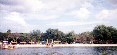
After arrival and check in at the resort, we had lunch and, after a short rest, we were all invited by Marissa to take a ride on one of the resort’s floating bamboo rafts (locally called balsa) where a merienda of pancit bihon and canned soft drinks awaited us.   Ideal in Matabungkay’s very shallow beach, the shore is lined with lots of these balsas.   They are navigated by long bamboo poles sometimes up to the edge of the drop-off and, once a suitable spot is chosen, anchored in place.  All rafts have shaded picnic tables and grills.  From the balsa, visitors could go swimming, snorkeling and, at the day’s end, sunset watching.

Even after the sun has set, a number of these lighted balsas are used to await fishermen and their much-awaited bountiful catch.   These balsas, in effect, have become a very important contributor to Lian’s tourism and livelihood economy.   As a tribute to this hardy and durable symbol of Matabungkay, Lian has decided to hold its first Balsa Festival this coming May 17-18.

The 2-day festival, proudly hosted by Matabungkay Beach Hotel & Resort, promises to be activity-packed.  Highlights are a Balsa Race and the Parade of Decorated Balsas.  Different sectors of Lian and the nearby towns will be invited to participate, 80 for the Balsa Race and 60-70 for the Parade of Decorated Balsas.  Students from the town’s different secondary and tertiary schools will also showcase their talents in dance and other production numbers.   The festival will be capped, on the evening of May 18, by band performances and a beach party.

Preparing for my trial dive

After the raft excursion, Marissa invited us to try our hand at scuba diving at the resort’s swimming pool.  I, plus  Blessie and Lala, took a crack at it.  The others begged off.   Mr. Jim Waite, the in-house dive instructor, gave us a brief overview on the  basics of diving and its equipment.  The much-awaited actual lesson followed and we were soon fitted with masks, snorkel, buoyancy compensator, tanks, weight belts and fins.   This being my second dive (my first was a trial dive in Club Paradise in Palawan), I was soon diving about at the pool’s floor like a fish within its element.

After a much-needed shower, a torchlit dinner was served along the beach.  Additional lighting was provided by a bonfire.   We were also joined by TV crews of ABS CBN and RPN 9 TV.  Immediately after that, we were again invited to a round of nighttime entertainment at Gotcha Club.  The girls monopolized the videoke while us guys contented ourselves with rounds and rounds of billiards and table tennis.  Still others just watched the girls sing to their heart’s content until the wee hours of the morning.

Press conference by the beach

The next day, after a sumptuous buffet breakfast at Caballero Café, we buckled down to serious business with a mini-conference held at the beach area.   Invited to the conference were Ms. Charlie Leviste-Antonio (the resort’s Vice-President for Operations), Mr. Jim Waite, Ms. Balangue, Mr. Violeta and the town’s Chief of Police.  Here we voiced our concerns (the “commissioner” episode, environmental issues, Holy Week security, etc.) and asked questions concerning the resort’s history, facilities and plans, the upcoming Balsa Festival, scuba diving opportunities and Fortune Island (a sister resort).

Posing with our hosts

Immediately after the mini-conference some of us opted, it being Palm Sunday, for a mass (complete with the appropriate palms) held at the resort’s pavilion.  After a late lunch at Café Caballero, we packed up our stuff, had a photo session at the resort entrance and said goodbye to our gracious hosts, Ms. Leviste-Antonio, Ms. Balangue and Mr. Violeta.  We left the resort by 2:30 PM  and arrived in Manila by 6:30 PM, after a side trip to Calatagan and numerous stopovers at Tagaytay City for fruits, espasol, buko pie and mazapan sweets.

Matabungkay Beach Resort and Hotel: Brgy. Matabungkay, Lian, Batangas.  Manila office: Unit H, Garden Floor, LPL Towers, 112 Legaspi St., Legaspi Village, Makati City.  Tel: (632) 819-3080, (632) 752-5252 and (632) 751-6685.  Fax: (632) 817-1176.  E-mail: mrb@matabungkay.net or inquiry@matabungkay.net.  Website: www.matabungkay.net.