
 |
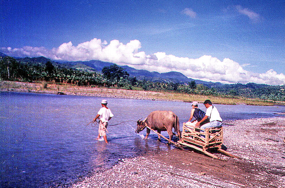
| Crossing the river with a carabao-driven cart |
We were all awake by 6:30 AM and soon picked up by our trusty driver Mr. Saez for breakfast at Byahero. Our guides soon arrived minus Karen who was replaced by Ms. Eleanor “Nhoy” Magsino. Laden with packed lunch and bottled water provided by Robert, we left by 8 AM, traveling the 14-km. distance to Brgy. Mirayan in 30 mins.. The starting point is beside a swift flowing river. From hereon, it would be all footwork (and some swimming) through different types of terrain: rivers, mud tracks, steep hills, creeks and boulders.
The short crossing over the fast-flowing river proved to be difficult, more so if it had rained the night before (no wonder we were not allowed to go during my first visit). Luckily, a carabao-driven cart was also crossing. Rodel, who would have had a hard time crossing with his polio-stricken right leg, hopped in. Me and the others followed behind. Our next hurdle would be just as difficult (and longer), slogging through the muck of a dirt road muddied by previous rains. This road, built to provide easier access to the falls, had just being started and grading work was going on. The carabao cart pushed on with its human load and so did we, merrily singing and chatting as we walked. An opening alongside the road signaled the start of our hilltop trek (and the end of Rodel’s carabao cart ride). It wasn’t so steep but the muddy trail, plus the intense heat of the sun which penetrated the light forest, made it very tiring especially for the limping but still game Rodel.
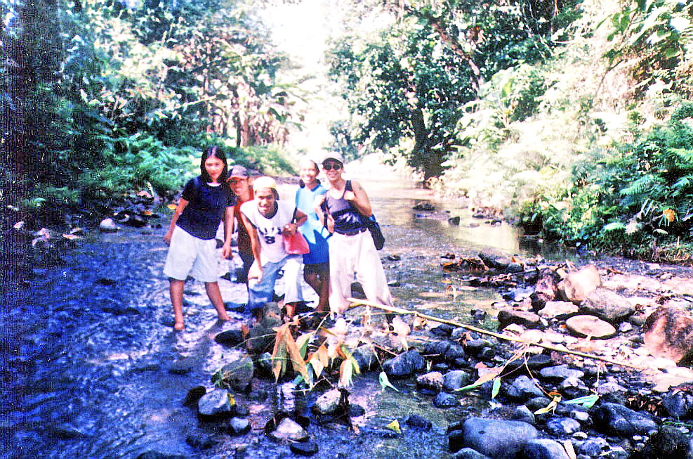
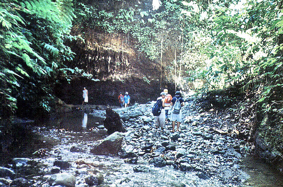
Once downhill, we were rewarded, at the foot, by the cool, clear and inviting waters of a smooth-flowing stream. I lay down by the shallow waters, feeling its cool comfort flow through the length of my body. I could have stayed that way the whole day but it was not to be as we were only halfway to our goal. Our sole consolation was that the remaining part of the trek would be all along this meandering stream. The initial portion was along evergreen banks lined with coconut and banana trees, giant ferns and some nipa houses. Occasionally, we would cut corners by making short, diagonal overland treks.

Soon, we were in for a change of scenery. As we went further down the river, it started to narrow dramatically and began to change to eerie jungle, with massive and very rugged rocky outcrops gradually towering, high and steeply, on both sides of the river. We also passed some bizarre, weather-sculpted rock formations. Huge trees, with interlaced, hanging roots and thick branches, hug the river’s edge. Some, uprooted by typhoons, blocked our path. Large boulders also jutted out the water. I was also slowly being drenched by a drizzle from above. No, it wasn’t raining. Rather, small waterfalls from underground streams in the cliff above were being blown by the wind to create a perpetual drizzle. I was so engrossed by my surroundings that I failed to notice that, with my huge stride, I had left behind my guides and now was all by my lonesome. It dawned upon me that I must have made a wrong turn. I was lost.
 |
| May Langit Falls |
But not for long. Soon enough, Exan and Donna came to my rescue. Rather than turn back, I decided to push forward and see what was at its end. The gorge was getting narrower, so much so that I could touch both sides of the gorge with my outstretched arms. The river was also getting deeper, waist-high, in my case, and neck-high for the diminutive Donna. Our efforts were rewarded with vistas of two small but beautiful waterfalls: an unnamed one, at our right, and May Langit Falls at the end of the gorge. Thus fulfilled, we retraced our way back to rejoin our companions.
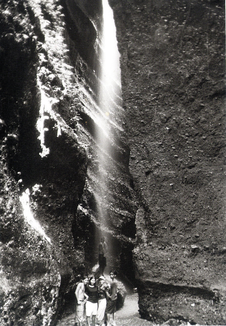
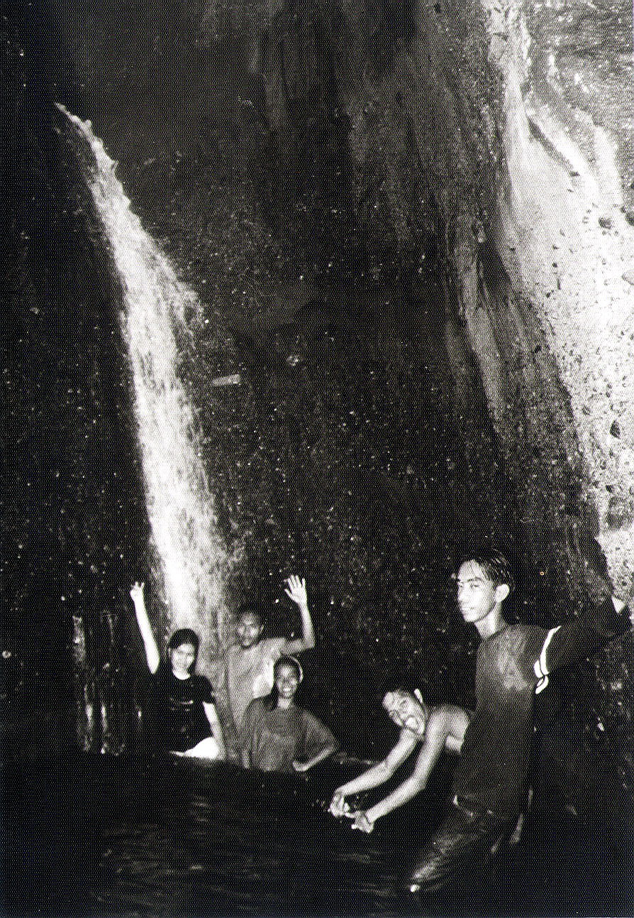
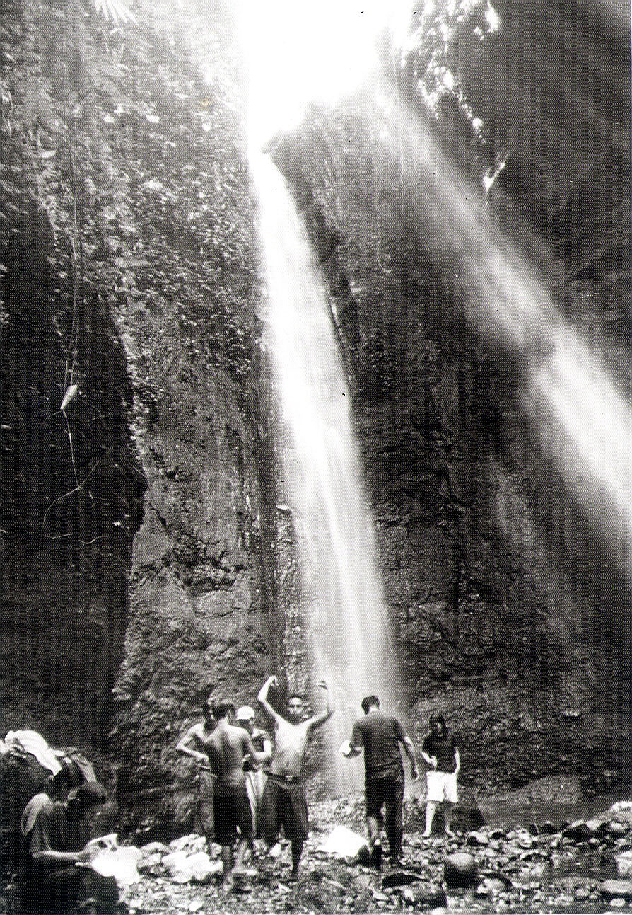
The way to Walang Langit was via a fork on the river which I somehow missed. The path through was no less difficult than my previous trek. Luckily, a huge fallen tree trunk which once blocked the path had been sawn by the municipal government into six-inch sections similar to the tadtaran (chopping boards) of old. After passing another waterfall, I was dumbstruck by what I finally saw at the gorge’s end, the 100-ft. high torrent of Walang Langit Falls, surrounded, in all its majesty, by equally tall, densely-vegetated cliffs flanking it. Here, the sun only penetrates the gorge at noon. Simply awe-inspiring. Only in my dreams can I imagine such a place.
 |
| Walang Langit Falls |
Much anticipated was a dip in its icy-cold, waist-deep pool. Once acclimatized with the cold, we also indulged in a tingling back massage underneath the fall. Soon all these activities made us hungry and we finally recharged ourselves with a much-needed lunch. Rodel and I soon finished our photo shoot with a prayer, hoping that our shots in the dim light would come out nice. Rodel alone used up 3rolls of black and white film by the end of the day. It was getting late and we had another long hike ahead of us. Our gear was soon packed (including our garbage). However, I wasn’t looking forward to this return hike as we were now going to do it in reverse, from heaven back to earth. We were totally drained once we got back to the dirt road. The return hike took twice as long and we made it back to our vehicle very late in the afternoon.
As we couldn’t make it to the last Supercat ferry trip back to Batangas City, we decided to stay another night in Gloria. Sleep was again out of the question as Robert honored us with a small despedida (farewell) party, with our guides, at our cottage. We left at 2:30 AM for Calapan City, making it to the first fast ferry (6 AM) back to Batangas City and on to Manila. I was back on “earth” by 9 AM. Goodbye heaven.


.jpg)


.jpg)


.jpg)


