
 |
| Alona Beach |
We all left Cebu City very early in the morning of May 24 via an Oceanjet fast ferry for Tagbilaran City, Bohol’s capital and route center. Upon arrival at the city’s wharf, we motored, via taxi, to Panglao Island which is connected to the mainland via 2 bridges. The older Taytay Bridge, near the City Hall, goes to Panglao (18.1 kms. away) while the Gov. Jacinto Borja Bridge, located 2 kms. southeast, connects the city’s Bool District with Dauis (3.1 kms. away). The flat 98.4 sq. km., coralline limestone Panglao Island is located south of the city.
 |
| Lost Horizon Beach Resort |
We booked ourselves at an airconditioned room with bath and cable TV at Lost Horizon Beach Resort along Alona Beach. The resort also has fan-cooled rooms with bath or common bath, a restaurant, swimming pool and a bar. Alona Beach is one of Panglao Island’s 4 beaches, all of them white sand. The other beaches are the 1.2-km. long, pretty shallow Doljo Beach (located between rocky promontories); Dumaluan Beach along the east coast; and Momo Beach on a quiet cove on the west side.
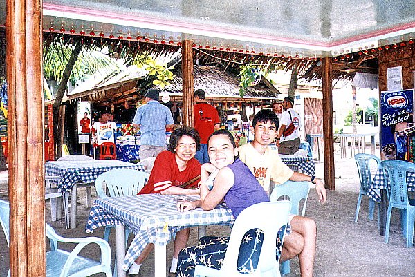 |
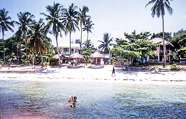
| At Trudie’s Place |
The sand off these beaches, although not as fine as that in Boracay, is just as white. A fact, known only by a few people, is that many white sand beaches on Mactan Island in neighboring Cebu are covered by sand imported from Bohol, including Panglao. Alona Beach, on the southeast side, is the most beautiful, most popular and, tourist-wise, the most developed beach of the four on the island. This beach, located in Brgy. Tawala, is said to have been named after Alona Alegre, the bomba star of the 1970s whom people say romped naked here during a film shoot. It has a number of small, individually-designed beach resorts, restaurants, beach bars and dive shops, all spread along the beach for about 1.5 kms.. This attractive, white sand beach is good for snorkeling. It is, however, clogged with seaweed growing in knee-deep waters, especially between December and March.
Lost Horizon Beach Resort: Brgy. Tawala, Alona Beach, Panglao, Bohol. Tel: (038) 502-9099 & 502-9088. Cebu City booking office: fax: (032) 232-4893. Website: www.losthorizonresort-bohol.com.


